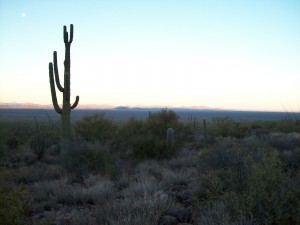
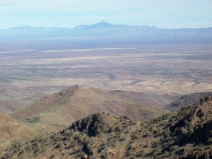
We got up early, ate, readied our packs and also marked our campsite location with the GPS. It was just after 7:00 am when we left camp, guessing it would take maybe seven hours round-trip to do the climb of the un-named high point of the Sierra El Humo.
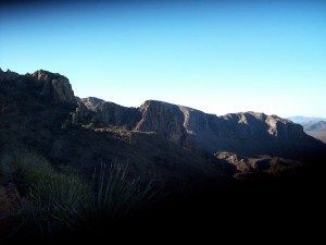
We headed north up gently-sloping ground, then swung northeast out on to a huge bajada. Before long we came to a deep wash with vertical sides. There were large trees growing at the bottom whose tops didn’t even reach to the top of the wash. We finally found a way down into and then out of this mother of all washes, and continued up the bajada. Ahead of us was a feature we dubbed “the wedding cake”, a tall bluff of layered rock. South of it was a smaller version of itself, “the little wedding cake”, which we outflanked on the right. Once around this, we were in the huge canyon which dropped 2,000 vertical feet directly west down from the summit. We dropped down to the canyon bottom, crossed it and ascended directly towards the summit.
We were making great progress, gaining elevation quickly, when we came to an area of steep cliffs which were not visible from our lower vantage point by the wedding cakes. We decided to drop 300 feet to our north and back into the main canyon bottom. The brush was terrible, so we stayed on rock as much as possible. The canyon was very steep, so we made good upward progress with every step.
Mike’s knees were starting to bother him, so he decided that the prudent thing to do would be to go no farther and save himself for the descent. We were now about 900 feet below the summit.
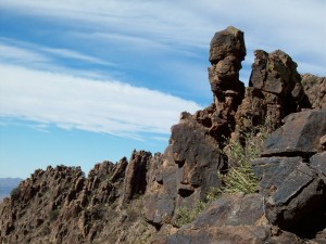
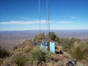
Mike waited there while I continued up to the summit ridge, where the wind was blowing hard for the last 200 vertical feet. On top, there were five radio towers powered by solar panels. The summit elevation was 5,450 feet.
You could see a long way in every direction because there was a clear blue sky and no haze. To the north, mountains could be seen in the US across many miles of barren desert.
I took pictures, left a register and called Mike on our walkie-talkies. Before long, I started down and met up with him. When I decided to take a reading of our elevation, I realized that I had left my GPS on the summit. My old faithful Garmin 12XL of many years – there was no way I was going to climb back up to get it.
The day had warmed up a lot by now. We descended the canyon, traversed below the wedding cake and on to the top of the bajada. When I was on the summit, Mike had told me over the radio that he had seen a vehicle down on the bajada with people moving around near it and had heard gunshots. We did see something white down below, maybe a metal tank for cattle – who knows – but no vehicle. I think somebody has a good imagination! We finally arrived back at the steep-sided wash. It took a while but we found a way down into it. It was like a lost world down in there – much cooler than the desert floor above, choked with thick unusual vegetation. We climbed back out and soon approached the area where the truck was parked.
Although we no longer had the GPS with us to help zero in on its location, we didn’t think it’d be too hard to find it. It didn’t take long before we realized that the brush was so thick that we couldn’t see much of anything. We walked around in the vicinity of where we thought it would be but we couldn’t find it. Mike looked at a photo he had taken the day before and we tried positioning ourselves with the perspective shown on it, but still no luck. We split up. Finally I saw a bit of our tire tracks from our drive in. That helped a bit, but we couldn’t follow the tracks for long. Five minutes later, I stumbled upon the truck. I called Mike and told him I’d honk the horn to guide him in. That worked and he found me. We had wasted an entire hour looking for the truck. It was embarrassing, and it shows how reliant we can become on technology instead of good old-fashioned orienteering. I mean, think about it – if you relied solely on your GPS and weren’t positioning yourself properly with map and compass, what kind of a fix would you be in if you ran out of batteries, broke your GPS, or, God forbid, left it somewhere?!
We quickly threw everything into the truck and started off. We wanted to drive back to El Dos, and were able to follow our faint tire tracks for a bit, but soon lost them. In order to actually return to El Dos we had to find our tracks so we could cross a deep wash, but once we lost our tracks we had to go to Plan B. We decided to drive southwest in hopes of finding the road in a different spot – we knew we’d have to cross it by going in that direction, then we’d just follow it out. Well, we never found it. The desert had reclaimed it after many years of disuse and we saw no trace of it. Once, as we sat there in a dense thicket, I actually despaired of ever getting out of that place. We could keep driving around, but chances were good that sooner or later we would get stopped by any one of the washes that crossed the area. So went to Plan C.
We would head cross-country gently downhill to the southwest. It was essential to get around the north side of a 250-foot hill which lay to the northeast of Cerro El Cimarron. The sun was now low, shining right into our eyes through all the dirt and bugs on the windshield, making for very poor visibility. Mike got out and walked ahead, guiding me through every twist and turn . We were mowing down small trees, bouncing horribly over rocks and being scraped on all sides by branches that resisted our passage. For a while we were down in a wash, dodging big rocks and heavy brush, but then got back out on to easier ground. The going was better here and before long we did it – we hit the road we were looking for!! Thank God. But all this off-road had eaten up another hour and a half of daylight.
We sped down the road to a locked gate we had encountered the day before. Mike had unraveled the barbed wire near the gate so we could drive through – today, we unraveled it in record time, drove through the opening and re-wired the fence so it looked good as new. It was now five o’clock – we were running out of daylight. It was good that we had made notes on all the road junctions the day before, because we now lacked the GPS to tell us our exact location. On we drove, much faster than the day before – we needed to make up for lost time. Why the big hurry? The Sasabe border crossing into the US closes at 8:00 pm every day, no exceptions. If we didn’t get back there in time, we would have to go to another crossing, involving several hours of extra travel in the dark on back roads. Either that or spend another night out – and then we’d have to answer to our wives upon our return, as we had no way to contact them to tell them what was going on and we knew they’d worry.
On we sped, negotiating all of the ranch gates very quickly. We made it all the way back to the Sasabe-Altar road with daylight to spare. We headed north on this dirt superhighway, at times reaching speeds of 55 mph. Then we noticed that the alternator must be wearing out, as the warning light would come on every time we dropped to 1500 rpm or below. On we rushed into the dark. We shot through a one-lane cattleguard at 40 mph – that seemed pretty crazy, narrowing down a wide road into such a tight gap. A while later, another one loomed out of the dark – we saw it at the last moment and almost struck the concrete post on its right side at 50 mph. That scared the crap out of us.
Finally, we reached Sasabe. The whole town’s population seemed to be out walking around on this Sunday night. Again, we noticed that the streets were as rough as most any of the four-wheel-drive places we had been on this weekend. Miraculously, we reached the border at 7:00 pm and passed on through. What had taken us over four hours to drive the day before, we did in two today. The pavement started as soon as we were back in the good ol’ US of A, and I felt like kissing the ground. Man, it sure felt good to be back. An hour and a half later, we were back home. It had been a great trip – we had climbed our mountain and had seen some great wilderness. Fortunately we hadn’t run into any bad guys out there (this time!).
Please visit our Facebook page at https://www.facebook.com/pages/Desert-Mountaineer/192730747542690

