These events happened a few years ago, about this same time of the year. It seems relevant to share them with you now.
The heat here has been extreme. We keep setting new records for the highest temperatures ever recorded on a given day. We had another 110-degree day a few days ago. The monsoon rains have not yet arrived and are now very late. And forest fires are burning up the high country. A major one is now raging in the Santa Rita Mountains, in plain sight just south of Tucson.
In spite of these conditions, I decided to go climbing on Sunday, July 10th. By sunrise I was deep into the Ajo Range, about 6.6 air miles southwest of the village of Gu Vo. I was about 2 miles southeast of the summit of Mt. Ajo, and the road I had driven had taken me right to the boundary of Organ Pipe Cactus National Monument. I parked and prepared my pack. I was a little concerned because this area has a reputation of being a major conduit for illegal activity, namely the smuggling of drugs and undocumented entrants. I noticed a lot of trash nearby that they had left. All I could do was lock up my truck with the club on the steering wheel and hope for the best.
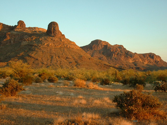
In the above photo, Peak 4540 (the third-highest in the Ajo Range) can be seen in the background, just to the right of center. Andy Martin and I climbed it earlier the same year on our way back from climbing Cerro Cubabi in Sonora, Mexico. There appear to be any number of good rock-climbing possibilities in this part of the range.
I headed out on foot through easy country, going southeast, and before long I started climbing the slopes of Peak 3455. Mercifully, I was able to climb much of it in the shade due to the low sun angle this early in the day. In a high saddle, I came upon a survey marker left by the National Parks Service. It was Monument 13. They have installed a series of 20 metal markers at intervals along their boundary with the reservation. They start with number 1 near the village of Kuakatch in the north. About 8 miles north of the Mexican border, on the south shoulder of the very isolated Peak 3072, the 20th one can be found. A few minutes more found me on the summit of Peak 3455. I was rewarded with great views in all directions. Diaz Peak and Diaz Spire were close at hand.
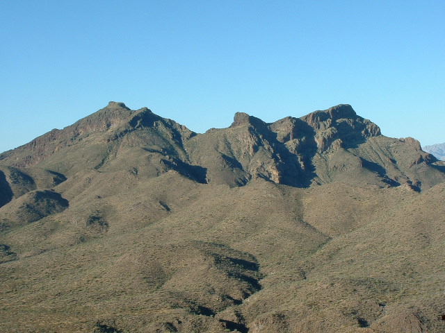
This photo looks southwest from Peak 3455. Diaz Peak and Diaz Spire are only two miles distant. At the bottom center of the photo are some shady bits – this is Sweetwater Pass. To the right of the pass, not visible in the photo, the land drops down a thousand vertical feet into Organ Pipe Cactus National Monument. The pass is a major conduit for illegal activity.
I had a clear view to the border town of Sonoita, Mexico, only 13 miles to the southwest, but of particular interest to me were the cairn and summit register that I found there. I had a hard time getting the lid off of the glass register jar but finally managed to do so without breaking it. Inside I found a small notebook and a pencil. The first entry (and therefore the names of those who had the first probable recorded ascent) were Gordon MacLeod and Barbara Lilley from California and Bob Martin and Mark Nichols from Arizona. I know all of these climbers, having climbed with them at various times over a 20-year period. They had summited on November 13, 1998, a much more sensible time of the year. And there were two more entries. Ken Carpenter of Ajo, Arizona had been there on September 12, 2001, and finally Matt O’Dwyer from Elmhurst, Illinois on March 5, 2002. It was exciting to read these entries. This is what a register is for, to provide a historical record of the climbs of a peak. I too signed in. I assume that they all had approached on foot from the Ajo Mountain Drive in Organ Pipe, quite a lengthy walk compared to my approach. Probably the main draw for them would have been the fact that this peak has 835 vertical feet of prominence.
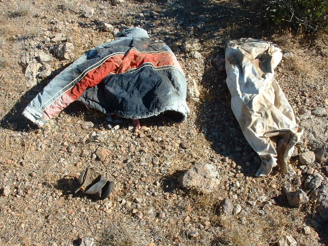
I headed back down to my truck, en route finding discarded articles of clothing and empty water jugs.
A jacket, pants and one sandal left behind by an undocumented passer-by. The jacket makes me think that they were here in the cooler months.
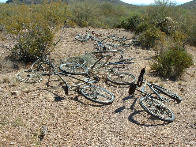
Once back at my vehicle, I drank as much as I could, then drove back out the way I had come in. About a mile later, I parked just off the road due north of the summit of Peak 3220. I noticed something glinting in the sun and went over to investigate. It was a large assortment of bicycles which had been left there by border crossers.
An assortment of eleven bicycles. This mess includes extra wheels, frames, even spare inner tubes draped over the handlebars of the bike in the lower right. This scene certainly makes you wonder what exactly transpired here.
Perhaps they had been apprehended there by the US Border Patrol. The bikes were of poor quality to begin with, but some of them had been disassembled in an attempt to pirate them for parts, perhaps to fix a few so some riders could continue. It was a veritable bicycle graveyard. Whoever had ridden them had done so for a very long way to get from the Mexican border to this place. But riding cross-country through terrain like that requires special tire and tube precautions. There are countless sharp cactus spines waiting to puncture your tires. I saw several spare tubes there but even that wasn’t enough. And such rough country requires a more rugged frame such as you would find on a mountain bike. These had the flimsy frames you would find in a cheap street bike and therefore many of them were badly broken.
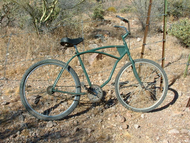
One of the bikes looked fairly intact.
I parked right beside them, arranged my pack, and headed up the steep north ridge of Peak 3220. I left a cairn and register on top and was back down in just over an hour. Cell phones just don’t work in this area. There is no line-of-sight to any cell tower anywhere.
I drove another mile to the north and parked to the south of Peak 2860. It was a quick ascent, less than an hour round-trip back to the truck. What I try to do in such heat is this: climb the longest, highest one first before the heat saps your energy too much. Then do the lesser ones later in the day. That way, God forbid, if for some reason you got into trouble due to the heat, say from bad leg cramps or not being able to think clearly, you would be closer to the vehicle and would have a better chance of crawling back to it to save yourself. I was glad to be done with these three peaks for the day. That was enough. To do any more of the many others nearby would be pushing my luck. They would still be here the next time I came back. There are two others I need to climb that would be best approached from the road I came in on this day, but they are considerably farther and will involve a lot more walking across the desert to reach them. They will require a really early start. I headed out and was back in Tucson in less than three hours.
Please check our Facebook page at https://www.facebook.com/pages/Desert-Mountaineer/192730747542690

