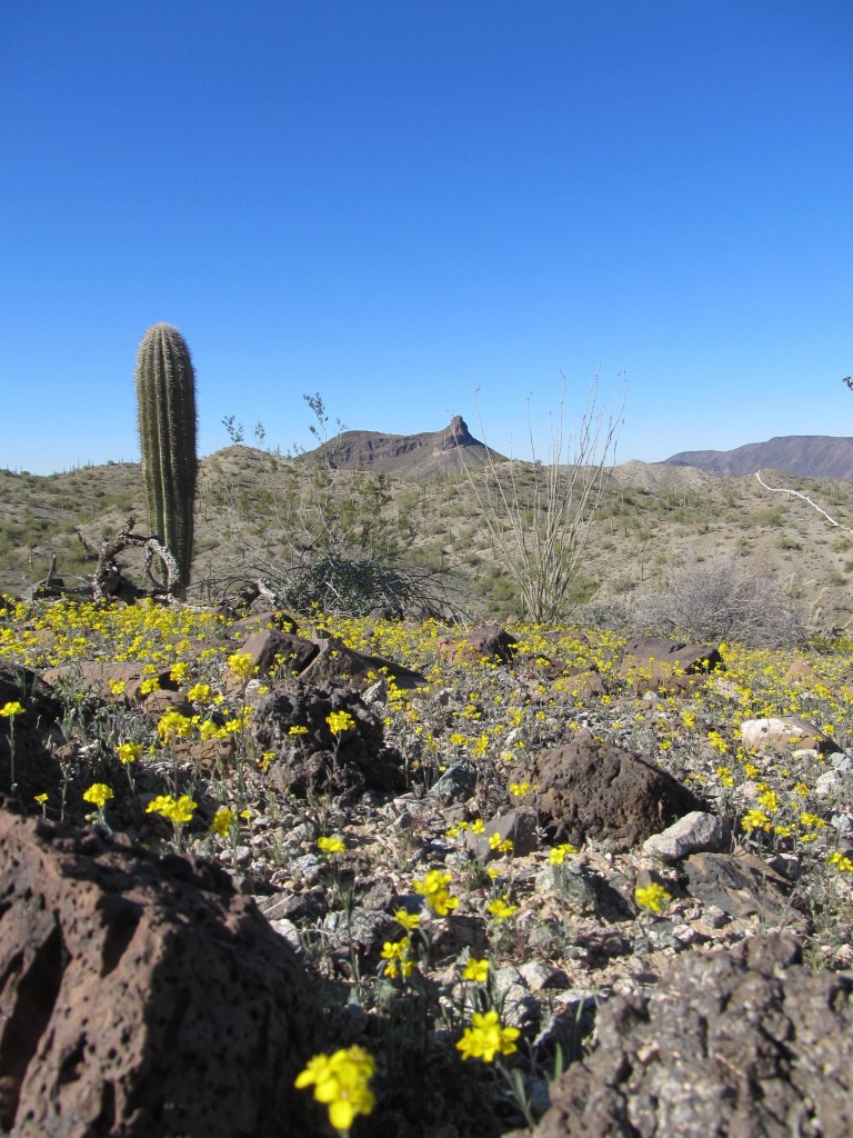
The next morning, we once again awoke at dawn, a perfect dawn of course. After a bite to eat, we loaded up our packs and set out. Camp was at 1,800 feet elevation. Today’s agenda involved three peaks and more miles than yesterday, but nothing technical was in the schedule. The high temperature was to be around 70 with bone-dry humidity. Even so, it’s surprising how warm you can feel in the direct sun. Here in the desert, even in the winter, the sun always has strength in these southern latitudes.
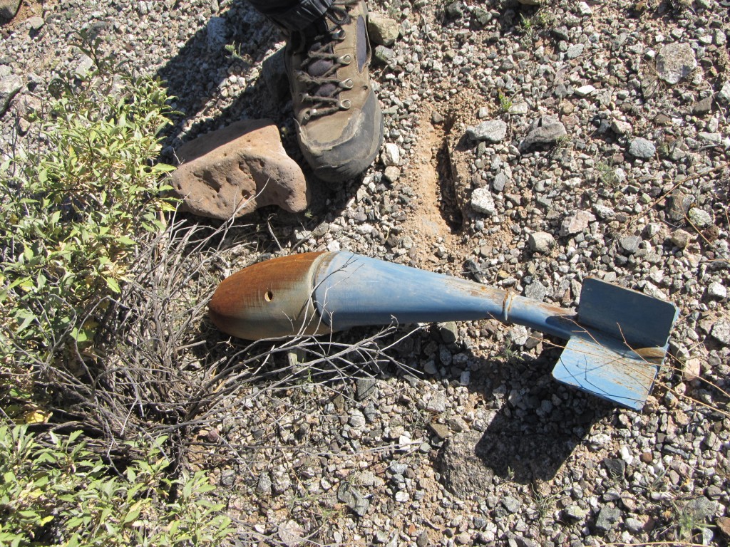
Our path lay across the grain, meaning that we had to more or less cross the countless gullies in our path at a right angle, dropping down into them and then back out. In the desert, that just comes with the territory. We did this for almost two miles, and the gullies weren’t that bad, but we were still only 50 feet higher than when we started. It was really important to keep a sharp eye out for unexploded ordinance on the ground – here is another example of what was out there.
Finally, we found a gully we could use for a while, as it was going in our direction. It twisted and turned constantly but kept us moving in the needed direction. We had a distant glimpse of yesterday’s Jack in the Pulpit as we continued on.
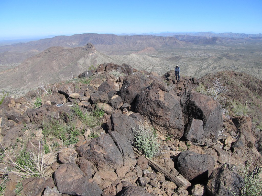
Nevertheless, it was only a matter of time before we needed to abandon it and head cross-country to pick up another drainage. Once in that one, we were still only 300 feet above the elevation of our camp. We kept following it through a huge curve of 270 degrees, abandoning it when it no longer served our purpose. Climbing west up a ridge, we finally reached 2,800 feet. The picture below is a perspective never seen anywhere else before now. It is looking north along the north ridge of Slag Benchmark. In the lower ground a few miles away can be seen Jack in the Pulpit, a bit left of center. And directly above it is the long ridge of Blue Plateau.
It was only a short walk south along the blocky summit ridge to reach the top of our first peak. Here we were on Slag Benchmark, elevation 2,948 feet above sea level.
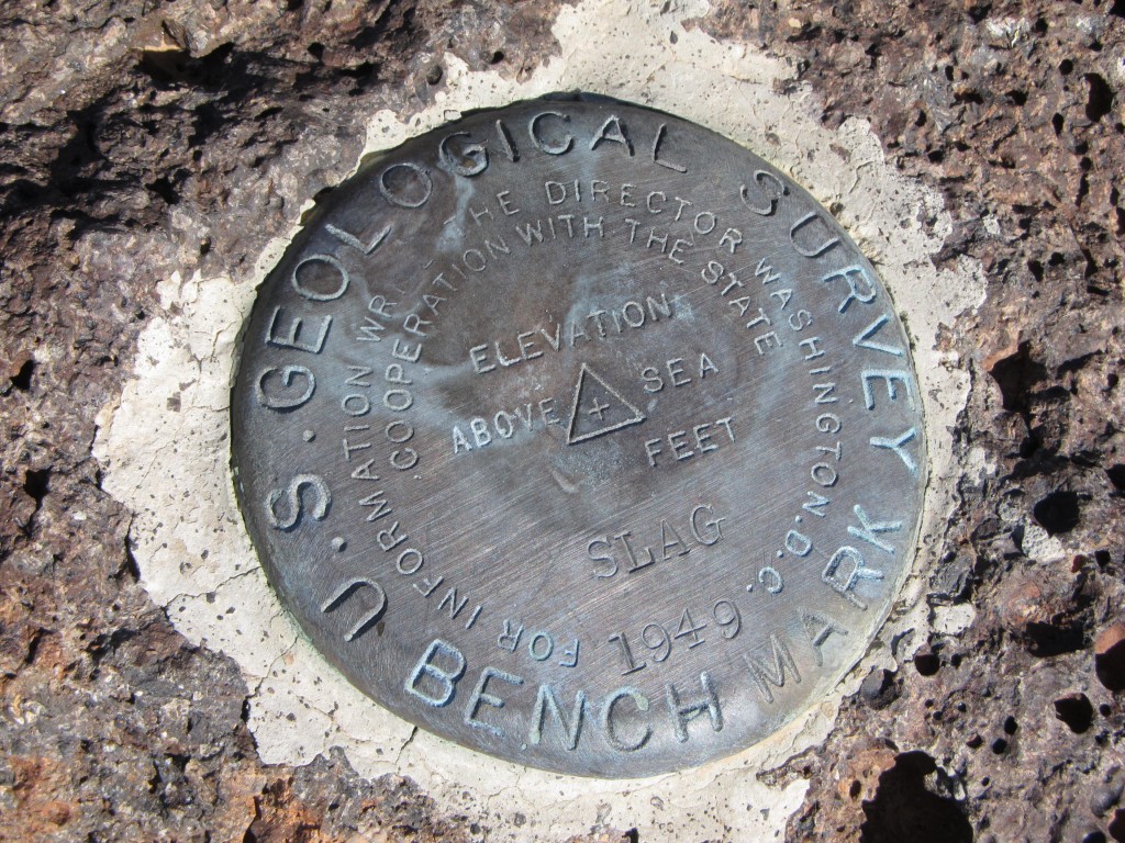
It has a prominence of almost a thousand feet, which means it towers well above all of its surroundings. The very name had intrigued us for years – why was it called Slag? It wasn’t ugly or anything like that, it didn’t look like a slag heap, it was just a big old mountain with a benchmark on the top. We did find the brass plate that bore the name, but other than this evidence of the surveyor’s visit way back in 1949, it seemed like nobody else had been there. We filled out a register and left it in the cairn we had built.
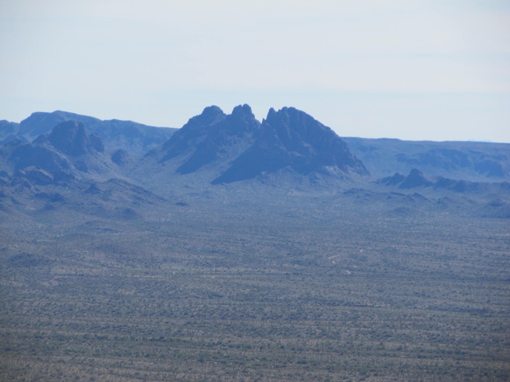
Something that really caught my eye was a dramatic peak to the southeast. In fact, it was the triple summit of Dragon’s Tooth, a mere ten miles away across pristine desert. Now there was a peak in No-Man’s Land, mysterious and untouched, the stuff of dreams!
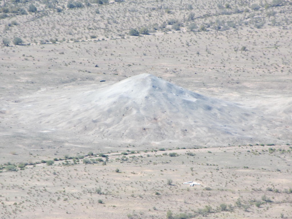
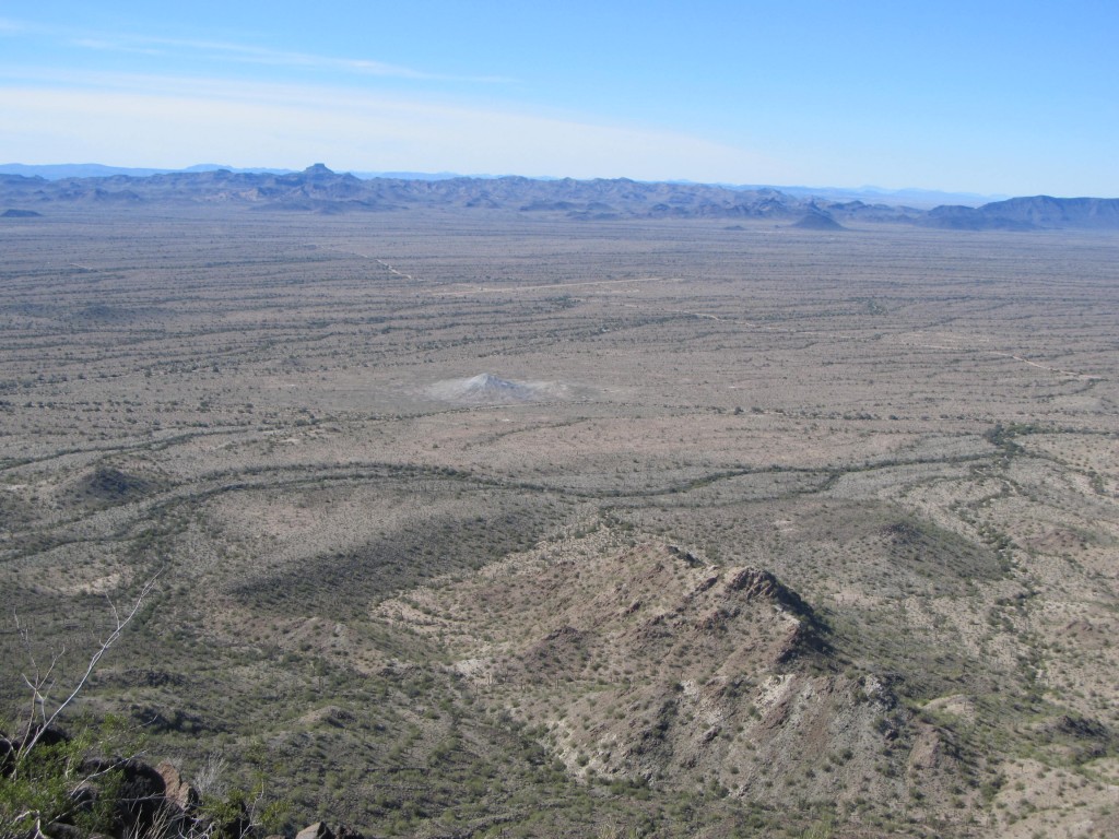
 Remembering the bombing display we had seen yesterday, we settled in for a leisurely lunch, hoping for a repeat performance. It was not to be. We were really disappointed – Slag was just over a mile from the little hill that was the bombing target, and 1,300 feet above it, so we had a front-row seat – to nothing! This hill looked white, no doubt because the rock it was made of had been pulverized to dust from the constant bombing.
Today must have been their day off. What a show it would have been! Oh well, benchmarks were more important than bombs – after all, we were here to climb. This target hill I have been talking about had four huge arrows on the ground, pointing to it from all sides. You can see one in the lower right of the photo shown above. I guess the Air Force was just making sure that there would be no doubt their pilots would know which was their bombing target. We also noticed that, a few miles away to the west, was what looked like a fake village – no doubt also playing some part in their training. We could see it quite well with the binoculars we carried. Another great view we had was, as seen in the photo below, looking across the desert all the way to Hat Mountain, a distance of 14 miles to the southwest.
Having waited as long as we could, we got ready to leave. There was some concern about getting cliffed out on the east side of Slag, so we headed along the south ridge for a while, then down through more passable ground to reach a saddle 800 feet below. A straightforward climb of 500 feet brought us to the summit of Peak 2667. With no sign of any previous human visit, we built a cairn and left a register. In the world of peakbagging, this is a special treat – the feeling that nobody has stood on a summit before you. We relished the moment, but not for long – we needed to keep moving. Time was a-wastin’, and “miles to go before I sleep”. Oh yes, one more thing to mention: from this summit we were on, we could look across miles of desert at a bearing of about 215 degrees and see a prominent mountain which we figured must be Quail Benchmark, a possible candidate for future days. It was far away, on the other side of Quilotosa Wash and Sauceda Wash.
A drop of 700 feet to the north brought us back to a gully we had used before. It served as a conduit for a while, then we headed cross-country, dipping in and out of smaller gullies for what seemed like an eternity. I was getting tired, and it felt really hot, even though it must have been only 70-ish. Together, we decided to head to higher ground to approach our final objective for the day – Desolate Benchmark. Once again, the name intrigued. We couldn’t help but wonder what the surveyors were thinking, dropping names like Slag and Desolate on these hills. It’s almost like they had something against the area. We gained a ridge, and had to cross over a couple of other bumps before finally arriving at the spot where we knew the benchmark must be. There was a glaring error on the topo map we were using, an error of 200 vertical feet. That aside, by the time we arrived at Desolate, I was really beat – I felt like hammered dog crap.
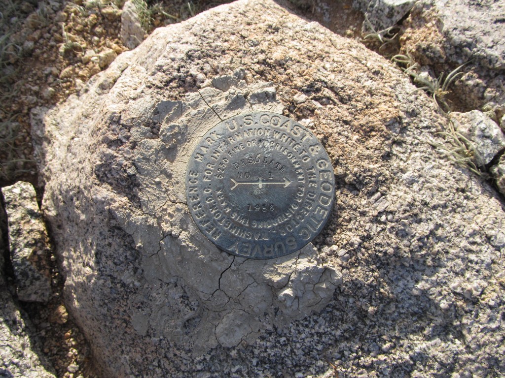
The guys had a copy of the field notes that the original surveyors had used, and they started to look for the benchmark in earnest. They decided where it must be, but there was nothing visible, just a patch of dirt on the mountaintop. They even dug down into rocks and dirt in what should have been the exact spot, but to no avail. Maybe it had been buried on purpose, maybe the surveyors had dug down to solid rock, but we couldn’t find it. I’m just an amateur when it comes to all things benchmark, but my two companions are real authorities, so much so that they could give seminars on the subject. We looked and looked, but didn’t find the benchmark – I for one was just glad we weren’t moving for a spell so I could rest. We finally gave up, but did leave a register there. The best we could do was find one of the witness markers, as shown below. This had been placed in 1936.
I want to share with you the type of information that the original surveyors left when they first visited this place. Here are their field notes, available on-line, which describe how precisely they left their benchmark.
DESCRIBED BY COAST AND GEODETIC SURVEY 1936 (JB)
ABOUT 18 MILES SOUTHEAST OF GILA BEND AND 9 MILES SOUTH OF
STATE HIGHWAY NO. 84, ON THE SUMMIT OF THE HIGHEST PEAK OF A RANGE OF LOW, BARREN HILLS LYING ABOUT 6 MILES WEST OF THE
MARICOPA MOUNTAINS, 2 MILES SOUTH OF A HIGH, LAVA MESA AND
ABOUT 1 MILE EAST OF A PROMINENT, LONE PEAK.  ON THE SUMMIT
OF THE FIRST PEAK NORTHEAST OF THE MOST SOUTHWESTERLY ONE OF
THE GROUP, IN THE APPROXIMATE CENTER OF THE SHARP, BARREN
SUMMIT WHICH IS COVERED WITH SMALL GRAYISH ROCKS, AND 4 FEET
NORTHEAST OF A ROCK CAIRN.  MARKED BY A STANDARD BRONZE DISK
SET IN BEDROCK ABOUT 6 INCHES BELOW SURFACE OF GROUND.
REFERENCE MARK NO. 1, A STANDARD
BRONZE REFERENCE DISK, IS IN TOP OF SMALL BOULDER
AT SOUTH EDGE OF SUMMIT AND 4.559 METERS (14.96 FEET) FROM
STATION S 23 DEG 41 MIN E.  REFERENCE MARK NO. 2, A
STANDARD BRONZE REFERENCE DISK, IS IN RANGE
WITH THE RIDGE LINE, IN TOP OF SMALL BOULDER AT EDGE OF
THE SUMMIT AND 3.610 METERS (11.84 FEET) FROM STATION
S 39 DEG 40 MIN W.  THE AZIMUTH MARK, A STANDARD
BRONZE DISK, IS ON THE HIGH POINT OF A SMALL HILL
COVERED WITH GRAYISH ROCK, THE MOST SOUTHERLY ENTIRELY
DETACHED ONE OF THE NUMEROUS SMALL HILLS OF THIS TYPE AND
ABOUT 0.8 MILE FROM STATION N 06 DEG 23 MIN E.
More time we didn’t have, so we gathered up our stuff and set out on the final stretch. Descending the north ridge was easy enough, and, by the time we had dropped 400 feet, we stood on the desert floor. From here on, it was pretty flat, but we still had to climb into and out of plenty of small gullies. Those trucks looked mighty fine by the time we got to camp, and I was really glad to be there because I was all in. We had been out on foot for almost 9 hours and it was party time. Little did we realize the adventures which awaited us tomorrow.
To be continued………………..
Please visit our Facebook page at https://www.facebook.com/pages/Desert-Mountaineer/192730747542690

