Ever since Andy Bates and I had run out of time trying to climb the Ugly Sister over Thanksgiving, I had wondered if there might exist an easier way to get up high on the mountain. “The Ugly Sister” is the nickname we had given to Peak 6300, which sits a mere 700 feet east of Peak 6328. We had required five pitches of roped climbing to get up to our high point of 6,000 feet elevation. I felt it was worth a day of exploration to look at other parts of the mountain we hadn’t seen. So, on Tuesday, December 6th, Mike and I drove from Tucson to the campground on the reservation. The campground sits at the mouth of Baboquivari Canyon at an elevation of 3,545 feet.
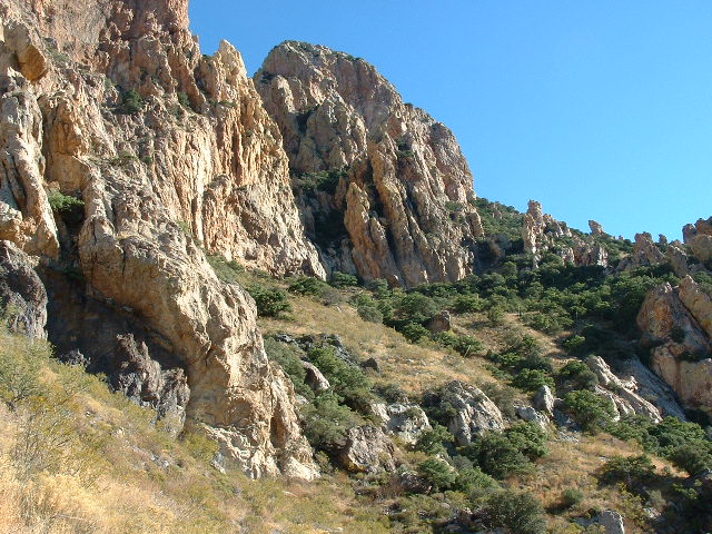
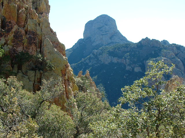
At 7:45 a.m. we set out with light day packs – the temperature was in the high twenties. We contoured across the slopes to the north of the canyon, steadily gaining elevation, until we reached the camp used by Brian Rundle and myself two years earlier, This sits at about 5,045′. In the next picture, we are looking east across the lower south face of the Ugly Sister. The path Mike and I took angles up from the bottom center of the photo, up and right, over to where several pinnacles stick up into the blue sky. From there, the route went left and uphill behind the large outcrop which fills the upper middle of the picture.
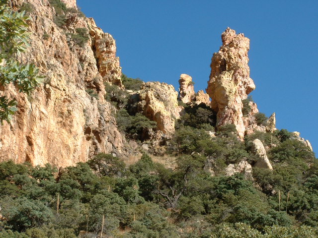
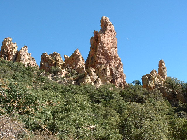
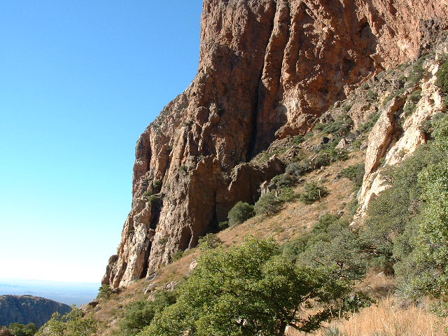
We continued on up to the camp Andy and I had used for two nights, at around 5,285′. In the next photo, we are again looking east. These are the same pinnacles seen in the first photo. Our route took us through the trees just to the left of the large pinnacle. From there, we turned left and continued up and then behind the large cliff.
Now it was time to keep our fingers crossed and see what lay higher up. Mike and I carried no rope or rock gear – today, we were just a couple of tourists. Our intention was simply to see how high we could go on the mountain by just walking, hopefully finding easy paths to get up pretty high.
The map shows a wide saddle on the east side of the Ugly Sister. It was our goal to try to find a walk-up route to that saddle. We headed out due east from the 5,285′ camp, walking through a nice flat area of tall grasses, oak trees and alligator junipers. We then started climbing again and reached a row of tall pinnacles and found a way through them. It was pretty brushy in spots, but still easy going.
Once past the pinnacles, we turned left and headed northwards upslope. It was fairly open. We flagged our route to make it easier to follow this path at a future date. At the top of this slope, we came up against steep cliffs, so we then headed west at their base and found a way through. It was easy. A nice ramp with big trees took us right over to the wide saddle. We were there – we had found a way up to the high area beside the peak!
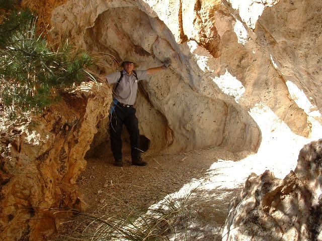
This saddle is far from flat, but is easy to navigate. It is probably as much as 300 feet wide in places. Covered with brush and trees, it has a lot of talus in spots. We climbed up to the top of the saddle, where we could look out to the north across Sycamore Canyon. We sat there and ate lunch. It was 11:30 a.m. I estimated our elevation to be around 5,785 feet. It was great to be here. About 25 feet below the top of the saddle, we found a nice roomy cave. This could make a good spot to spend the night. This cave is at about 5,760′ elevation. The ceiling is completely overhanging and so it would offer excellent protection from the elements – four or five could sleep here comfortably. There is unlimited firewood nearby, and it is an easy 30 minutes from the start of the summit climb. It’s a long hard slog to get here, though, with big packs.
Over Thanksgiving, Andy and I had climbed eastwards up a steep brushy gully to a high saddle at 6,000 feet elevation. This was the highest point we reached on the mountain. From that high saddle, we couldn’t see very far down the other side, but we could see that there was another gully descending eastwards to where Mike and I had just found the cave. I had wondered whether, if Mike and I could reach the bottom of this gully, we would be able to climb up it to the 6.000-foot high point I had reached with Andy.
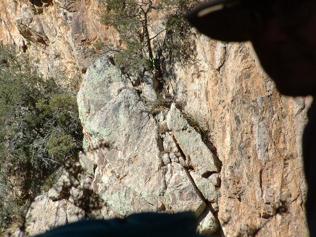
We left the cave and found what seemed to be a likely gully. It was steep and brushy, but easy to ascend. It took us another 250 feet higher and there we were, at the exact place where Andy and I had stopped, at the 6,000-foot saddle!!! We had done it – we had found a walk-up route up to 6,000 feet on the Ugly Sister. By doing so, there was now a way to get within 300 feet of the summit as a Class 1-2 stroll. Granted, it was a stroll which required you to walk up 2,500 vertical feet, and with large packs it would be an annoying bushwhack, but it could be done without having to do the five pitches of technical rock climbing Andy and I had completed. I was giddy over the prospects. We took pictures from the saddle – this next one silhouettes Mike’s hat and face in the upper right. If you look closely at the tree shown to the left of his hat brim, at the top center of the photo, you can see a bright green sling hanging off of the base of the trunk. That was Andy’s rappel sling from Thanksgiving, left ten days earlier, at his highest point.
We decided to explore a bit farther. We went over to a nearby gully and started up it directly north towards the summit ridge of the Ugly Sister. We climbed up about 50 vertical feet and stopped at a huge chockstone. It was a bit of 4th or low 5th-class climbing to get around it. I decided not to proceed, but felt that once around the chockstone it would be a straightforward additional 100 vertical feet to the summit ridge. We returned to 6,000′ and then started down. It was about 1:05 p.m.
By 2:20 we were back down to the 5,045′ camp, and all the way back down to the truck by about 4:15 p.m. A very productive day, it was dark by the time we returned to Tucson. It appeared that an easy way had now been found to get up to the last challenge of the Ugly Sister. Granted, there was no way of knowing how difficult that last 300 feet would be, but at least I knew we could return, loaded for bear, to give it our all. Hmmm, now I just needed someone to lead the thing.
Please visit our Facebook page at: https://www.facebook.com/pages/Desert-Mountaineer/192730747542690

