
Interesting name – Sikort Chuapo to us English-speakers, or more properly, Sikol Chehpo in the Tohono O’odham language. The term means “round mashing pit”, but that in itself conjures up more unanswered questions. In any case, the O’odham must have felt it important enough for a settlement, a wash and a mountain range to carry the name. I’ve had a near-thirty-year history with the people and their incredibly beautiful nation, so it’s not surprising that I first visited the mountain range early on. It sits in the far western part of their land, in the Hickiwan District to be exact, sharing a border with the White Man’s territory. The range extends from the village of Hotason Vo in the south to the gas pipeline road in the north, almost 16 miles. The width is about 8 miles at its greatest. A small range, it contains 12 peaks. It was in 1989 when my O’odham companion and I visited the area. More specifically, it was Hahshani Bahithag Mashath, or The Saguaro Cactus Fruit Month – or, to the rest of us, June. Naturally, we picked the hottest month to go. It was the 5th, and I still remember it vividly.
After picking him up at his home in the hamlet of Choulic on the opposite side of the reservation, we had driven to a starting point for our climb by first light. Parking just off the highway, we set out on foot. It was early, well before sunup, but you knew right away it was going to be one of those incredibly hot days that takes your breath away. The early morning light in the desert is magical, and the air is filled with the stirrings of every creature, doing what they need to do before the sun’s blast furnace is unleashed upon the land. We walked along in silence, crossing miles of easy ground, then up on to a long ridge, crossing over Point 3603 to gain the final slopes before the relatively flat summit area of Peak 3610. It looked like nobody had been there before us, so we left a register. In fact, it would be ten years before another climber stood on the same spot. The round trip time back to the truck was 4 hours 22 minutes, so we had beaten the heat.
Sixteen long years would pass before I returned to the Sikort Chuapo Mountains to climb again. It was October 6, 2005. when I turned north from AZ Hwy. 86 and up the Pozo Redondo Valley. The first faint light of day was visible as I drove the excellent dirt road which goes between the Pozo Redondo Mountains to the west and the Sikort Chuapo Mountains to the east.
After 6 1/2 miles I arrived at what is marked as the community of Sikort Chuapo – all that is there is one house with a few out-buildings. I saw nobody as I drove through their yard (that’s the path the road follows) but their dozen barking dogs followed me for a while. Maybe the people who live there were sleeping – it was pretty early, after all. Brian Rundle and I had driven through here two years earlier on a climbing jag and seen the same thing – no people but several dogs. Once past the house, the road crosses Sikort Chuapo wash and is little traveled, mostly by law enforcement. After 2.4 miles more, a faint track headed off to the right. This road goes to several tanks which provide water for cattle, but it is faint and very little used. Another half a mile brought me to a nice parking spot. I prepared my pack and set off up the western slope of my first objective, Peak 2801. I reached the summit area after a while, and when I got on top something didn’t seem right. Turns out that I was on a lesser bump, so I headed north for another ten minutes and finally arrived on the true summit. There was no sign of a previous visit, so I left my usual cairn and register. I descended by a different way than I had used to get up, and arrived back at the truck just under two hours after I had left.
A few short weeks later, on Monday, October 24, I headed out to the reservation with my friend Mike from Tucson. He had returned from a two-year stint working in Colorado and was ready to enjoy the peaks of the Sonoran Desert again. We drove through the night on Arizona Highway 86, then turned north on to Indian Highway 34. Another 14 miles brought us to the village of Hickiwan at first light. The dirt road we wanted started right from the village but was blocked by a locked gate. We quickly figured out that we could drive through a neighboring property and gain access to this road, however. That done, we headed northwest along a good dirt road, the sleeping village receding in the background.
Before long, the road became sketchy in places. You could tell that it hadn’t been driven all that much. It was deeply eroded in spots from rainwater running along it, forcing us to choose a parallel path off to the side. After four miles, we reached a large tank, where a lot of vegetation had grown up. We lost the road and both of us scouted the area for half an hour before we found the continuation of it. For a while, the going was pretty good as we traveled through drier, higher ground away from the wash, but after another mile and a half we entered the wash again in an area between two tanks. For hundreds of yards we drove directly in the wash and then in and out of it a few times, sometimes through thick brush. Several times we had to get out of the truck and walk ahead, to see if we were still on the road and also to see if it was passable. While we forged ahead and got through this bad area, the truck got a whole new pinstriping in the process.
We drove for almost three miles along an open area, not brushy. There was one spot where we crossed a deep narrow wash and I got the truck high-centered on its front end. We also had the right front and the left rear wheels both off the ground at the same time. Even in four-wheel drive, we weren’t going anywhere. Mike sat on the tailgate and that shifted things enough that both rear wheels were on the ground and we backed out of the wash. A little work with pick and shovel got rid of the high spot and we were able to continue. We arrived at a corral beside a wash. There was a lot of erosion, and the road was just wide enough for us to get through. A short way past the corral, the road became so hard to follow that we lost it altogether. About 1 1/2 miles past the corral, we gave up and parked. Had we still been on the road, it would have ended in another mile at the reservation boundary.
It didn’t matter – we were in a perfect spot. This valley was really beautiful – we were surrounded by interesting peaks, some of which were very steep and guarded by big cliffs.
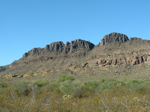
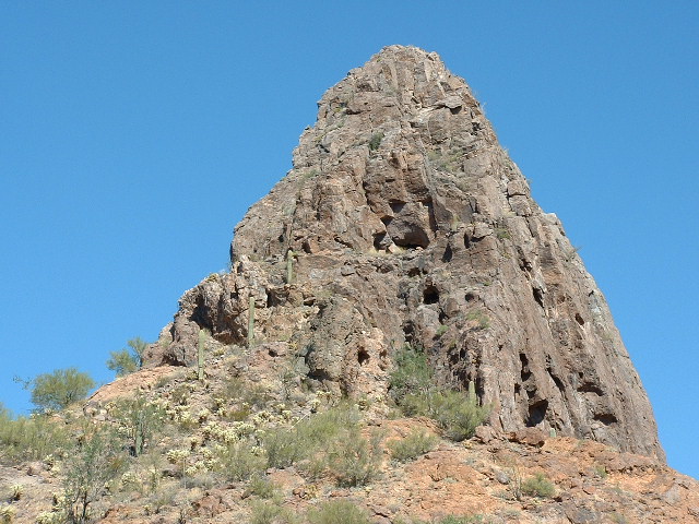
A ridge in the Sikort Chuapo Mountains
I hadn’t been expecting so much spectacular beauty here and was really pleasantly surprised by what we had found.
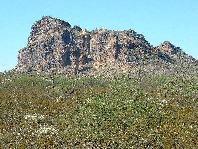
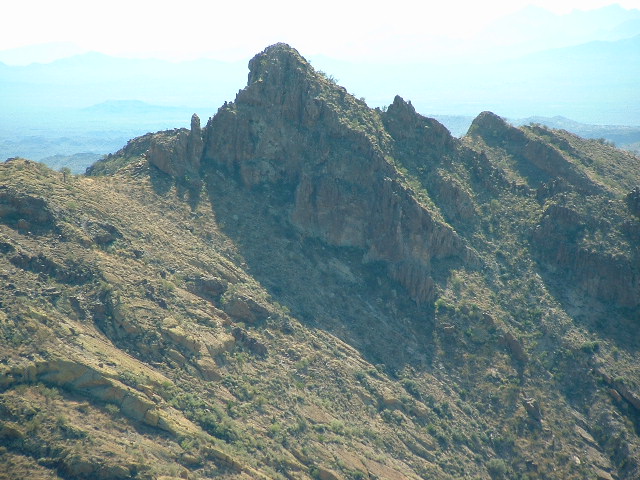
Peak 3325, farther north in the Sikort Chuapo Mountains. Note the huge pillars in front at its base
There were three peaks we had hoped to climb on this day, all to be done as one big loop on foot from the truck. Mike rightly figured out that two of our objectives were actually hidden behind a closer ridge. I was relieved, because a very steep peak that concerned me turned out to not be one of the ones we had to climb. Whew!
The steep peak we were relieved to not have to climb
We prepared our packs, carrying lots to drink. It was supposed to hit 90 degrees here today, unseasonably warm. We were starting on foot quite late because it had taken far longer to drive up this valley than we had anticipated. Away we went, heading west across the valley and up on to the intervening ridge. We passed directly beneath the very steep peak we had seen from below and then our objective came into view, Peak 3265. It didn’t take long to drop down into a saddle and then head up the southeast slope to the summit. Once there, right away we realized that something was wrong. We looked back to the steep peak and saw that it was higher than where we were. We’d have to climb it after all.
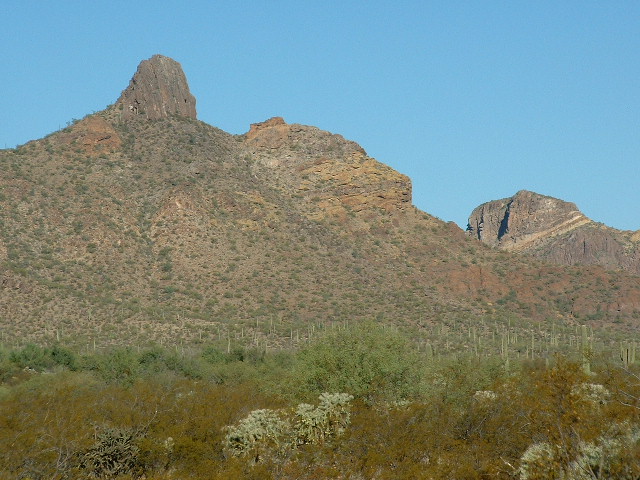
The map was wrong, very wrong. Using my 5x hand level, I found the point on the steep peak which was the same height as we were sitting. It was at least 25 feet higher than us, and probably more. The highest contour the map shows is 3220 feet, and the interval used here is 20 feet. The peak is a minimum of 3290 feet, so that means there are at least three contours missing, and perhaps a fourth. Here’s a photo I took from a different peak to the north. It clearly shows the difference between the part shown as 3265 on the map, and the new-found and higher pointed part on the left (to the east) of 3265.
Peak 3265 on the right and the higher point to its left
We returned to this new objective, which on my map I have re-labelled Peak 3290. As we approached it, I realized that there was only one possible side that might be climbed without protection. We couldn’t really see the route until we were right under it.
The south side of the new peak
The south side just might work. I wanted to give it a try, but it looked borderline. Mike decided to wait while I gave it a go. I started by climbing to the right up a small gendarme, perhaps the trickiest bit of the entire climb. Once on it, I traversed left into a very shallow gully, where I sent rocks cascading down towards Mike.
I hollered and he got out of the way just in time as the rocks crashed down near him fifty feet below me. I continued up the steep rock, which was of reasonable quality. There was a lot of exposure. The entire rock climb was 125 to 150 vertical feet. I left a register on top but did not linger, I just wanted to get down off the thing. I downclimbed the whole thing facing in towards the rock, it was that steep. A sustained Class 4 climb, with a few very low Class 5 moves. A prudent party would rope up. As I reached the bottom, Mike was patiently waiting for me. He offered a few helpful suggestions for holds as I tried to get down the gendarme, which I appreciated.
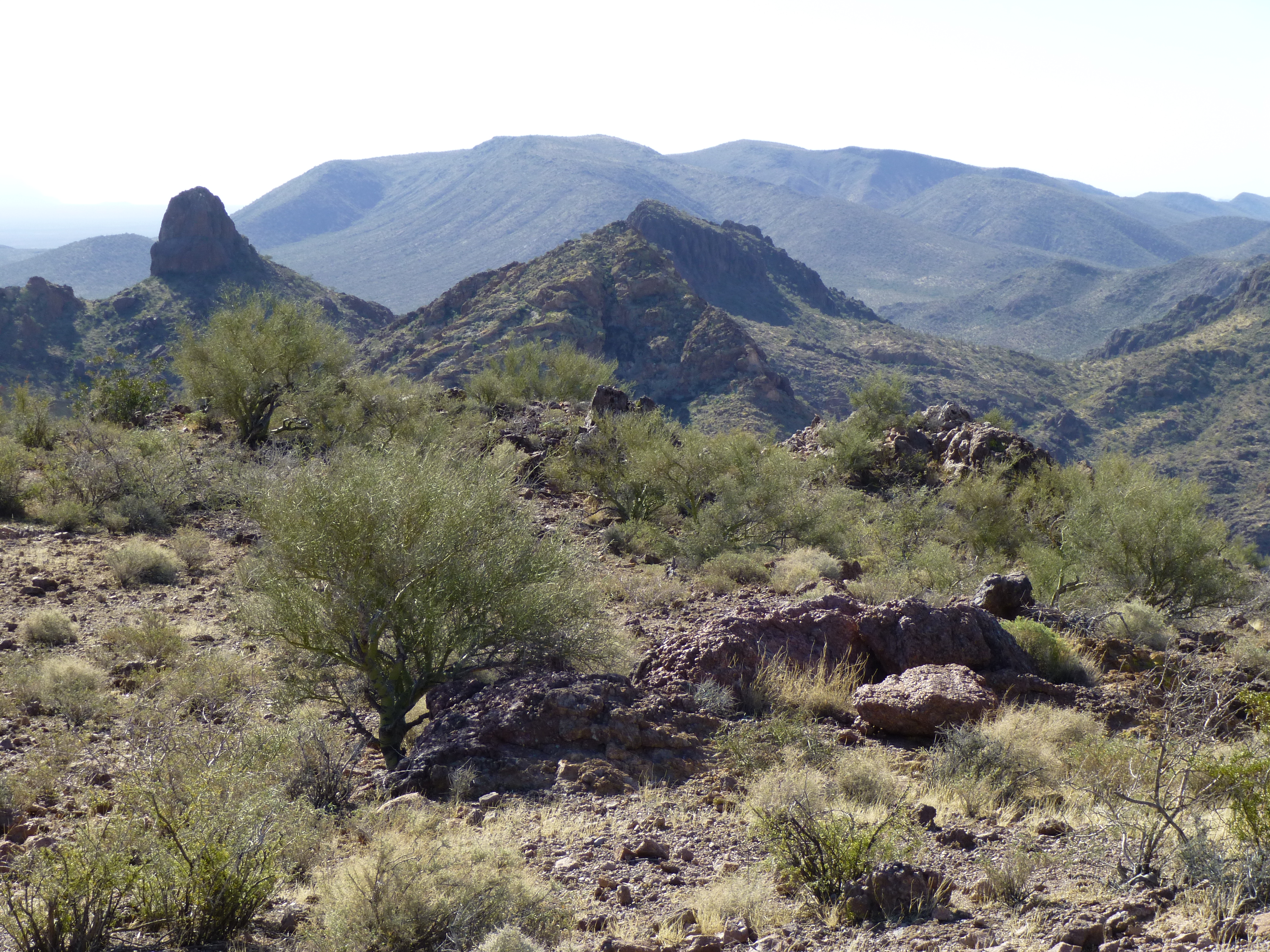
Once down, we continued south along the ridge, passing Point 3262 to the west and dropping to a saddle, then up to the top of Peak 3270.
Looking southwest to Peak 3270
No sign of any previous visit so we built a cairn and left a register. We ate lunch on top and even phoned our wives. We had line-of-sight to Ajo, and I had four bars on my cell phone – in many parts of Tucson, I am lucky to have one or two.
Looking west to Ajo
Here’s a shot looking back north to Peak 3265 that we had climbed earlier – it is on the right, its top just breaking the horizon..
North to Peak 3265 on the right
The day was wearing on, so we decided not to climb Peak 3257 farther to the south. We descended to the saddle, then southeast down a wash to re- enter the valley well to the south of where we had started the climb. In the wash, we came upon this depression in the rock, about five feet across and three feet deep.
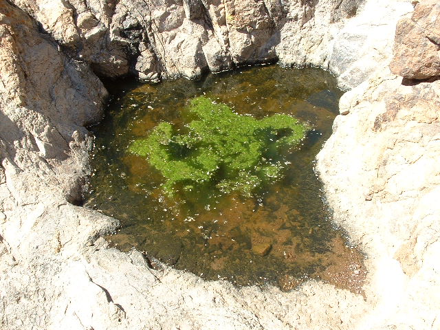
Water in the canyon
The water had been there at least a month. If you strained it through your shirt it would be fine to drink. It would probably taste better than water from a cattle- trough, which I have tried a few times. Once we reached the valley floor we lost all sight of the truck, as it was so brushy. The GPS came in handy in getting us back – about four hours had passed since we had started out.
The right rear tire looked a bit low. We decided to drive on it and see what happened. I checked it again soon afterwards and it was deflating quickly – we changed it and continued on our way. I’m glad at times like this that I carry two spare tires. Other than the flat, the drive out went well and took a lot less time than the trip in. This valley is rarely visited even by local residents, so it was a treat to experience it. The Sikort Chuapo Mountains weren’t done with me yet, as I would soon find out.
Please visit our Facebook page at: https://www.facebook.com/pages/Desert-Mountaineer/192730747542690