
I wasn’t sure if I should tell you about a recent day of climbing that I had in the Bates Mountains of Arizona, but the more I thought about it, I decided you might get a kick out of it. As the weekend approached, it seemed like a predicted high in the mid-80s wouldn’t cause too many problems, so I decided to head on out. Instead of taking the longer (but faster and hassle-free) route on the freeway, I opted to drive through the Indian reservation. A long slow crawl past an accident (the Border Patrol had chased a smuggler and his truck had flipped on the highway) and miles of construction slowdown soon ate up any gains the shorter route may have offered. I was pretty annoyed with myself by the time I reached a camping spot near the village of Why. The solitude made up for the long drive, and I fell asleep to a chorus of wild burros, coyotes and a great horned owl.
There was only one way I could pull off the day of climbing I had planned, and that was to get an early start. So, after a peaceful but abbreviated night, my frickin’ alarm went off at 3:00 AM. I wolfed down some yogurt and granola, then drove back to the highway. Twenty-five miles of driving in the dark brought me to the visitor center of Organ Pipe Cactus National Monument. Since I already had my entry permit, I headed straight out on to what is called the Puerto Blanco Drive, and ten miles later I parked – right under one of the accursed flashing blue light rescue beacons that dot the desert. If you are dying or distraught, you push the red button and wait for help – they serve a purpose, but are obnoxiously bright if you camp anywhere near one.
After some stretching and hydrating, my pack was ready and I set out on foot. Fellow peakbagger Bob Packard had told me how, 15 years earlier, he and friends had walked an old road north to some remote peaks and, lo and behold, it was still there. I set out in the dark, moonless night – the road was easy, level and free of vegetation, so I could’ve walked it without my headlamp but didn’t. The first glow of dawn in the east gave me this silhouette of Montezuma’s Head.
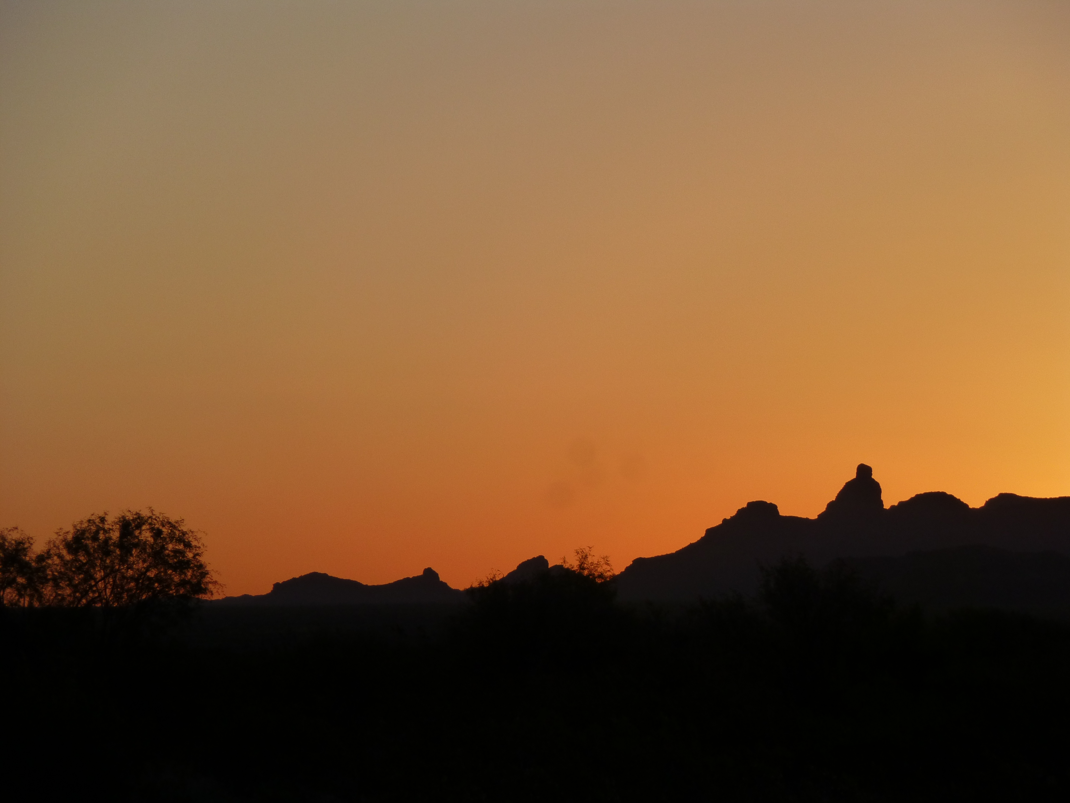
Looking east to Montezuma’s Head, the tower on the right
About that time, I turned off my light. This is a magical time in the desert and I wanted to savor it, before the real work started. At around 6:15, the first rays of the rising sun touched the highest summits, then crept down to the desert floor. Here’s Peak 2130 still way off in the distance, the first one I wanted to do for the day. I was walking through The Valley of the Ajo, and as you can see, it was still a cakewalk on the old road. There came a time, though, when it curved farther east and served no further purpose – that was where I left it and headed north cross-country.
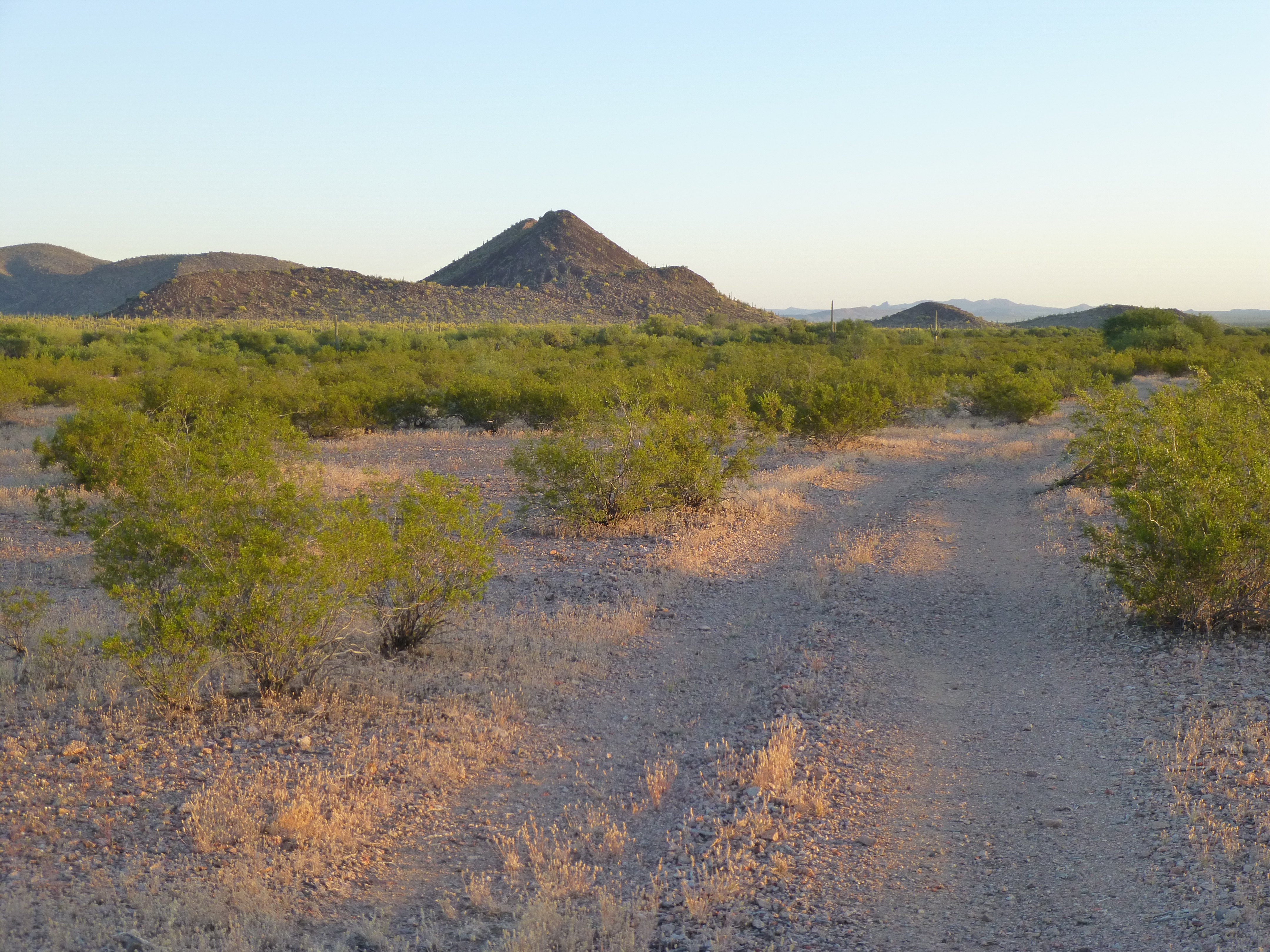
A glance at my first peak of the day, Peak 2130
It’s never ceased to amaze me, even after thirty years of traipsing through the desert, how you can walk through completely flat country and come upon a wash that is so brushy it is pure hell to walk through, like the one I encountered as I headed north, a small nameless tributary of the Cherioni Wash. As you approach it, it looks like a band of trees across your path – no big deal, right, you’ll just pass through them and be on your way. Even though no part of it was more than five feet deep, it turned out to be a real bushwhack, choked with trees, brush and thorns – a 500-foot band of crap that was a lovely way to start the day. Plowing through it and coming out the other side, it was an easy walk from that point on to reach the east side of the peak.
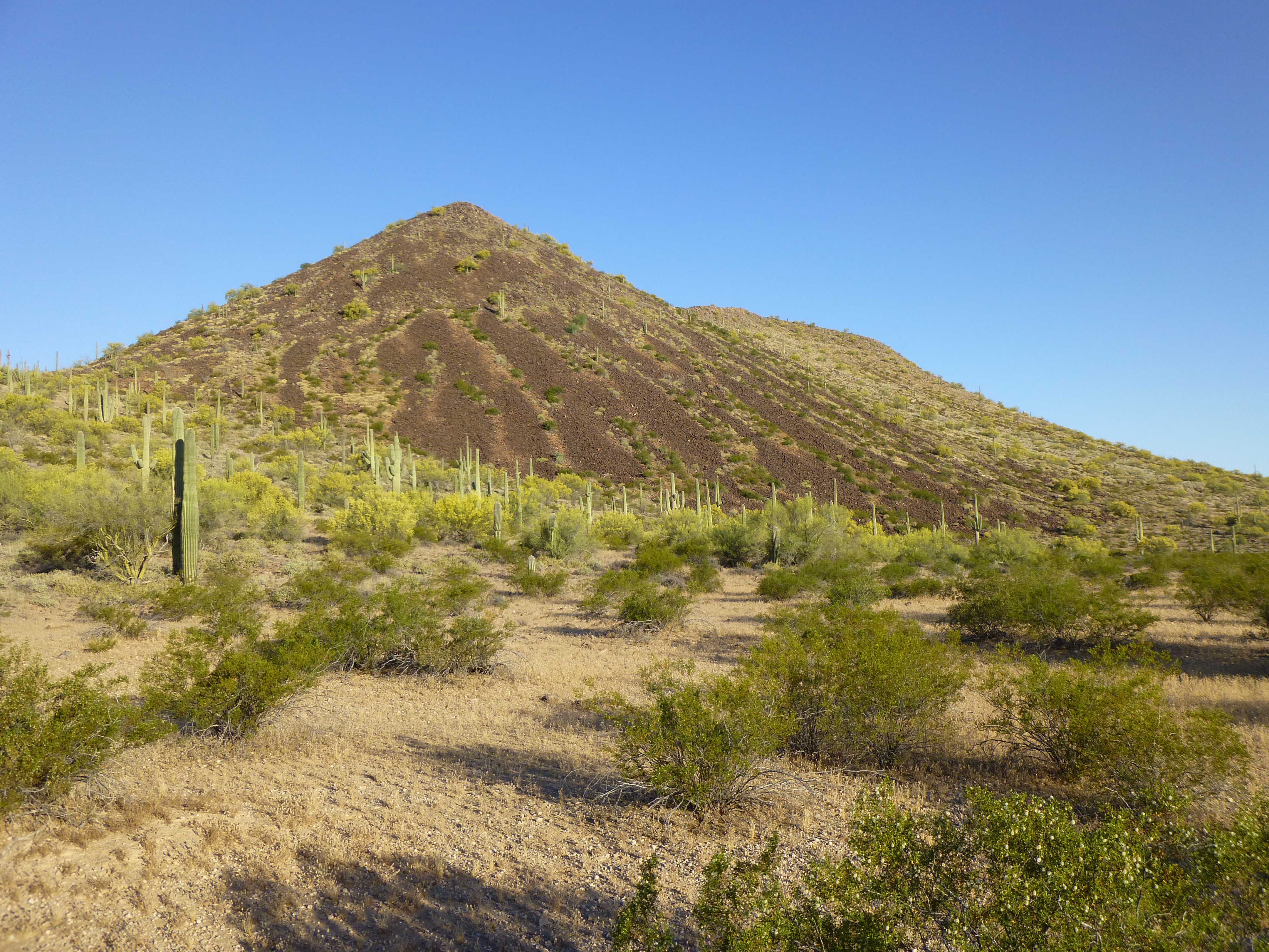
The east side of Peak 2130
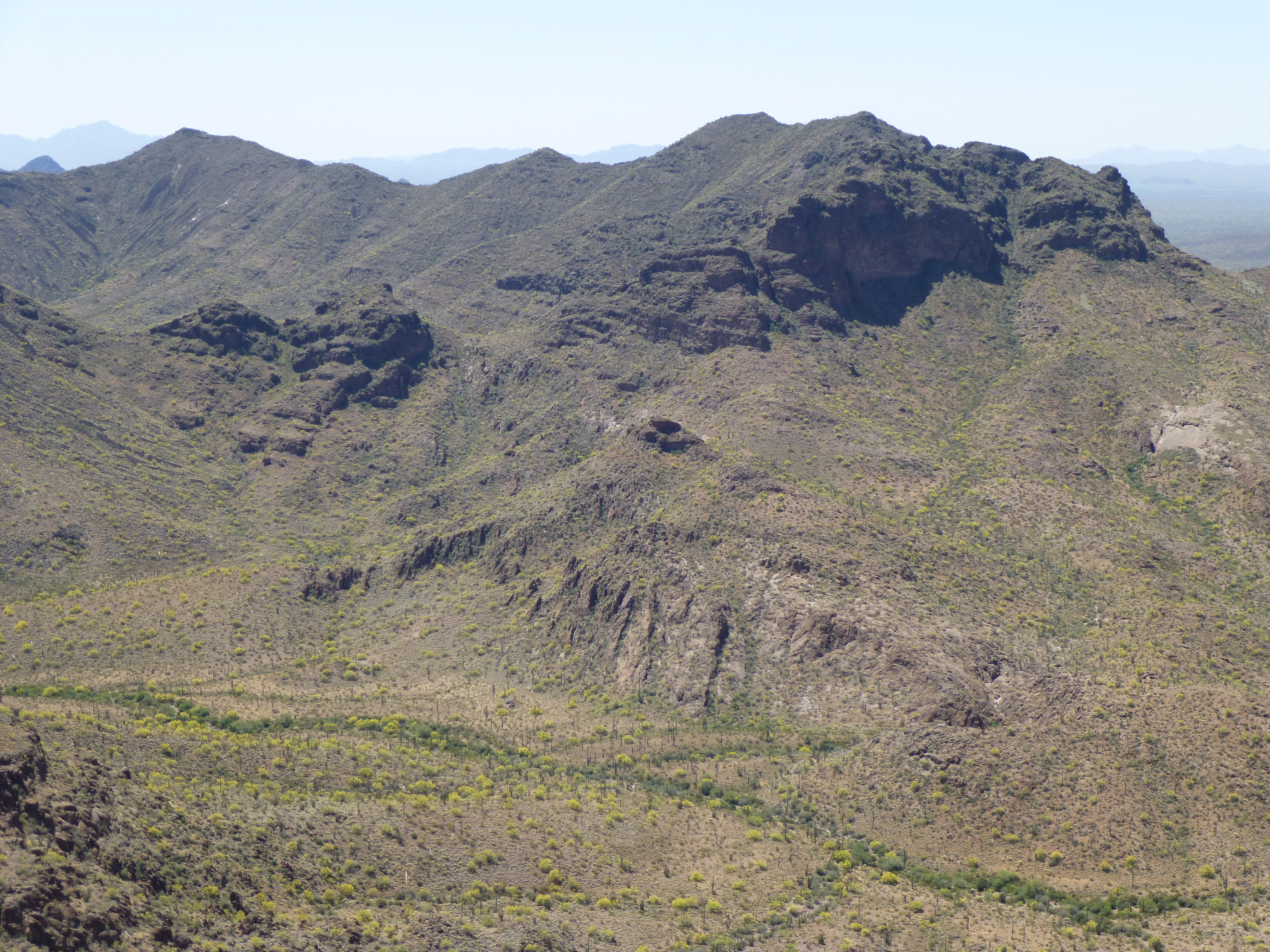
The talus slope made for a quick path to the top, and there I was – 7:38 in the AM, and over five miles under my belt. The register left by the first-ascent party had been destroyed by smugglers – I chose to not leave another. It was still nice and cool in this early part of the day. As I looked to the northwest, the direction of travel for the next part of the trip, it looked bloody awful far to go to reach the next peaks. Hmmm, was I biting off more than I could chew? The steep one on the left horizon was next on my hit list. It looked pretty straightforward to get there – it usually does, but the desert can fool you. If you zoom in on the next photo, you can see thousands of little yellow bits in the distance – those are Palo Verde trees with yellow blossoms, just like the ones by the Saguaro cactus close by.
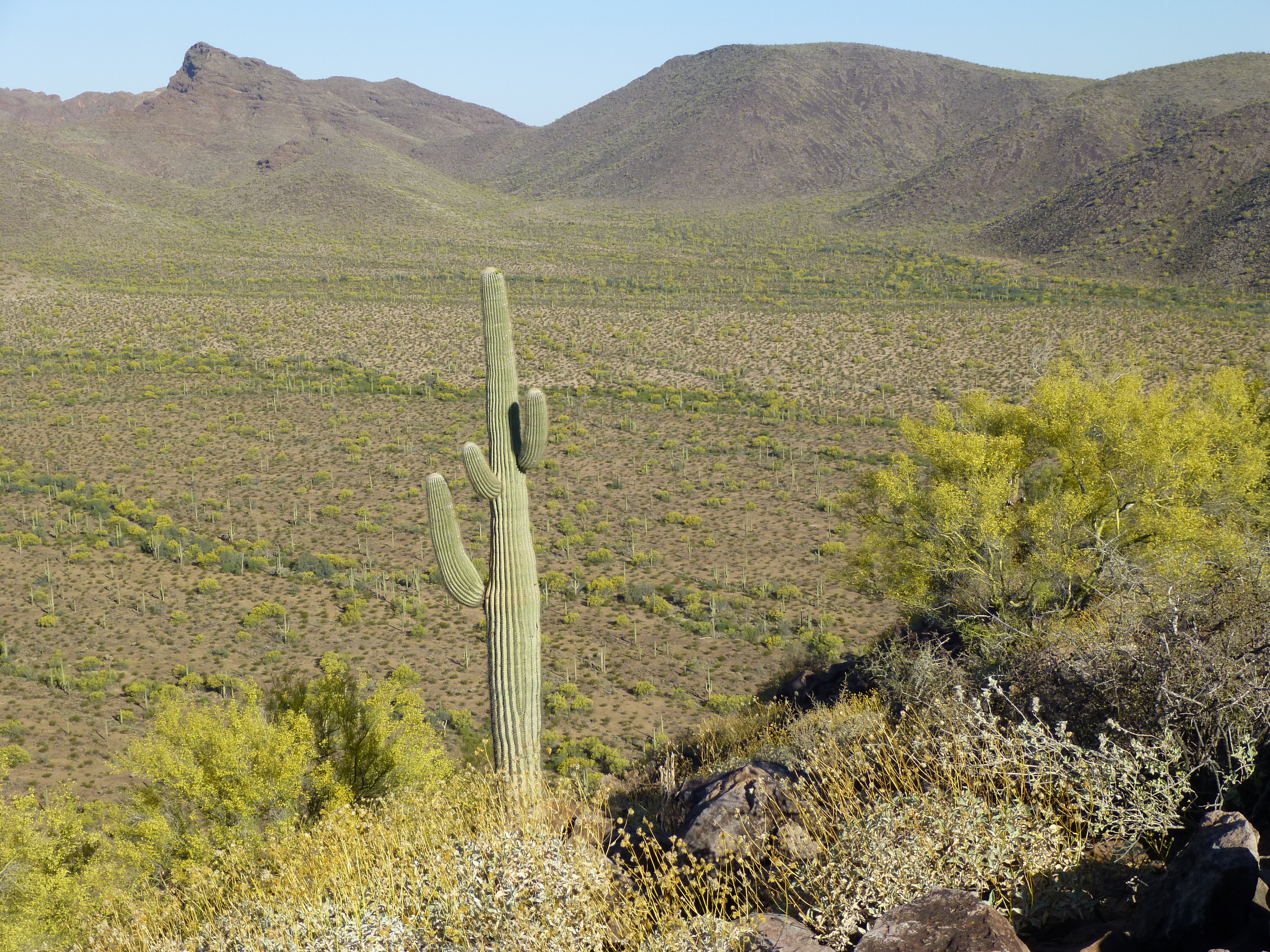
Looking to the next peaks, miles away
The 500-foot drop down the west side was all in the shade, so that helped some, but once I reached the desert floor I knew I’d be in full sun the rest of the day. It was a long uphill march, fairly easy going with the exception of a couple of major washes to cross.
Palo Verde trees, the most common species in this part of the Sonoran desert, were in full bloom, adding a welcome splash of color to the landscape. You get used to the sound of bees out here, and the yellow flowers must have been quite an attraction to them. As I’d approach a tree, the hum of hundreds, maybe even thousands, of bees filled the air. Even though all of our bees here are now Africanized (read “killer”), these gals were so occupied with gathering pollen and nectar that they paid me no mind. It was interesting to hear the doppler effect of approaching and leaving each tree. I also noticed that if a tree’s flowers were ever-so-slightly past their peak, it’d be almost deserted.
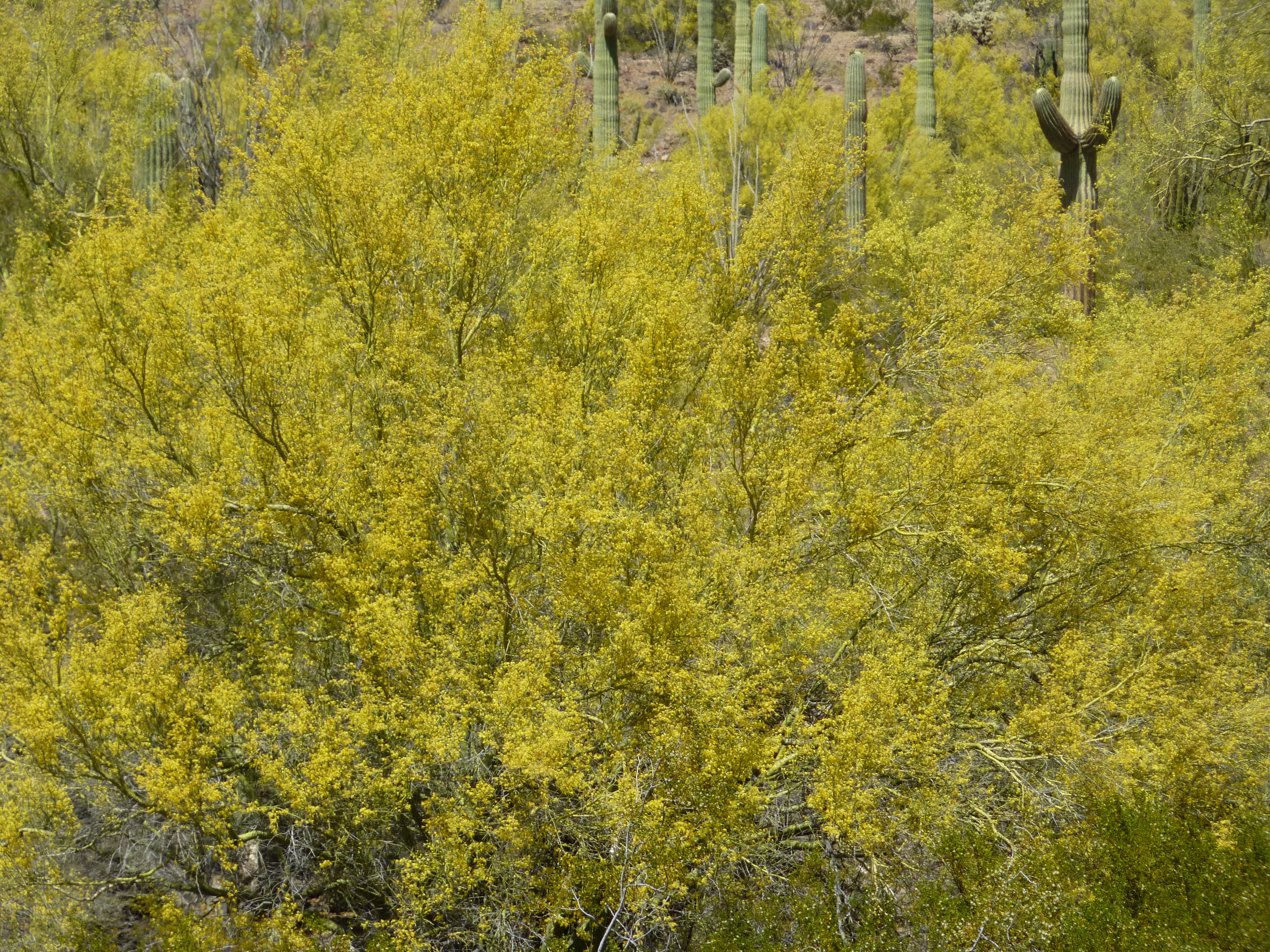
Palo Verde tree in full bloom
Aside from a few birds, the only wildlife I saw was this fine fellow.
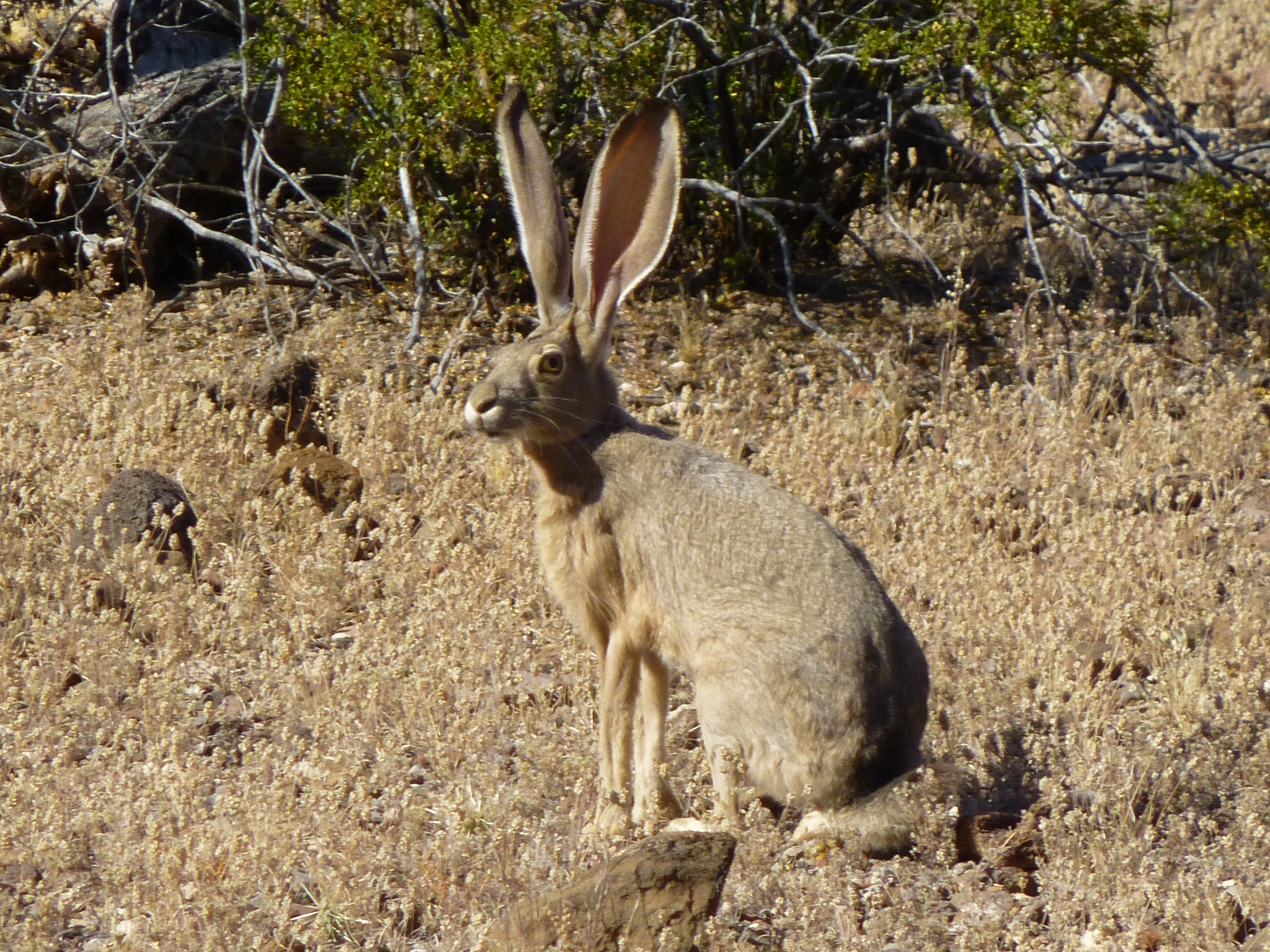
A black-tailed jackrabbit
The valley narrowed as I approached the peaks. Tell-tale bits of trash started to appear, as did a faint footpath, which I followed up a steep slope to a saddle at 2,100′. Something caught my eye, an area of light-colored rock on a steep ridge about half a mile away. Maybe it was the heat starting to work on my brain, but it looked like a huge face. See it, filling the left half of the picture? The nose, and below it a massive fold of rock forming the lip, or perhaps a drooping moustache. Above the nose, the dark rock forming a cap, or perhaps hair. He is facing to the right, and is the height of a 50-story building. Okay, maybe it’s just me, but I thought it was pretty cool.
The face
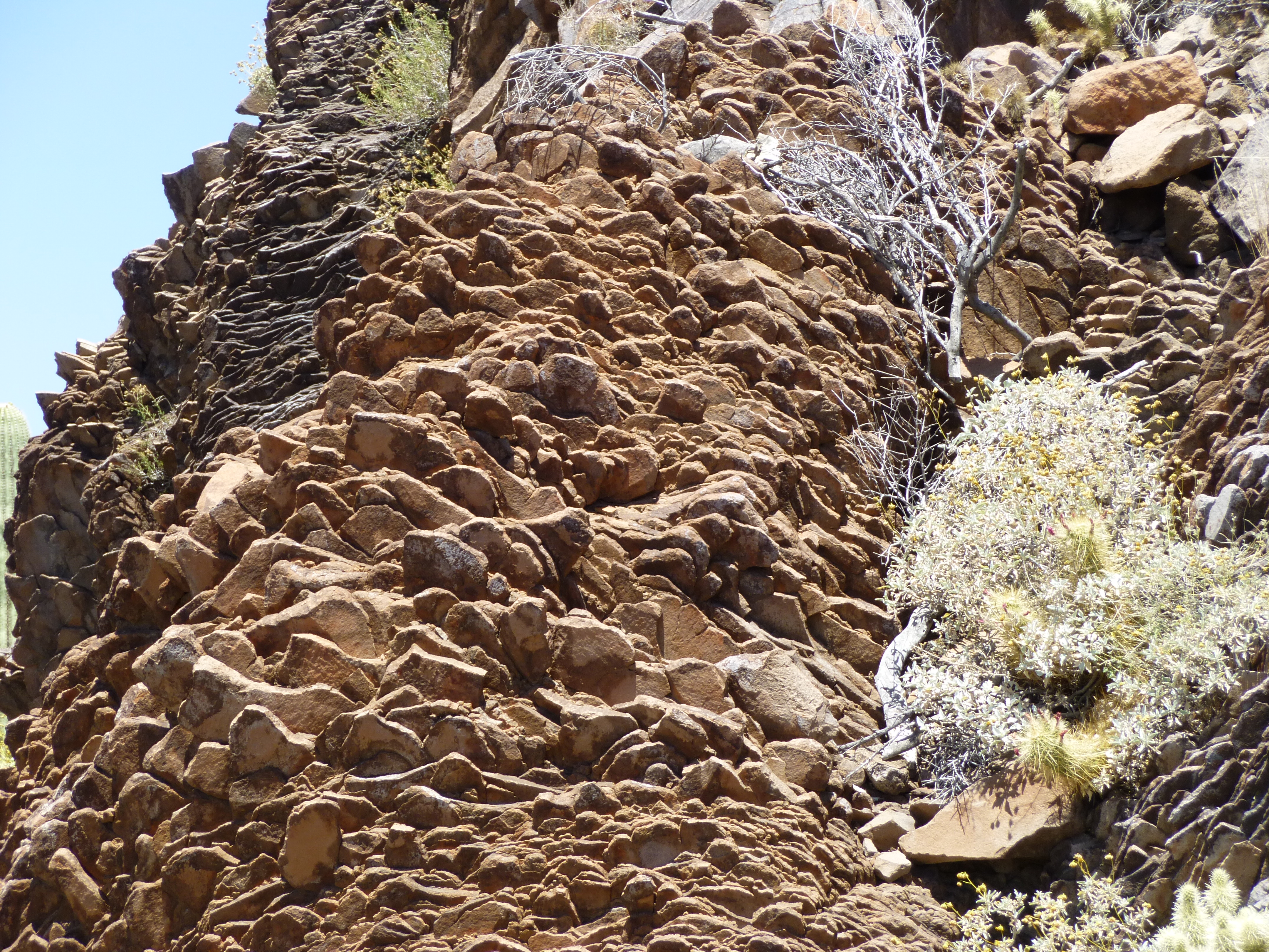
From the saddle, the highest of the peaks was right in front of me, rising a quick 800 feet up a steep ridge. That seemed the best way to climb it, but as I started up the slope, an obvious path veered off to the right. The lure was strong, so I followed it. It soon led into a deep canyon, but I was optimistic that it still might lead to the summit, so I stayed on it. As I went farther up the canyon, something amazing appeared. The canyon walls were formed of striking layers of rock which were overhanging along much of their length, much like the light-colored rock on the face in the above photo. Beneath the overhang was a series of natural caves, dozens of them. Most of them had their flat floors lined with pieces of cardboard or with colorful blankets, the type common in Mexico. As the path climbed, its slope matched the natural incline of the rock band. In the past, I have come across such natural caves used as shelter, but nothing as extensive as these. The more of them I passed, the more concerned I became, expecting that any minute I might come upon some that were occupied – thankfully, none were.
Whoever used these shelters as a shady respite from the desert sun, monsoon rains and prying eyes of planes, choppers and drones of the Border Patrol had tried to make them as comfortable as possible. Cast-off food containers, toiletries and water jugs were everywhere. This was the most organized and heavily-used of any of the hide-outs I’d ever come across. Just being there really put me on edge – I was both paranoid and fascinated at the same time. Normally, I’d be snapping photos like crazy to document a place like this, but all I wanted to do was get past it as quickly as possible, so I ended up with none. The risk of running into smugglers in a place like this is very real, and my heart was pounding.
Here I was, out in the middle of nowhere, or so it seemed to me. And yet, this was obviously a major waypoint for Bad Guys. It was about half-way between the Puerto Blanco road and the Camino del Diablo, and remote enough that law enforcement wouldn’t pursue them on foot into this enclave.
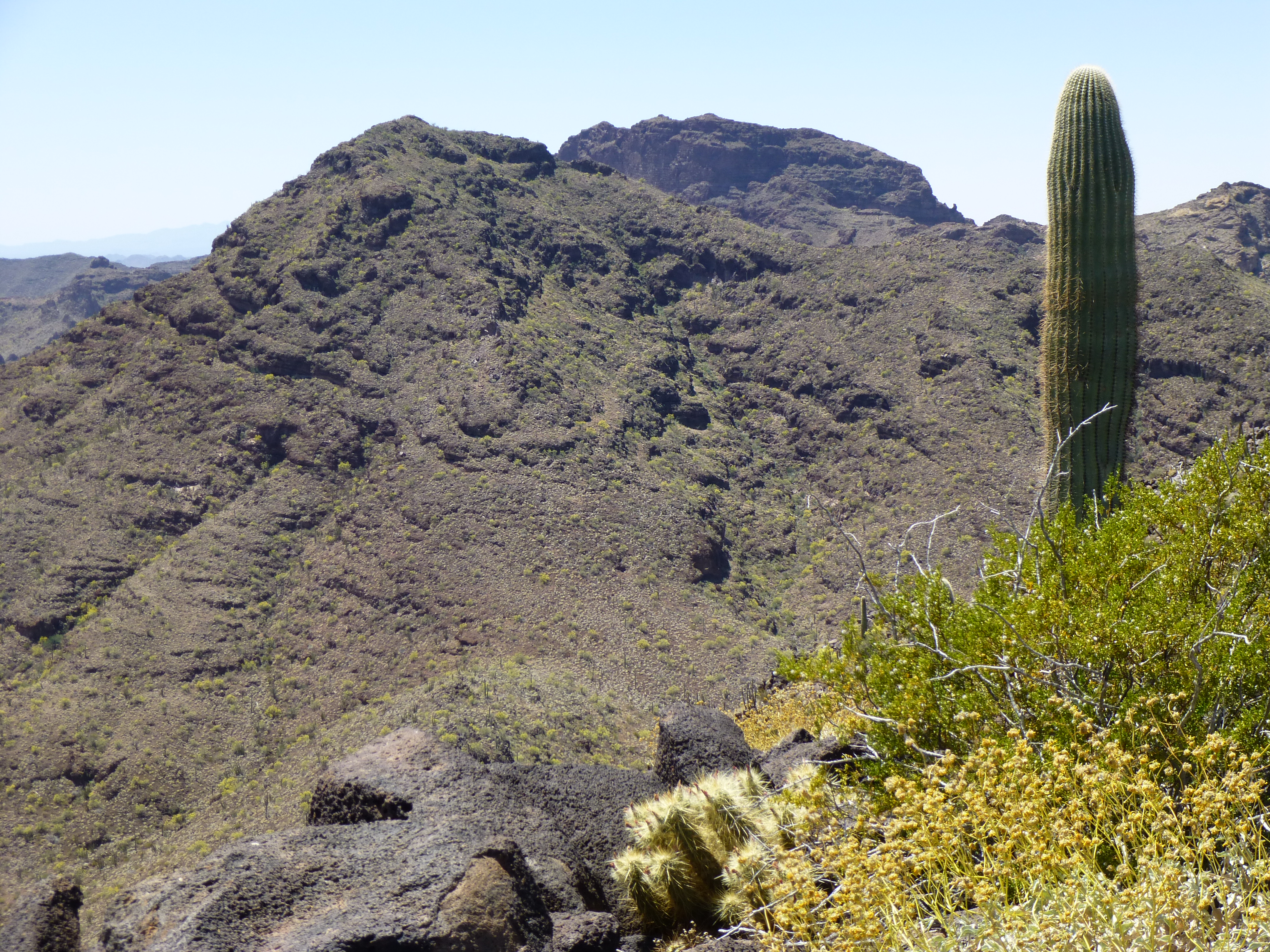
As I continued up the canyon, it looked like I was going to get completely boxed in. My luck held, though. Just when it appeared I’d have to backtrack, I found a Class 3 weakness through the cliff bands, then another and another – 600 feet later, I stood on the summit of Peak 2919. The time had really gotten away on me – it was eleven o’clock. It was really warming up, but a stiff breeze helped. I had a front-row seat for Kino Peak, at 3,197′ the range high point.
The east face of Kino Peak
Also, a great view of Peak 3019 , a large prominence farther south.
South to Peak 3019
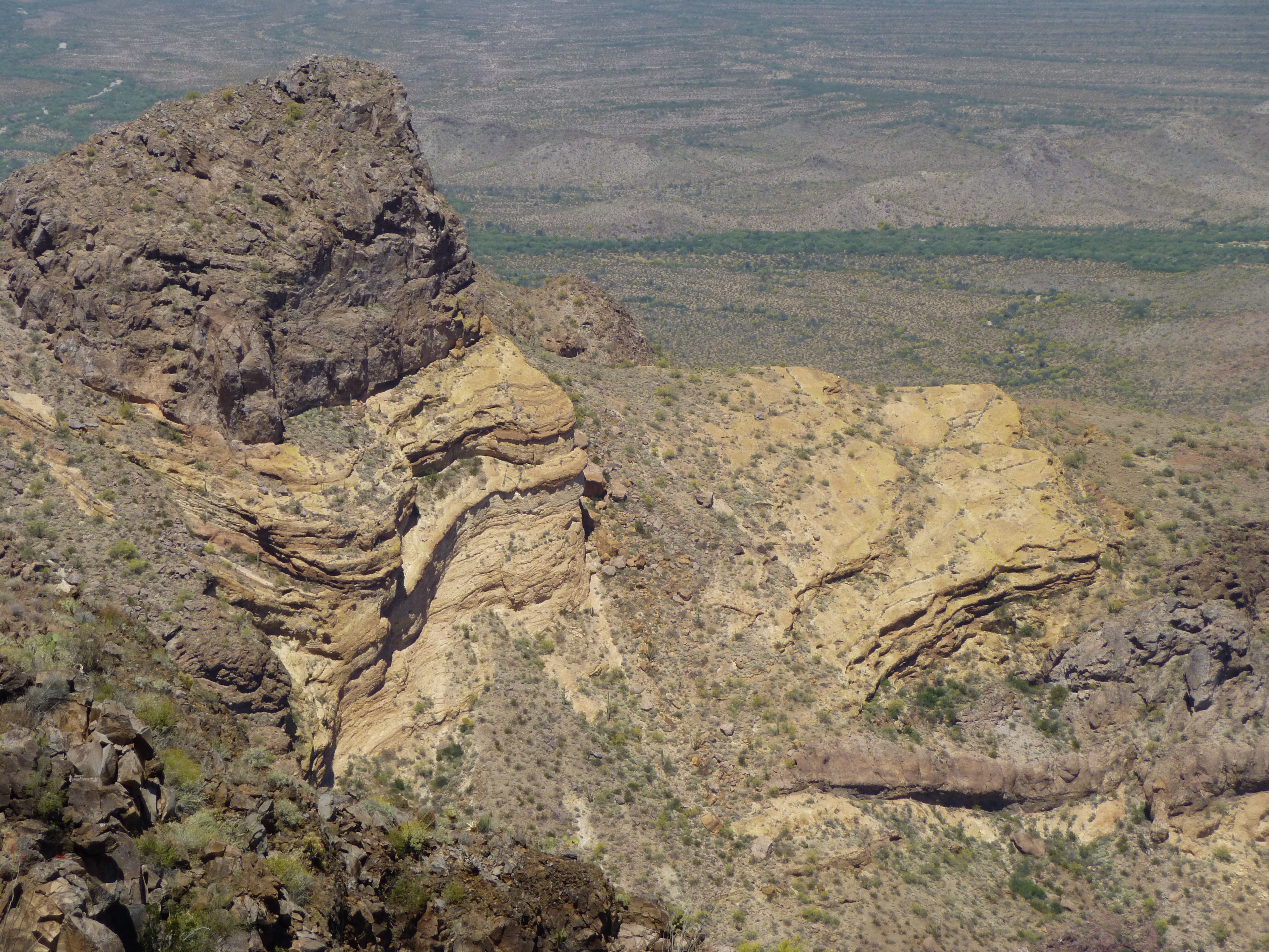
I still felt good, but jeez, I had only done two of my five peaks. The register had been destroyed and I saw no point in leaving another, so I elected to move on, back to the saddle by the shortest route, the steep northeast ridge. Twice on the descent, I feared getting cliffed out, but squeaked through both times. Once at the saddle, it was a straight shot northeast up the ridge to the top of Peak 2678. The only thing of note was this unusual formation along the ridge.
The weird rock formation
Atop the peak, I found, once again, that the register had been destroyed by smugglers. This was becoming an all-too-frequent pattern. It was a quarter of one when I arrived, and twenty minutes later when I left. Here’s a view looking back to Peak 2919, with Kino Peak behind it.
The northeast side of Peak 2919
It took almost an hour to drop off the steep, loose south side to the valley below. It felt hot, and I was no longer having fun. Contouring over to a saddle, I went up a long ridge which spiralled up to the top of Peak 2356. At 3:00 PM, I found what was left of a summit register. It sat atop the cairn, quite exposed to the sun; a small glass baby-food jar, untouched for 15 years since left by the first-ascent party. I was disappointed to see how badly the lid had deteriorated, because I too have left plenty of these on summits and I now know that they wouldn’t last as well as other jars with a regular threaded lid. I signed in and ate some food. What now?
Every 3 hours, I had been taking 3 Sportslegs capsules to help prevent cramps. They worked well, but you still had to be drinking enough electrolyte replacement to deal with the moisture loss from sweating. Of the 5 quarts I’d brought, I now had less than one left. I looked over at my fifth and final peak – the quickest way to climb it would be to drop down to the valley below, then head straight up the north slope for 1,100 vertical feet to the summit. I think I had it in me, but I wouldn’t have had a drop left to drink by the time I reached the top. With all the distance yet to cover to get back to my truck, that wouldn’t be a smart move. So, the decision was almost made for me. The mountain would still be there when I returned at a future date.
It wasn’t a stroll in the park to finish. Once I descended the east ridge of my peak, I set out across the desert floor and soon crossed through a gentle saddle, then put in some miles across fairly flat ground to pass south of Point 1813. After another wearying thrash through this morning’s brushy wash, I finally re-gained the old road. Now it was just a matter of putting one foot in front of another, but it was still four miles of steady uphill.
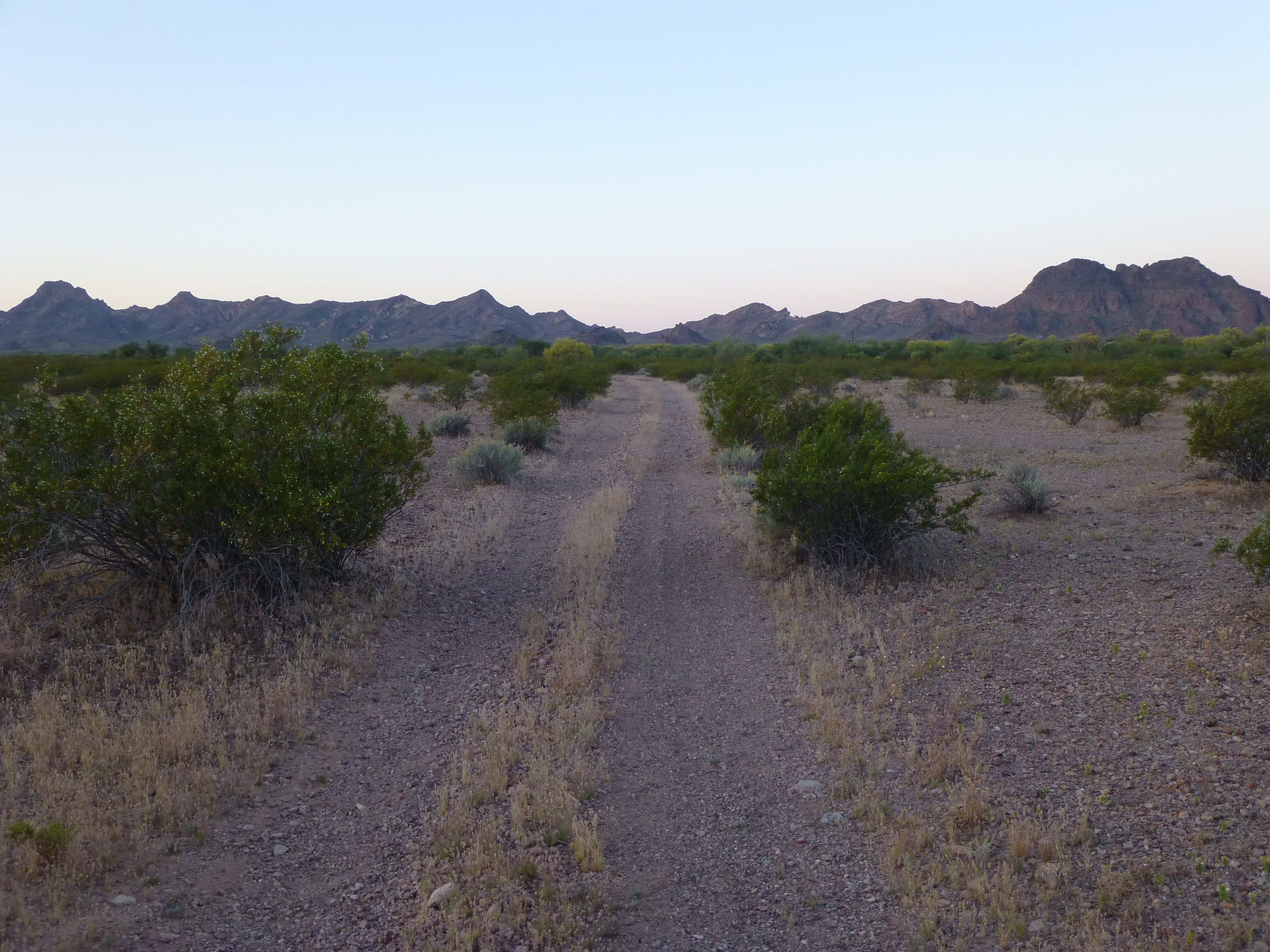
The way home. My truck was parked way over by the mountains in the distance.
I took out my phone and tried to distract myself by listening to Hendrix, Country Joe and the like. A strong wind cut across my path and nicely cooled me off as I plodded along. Words can’t quite express how good that truck looked as it came into view, and by a quarter of seven I was there. What a day – 13 and a half hours out on foot, and 21.4 miles on the old boots. If I had to do it all over, I’d bring 8 quarts instead of the 5, as I’d finished everything I had several miles before the end. It all turned out well, though. I set out driving right away, and it was insanely late by the time I got back home, but it’s been great getting into the back country of Organ Pipe once again.
Please visit our Facebook page at: https://www.facebook.com/pages/Desert-Mountaineer/192730747542690