
Our cool weather was still holding into early May, so I spent some time in the Bates Mountains bagging a bunch of peaks. But when, two weeks later, the forecasters called for a high temperature of only 78 degrees in Organ Pipe National Monument, I figured they must have been smoking something. They were saying it’d hit 101 one week later, which was closer to normal, so I thought to myself “Self, you’d better get out one last time climbing before the desert starts really cooking”. My job as a teacher wasn’t an issue, as school was out for the summer, so I loaded up the truck and headed out. Three hours later I had reached my destination.
I parked near Alamo Wash just after one in the afternoon and walked south towards Peak 2610.
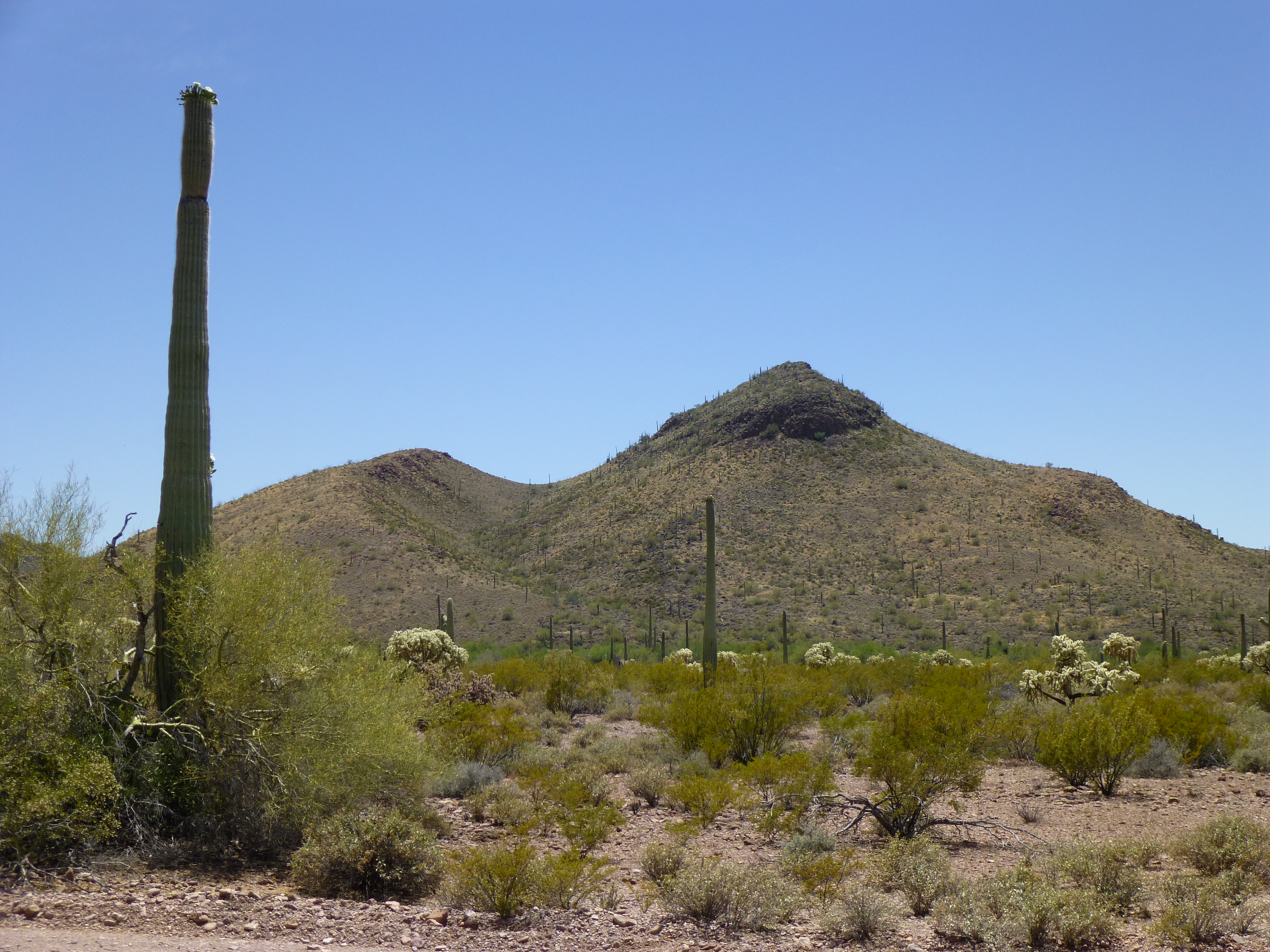
Looking south to Peak 2610
Part way up the north ridge, I heard a noise and looked back to my truck, only to see a white truck stopped by it. It stayed there for 15 minutes, then left – I figured it must be an Organ Pipe vehicle. Meanwhile, I reached the summit, where I found this huge cairn and a register.
The cairn on the summit of Peak 2610
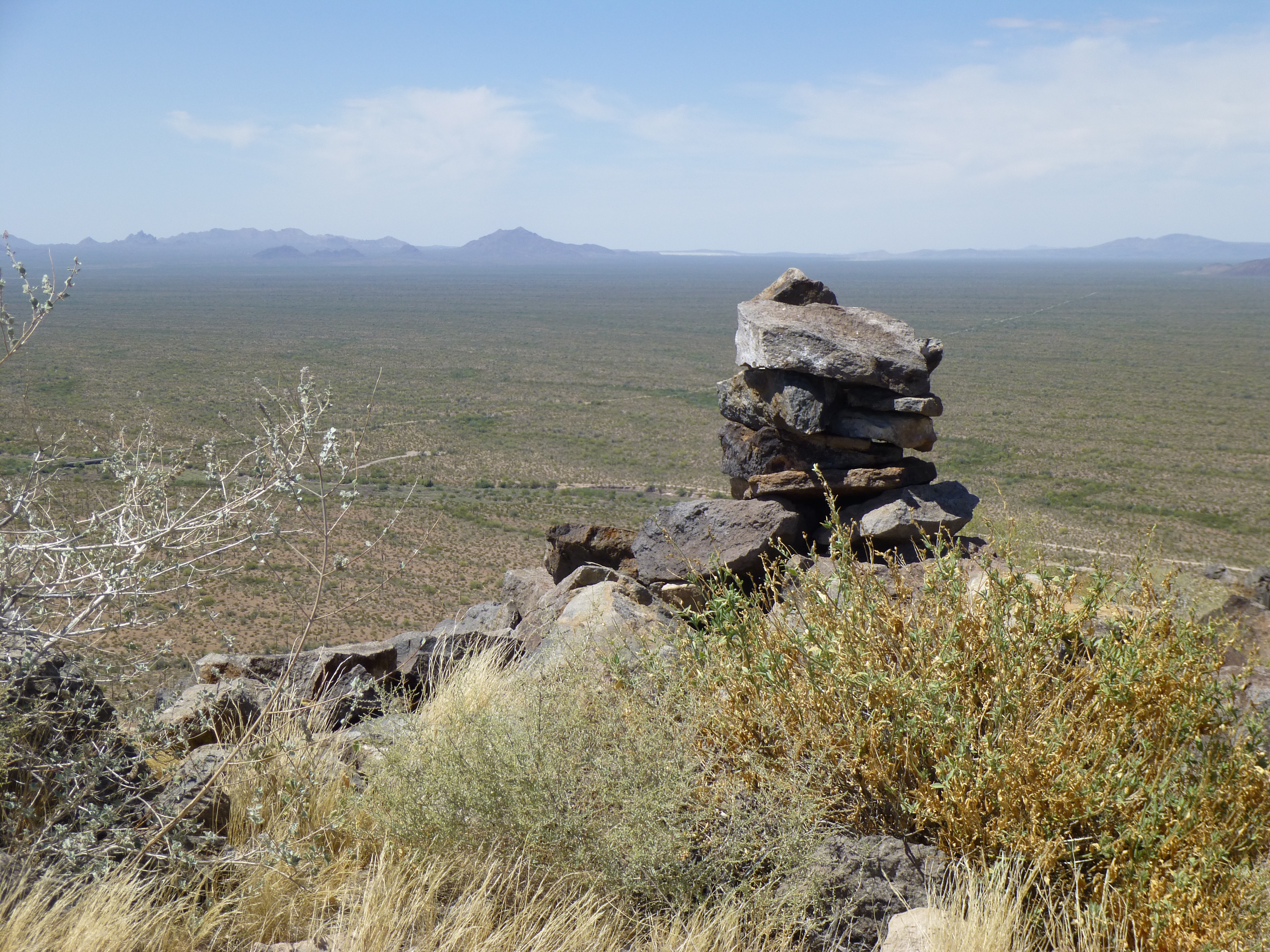
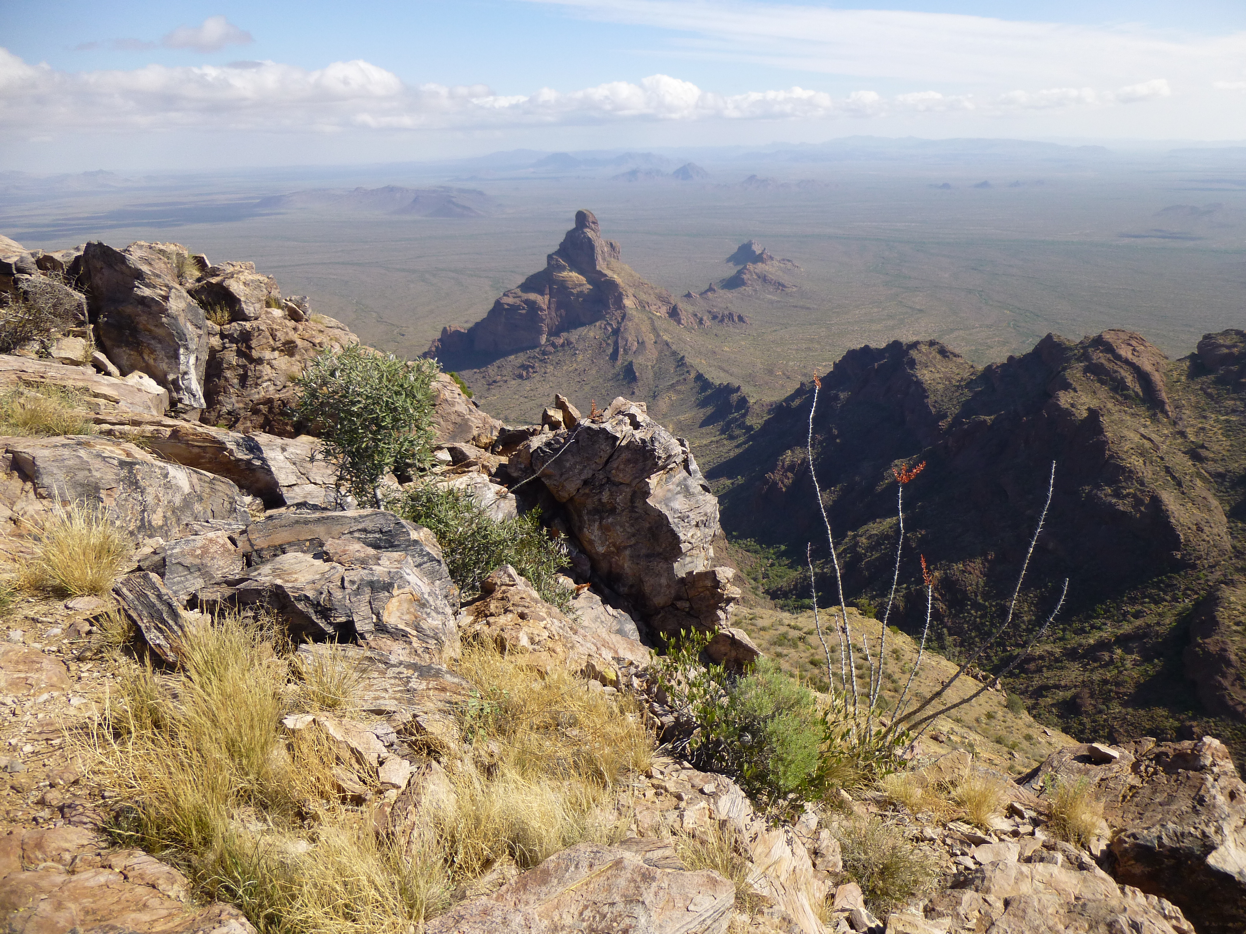
I was expecting maybe three prior entries, so you can imagine my surprise when I found over twenty, including many Mexican nationals who’d signed in. Perhaps this was to be expected – the peak was, after all, only a mile east of Eagle Pass on Highway 85, easy of access to smugglers heading north and wanting a good vantage point for spotting their ride on the desert below. Peak 2610 isn’t part of any range, but rather sits at the north end of a long ridge having its origin near Tillotson Peak miles to the south.
Looking south along the ridge to Tillotson Peak
Once back down at my truck, I drove the remaining few miles up Alamo Wash to the Alamo Canyon campground. The park calls it primitive, as all it offers is a toilet building and four campsites. At four bucks a night, the price was right, though. I parked at the trailhead and headed out right away for another peak. Jake Cramer had climbed it a year earlier and recommended it, so I wanted to give it a try.
I set out south, dropping down into and across Alamo Wash, then over an easy chunk of desert to reach a pass at about 2,600 feet. There, I had my first good view of the summit area of Peak 2900.
Looking south to the summit of Peak 2900
It always gets my heart racing when I see a peak with an unknown challenge. Even though Jake had said it went fine, I had to figure out my own way up it. I clambered up to the summit ridge and had a better view, but still hadn’t unlocked the puzzle.

Nearing the top
The rock was decent, and I kept climbing, ending up on a pinnacle which I quickly realized was not the high point. A bit more exploration and, bingo! – I had it. What a nice airy fin of rock. There was no register, and I chose not to leave one, instead enjoying the moment. I reached over and touched the highest point but there was no way I was going to stand on it – way too narrow, exposed and dangerous. A good solid Class 3. I backed off slowly, then retreated down to safer ground. By the time I was back at the campground, two hours had passed. It was line-of-sight to the town of Ajo, 22 miles away, so I was able to connect to their cell-phone tower and call home. After a bite to eat, all that remained was to watch the sun go down over the saguaros.
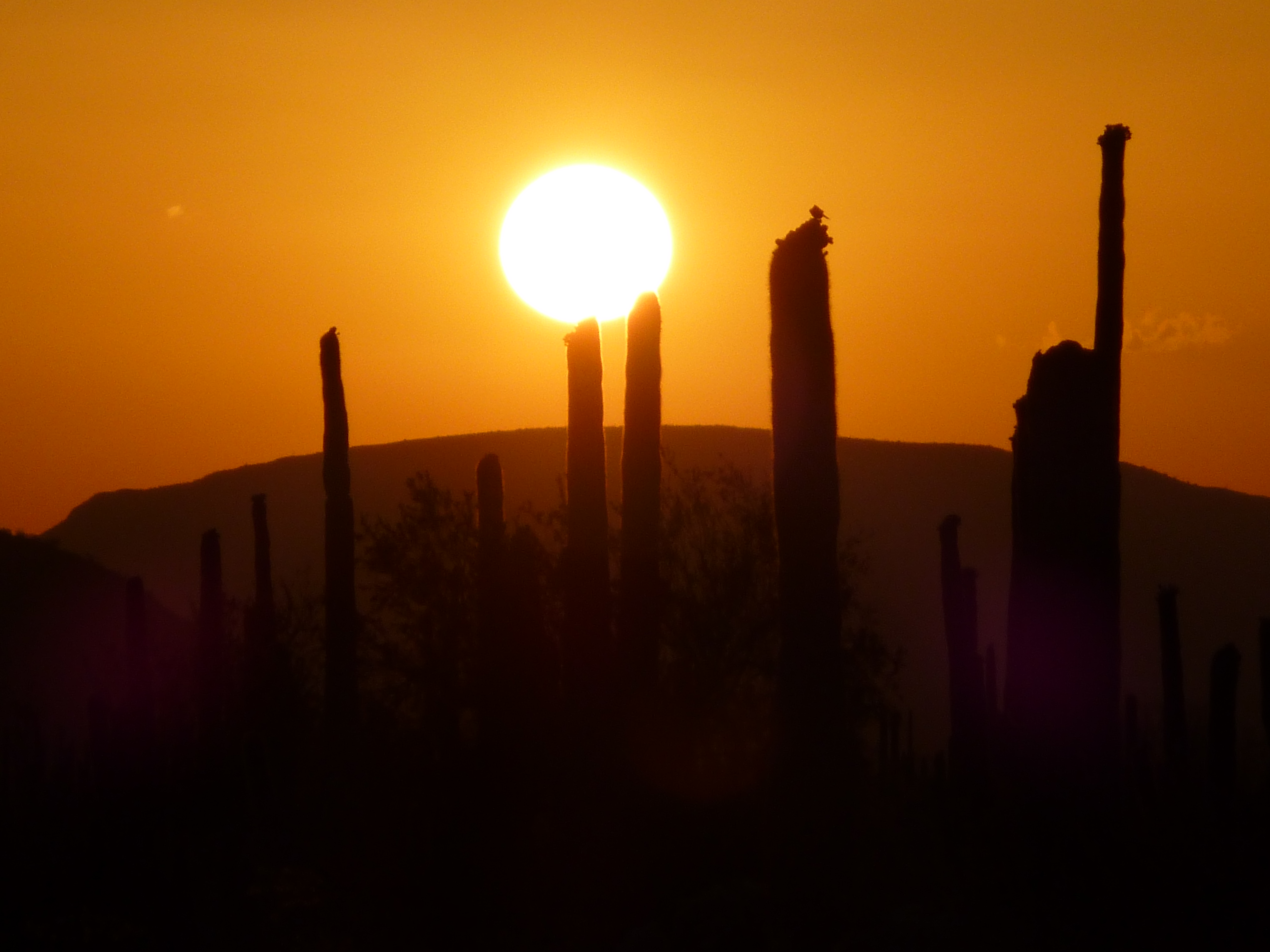
Another desert sunset
The next morning, I was up at 4:00 AM. The two peaks yesterday were just a warm-up for what was to come today. Donning my headlamp, I started up the trail (it was a rough road years ago) and walked a mile to its end. That took me past the ruins of an old adobe home. This was where Bill and Birdy Miller used to live – they had a mining claim and ran a few head of cattle. Archaeologists know that long before the Miller’s time in the canyon, early peoples walked there as much as 10,000 years ago.
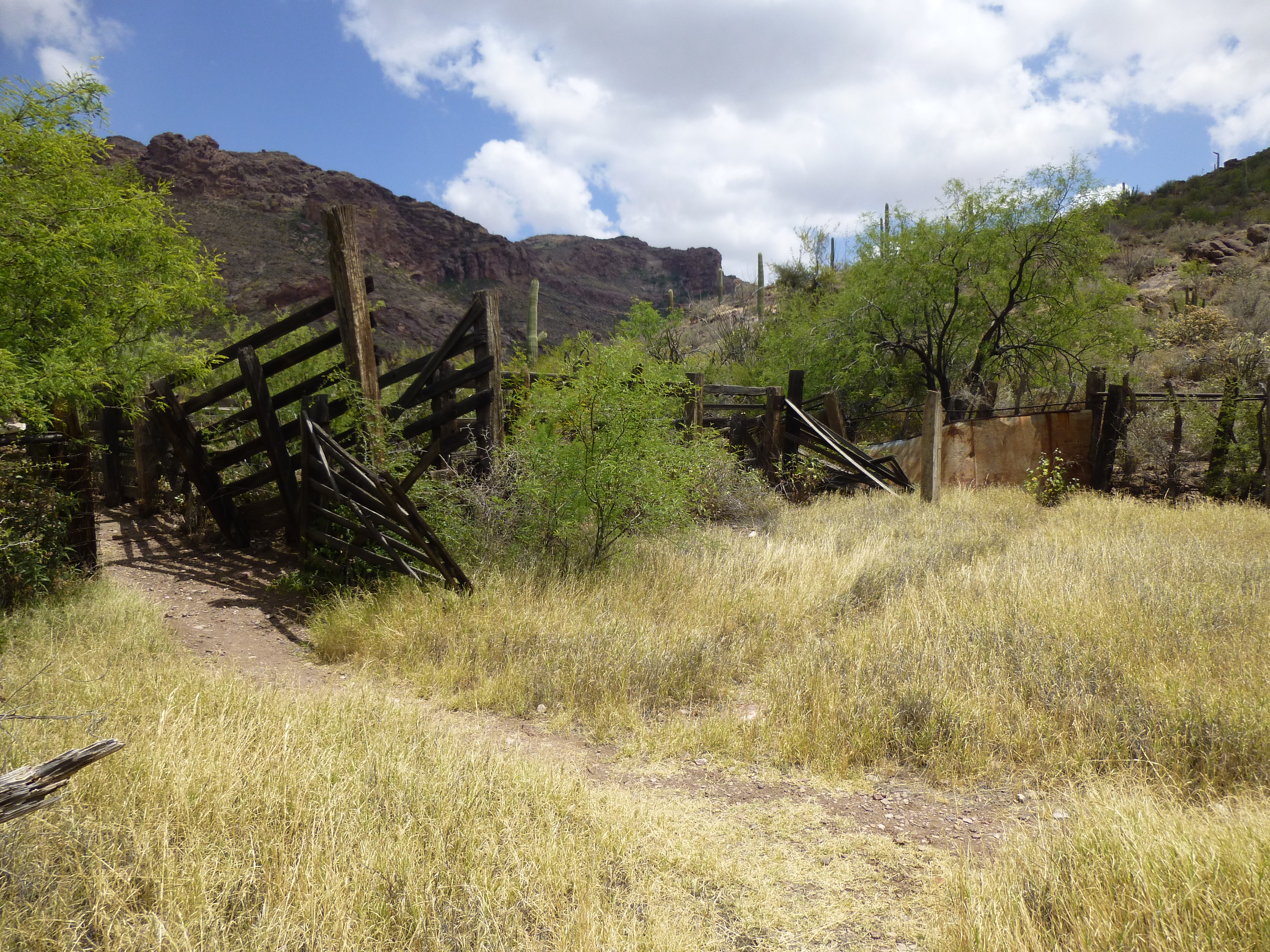
The old corral at the Miller’s homestead
Just past the old well and corral, Alamo Canyon splits into three major branches, the North, Middle and South forks. The north would take me where I needed to go. For a full mile, I walked up the wide channel of the dry wash. In several spots, pools of water sat in natural depressions in the rocky bed.
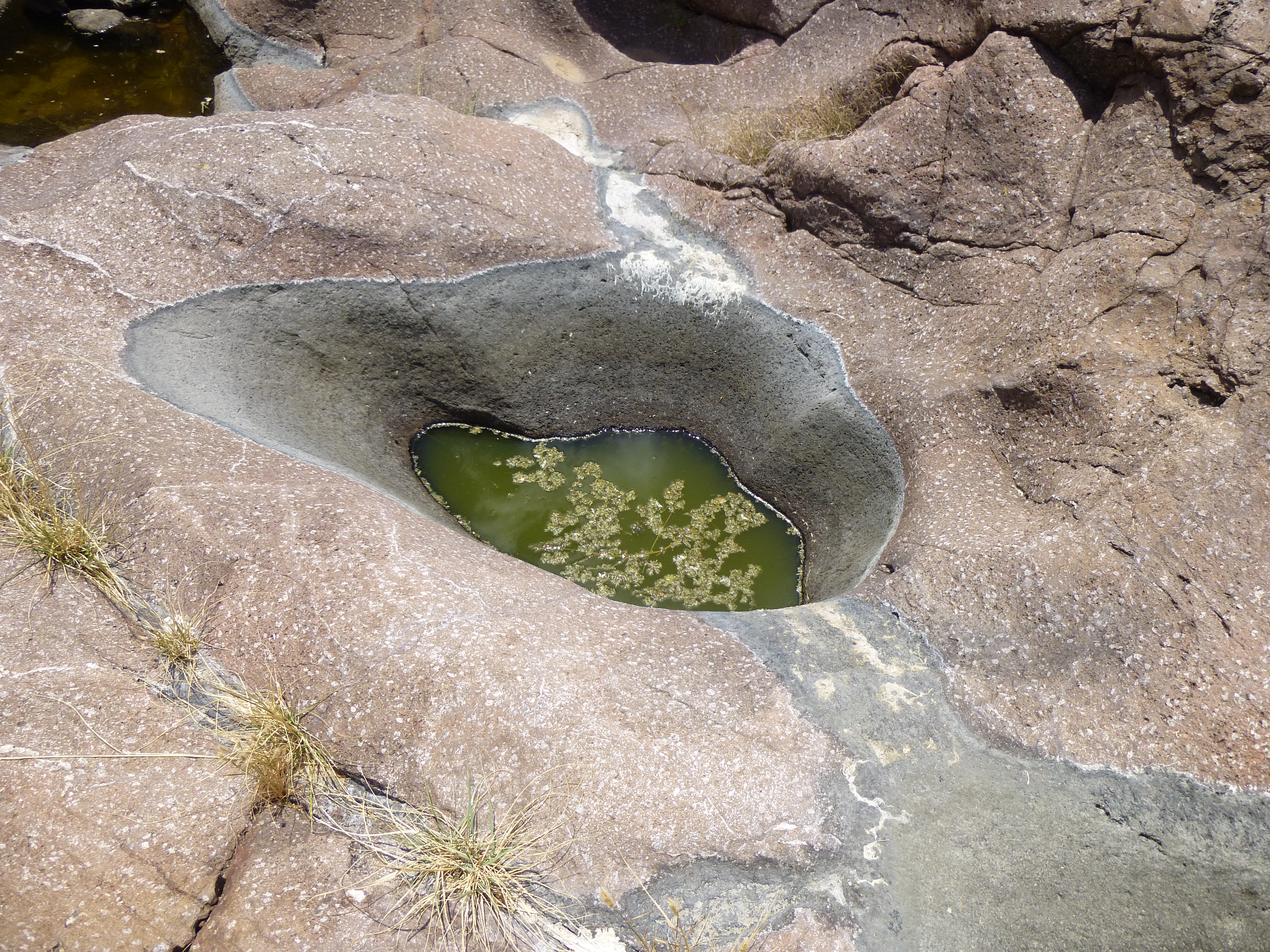
Lifesaving pools of water
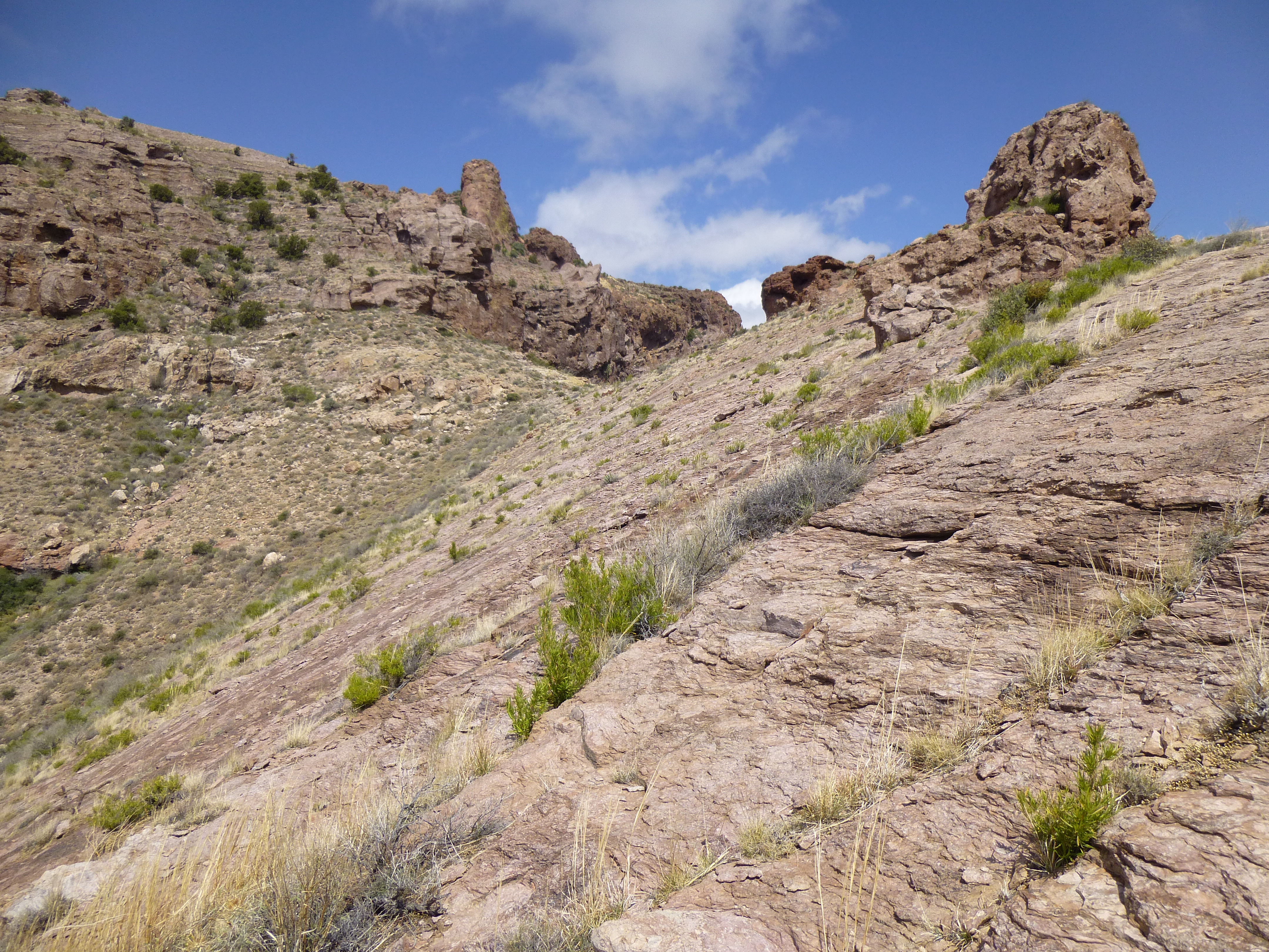
A time came when I reached a major split in the canyon, and I took the east branch. After a climb up a small dry waterfall, the path ahead was a bit rougher than before, but still presented no obstacles.
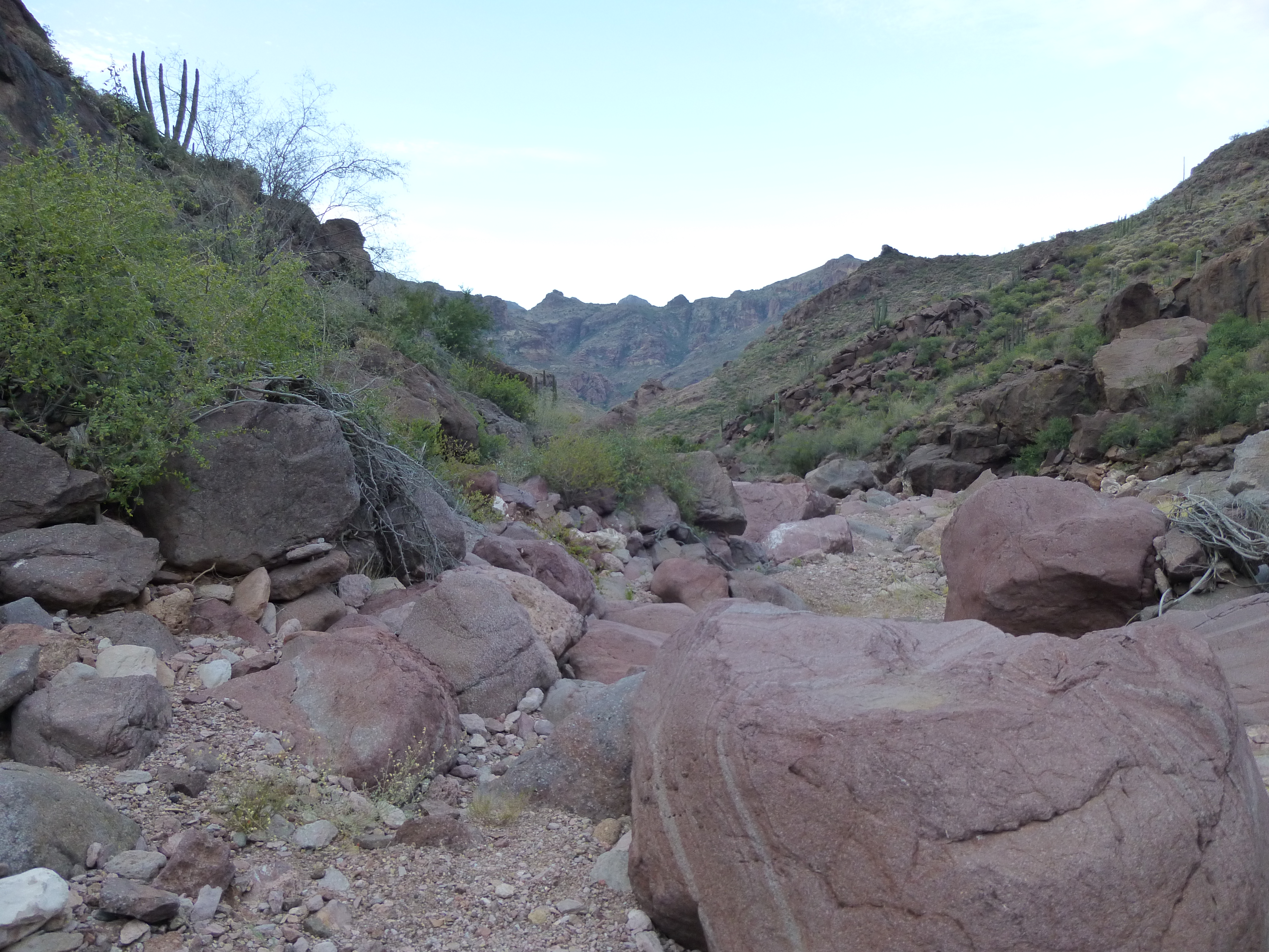
Continuing up the canyon
Something that caught my eye was this juniper tree, Juniperus arizonica, at an elevation of 2,800 feet. This seemed awfully low – normally one would expect to find one of these at a much higher elevation. It is probably several hundred years old.
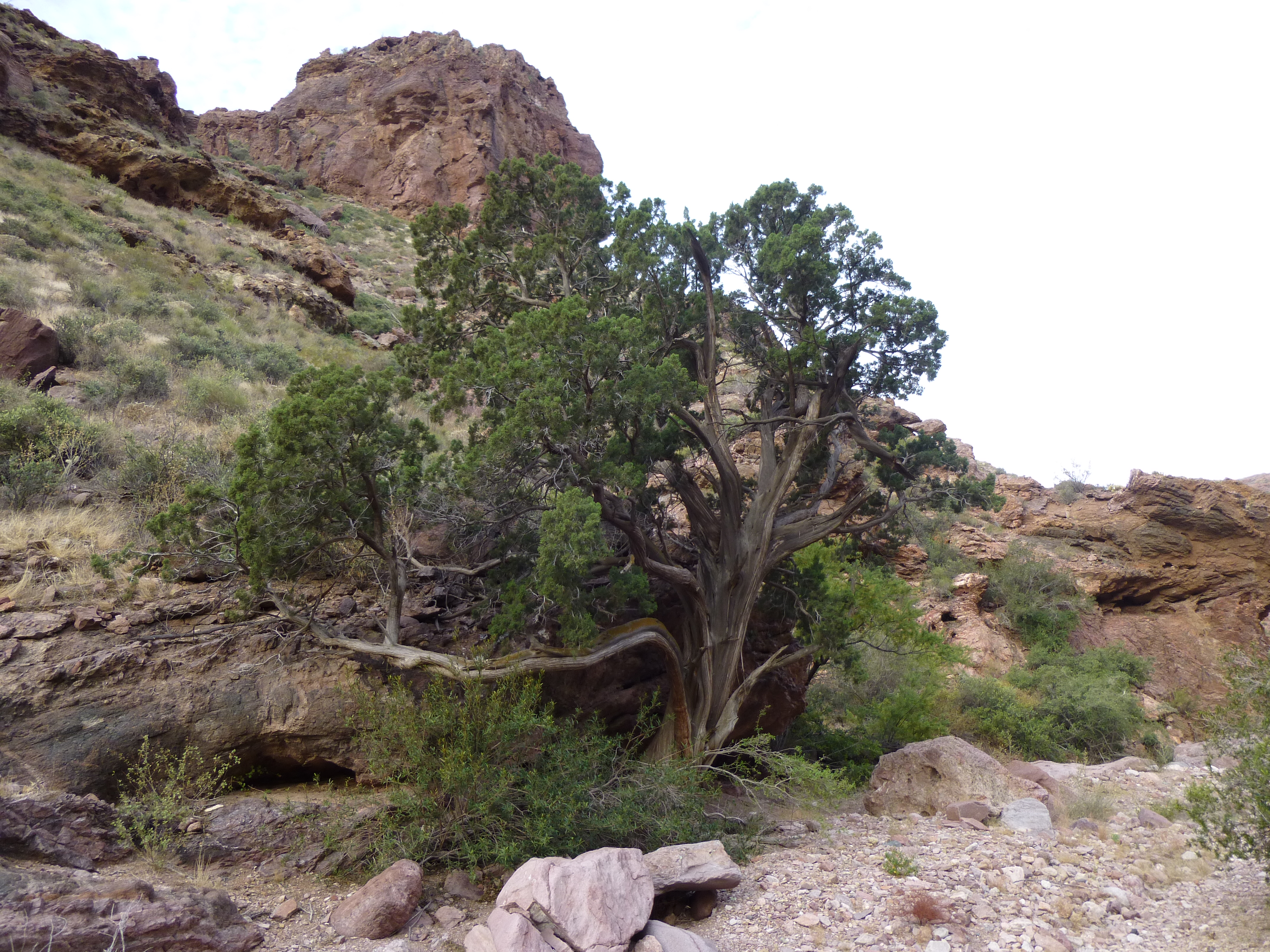
The tree
After another mile, I left this branch of the canyon and made one more major change of direction, heading north once again. As I moved higher, the canyon narrowed and the walls closed in. Several waterfalls had to be climbed, and there was something interesting around every corner, like this huge overhang which I nicknamed “Eagle Rock” as it looked like an eagle’s head.
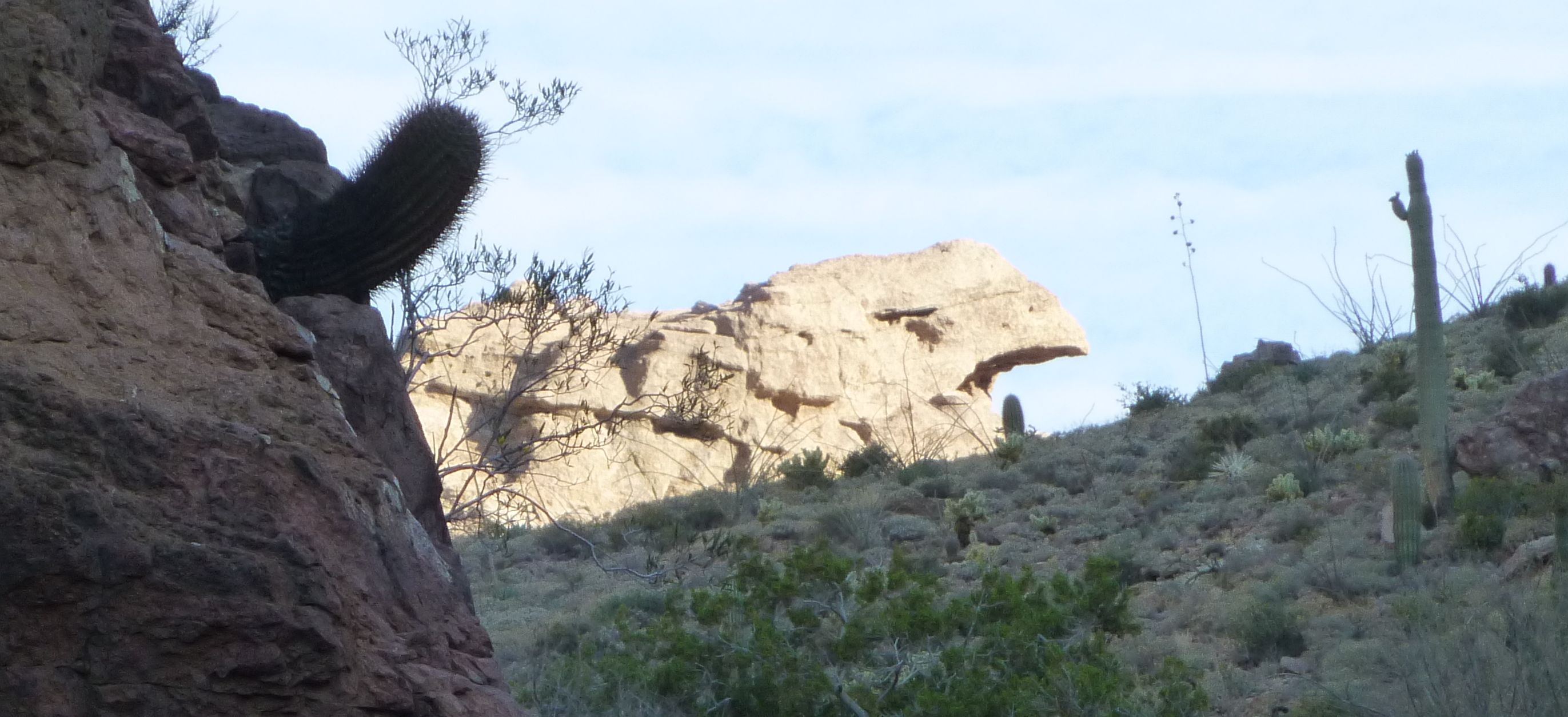
Eagle Rock
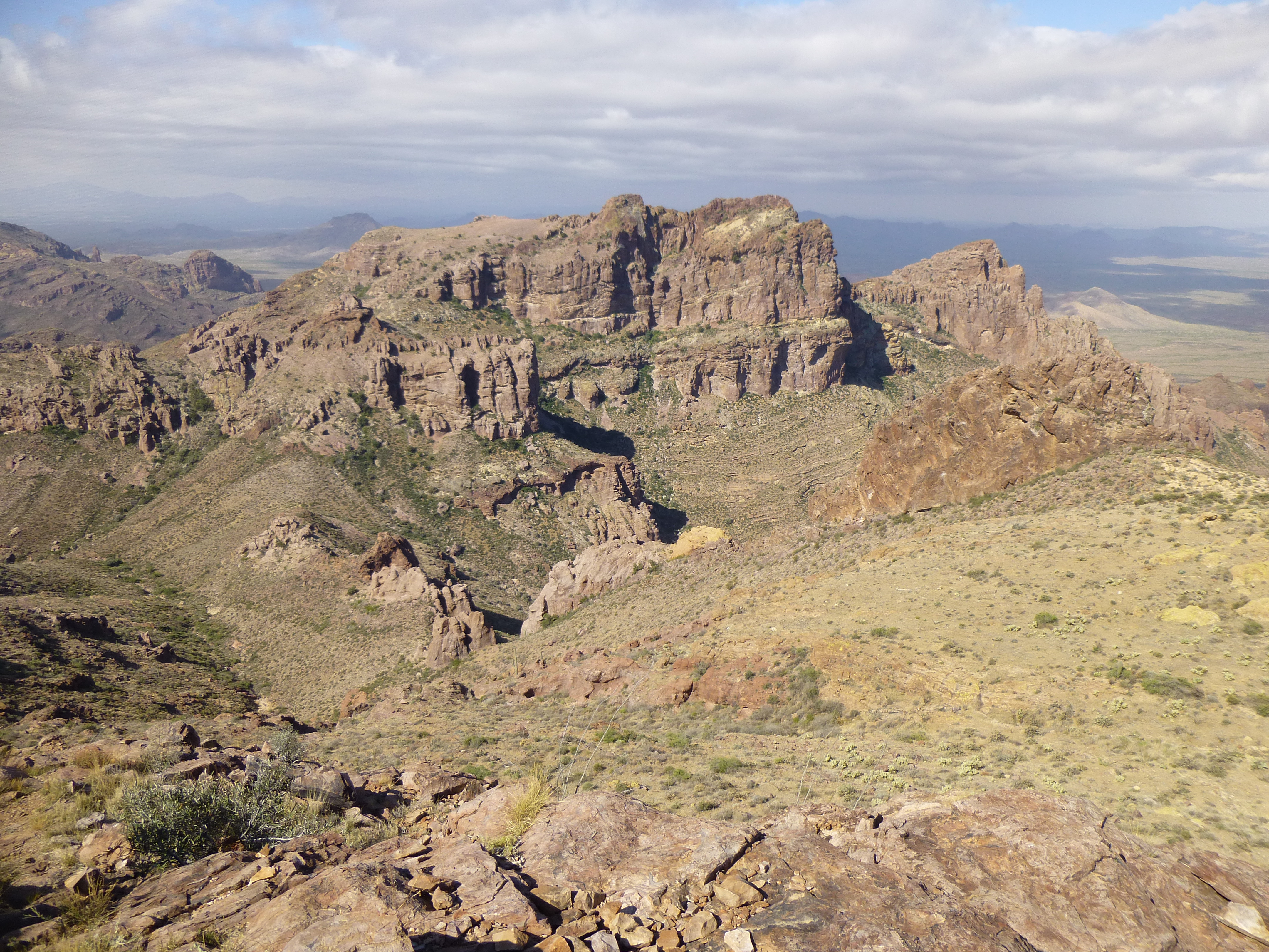
All my effort was paying off, By the time I reached 3,400 feet elevation, I had my first good look at my objective. What I needed to do was climb up close to the huge rocky tower you see in this picture, then cut across the open slope to the right of it and make my way through some easy cliff bands.
Getting close to my first summit
The summit was pretty straightforward, and I was glad to find the register left by those who had first climbed Peak 4220 – many of these have been destroyed by undocumented border-crossers.
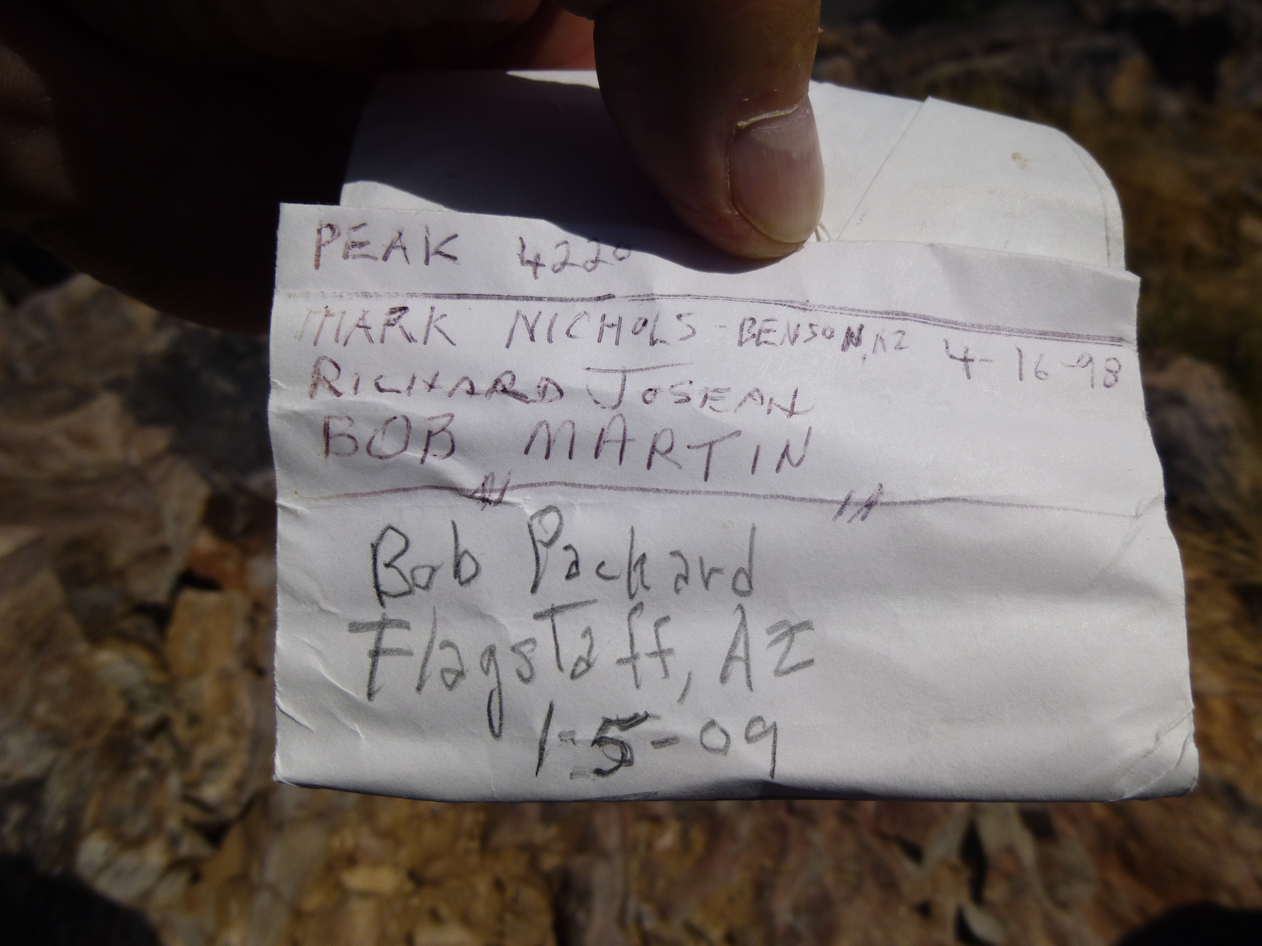
The summit register on Peak 4220
So there I was, four hours after I had left camp and 2,000 feet higher. What a spot – I had a front-row seat for Montezuma’s Head to the north.
Looking north to Montezuma’s Head
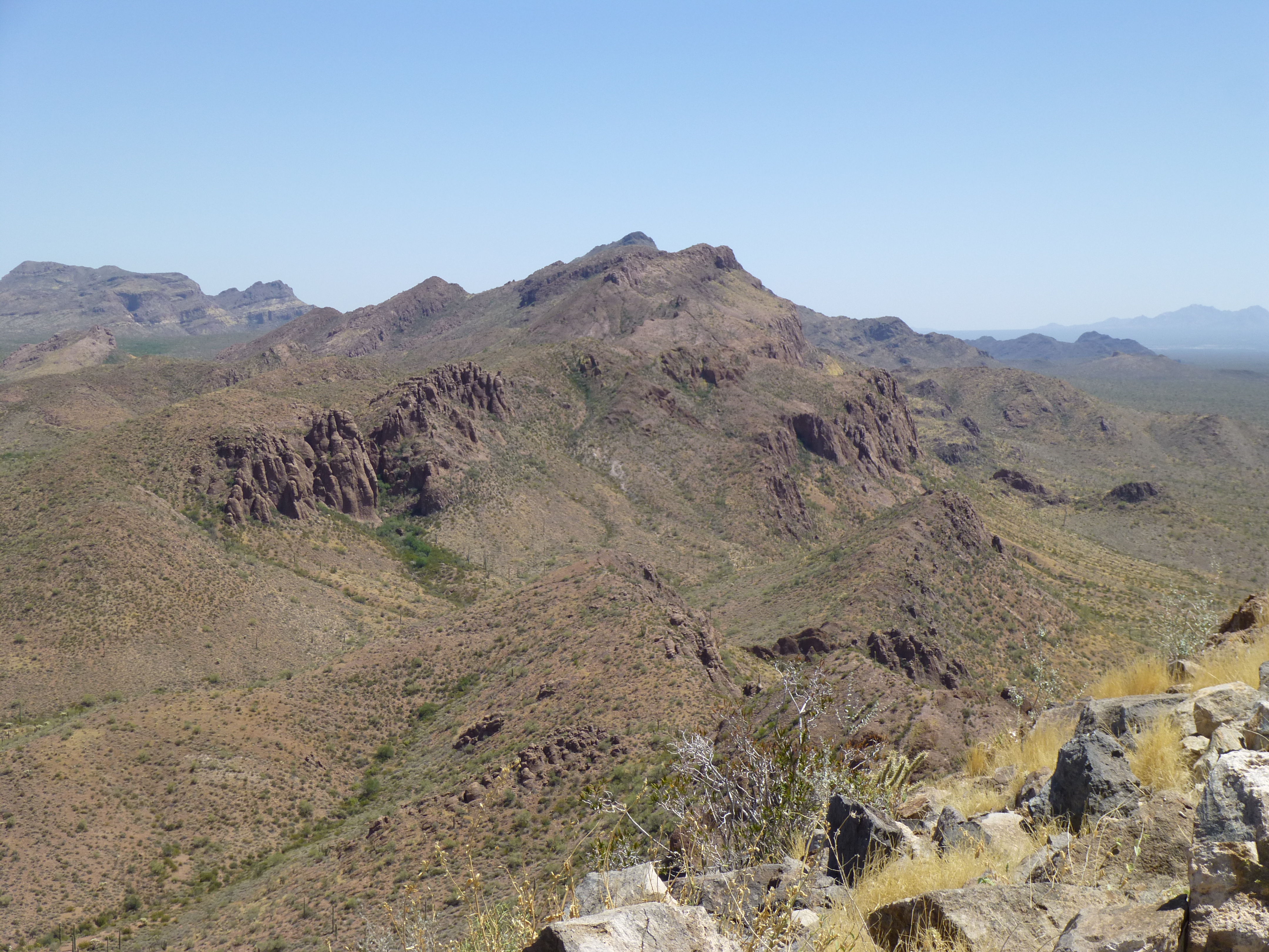
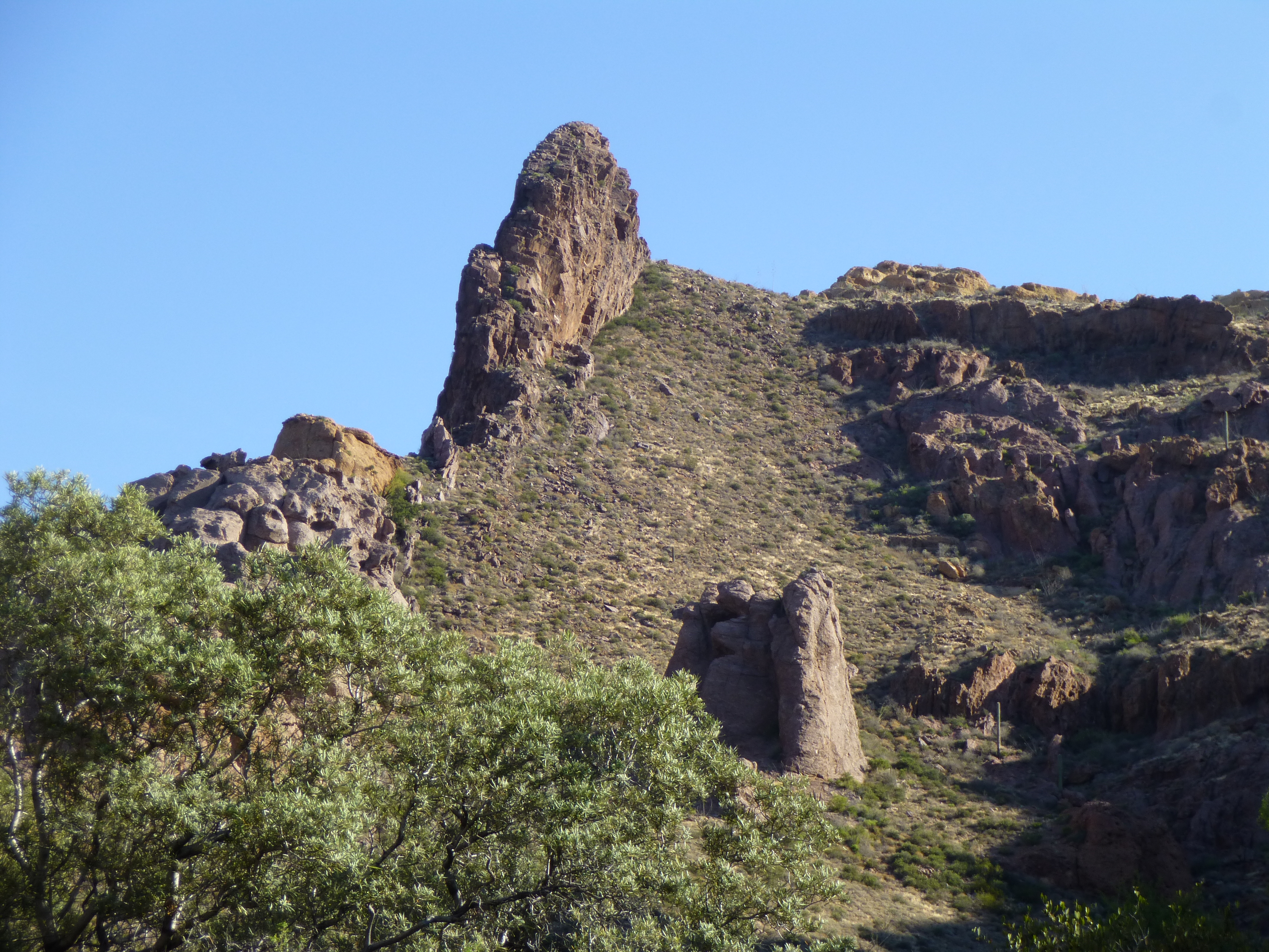
I also had a perfect view of the other peak of the day, to the southwest a mere 3,500 feet distant as the crow flies – somehow it looked much farther. If you look at the peak, on the right side above the white smudge sits the high point.
Peak 4180
The day was changing – a solid bank of clouds was moving in. Even though it looked threatening, there was no rain in the forecast. Mexico was sending this weather up my way, and even though it was chilly enough to have to put on my fleece in the strong wind, I didn’t think I’d get stormed on. Still, it was time to go. I contoured down the slope and then dropped to the valley bottom, a full 800′ below the summit. From there, I thrashed my way up the only bushwhack of the day, a gully thick with brush. The higher I went, the more interesting the rock became.
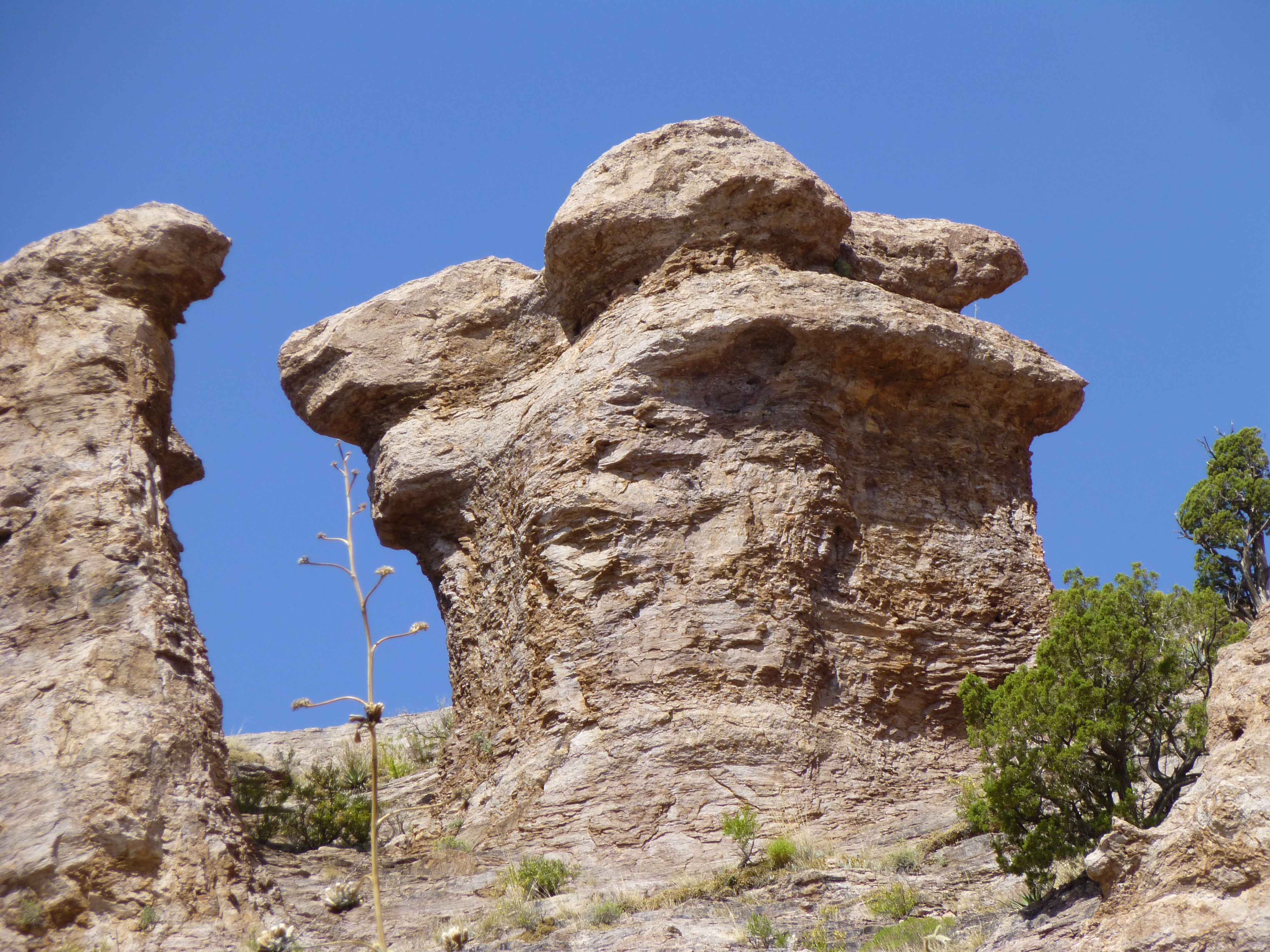
Strange formations
At about 3,700′, the terrain changed again. I had to cross 600 feet of rock slab tilted way up.
The tilted mountainside
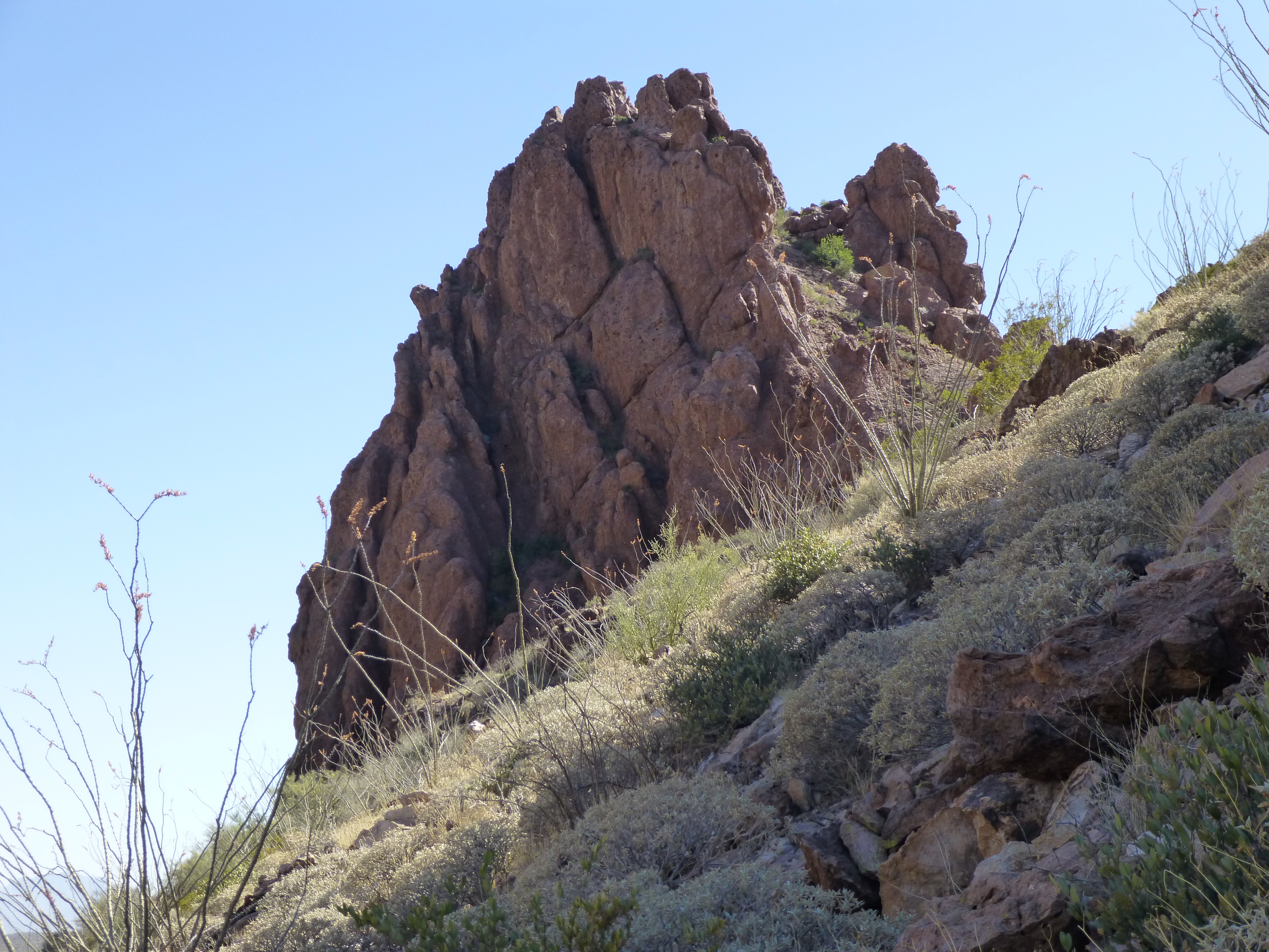
Once across the gigantic slab, I climbed up a couple of hundred feet of easy rock, then across another large area of slabs. I knew I was getting very close to the summit, but where was it, exactly? The first part of the summit area I came to was a rocky tower that scared me – it was very steep, and I sure hoped I didn’t have to climb it.
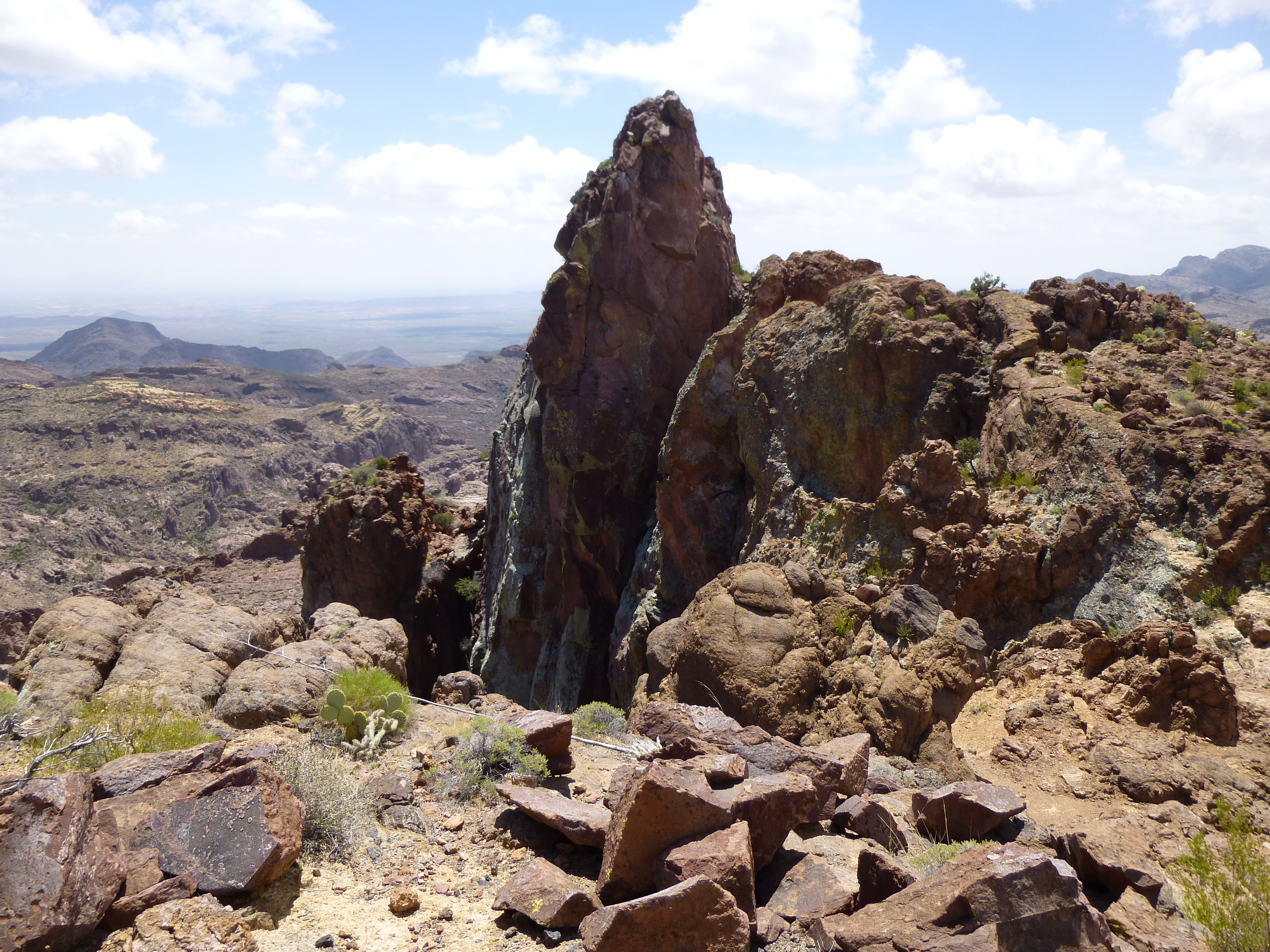
Looking east to the steep tower on the summit ridge
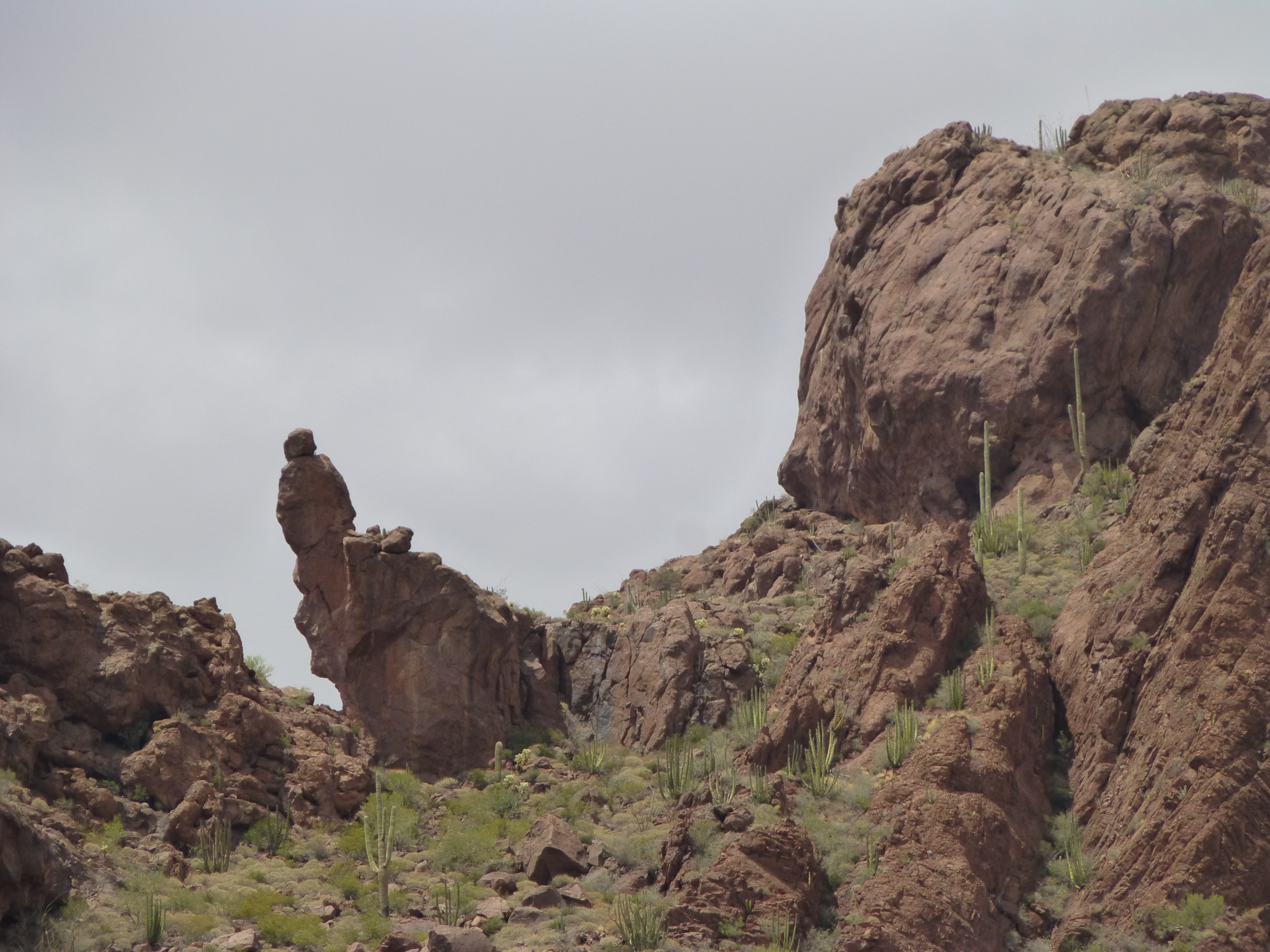
There had to be an easier way to the summit, but where exactly was the summit? I continued along the ridge, hoping that as I moved farther to the northwest I’d climb up high enough to reach a point obviously higher than the tower. Others had been here before me and hadn’t reported any problems, so I had a fairly high degree of confidence that a solution would present itself. There was some very cool Class 3 scrambling along the airy ridge, with some outrageous exposure thrown in for good measure, but in the end, it all worked out. Try as I might, I couldn’t find a register on the highest point, but I could tell by sighting over the top of the tower, 450 feet away, and looking at the distant Mesquite Mountains behind it, that the high point was probably less than ten feet higher than the tower. So there I was, on top of Peak 4180, my second and last of the day. I’m happy to report that this was one mountaintop the smugglers hadn’t defiled, as, quite frankly, there was nothing to be gained by them in trying to reach it. Kudos to the first ascenders for unlocking the puzzle that was 4180.
Making my way back along the ridge to the tower, I discovered two cool things. The first was this natural arch, through which you can see the valley bottom 2,000 feet below.
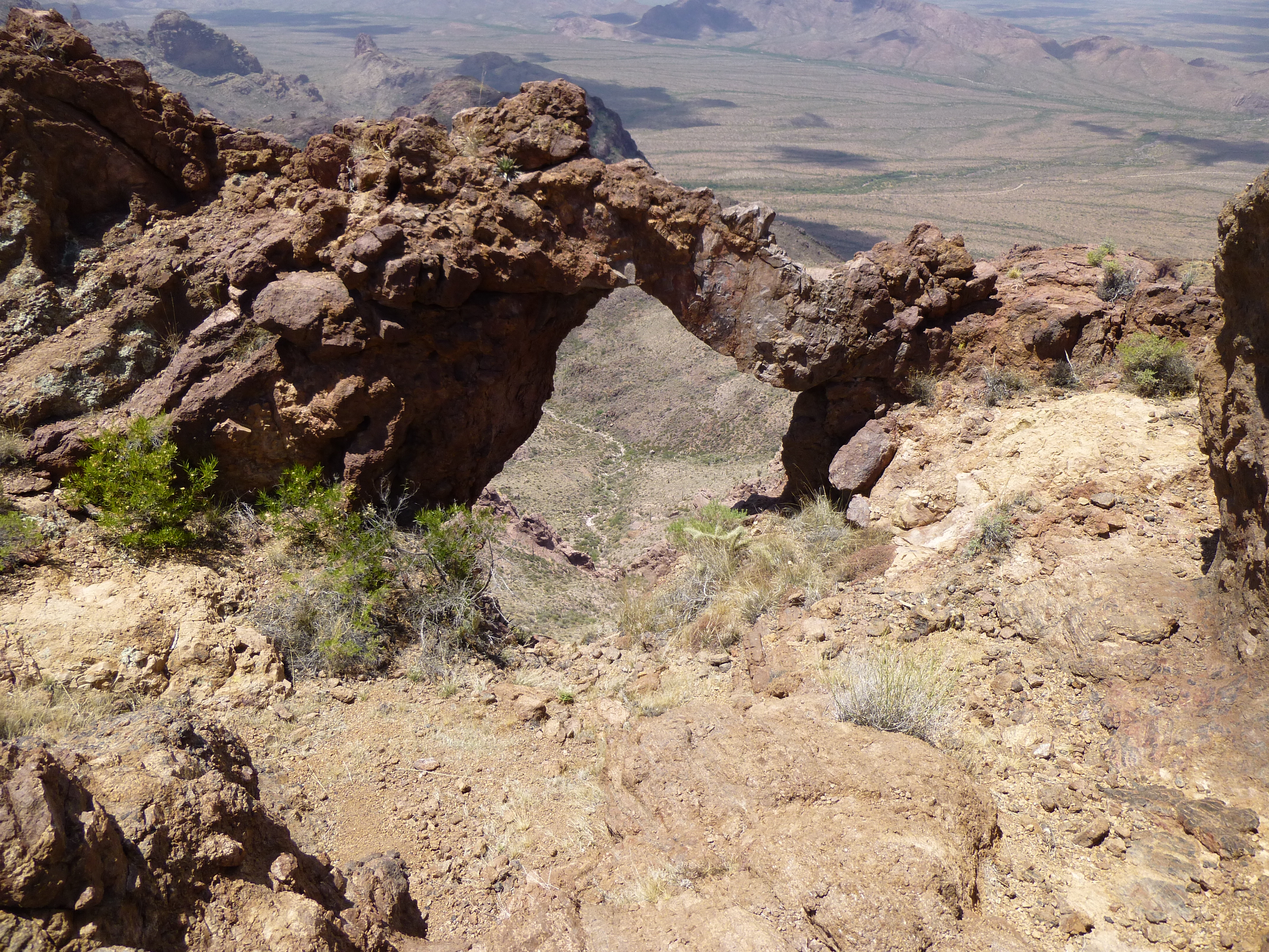
The arch
And a few feet away was this cave. When I went inside, something squeaked loudly at me. Perhaps it was a bat on the ceiling – I didn’t stick around to investigate.
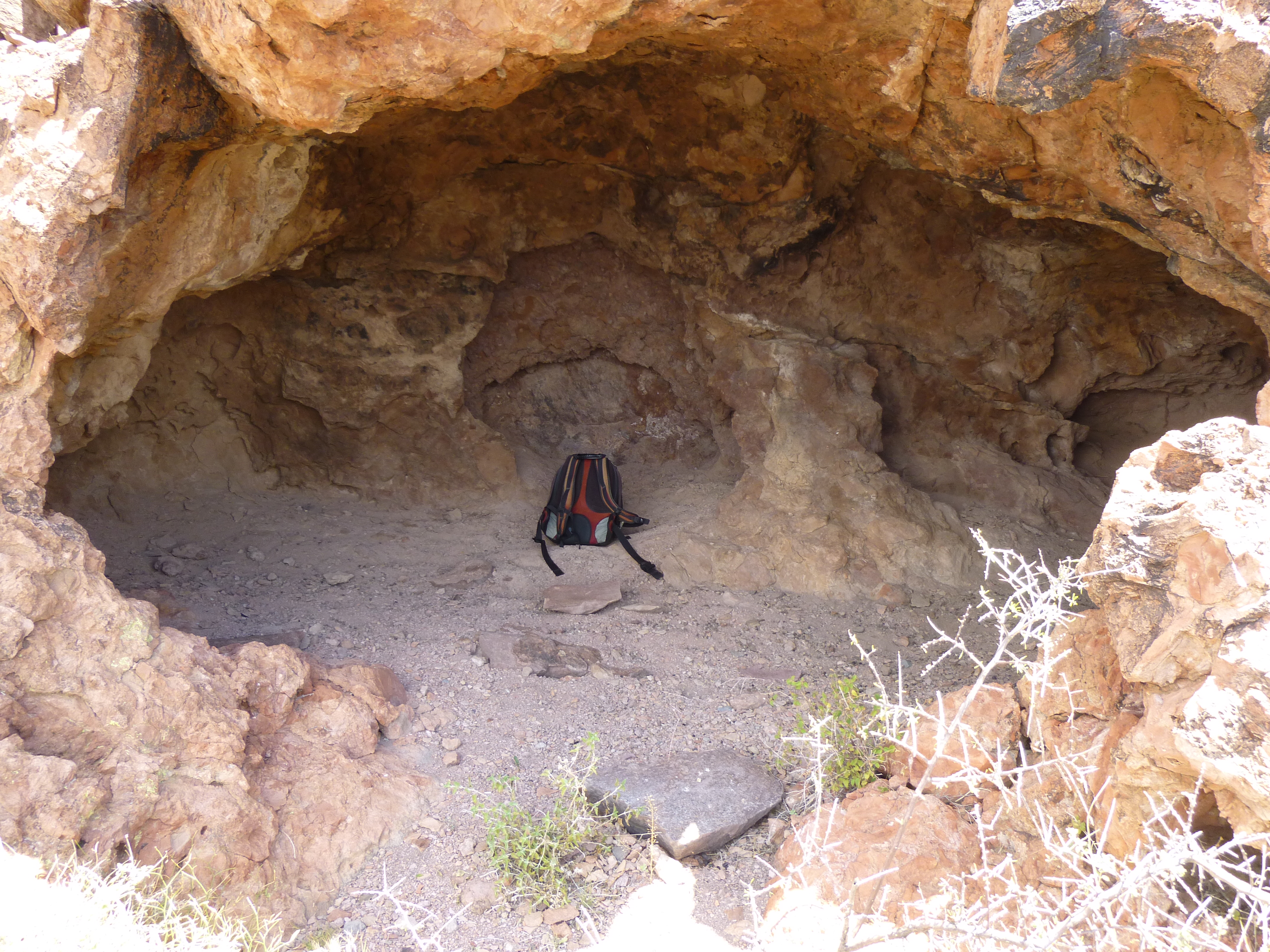
The cave
What if I descended to Alamo Canyon by a different route than I’d used to climb? If I chose wisely, I could cut both time and distance off the return trip. One canyon I had seen on the way in looked promising, so I made the decision to head down it. My luck held – sure, there were the usual cliffs to negotiate, but they all went well.
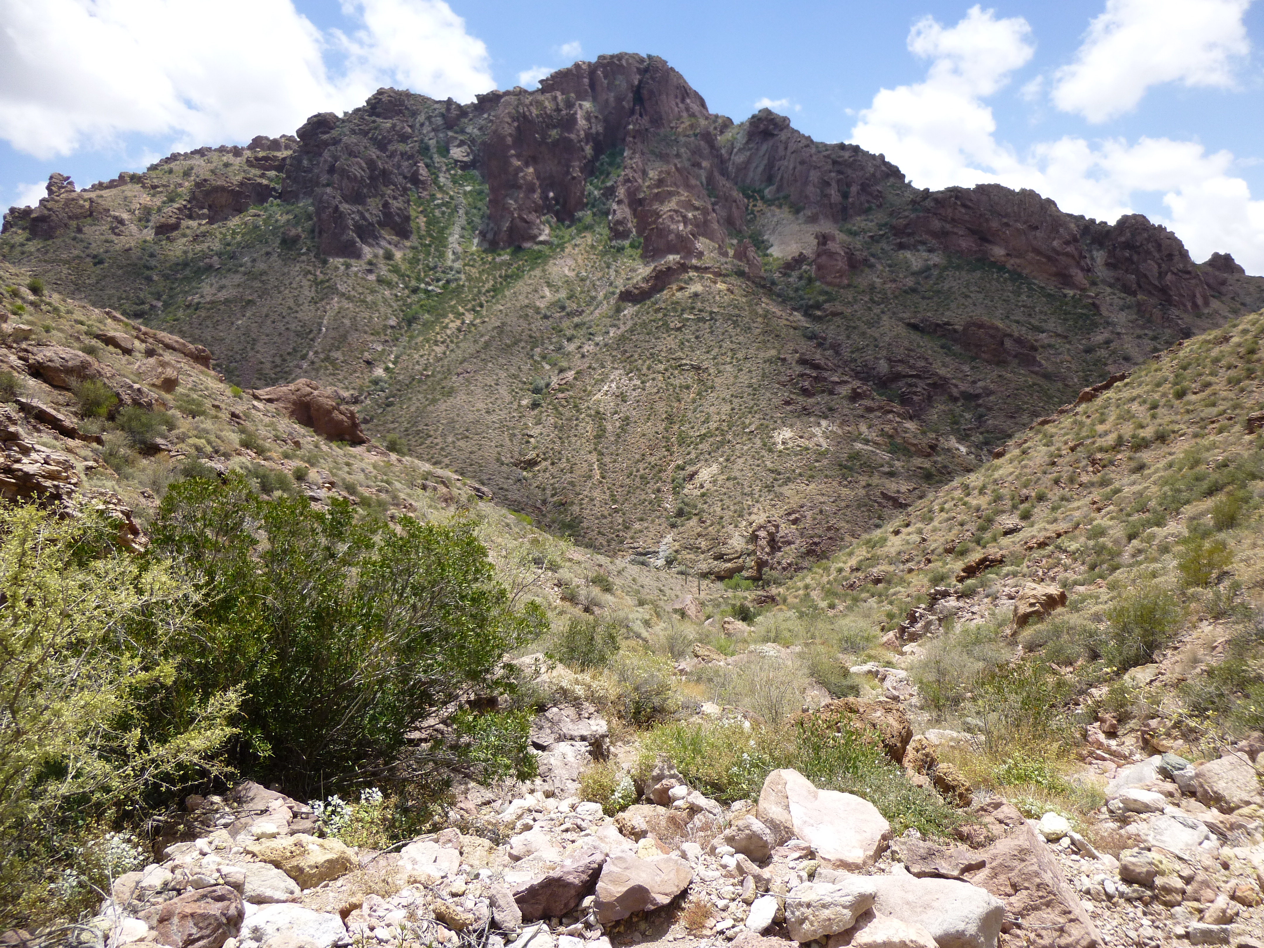
Looking south down my canyon to Peak 3820
Before I knew it, I had reached the main part of the North Fork of Alamo Canyon. It was an enjoyable stroll the last few miles. One more thing of interest I saw along the way was this small stand of bullrushes. I’m guessing there must have been enough water available to them from the pools in the rock or someplace else close by to keep them alive. Very unusual in a desert canyon.
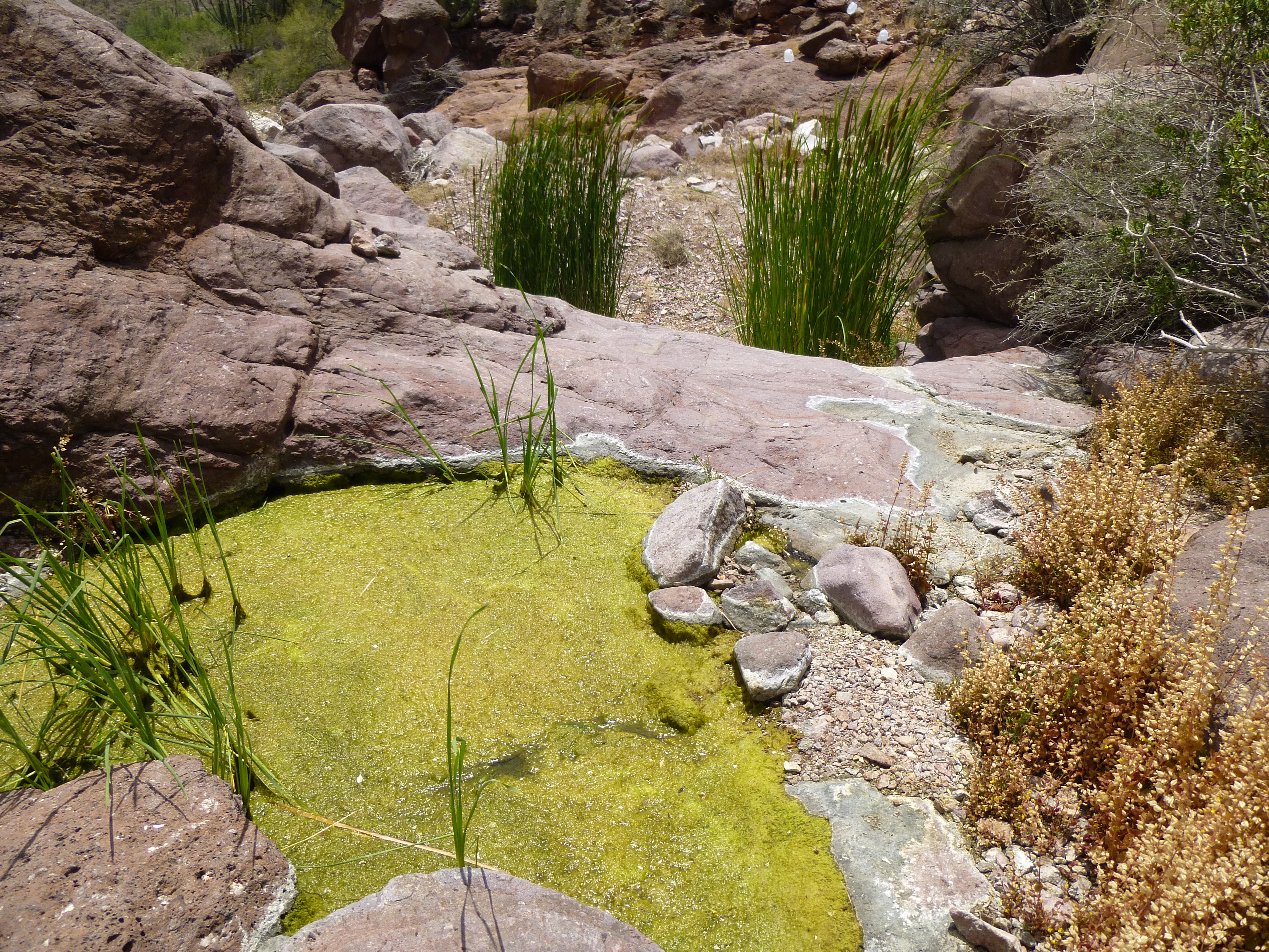
Bullrushes in the North Fork of Alamo Canyon
The end was in sight. As I covered the last half-mile to the campsite, I looked up and saw this huge leaning rock formation. Somehow it reminded me of the Easter Island moai, but with an added topknot. It was the height of an 8-story building.
The huge leaning rock
By the time I reached my truck, it was two in the afternoon. The nine-hour outing had covered about ten miles, and had taken me through some spectacular country. I can’t wait to get back there to climb more peaks.
Please visit our Facebook page at: https://www.facebook.com/pages/Desert-Mountaineer/192730747542690