
Three of us wanted to go to the Sand Tank Mountains to do a little pre-Christmas peakbagging, so we arranged a day and a time to meet – this happened back in December of 2011. Andy Martin and I drove in his old Honda car from Tucson the 70 or so freeway miles to the Vekol Valley, then convoyed with Andy B over 20 more miles of rough roads until we reached Johnson Well. It was time to park the car, so we all piled into Andy B’s 4WD pickup and continued. The road quickly deteriorated as we drove several more miles, then reached a spot where Andy M wanted out, south of Maricopa Peak, the range high point. It was agreed that we’d meet him a mile farther down the road at the end of the day.
Andy B and I left him there, then drove another couple of miles west and parked by Point 2634 at the side of the road. It was already 9:00 AM when we started walking in the chilly morning air – the temperature had dropped to 24 degrees F. overnight, and was little more than that for our start, so we wore jackets. We were excited about the day ahead of us – we’d probe deeply into an un-visited part of the Sand Tank Mountains. The first half-mile was across flat ground (if you don’t count a few substantial washes we had to cross), then over a low ridge and down into a new drainage. It was fun to follow this through all its twists and turns, and we covered two more miles this way. It was then time to leave that drainage, cross more fairly flat land and a few big washes, then over a small saddle and into yet another drainage. This too was followed for another mile and a half, and now we were finally at the base of our first climb. Traveling in washes like this can be fun. A lot of it is simply walking on sand, whether firm or soft; sometimes you’re walking on exposed rock, whether slabs or climbing waterfalls; you could also be walking on gravelly surfaces, or thrashing your way through vegetation. Today, Andy and I found a little of everything. We made good time, though, and had climbed up the northeast side of Peak 3089 to its summit by 10:50 AM.
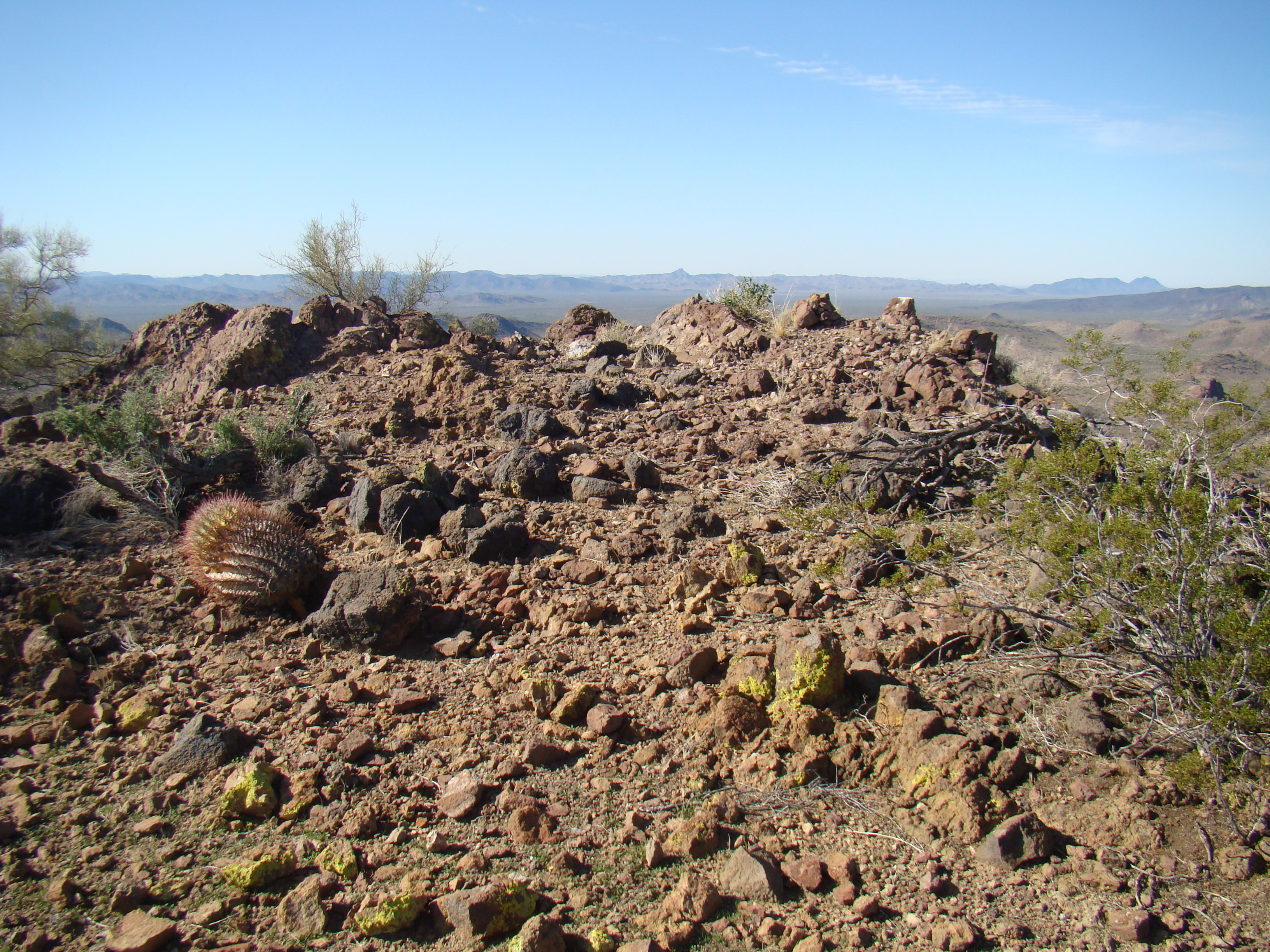
West from the summit of Peak 3089, with Hat Mountain in the distance on the center horizon
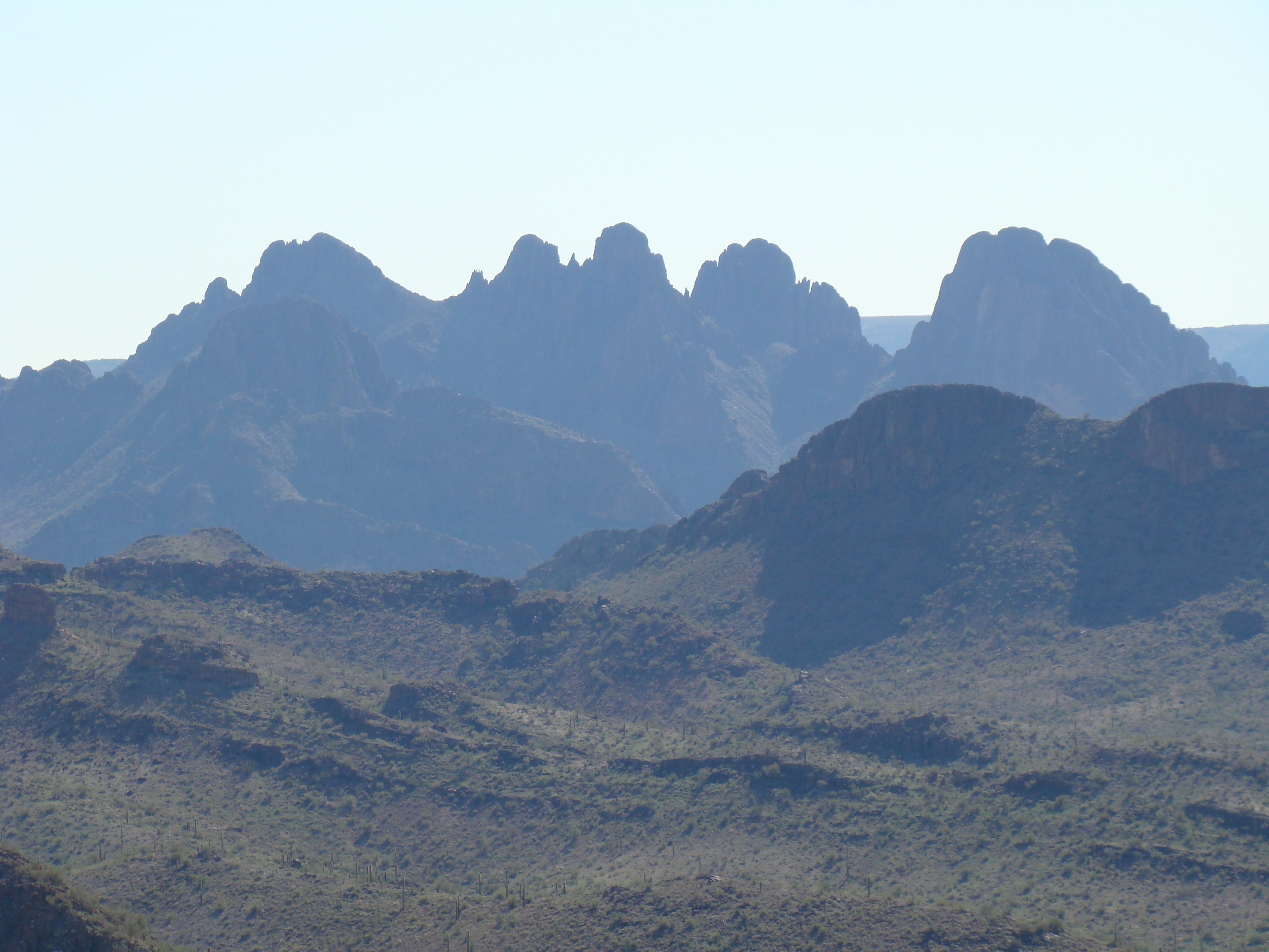
The next photo is a view from the summit which I really like – in this one, you are looking south from 3089. The big bulky mountain on the right side is Peak 3220, which would see its first ascent four years later. I like the long view down the deep valley in the middle of the photo, with the huge 1,500′ wall rising up to the high country of the Sand Tanks on the left side.
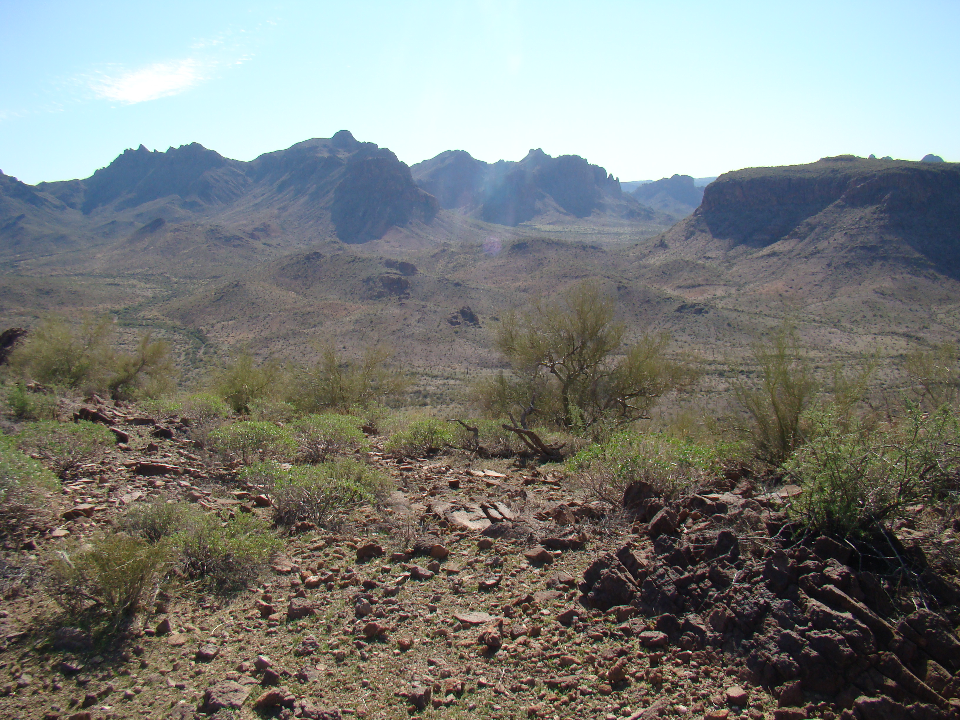
Looking south from Peak 3089
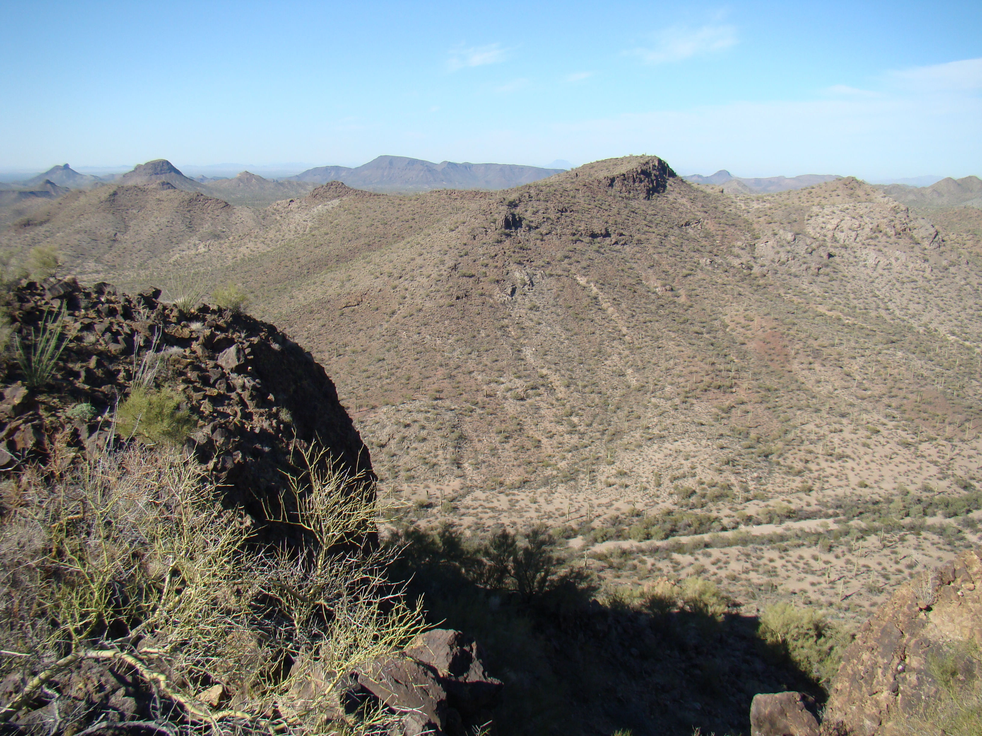
What Andy and I had done was to go to the farthest peak first, planning to spend our day working our way back to the truck. From the top of Peak 3089, we could see the next two we wanted to climb. In this next photo, I’ve drawn two yellow lines on the horizon. Look carefully and you’ll see them – zoom in if you have to. The line on the left sits on top of Peak 2922, the next one we were shooting for. The line on the right is above Peak 2949, next on the agenda after 2922. But an important detail about the right-hand line is this: directly under the line is a distant peak on the skyline, called Woolsey Peak, in the haze 42 miles away. I’m talking about the peak below that, the dark one with the cliffs on its right-hand side, just two miles away – that is Peak 2949.
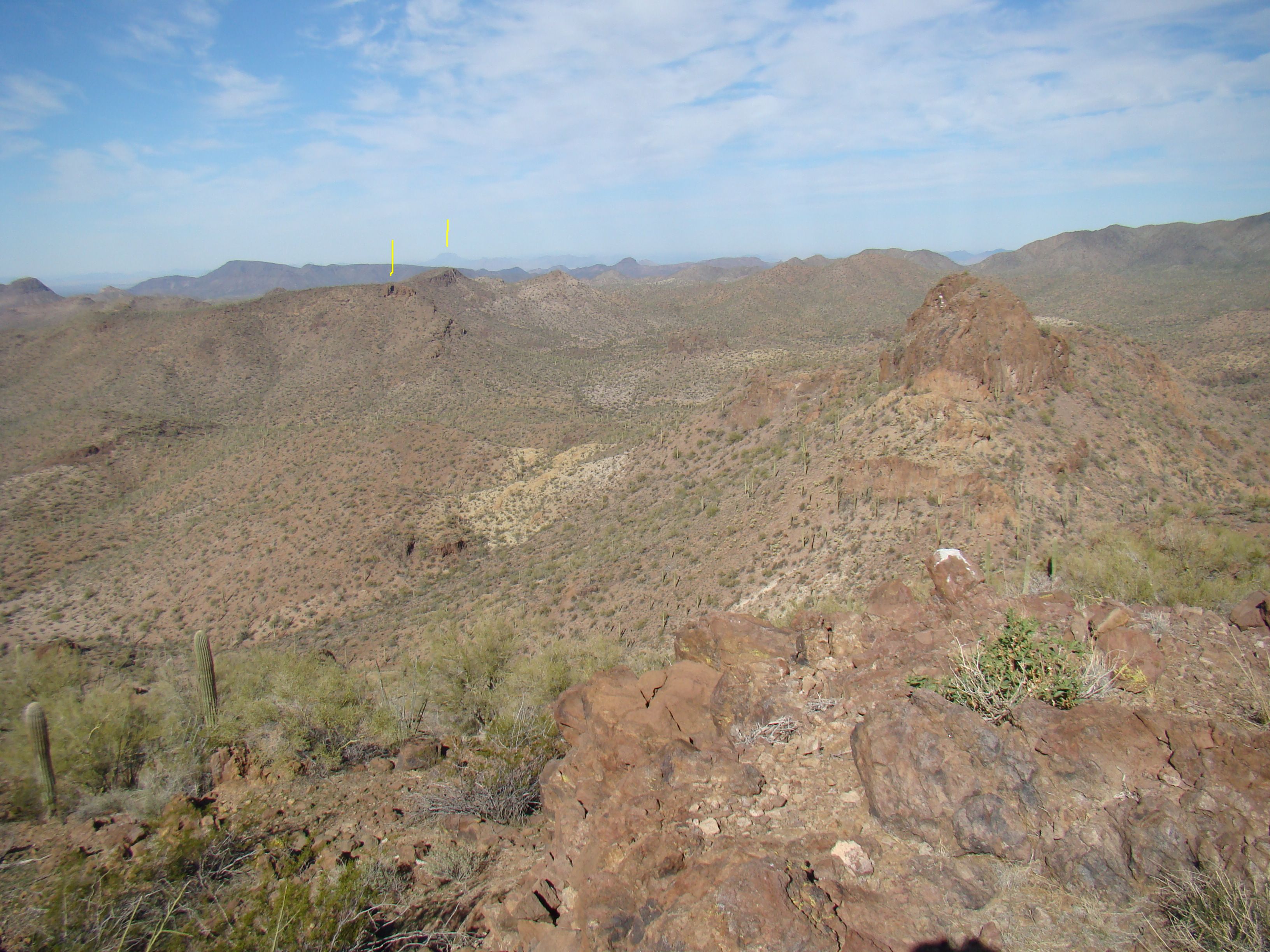
Looking northwest to our next two peaks
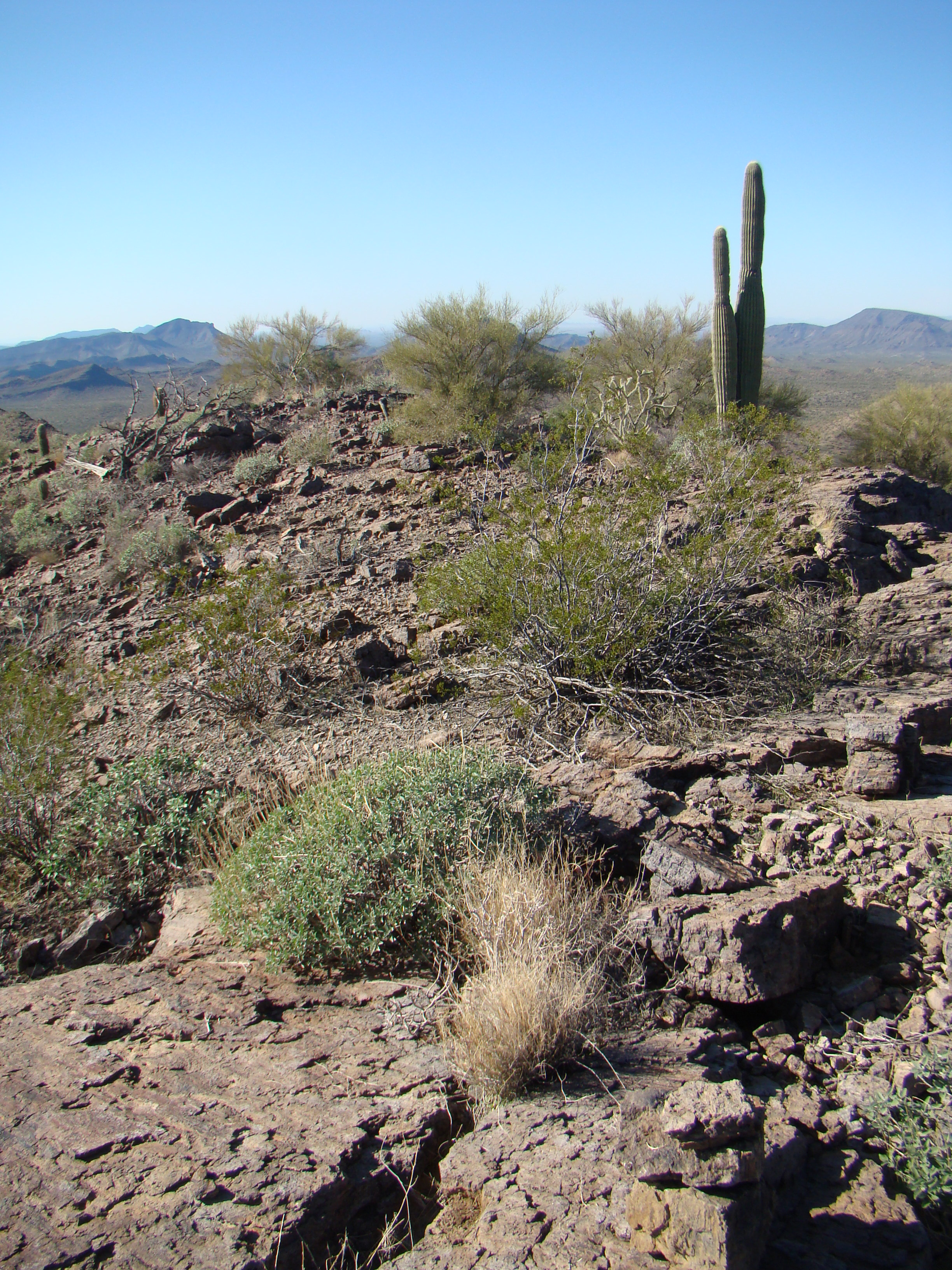
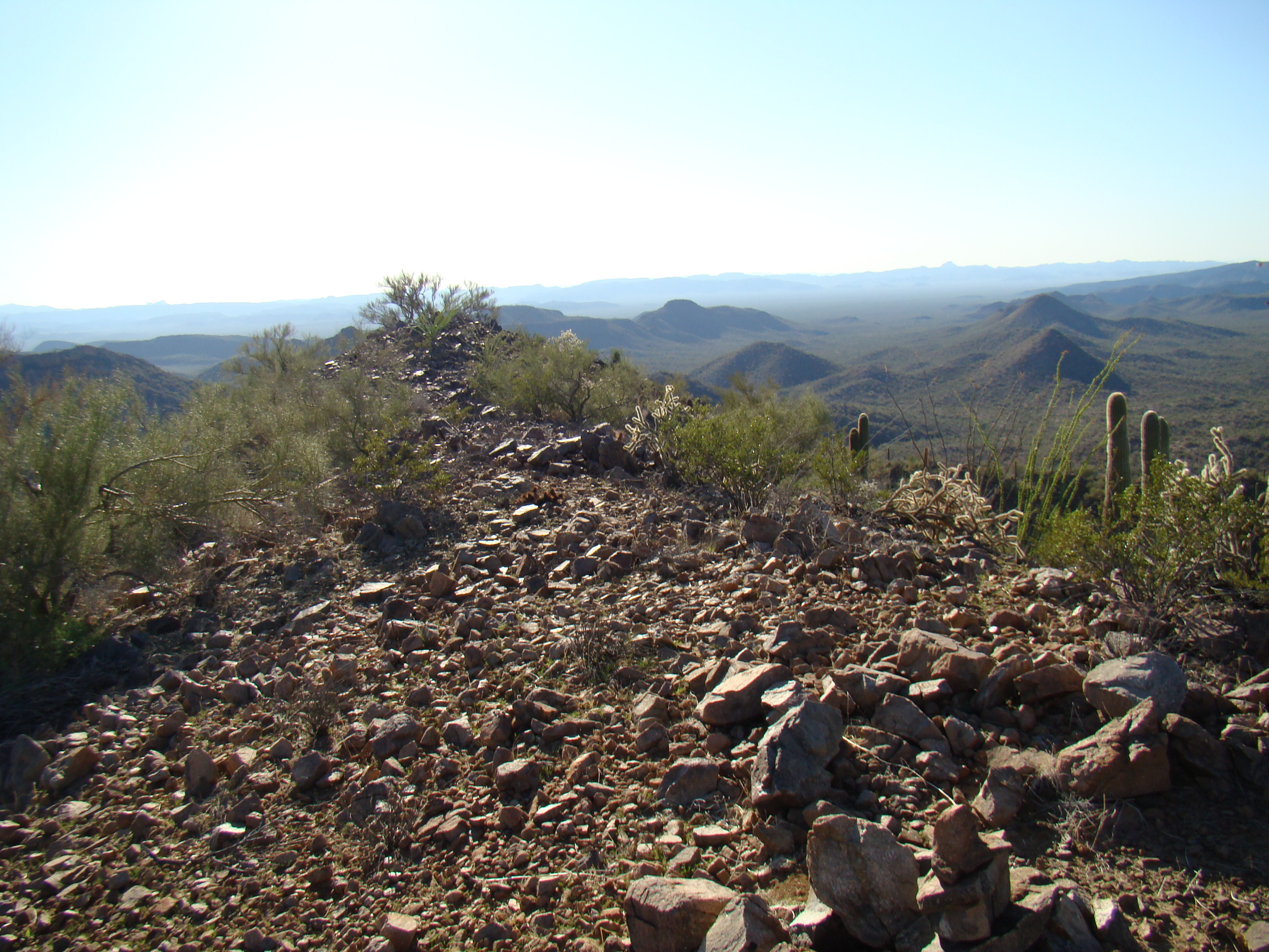
After leaving a register, we left the way we’d come and soon found ourselves down in the valley bottom, where we walked a mile downstream. Now here’s an interesting factoid for you – when Andy and I were there, the place was unspoiled, with no trace of smugglers. Since our visit, Bad Guys have driven their quads through the area and have desecrated it by creating a crude road. Andy and I left the valley bottom and climbed Peak 2922. Right about where this next picture was taken, there is now a rough road which the smugglers use to haul loads of drugs – this road is well-known to the hard-working agents of the Maricopa County Sheriff’s Department Drug Suppression Task Force and also the Border Patrol. They keep an eye on the road and play a dangerous cat-and-mouse game with the smugglers, many of whom are armed and very desperate. The smugglers don’t want to lose those loads in a confrontation with law enforcement, and, if somehow they escape, have to answer to their bosses in the drug cartel.
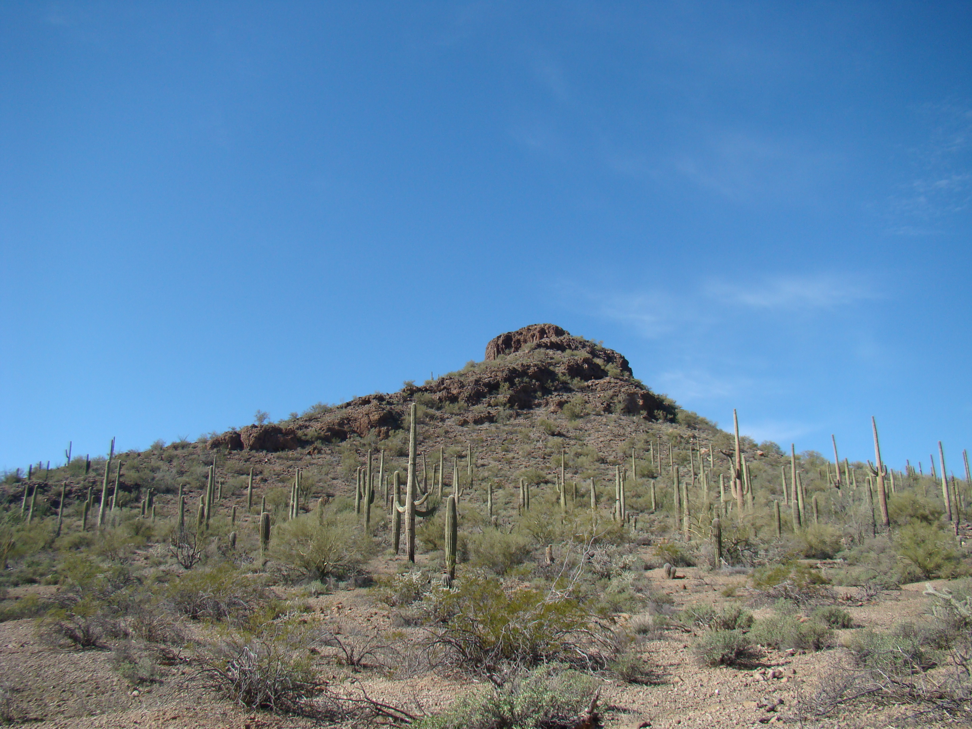
The east side of Peak 2922
Here’s a map I’ve created showing our climbing route (red line) and the smuggler’s road (blue) put in since we were there. This bit of a map also shows Peaks 3089, 2922 and 2949.
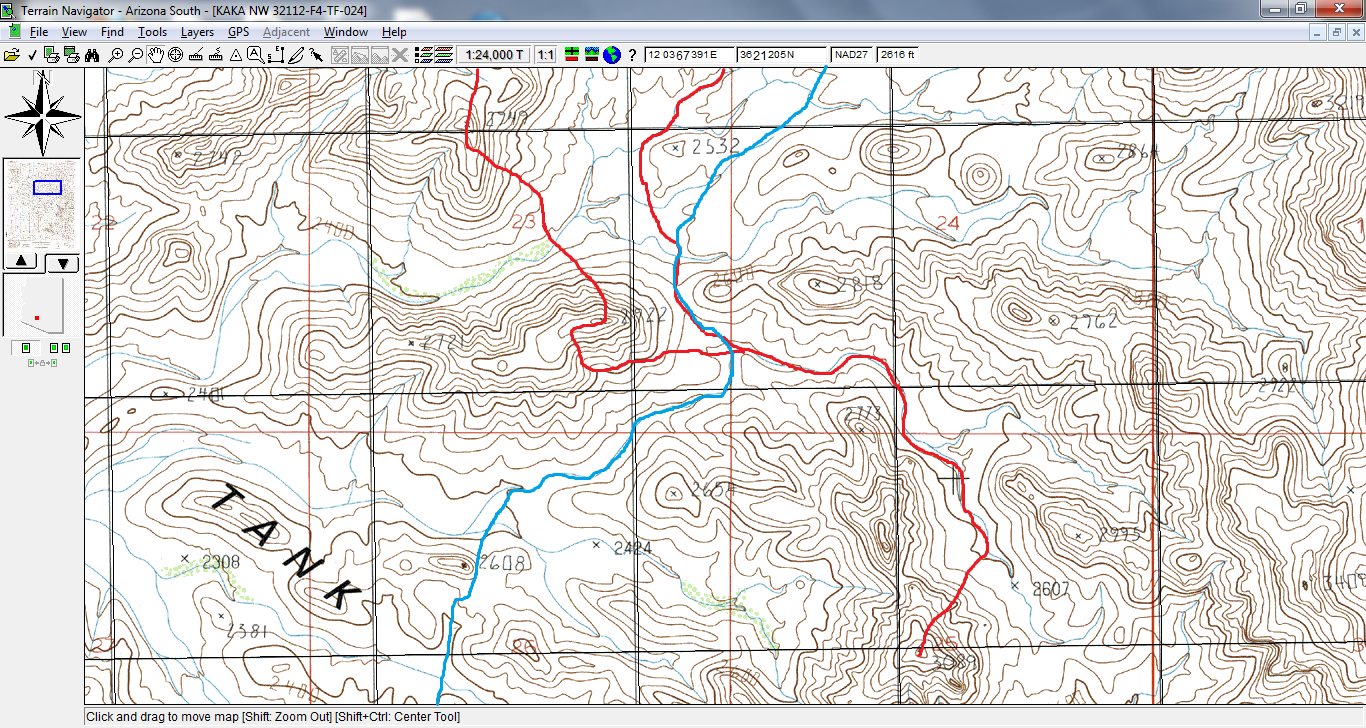
Map showing our climbing route (red) and smuggler’s road put in later (blue)
We skirted the south side of the peak, then climbed north to the flat ridge, and then back east to the highest point. By the time we stood on the top of 2922, it was 12:30 – time to eat lunch and soak up the view. The great thing about covering a lot of miles and being out in the wilderness like this all day is that you can solve all the world’s problems, and Andy and I had already solved quite a few. Check out these views from the top.
South from Peak 2922
The above telephoto looking south shows a lot. The steep peak on the skyline on the far right is Peak 3300, which to this day is unclimbed. All of the other bumps, four of them, to the left of 3300, are all parts of Dragon’s Tooth, also to this day unclimbed. The dark double bump on the far right in front of 3300 is Peak 2975, first climbed on December 27, 2014.
In this next photo, see the yellow arrow I’ve drawn? It points to the top of Peak 3089, the first one we’d climbed today. In the background on the skyline are several of the highest peaks in the Sand Tank Mountains.
Looking southeast to Peak 3089
Another important view was this one, looking northwest to our next peak.
Looking from the top of Peak 2922, northwest to Peak 2949
Two down, two to go, We still had a lot of work to do, so after a good break, we dropped 500 vertical feet down to the wash you can see in the above photo, then climbed 500′ up to and along the long south ridge (also plainly seen in the above photo) to arrive at the top of Peak 2949 just before two in the afternoon.
Were we still having fun? Definitely. Here’s what we saw on the top.
The summit of Peak 2949
Unless you do this kind of thing on a regular basis, it may be hard to understand how we get such a thrill out of going all day, climbing one mountain after another and wearing ourselves out in the process. But when you’ve stood on the top of a peak where no human has ever stood before, you’re making history, and that’s very exciting..
After a short stay, it was time to head north. The 500′ drop to the valley below went through some steep, loose country, then we started to climb up through a gritty canyon with interesting rock formations. It was hot, sweaty work getting that done, and finally we walked along the easy summit ridge to reach the summit of Peak 2940. That was it, our last peak of the four we’d set out to do, and it was just after three o’clock.
The top of Peak 2940
Here, we placed the last of our four registers – it’s always satisfying to leave one of these on a mountain top. It was an enjoyable descent along the northeast ridge, covering the last mile to Andy’s truck, and just after 3:30 we were done. It felt surprisingly cool when we arrived. Our day had lasted 6 1/2 hours, covered ten miles and demanded 2,900 vertical feet of climbing. It only took a minute to hit the road and a short while later we found the other Andy at a high point on the road – he hadn’t been waiting too long. His day had gone really well, with a successful ascent of Maricopa Peak (on the summit, he’d found a register with entries going back to the 1980s). After that was done, he came back down, moved west and climbed Peak 3689 (a first ascent) before heading to our arranged meeting point.
It was late, way after dark, by the time we all made it home. It’d been a great day of peakbagging for us all, in one of Arizona’s most beautiful mountain ranges. Many more days have been spent in the Sand Tanks since then, and the range never ceases to amaze. In case I didn’t mention it already, all of these photos are courtesy of Andy B.
Please visit our Facebook page at: https://www.facebook.com/pages/Desert-Mountaineer/192730747542690