
It didn’t take me long to spot them. When I first moved to Tucson in 1987, I could see them, 38 miles to the southwest of my house. There they sat, just 4 miles to the east of Kitt Peak, the site of a world-famous observatory. I hadn’t been in Tucson but eight months when I decided to give them a try. I’m talking about the Coyote Mountains, of course.
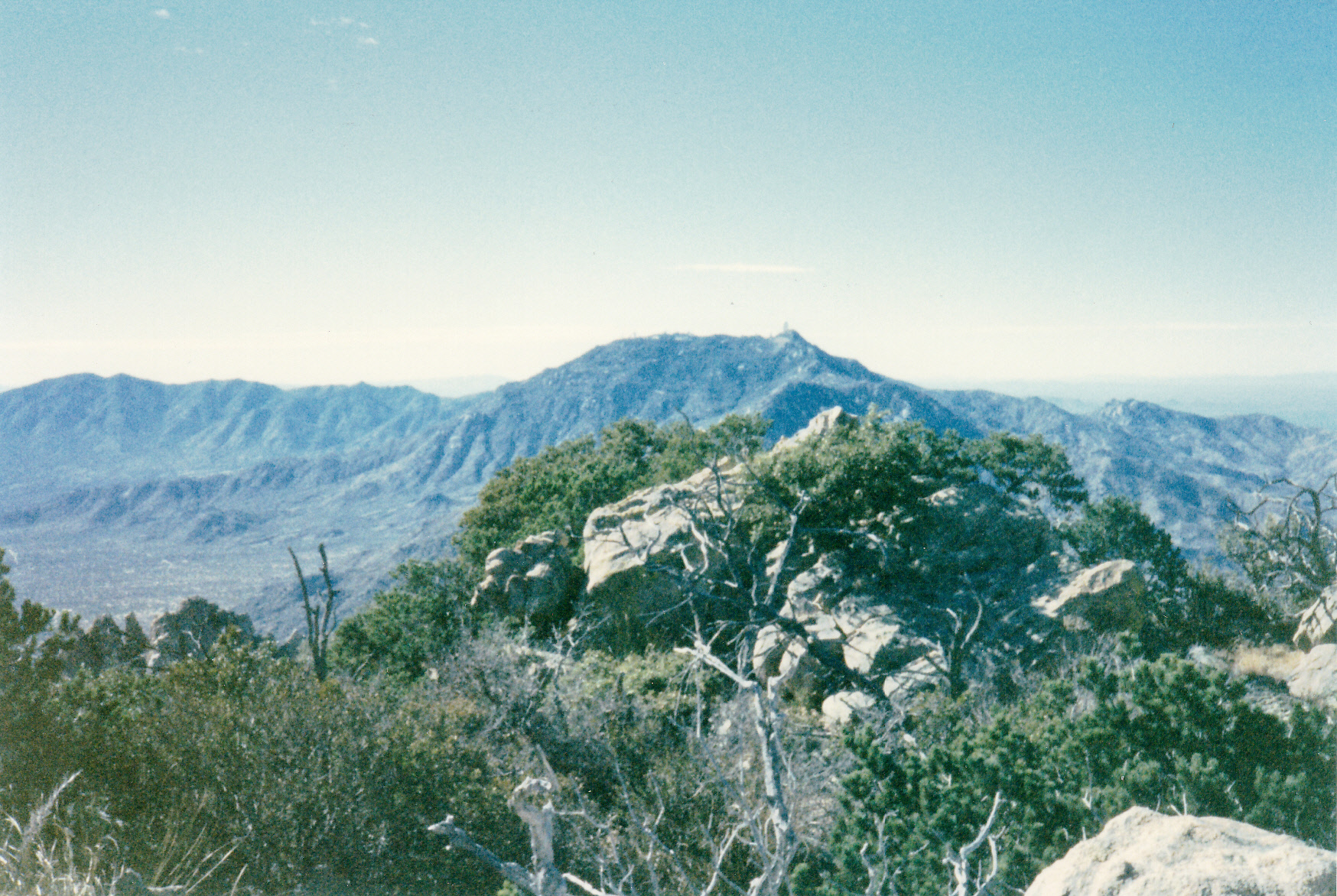
There was a picnic area hard by the highway to the north of the range high point, and that seemed as good a place as any to start. I parked there and set out one fine April morning in 1988, making a bee-line for the range high point, Peak 6529. Here’s the view I had starting out.
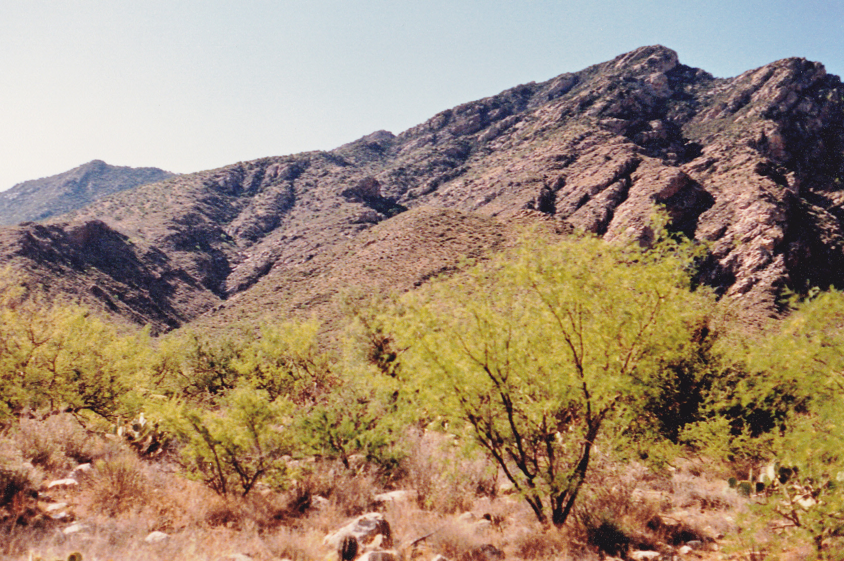
Looking up to the high point.
Within the first half-hour, I had encountered two Gila monsters, a fond memory to this day. These creatures are hard to see, and most Arizonans can spend their entire lives without seeing one in the wild.
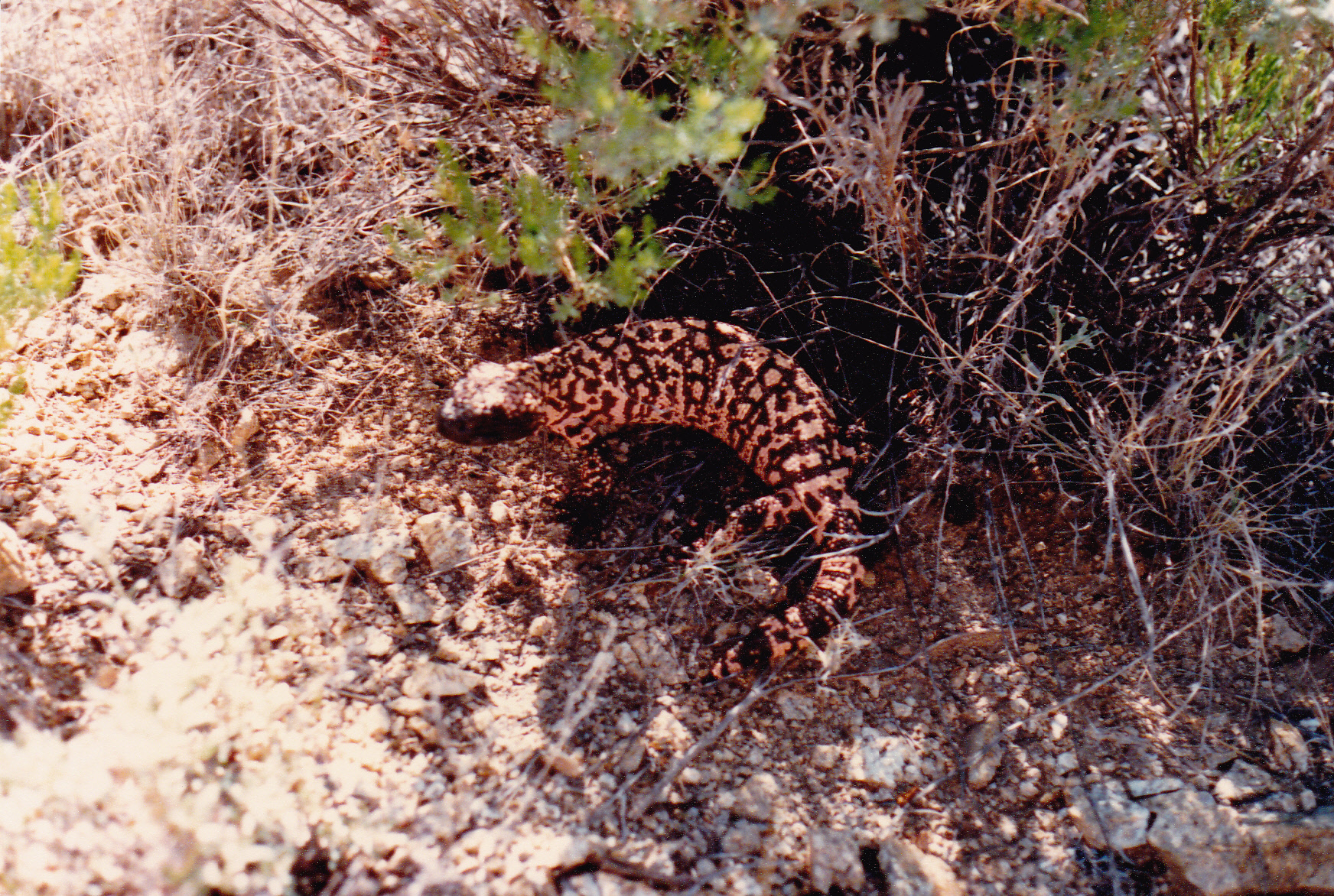
My first Gila monster of the day.
The climb was straightforward, with a few cliff bands near the summit thrown in for excitement. By the time I was back at my truck, 8 hours had passed, and I was feeling the 3,900 vertical feet that the climb had exacted. Other than being reminded of the climb every time I drove past, I didn’t pay much attention to the range after that.
Time passed. One February day in 1998, my friends Mark Adrian and Dave Jurasevich from California were in the vicinity, and invited me to join them on a climb of the high point. We climbed it by the same route I’d used 10 years earlier. The climb went without incident, and hours later we found ourselves on the summit.
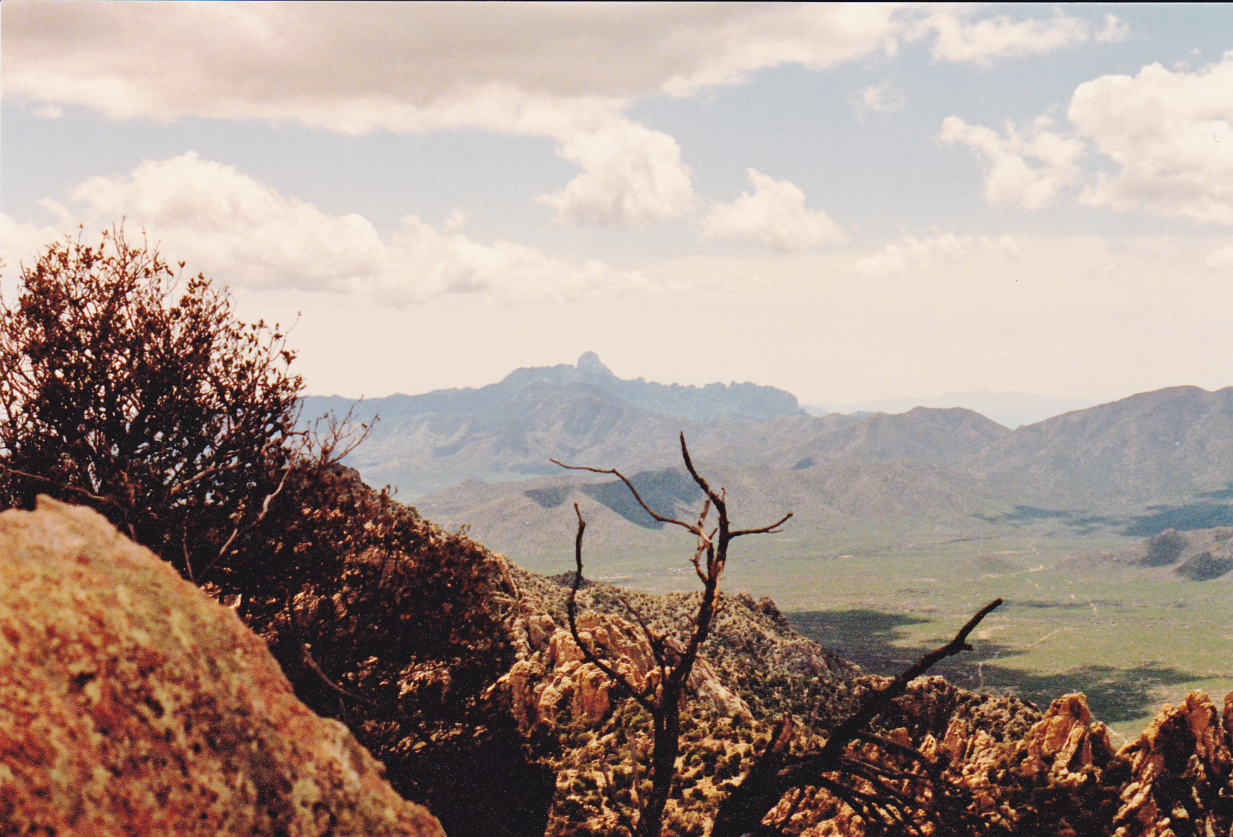
Looking south to Baboquivari Peak from the summit
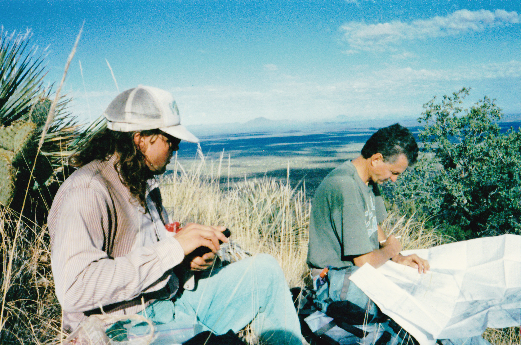
Mark (left) on the summit. Dave with the world’s biggest map.
Southwest to Kitt Peak from the summit

Bell Mountain (left center with light band); Martina Mountain on upper right with dark shadow
This un-named peak makes for a long day by any route, and by the time we arrived back at our trucks, we were feeling the pain.
Years passed. I became aware that there were two other big peaks in the range, both over 6,000 feet, that needed climbing. So, on January 25, 2009 I set out to try them. I parked by a gate near Pan Tak Pass and up I went. This time, I was on the west side of the range. I zig-zagged up through a seemingly-endless series of cliff bands to get up into the high country. By the time I’d finished farting around looking for the best way to the tops of these two peaks, I’d climbed neither and had run out of time. Back down I went, losing the daylight and pondering what I’d do next.
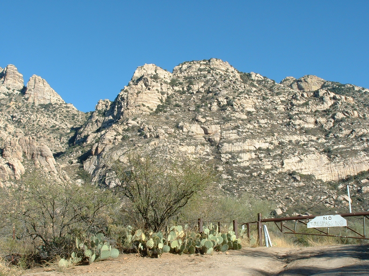
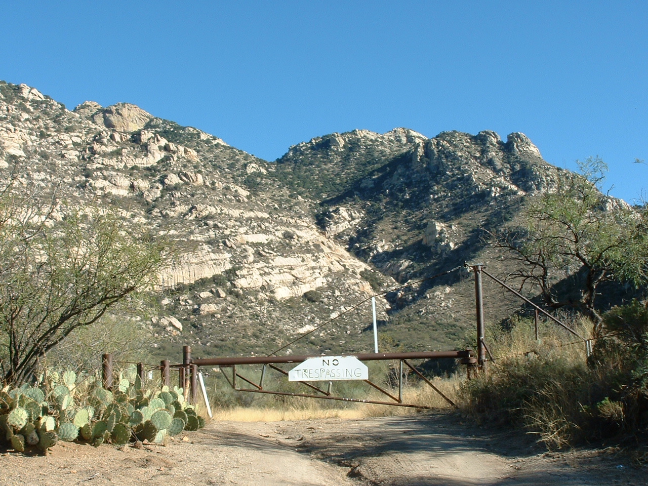
Another year passed. I’d started climbing with Paul, a Tucson friend, and asked him to accompany me on a climb of one of the peaks. We set out on a fine morning in February, and parked by the locked gate near Pan Tak Pass. Back up through the cliffs we went, this time to the 5,650-foot saddle between Peak 6140 and Peak 6075. The day was fine and time was on our side. We climbed north and figured out where the high point was after a world-class bushwhack up a steep gully.The final bit up to the summit was a block of granite which had us scratching our heads. Our solution was novel – we climbed up a tree, then used one of its sturdier branches to get over to the rock itself and scrambled to the highest point. There, on Peak 6075, we found a register left by Bob Martin and Richard Joseph back in 1991. After signing in, we left by re-gaining the tree branch and down-climbing the tree. It wasn’t Paul’s first peak, but it was the first tree he’d ever climbed.
Like a couple of brainiacs, we decided to descend to the truck by a different and more direct way. Big mistake. We had to deal with more cliffs than I could count, eating up several hours of valuable time. Almost out of water, at one point we watched a quart tip out of Paul’s pack and bounce down the mountain and out of reach. Once we reached the truck, we had this view back up the mountain. The summit of Peak 6075 is on the center skyline, a full 2,400 vertical feet above.
The summit of Peak 6075 is on the center skyline, a full 2,400 vertical feet above
Peak 6140, on the skyline to the right of center, in the back
Not having had enough punishment, two weeks later we were back. The weatherman had said a cold winter storm was approaching, but I pooh-poohed his forecast and talked Paul into joining me for a climb of the other big one, Peak 6140. We set out from his truck on a cold, windy morning and quickly climbed 2,300 vertical feet up to the high part of the mountain. Some Class 3 scrambling took us up the west side of the summit block, where we signed into the 1991 register.
It looked like our luck was about to run out, big-time. A solid overcast had moved in from the southwest and was lowering fast. We beat a hasty retreat down the easier south ridge, but hadn’t dropped 500 feet when we felt the first drops of icy rain, “Maybe it won’t amount to much”, we hoped – no such luck. The cloud cover lowered as we descended, and we were soon soaked to the arse. By the time we’d dropped down far enough to reach an old road and walk it back to the truck, we were shivering uncontrollably and hypothermic. That truck sure looked good. The rain was coming down in buckets as we climbed into the cab and stripped off our wet clothes while Paul got the heater going. It was one of the coldest and most miserable climbs I’ve ever done.
Paul had his eye on Peak 6529, the range high point, and talked me into going up it one more time. We picked a warm day in March and set out by the now-familiar route from the highway to the north. As we climbed higher, we kept hearing voices in the distance, finally spotting people climbing up the east ridge, a route I’d heard of in prior years. I believe it’s longer, but historically the most-used. We made it to the top ahead of them, maybe 4 hours after we’d set out, and were eating our lunch when they arrived. They were a group of 15 from a local hiking club, and were probably on the summit ten minutes before they even noticed our presence. With barely a hello, they pretty much ignored us, not even bothering to ask if we were doing okay or how we’d gotten there. No worries, we headed back down the way we’d come up and, nine hours after our start, were back at the truck, quite shagged out.
Since so much effort had been expended to climb the range’s three highest, it made sense to clean up the rest of them. Seven months later, one fine fall day, after some other climbing farther south, I stopped by Peak 3719. Since I was driving right past it, it only made sense to do the quick 500-footer by its northeast slope. That done, I realized there was only one left. So, a month later, Paul and I went back in one more time. It was a warm day as we thrashed our way up through the brush on the south side of Peak 4905. What a relief to finally stand on the summit after a 1,500′ climb through thorny hell. We found a register and signed in. There was no way we were going to brutalize ourselves again in all that catclaw, so we opted to descend a big canyon on the southwest side. Paul had climbed 50 or so peaks by that time, always with me out front, so I felt he needed a bit of route-finding practice. Halfway down the canyon, I pushed out maybe 500 feet ahead and was lost from sight to Paul. I wanted him to try some steep descent through a messy canyon on his own. It was a great place to get cliffed out, and Paul did, but we sorted it all out quickly enough with some shouting back and forth. Once we had finished the canyon fun, it felt good to walk out on to easier ground in the bottom of Mendoza Canyon, then down the old road back to the truck.
So, another range completed – it had only taken 22 years to climb the 5 peaks. Hmmm, if I want to finish any more ranges, I think I need to pick up the pace.
Please visit our Facebook page at: https://www.facebook.com/pages/Desert-Mountaineer/192730747542690