
A friend from Manhattan Beach called me one February and said let’s go climb South Mountain, a big peak out in the middle of the reservation. Sounded good to me, so very early one morning, John Vitz and I met at a pre-determined point along Arizona Highway 86 between Sells and the Quijotoa Trading Post. It was still pretty dark when we left the highway and drove southwest, through the abandoned village of Vainom Kug, the name shown on the USGS topo map (Wainomi Kehk is the proper name in the Tohono O”odham language – the English translation is “iron standing”) and continued down to the abandoned site of Kaihon Kug (Gahon Kehk – translation: “box standing”). It was new territory for me, driving past Vainom Kug. Kaihon Kug is the remains of just two houses. From there, we started more or less in a westerly direction along the road which goes all the way over to the old San Antone well, a place where Dave Jurasevich and I spent a cold April night a few years ago after getting soaked while climbing Black Butte in a rainstorm. But we didn’t go as far as the well. Instead, we stopped along the road, which remained surprisingly good, at a point northeast of the mountain, parking at 2110′ elevation.
About one kilometer west of Kaihon Kug, a road branched and headed south through the Gu Oidak Valley (Ge Oithag – translation: “big field”) to the west of the San Luis wash. My guess is that several miles further south, it would connect with the road which runs from Kupk (Kuhpik – translation: “the dike”) over to the village of Gu Oidak in the east.
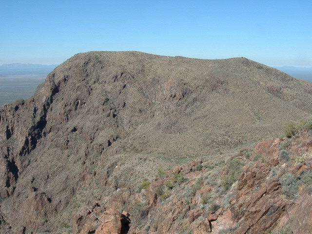
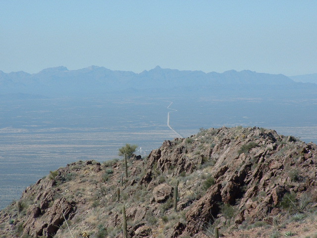
From our parking place, we looked southwest to South Mountain. It rose over two thousand vertical feet above us and dominated the area. It is five air miles from one end to the other and looks really huge.
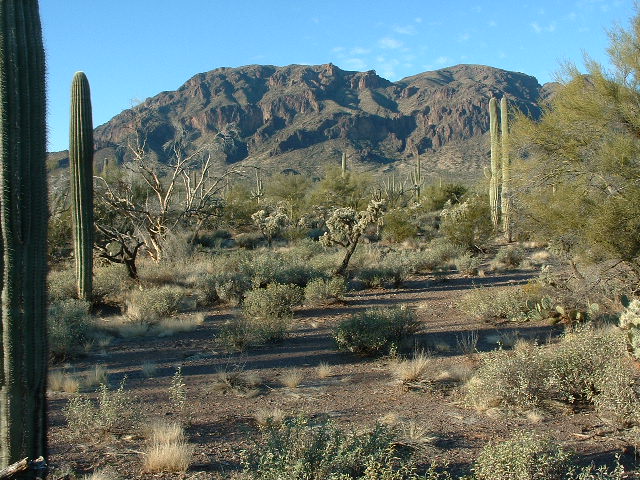
The north side of South Mountain
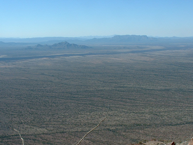
We headed across the desert towards what looked like a possible way up through the huge cliff bands of the peak.
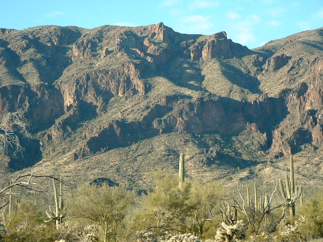
Rough country on the north side of the mountain
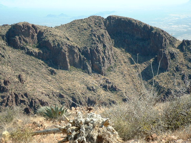
As we reached the base of the mountain, we started up the slopes and before long came upon a trail – this really threw us for a loop, as we never expected to find anything here. In the above photo, our route on the trail roughly went from lower left to upper right. The saddle between South Mountain and Peak 4062 can be plainly seen on the right skyline. You could tell that the trail had probably been built during the heyday of the mining activity on the reservation, back in the 1880’s. It switchbacked up through very steep country. A tremendous amount of work had been put into creating it – countless rocks had been piled up along the trail’s path on the downhill side to prevent its slumping and eroding away. This trail was built to last, and it had, because here we were 120 years later and easily following it. The only evidence of any maintainence was that a few branches had been cut (fairly recently, but by whom?) from trees next to the trail, branches which would have been a little bit in the way of someone walking on the trail. In this next photo, you can see the trail in the middle of the photo coming towards you – it may not look like much, but that’s only because it’s covered with dry grasses – it’s actually 3 or 4 feet wide and is quite flat to walk on. It was probably originally built to allow mules to walk on easily.
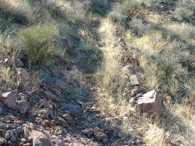
The old mining trail
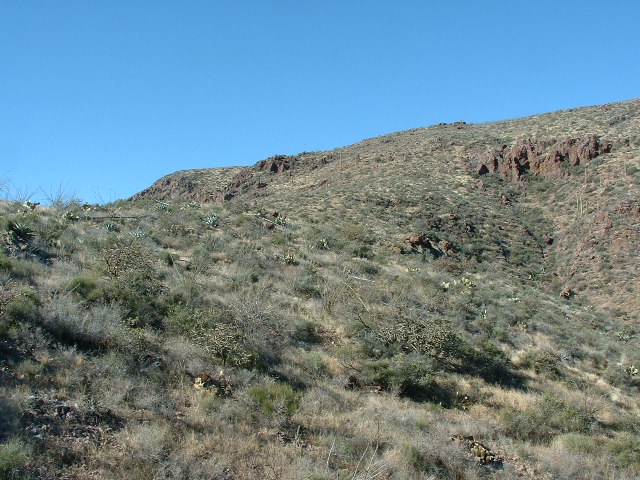
The trail had been located really cleverly, dodging all of the cliffs, and gained elevation quickly. It climbed up through spectacular country, and before long we had reached the saddle which lies between the summit of South Mountain and the outlier Peak 4062 to the east.
At the saddle
From the saddle, we left the trail and headed southeast upslope and over to Peak 4062, crossing a few lesser bumps en route. On the summit of 4062, we found a cairn and inside it a register left by Andy Bates a few years before, so of course we signed in. To the west loomed the bulk of South Mountain, barely higher than we were.
Looking west to South Mountain
After a short visit, we headed back down to the saddle. On our way down, we crossed the trail again, where I took this photo of Ben Nevis Mountain, 4 miles to the north, and at 4,011 feet elevation one of the highest peaks in the area.
North to Ben Nevis
From there, we headed up through easy country and to the top of South Mountain. The bench mark shown on the map is 4157′, and it sits at the south end of the high area of the summit, but anyone who has been there knows that the highest point of the mountain lies a few hundred feet further north. Dave Jurasevich and I once patiently measured it with both of our GPS units and determined it to be 9 feet higher than the bench mark. I’m going to stick with that, so as far as I am concerned the elevation of South Mountain is 4166′. Andy Martin, the prominence king, might want to adjust the prominence of South Mountain a bit if he takes that elevation into account.
The summit register reads like a Who’s Who of prominent mountaineers in the southwest. At the time John and I climbed it, It included such notables as Mark Adrian, Richard Carey, Bob Packard, Bob Martin, Mark Nichols, Dave Jurasevich, Andy Bates and recently Andy and Sarah Martin. Other than them, only a few unknowns had signed in. The Border Patrol has a 2-meter repeater by the benchmark, powered by a solar panel. Here’s a picture of the summit area – John is by the bench mark and repeater, but it can be plainly seen that the high point is hundreds of feet away to the north.
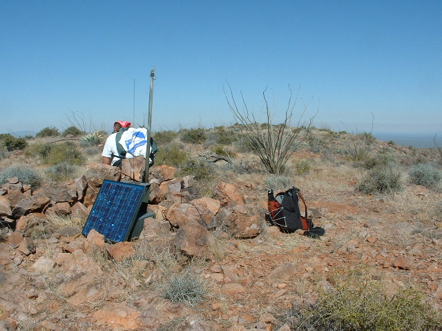
John Vitz on South Mountain
The views are very impressive from up there. If you look straight down the very steep south slopes, you can plainly see the fence which divides the Sells district (Komkch’ed e Wah’osithk Chekshani – translation: “Turtle Got Wedged District”) on the east from the Pisinimo district (Pisin Mo’o Chekshani – translation: “Buffalo Head District”) to the west. Actually, it’s not the fence you can see in the photo, but the rough road that parallels it so it can be maintained.
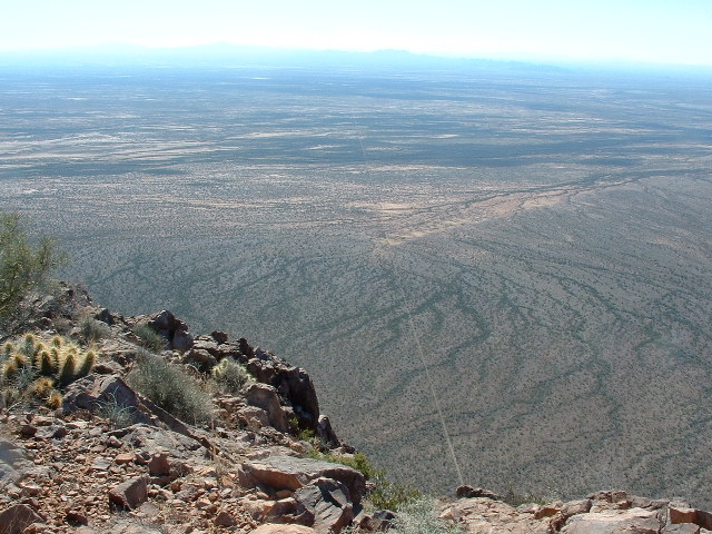
Looking south from South Mountain
An odd thing about these fences which demarcate one district from another is that they mostly serve to keep the cattle of one district separated from those of another. A surprising number of the O’odham cannot tell you where the district boundaries lie. But more on that subject another time.
The village of Pisinimo can be plainly seen from South Mountain. The road which runs due west from Pisinimo and crosses the Quijotoa Valley and heads over to the village of Gu Vo (translation: “Big Pond”) stands out like a huge white scar across the desert. Seeing that road made me think of Dave and the guys driving it in the company of Philip, their T.O. guide from Sells, a few years ago, ignoring the outrageous warning signs to keep out of the Gu Vo district. In the next photo, you can see the road plainly. See the bush on the nearby slope? Just to the right of it is a white dot – that’s the water tower at the town of Pisinimo.
Looking west from the summit
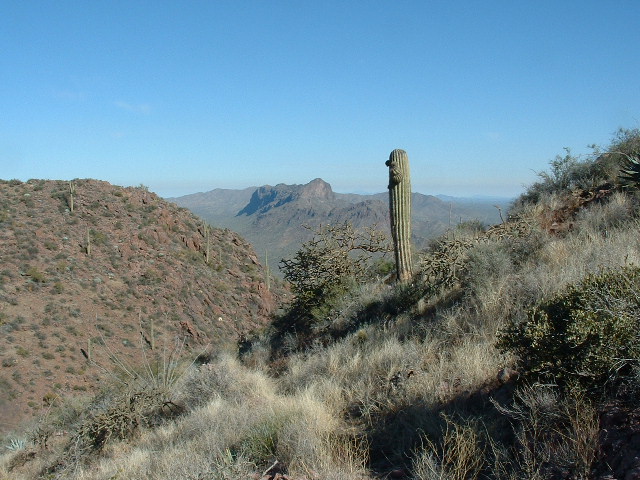
Another view I liked from up there was this one. In it, the dark mass in the middle distance on the left is the Kupk Hills, and the broad uplift on the horizon farther to the right is the amazing range known as the Mesquite Mountains.
Southwest from the summit of South Mountain
When Dave and I climbed South Mountain a few years ago, we actually saw the trail that John and I had just used to climb the mountain. We couldn’t tell back then if it was a trail or maybe an old road. I had mentioned it to Andy Martin and he also spotted it recently when he and Sarah were up there. It ends at an old mine digging below the steep cliffs on the west side of Peak 4062, so that would seem to indicate that miners had in fact built it in the first place. Here’s a view looking back over to 4062, and you can plainly see the trail crossing the slope across the middle of the picture – it’s faint, but you can spot it.
Looking east to Peak 4062
John and I left the summit, regained the trail back at the saddle, and had a good time walking down it. This time, we followed it all the way down to the desert floor, to where it began at the end of a fairly decent road. I have UTM coordinates for that point if anybody needs them. We walked down this road to a point within one kilometer of our trucks, then headed cross-country to the vehicles. The entire trip, on foot, only took 5 hours 22 minutes. That included two summits, plenty of stops to eat and drink and take pictures, and generally just taking our sweet time and enjoying the day. There is no doubt that this is THE way to climb South Mountain. Using the road and trail, Dave could wear his tux and tails and climb the peak and barely break a sweat.
Please visit our Facebook page at: https://www.facebook.com/pages/Desert-Mountaineer/192730747542690