
Not much surprises me these days when climbing near the Mexican border. I’ve seen so much nonsense over the years, maybe I’ve become jaded towards all of it. When I head out to climb in those areas, I’m not looking for trouble, or even expecting it, but I am always keeping a wary eye should anything pop up.
November 28th started out like any other day. I like an early start, so when I pulled off to the edge of the road to park, it was still dark. My pack was soon ready, and so was I. It was cold enough to freeze the nuts off a bridge, so I was hoping my light fleece jacket would be adequate. A polypro balaclava and gloves provided a bit more warmth. As soon as I could see without my headlamp, I set out.
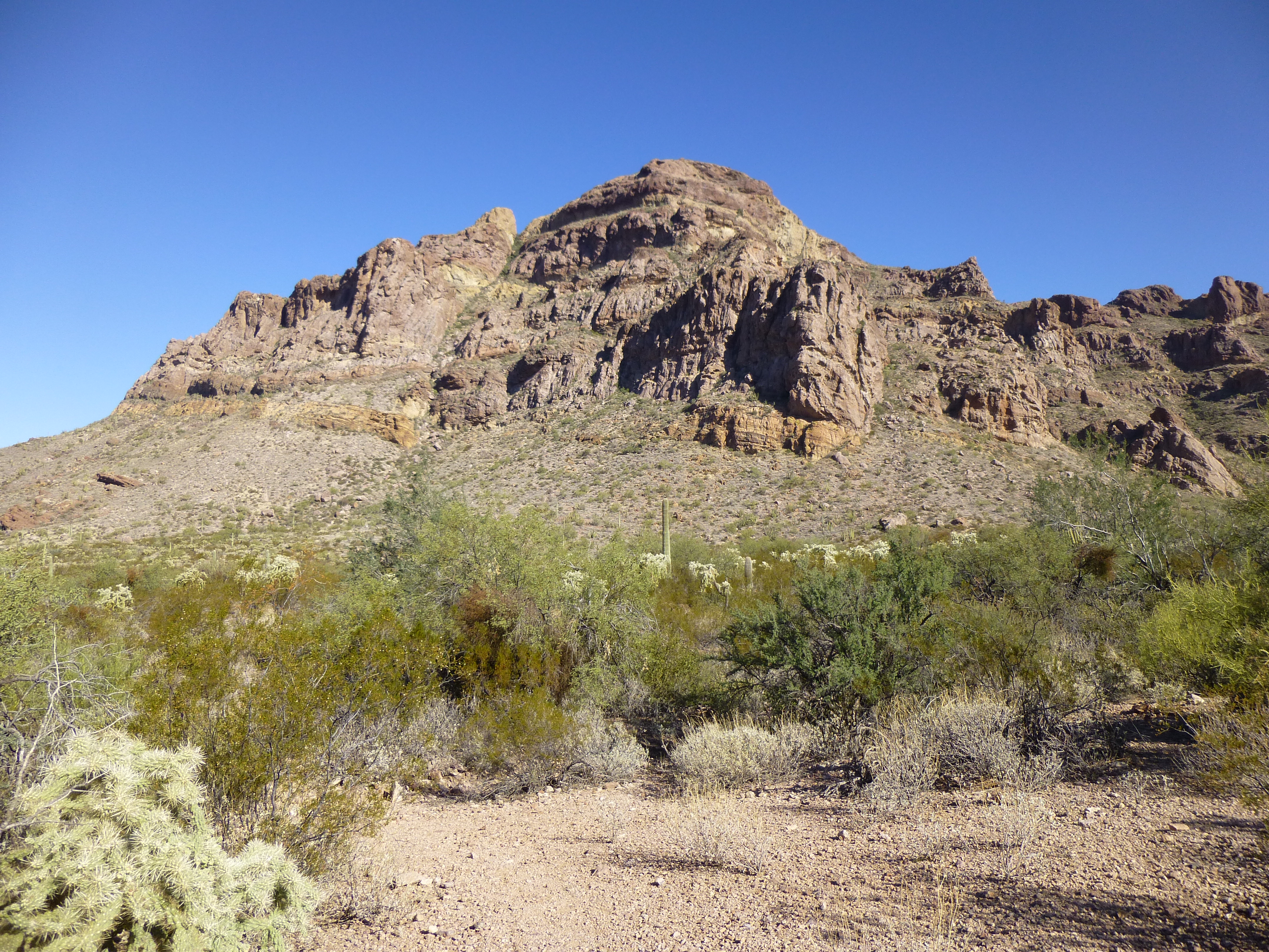
My goal today was Peak 3704, a big bruiser right next to Diaz Spire. I’d kept putting it off, but now it was time to fish or cut bait. The thing was steep, dauntingly so, on all sides, and I was dreading it. There didn’t appear to be any simple way up, so I was hoping I’d get lucky. It had been climbed once before that I knew of, but I had no good info on how it was done.
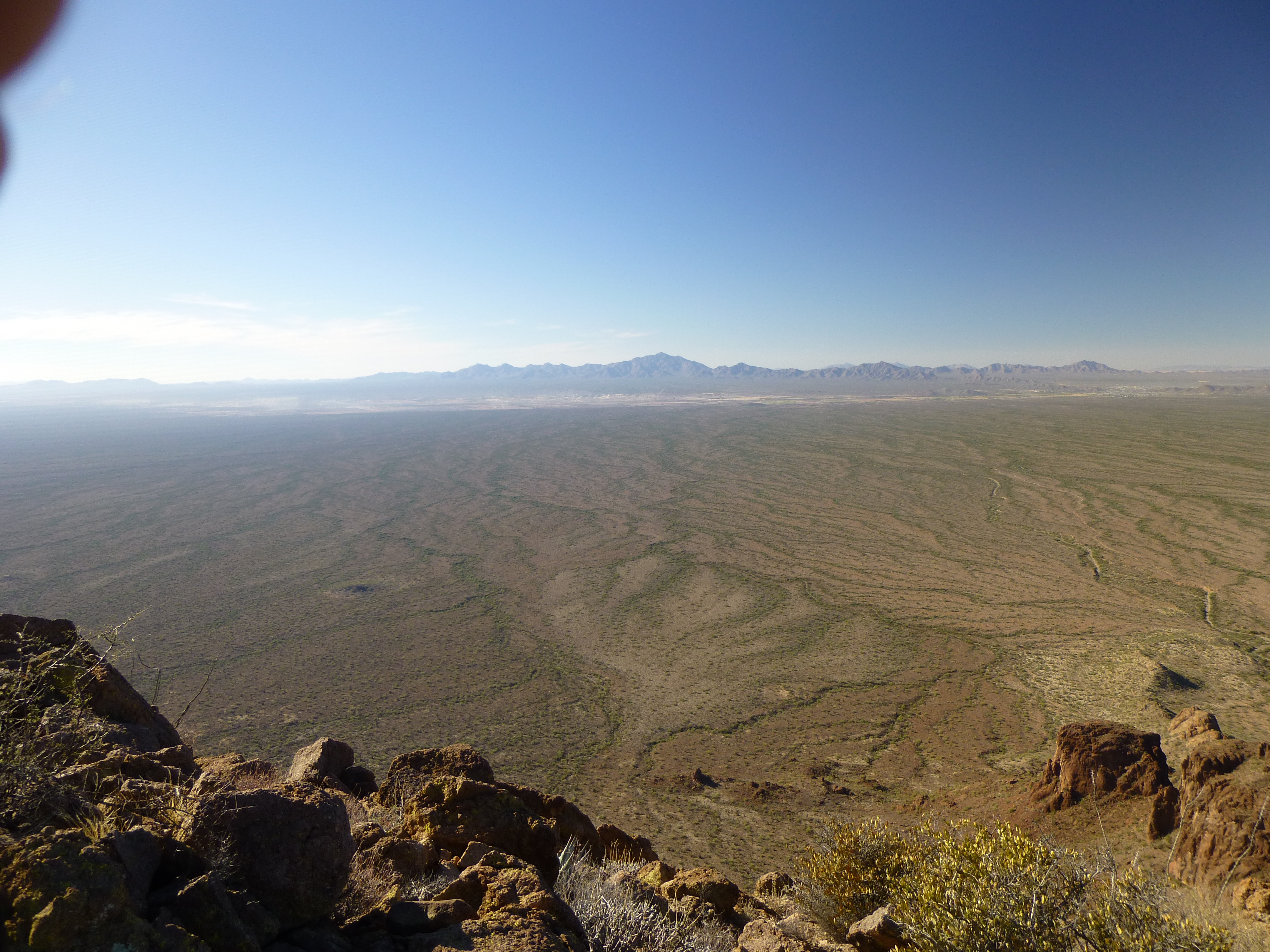
I set out at a brisk pace to warm up, and soon turned the shoulder of Point 2298, a small hill along my path. Only then did I get my first view of 3704. Heading southeast, I crossed innumerable small gullies and washes. My route took me just to the north of Point 2212, and by then the sun was shining full on me and warming me up, which felt good. After about two miles, I came across a road, not shown on any map but visible on the satellite photos, so I was expecting it. It was obviously heavily traveled. Only two types of people could be using this road – smugglers, and their nemesis, the U.S. Border Patrol.
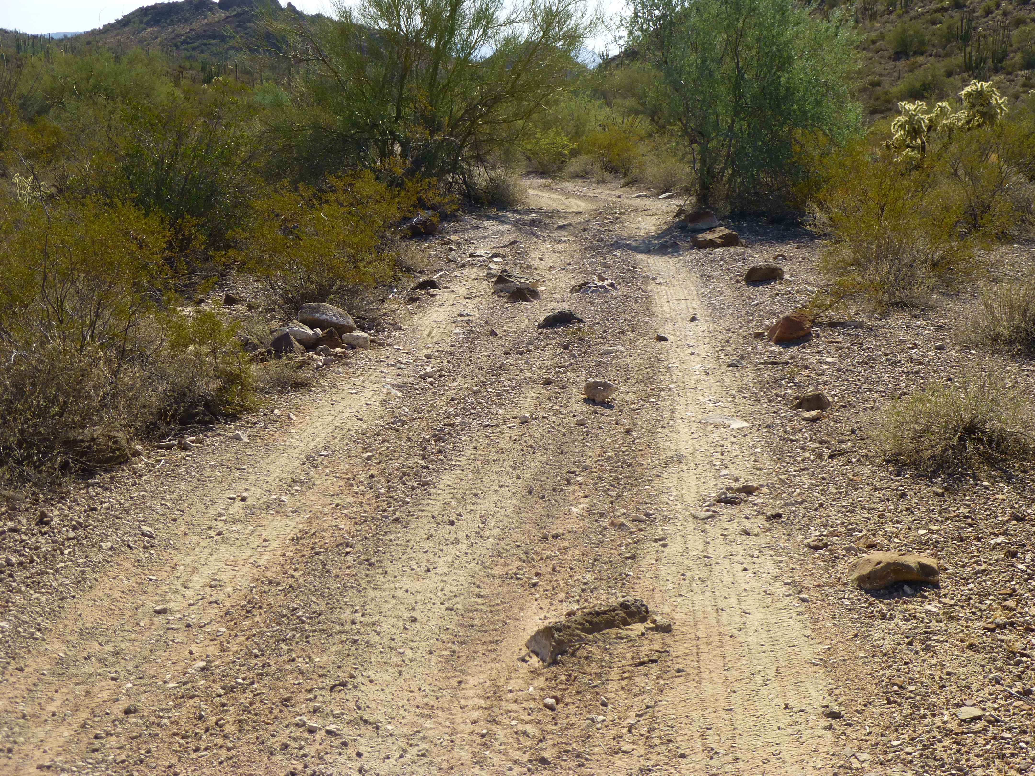
The road, not on any map
Next came a major wash, draining most of the area west of Sweetwater Pass. Downstream from where I crossed it sat Cement Tank, a last vestige of the cattle-ranching activity that used to take place here on Organ Pipe Cactus National Monument. A little east of the wash I came upon a well-used footpath, indicating that this area was a conduit for illegal smuggling activity – that, in itself, should have raised some red flags.
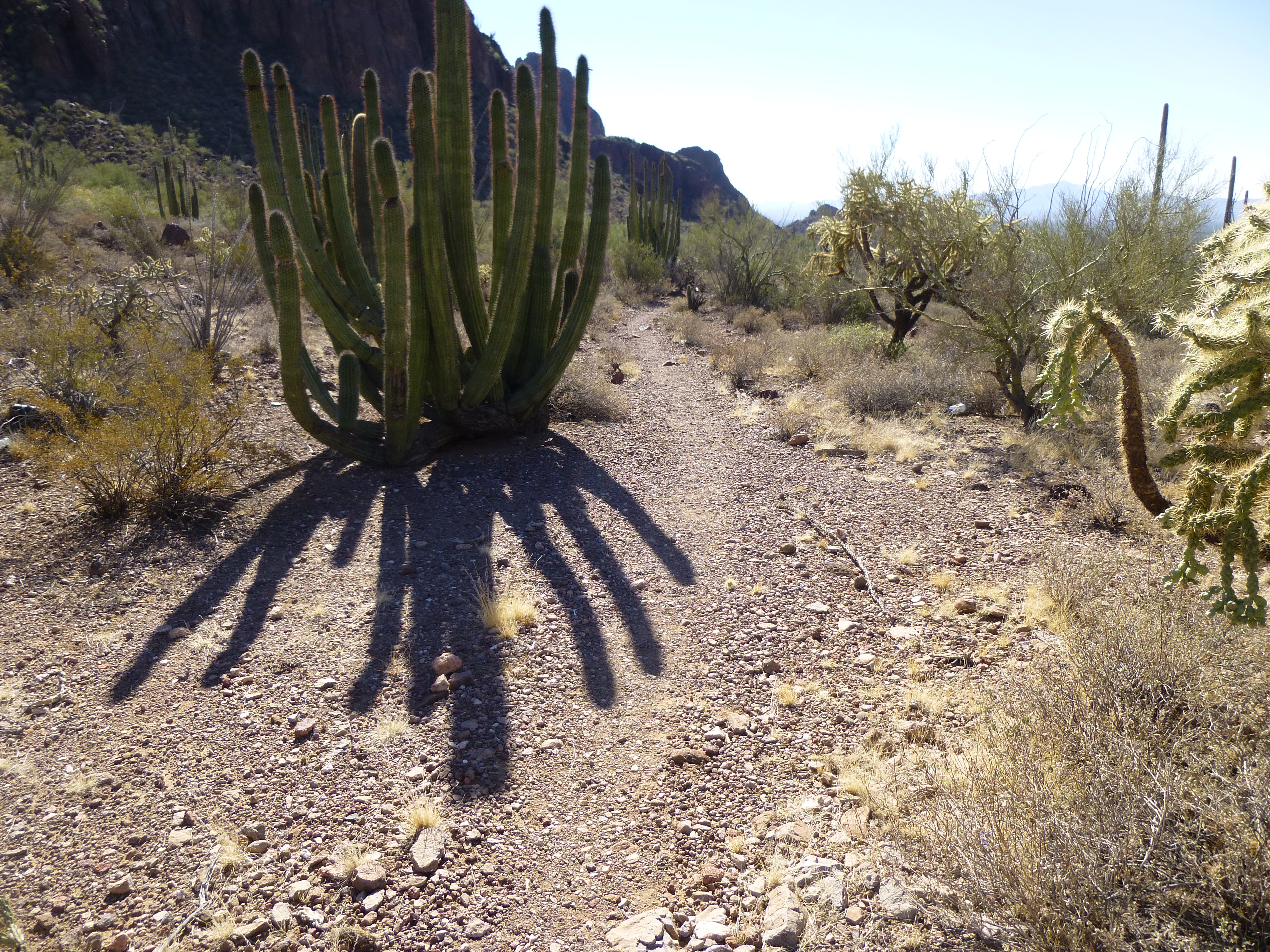
The footpath
I was now getting close to the base of the mountain, 2 1/2 miles after having left the truck. In front of me sat a ridge, definitely in my way, so instead of going around it low down, I decided to climb up to the top of it, then follow its crest. This would cost me some extra time and distance, but it seemed like the right thing to do. This bit of intuition served me well, because halfway along it, I heard voices. Out here in such a place, that can only mean one thing – illegal activity of some sort. Either it was a group of border-crossers making their way north into the U.S., or it was smugglers working for one of the Mexican drug cartels. Indocumentados are not usually carrying weapons and only want to move on, posing little threat on their way to the promised land. However, some of their coyotes have been known to carry guns, and those are the ones who are more serious. Drug smugglers, on the other hand, have a lot more to lose and are the ones to be avoided at all costs. Border Patrol agents I have met have told me that they’ve apprehended some smugglers who were carrying AK-47s, and if that doesn’t put the fear of God into you, then nothing will. Out in these remote areas, your bones could sit for all eternity and never be found.
As soon as I heard the voices, my immediate reaction was “Shit, what do I do now?” They seemed to be below me, so I felt that if I stayed on the ridge there was a good chance they wouldn’t see me. I walked carefully, making sure to not set any rocks rolling downhill, a sound that can be heard over a long distance. I even moved to the other side of the crest to minimize the chance of being spotted. Several hundred yards later, as I approached the end of the ridge, I heard them again, too distant to be able to make out any words but close enough to send a chill up my spine. Their voices still seemed to be coming from below me, down in a major wash which drained the whole west side of the Diaz Spire – Peak 3704 complex. My route today would have to go right up that wash, so it seemed there’d be a pretty good chance I’d run into somebody, and I was dreading the thought.
Without losing more than a hundred feet of elevation, I dropped into a small saddle, then contoured southeast across a hillside. Here, I was quite exposed, and if anybody was going to see me, this is where it would happen. Within ten minutes, though, I had moved into the major wash I mentioned a minute ago. This put me at 2,300′ elevation – I had reached the mountain itself, and now the climbing would begin in earnest. In spite of all the miles of traipsing across the desert to this point, I was still only 200 feet above where I’d started.
The mouth of the wash quickly narrowed, and I found myself boulder-hopping to gain elevation. It was pretty brush-choked in places, but a well-worn path snaked its way up through the vegetation – a bad sign, as that proved that a lot of people had been passing through, and recently. For a fact, they had all been up to no good. Sadly, their trash littered the ground as I climbed, a constant reminder that this valley was a conduit for illegal activity.
At one point, I reached a waterfall, a steeply-inclined rock ramp at maybe a 45-degree angle (here in the desert, unlike most other places, our waterfalls are nearly always dry).
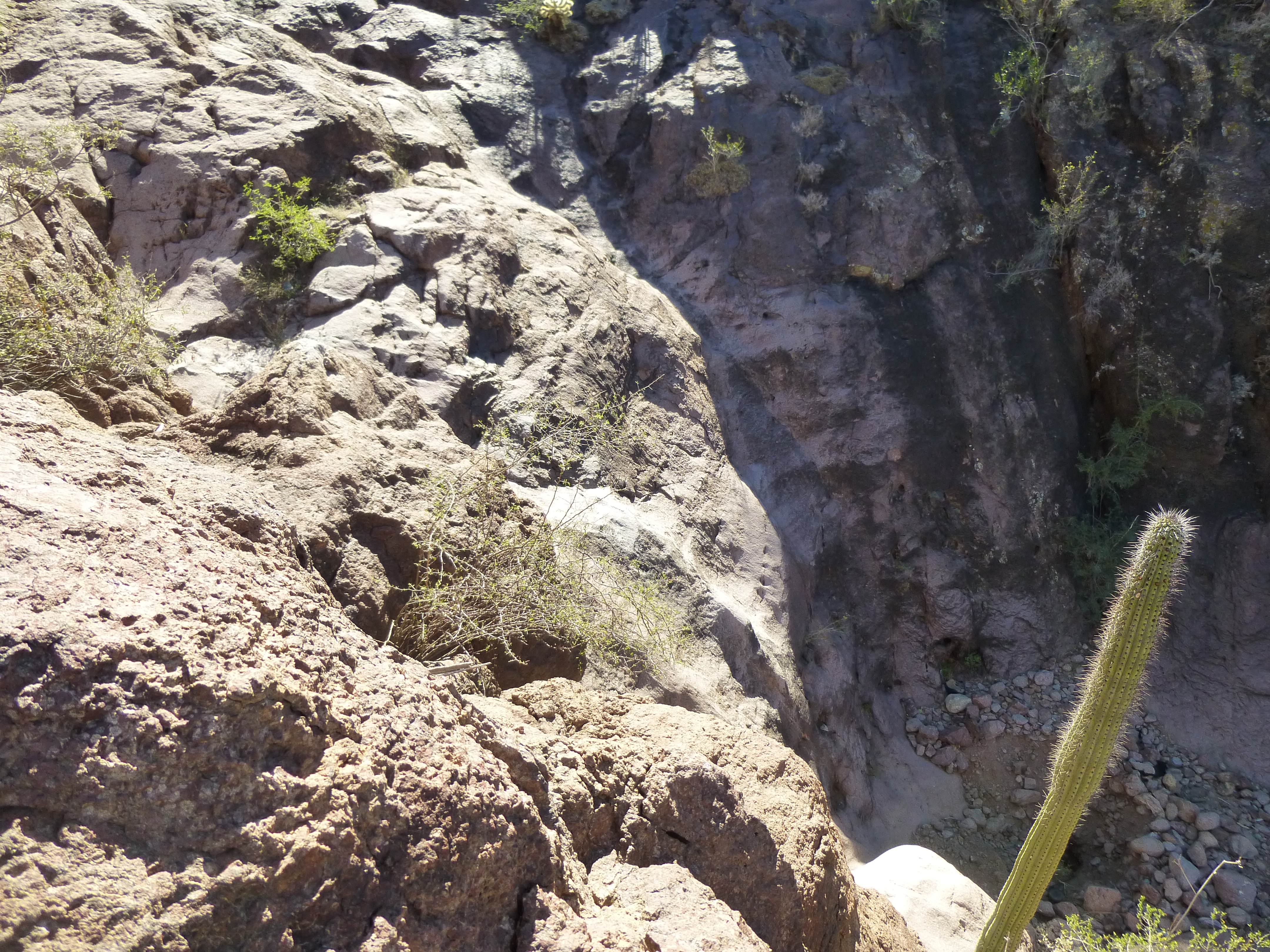
The waterfall (this was taken later, on my way back down)
At its base, someone had dug a deep hole in the sand, hoping they’d find water. In this photo, you can see a couple of black plastic water jugs (the exact type they bring up from Mexico) which had been used to dig in a desperate search for water.
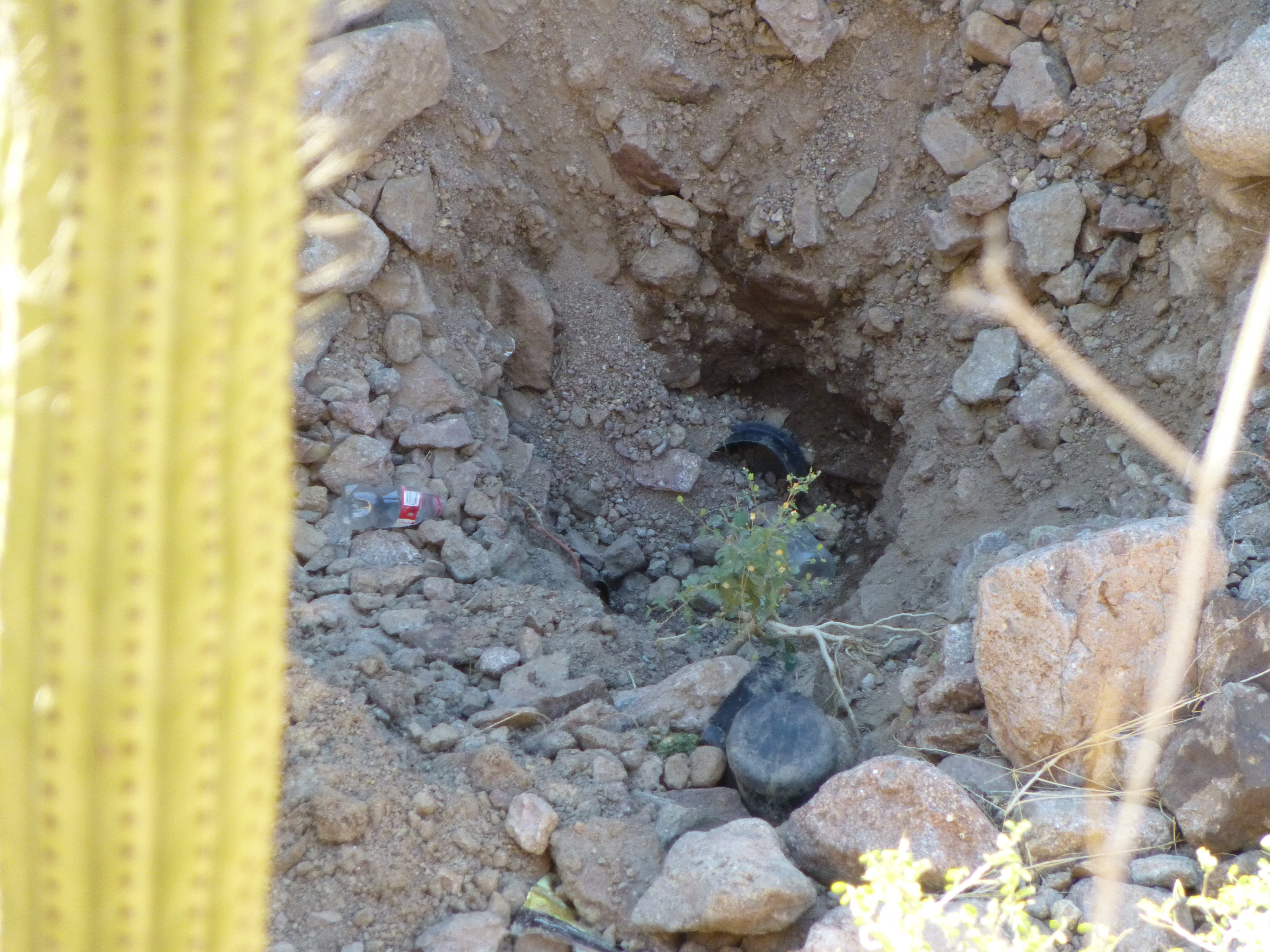
Looking down from the top of the waterfall on to the hole in the sand at the base
The rock had some decent-looking holds, so I gave it a go and made it up in decent time. Then, it happened again – voices, and just when I was starting to think I’d left that nonsense behind me. It was hard to tell where they were coming from, and that uncertainty made me as nervous as a long-tailed cat in a roomful of rocking chairs.
Decision time. If I were to keep climbing southeast up this canyon, it would take me to a high saddle between Diaz Spire and Peak 3704 (my objective). The only problem with that was I’d be faced with a climb of over 400 feet of steep cliffy mountainside which, from out on the desert floor, looked totally unappetizing. There seemed to be only one other possible alternative – a steep canyon climbed south-southeast out of the main canyon I was already in, and although I couldn’t see any good possibilities for an exit higher up, I hoped against hope that it’d work.
I started up, and things were going well, but after climbing a couple of hundred feet, things went to hell in a handbasket. Voices, louder and closer than at any other time today, and they were directly above me. My heart was pounding as I scanned the slopes above, but I couldn’t see them – it felt like my climb was unraveling, and fast. There was only one place those guys could be – under an overhanging cliff, no more than 200 vertical feet higher on the steep slope. What really sucked was that my path upwards would take me right past them. I know they hadn’t seen me, as their spirited conversation carried on unchanged. Now what was I going to do? My experience with drug smugglers was that they didn’t want to engage with Americans, at any cost – it wasn’t worth jeopardizing their goal, that of getting their illicit cargo to its destination farther north. Minutes before hearing their voices, I had found this on the canyon floor.
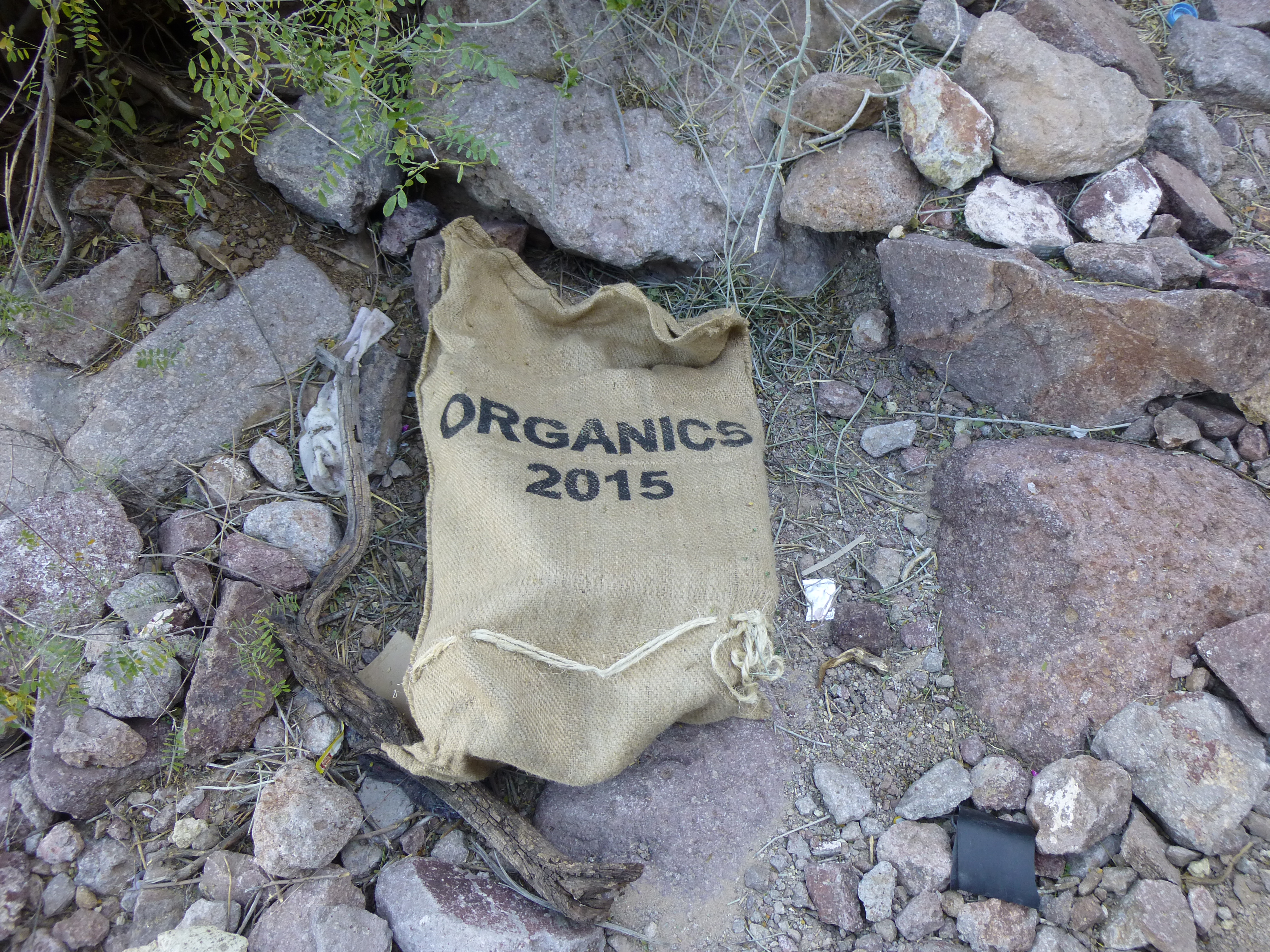
The burlap sack used to carry drugs
I had looked inside this burlap, and it was lined with cardboard – the preferred way smugglers carried the packages which made up their loads. No drugs were there, so the bundles had already been re-packaged and probably moved farther north. There was no way I was going to tangle with those guys – it was just me against who knows how many of them, and they may have been packing. It’d be easy to pick off a lone montañista in a remote spot like this and make him disappear forever. My next decision was made in a moment – move away from the danger, but hopefully still get my peak.
Moving directly away from their position, I crossed an open slope in an ascending traverse. My heart was pounding – all they had to do was look down and they’d see me for sure. It took me maybe 250 yards to reach a point where I disappeared around a corner and would no longer be visible to them, and once that was done, I breathed easier. Of course, my whole route had now been changed, big-time. I was following the base of a big wall, hugging it as best I could, hoping only to be able to continue and find a way up. It was brushy as hell, so that didn’t help my mood any. At times I was forced down, then I’d re-gain the lost ground, always hoping for a net gain. All I wanted to do was follow the path of least resistance, which I did, and after a few major changes of direction, I ended up perched on an exposed rib of rock well above where those jokers were holed up.
Finally, a bit of good luck. I could see ahead far enough now that if I crossed over into an open, steep slope I should be able to climb to the summit – in fact, it looked like I was now within 300 feet of the top. Moving quickly but carefully, I pushed out on to the slope, pretty confident the men below couldn’t see me up here. It didn’t take but another 15 minutes and I topped out on Peak 3704. Well I’ll be damned, I made it! Click on the link, and you can see the crazy-quilt of contours guarding this mountain, and hopefully get a feeling as to why I’d been very apprehensive of this one for a long time. I was 3 hours 20 minutes out from my vehicle at this point.
On the summit, I found no border-crosser trash, only the cairn and register left by Bob Martin and Bob Packard, the first ascenders, back in 1998. Besides theirs was one more register entry left by 3 guys in 2002.
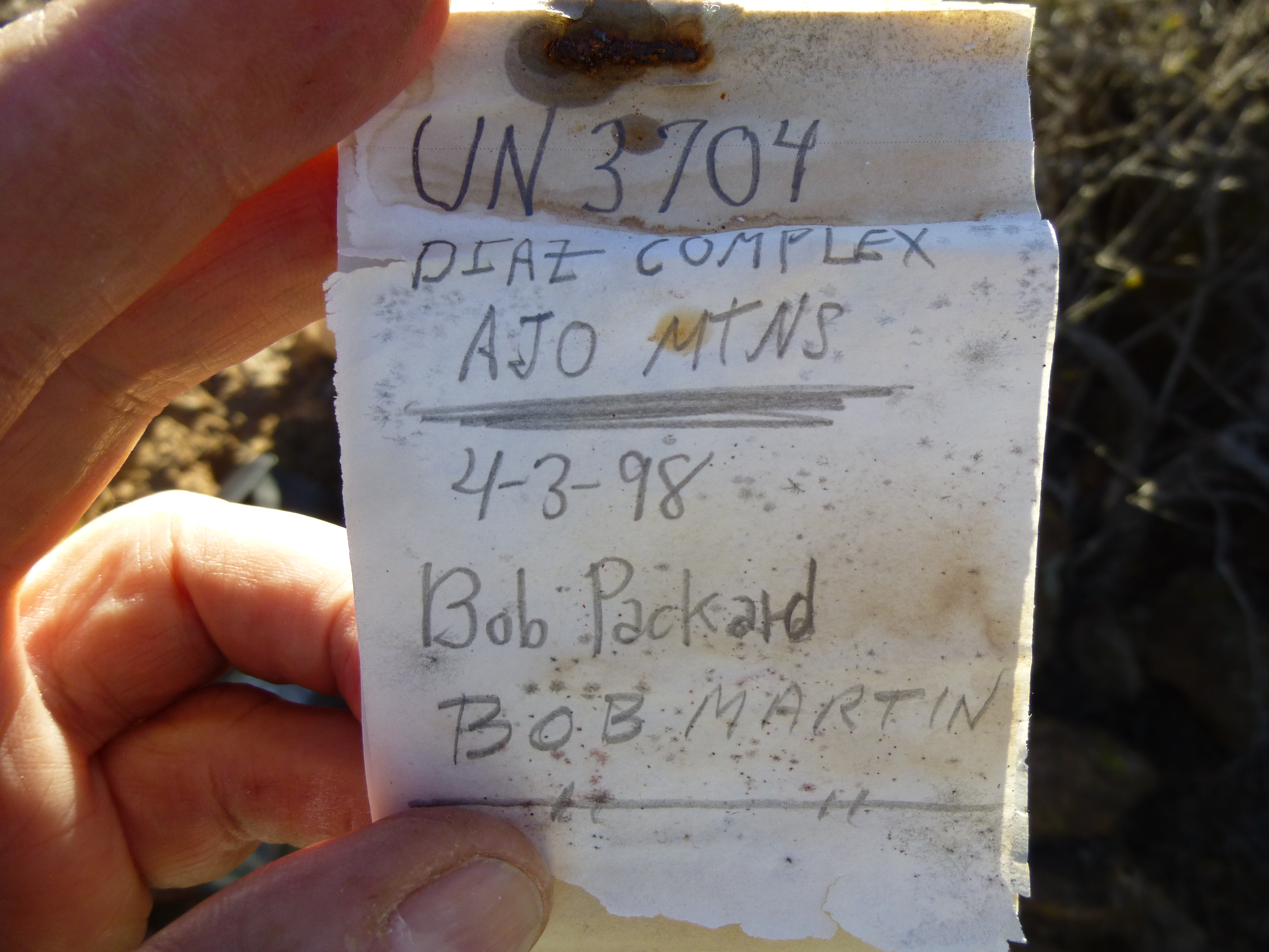
The first ascent record
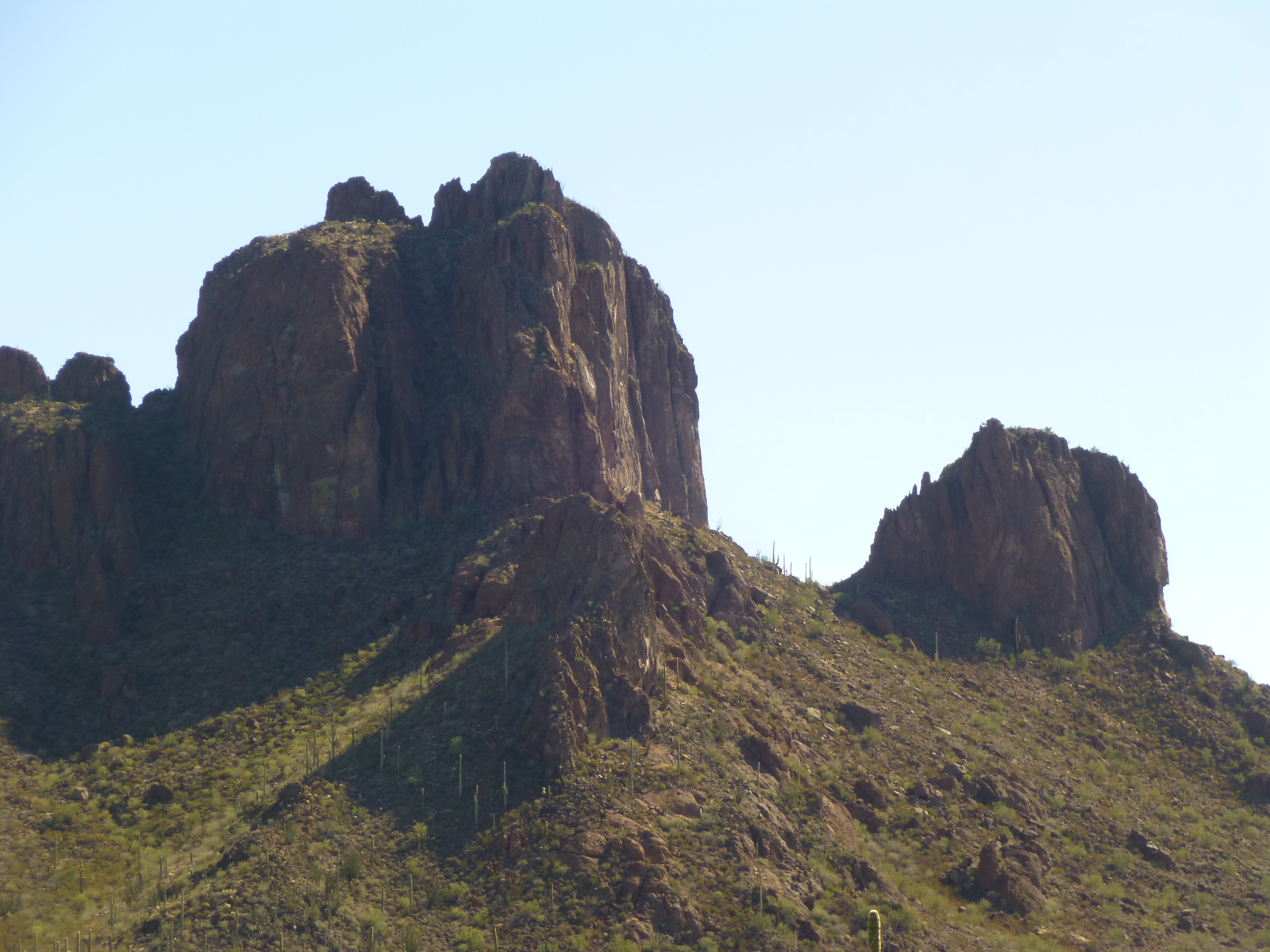
There was one heck of a view from this peak. Most impressively was the front-row seat for Diaz Peak and Diaz Spire.
Diaz Spire, in the center, elevation 3,892′
Diaz Peak, elevation 4,024′
Also, I liked the clean sweep of desert over to the Mexican border, a mere 8 1/2 miles distant.
Looking southwest to Mexico
Even though I knew I wouldn’t be bothered up there, I spent less than half an hour before starting back down. This mountain was so crazy-steep, I wasn’t going to try anything heroic like a different route down – I’d retrace my exact steps. Down the steep slope, over to and across the rock rib, then down, down to reach the base of the wall. As I skirted that, then crossed the open slope, moving closer to and in plain view of those guys under their overhang, I prayed they wouldn’t see me – maybe they’d gone to sleep, waiting for nightfall to move on. Without incident, I reached the relative shelter of the lesser canyon and made quick time down it, finally reaching the main canyon.
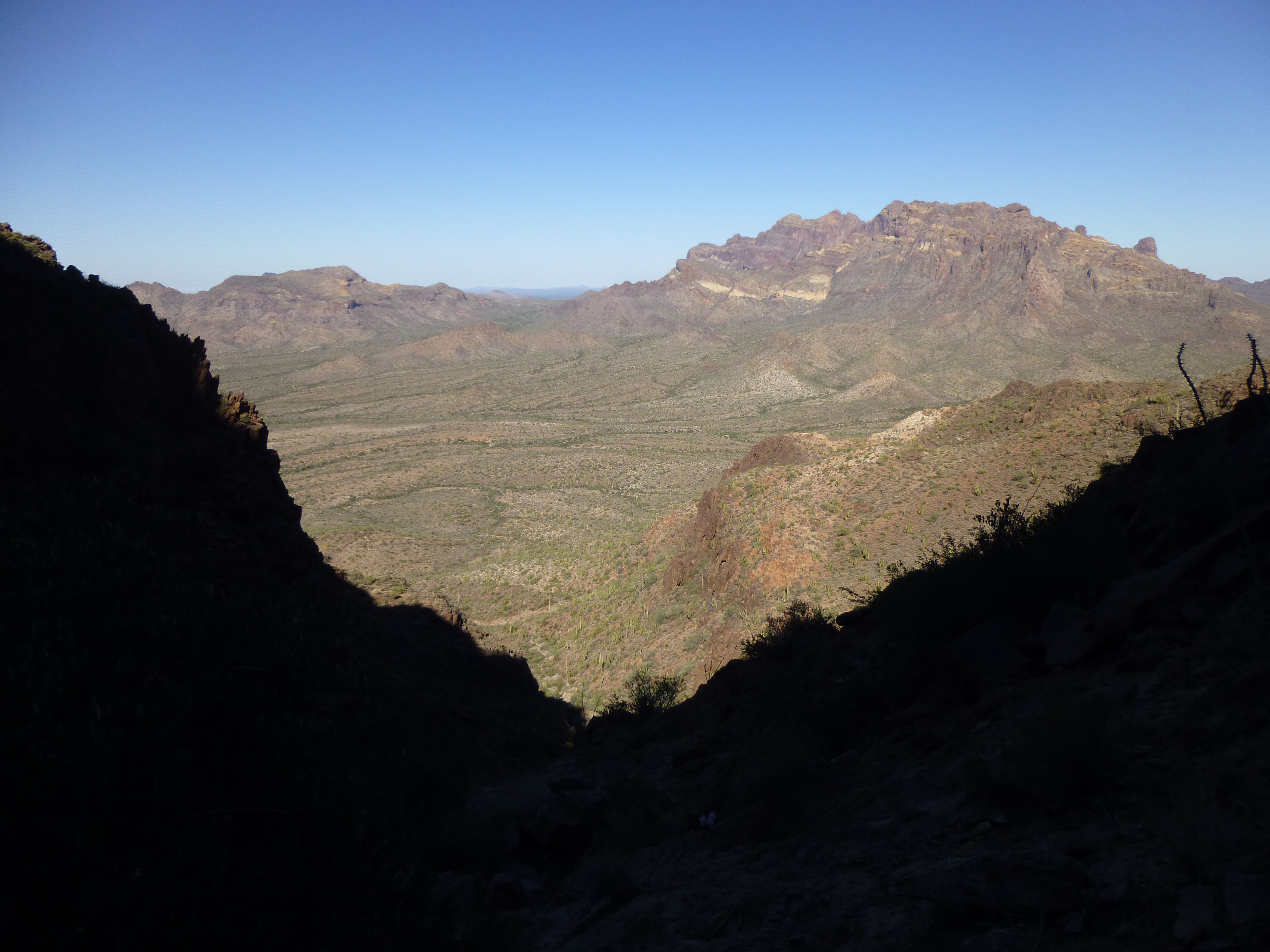
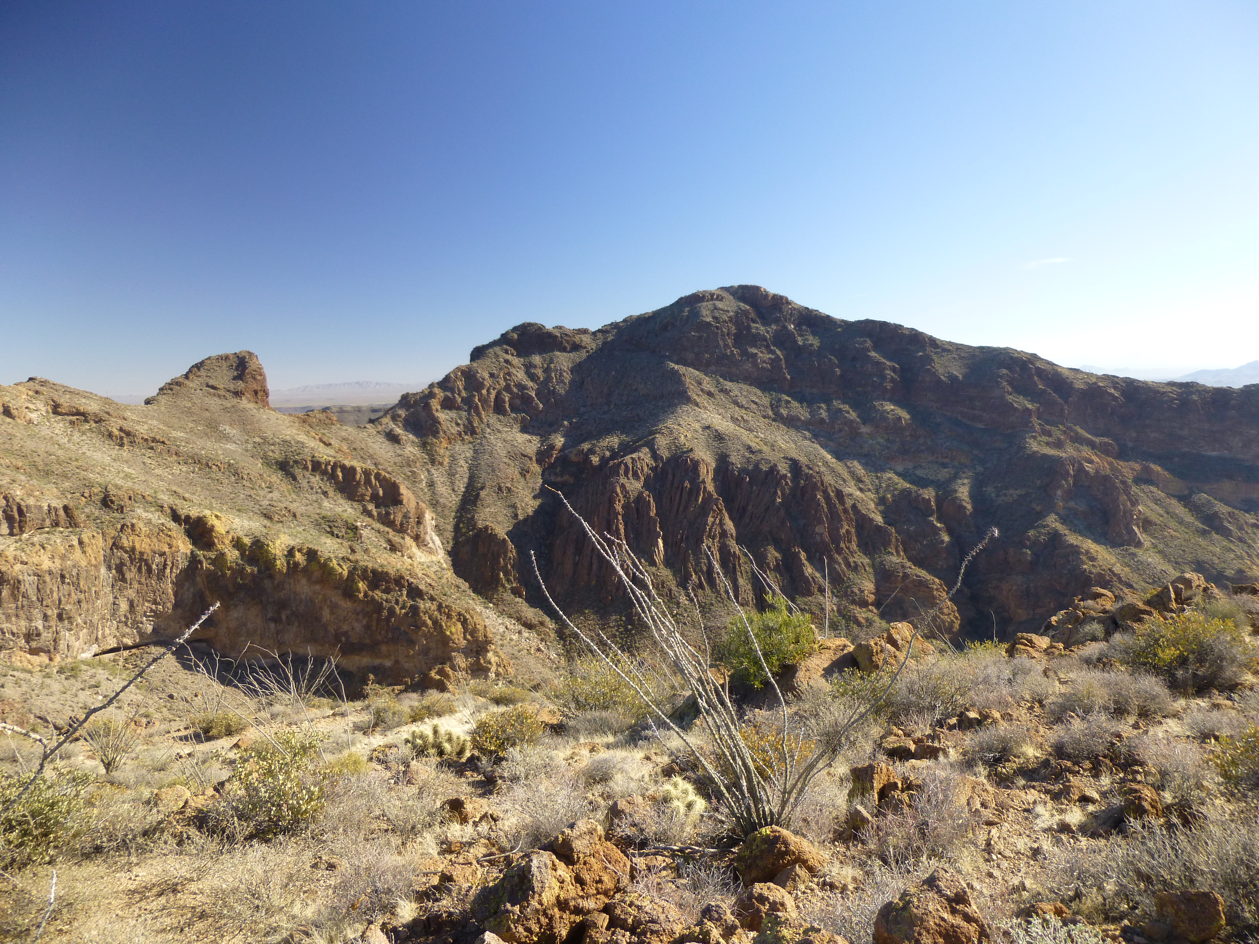
From high up in the canyon, looking north to the Mt. Ajo complex over on the right.
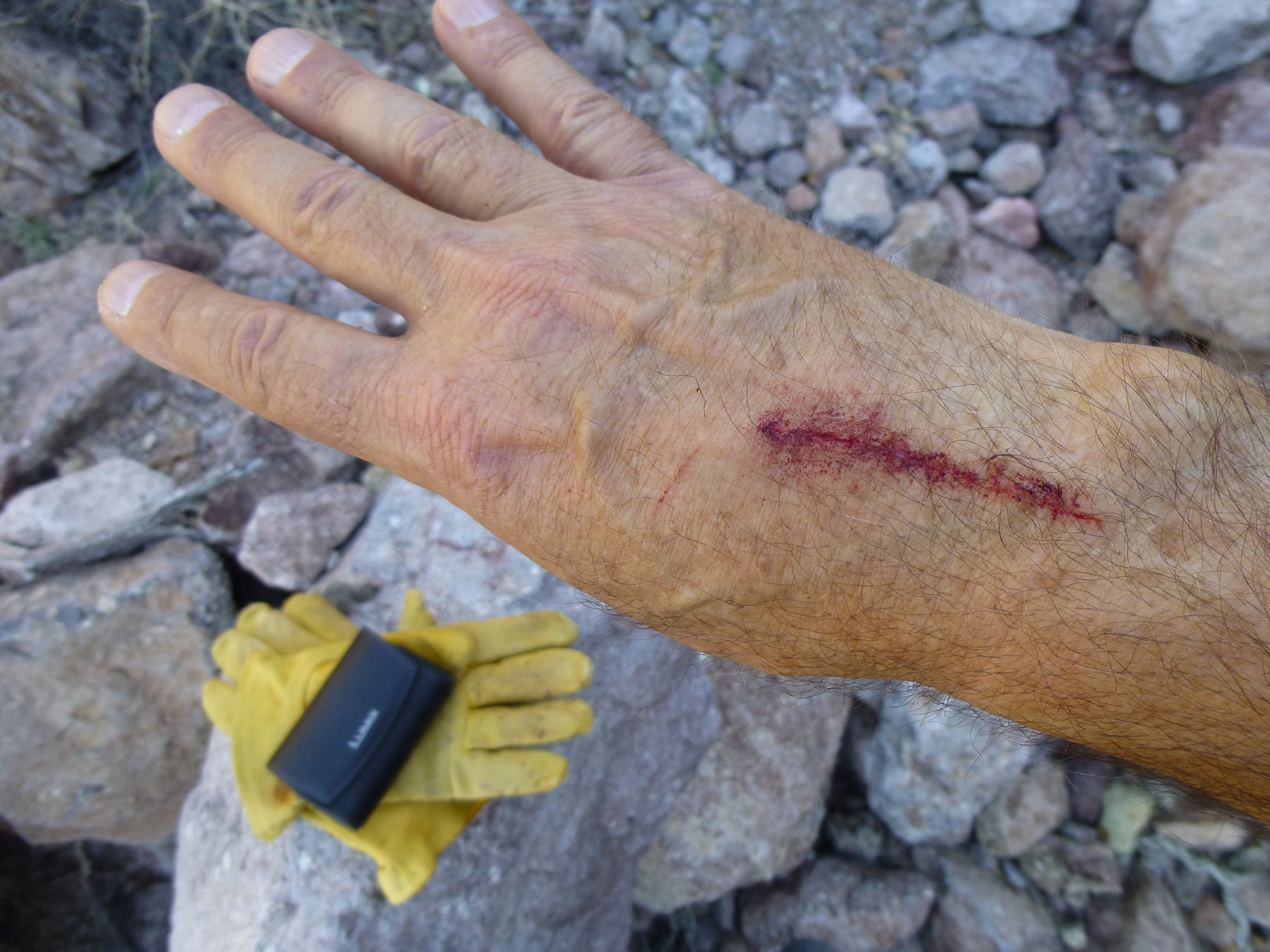
One hazard of climbing in the desert is all the nasty, thorny vegetation – something got me in the canyon, and I don’t even remember it happening. As a memento of this climb, I still carry the scar. Oops, looks like I lost my thumb in the process.
Hand scratch
All was quiet – no voices heard – either they had bedded down for the daylight hours, or had seen me and decided to quit talking so I wouldn’t interfere with them. When I got as far down as the big waterfall, after looking at it carefully I chickened out, deciding it wasn’t worth the risk of trying to downclimb it. A bit of looking around showed me a well-worn path that traveled through much easier terrain to re-gain the canyon farther down, and I decided that’s where the smart money was. Feeling much more comfortable now, I continued to re-trace my steps of earlier in the day. As I reached the lower slope of the mountain, I glimpsed something white down in the big wash I had crossed on the way in early in the day. I took this telephoto shot (you can zoom in more) of what looks like the top of a vehicle. It was about 1,200 feet away, and my guess is that it was broken-down and abandoned, once used by smugglers. I was really curious to go see it, but I didn’t feel like deviating away from my route back to my truck.
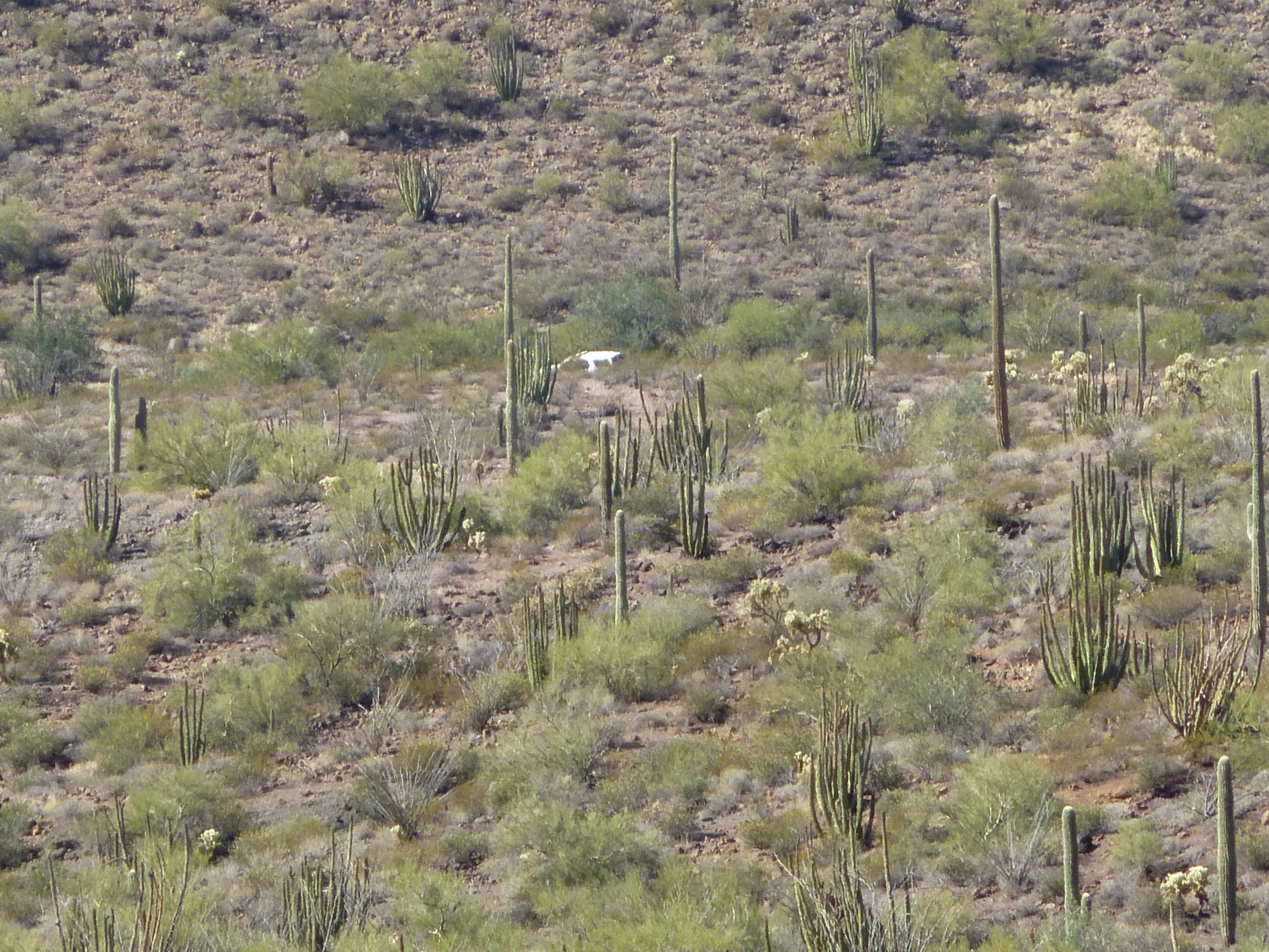
The mysterious vehicle
Down on the desert floor, I looked south and saw this un-named tower with its 500-foot face,
Desert tower
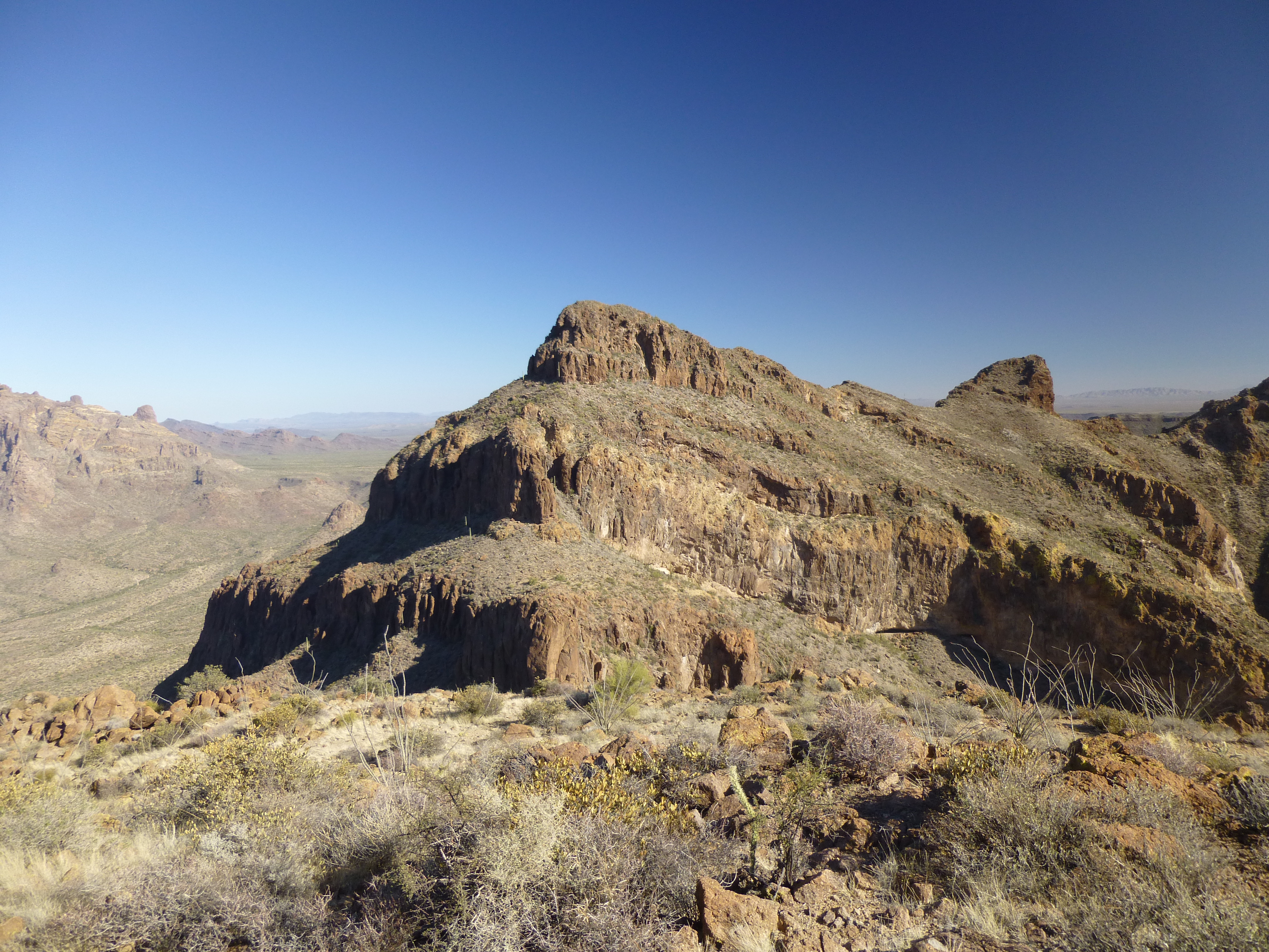
Also, looking back to where I’d spent my day, I had this view.
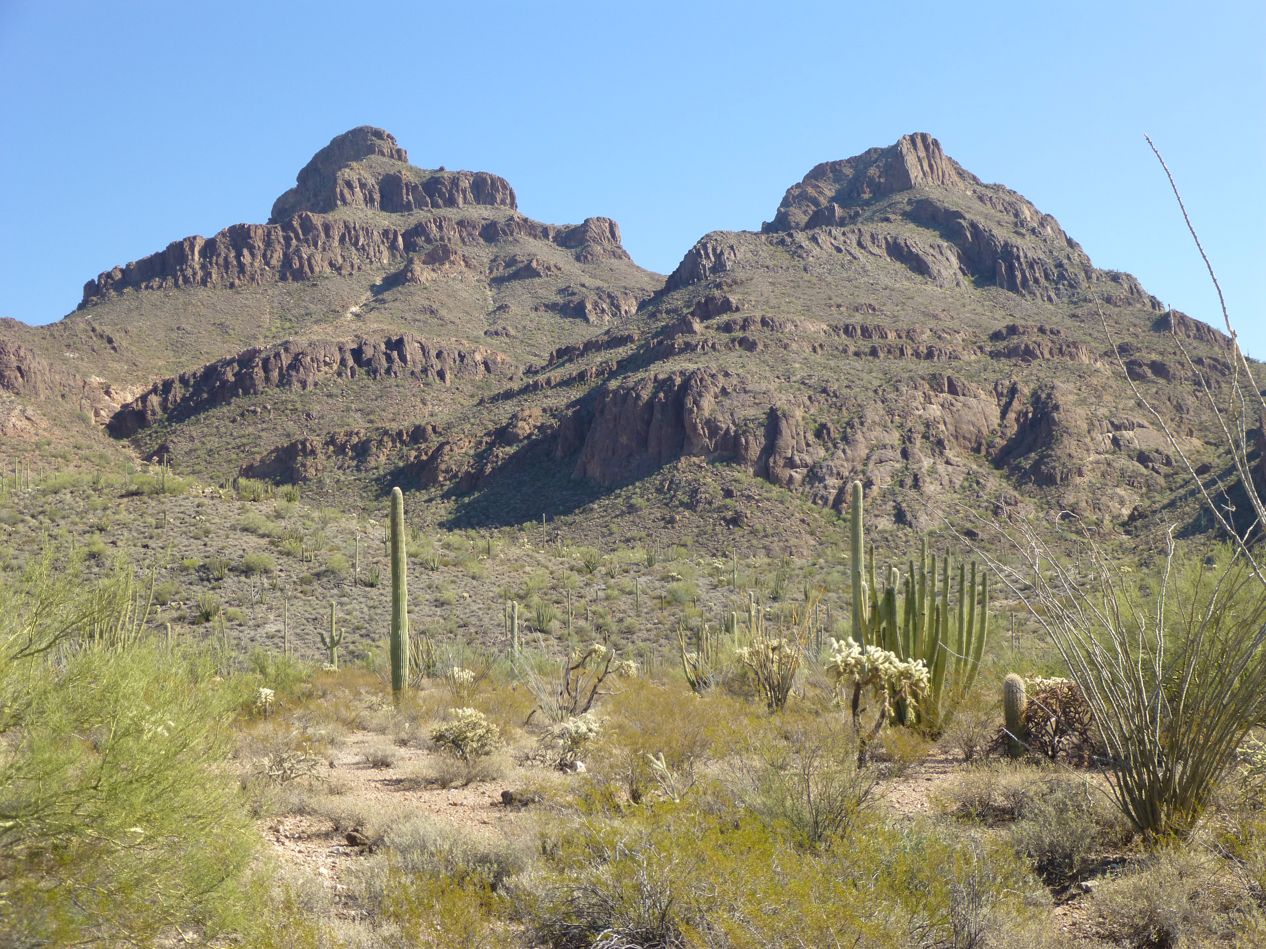
Diaz Spire on the left; Peak 3704 on the right
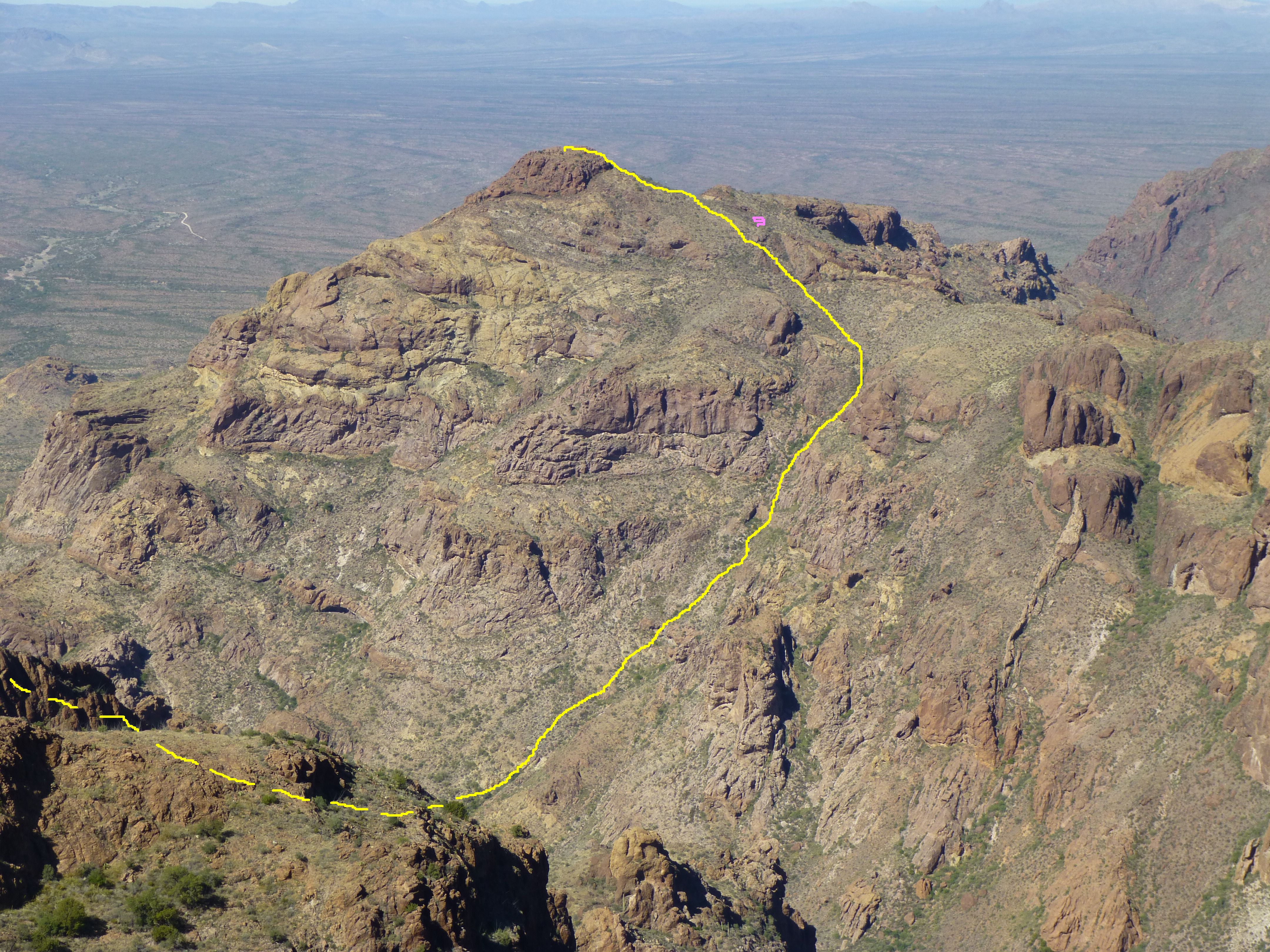
From farther out, I took this telephoto to give you an idea of my route. The broken yellow line indicates my route up the larger and smaller canyons, hidden from view; the pink mark is where the smugglers were holed up (you can see my abrupt change of direction when I realized where they were); the solid line indicated my route below the wall, heading left, then steeply up, then higher to the right to cross the rock rib, then out more to the right on to the more open slope, then steeply up the final bit to the summit. The total gain of the line in the photo is about 1,500 vertical feet.
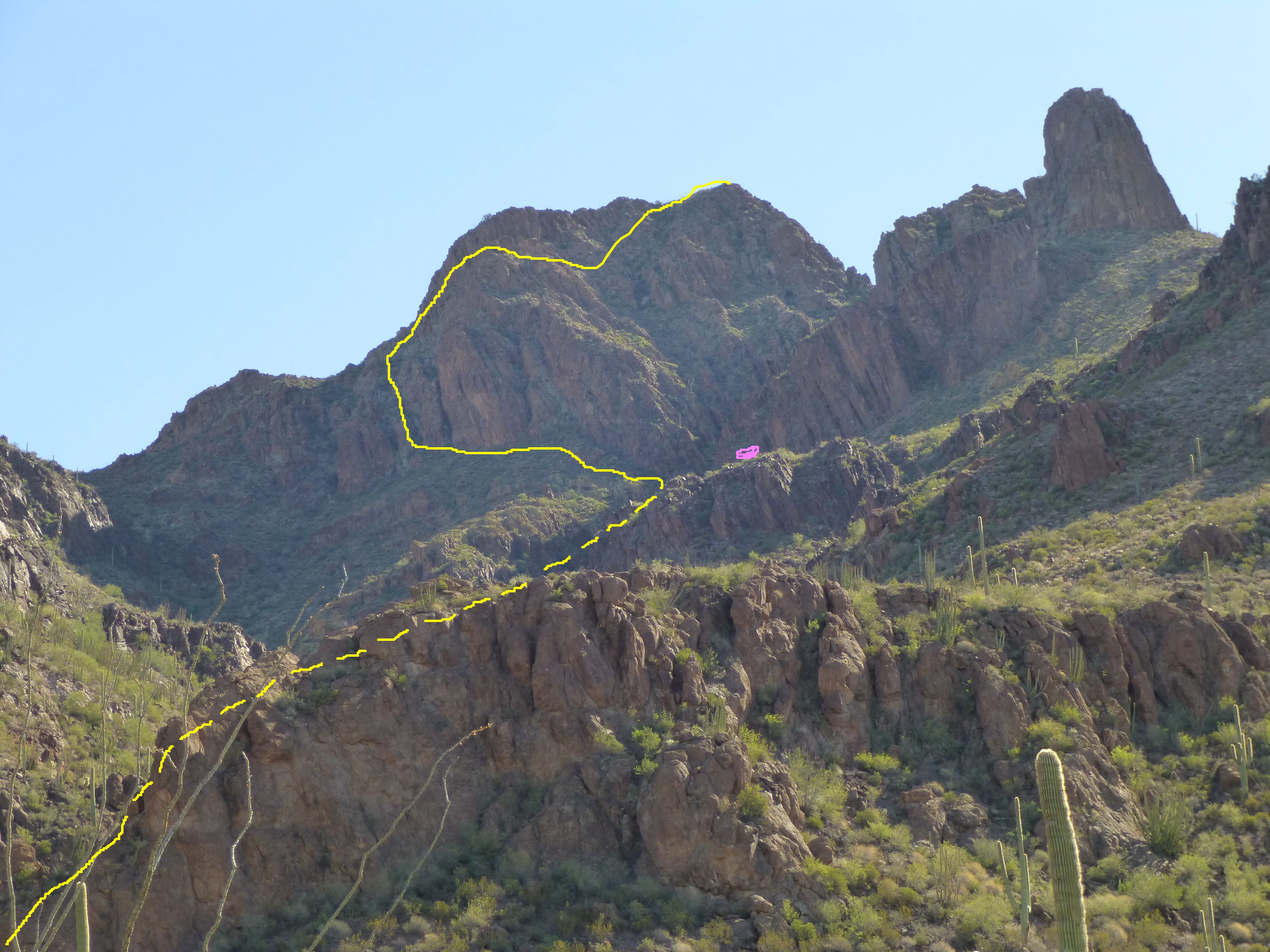
My route on Peak 3704
Once down on to the desert floor, it was just a matter of putting one foot in front of the other and covering the miles back to the truck. Almost seven hours after leaving, I had made it back, none the worse for wear.
But wait – there was more excitement still to come. The following morning, I drove to the trailhead at Arch Canyon and started on foot at first light. This climb would be so much easier. A half-mile walk up a trail, then downslope to and across the main wash draining the canyon. I was expecting something of a bushwhack up the steep subsidiary canyon on the other side, but it wasn’t all that bad, and here’s why – I found a trail, and what a trail it was! It switchbacked steeply up, weaving its way through the vegetation and cleverly avoiding the cliff bands. This trail was well-worn, trodden by many feet and littered by trash of Mexican origin. No complaints from me, though – it lifted me up a thousand vertical feet above the floor of Arch Canyon in quick time.
I was now in open country, and had only 600 more feet to climb to the summit. At one point during this last stretch, I paused to check my surroundings on an open slope and got a big surprise. As I looked over to the east ridge, I saw a man standing there, no more than 50 feet above me. He took me by surprise, to put it mildly. He was dressed in camouflage from head to foot, and appeared to be carrying good gear. A short conversation then ensued in Spanish. He asked me if I was lost. I told him no, that I was a climber, that I knew the area and I could possibly offer him some guidance. When I asked him if he was alone, he said that in fact he was. “All alone?” “Yes” was his reply. He said he was going “there”, and pointed east downslope. It was obvious he was determined to leave, and perhaps mistrusted my motives. From my side, I was happy to see him go, as I didn’t want any trouble. He moved off quickly, and by the time I reached the spot where he had first been standing, he was well downslope. I managed to snap this telephoto shot of him. Do you see him?
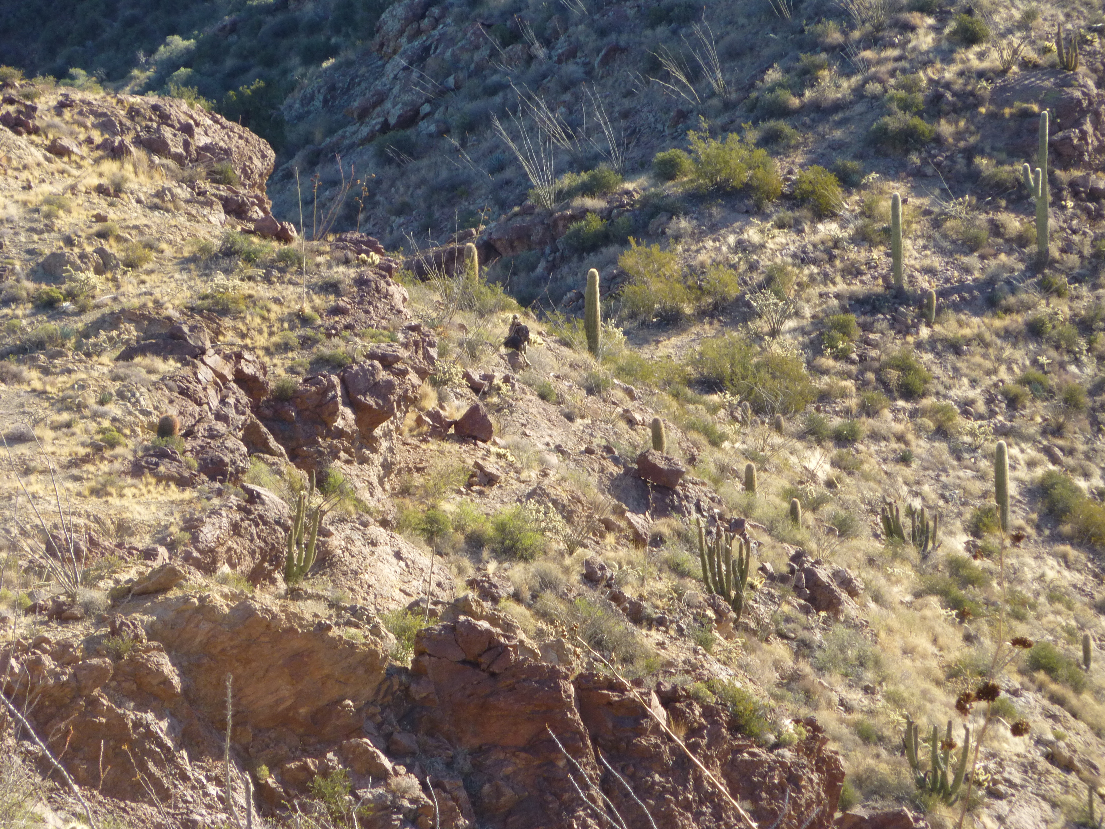
The stranger
Here’s even more of a telephoto shot – you can zoom in to get a better look.
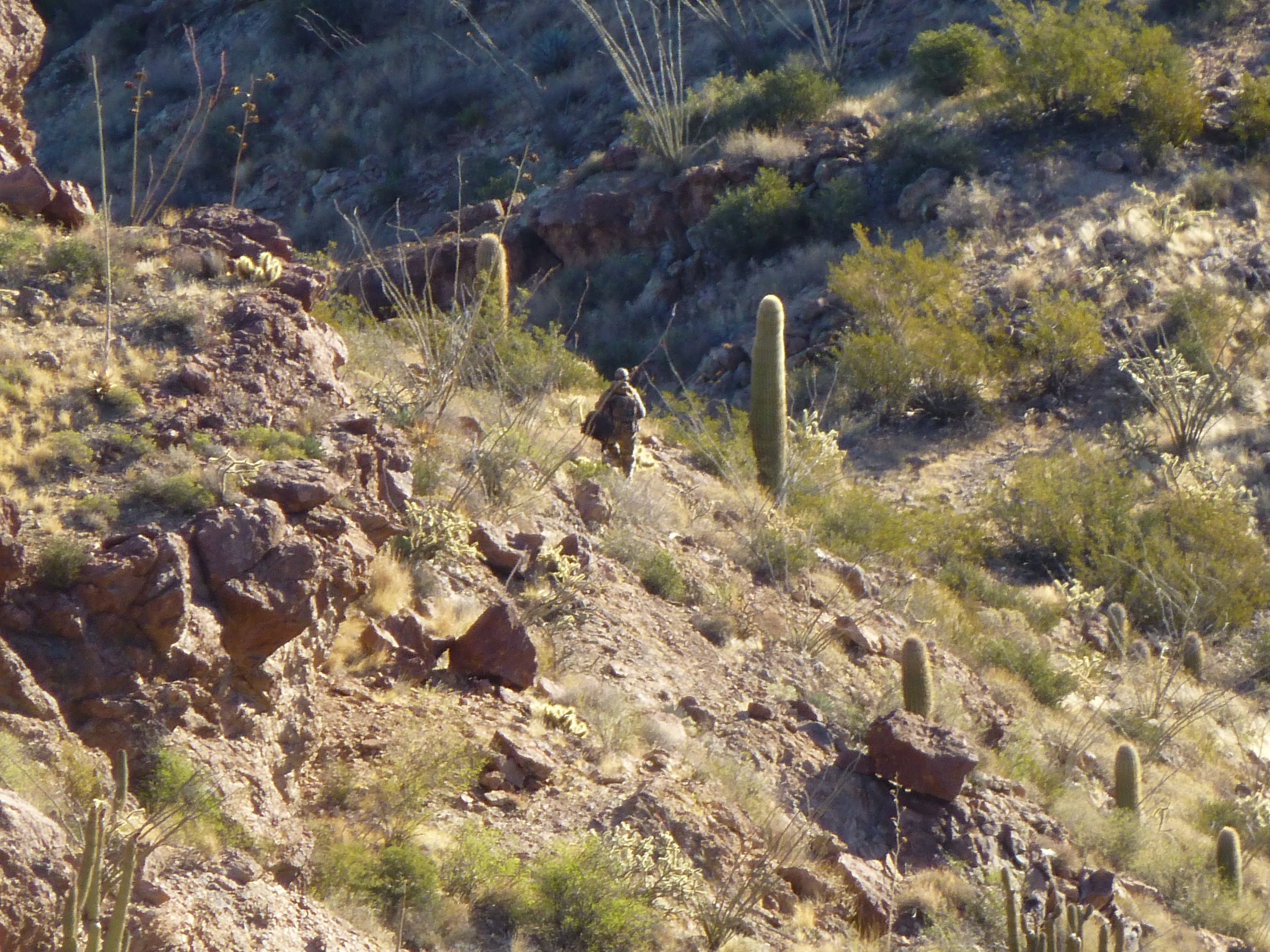
A closer view of the stranger
Now I was nervous. I didn’t know this guy’s game, so I couldn’t be sure if he truly was alone. Maybe there were others nearby who had spent a cold, miserable night at 4,000 feet and were in no mood to take no for an answer. Everything in my pack would be of interest to them, and useful too. Cautiously, I approached the final summit block on high alert. Nope, nobody there, although there were plenty of places to shelter. It had taken less than two hours to the summit of Peak 4158. Other climbers had been there, in 1998 and 2006, but their register was gone, no doubt the victim of border-crossers whose trash, sadly, littered the area.
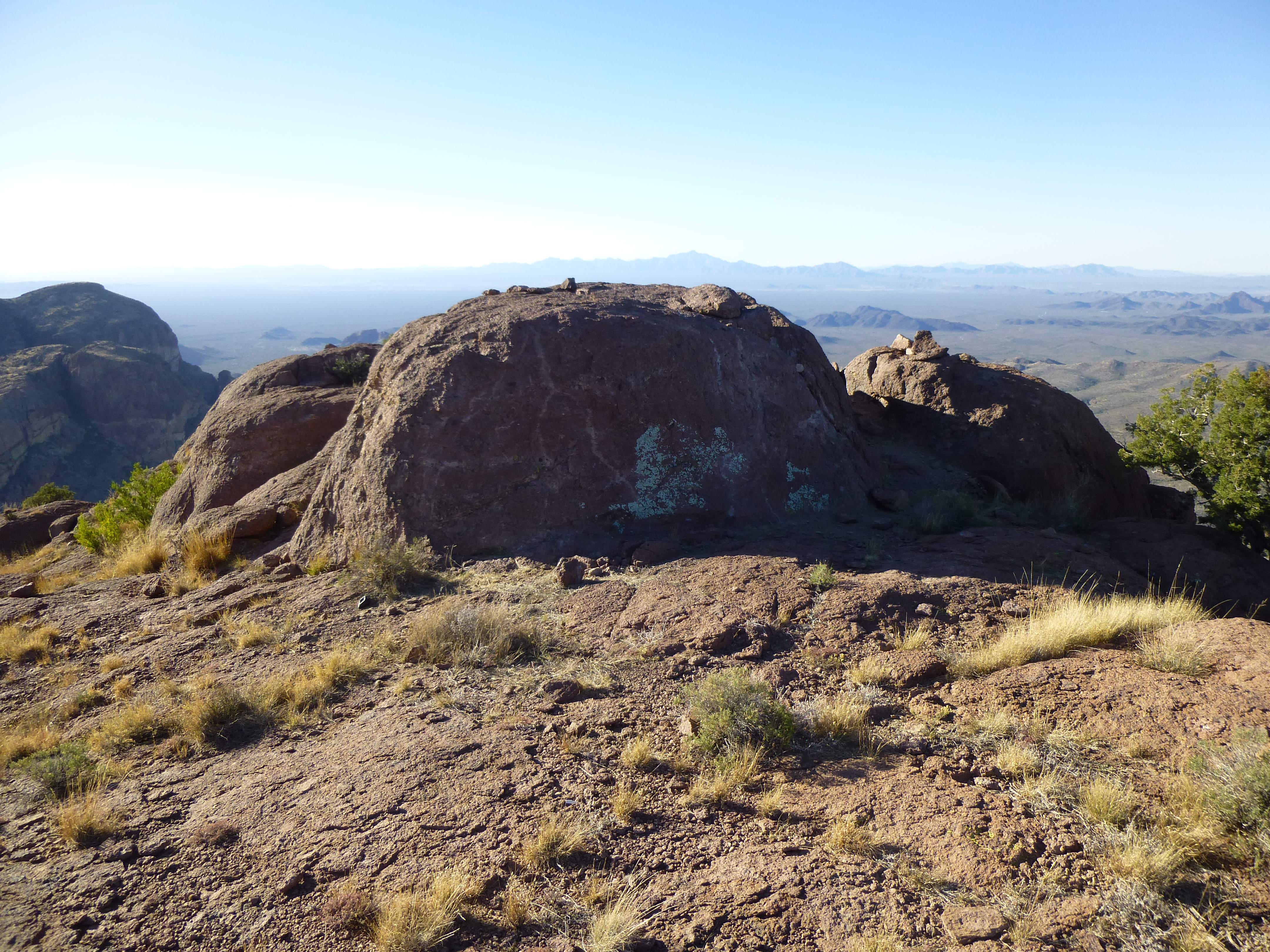
Looking south on the summit of Peak 4158
I snapped a few photos and made a beeline for my truck 1,600′ below. That amazing trail took me all the way down in just over an hour.
The south side of Peak 4158
Here’s a view of my route on the climb, as seen from the higher Peak 4740 which is 1.6 miles to the southeast. The pink spot is where I met the solitary man, up near the top.
Looking northwest, showing my route on Peak 4158
Two days in a row of encounters with people up to God-knows-what was enough excitement for one trip. I guess I was lucky – things could have turned out much worse in dealing with people who were desperate.
Please visit our Facebook page at: https://www.facebook.com/pages/Desert-Mountaineer/192730747542690