
It was 1981, I was living in a city in northern British Columbia, embroiled in a troubled relationship and, bottom line, I wasn’t climbing enough. Man, I needed to get back to the mountains, and old friend and climbing partner Ross Lillie came along at just the right moment. He contacted me from the coast, asking if I’d like to meet up with him and Phil and make an attempt to climb Mt. Columbia – I jumped at the chance.
Here’s a little background on the peak. At 12,293 feet (3,747 meters), it is the highest peak in the province of Alberta, and the second-highest in the Canadian Rockies, with 7,818 feet of prominence. Astraddle the BC-Alberta boundary, it is both accessible and remote, depending on the climbing route you choose. It was first ascended in 1902 by James Outram and Swiss guide Christian Kaufmann. The mountain’s North Ridge offers a challenging 2,000-meter climb (V 5.7 W3) in a remote setting, but most climbers opt for the easier standard route, the East Face, and that was our choice.
On August 8th, I drove the 300 miles from my home to the Columbia Icefields campground, only to find all of the tenting spaces already taken. I managed to scout around and find a spot to pitch my tent, waiting for Ross and Phil to show up. An hour and a half later, they arrived and we crowded into my illicit spot. It had been 3 years since I’d climbed with Ross, and it was great to see him again; I was meeting Phil for the first time. I’d been climbing for 19 years by 1981, but it’d been a while since trying a glaciated climb of this caliber.
The days are still long at 52 degrees north latitude in August, so we awoke early and left camp at 6:00 AM, driving ourselves up to the Icefields snowmobile parking lot. Now when I say snowmobile, I’m not talking about your typical family skidoo. Rather, a company called Brewster operates tours in large buses with special tires that take tourists out on to the glacier so they can walk around and take photos, about the only chance that most folks would ever have to do so. Once parked, we finished readying our packs, which were a lot heavier than we would have liked, in the 50- to 60-pound range. Much of the weight was ice gear – rope, crampons, ice axes, ice screws and the like. In any case, my diary described my load as “horrible and ugly”.
From the parking lot, we actually dropped down to the 7,000-foot level of the glacier, down an ice road that the tourism company had made. Their road had been graded on the solid ice surface of the Athabasca Glacier, and we walked along its north edge for a while. Before long, we left the road behind and all 3 of us tied in to the one rope. As we headed west, we climbed steadily until we finally left the bare ice surface behind and continued up ever-steepening snow slopes. It was a long trudge – for me, especially, because my legs were bothering me (out of shape), as were my shoulders (heavy pack, straps too tight, out of shape). Once up the snow slopes, the surface became fairly level and we plodded on, finally stopping at 9,500′ elevation. We were camped on a line between Mt. Andromeda and Mt. Columbia.
The Columbia Icefield straddles the Continental Divide along the border between British Columbia and Alberta, and is the largest icefield in the Rocky Mountains of North America, about 125 square miles in area. Its thickness varies from 330 feet to 1,200 feet, and it receives about 280 inches of snowfall per year. The icefield feeds 8 major glaciers, and is surrounded by some of the highest mountains in the Canadian Rockies, including: Andromeda, Athabasca, Bryce, Castleguard, Columbia, King Edward, Kitchener, North Twin, South Twin, Snow Dome and Stutfield.
The Athabasca River and the North Saskatchewan River originate in the Columbia Icefield, as well as tributary headwaters of the Columbia River. This means that the icefield sits atop a triple continental divide. Waters from the Athabasca ultimately flow to the Arctic Ocean; waters from the North Saskatchewan flow to Hudson Bay and the North Atlantic Ocean; waters flow south and west to the Pacific Ocean. This is a unique spot in all of North America, and the peak called Snow Dome is the epicenter of this triple drainage.
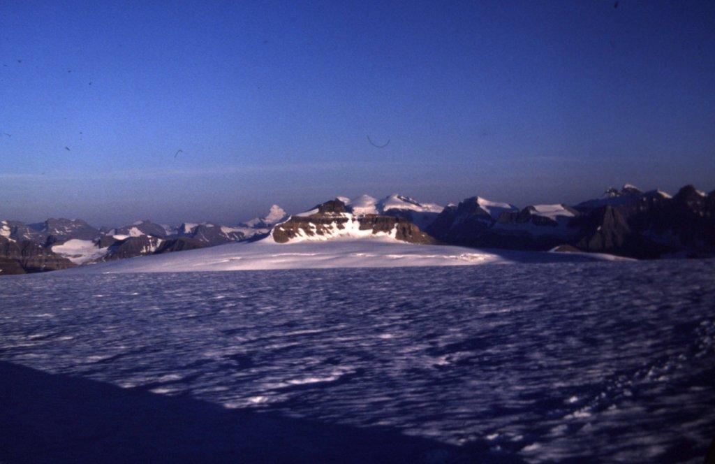
Camping out in the middle of the icefield is almost like camping on a huge, flat, white plain, stretching for miles in every direction. Here’s a shot of our camp. We couldn’t see another soul from here, but had great views of many impressive peaks. This shot also clearly highlights the east face of Mt. Columbia, about seven miles away.
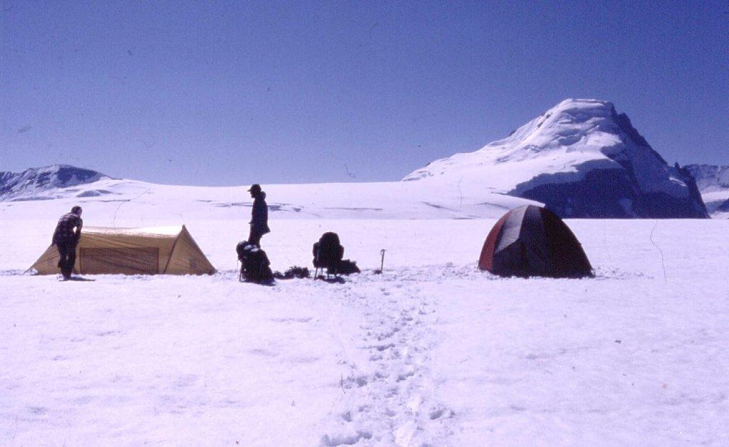
Looking west from our camp to Mt. Columbia
On our first day, we had covered a distance of 5 miles and climbed 2,500 vertical feet, but hadn’t even covered half the distance to the peak. Tomorrow would show what we were made of.
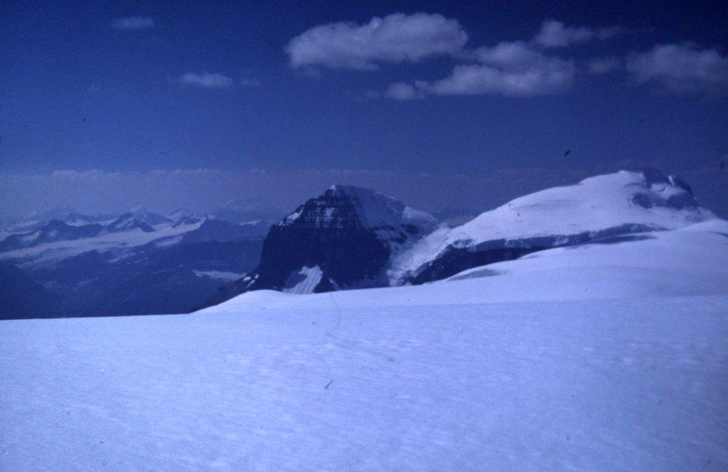
Mt. Bryce, one tough climb, in the distance.
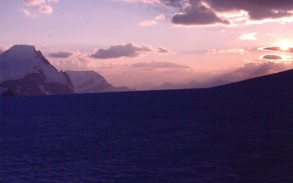
Sunset from camp
The sun rose at 5:30 AM. We ate, readied our packs and were moving by 6:15. Our tents stayed right where they were, safe for the day. Our route took us southwest, down the gently sloping icefield, to a saddle of the Columbia Glacier at 8,800 feet elevation. From there, we contoured to the northwest. There were 2 climbers camped along our path – we spoke briefly with them, then continued. Just boots on the snow surface, no crampons needed so far. It took us a full five hours of walking to reach the base of Columbia’s east face. Everything out there was so big and so far.
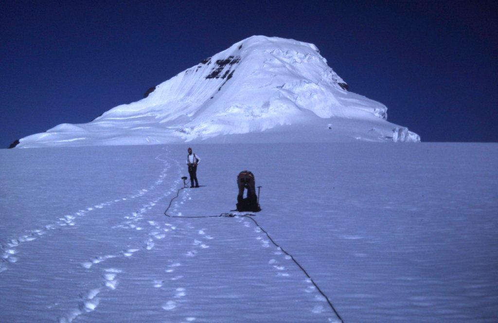
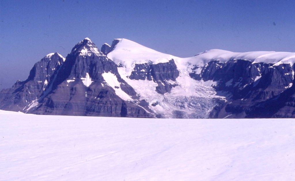
Approaching the base of the East Face of Mt. Columbia
We started up the face, soon crossing a few crevasses lower down. Our estimate was that it should take us about 4 hours to climb the 3,500 vertical feet to the summit. I was leading. We ascended an avalanched snow slope, quite lumpy and uneven. What happened next, I still remember as clearly as if it were yesterday, even though it was 35 years ago.
We were at 11,300 feet elevation, a thousand feet below the summit. I had pushed the shaft of my ice axe up to its head into the snow on the steep slope, about 45 degrees at this point. It met with no resistance, and I heard the sound of chunks of ice tinkling as they fell deep inside the mountain. My blood froze. I very cautiously backed down a few feet, moved laterally several feet, then pushed my ice axe in up to its hilt. The same thing happened again, no bottom to my probe. I was scared. Once more I moved over and tried again, with the same result. Ross and Phil were below me on the slope, still tied in to the rope. They asked me what was happening, and I explained, They said it was my call as to how to proceed. I told them I was standing at the lip of a large hidden crevasse, size unknown, and that it was unnerving me badly. Trying to pull someone out of a crevasse is risky and difficult, and I didn’t want to be the test subject up on a slope like this, far from help. That’s it, Lads, we’re done. Even though we were within striking distance of the summit and above most of the steep part, we retreated. Back down to the bottom of the face by 3:00 PM, we began the interminable slog back to camp, arriving at 8:00 PM – we had been gone 13 1/2 hours. In the years that followed, we often wondered if we shouldn’t have tried the south ridge, a route with more rock but a little farther away, probably more of a sure thing, but hindsight is always 20-20, isn’t it?
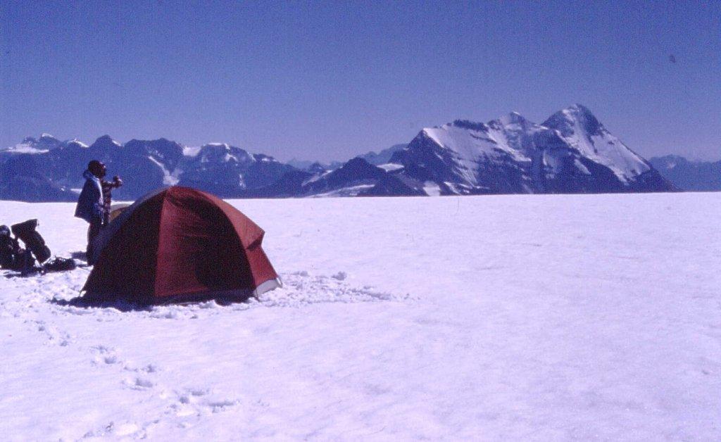
Mt. Castlegard from camp in the evening
Tuesday, August 11th dawned clear and cold. We slept in, still beat from yesterday’s exertion. Our plan was to climb something to salvage the trip.
North Twin and South Twin from camp
With a late start, we started up Snow Dome, a long plod up very gentle snow slopes. At 10,800 feet, I led up a short, steeper bit of ice with a few crevasses, but above that conditions changed. The snow above that was terrible, a crust which kept breaking even under my 140 pounds – I’d sink in to my knees and even up to my thighs. It seemed like we never got any closer to the huge, gentle summit but finally, at 1:30 PM, there we stood at 11,339 feet. Snow Dome is that point of the triple watershed where water flows to the three oceans.
The Twins, seen from Snow Dome
It was sunny and windy as we sat and ate our lunch on the summit. Phil mentioned that he was starting to have pain in a tooth. Hmmm, hopefully it wouldn’t get any worse. It only took us an hour to get all the way back down to our camp, there by 3:00 PM, where we had a good rest. I mentioned to the guys that I had 3 other climbs in mind, as we all had plenty of time before we had to be back to town for work. The first was Andromeda from our camp as a day climb. The second was Athabasca as a day climb from the highway. The third was a long day climb of Edith Cavell via its west side. After mentioning these to the guys, I didn’t get much feedback, probably because we were concerned about Phil’s tooth which got a lot worse during the night.
During the night, clouds, rain and sleet moved in – it was very noisy, with thunder and lightning. By 6:00 AM, a wall of black cloud was moving across the icefield toward us. Phil and Ross quickly packed up, almost in a panic, so I did too. Our gear got soaked in a downpour while packing. We stumbled off in rain gear, quite cold and roped up. Almost as quickly as it came, the storm passed, and 30 minutes after leaving camp, blue skies were with us again. Phil’s tooth was bothering him even more by now, so it was a good thing we were heading out. I crossed the lower Athabasca Glacier in bare boots, no crampons – one had broken, and trying to limp along in it would have been more hassle than it was worth. We arrived at the tea-house and were stared at by throngs of gawking tourists (this area is a huge draw for tourists from all over the world). We went down to the Icefields Chalet, and I practically took a sponge bath in their bathroom sink. After that, we all drove the 64 miles north to Jasper for breakfast, then cold beer in the Athabasca Hotel pub. When I left for my 3-hour drive back home to Prince George, Phil and Ross left for the coast. It would be 5 years before I climbed with Ross again, in the Wind River Range of Wyoming – I never saw Phil again.