
Back in 2005, October 6 to be exact, my sister was visiting from British Columbia, Canada and I talked her into going out to the Tohono O’odham Indian Reservation with me for a day of climbing. She wasn’t going to do any actual climbing herself, just hang out and get a glimpse of the Sonoran desert from a perspective most people never do. We drove away from Tucson at 3:30 AM and two hours later we turned north from Arizona State Highway 86. The first faint light of day was visible as we drove north on the excellent dirt road which goes between the Pozo Redondo Mountains to the west and the Sikort Chuapo Mountains to the east. Today we would visit both of those ranges, as I had a permit to climb in the area from the Hickiwan District.
We were driving up the Pozo Redondo Valley. After 6 1/2 miles we arrived at what is marked on maps as the community of Sikort Chuapo (more properly spelled “Sikol Chehpo” in the O’odham language) which translates as “round mashing pit”. All that is there is one house with a few out-buildings. We saw nobody as we drove through their yard (that’s the path the road follows) but their dozen barking dogs followed us for a while. Maybe the people who live there were sleeping – it was pretty early, after all. Brian Rundle and I had driven through here two years ago and seen the same thing – no people but several dogs.
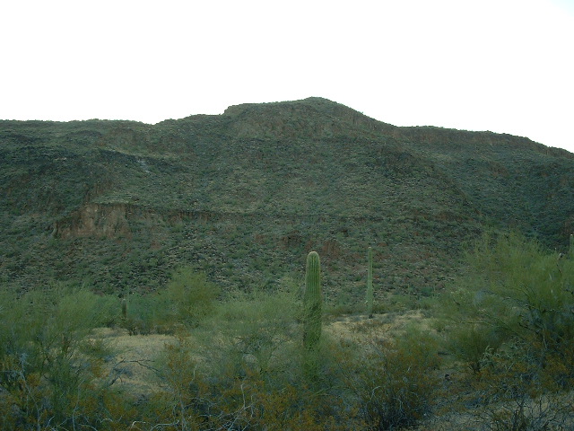
Once past the house, the road crosses Sikort Chuapo Wash and is little traveled, mostly by law enforcement. After 2.4 miles more, a faint track headed off to the right. This road goes to several tanks which provide water for cattle, but it is faint and very little used. Another half a mile brought us to a nice parking spot. My sister wasn’t expecting it to be such a bumpy drive and was getting a headache from the jostling. I made sure she was comfortable and prepared my pack. We had walkie-talkies so we could keep in touch. I set off up the western slope of my first objective, Peak 2801.
Peak 2801
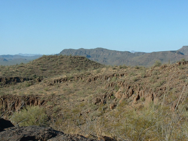
I reached the summit area after a while, and when I got on top something didn’t seem right. Turns out that I was on a lesser bump, so I headed north for another ten minutes and finally arrived on the true summit. No sign of a previous visit, and I left a register. Here’s a view from the top, looking over the top of Point 2784, which is left of center and is 1,800 feet away to the southwest. The long ridge a few miles away is a part of the Pozo Redondo Mountains.
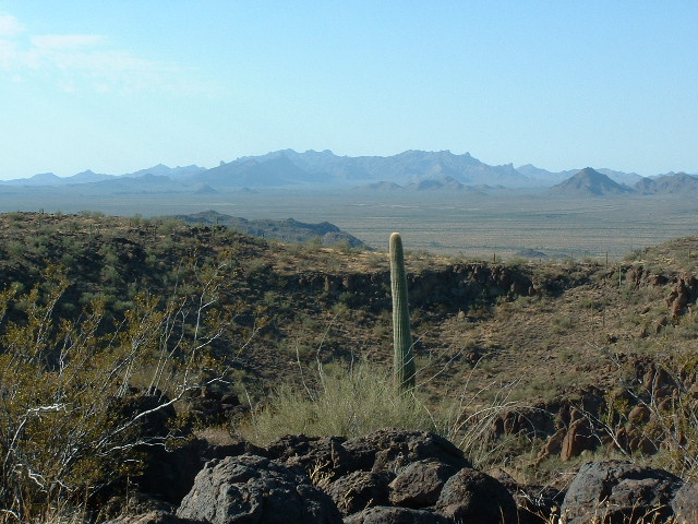
Here’s another view from the top, this time looking a bit north of west.
Looking southwest from Peak 2801
Here’s yet another of the great views from the top, one of the many striking peaks of the Silort Chuapo Mountains.
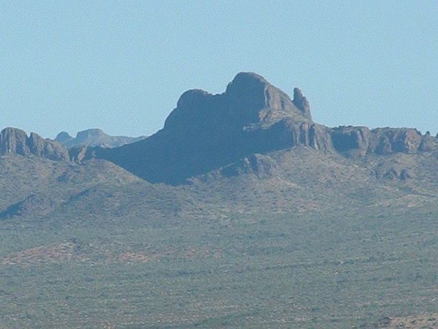
Sikort Chuapo beauty.
I descended by a different way than I had used to get up, and arrived back at the truck just under two hours after I had left. We drove back to Sikort Chuapo. Once there, we followed a road for half a mile to the northwest to an old cemetery and parked. The day was warming up.
I left Karen to explore, and headed off to climb another peak. I walked a short while up a valley, then up 700 feet of mixed ground to the very flat summit of Peak 2768. Again, no sign of any previous visit. I left a cairn and register on what seemed to be the highest point. From this summit and the previous one, I had an unhindered view of the town of Ajo, about ten miles to the northwest.
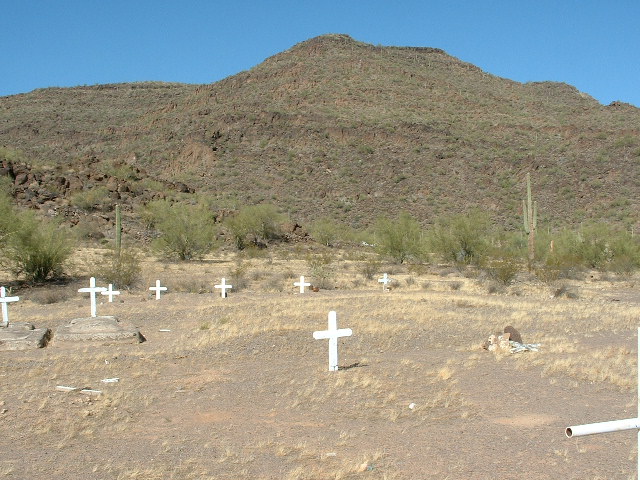
Peak 2768 and the old cemetery at Sikort Chuapo
I descended to the truck and was told by my sister that she had counted 81 graves in and around the cemetery. Only two were marked. All the rest had plain crosses, or were simple mounds. This is one of the unusual rock graves at the Sikort Chuapo cemetery. It is one of the few marked with a cross. You are seeing it in a side view. Another one is behind it to the left, and another is below it and right in front of the camera.
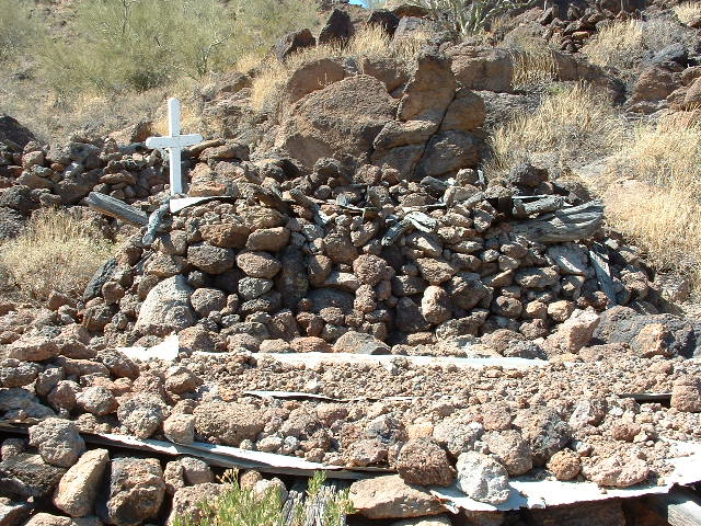
One of the graves.
This is one of the rock graves seen from above. The rocks are merely a shell – the inside of it is open. A quick peak inside showed some pieces of wood and something made of leather. It was hard to say if those were personal items or not. It has corrugated metal sheets on top of it, which are in turn lying on top of wooden cross beams, probably from local trees, likely mesquite.
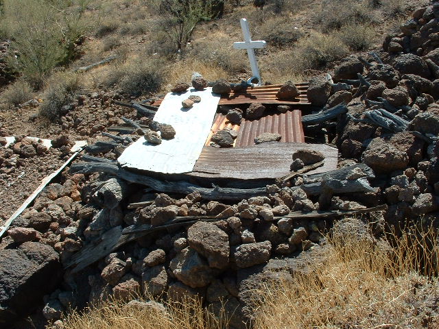
The old grave
This final view shows a single grave. It had no metal sheets. Overall dimensions are about three feet tall, five feet wide and ten feet long. I am curious to know more about this method of burial that the O’odham used. How long did it take to accumulate 81 graves on this site, where now only one house remains? I am guessing that these rock graves pre-date the more modern-looking graves with crosses in the lower part of the cemetery.
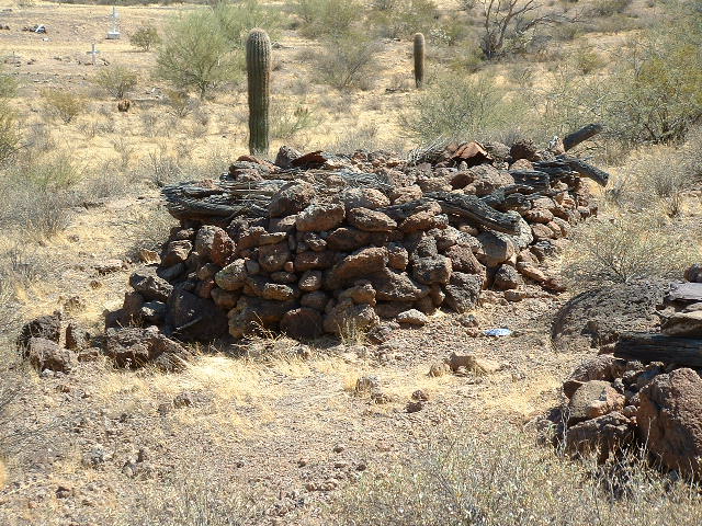
The final grave
We then drove back through Sikort Chuapo, where once again we saw no sign of the occupant. A drive of one mile farther south on the main road brought us to a faint track leading west to the base of Peak 2446.
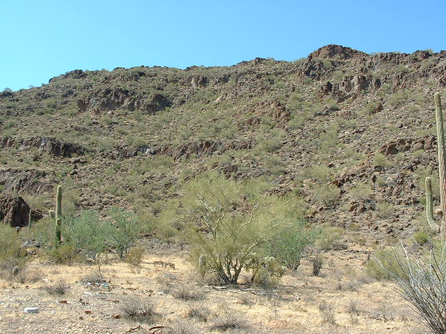
Peak 2446
We parked there and my sister explored the oddities in an old garbage dump.
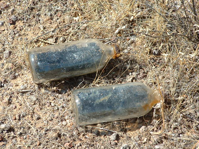
One man’s trash ,,,,,,,,,,
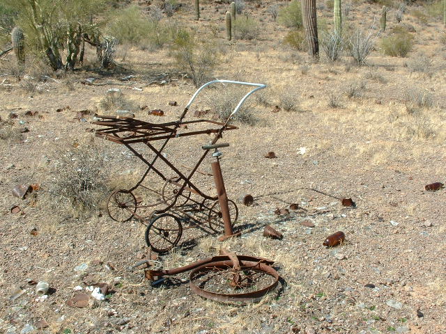
Memories.
I climbed the peak, left a register and returned to the truck in about 45 minutes round-trip. My sister took this picture of me on the way down.
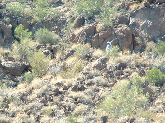
The Desert Mountaineer coming down.
It had certainly been an interesting day – curiosities, and things to ponder. Our return to Tucson was much less eventful, but every day on the Reservation is an enjoyable one.