
This story is about a summer’s day of climbing many years ago on the Tohono O’odham Indian Reservation, a blast from the past. I hope you enjoy it.
On May 20th, I left my house at about 3:30 AM and drove Arizona Highway 86 through
Sells, the capital of the T.O. Nation. At first light, I reached my turnoff about halfway between Sells and the Quijotoa trading post. In the past, I had used this as a place to meet other climbers for adventures in this area. Leaving the pavement, I drove west to a spot shown on the map as Vainom Kug. The proper spelling in the O’odham language is Wainomi Kehk, which means”iron standing”. It used to be a small village of 20 homes, but today none appear occupied. The road continues south another 3 miles to take you to spot called Kaihon Kug on the USGS topographic map, more correctly known as Gahon Kehk, which means “box standing”. There were once 9 structures there, but now only one survives and is vacant. This settlement even has its own cemetery a mile away, with 11 graves.
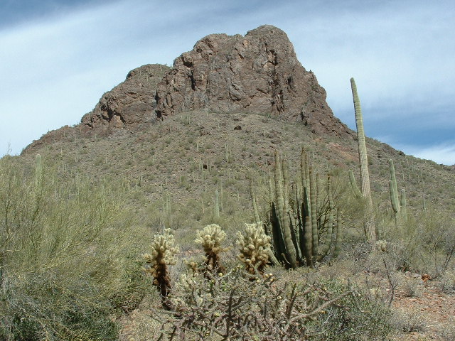
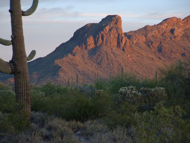
It was a beautiful morning, and as I headed west deeper into the desert the sun rose – I just had to stop to take some pictures. I was passing to the north of the biggest mountain in the area – South Mountain – and it looked great in the early morning light.
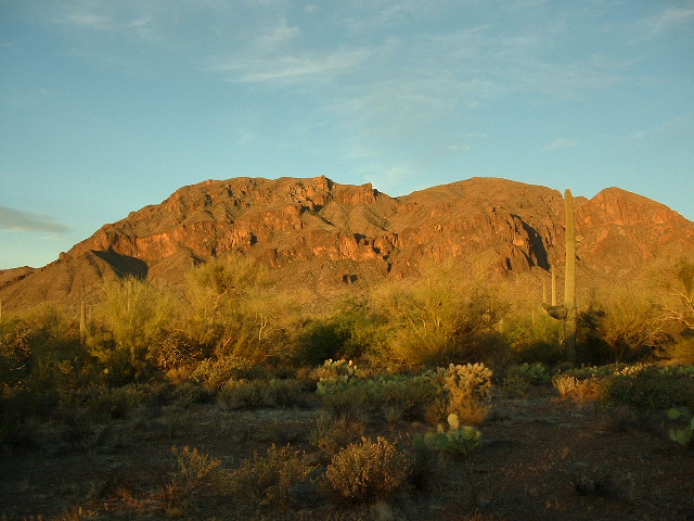
South Mountain
South Mountain meant a lot to me, as I had climbed it twice. The first time was with Dave Jurasevich in 2001; the second, with John Vitz in 2004. The road was pretty decent, and about 5 miles later I crossed through the fence into the Pisinimo district. From here, it was a short drive to San Antone Well, where I parked.
Here, I’ll enter into a brief sidebar. On my first foray into the area, with Dave in 2001, we climbed Ben Nevis, a big peak to the north. The winds high up on the peak were intensely strong, a harbinger of a storm to come. Hours later, we found ourselves 4 miles to the west. Intent on climbing one more peak for the day, we struggled up the south slopes of Black Butte, elevation 2,838 feet. The storm had arrived, and how! The wind howled, and the rain fell in torrents. More determined than smart, we pushed on and made the summit, then turned tail and rushed back down to the truck. We were soaked to the skin, and cold to boot. Driving back to San Antone Well, we camped for the night, Dave in his truck and I in my tent. I just couldn’t get warm, and lay in my sleeping bag shivering all night. It was one miserable night, one of those you never forget.
I walked northwest along the road, passing the abandoned community of Piato
Vaya. A few years ago Dave and I discovered here what looked like a seasonal saguaro-fruit gathering and processing spot. The O’odham go to spots like
this in June and boil the fruits into a syrup. This is such an important
event in their culture that the month of June is called Hahshani Bahithag
Mashath, which means “The Saguaro Cactus Fruit Month” in the O’odham
language. About a mile from the site of Piato Vaya sits Piato Vaya Pass. I kept wondering what this name Piato Vaya actually meant, but couldn’t come up with a good answer. All I knew was that the word “vaya” (actually wawhia in the O’odham language) meant “well”, but drew a blank on “piato”. So, I went to the source, so to speak – I contacted a fellow who lives on the reservation and is a native speaker of the language. After some thought, he felt that the best meaning is “a place that people have deserted”. That would make a lot of sense. I left the road and headed due west and up Peak 2918 to its nice rocky summit, where I found a register that Andy Bates had left a few years ago.
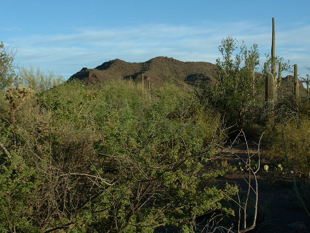
Peak 2918
I signed in and then descended, heading cross-country over a few intervening bumps until I reached the slopes of Peak 2810.
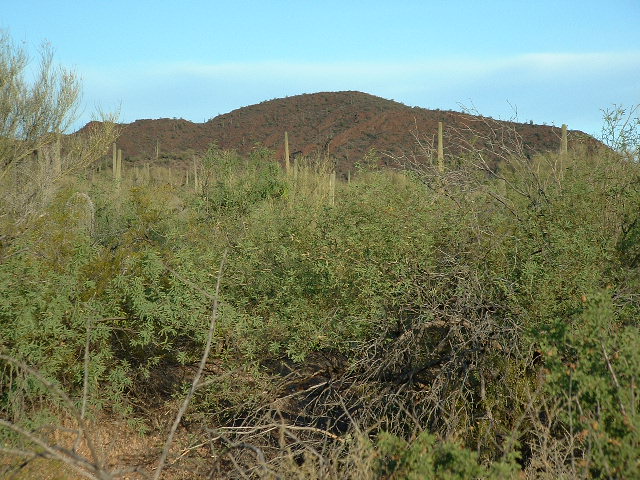
Peak 2810
On top, I left a cairn and register, then headed east, down and overland back to my truck. There, I spent some time poking around. The San Antone Well is a pretty impressive structure, but has gone dry. This is where Dave and I camped that night, in between climbs of Ben Nevis and South Mountain.
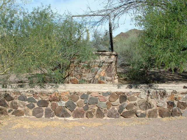
San Antone Well
I then drove a few miles northeast, on pretty decent roads. A spur road took
me up on to the east slopes of Ka Kotk, elevation 2,802′. All of the diggings of Ben Lomond Mine are very visible from here, and the south end of Ben Nevis looms
overhead.
The south end of Ben Nevis Mountain
Curious, such a name for a peak out here. As you probably know, Ben Nevis is the name of the highest mountain in Great Britain. I’m guessing that some miner back in the 1880s who was working one of the nearby mineral deposits was homesick for his native Scotland and dropped the name on the peak. In 2001, Dave and I had climbed it together on one of the windiest days you could imagine.
The climb was short. I signed into Andy Bates’ register here, and admired the view.
Ka Kotk
Back down to the truck, I then retraced my route back to the highway. As I neared the pavement, a Blackhawk helicopter flew near me but continued on south without incident. It was, no doubt, working with the Border Patrol and checking out any suspicious activity. It still hasn’t hit 100 degrees yet here in Tucson, but it gets darn close most days. It will soon enough, and when it does the climbs will need to start earlier and end earlier.
When I originally wrote this piece, it was late May, a time when temperatures can easily reach 100 degrees. In fact, the earliest-ever such event was April 19th, in the year 1989.