
Why am I writing about mines? Well, for one reason, Arizona is full of them. Not just active mines, but all kinds of prior mining activity. It was mining and cattle that put Arizona on the map, that attracted early settlers to the region. There was literally no part of Arizona that early prospectors didn’t visit and examine. Here is an excerpt from the website of the Arizona Department of Mines:
The earliest miners in what is now Arizona were Native Americans who chiefly mined surface outcrops of salt, clays, hematite, quartz, obsidian, stone, turquoise, and coal. In the late 1600s, Spanish explorers began the hunt for metallic deposits with special focus on gold and silver. Antonio de Espejo made the first major silver discovery south of the San Francisco Peaks in May 1583, near what some believe is present-day Jerome, Arizona. By the late 17th Century, Spanish prospectors had engaged in extensive mining in the mountains bordering the Santa Cruz River and its tributary, Sonoita Creek. Rare finds of sheets or “planchas” of silver – one sheet reportedly weighed 2700 pounds – fired the imaginations of several generations of miners.
 In 1854, in Ajo, Arizona, the Arizona Mining and Trading Company launched the modern era of hard-rock mining. A burgeoning mining industry stimulated early growth in the Arizona Territory, and by 1864 nearly 25 percent of the male, non-native populace was prospectors. By the 1870s a plethora of hardrock mines were yielding prodigious volumes of copper, lead, zinc, silver and gold ore. In 1912, the newly christened state of Arizona supported 445 active mines, 72 concentrating facilities, and 11 smelters; their gross value that year was nearly 67 million dollars — equivalent to 1.4 billion dollars in 2006.
The important metallic commodities of Arizona, listed in order of decreasing value, include copper, gold, silver, molybdenum, and lead. Non-metallic (industrial) minerals produced — listed in order of decreasing value — include sand and gravel, crushed stone, clay, cement, gypsum, lime, perlite, pumice, and salt. Arizona is world-famous for its turquoise, peridot, petrified wood, azurite, and malachite; turquoise, azurite and malachite are copper-bearing minerals. Arizona also produces energy resources such as coal and small quantities of petroleum and natural gas.
There are 2,012 different 7.5-minute topographic map sheets at a scale of 1:24,000 that are needed to cover the entire state of Arizona. The area of the state is 113,998 square miles. The Geological Survey of Arizona tells me that there are over 100,000 mining prospects in Arizona. That includes just about every type of activity, everything from shafts, tunnels, bulldozer cuts, trenches – places where prospectors were looking for valuable ore but didn’t find enough to make a mine. A great many of those date back a century or more That means that you’re never far from some old mine digging. Arizona has it all, from some of the largest open-pit mines on the planet, to all manner of underground mines.
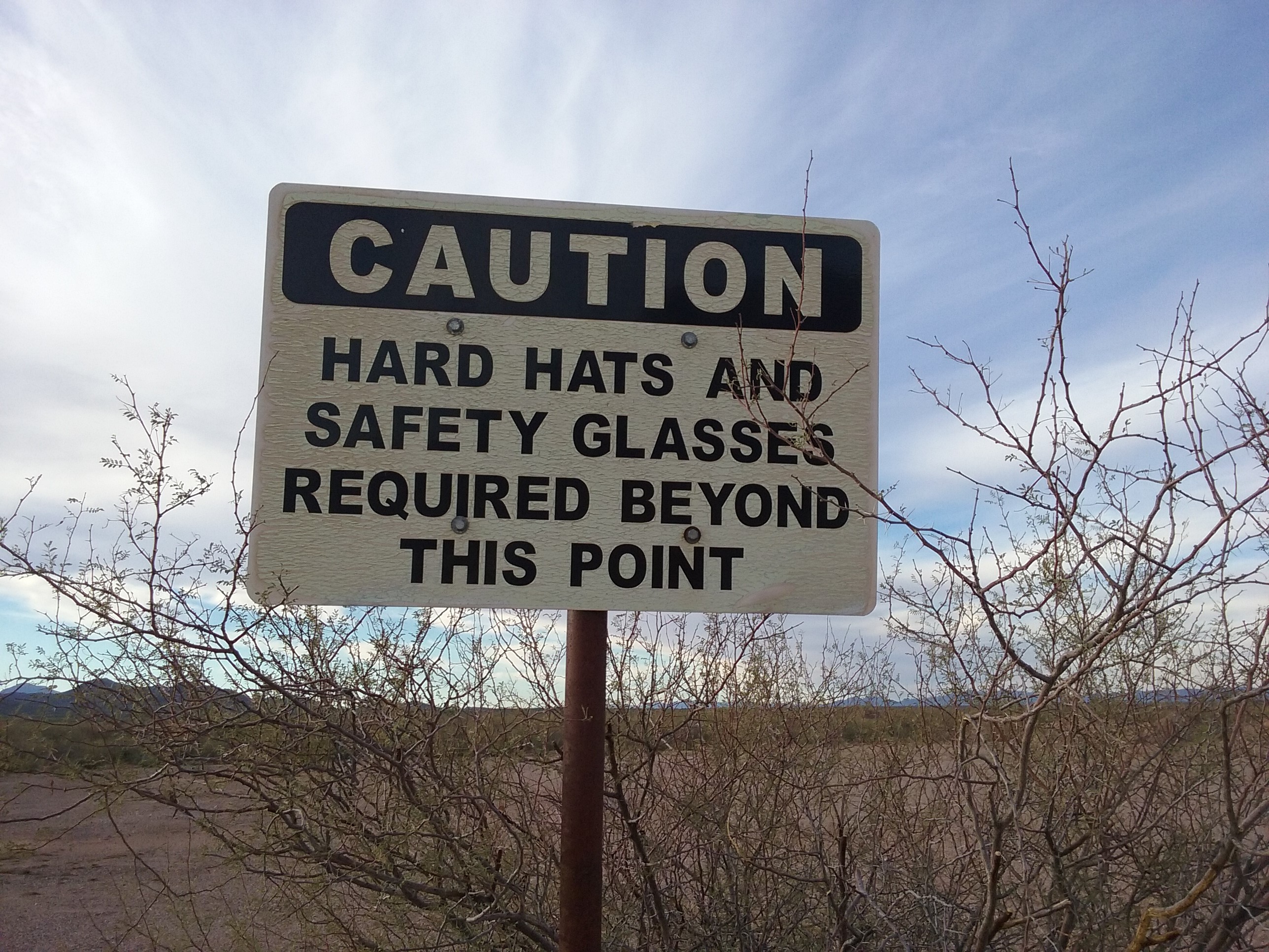
In fact, with so very many mining enterprises in the state, there’s always one of Arizona’s 7,300 peaks to climb nearby. Or conversely, just about wherever you go to climb, there’s some mining activity nearby to be investigated. With so many possibilities, there’s no end to the stories that I could write about mines, but I think I’ll just talk about a few in one small area that I visited while climbing. Here is some information about the first one.
The Papago Mine
Principal minerals – chrysocolla, gold, malachite, silver
Gangue minerals or materials – calcite
Mine type – underground
Ore controls – E-W Trending Fault
Host rock type – quartz monzonite
Associated rock type – quartz monzonite
Structural characteristics – E-W Fault, dips south 40 degrees
Discovery year – 1902
Primary commodity – gold
Secondary commodities – silver, copper, manganese
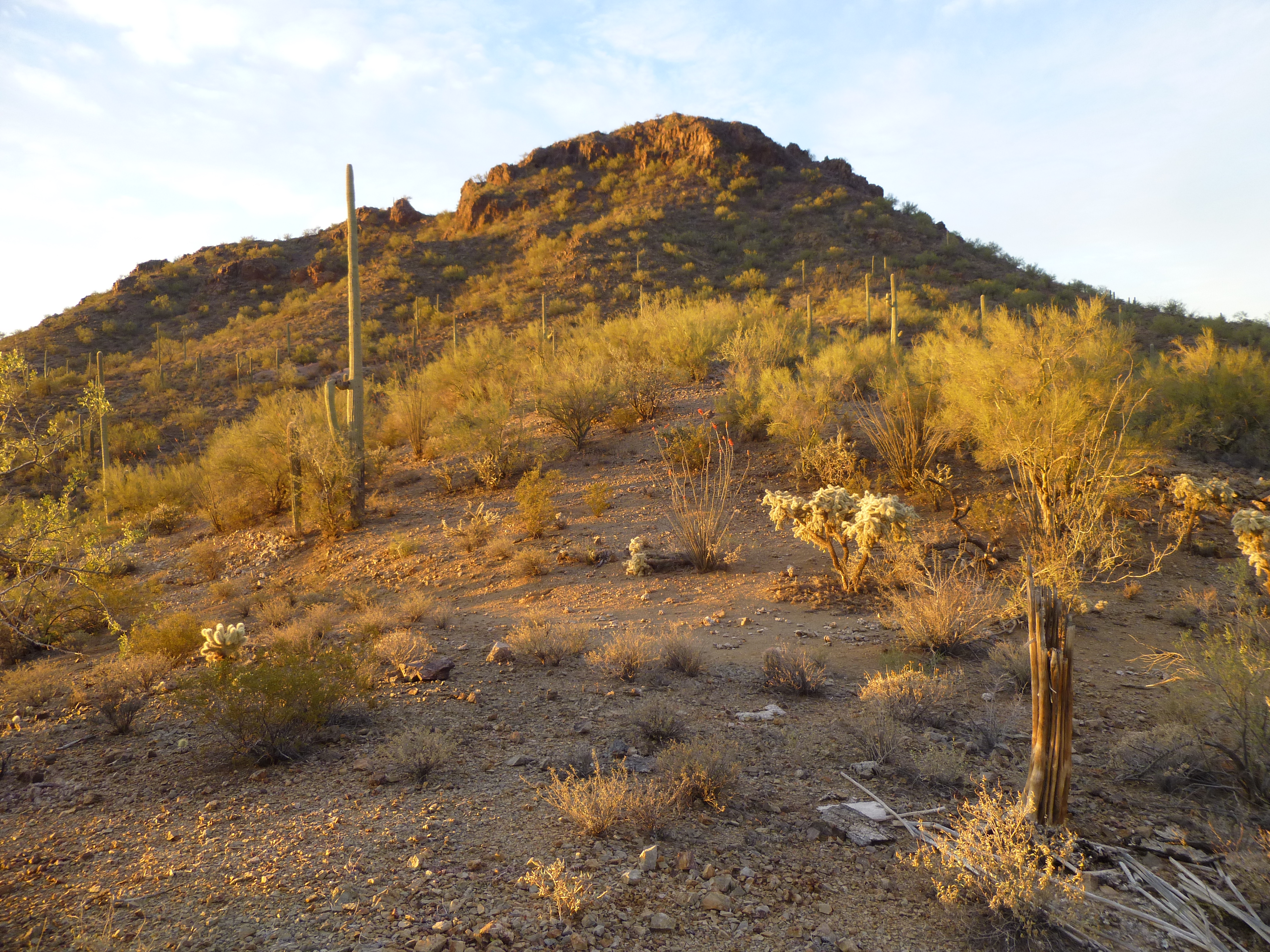
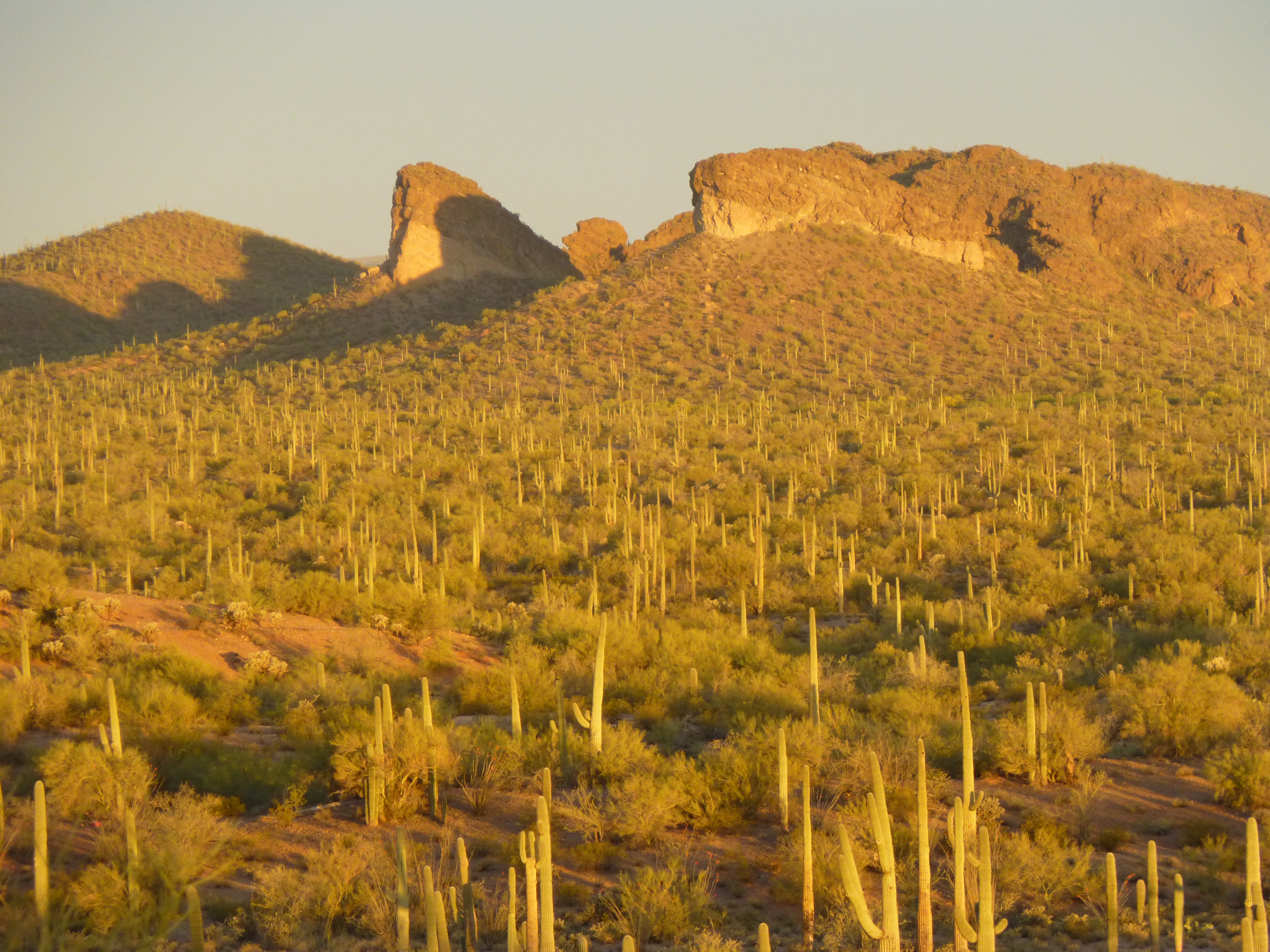
It sits on the north side of the Copperosity Hills, and I visited it one morning when I went to climb the nearby Peak 2380 less than a mile to the south.
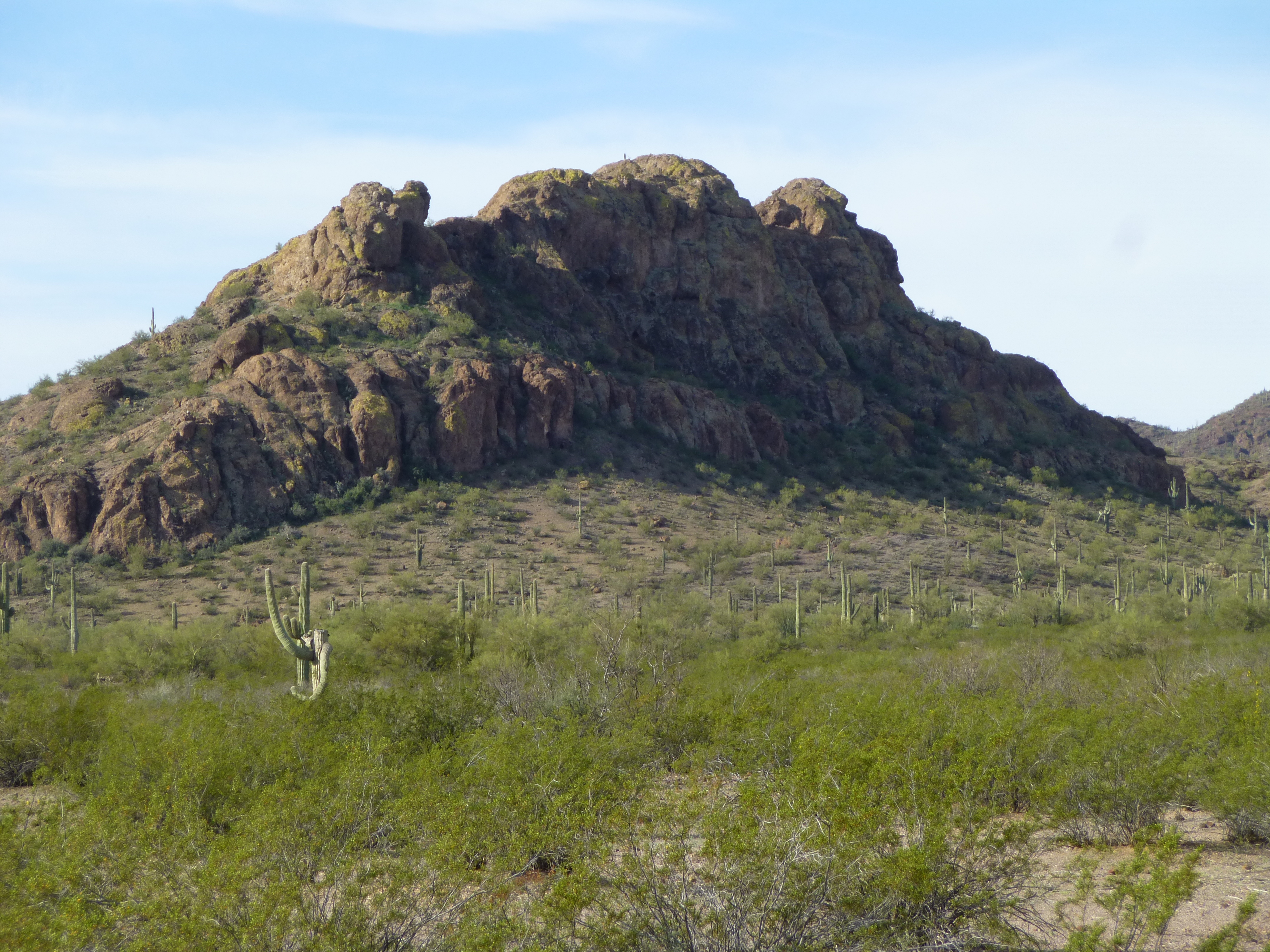
Peak 2380
Our topographic maps can show a lot of information about mining activity, and this one was no exception. On it, we can see that there are 4 shafts and not less than 24 other things, all within a space of about half a mile. If you click on this link, it will open up a topographic map for you.
https://listsofjohn.com/mapf?lat=32.5670&lon=-112.1823&z=16&t=u&d=y
The squares that have a diagonal line through them, half black and half white, show the positions of vertical shafts in this case. The things that look like tall Xs happen to be trenches that were dug along the surface. It never ceases to amaze me how a satellite orbiting 300 miles above the surface of the earth can show such detail. Try this next – when you’re looking at the map, see the word “Caltopo” in the upper right corner. Click on that, and a drop-down menu will appear. Now you see 10 different views you can have of this same spot. Click on the one at the very bottom that says “Satellite”. When you do, the whole view changes – you’ll be looking at the desert from many miles above the earth. Now look in the upper left corner. See the + and – signs? If you click the + sign, it will zoom you in closer and closer. Just how close? Look in the lower right corner, and you will see a scale which changes as you zoom in. The farthest you can zoom in here on the “Satellite” view shows a scale of 10 meters. That means that you are looking at some very small details, such as trees, bushes and rocks, some of them as small as one meter or less in size. We can have some fun with this. Go ahead and click on this next link:
https://listsofjohn.com/mapf?lat=32.5675&lon=-112.1847&z=20&t=h&d=y
When it opens, change over to “Satellite”, and zoom in with the + as far as you can go. Right by the cross-hairs in the middle of the view, you can see a black thing surrounded by a ring of gray material. You are looking at a vertical mine shaft (the black thing) which is a tunnel headed straight down into the ground, and the gray ring is rock that came out of that shaft. By using the scale, you can see that that black hole is only about 3 meters across, but still clearly visible – from space! Isn’t that amazing? I’m going to let you try this next step on your own. About 250 meters away to the east (near the bend in that road overlay) are 3 more black holes, all fairly close to each other. They are about 50 meters from one another, and lie in a line trending NW-SE. See them? You can click and drag the image over to them.
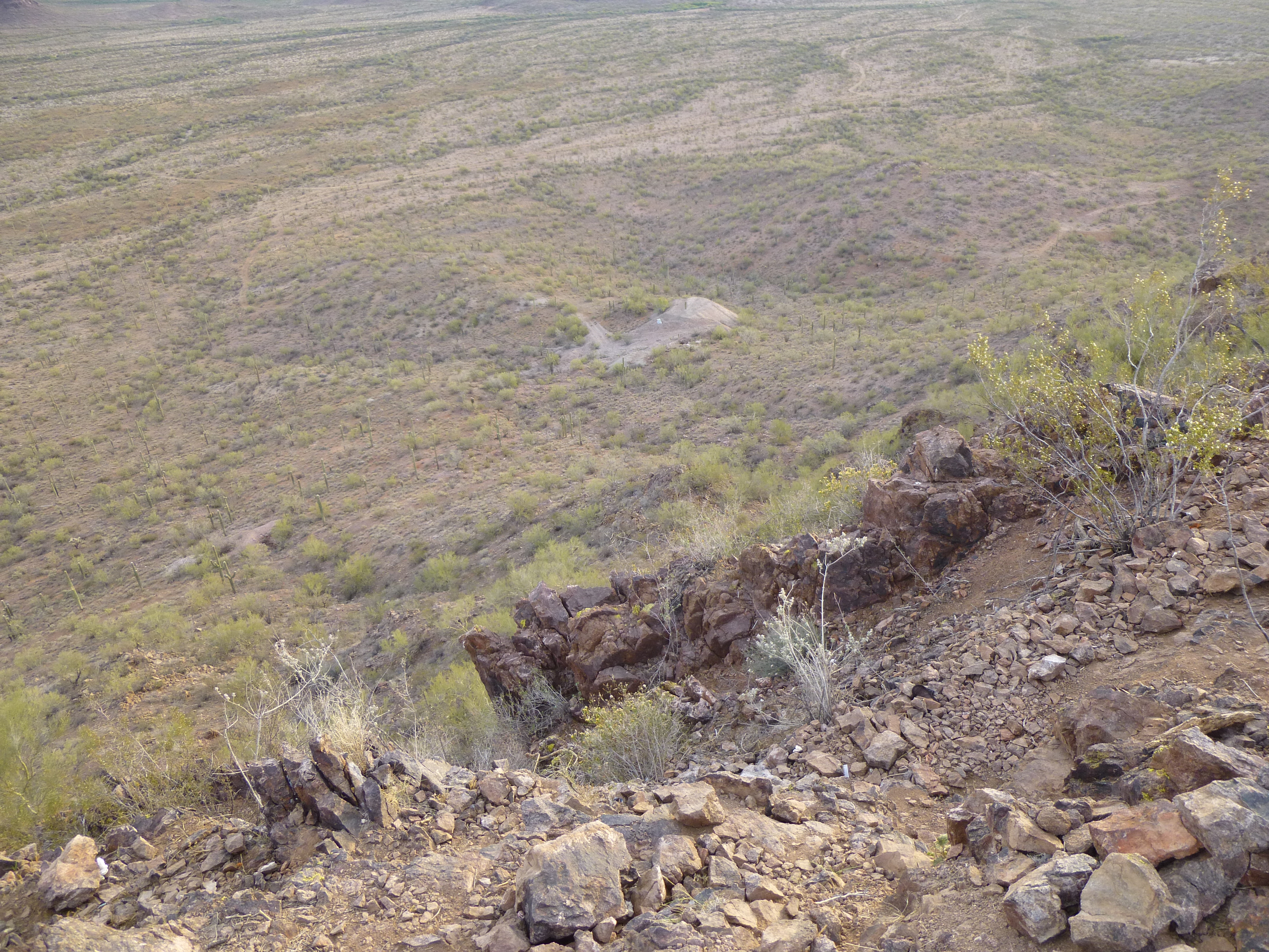
So here’s your reward for finding them – a set of pictures I took that day I was there. Here’s one of one of the trenches.
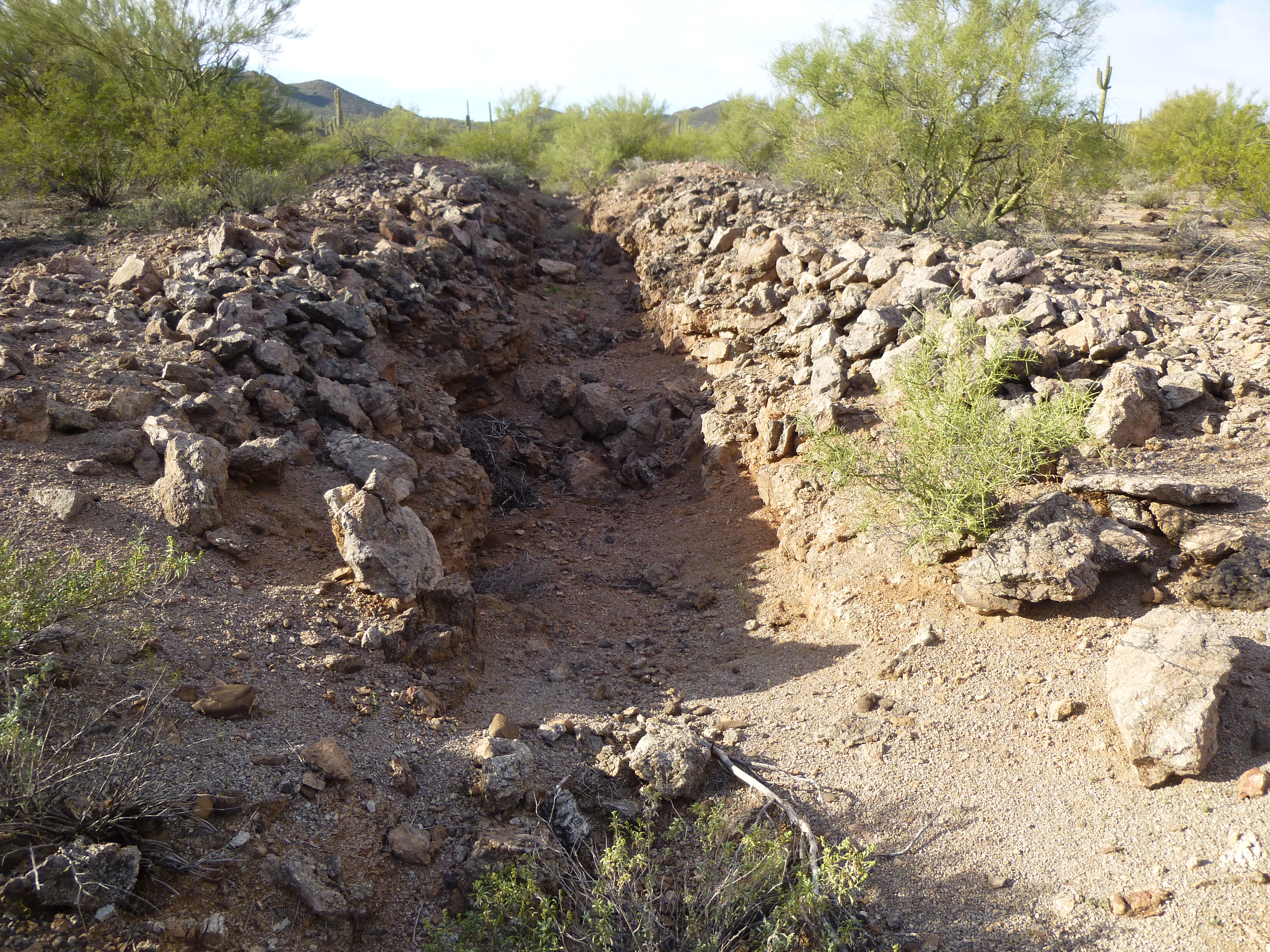
A trench
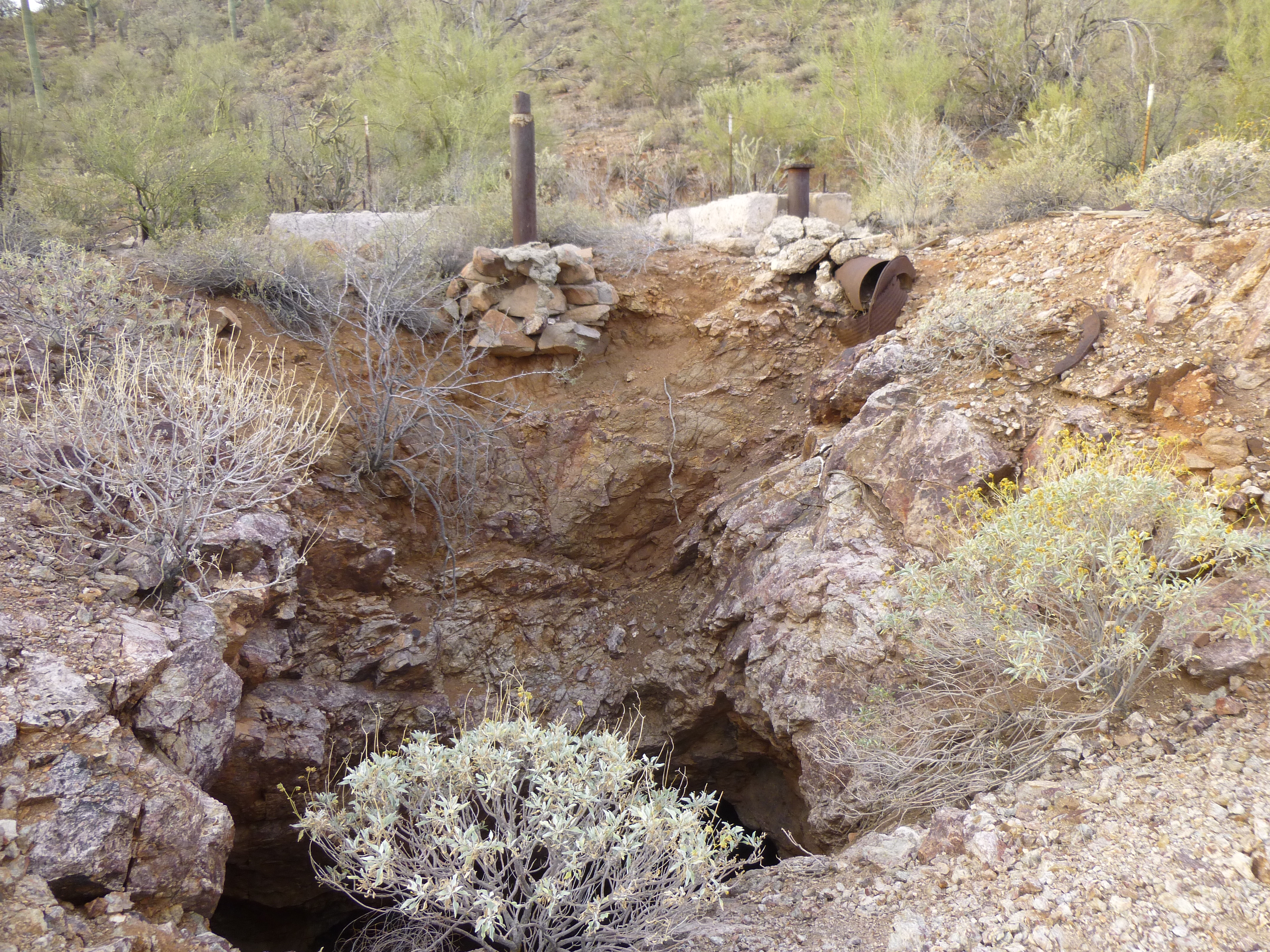
And here’s a view looking down one of the vertical shafts, one of those seen in the satellite photo.
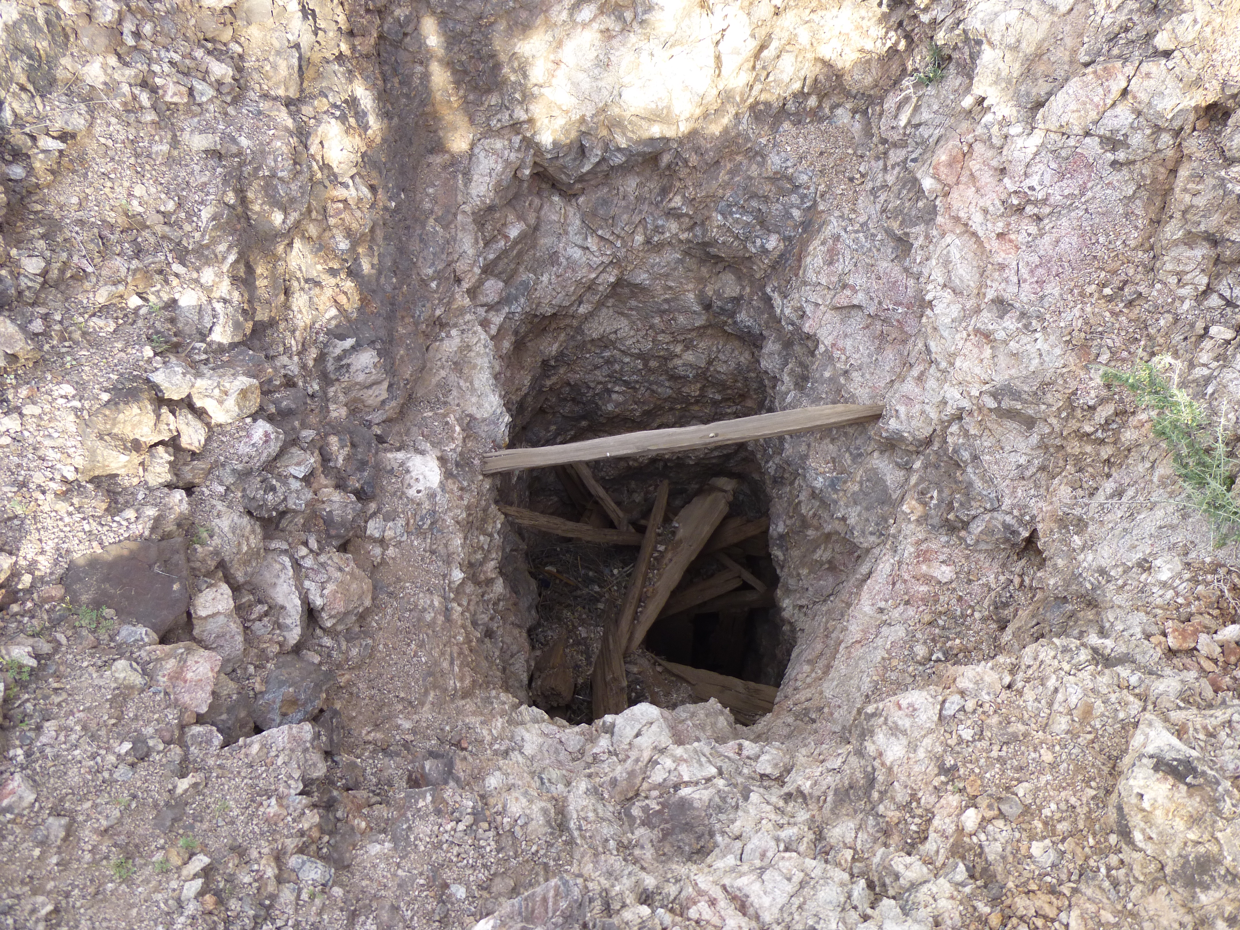
The vertical shaft
There were a number of old rock walls here at the Papago Mine site.
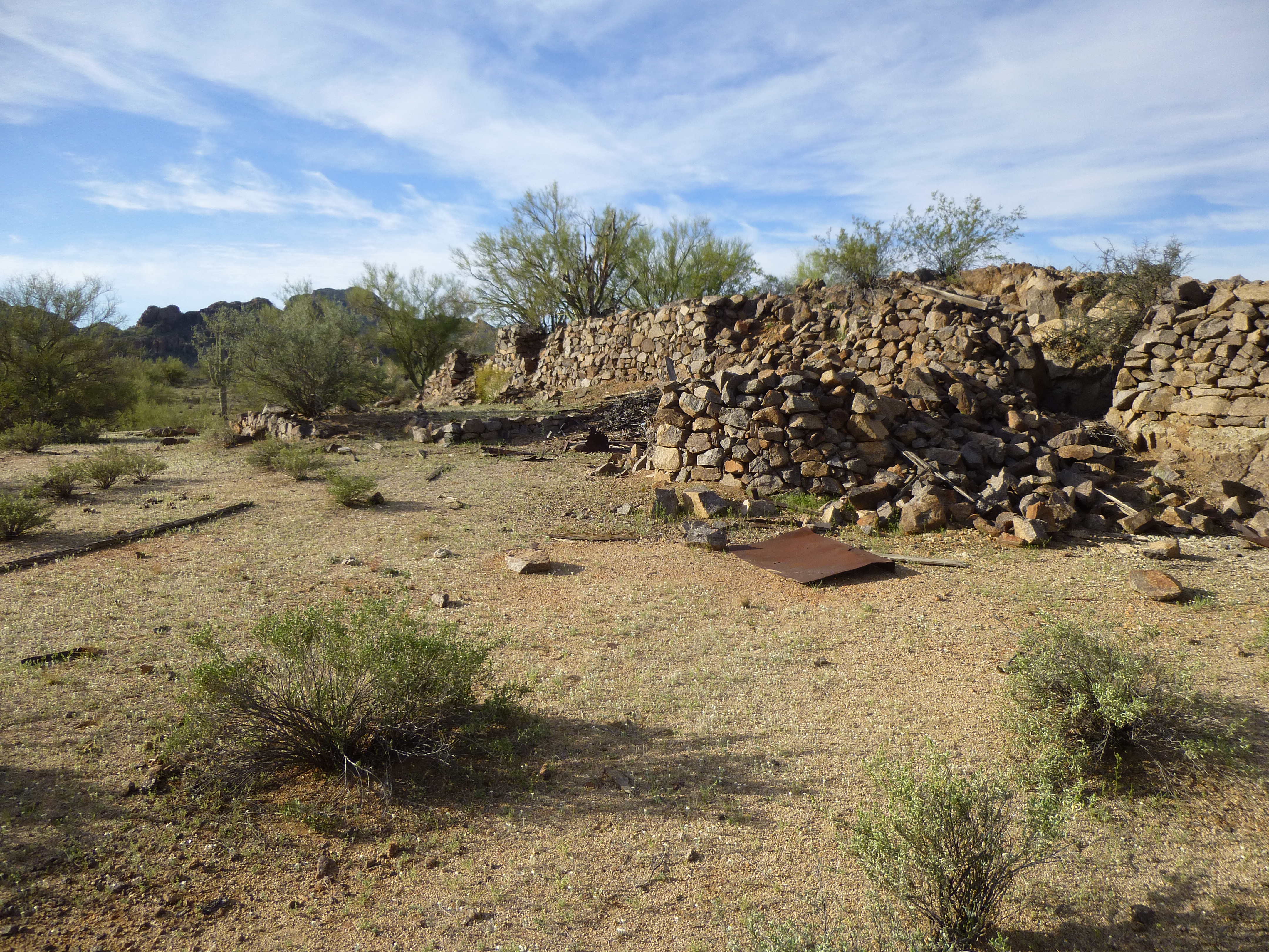
Old rock walls
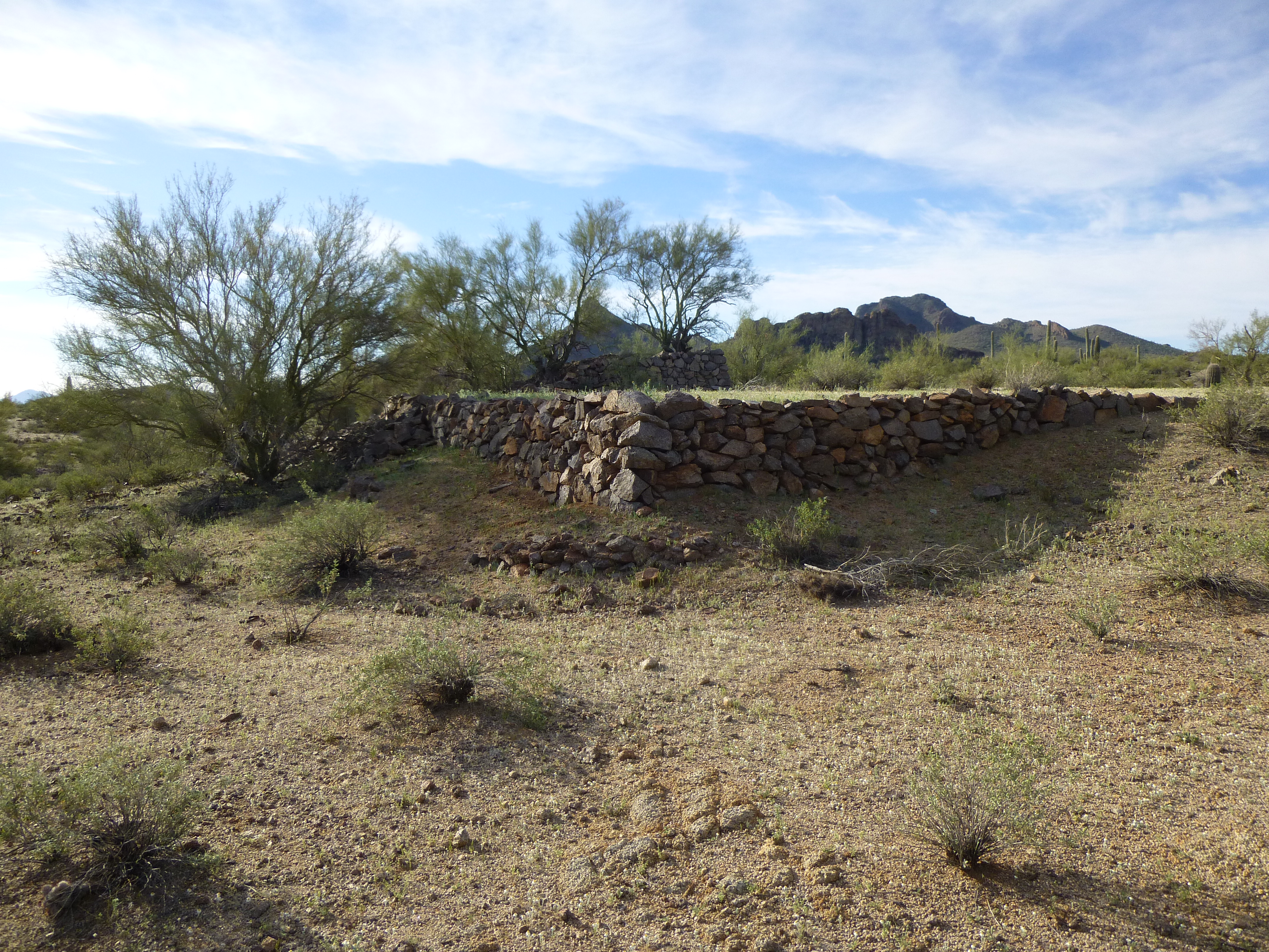
More walls
Out here in the desert, things like old rock walls can sit for a long time, even stacked stone like this with no mortar. These may have been standing for over a century.
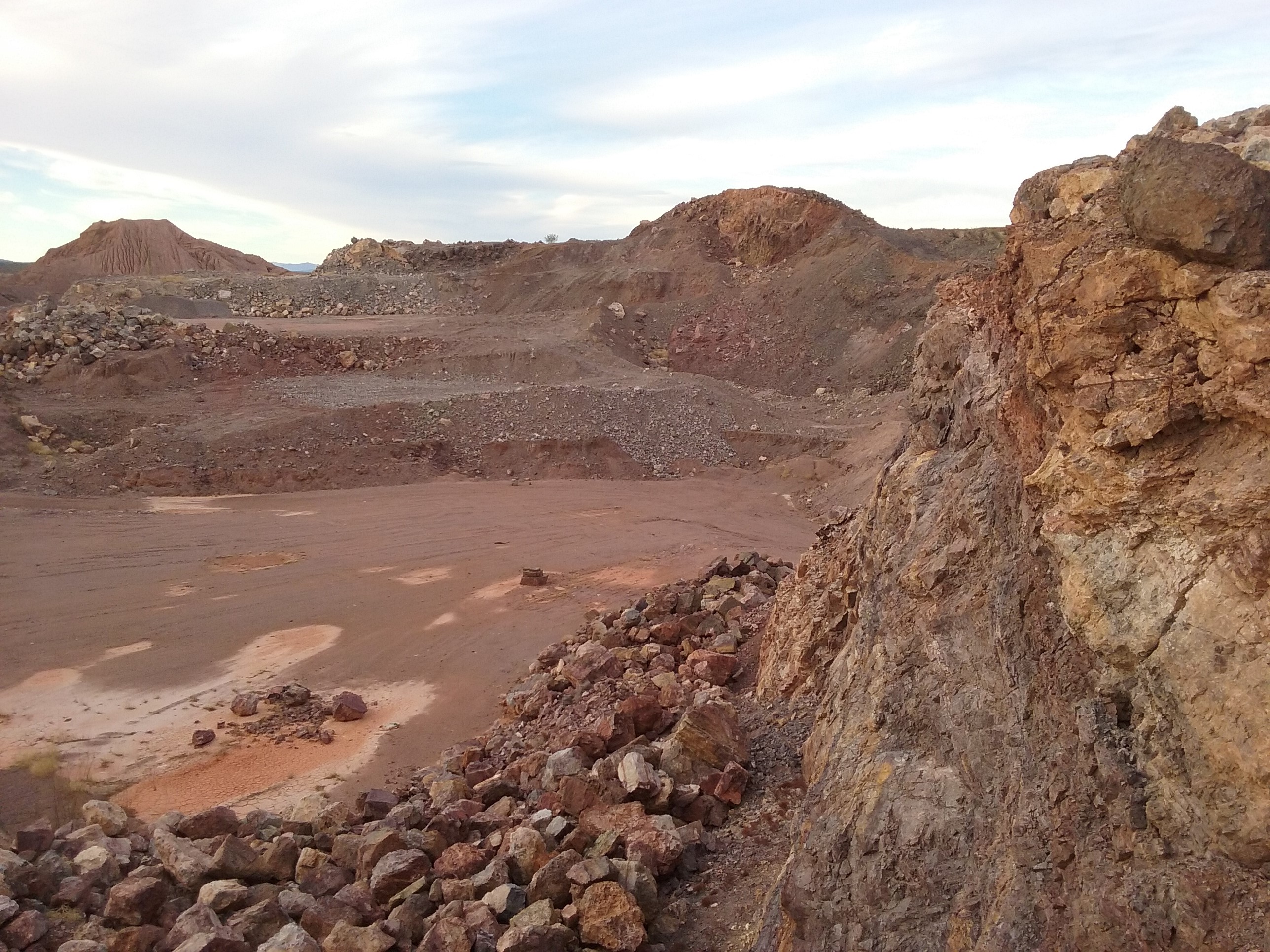
Here’s another one, an open-pit mine a mere 16 miles away from the Papago Mine, at a bearing of 77 degrees (true).
Orizaba Mine
Here’s a detailed description of the mine and its geology.
A former Ag-Pb-Au-Mo-Cu mine located on 6 claims and a millsite claim (1960’s), in the NW¼ (W½NW¼) sec. 25 & 26, T9S, R4E (Silver Reef Mountains 15 minute topo map), in the Lake St. Clair dry lakebed, 2 miles NW of the Jackrabbit Mine. Discovered in 1883. Produced 1885 – 1979.
Mineralization is a 50 foot wide fracture zone at the contact of quartzite and sandstone where limestone is thrust over quartzite. Quartzite dips NE, strikes NW. The south contact is against altered limestone and shale to the NE. The ore zone strikes N and dips 60-75W. Ore control was red cemented sandstone overlain by shale and limestone. Associated rock units are diorite and hornblendite.
Workings include a deep vertical shaft sunk and mill erected in 1915; shallow pits, stopes, and open cuts. There are several thousand feet of workings. There is also an old L-shaped pit. The SW winze is 150 by 75 by 75 feet deep. The other winze is 35 feet deep and 75 feet long.
The principal minerals found in the mine were: anglesite; chrysocolla; galena; sphalerite; vanadinite; wulfenite. It looks like this mine produced for a period of 94 years, a long time indeed.
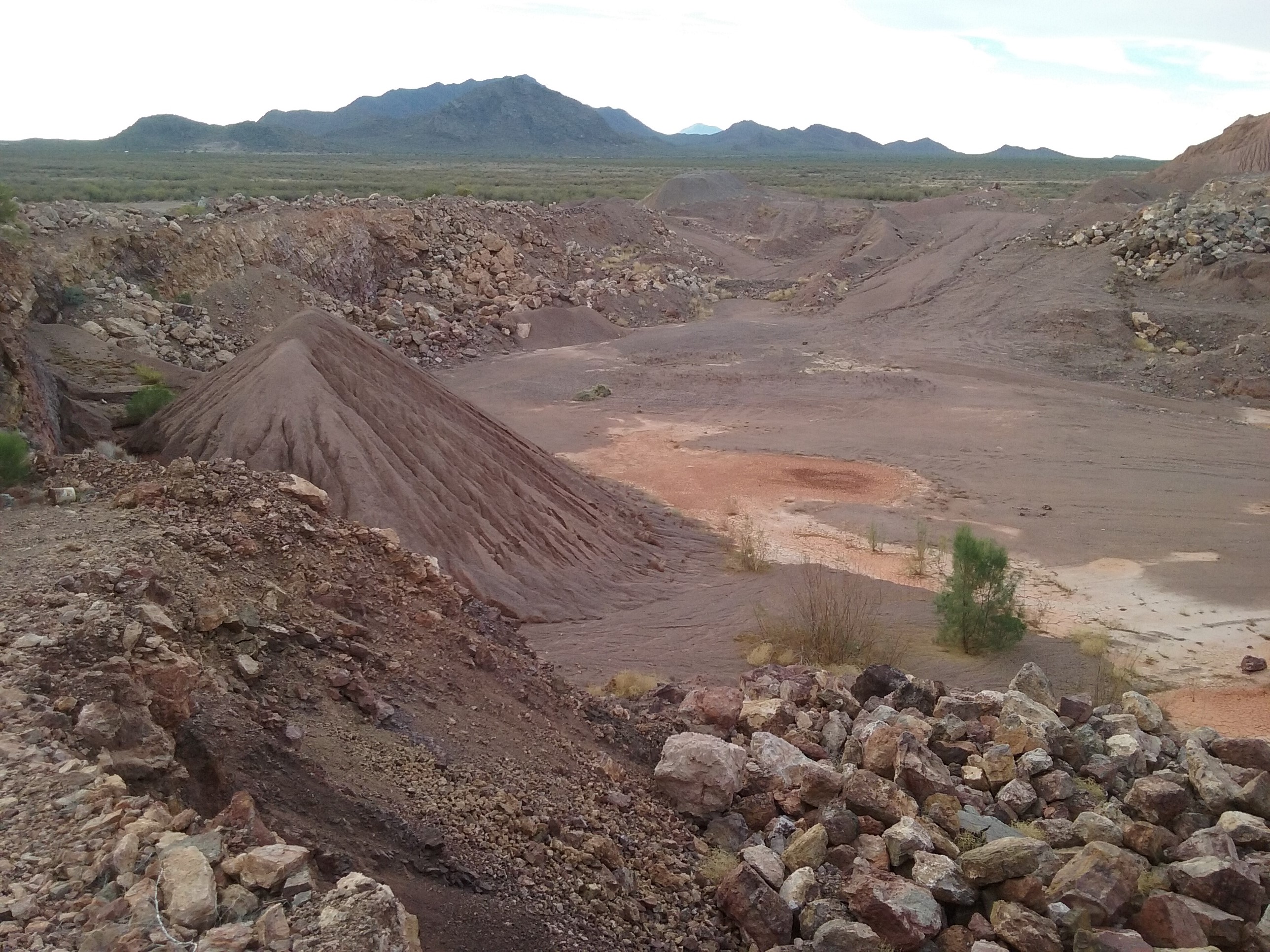
On a fine February morning, I visited the mine. Truth be told, my visit was a by-product of climbing a small peak which rose up from the north side of the open pit, a summit known as Peak 1838. Here I am at sunrise, casting a long shadow, looking at the peak – it’s not much to look at, is it?
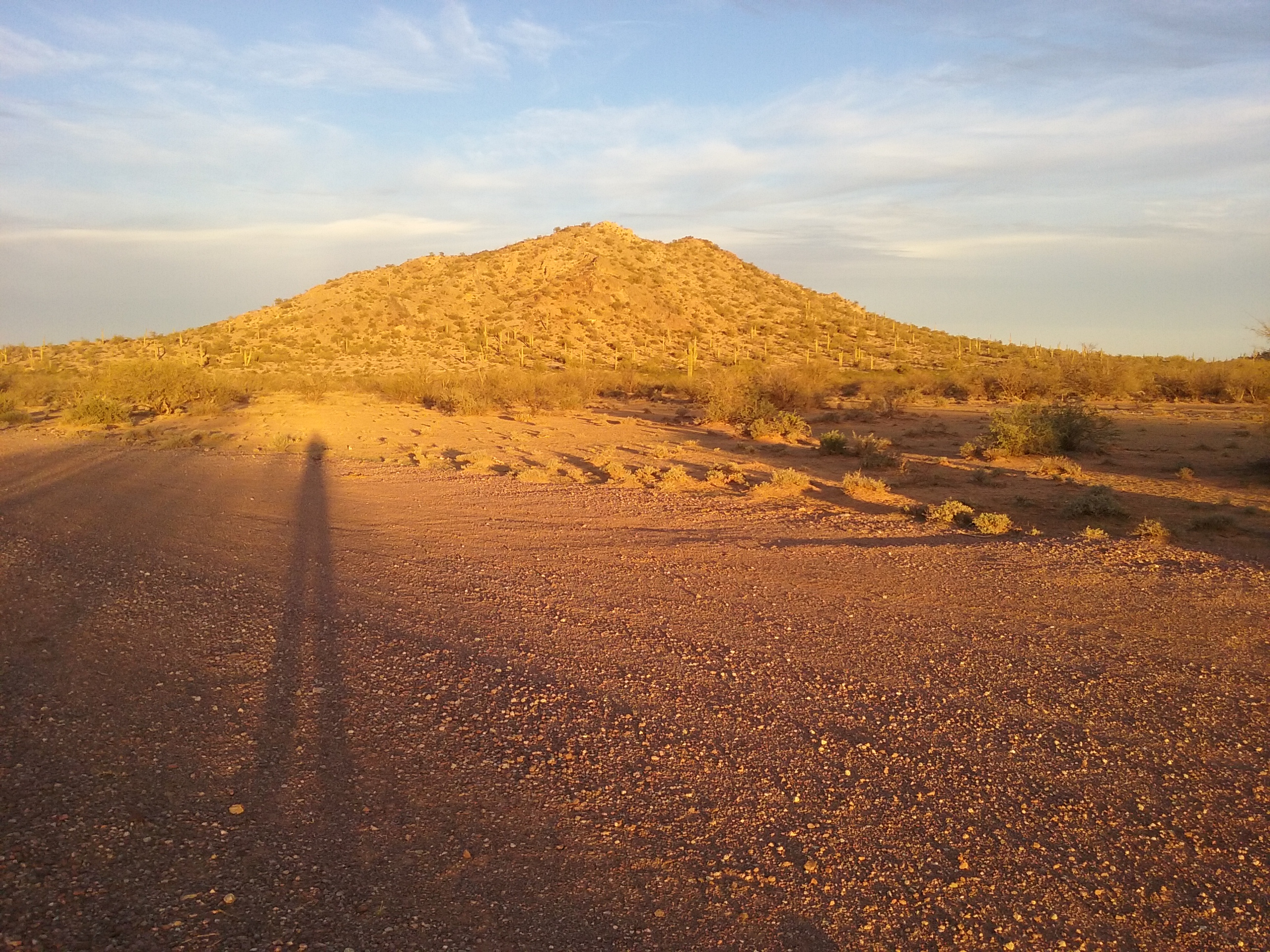
The east side of Peak 1838
I parked at the southern edge of the peak, hard by the open pit, then made a quick ascent – I wanted to catch the early morning light. Here’s a look to the north to the Tat Momoli Mountains.
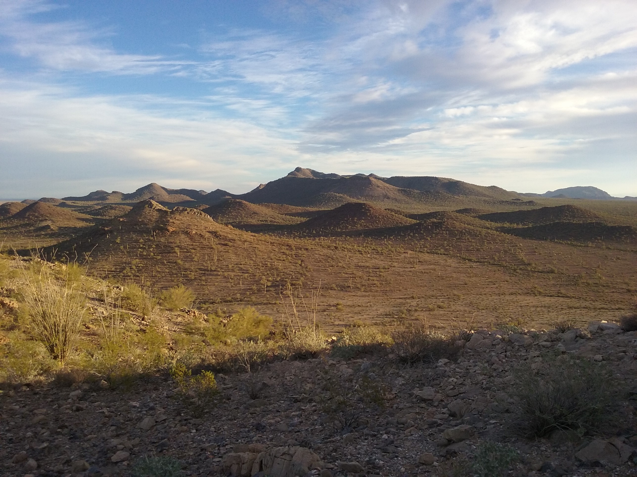
Looking north to the Tat Momoli Mountains
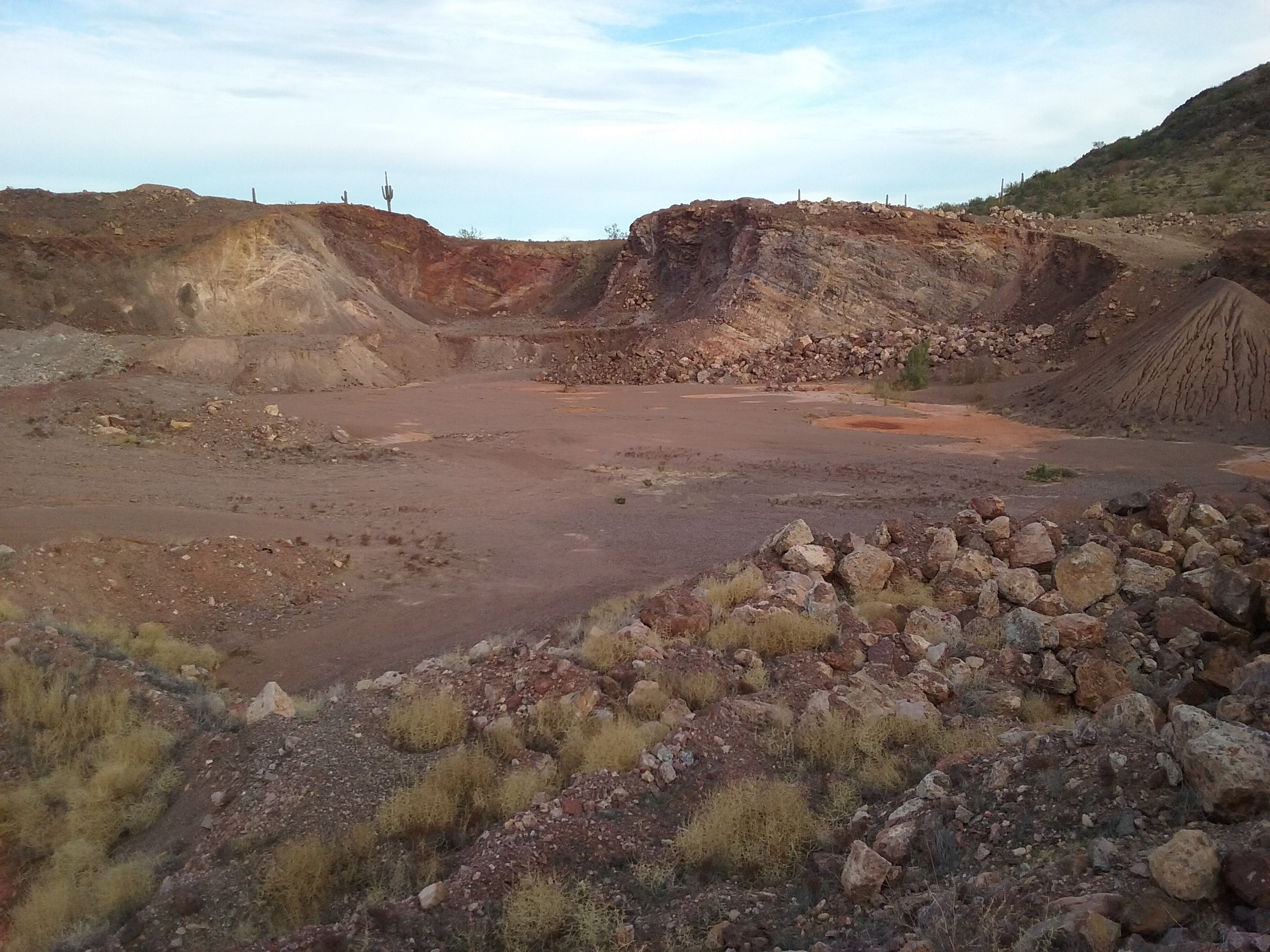
And here’s a look down at the mine itself – the view is south down the Santa Rosa Valley.
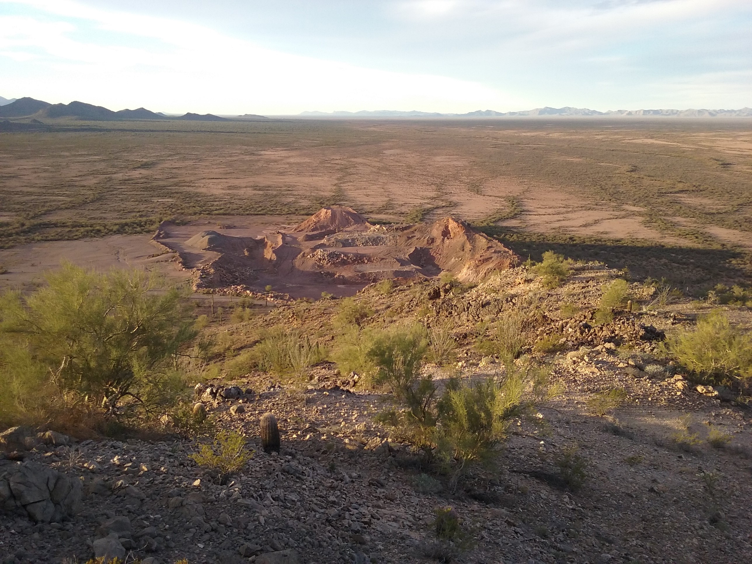
The Orizaba Mine
The records show that the mine was in production until 1979, and as I wandered around it once down from the peak, it looked as if it had been abandoned only yesterday.
Looking south to the Slate Mountains
Mineralization is a lens-shaped ore body hosted in Pinal Schist and in Tertiary volcanic rocks (dacite). The ore zone strikes N70E-N70W, dips 45-50S at 0.91 meters thick. Younger mineralization than in the Vekol District and the Copperosity Mine to the NE. Ore control was E-W-trending fault zones. An associated rock unit is dacite. Area structures include NW and NE-trending fault zones, E-W-trending fault zones and an E-W-trending fault zone through the mine. Two parallel NW-trending faults occur 1/3 mile SW of the mine. Minerals at this site include chrysocolla, malachite and gold.
It sounds like whoever named this mine had high hopes – greenbacks, indeed! I was here to climb a small peak just uphill from the mine, Peak 2510.
Looking up at Peak 2510
As I walked up the slope, I was transfixed by the golden, early-morning light on the south side of the Copperosity Hills.
Golden dawn
From atop the peak, I had a good overview of the mine area. The map shows around 20 shafts within a mile, and around 25 other things shown as prospects. The words “Greenback Mine” appear on the map beside 2 shafts, and I could plainly see that from above. The pile of waste rock was a dead giveaway.
The heart of the Greenback Mine
I was curious to see what I would see once I dropped down the slope. Arriving at the tailings, I found this – it appeared to be the entrance to a shaft.
What would I find?
There were a few strands of barbed wire attempting to guard the entrance, easily-stepped-over. There I stood at the gaping maw of a steep shaft which plunged into the bowels of the earth.
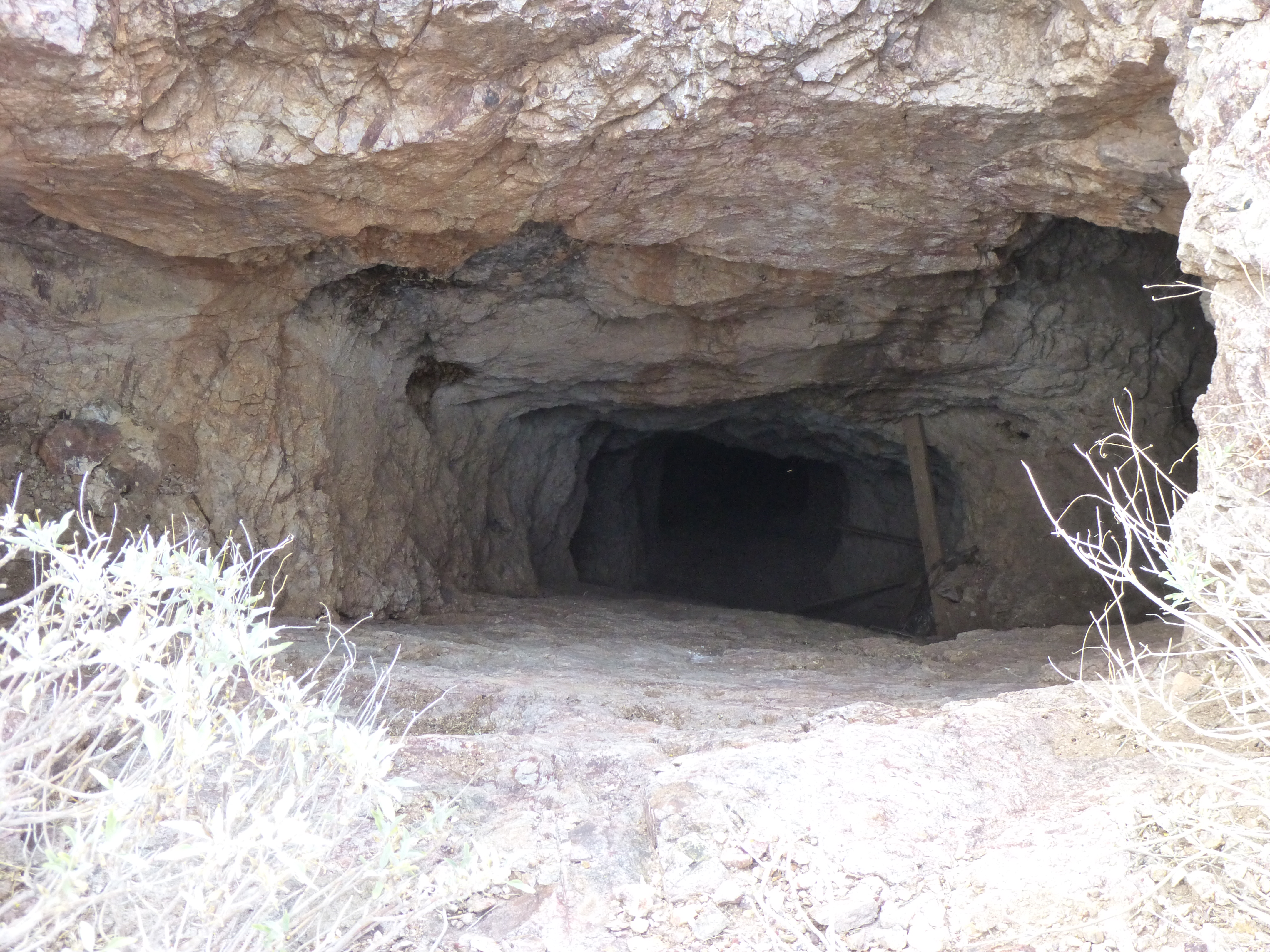
The shaft
It looked deep, and scared me – I kept a safe distance from the lip, but got close enough to roll a rock down into it. To my amazement, it seemed to take forever to reach the bottom. The lower surface, or floor, of the shaft looked quite smooth – if you slipped on it, you’d probably keep on sliding. I backed off, then looked around the immediate vicinity at other details. But, after a few minutes, it kept nagging at me – that shaft seemed awfully deep. I couldn’t help but walk back to the opening. Looking around, I found a rock about the size of my head. I set it at the edge of the shaft and gave it a push. The opening of the shaft acted as a megaphone, funneling the sound of the falling rock back up to me. I was wearing a digital watch, so it was easy to time the fall. Down and down it went. The sound of the rock was loud and clear, and when it stopped, the noise ended right away. It was hard to believe, but it fell for a full 21 seconds!!!
When I returned home, I called my mining engineer friend Andy Martin and told him of my experience. He looked on-line and found some good information – there were 2 main shafts associated with the mine: the Green Back shaft, which was 100 feet deep on a 40-degree incline, and the Pinal shaft. Are you ready for this? – records show that it was 688 feet deep on a 50-degree incline. Sweet Jesus – that’s like a 70-story-building deep.
When I timed the rock’s fall, I was flabbergasted how long it was – now I knew why. Quite frankly, it scared the hell out of me, and I backed off. This shaft had sat open and unattended for 77 years before I came along. I couldn’t help but wonder what, or maybe even who, had fallen in over that time, and had died an awful death deep in the bowels of the earth.
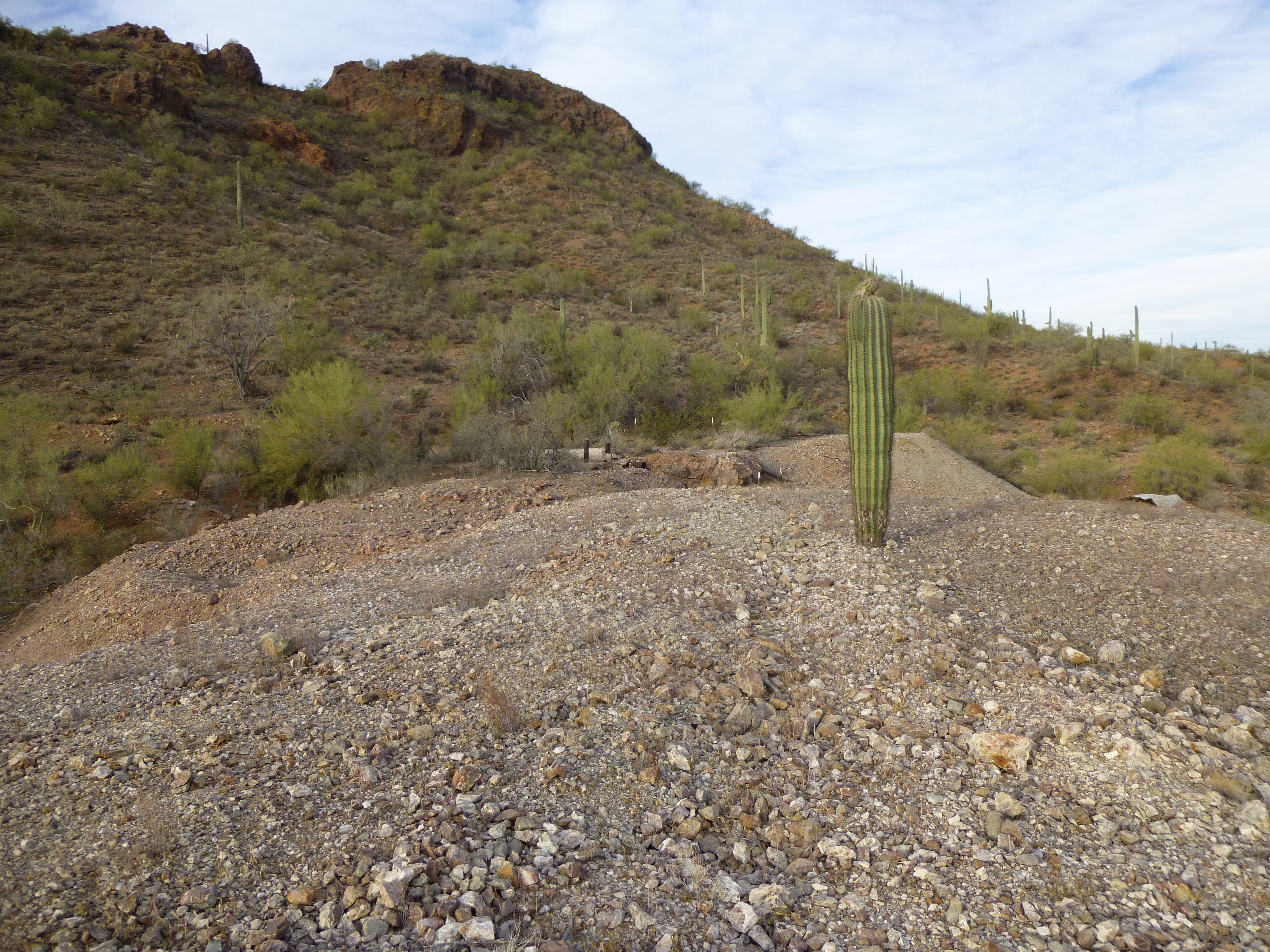
The waste rock from the shaft
A lonely saguaro cactus sat atop the pile of waste rock next to the shaft, testament to the years that had passed since the mine had been abandoned. As I left the area, I was struck by the differences among these 3 mines presented to you in this piece. Much has been written about Arizona’s old mines, by those far more qualified than I to do so, but it seemed like a fun idea to show you a few I had visited personally. Thanks for listening.