
Okay, I know that right away some of you are going to say that there should be an apostrophe in the title. For some bizarre reason, when the US Board on Geographic Names gives an official name to a feature, they seem to omit apostrophes. It really chaps my hide when they do that. And here is the official mumbo-jumbo reasoning as to why that happens, and I quote: “The word or words that form a geographic name change their connotative function and together become a single denotative unit. They change from words having specific dictionary meaning to fixed labels used to refer to geographic entities. The need to imply possession or association no longer exists.” So the official spelling of plenty of geographic features, official names on our maps, show up as, for example: Montezumas Head; Weavers Needle; Dantes View; Ryans Canyon. And, of course, Humphreys Peak. So there you have it – possessive place names are not supposed to contain apostrophes because the government said so. Period. So I’ll be a good boy and play along.
Let me tell you about Humphreys Peak. Why am I writing this in the first place? Well, it is, after all, the highest peak in the state of Arizona. Its elevation has been recently revised, courtesy of LiDAR, to 12,634 feet. As far as state high points go, it’s no giant, ranking only 12th-highest in the list of USA state high points, and climbing it is easier than many of those go as there’s a trail all the way to the top. That’s okay, though, it’s high enough to present a bit of a challenge and it is a nice-looking peak. Here’s a link to it which will show you some photos. Hundreds of people climb it each year, mostly in the summer and fall months when the snow is at its minimum, but a few hardy souls try it in the winter – more on that later. Only 2 peaks in the entire state exceed 12,000 feet in elevation, it and nearby Agassiz Peak.
Humphreys is the highest point of the Kachina Peaks Wilderness, the Coconino National Forest and Coconino County. It has a lot of prominence, a full 6,054 feet (the second-highest in the state). It contains the only alpine life-zone in the state. The Arizona Snowbowl ski resort, which operates 8 lifts and 55 ski runs with a total vertical drop of 2,300 ft, is located on the western slope of Humphreys. Mainly because of its status as the state high point, people come from all over the US to climb it, and some even from other countries. The peak is sacred to Hopi, Navajo, Havasupai and Zuni people.
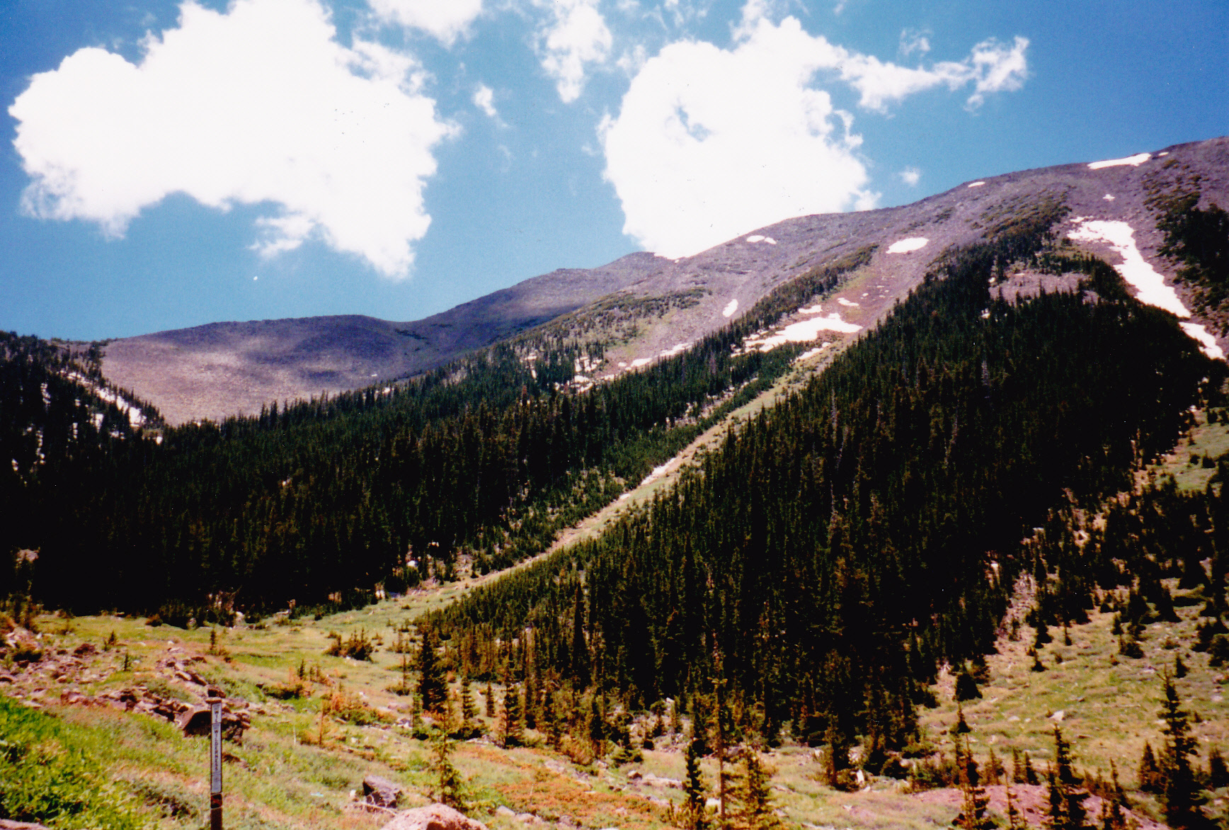
About 200,000 years ago, there was a huge explosion where Humphreys now stands, much like the type of explosion that occurred at Mt. St. Helens in Washington state – it was a large lateral eruption, meaning that it blew out sideways. Geologists feel that before it blew, the original peak could have been as high as 16,000 feet – wouldn’t that be a sight to see! The enormous blast reduced the height of the peak by several thousand feet, sending all of the debris eastward. What is known as the San Francisco Volcanic Field covers an area of 2,100 square miles to the west, east and north of the city of Flagstaff, containing hundreds of mounds, hills and volcanic peaks. The youngest feature there is Sunset Crater, which formed only 940 years ago. The map shows something called San Francisco Mountain, which is what now remains of the 16,000-foot peak. It contains Humphreys Peak, Agassiz Peak, Fremont Peak and Doyle Peak, together forming most of a circle but open to the northeast – these are the four highest peaks in the state. For the sake of completeness, I should also mention 2 more bumps on the northern edge of the circle: Aubineau Peak, at 11,855′, and Rees Peak at 11,477′. Although not ranked summits, they are each quite substantial in their own right.
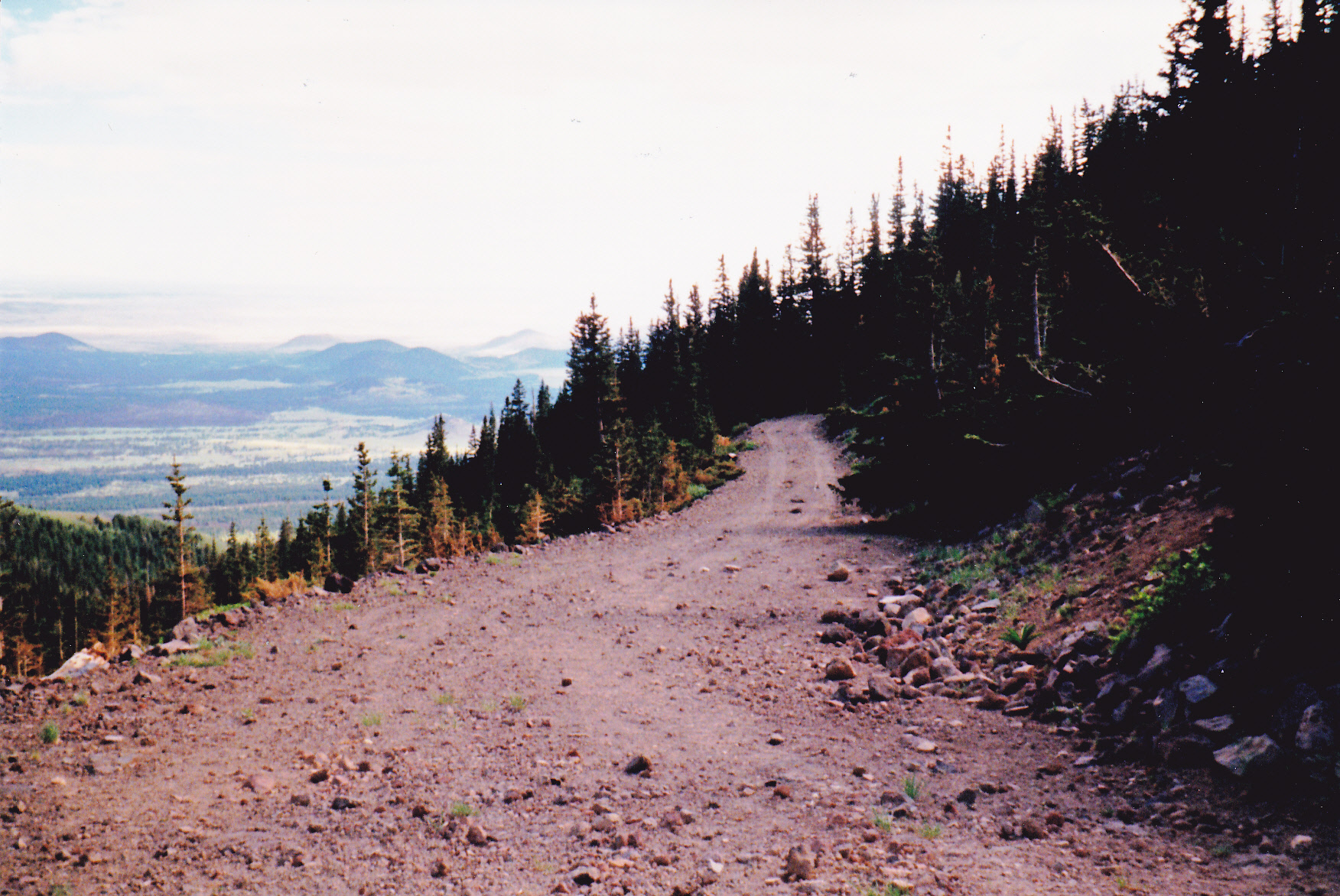
Let’s talk about the trail to the summit. To get there, you drive 8 miles north of Flagstaff, then go another 7 miles up the road to the Snowbowl. You park at 9,500 feet, then walk across the bottom of the ski area to the start of the trail where it enters the forest and the Kachina Wilderness. It’s a good trail, making long switchbacks up through the forest. You’ll be on the west side of the peak as you follow this trail, and there’s not much of a view to be had until you get above most of the forest. The forest itself is mostly composed of Engelmann spruce, firs, Ponderosa pines and aspens. There are plenty of birds to be seen, like Western bluebirds, chickadees, white-throated swifts, and even wild turkeys. Animals that inhabit the forest include porcupines, mountain lions, bobcats, elk, black bears and deer.
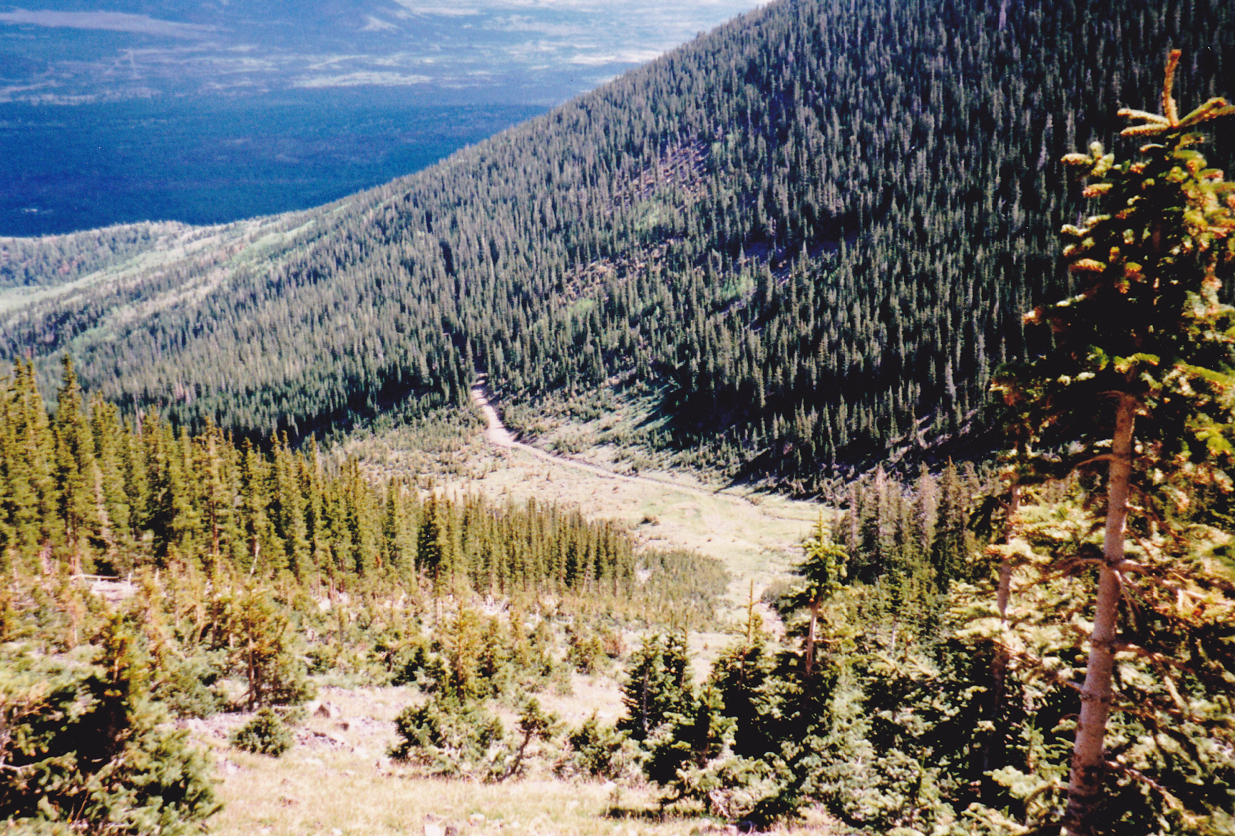
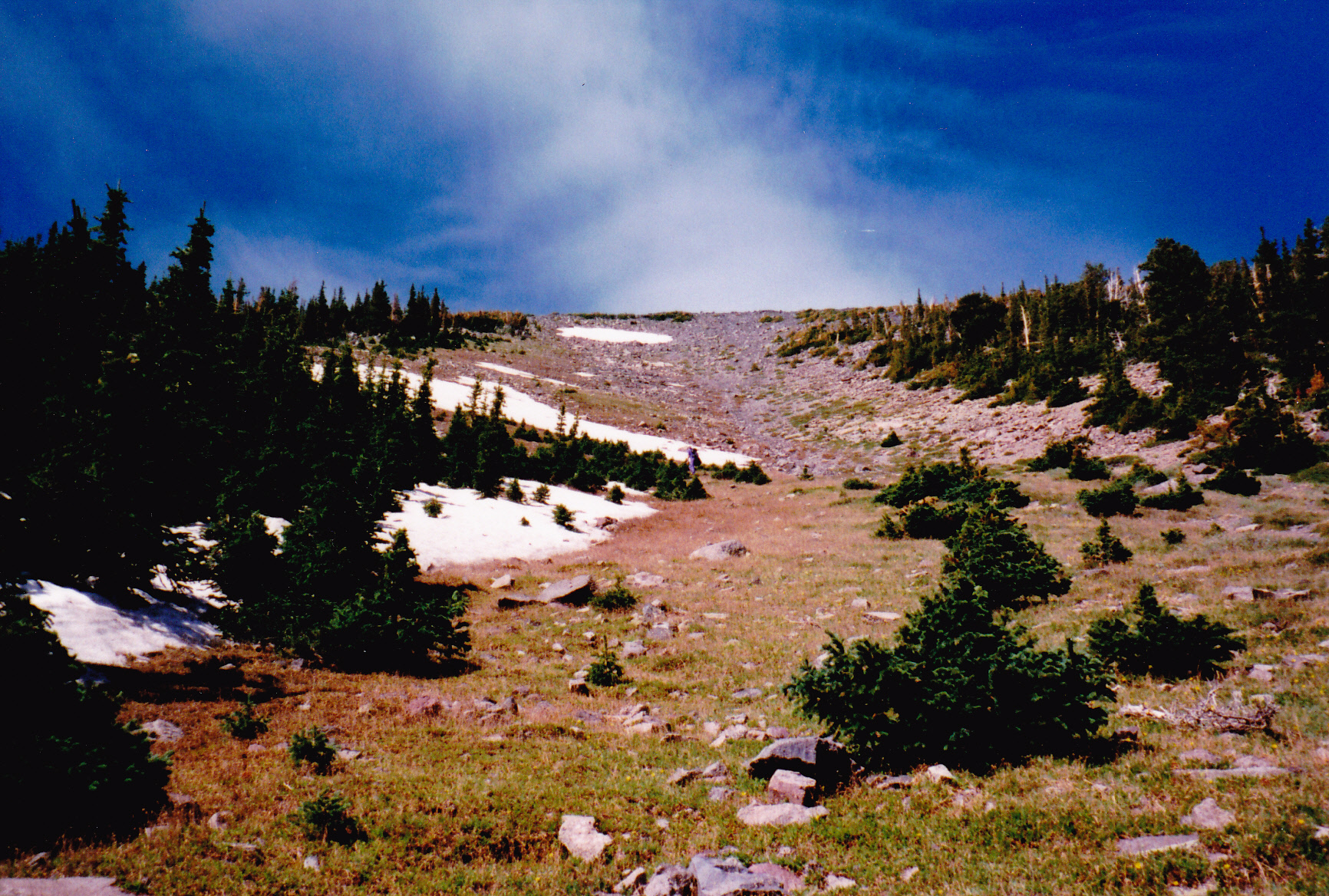
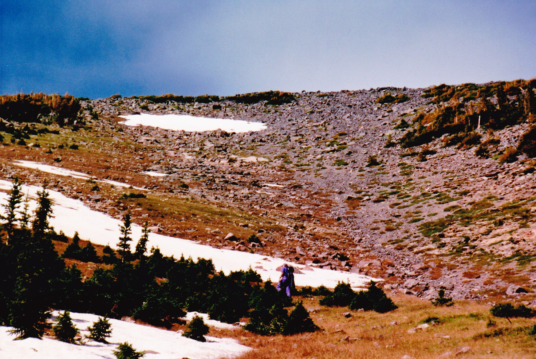
After about 3 1/2 miles, the trail has climbed up to what is known as Weatherford Saddle at around 11,800 feet elevation. You’ve left the trees behind and you’re out in the open, in alpine country above tree-line. The views are amazing – you can see the Grand Canyon and the Hopi mesas to the north, the White Mountains to the east and Oak Creek Canyon to the south. You can see down to the east into what is called the Inner Basin and easily spot all of the other named peaks which mark the edge of the volcanic remnant. All of this is known collectively as San Francisco Mountain. You’re not allowed to go off-trail, in order to protect the San Francisco Peaks groundsel (Packera franciscana), an extremely rare plant that grows nowhere else in the world. In winter you can, when the area is deep in snow, but otherwise no, for those who have designs on the summit of Agassiz Peak.
There’s one more mile to the summit of Humphreys, as the trail continues to the north. It’s probably the toughest mile, as it’s the highest and it crosses over 3 bumps along the way. In the summer and fall months, you’ll probably have plenty of company as you make your final approach to the summit, and will likely share your stay on top with others – it is one popular place. During those months, it’s monsoon season – thunderstorms can boil up seemingly out of nowhere and within minutes you may find yourself battling high winds, thunder and lightning, and torrential rain. If you’ve used the trail, you will have climbed about 3,300 vertical feet and gone 4.5 miles. I’ve made the climb 3 times and each time has been different, and I’d like to tell you about them.
I arrived in Arizona in 1985 and was living in Phoenix. While living a very sedentary lifestyle, it occurred to me one hot summer day that I should get up off my ass and go climb something. Something cool, but the only way I could see to do that was to head to the northern part of the state into the high country. I had learned that Humphreys Peak was the state high point and it seemed like it would fill the bill. Away I drove in an old Dodge I had at the time and eventually found my way to the parking lot at Snowbowl. I was excited to be climbing something nice and high, and cool to boot. It was July 20th and the day was fair as I started out. I made good time all the way to the summit on the trail and found myself in the company of several others. Not being acclimatized for the elevation, I soon found myself feeling unwell. On the way down, I hadn’t gone that first mile before I started vomiting – typical mountain sickness. After throwing up a few times along the way, I soon felt better and made it down to my car just fine.
Three years later, I went back, this time with a friend. Our intention was to climb Humphreys, but we went there on November 10th – the dead of winter, as far as the peak was concerned. The higher we climbed on the trail, the deeper the snow became. It took us quite a while, the going was pretty slow, and we finally stopped in the fading light. We pitched a tent in the deep snow just below the saddle and spent the night. The next morning, it was clear and cold. We continued the short distance to the saddle and found ourselves in very wintery conditions – a strong wind and deep snow. We were at 11,800 feet. Going the rest of the way to the summit of Humphreys seemed like it’d be quite a challenge, given the conditions, but then we wondered if we could make it south down the ridge to Agassiz Peak. It was almost 300 feet lower in elevation than Humphreys, and only about eight-tenths of a mile away as opposed to a mile and one-eighth to Humphreys. If we were going to climb anything that day, Agassiz seemed the better choice, so away we went. We made it okay but didn’t linger as it was cold and windy, so straight back to the saddle we went, then back down the trail to Snowbowl. That turned out to be one wintery climb, for sure.
Fast-forward eleven years to 1999. My old friend and climbing partner Brian Rundle and I drove from Tucson up to Flagstaff, then around to the northeast side of the peak into what is called the Inner Basin. We spent the night at a campground at 8,600 feet and drank plenty of beer to get ourselves into condition for a climb of Humphreys.

Brian at the campground.
Bright and early the next morning, we set out on a trail which took us up to 9,400 feet. We left it behind and made our way up to an old road which headed north, then west, around the base of Rees Peak. We crossed Bear Jaw Canyon, still on the road, then continued more-or-less west and across the lower reaches of Aubineau Peak. This was a mighty fine road, as you can see in this picture.
Excellent walking along the old road.
In a short while, our road crossed Reese Canyon, then carried on west, then south, and ended at Aubineau Canyon at 10,400 feet. Not bad, we had gained almost 2,000 feet from the campground just by following a trail and a road and had walked 7.5 miles. Where the road ended, there was a sign indicating we were about to enter a wilderness area.
The start of the real climbing.
In the above picture, we climbed up the open strip of the avalanche chute angling up to the right in the dark trees. Brian and I were no strangers to alpine country like this and we felt right at home. We soon had this view down to the end of the road.
Looking northeast down to the end of the road.
As we climbed, we had this view up ahead.
Looking up the slope.
Here’s a look from even higher up.
Getting higher – that’s Brian up ahead.
We climbed up to the north ridge of Humphreys at 12,000 feet, then headed south for the final 600 feet to the summit. There were several others already there.
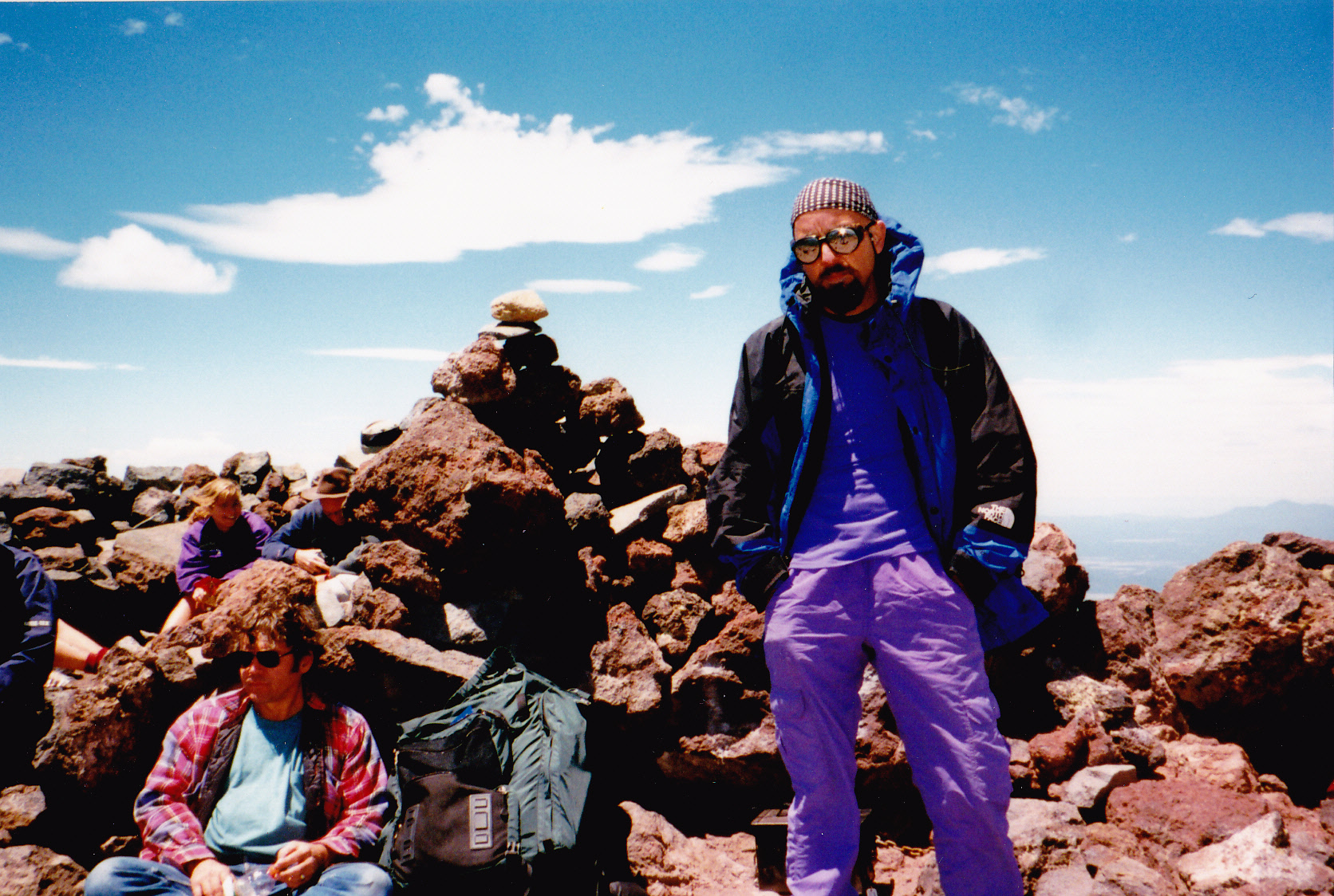
On top.
From the summit, we could look downslope to the south. The trail comes up from there, and you can see it if you zoom in.
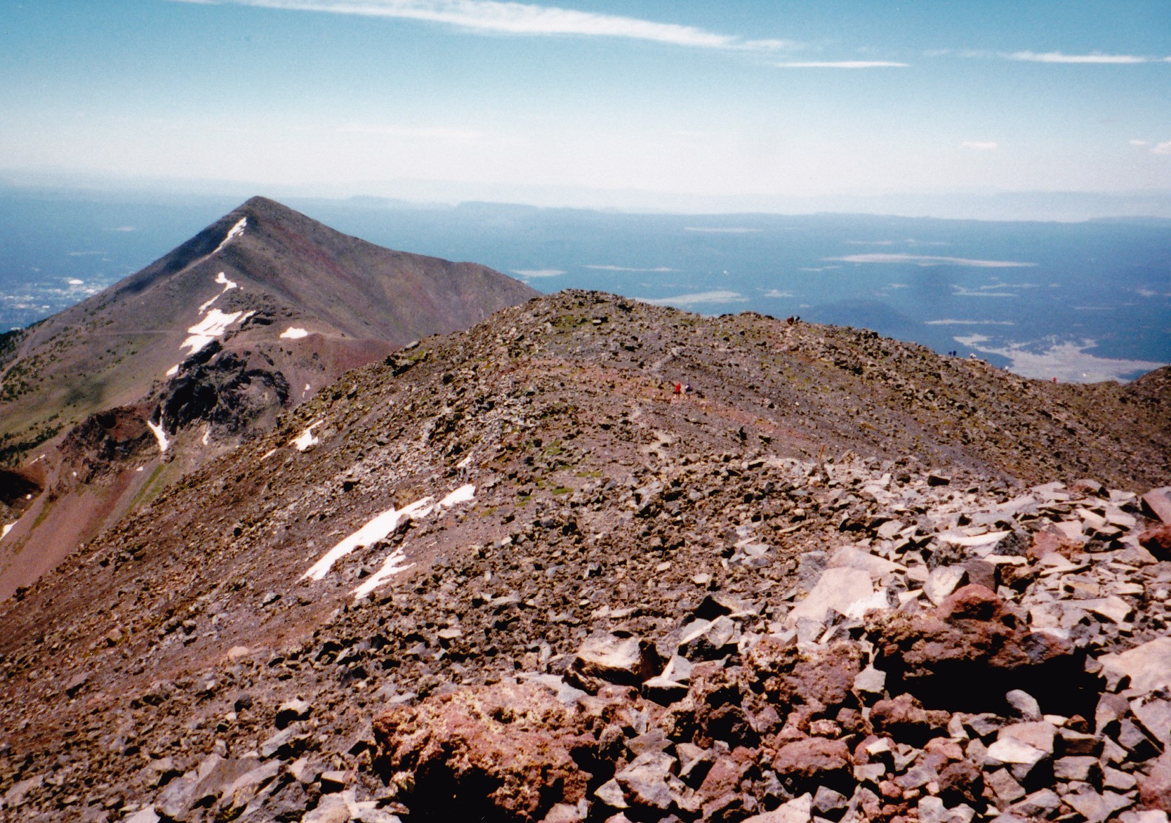
See the trail? I spot at least 12 people on it. That’s Agassiz Peak out there on the left.
Here’s another view from the top. That’s Doyle Peak down there, just to the right of center. Rising up on the right edge of the picture is the east ridge of Fremont Peak.
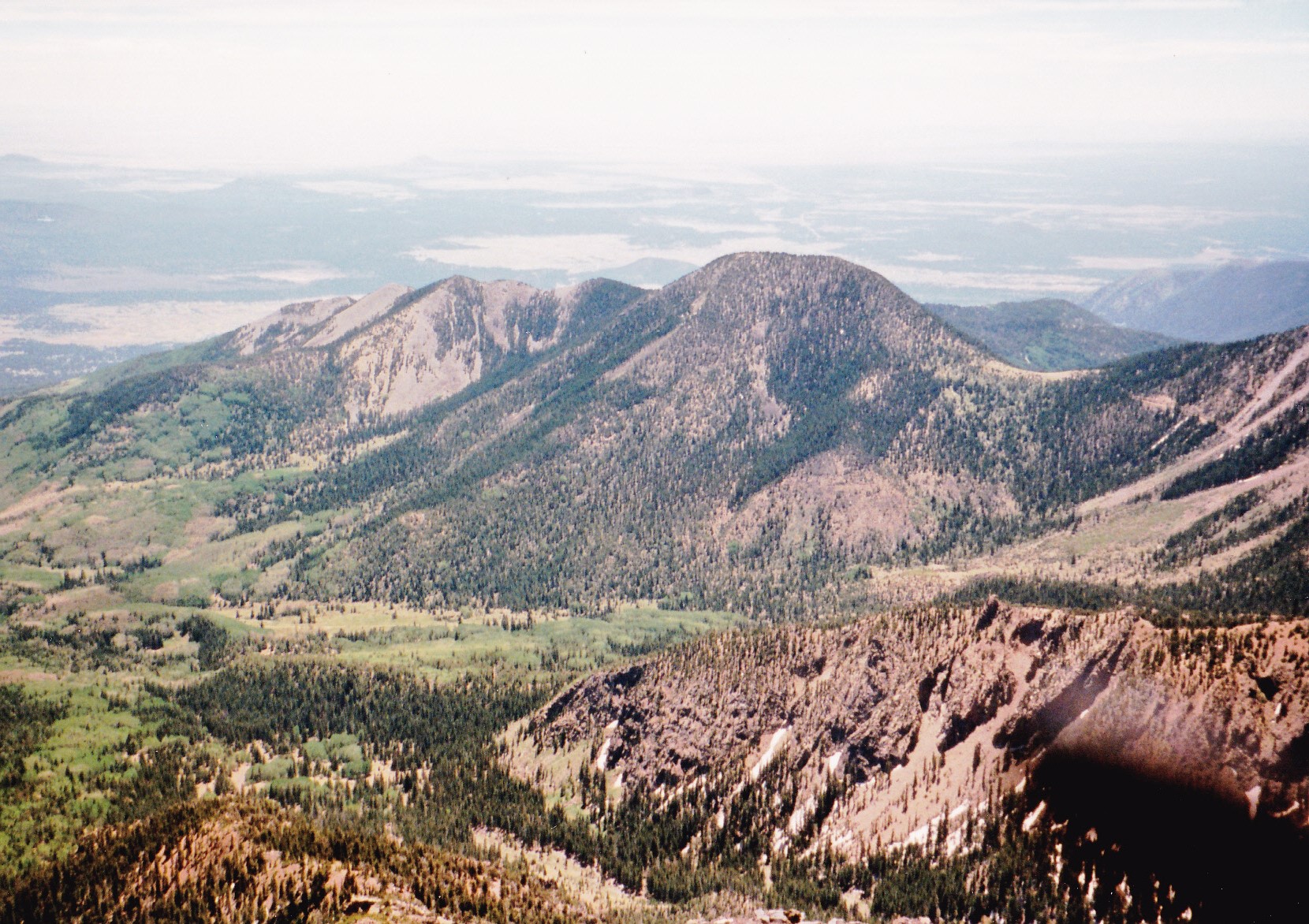
That’s Doyle Peak out there.
We didn’t stick around long on the summit, instead turning around and heading back down the same way we’d come up. The 8.8 miles back to camp was all downhill, so a piece of cake.
I had one last run-in with Humphreys. Friend and climbing partner Paul McMichael and I had been doing a lot of climbing together in 2010, and we decided he needed to tackle Humphreys and add it to his completed list. After all, it is the highest thing in the state and every red-blooded peakbagger should climb it at least once, right? So on September 24th, we left the scorching lowlands of Tucson and drove up to Flagstaff and then to the Snowbowl parking lot. Away we went up the trail and made good time all the way to the summit. An important thing to mention about climbing Humphreys in the summer months is this: monsoon storms can build up quickly. The sky can be clear, and within a few minutes clouds can build up. You can find yourself caught in the middle of a violent thunderstorm with high winds, rain, hail, even snow, with dangerous lightning and thunder crashing all around you. The higher you are on the peak, especially above tree-line, the more likely this is to happen. We were lucky that day and the weather remained clear. The return trip back down went without incident, but Mother Nature finally caught up with Paul. As we drove down from Snowbowl, we had to pull over and Paul threw up – the quick ascent to altitude had given him a bout of mountain sickness (for some reason I was spared this time). The thing about throwing up is that once done, you feel a lot better, and Paul did. After camping in the forest for the night, we drove back to Tucson the next day.
So there you have it, Folks – my time with Humphreys Peak was enjoyable, and I hope some of you can make it there and stand on the summit of our state’s highest point as I did.