
Back on July 8th of 2013, on this website, I published a story about a mysterious place I had found on a mountaintop in a remote part of the Tohono O’odham Indian Reservation. What I had found remained a complete mystery to me, not only then but in the years that followed. I had given up trying to learn any more about it, as I had found nothing but dead-ends as a result of my efforts. The name of that piece from 2013 was entitled “Secret Government Installation”. I had given it that name because I somehow suspected that only the government could have built something so mysterious in such a spot. Almost 6 years later, my peakbagger friend Andy Martin visited the same site and found things unchanged. We still had no idea as to the origin of the site, who built it and for what purpose.
Then, in late September of 2025 I received an email from a fellow named Bob Morse. He had read some of my stories and said that he could tell me all about the mysterious site. Was I interested? You bet! I made arrangements to visit him and, an hour’s drive from my home, found myself sitting in his comfortable living room in a quiet rural setting. I was all ears as he answered my questions, and all of the mystery was solved. Here follow the results of our conversation. First of all, he told me about his fascinating career, and what comes next are his own words in italics.
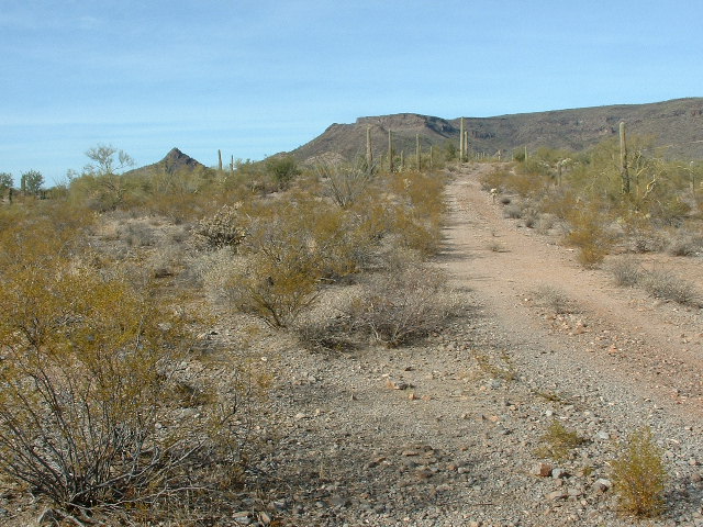
Where the military road starts, at Point 2665.
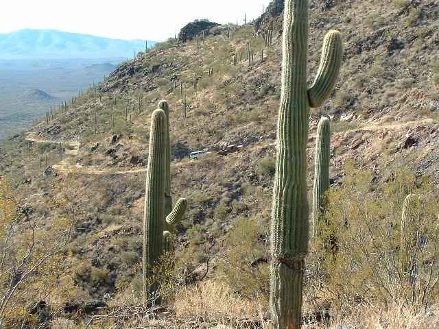
The road was blocked.
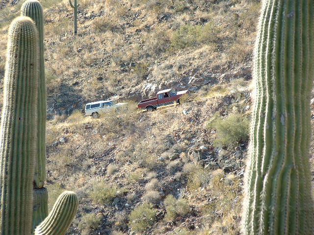
Here’s a zoomed-in view.
The close-up.
I walked the remaining short distance up the road to the top of Peak 3667, but I wasn’t prepared for what I saw there that day – it was January 29th, 2006. Several concrete slabs adorned the summit. Several of them had markers embedded in them. There were 2 different types, shown here.
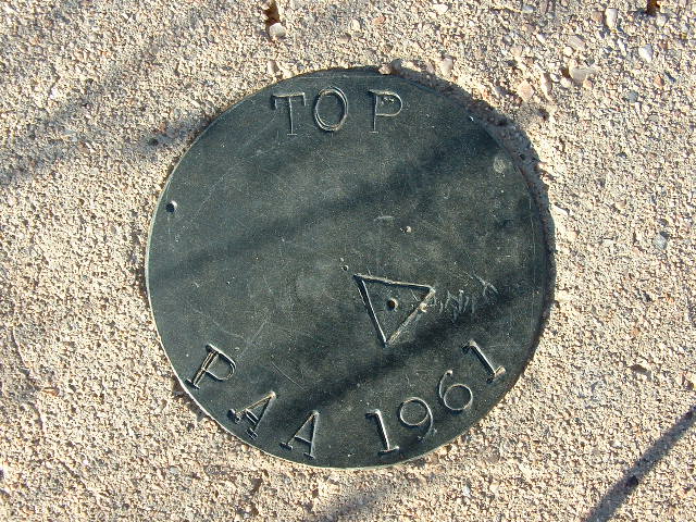
One type of marker.
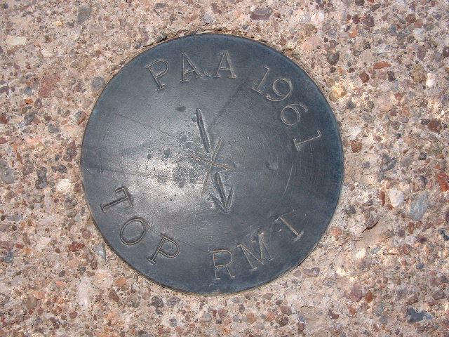
The other type of marker.
We now know that the PAA stands for Pan American Airways, and of course the 1961 tells the date it was installed. Bob has described what the site would have looked like back in the 60s when it was operational.
There were a number of concrete pads. Each one would have had a trailer parked on it. The trailers were about 8 feet wide and 25-30 feet long. A generator would have sat on one of the pads. There was a small building used for communications, perhaps 12 feet by 12 feet. Next to it stood a tower with 2 microwave antennas – one of them was aimed at Oatman Mountain, and the other was aimed at some site farther east, perhaps Mount Lemmon. There was precision tracking radar at the Yuma Proving Ground, Oatman Mountain, Peak 3667, Mount Lemmon and Fort Huachuca. The type of radar used were modified SCR584 tracking radar systems developed by MIT in WWII. SCR stood for Set, Complete, Radio.
Bob went on to tell me that, surprisingly, the crew that manned the installation didn’t live up there. Instead, they commuted there 5 days a week, and sometimes other days depending on the missions to support. But commuted from where?, I wondered. One possibility was from Gila Bend. Back in the 1960s, some of the roads on the Barry M. Goldwater Air Force Range were more heavily used and kept in better shape than they are now, and I can see a situation where such a commute could be done in an hour or an hour and a half, each way. That would still make for a long day in any case.
Now we come to the real reason the radar facility existed on top of Peak 3667. Are you ready for this? Drumroll ……… The site was built to track the progress of the Fairchild SD-5 Osprey. This was an early high-speed reconnaissance drone, to gather targeting information for the United States Army.

- Length: 36 ft 8 in (11.18 m)
- Wingspan: 24 ft 8 in (7.52 m)
- Height: 8 ft (2.4 m)
- Gross weight: 9,000 lb (4,082 kg)
- Powerplant: 1 × Pratt & Whitney J60 turbojet 3,000 lbf (13 kN) thrust
Performance
- Maximum speed: Mach 0.7
- Range: 1,000 mi (1,600 km, 870 nmi)
- Service ceiling: 35,000 ft (11,000 m)
Its rocket booster allowed for zero-length launch from a specially-designed trailer. Recovery following the mission was by parachute, with airbags used to cushion the landing; sensors including infrared scanners, side-looking airborne radar (SLAR) and optical mapping were available for use, and could be recovered following the mission, or transmitted during the mission via telemetry. Guidance during the mission was provided by an inertial navigation system and autopilot. The Army would launch the Osprey from Yuma and it would fly all the way to Fort Huachuca and then back to Yuma, if conditions allowed. The facility atop Peak 3667 would gather telemetry data during the flight.
Communications for every site was via the microwave radio communications system. Radar tracking data and telemetry data was also sent to different sites via the microwave system. Radar data was sent from a site that was tracking the data to other sites so that those sites’ radars cold be slaved to this data and allow those radars to acquire the aircraft. This data was very accurate and precise, allowing the radar operator to acquire the track easily. This same data could also be displayed on inked plotting boards (essentially a large-scale map of an area showing the real-time trace of the object the radar was tracking).
Bob’s 7 years of experience at Oatman Mountain helped him obtain a job working for Bendix Field Engineering, contracted to NASA to operate and maintain the MSFN (Manned Spaceflight Network) in support of the moon missions. He was trained and worked on several Apollo missions, including Apollo 11, at Greenbelt, Maryland, Ascension Island and Guaymas, Mexico.
Let me share with you some photos I took on my 2006 visit to the site atop Peak 3667. There wasn’t much left to see. Several concrete pads, and a wooden apparatus with what looked like a lightning rod on top.
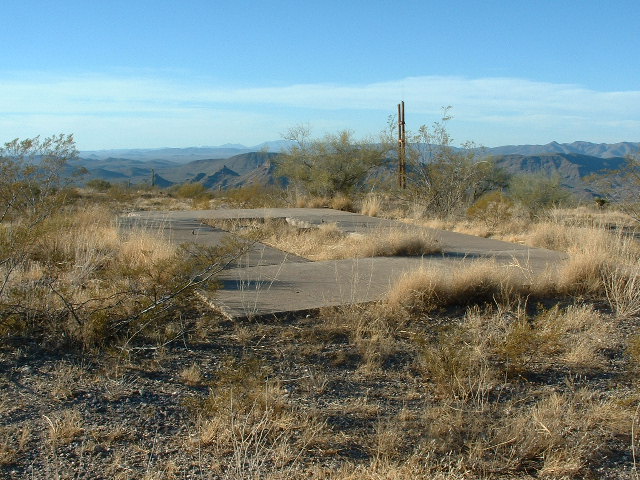
Concrete pads
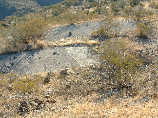
More pads
Pads.
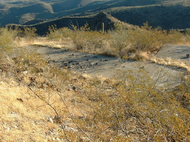
One of the pads had some remnants of cables.
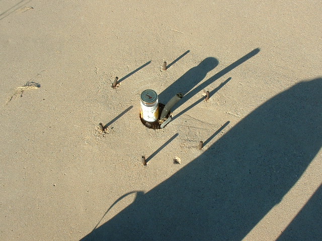
That’s my glass jar register that I left on the mountaintop. Something must have been bolted down there.
Sturdy wooden poles were still standing, A metal rod is on top of the right-hand pole, and conduit runs down the pole. It must have protected a cable at one time. A guy-wire holds up each side.
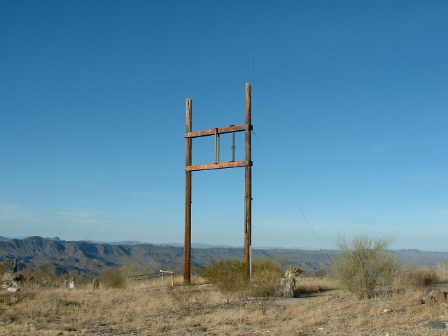
Still standing.
So there you have it, Friends. The mystery of Peak 3667 has been solved. The entire facility was built for one purpose, to help control and follow the movements of the SD-5 Osprey. This was an early high-speed reconnaissance drone, built to gather targeting information for the United States Army. Many thanks to Bob Morse for shining a light on all of this. I’m sure that the top of the mountain will sit undisturbed for years to come, if not forever.