
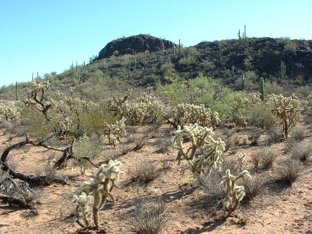
In our vast southwestern deserts here in Arizona, there are plenty of strange drainages, or washes as we call them. They abound in places like the Barry M. Goldwater Air Force Range, Organ Pipe Cactus National Monument and the Tohono O’odham Indian Reservation. Washes that start or stop in odd places, or travel through interesting country. I’d like to share some of my favorites with you here.
Vamori Wash – if you’ve never heard of it, I can’t blame you. It has its origin way down south of the border in old Mexico. However, in Mexico they have a different name for it. There, it’s called El Coyote. Not wash, not river, just El Coyote. It has its beginnings out in the wasteland to the northeast of Sierra El Humo in some hills at around 3,300 feet elevation. There’s nothing out there, it’s a true despoblado, no people, just a few faint vehicle tracks. Drug cartel members use the area, though, to get drugs up to the border. El Coyote runs for about 22 miles until it crosses into the USA.
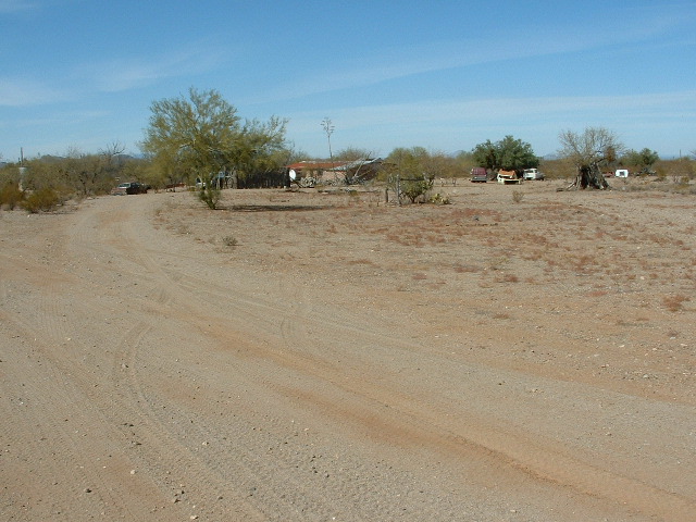
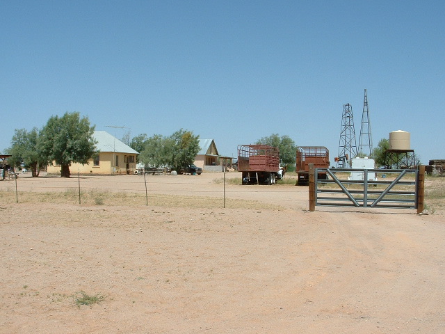
Just 4 miles west of that crossing sits an abandoned ranch called Rancho La Sierrita, only 160 yards south of the border. Andy Martin and I had driven a road just north of the border a few times to go climbing, but we knew nothing about the ranch at the time. This picture was taken very near the ranch. In late 2015, the bodies of seven men were found there, all had been shot with high-caliber rifles and left behind, some of them beheaded. This, of course, was a result of their involvement with the Mexican drug cartels. Bad business.
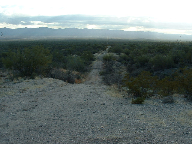
The border road.
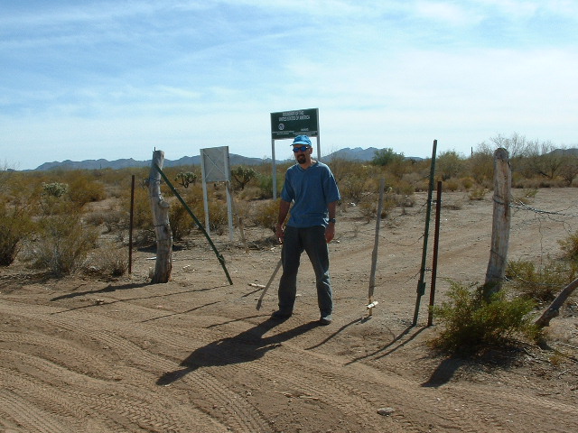
Along the border road, about 2 miles west of where Vamori Wash enters the US, we found Border Monument 145. The elements had not been kind to this one – runoff had eroded its base and knocked it over.
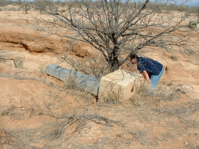
Monument 145
Once you cross the border at about 2,500 feet elevation, you are in the Tohono O’odham Indian Reservation – more specifically, in the Baboquivari Valley. I’m going to continue counting off mileages as we travel along Vamori Wash, with 22 miles as the border crossing. Around 23 miles, we pass just west of the hamlet of Hashan Chuchg. A bit later, at 26.7 miles, we are just west of the village of San Miguel. In this part of the Baboquivari Valley, all of the dozens of washes that drain the west side of the Baboquivari Mountains flow west to Vamori Wash.
Let’s continue. At 28.7 miles, we pass the now abandoned site of Ak Chut Vaya. At 33.7 miles we find ourselves about 5 miles west of the village of Choulic, where my climbing companion of the 1980s, Nathaniel Harvey, lives with his family. At 35.3 miles, we see Chutum Vaya Wash coming in from the east. This one is no trifler, running a full 17 miles from its origin high in the Baboquivari Mountains near Chutum Vaya Pass near Osobavi Peak. It runs downhill from 5,000 feet on the divide, passes the abandoned site of Chutum Vaya and, later on, the hamlet of South Komelik.
Where the Chutum Vaya Wash is absorbed by Vamori Wash, we transition into the Vamori Valley as we continue northwest. After another 5.7 miles, we pass right by the village of Vamori. The mileage here is now 41.2. A good paved road brings you to Vamori from Highway 19 (the major highway running south from the nation’s capital at Sells down to the Mexican border). If we continue downstream, for the next 8.5 miles we will be passing east of the Alvarez Mountains, the site of some good adventures in past years. The count is now 49.7. But wait – at the 51.5 mark, we pass right beside the village of Cowlic. Go 2.6 miles past Cowlic and a major wash enters from the east.
Fresnal Wash comes in to join us at 54.1 miles. This is in itself a major wash. It starts high up along the height-of-land in the Baboquivari Mountains at around 5,500 feet elevation and spends its life flowing west. Its first miles are spent dropping down Fresnal Canyon, then passing the tiny settlements of Pitoikam and Kahachi Miliuk.
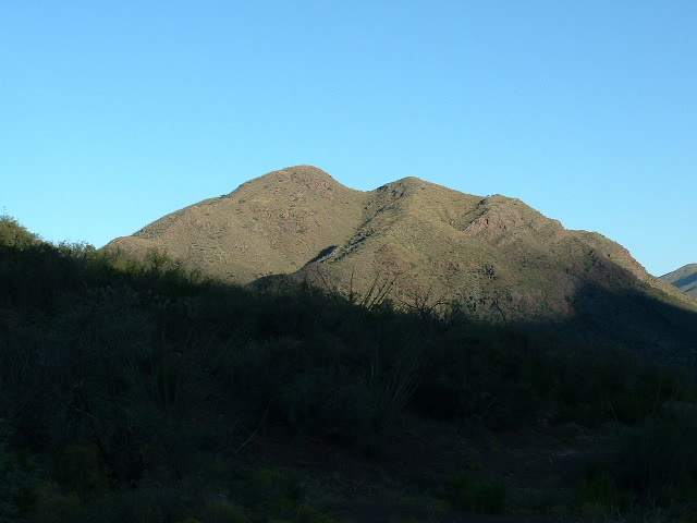
Peak 4704, high up in Fresnal Canyon
At close to 20 miles into its journey, it passes under Highway 19 just south of the town of Topawa, then continues west, grazing the north edge of the Topawa Hills. Nearing its end, it passes just north of Cowlic and empties into Vamori Wash after a total run of 34 miles. For a lesser wash, this one is important because it passes several communities along its path.
Let’s continue with Vamori Wash. Where we had left off, we had already traveled 54.1 miles from its humble beginnings down in Mexico. Still heading northwest, near Mile 59 we pass south of Pablos Charco Reservoir. At 62.7 miles, the wash is briefly impounded by Not Tak Tank, then flows out of it again. At 64.6 miles we pass by the small settlement of Chuwut Murk and its St. Theresa Mission, a sign of by-gone days. Moving on, at 69.2 miles we reach a man-made water catchment called Tonuk Vo. This is a good spot to place it, because 3 other washes flow from east to west and meet Vamori Wash near here – they are San Luis Wash, Murk Kui Wash and Sells Wash. Of these 3, only the Sells Wash is substantial, originating way back in the Baboquiviri Mountains and running 42 miles, past the town of Sells, until it flows into Vamori Wash.
Moving on from Tonuk Vo, we continue through open desert. Much of the ground we have been covering along Vamori Wash for the last 15 miles is so flat that the topographic maps have 5-foot contour intervals – that’s flat! Near 74.7 miles, we are just north of the hamlet of Kupk. There are half a dozen homes there, but when I was last there in 2004, only one of them appeared occupied – the last census counted 3 people. There’s a little church there called “St. Francis Mission”.
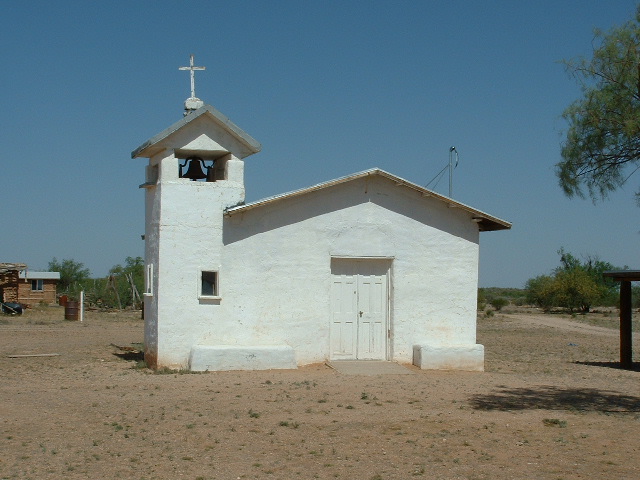
The little church at Kupk.
Continuing west from Kupk, at 81.2 miles we find ourselves to the north of the Kupk Hills, a lovely grouping with Kopeka Benchmark as the 1K highpoint. Nice climb. At 85.2 miles, our wash reaches the village of Kom Vo (also known as Santa Cruz), crosses the paved road and comes to an end at 87.4 miles where it empties into San Simon Wash. Now what? Well, we could follow this new wash as it heads south towards old Mexico. Why not, it doesn’t go too far.
Let’s call this point on the San Simon Wash mile 0.0. We are now in the Kom Vo Valley, and after 9.5 miles our wash passes between the southeasternmost edge of the Mesquite Mountains (on the west) and a small group of un-named hills to the east. Beyond that, we enter what is shown on the map as The Great Plain. Aptly-named, as it’s flatter than piss on a tin plate. Years ago, there was an attempt at farming near here – the called it Papago Farms.
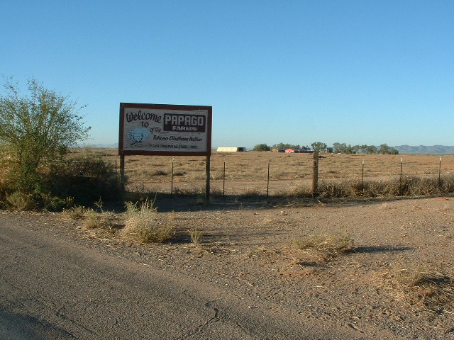
What was once the farm.
If you drive south of Papago Farms all the way to the border, you are greeted by these signs. Notice in this next one how there just used to be a few strands of barbed wire denoting the border, and even simple wire gates you could open and drive through.
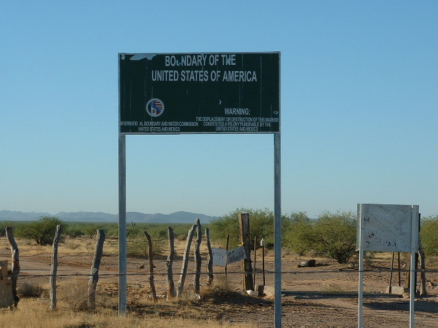
At the border.
If you’re standing on the Mexican side of the fence, you can see these signs.
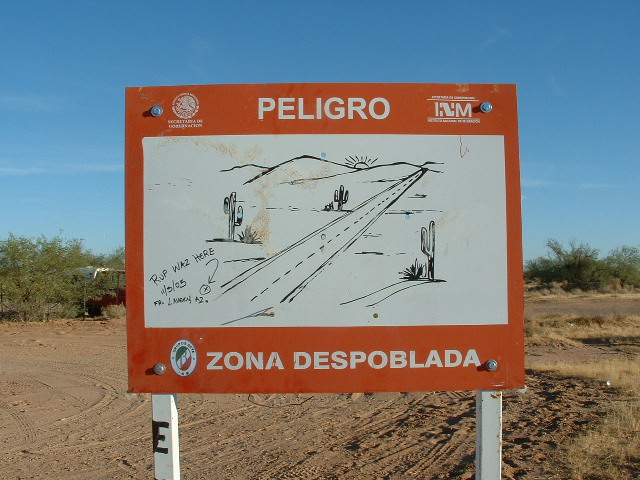
A good sign.
And here is one of my favorite border warning signs of all time.
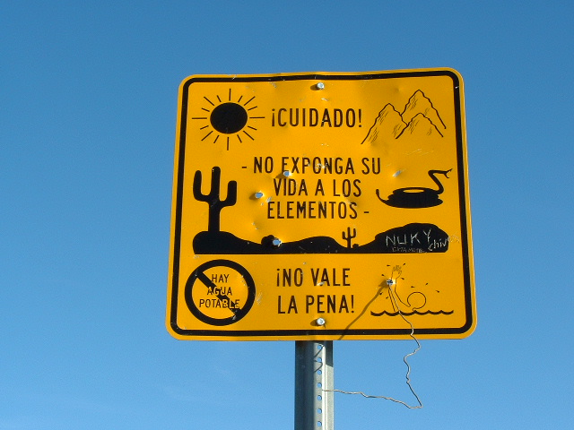
Best sign ever.
Okay, back to San Simon Wash. At 17.5 miles, the wash crosses the border just east of Border Monument 157 at about 1,675 feet above sea level. In Mexico, what happens next is hard to say. Even though I have studied maps and satellite photos, about all I can conclude is that, several miles east of Sierra El Conejo, the waters of San Simon Wash are absorbed into the desert and just fade away. I don’t think there’s much chance of any of it ever reaching the Río Sonoita. So there you have it, Folks – the obscure Vamori Wash, flowing 87.4 miles and then traveling another 17.5 miles to vanish south of the border in Old Mexico, its country of origin.
Chukut Kuk Wash – okay, if you want to talk about obscure, this is one for the record books. Not obscure if you live in certain parts of the Tohono O’odham Indian Reservation, though, but to all outsiders, yes. I’m including it in today’s discussion because it drains a significant part of the res. Ready to follow along? Okay, let’s go.
Just like Vamori Wash, this one starts in Old Mexico. Not way far in, but about 12.7 miles down, and south of the border it is called El Gato. It rises in the canyons on the east side of Sierra El Cobre. There’s nothing down on the Mexican side but a few cattle and the usual drug-runners. It crosses north into the US just east of Border Monument 149, and we find ourselves in the Tecolote Valley.
A short 6 miles west of where we enter the US can be found a notorious spot called Tatkum Vo, or as some call it in English, Serapio’s Gate (named for the site Serapio just across the line). Years ago, it had quite the reputation. There was nothing but a wire gate between the 2 countries. You could open it and drive right through.
The border fence.
Just inside the US lived an old man in this house.
There were times when Mexican Federal Police escorted loads of drugs right up to the border. Drug cartel guys would then drive north into the US, and Border Patrol would pounce on them a few miles later.
Okay, let’s go back to Chukut Kuk Wash. We crossed into the US, into the Tohono O’odham Indian Reservation, at mile 12.7. Let’s continue north. There’s not much to see yet, just flat desert. However, near mile 18.5, we pass near Tecolote Ranch. One day back in 2004, I passed by and saw a Border Patrol agent parked by the house. We recognized each other from previous encounters and had a good visit. He told me to be careful out in those parts, that there were a lot of very bad men out there (cartel thugs), willing to practice mayhem on any whose paths they crossed. He proudly showed me an automatic rifle, a recent issue, the idea of which was to even up the playing field with cartel guys, and told me that if I ever needed help, to not hesitate to call on the Border Patrol. Good visit.
At 25.1 miles, we pass by a pond – man-made, it is impounded by berms and catches rain-water runoff. It actually goes by the name Chukut Kuk.
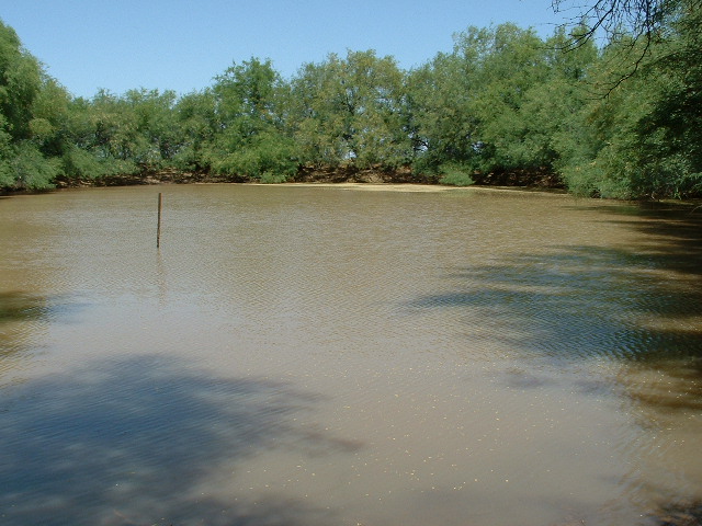
The pond at Chukut Kuk
There is an elevated benchmark by the pond.
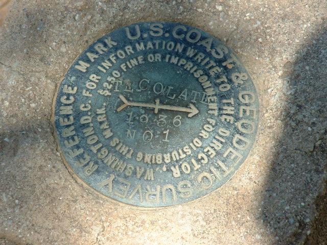
The benchmark.
Our wash continues north, then northwest, then west, and at 35.1 miles we pass near the Kots Kug Ranch. This is a working ranch, but it sure is way out there by itself. The nearest community is Gu Oidak, which is 13 miles of hard driving on dirt roads. I stopped there one time and was greeted by a beautiful young O’odham woman who lived there with her family.
The Kots Kug Ranch
If you continue west from the ranch, the wash reaches a small hill on which sits Molenitus Benchmark. Try as I might, there’s no accounting for that name. Update – Andy Martin did some of his amazing research and thinks that it is a bastardization of the Spanish word “molinitos” which translates as “a small windmill, a small mill, or a pinwheel”. I agree.
Geologists have given the name Molenitus fault to one that passes through the area.
One time I was driving a remote road in that part of the desert and it dropped down into Chukut Kuk Wash and climbed up and out of the wash on the other side. The sides of the wash were steep, so much so that I seriously wondered if I’d be able to drive back out the same way. What the hell, why not go for it? So I did, but prudently decided to return by a different route.
We entered The Great Plain 10 miles back, and will stay in it all the way to the Mexican border which we reach at 51.8 miles. This wash, like San Simon Wash mentioned earlier, flows directly into Mexico. Like the San Simon Wash, it enters a wasteland where all waters simply die by being absorbed into the desert sands.
So there you have it, Folks – two major washes that start in Mexico, live most of their miles on the reservation, then flow back south into Mexico to die. I use the word flow rather loosely, as each of them can go years without actually seeing any water flowing in their channels. Thanks for keeping me company.