
Please read Part One of this story to get the most out of this next piece.
Hello Everyone, and welcome back to our journey through the Sand Tank Mountains of Arizona. This range sits in the south-central part of the state, and occupies a space about 32 miles from north to south and 12 miles from west to east. In all of its 400-or-so square miles lives not a single person. Up until now, we’ve focused on the northern part of the range, mostly BLM land (Bureau of Land Management), but now we’ll focus on the more southerly areas of the range, much of which is within the Barry M. Goldwater Air Force Range, and much of that is off-limits to civilians at all times, an area I’ll now refer to as the Hot Zone.
Don’t forget to click on the blue links throughout the story. Every link will give you access to a photo of the peak, and also a small map. Click on the map to open up a full-screen map to see a lot more detail.
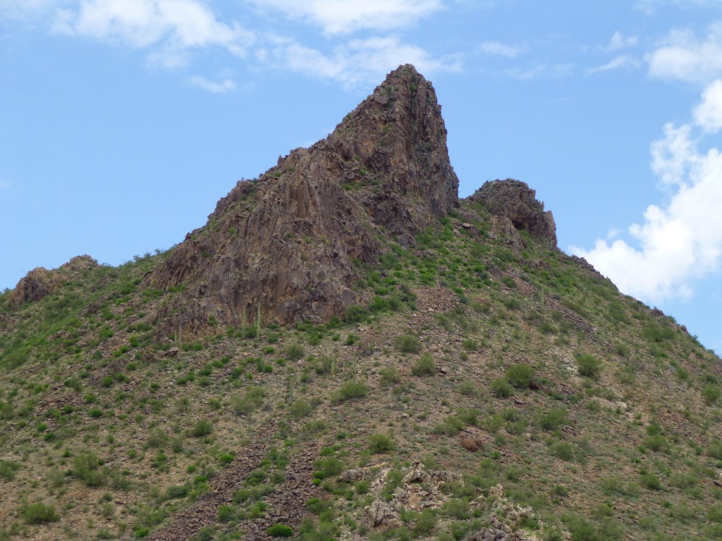
About 3 miles due south of Blue Plateau sits a most interesting peak with the name of Jack in the Pulpit. I assume it is so-named because of its unusual shape, resembling a flower of the same name which, coincidentally, doesn’t grow anywhere in the desert southwest.
This beauty was first climbed by Azb1 back in 2001 in a bold solo ascent. The solid Class 4 finish will put the fear of God into anyone who has a pulse, with a 250-foot vertical plunge yawning below the final crux moves just below the summit. Three of us went there a decade later and repeated the ascent, done foolishly without any protection. My hands get all clammy just thinking about it.
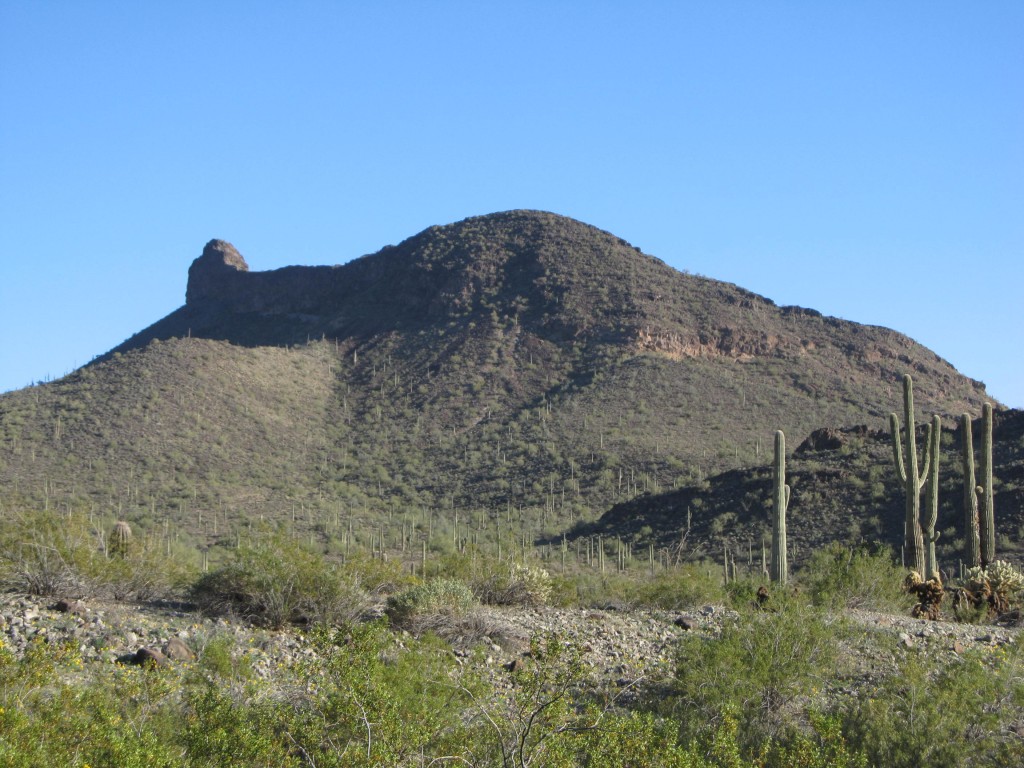
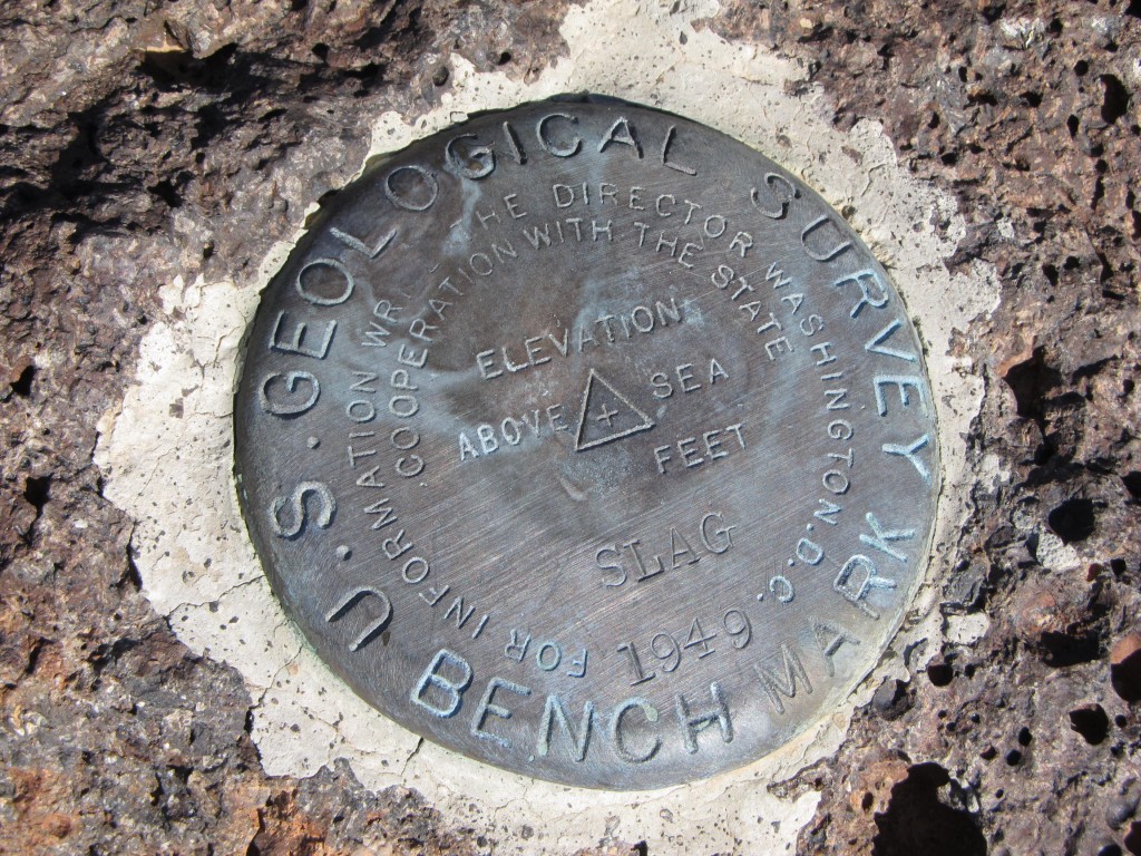
A mile due south of Jack sits a big bruiser called Slag Benchmark. Nobody visits this one, deep into the Hot Zone. Three of us climbed it in 2012, though.
Something you can see here that you won’t anywhere else is Air Force jets dropping huge bombs. Their target is Point 1735, a tiny hill only 1.4 miles southwest of Slag. The explosions are deafening, with the concussions felt inside your chest at this close range. Nearby sits Peak 2667. From it, you can follow washes to the north and a couple of miles later reach another interesting spot called Desolate Benchmark (you’ve got to love these names). We visited that one the same day as Slag.
Just a couple of miles east of Slag sits a group of 3 peaks, all sitting squarely within the Hot Zone. Peak 2263 is the farthest north of the group, and a fine-looking peak it is. Gentle Peak 2270 isn’t far away, and affords a good look deep into the heart of the bombing range. Then there’s nearby Peak 2324 – Jake and I walked in there from the road to the north.
There’s an entirely different way to approach the Sand Tank Mountains, and that’s from the east. If you leave Interstate 8 at the Vekol interchange and head south into the Vekol Valley on Vekol Road, after 9 miles on a good dirt road you will arrive at what is shown on the map as South Vekol Well. An old building or two still stand, testament to a vision of some rancher in years gone by. Here, we’ll leave Vekol Road and head southwest for 7 miles, to pass by solitary Peak 2723. Go another 2 miles to reach Peak 3357 with a wildlife guzzler tucked into its northern base. This is more of a climb than 2723 with more of a challenge waiting for you near the summit.
Now comes the fun part – if you want to approach all of the delicious peaks waiting farther west, you’ll going to have to work for them, because the road quickly goes to hell in a handbasket once past 3357. A series of torrential downpours over the past 25 years has taken the road down to bedrock in places – you’ll creep along at 5 miles per hour (if you’re lucky) while your fillings are loosened. Just over 3 miles beyond 3357, you’ll arrive at a wildlife guzzler sitting at around 2,700 feet elevation. Congratulations, you made it! Park here and don’t even contemplate driving any farther along the old road, even though it goes another mile – it’s so steep and rutted, I’d be gobsmacked if anybody in any vehicle could drive it.
Peak 3425 towers 700 vertical feet directly above the guzzler on its north side. Leave your truck and walk up the old road – in a mile, you’ll reach the site of Bender Spring, dry these many years. Keep heading northwest, up over a pass and down an un-named drainage to finally arrive at Peak 3540, where Dennis and I arrived one hot July day. Man, you really feel like you’re out there when you stand atop that one.
Half a mile, as the crow flies, to the south of Bender Spring, sits one fine peak shown on maps as Squaw Tit. Fortunately, the U.S. Board on Geographic Names had the sense in 2022 to right a wrong and re-name this one, and it is now officially known as Sand Tank Peak. This striking summit, in spite of its difficult access, has drawn about 20 climbers to its summit over the years, mainly because it has over a thousand feet of prominence. Pat yourself on the back if you stand atop this one.
One insanely-hot June day, Jake and I set our sights on an obscure summit way the hell and gone out there. It involved a lot of high-level cross-country travel beyond Sand Tank Peak, and finally we stood on Peak 3940. On our way back, we did an ascent of Sand Tank Peak before the heat did us in. There was something funny going on with the map of this area, though. On our way in to 3940, we passed by Point 3908. We could easily see that the uplift a thousand feet to the east was much higher, although the map didn’t show that. So, a couple of months later, three of us went back in to the area, approaching this time from the southeast, determined to make sense of the topography. With simple instruments and a lot of hard work, we verified that there was indeed an error on the map – they had left out a contour! Records were corrected, and Lists of John now shows the new peak as another Peak 3940, and it was a beauty – a solid Class 3 with an airy summit ridge brimming with exposure. All that hard, hot work was well-rewarded.
The new Peak 3940 which we found and climbed on August 9th, 2014.
Ever the gluttons for punishment, Jake and I went in one mid-July day and climbed Peak 3780 just for fun. This was a bit of a trek, but well worth it, once again the first climbers who had dared stealth their way in this far.
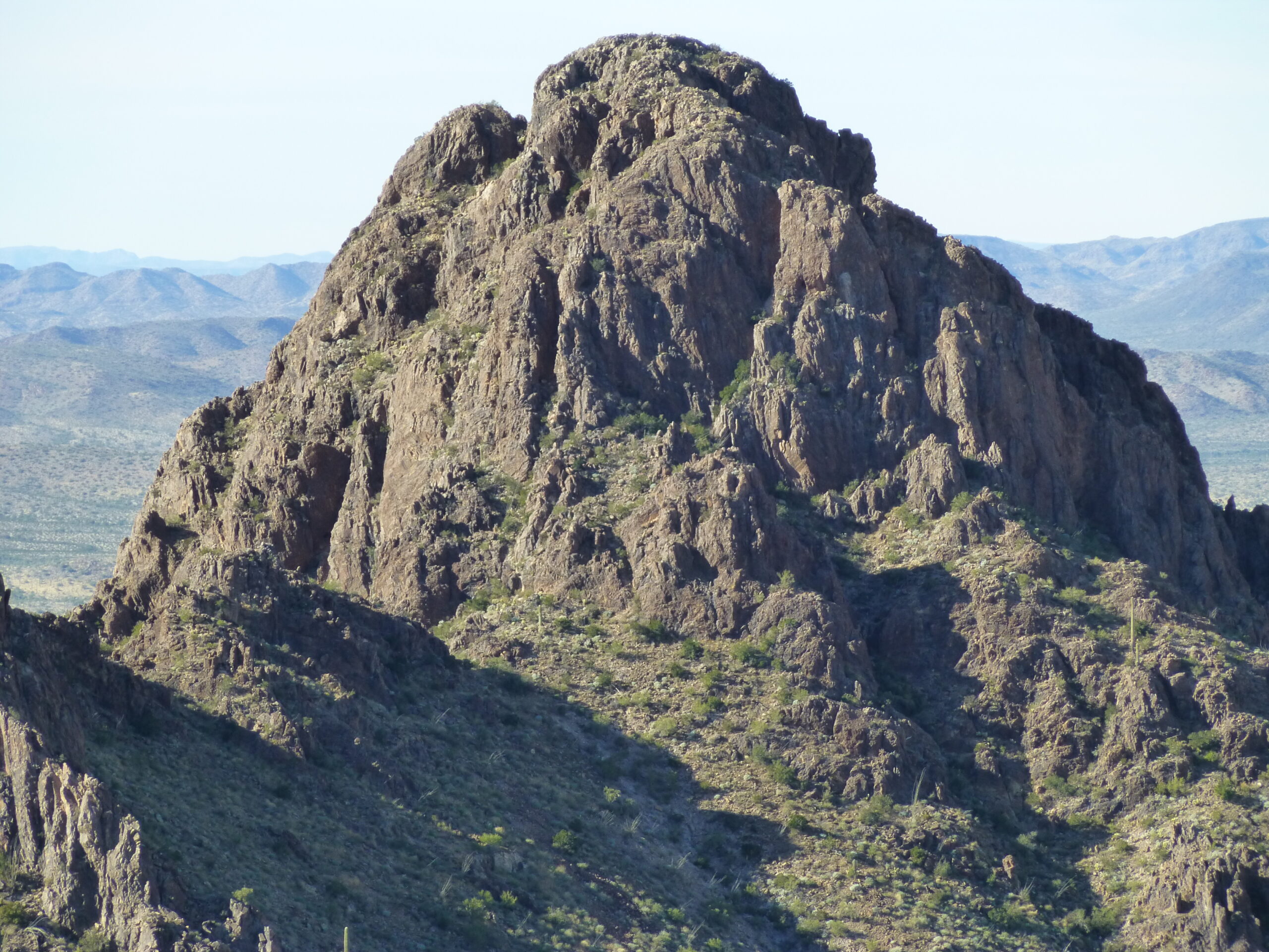
If you want to avoid the military, serious stealth climbers know to sneak into an area between Christmas and New Year’s Day (Superbowl Sunday is also a good time). The Christmas of 2014 saw such a trip. Paul and I drove in as far as we dared, then headed in on foot to bag 8 dandy peaks that had been untrodden up until then. It was not a boring time, though. Twice we were buzzed by law enforcement helicopters, once by military jets, suffered through a fall high on a peak, and discovered a route used by cartel smugglers where we destroyed cans of fuel they had stashed for their vehicles. We were west of the imposing 1,500-foot wall presented by Peaks 3940 and Peak 3780 mentioned above, in an area never-before visited by climbers. It was an amazingly-beautiful area of pristine desert, and the peaks welcomed us. They were Peak 3220, Peak 2975, another Peak 3220, Peak 2700, Peak 2740, Peak 2660, Peak 2500 and finally Peak 2588. All of this climbing was deep within the Hot Zone, and we managed to get it done and escape just before a winter storm of biblical proportions hit the area. Here’s a picture of Peak 3220, to give you an idea of how amazing these peaks were.
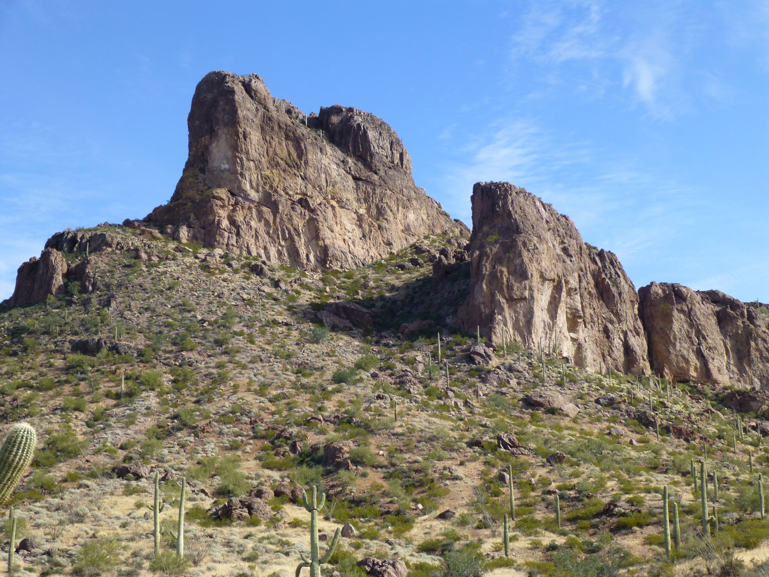
Peak 3220
In a remote part of the eastern Sand Tanks, if you know where to look, is a man-made water catchment once known as Paradise Well (you won’t find that name on any maps these days). There was even a landing strip there at one time. I discovered an ancient road that left from there and wound its way several miles into a high saddle. I last drove the road in late 2016, and it was a real challenge – a difficult wash crossing followed by a steep hill, and a spot where the road was eroded so much that I could barely pass, at risk of tumbling down the slope on the side. From the high saddle, the road actually continued down into the heart of the bombing range, but just below the saddle the road is washed out, so driving stops there.
From the saddle, you’re well-positioned for a climb of nearby Peak 3540. Not even 2 miles east of it can be found Peak 3303. Both of these are inside the Hot Zone, but nobody seems to care. In all the years I’ve been traveling out in those parts, I’ve never seen hide nor hair of the military. Border Patrol, yes, but no military.
In 2016, Dennis and I did something really cool. We camped near the high saddle mentioned earlier, then climbed up to Point 3403 and from there followed a long, sinuous ridge for miles to the southwest to finally arrive at Peak 3311. Man, talk about a peak that’s way out there back of beyond! It’s one of only a few Sand Tank peaks that lies within the Tohono O’odham Indian Reservation, but barely, by 500 feet. Another is Thorn Benchmark, at the extreme southeastern end of the range. Three more peaks lie within the Res that can be considered part of the range. These lie in the southwest corner of the Sand Tanks, and all 3 are best accessed out of the abandoned settlement of Moivayi. Peak 2679 lies a mile north of it. The summit of Peak 2913 lies only 175 feet inside the Res, and is a mile northeast of 2679. That leaves us with Peak 3667, one of the most curious peaks ever.
There is an excellent road to the summit of this peak – beautifully-graded, with culverts for drainage and erosion control – a road meant to last for a long time. On top of the peak are several concrete pads, and even metal markers with the stamp “PAA 1961” but nobody seems to know anything about this spot, what it was that stood there at one time. Some sort of buildings, I guess. Other than the pads, no trace of any buildings remains.
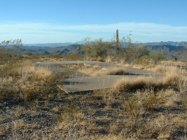
The mysterious concrete pads.
Another mountain sits nearby, Peak 2614. Isolated, out in the Hot Zone all by itself, removed from everything else. it is a stealth dash from the Res boundary a couple of miles away. This one will sit for all eternity without another ascent.
Well, Folks, I’ve saved the best for last – the only peaks in the entire range that remain unclimbed. There are 3, and they’re real doozies. The reason that they’re unclimbed is that all of them are technical climbs – well, that and the fact they sit out in the middle of the Hot Zone. God only knows I’ve tried them, but my problem was that I couldn’t find anyone to lead the climbs. I’ve explored them a bit, but couldn’t summit any of them by myself. Let’s have a look at them.
Peak 3300 sits only 3,000 feet to the north of the other two. Its weakest point seems to be the northeast side, and if I ever had the opportunity to return with a partner, that’s the side I’d attack. Here’s a good photo of that side – it’s only 300 vertical feet of climbing from the saddle.
The northeast side of Peak 3300.
Now let’s get to the elephant in the room, finally. There’s a pair of summits called, collectively, Dragons Tooth. If you click on the link and look at the map, you’ll see that there’s a west peak and an east peak. I can’t find any record of where the name came from, but it doesn’t take a lot of imagination to picture a set of sharp teeth when you look at the peaks from almost any angle. Look at the map – see the word “Tooth”. Right beside the first “o” in Tooth sits a closed contour of 3,520 feet. One year I climbed to the top of that, and I saw that the highest ground was over where they show the red teardrop named “Dragons Tooth, East”. Not by much, just a few feet, but a bit higher. One attempt was made on the East peak in 2024 but was unsuccessful. That’s the only time it’s ever been attempted. The West Peak remains untouched by the hand of man. So, Dragons Tooth remains the big prize. It’ll take someone with technical chops and no fear of trespassing deep into the Hot Zone to collect it. I wish them luck.
So there you have it, Folks – a complete rundown of all 71 peaks in the Sand Tank Mountains. It’s an amazing range, offering all sorts of fun and adventure for climbers who enjoy a challenge. Five of them are in the Tohono O’odham Indian Reservation, 29 of them sit on BLM land and 37 of them are in the Barry M. Goldwater Air Force Range. I hope you go out and enjoy them! And thanks for keeping me company on the ride.