
Most climbers have a favorite place they’ve visited, or maybe several, in the course of their climbing careers. One of mine is something called Ryans Canyon. I smile whenever I think of the days and nights spent there, so I thought I’d share some of that with you. By the way, on all of the official maps, “Ryans” is never spelled “Ryan’s” – the apostrophe has been left out by the mapmakers.
Usually when people think of a drainage, a place where water flows, you could go there and actually see water running. Here in the desert, that might not happen even one day in a thousand, so it may seem strange to think of the “headwaters” of a drainage that is always dry. But since we need to begin somewhere, I’ll use that word anyway. Let’s start you from the junction of Interstate 10 and Interstate 19 in the city of Tucson, Arizona. Then travel a distance of 96 air miles in a direction of 284 degrees by your compass. That puts you up on a remote hillside in the Sauceda Mountains at an elevation of 2,940 feet. You will be sitting in a bit of a saddle, 565 feet to the north of Point 3130. This is the highest, ultimate source of Ryans Canyon, the place where it all begins. You find yourself a mere 1,100 feet inside the Tohono O’odham Indian Reservation, right along its westernmost edge. The res is a vast land, the size of Connecticut but populated with only 11,000 people.
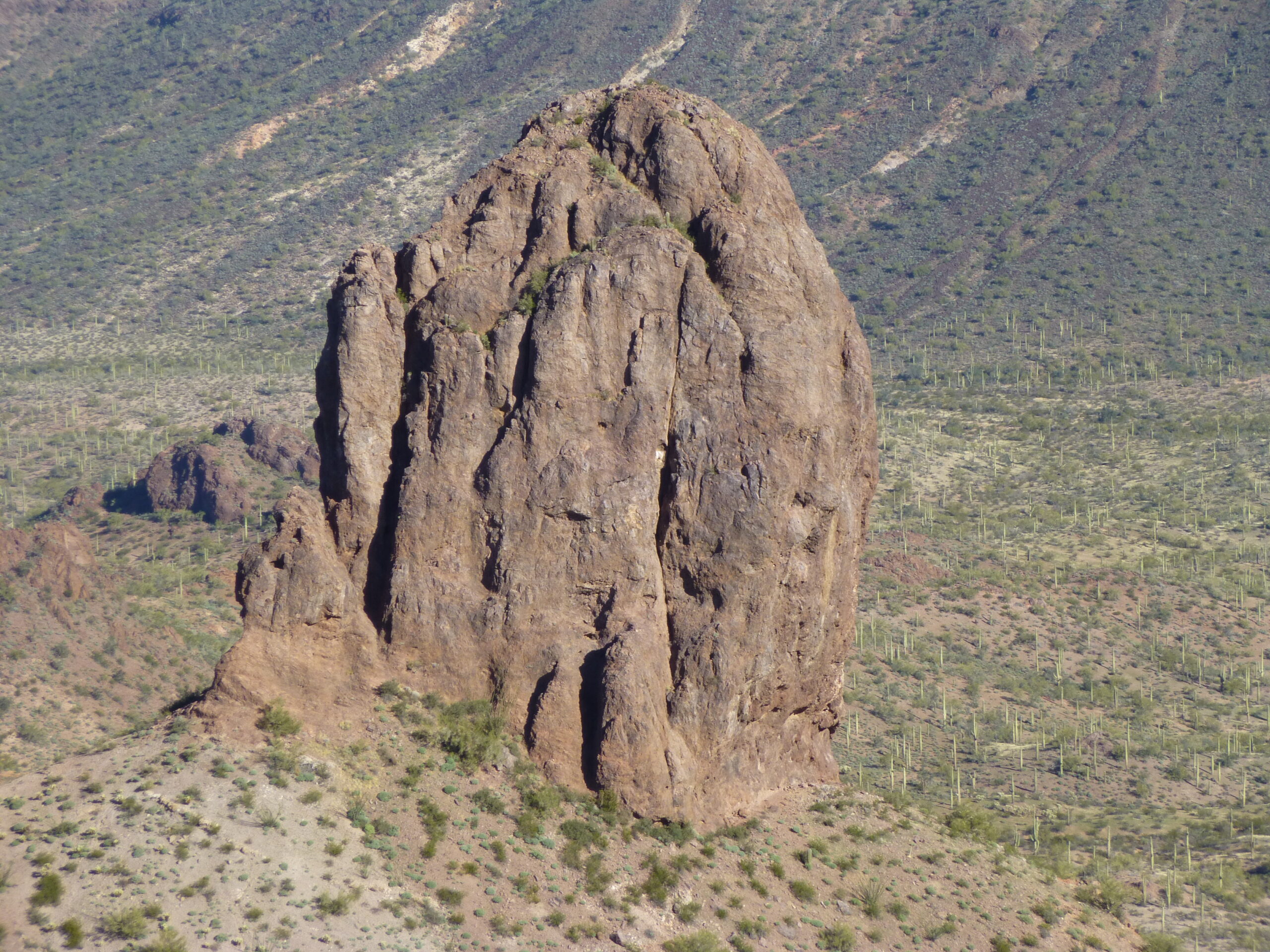
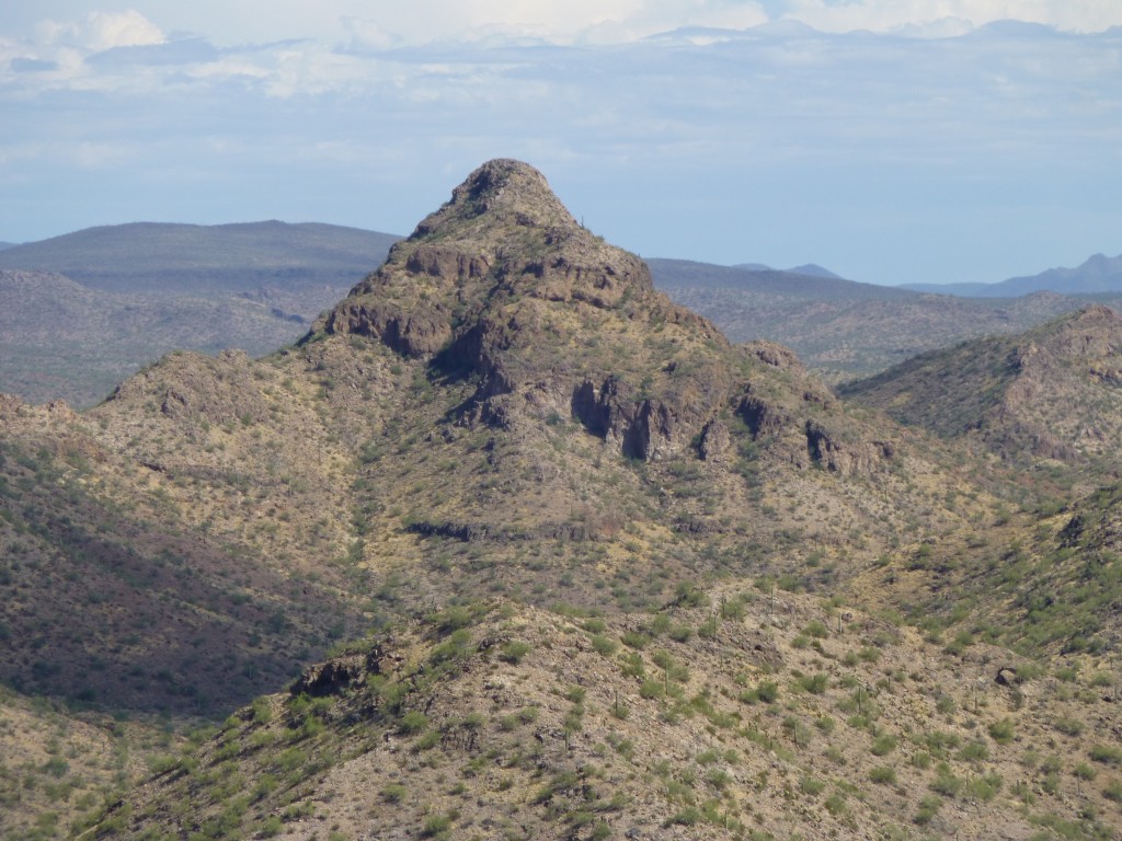
We’re going to follow the course of Ryans Canyon on its journey downhill. From that saddle, we drop almost 300 vertical feet in a horizontal distance of only 3,300 feet while heading south. At that point, we cross over ever-so-briefly into the Barry M. Goldwater Air force Range (which I’ll refer to simply as the BMG from this point on), but we only stay there for 975 feet, barely the length of 3 football fields. We then swing back to the southeast and re-enter the TOIR where, off to our right-hand side, a slope climbs up 500 vertical feet to the top of Peak 3140. This mountaintop has its highest point less than a hundred feet back into the BMG. If we climb up to the top, we get a view that’s totally worth the effort. Holy crap, talk about the elephant in the room! Look at this.
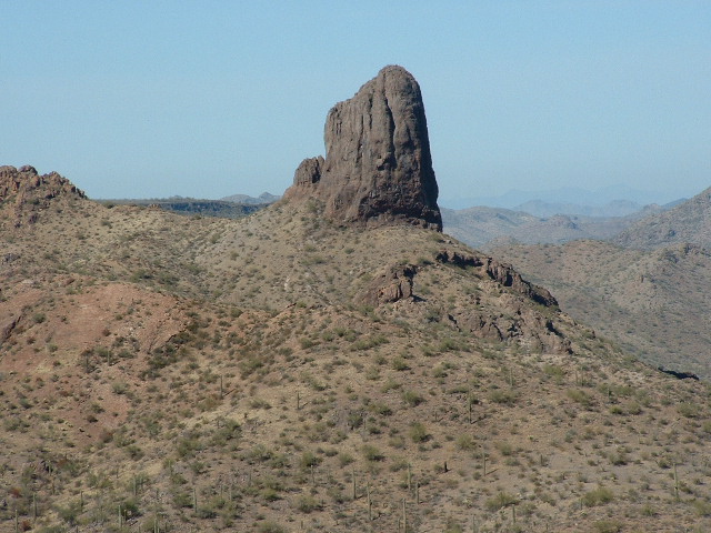
It’s Tom Thumb!
There, barely a mile away to the northwest, sits a peak known as Tom Thumb. It’s enough to put the fear of God into anyone, and it didn’t see its first ascent until early 2010, four years after the above photo was taken. It sits there, brooding over everything for miles around. The ground between it and the camera is part of the uppermost drainage of Ryans Canyon.
Continuing to the southeast farther into the res, after another mile in the canyon bottom we encounter a lot of exposed bedrock in the channel. This lasts for half a mile, then the canyon swings to the south. An old tired dirt road used to come all the way to the canyon in this rocky stretch, but the passage of time has pretty-well wiped it out along its original track which started back near the village of Stoa Pitk on the res. The next mile in the canyon takes us south, then southwest. This puts us close to one of the strangest little peaks ever, if we can even call it that. Stinson Peak rises a mighty 40 feet above its surroundings. Why anyone would ever bother to drop a name on such an insignificant bump out in the middle of nowhere is beyond me – I guess it must have meant something to someone in the distant past. Even though it’s an official name, the US Board on Geographic Names (which had to approve the name in the first place) shows no record of how, when or why the peak got that name. It sits a mere 1,900 feet northwest of the canyon.
Moving on, if we travel another 1,700 feet down the canyon, we cross from Maricopa County into Pima County. Then, we enter a full hairpin turn and exit it 1,900 feet later. A further 1,900 feet of walking down the canyon sees us crossing from the res into BLM land (Bureau of Land Management). This is fleeting, though – fleeting indeed, because only 2,300 feet later, we have left the BLM and crossed back into the BMG, where we will spend the rest of our journey. Part of the way along this 2,300 feet, a faint old road came down into the canyon and ended there. I suspect that in olden days, it may have continued east and into the res, but no more. Right where the road ended sat a group of 3 old cars: a 1950 Mercury, a 1947 Plymouth and a 1946 Hudson.
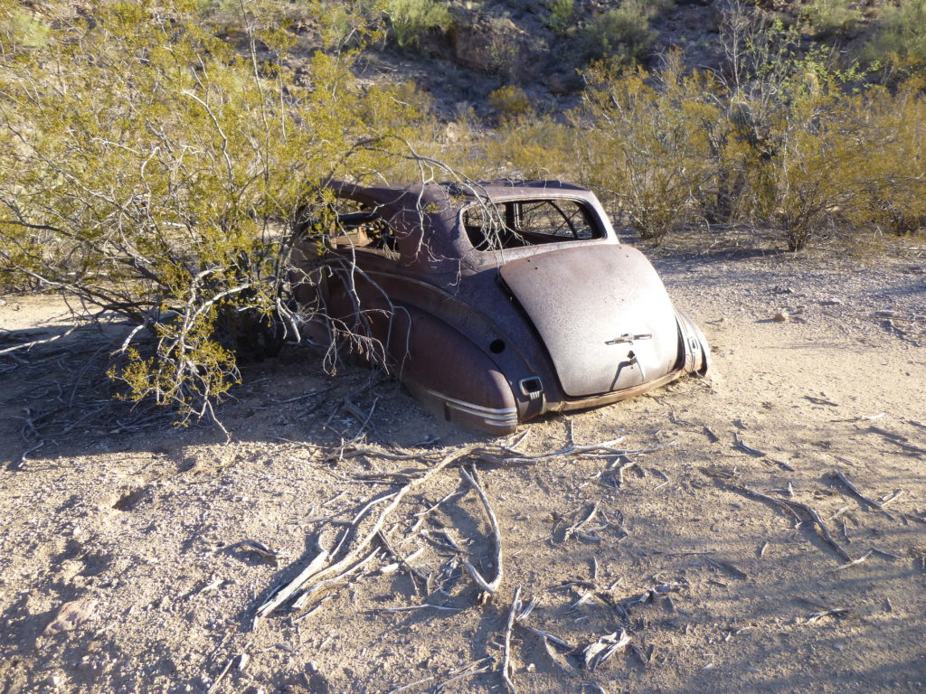
The 1946 Hudson
Another mystery, right? At this point, where we’re entering the BMG, we’ve now traveled a distance of 4 2/3 miles and our elevation is 2,383 feet. In that distance, we’ve dropped about 550 feet, and have crossed over into Maricopa County from Pima County. Travel another thousand feet down the canyon and we see a tired old road heading south. This rough track hasn’t been used for a very long time – I drove it once, and although it only goes 2 miles before it joined up with the El Paso Natural Gas Pipeline Road, I have to say that it deserves the 4WD label shown on the map – it was a real sumbitch.
Back to the canyon – if we head another 3,600 feet along the canyon bottom, we cross a military road which is in pretty good shape, although nobody drives it any more. A further 3,500 feet takes us to a wash coming in from the north. A good road (dirt, of course, as are all the roads in this piece) travels 4,000 feet northeast and ends at a guzzler (a man-made water catchment meant for wildlife). It’s as pretty a spot as you could find – I started from there one frosty morning to climb Peak 3180, seen in this next photo.
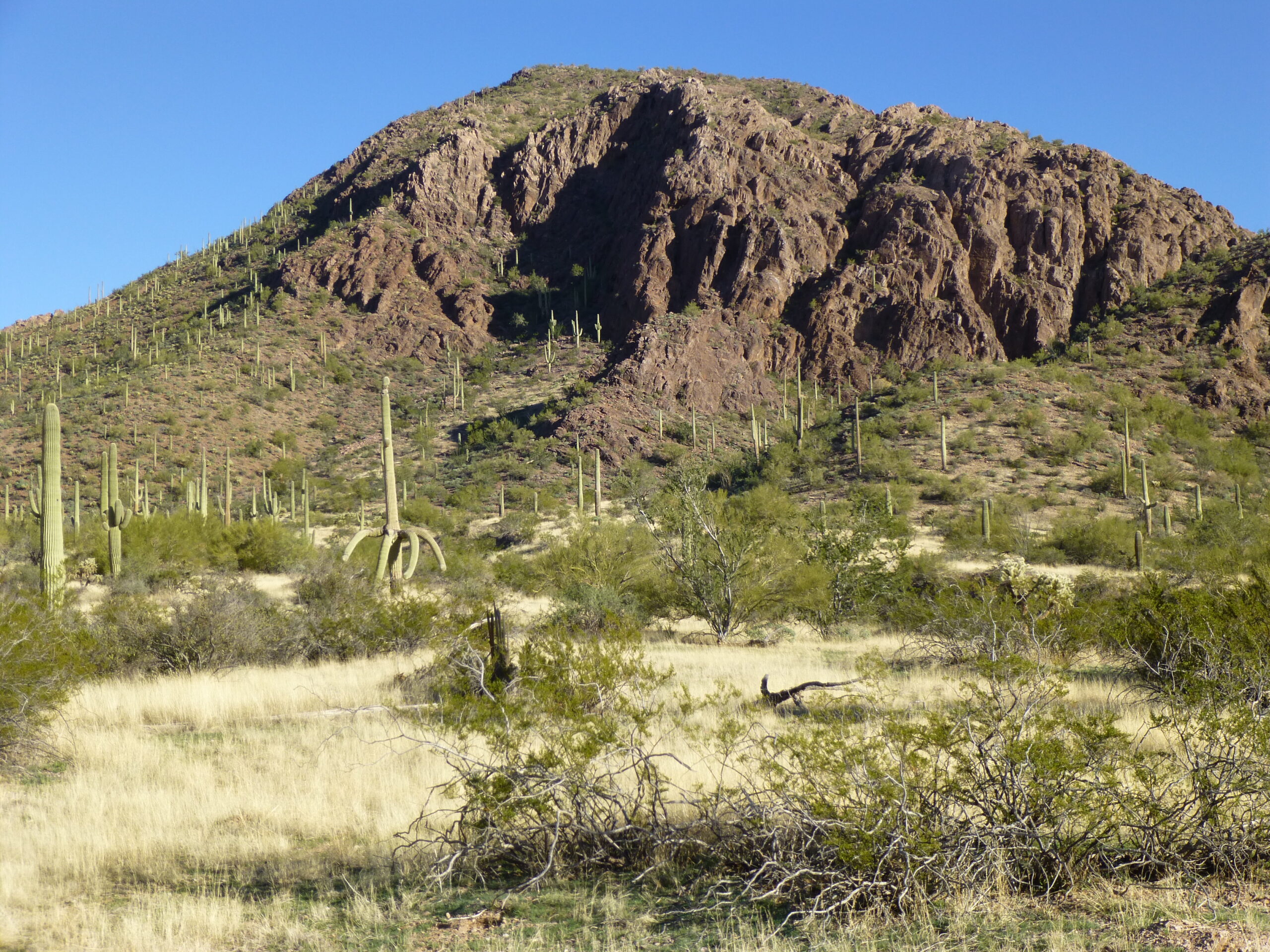
The south side of Peak 3180
When I arrived at the bald summit, I was greeted with a very special view. Remember Tom Thumb, seen in the first photo in this piece? Well, here’s what I saw from atop Peak 3180. A mere 1,750 feet away to the north as the crow flies, I had this tasty view of Tom.
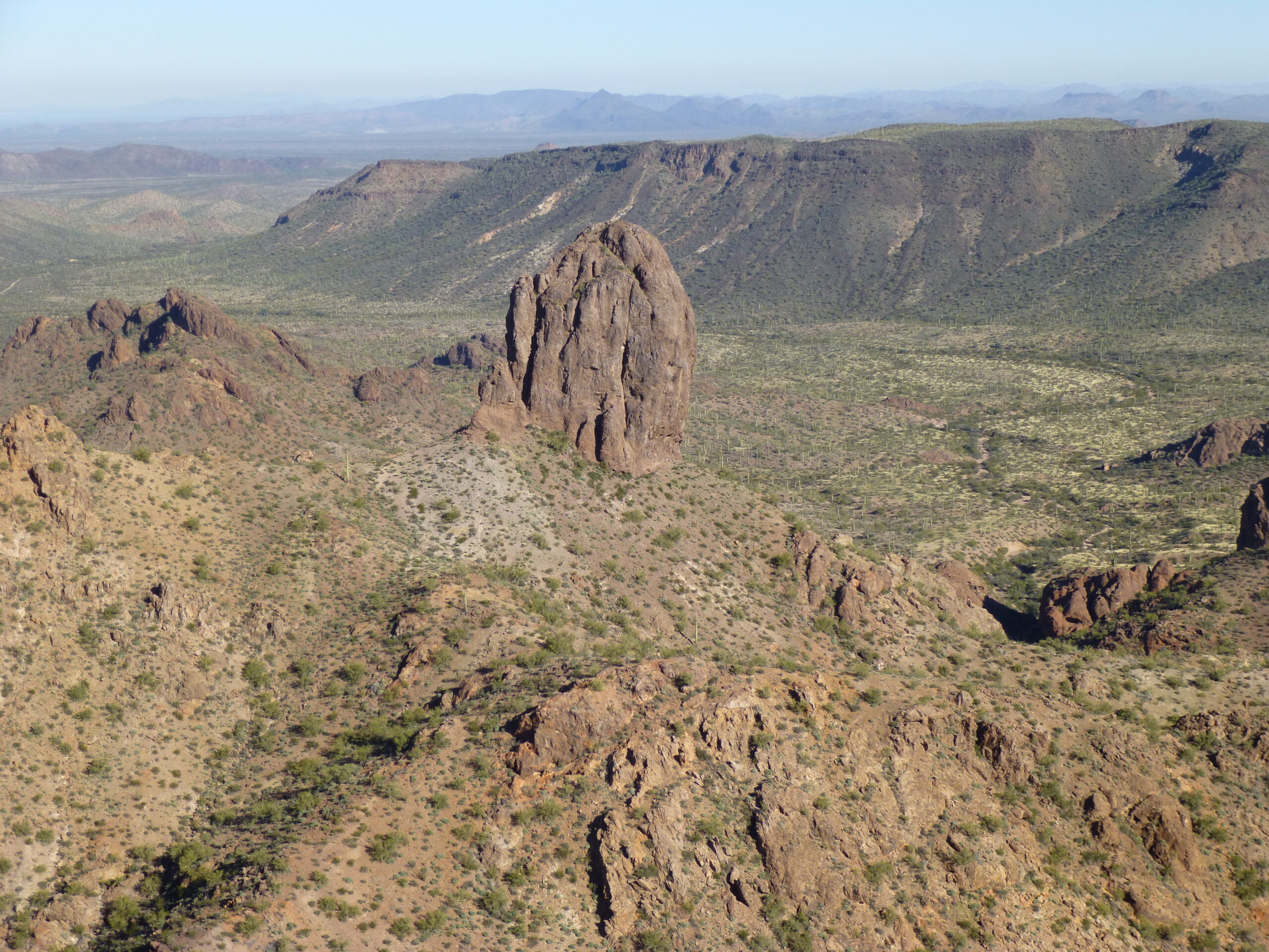
A look north to Tom Thumb.
Here’s a close-up – kind of takes your breath away, doesn’t it?
The south side of Tom Thumb. Too much Tom? – I don’t think so! How is that even possible?
If we travel another 2,800 feet down the canyon, we come to another military road. This one is more used, as it is the main access into this corner of the BMG. From where it crosses the canyon, it is a 3-mile drive south to reach the Pipeline Road. This same military road also continues north for many miles into the heart of the bombing range.
Let’s continue down the canyon itself. In the next 2.4 miles, we see no sign of man, just pristine desert. The land here is more like a wide valley than a canyon, and it’s nice and untouched. Walking in a serene place like this makes you feel like you are back at the dawn of time. But wait – what’s this? After that 2.4 miles of bliss, we come upon a rough track coming up from the wash downstream. This spot is a thousand feet east of Point 2265 on the topo map. This rough road is important, though, as it runs for a mile south and ends at another guzzler, which happens to be the perfect jumping-off point for a climb of Peak 2682. This isolated peak has only been visited once.
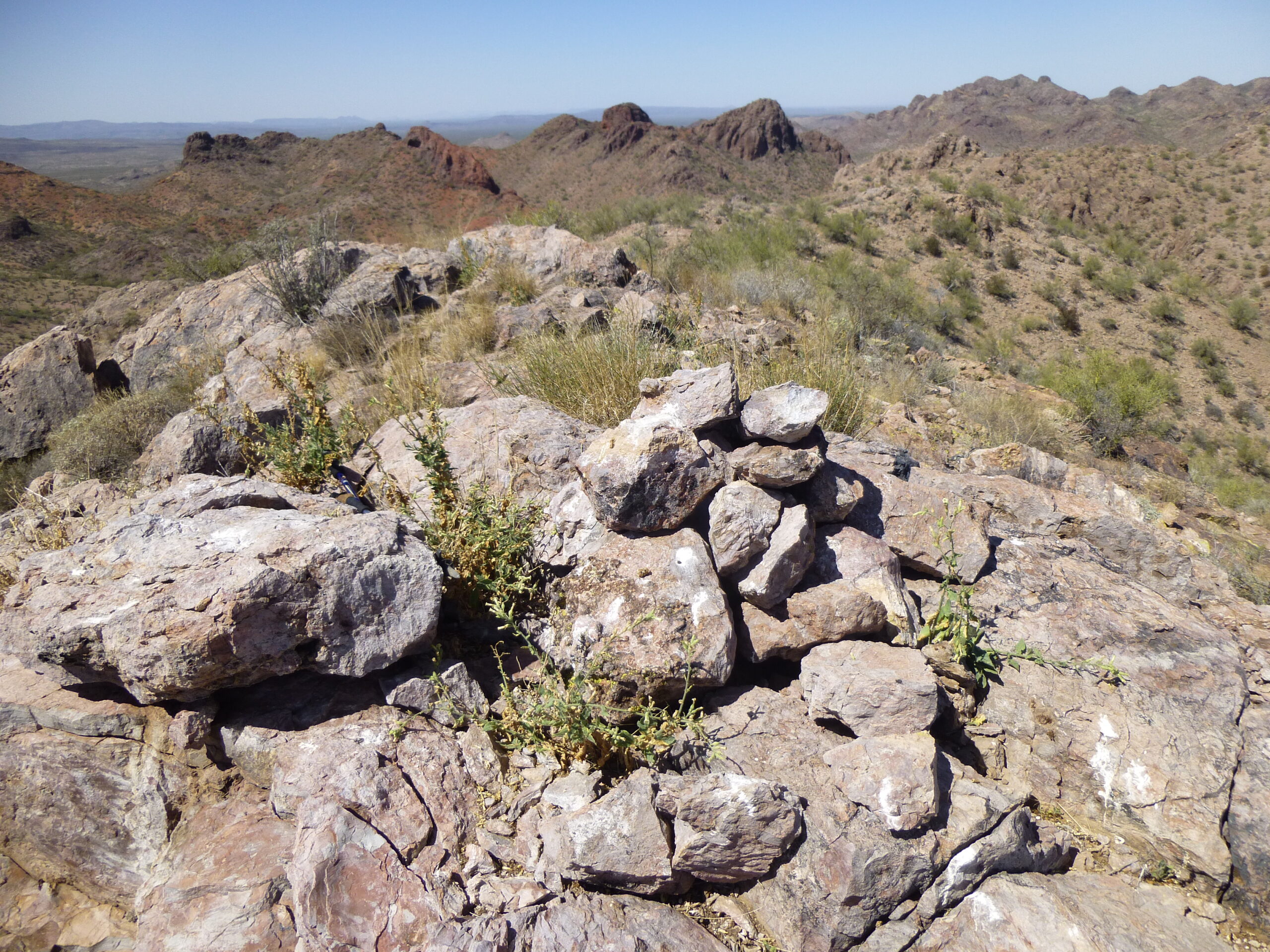
The summit of Peak 2682
If we drive back down from the guzzler to Ryans Canyon and continue downstream, we find ourselves on a better road, which weaves in and out of the canyon itself – sometimes the road is in the sandy canyon bottom, sometimes it is on the firmer land off to the side of the canyon. In any case, after a mile and a half of this, we come to a place where we find an important junction. A road cuts back sharply to the southeast up a lesser branch of the canyon and, if we’ve a mind to, it can take us to several places of note in this part of the BMG: the old corral on the way to Pistol Pass; the place informally known as Javelina Camp, once the home of rancher Mark Alley up until 1950; Cougar Canyon; and also the western foot approach to Tom Thumb.
Continuing downstream from this junction, the canyon bottom is the road. It is the only means of travel through this area, and even the topo map shows the canyon with the road marked squarely in its bottom. You need to exercise caution when driving here, as the canyon is sandy and you need to be paying attention so as not to get stuck in the many soft spots. After another 1.3 miles, we come to another junction – this one travels 3,500 feet up a side drainage northeast to another guzzler, tucked into the hills at 2,150 feet elevation. If you don’t drive up to the guzzler and instead continue down Ryans Canyon, you only need travel one more mile to park for a climb of Peak 2780. For this one, I went up a gnarly and convoluted canyon on the south side of the peak, but was rewarded by a nice ramp on the northeast side of the summit.
That climb done, let’s continue west down the canyon. After another 1.8 miles, you reach an excellent stopping place to park and climb Peak 2786. Once you’ve climbed the almost-900 feet to the summit, you realize that this is quite an unusual mountaintop. Seen from 2 miles away, it’s easy to see how flat is the summit plateau. In fact, you can walk from one end of it to the other and you’ll have covered almost 2 miles.
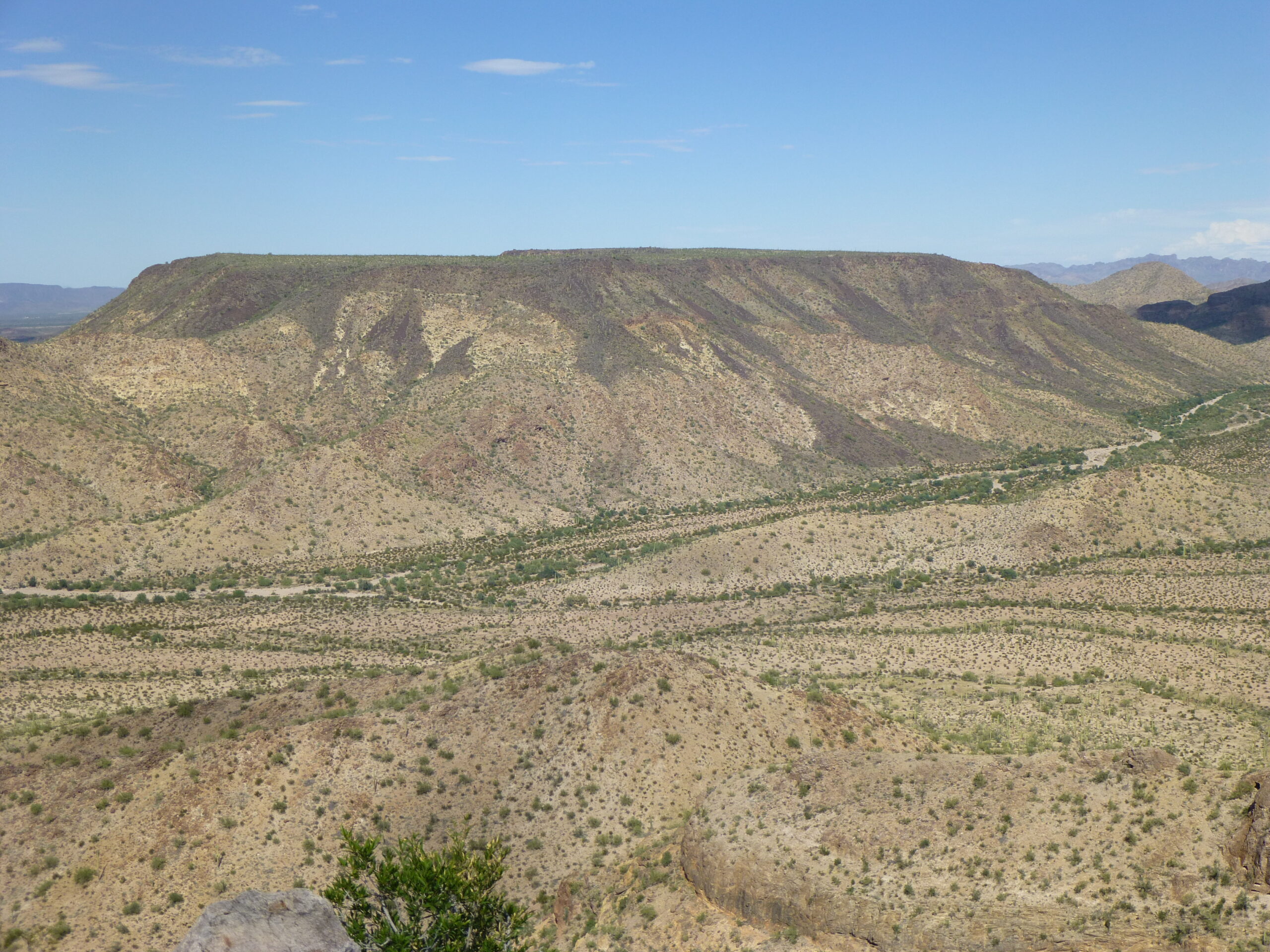
Looking northeast to Peak 2786
From where you parked to climb this peak, you can drive south on a very tired old road. Out there one steamy hot summer night, I met up with climber friend Andy B. We camped, then the next morning drove about 2.4 miles up a lovely valley to another guzzler. Here is a photo of the drinker, the part of the guzzler apparatus that actually delivers the life-saving water to the wildlife.
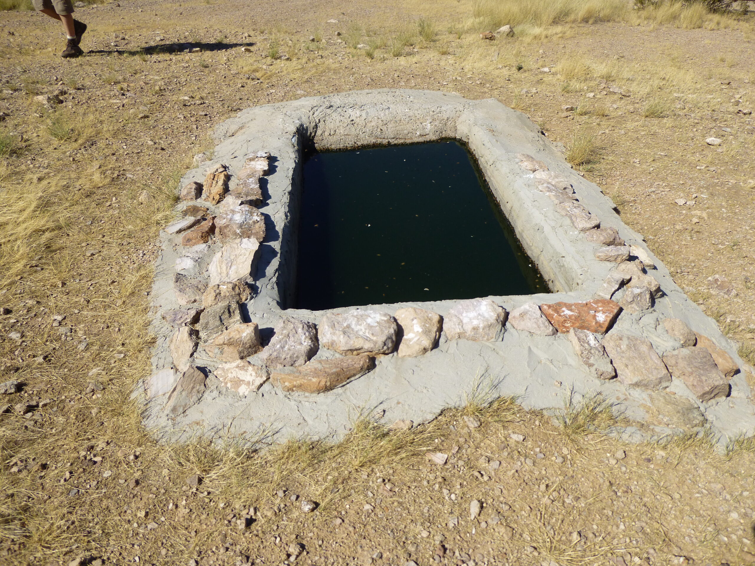
The drinker.
And here is a photo of the motion-sensor camera (works in the dark, too) that records any creatures that come by for a drink.
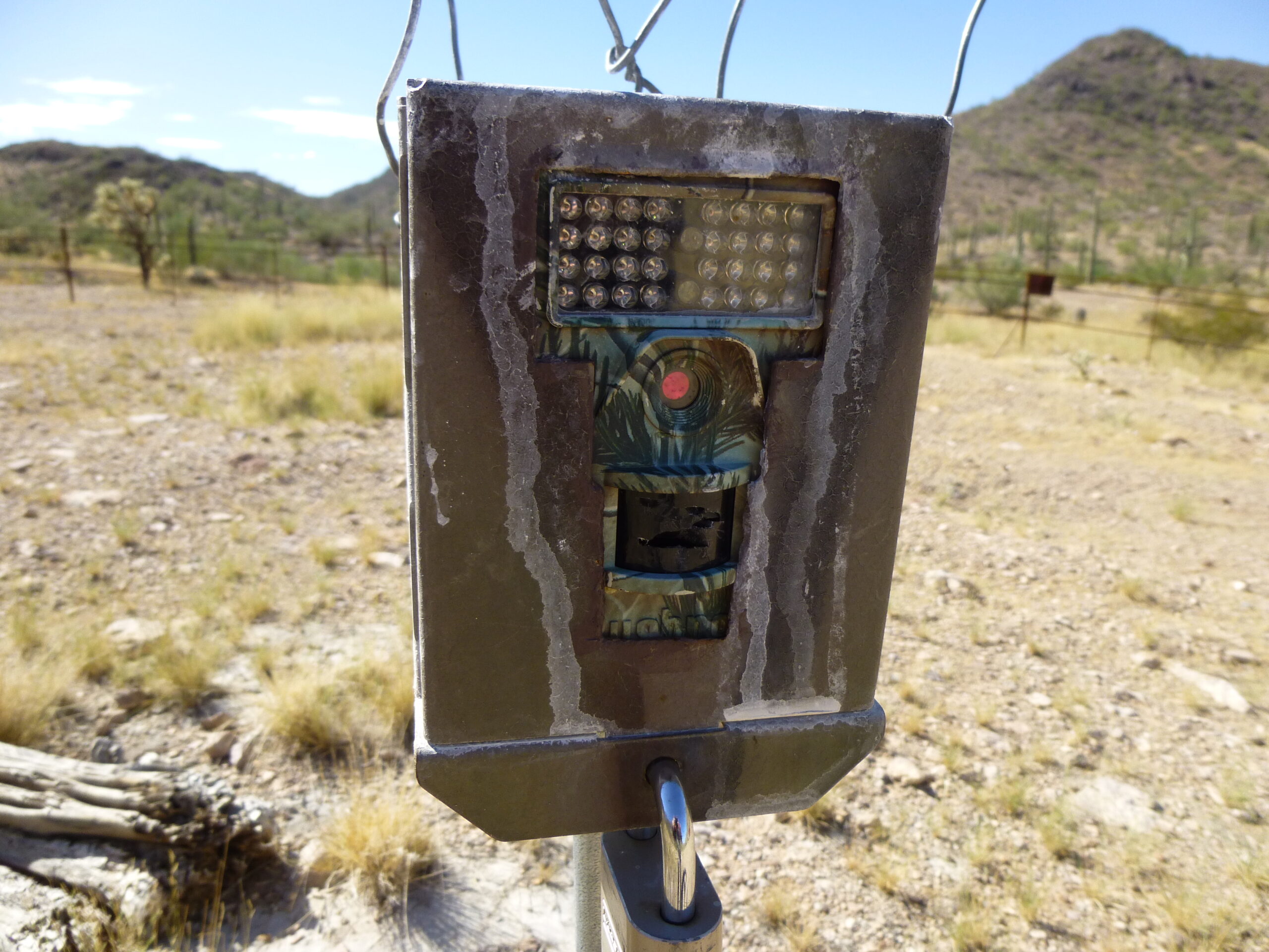
The wildlife camera.
Andy and I were here to climb Peak 2768. This is a striking peak from any angle. Here’s a good shot of it.
After the climb, we convoyed back out to Ryans Canyon. It was late September and hotter than a two-dollar pistol, so Andy decided to head home while I drove another 2.5 miles down the canyon and parked for a toilsome climb of Peak 2587. Dumb move, choosing the long summit ridge as I did. It seemed to take forever to finally stagger on to the top in the 102-degree heat. I descended by a shorter, steeper route back to my truck but the fun wasn’t over yet. When I reached my truck, I cranked up the AC to help me cool off. As I sat there, I saw a young Hispanic man walking towards me – he looked to be in bad shape. He begged me for water, and said he had a friend nearby who was unable to walk. We went over to his friend whose feet were blistered badly. They were 4 days out from Mexico on foot, had already covered 70-80 miles and had nothing but the clothes on their backs. I told them that their attempt to reach the Interstate would take several days, even for a fit and able-bodied person, and would require crossing a dangerous, active military bombing range. I offered to contact the US Border Patrol who could come in and rescue them. They agreed, but I told them they’d have to stay put until rescue arrived. I left them with food and water, then drove another 1.3 miles to where Ryans Canyon ended and I could get a cell phone signal to call the BP. It all ended well – it was not their day to die.
So, Gentle Readers, there ends your guided tour of Ryans Canyon. I have traveled its length many times over the years and have had plenty of adventures within its confines. From start to finish, I measure it at a total distance of about 18 1/3 miles. It’s a special place, and I wish we could travel it together.