
The year was 1989 – I had been living in Tucson for about a year and a half and happily climbing all manner of peaks all over Arizona. Although it was exciting to travel around the state, camping out and climbing range high points far and wide, I couldn’t help but notice that there were plenty of attractive peaks near home. A range called the Tucson Mountains stood just a few miles away, and the more I thought about it, the more I wanted to travel its high ridges and snag peaks along the way. It was the cool of winter when I decided to make my move. I was just a young whippersnapper of 41 at the time and really feeling my oats, and it felt like it was time to give it a try.
Part One
The range was much too long to travel its entire length in a single day and I knew I’d have to break it up into bite-size pieces. The north end seemed like a good place to start, so on January 12th, a friend dropped me off at the side of Avra Valley Road in the town of Marana. With just a day pack, the climbing started immediately, just a few feet south of the road. Heading southeast up a ridge, I climbed about 425 feet to arrive at my first peak of the day known as Rillito Benchmark. I left a small register, and was surprised to find a petroglyph on the top. I didn’t linger, soon continuing to the southeast along the summit ridge, crossing over bumps at 2,410′, 2,350′ and 2,370′. My goal was to follow the height-of-land as much as possible, so at the end of the ridge I dropped down and crossed busy Silverbell Road at 2,150 feet elevation.
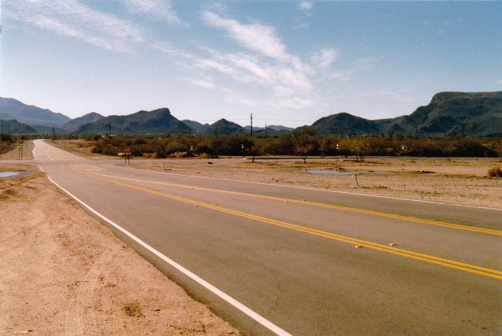
I climbed up a scruffy hillside and picked up a rough, paved road which wound its way steeply uphill to some towers, then continued south along a ridge to a slightly higher point known as Peak 2485 which also held a communications tower. Although there is a locked gate at the bottom of the north end of this road, the “No Trespassing” signs are ignored by the many who walk up the road for exercise. Once I left Point 2485, I headed south and dropped down about 230 feet, then climbed up and over a bump at 2,470 feet. Another 160-foot drop followed, then a climb up to another bump at 2,370 feet. From there, I dropped straight down to what is known as Rattlesnake Pass, elevation 2,170 feet. In this pass, I crossed busy paved Twin Peaks Road. This picture shows much of what is described above.
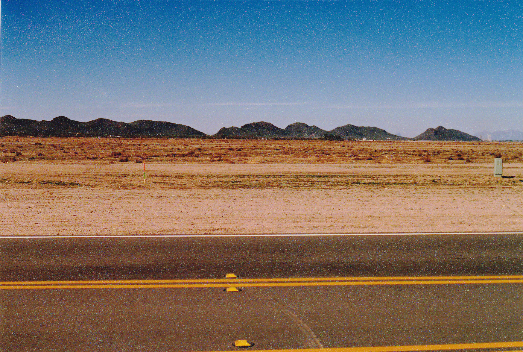
This picture is looking west to the northernmost end of the Tucson Mountains. It was taken in 1989. Nowadays, in 2025, all of the foreground is filled with housing developments.
The next mile and a quarter I followed the ridge south and crossed over bumps at 2,470′, 2,490′, 2,510′ and 2,450′, then Point 2510, with drops of as much as 100 feet between bumps. From Point 2510, I dropped down to an old dirt road at 2,230 feet. From there, my route continued generally south along the very sinuous ridge. To give you a good idea of how messy that ridge was, I soon crossed over bumps at 2,610′, 2,590′, 2,530′, 2,520′, 2,650′, 2,670′, 2,560′ and 2,650′. Next came a sizeable obstacle, the first of the day, a prominent mountain known as Safford Peak (locals often call it Sombrero Peak due to its distinctive outline as seen from the east). The east face is a fun and challenging Class 3-4 climb and that’s how I did it that day.
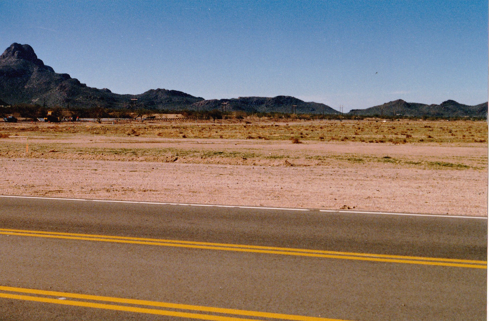
This shows the terrain I crossed before arriving at Safford Peak, which rises up on the left edge of the photo.
Something enjoyable to do is to descend the west ridge of Safford – it is very broken and involves tackling 7 distinct bumps, some of them quite sharp, as you descend to the saddle at 3,030 feet, and that’s what I did that day. Once down at the saddle, I headed west up the easy slope of Panther Peak, a quick 400-foot gain. Again, I didn’t linger but headed back down to the saddle.
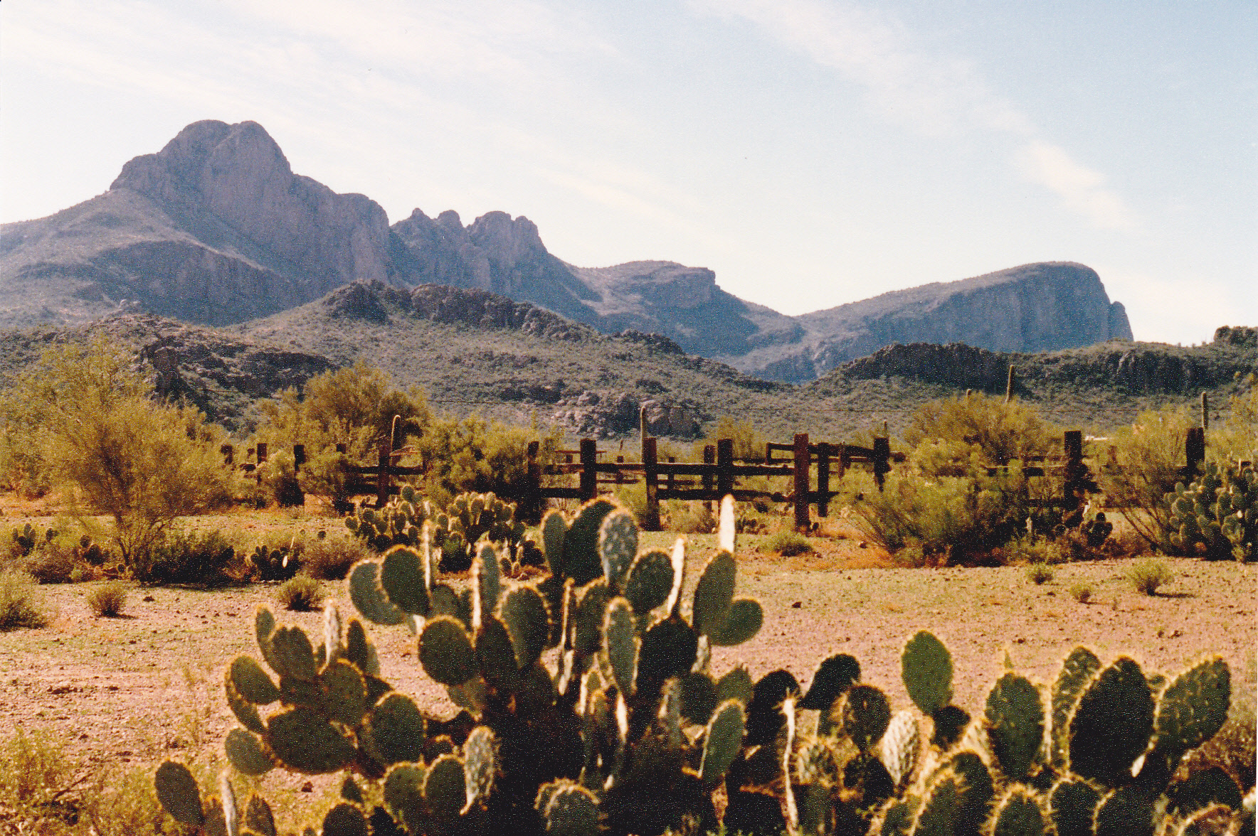
This one shows Safford Peak on the left, and Panther Peak on the far right. Some of the 7 bumps can be seen to the right of Safford.
Hmmm, how to continue from there? I decided to sidehill to the southeast, below the lowest bump of the 7, and continue to the main spine of the range which I reached at around 3,100 feet. I crossed over Point 3149, then a couple more bumps to reach Point 3263.
This shows the long ridge from Point 3149 to Point 3263.
From there, it was a drop of 700 vertical feet to reach a saddle at 2,570 feet, en route crossing a bump at 3,250 feet. Almost done for the day, I climbed up to Point 2782, gaining almost 225 feet in the process. A steep drop took me down to a wash in a saddle at 2,370 feet, then up one last bump at 2,670 feet. From there, I dropped south down to the paved Picture Rocks Road in Contzen Pass at 2,489 feet. My day was done. A friend picked me up at a nearby parking spot and drove me home.
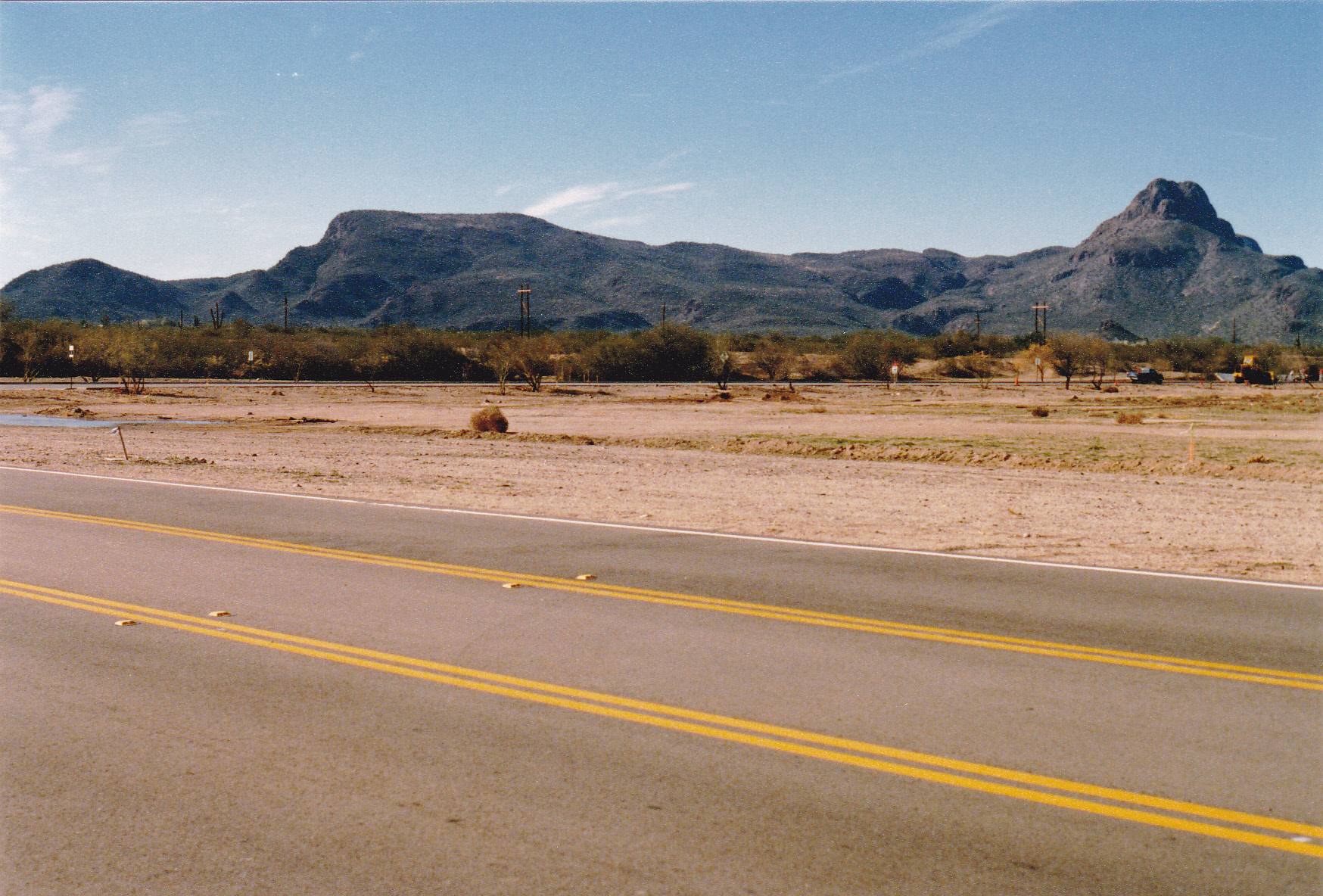
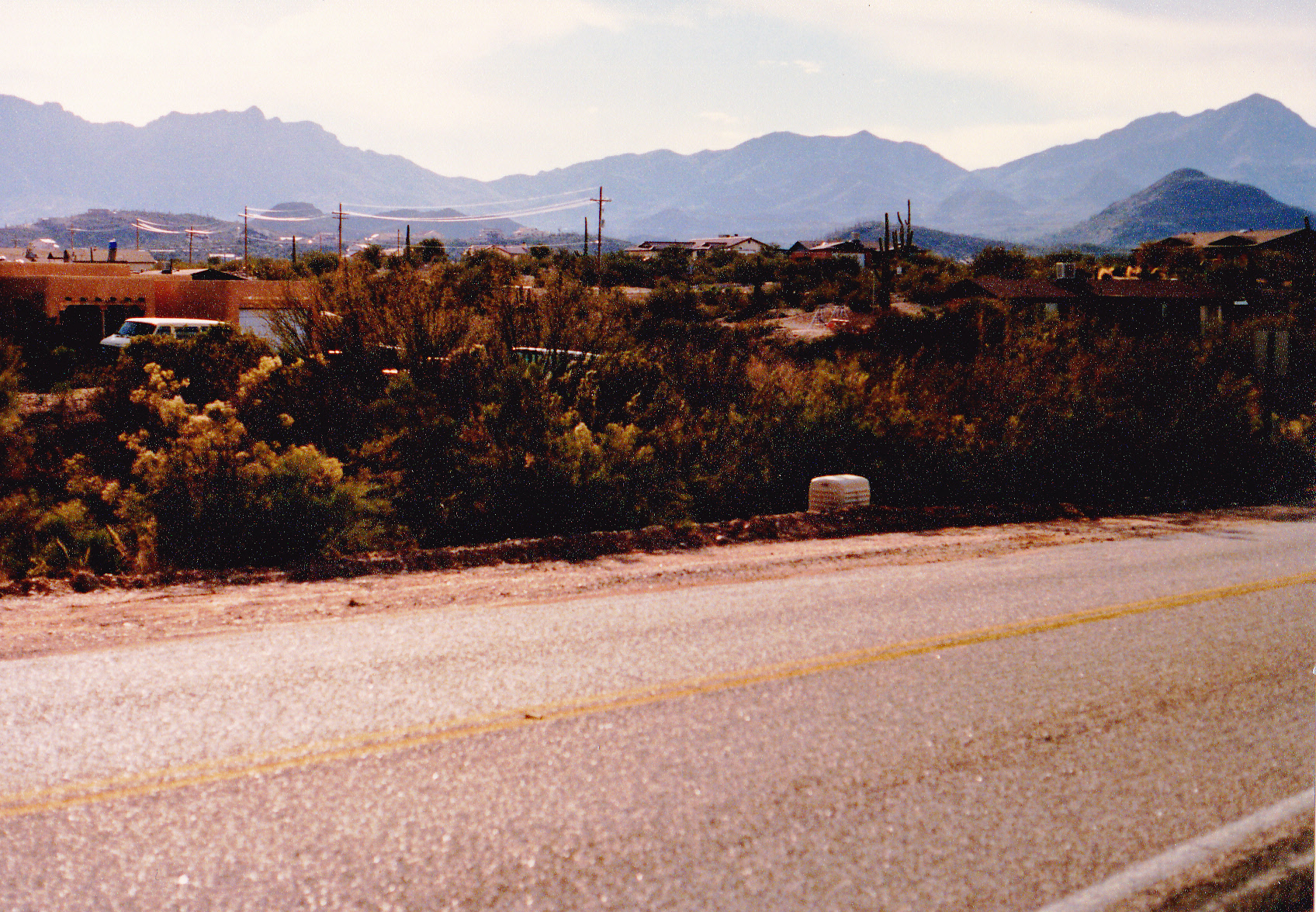
This photo shows the area of Contzen Pass. The pass itself would be about where the telephone pole is sticking up above the horizon.
That first segment involved 5,800 vertical feet of climbing and a distance of 13.2 miles. It was made easier by just carrying a day pack – most of the weight was water, but I had enough. You can see all of my route in great detail if you go back and click on the first blue link, Rillito Benchmark. That will open a small map. Click on the map and it will then open a full-page map, which you can zoom in or out as you please and follow along with the details of my description. I was excitedly looking forward to continuing with my traverse through the rest of the Tucson Mountains.
Part Two
I didn’t have to wait long. The weather in the desert is so perfect in mid-January that I felt I should seize the moment, so on January 18th, only 6 days after completing the first segment, I set out again. My goal was to get all the way to the next road through the range, but it was so many miles away that I knew I’d have to break that stretch up with camping out for one night. That also meant carrying more stuff, so I knew I’d have to do a backpack. My plan was to hit every bump along the spine of the range, so that meant a lot of extra up and down, but to me a true traverse meant just that. This was in the days before GPS or fancy phone apps showing you precisely where you were, so you had to rely on good old-fashioned orienteering skills to stay on track, using map and compass.
On the morning of the 18th, a friend dropped me off at Contzen Pass at 7:00 AM. It was a perfect, blue-sky day, pleasantly cool, and I was raring to go. My starting elevation at the pass was 2,489 feet. From there, it was a quick 400-foot climb to the top of Peak 2883, also known as Picture Rocks. There are known petroglyphs in the area, thus the name. As I continue, I’ll name all of the bumps I crossed over so you can more easily follow along on the topographic map if you so desire. Most of the bumps are interpolated elevations. From the summit of 2883, I headed down the southeast ridge, crossing over minor bump 2830, then dropped down to cross a major wash at 2,400 feet. From there, I climbed the steep west side of Point 2651. Downhill from there, south, to cross point 2610, then southwest over Point 2550. Then I walked right past the old Yuma Mine diggings before climbing up to Point 2741 at 8:20 AM. Down its west ridge a bit, then down to a saddle at 2,570 feet. It was then a climb of almost 300 feet south to the top of Point 2850.
I had been in Saguaro National Park most of the day. No other people out there, though, I had the place all to myself. Although there were endless ups and downs, the ups were predominating and I was slowly gaining elevation. Next, I climbed up to Point 2770 on a ridge, then continued south along it. Over bumps at 2,810 feet, 2,870 feet, a small one at 2,770 feet and then up to a more prominent one at 3,037 feet. South down to 2,770 feet brought me to a saddle where the Brittlebush Trail passed through. No sign of anyone else, so I continued south and up to a bump at 2,830 feet. Shortly after that, I reached Point 2913. There, I stopped for a brief look around – gaining elevation, bit by bit. In the distance, I could see a major landmark that was to dominate my entire day.
Down another 250 feet to a saddle, then up again, always heading south. Over Point 2830, and then I soon arrived at Point 2913. Half a mile away to the east and a couple of hundred feet lower sat the old Gila Monster Mine. My route headed southwest up a ridge, crossing over bumps at 2,950′, 2,990′, 3,050′, 3,130′, 3,230′ before I arrived at Point 3373. That was about a thousand feet higher than my lowest point of the day – making progress. I had just crossed over a boundary and was now inside a wilderness area within Saguaro Park. It was now time for a major change of direction.
My path now led along a ridge heading west. In short order, I passed over a bump at 3,350′, then down to and over bumps at 3,230′ and 3,210′. From a saddle at 3,150′, I climbed up to and over a bump at 3,430 feet, then past an old mine digging. Not much to see there, so I then climbed 180 feet up to Point 3549. From there, my route changed to a more southerly direction, over a bump contoured at 3,550 feet. Then came a climb of another 200 vertical feet up to and over a bump at 3,750 feet. This was followed by bumps contoured at 3,790 feet and 3,870 feet to finally arrive at Point 3,869 feet. Hey, I was getting up there!
A major goal of the day was now in plain sight. From atop 3869, I was staring at the elephant in the room. Wasson Peak, the highest point in the entire Tucson Mountains, reared up above me to the south, less than 2,000 feet away horizontally. I crossed over a minor bump at 3,870 feet, then started up the steep northern slope. It was a climb of 800 vertical feet, but even with a full pack I was moving well. I pulled up on to the summit at 1:15 in the afternoon. I can still see the look of surprise on the faces of the folks who were already on top. Even though this was a Wednesday, there were several people there. Because Wasson is the range high point and has over 2,000 feet of prominence, it is a very popular objective. There are at least 3 major, well-groomed trails that lead to the top. Even on the worst day, somebody makes it to the top, and on a good day, there could be dozens, if not a hundred or more. The views over Tucson are stunning, and it is well worth the hike up one of the trails to reach the summit. But nobody ever reaches it the way I did that day. There I was, a sweaty, dirty guy with a full pack coming from a direction nobody would ever expect.
This shows Wasson Peak on the right skyline. The other peaks are along the spine of the range to the south of Wasson.
I didn’t stick around to chat. After I signed in to the register, I moved on. The next part of my journey was easy – a trail! It dropped down to the southwest, then to the southeast, using many switchbacks, and in a mile and a quarter deposited me at a saddle at 3,860 feet, a quick drop of about 825 feet. The Sweetwater Trail came up from the east and met with my trail at the saddle. From the saddle, my next peak was plain to see – it lay just ahead to the southwest up an easy ridge. I crossed a couple of small bumps on the way to Peak 4236. The day was wearing on, so when I reached the peak I kept moving.
At this point, my route along the ridge lay south. I passed up and over bumps at 4,190′, 4,230′, 4,070′ and then another at 4,070 feet. When I reached a small bump at 4,090 feet, I dropped my pack and made a slight detour. About 700 feet away along a ridge to the southwest was Point 4121, which I visited. Even though it wasn’t directly along the height-of-land, I wanted to go there anyway. That done, I went back to my pack, shouldered it and carried on, this time to the southeast. In the next 3,000 feet of travel, I crossed over 4 small bumps at 3,930′, 3,930′, 3,770′ and 3,730′ and found myself at a saddle, shown on the map as Point 3634.
This seemed like a good place to stop for the night – it was 4:30 PM. There was a flat spot to lay out my sleeping bag – no tent, just a ground sheet (there was no chance of rain). I had a bite to eat, just some cold food. I had a splendid wall-to-wall view of the city of Tucson laid out below me – it cast plenty of light so that I could easily see what I was doing when it got dark. It only got down to 32 degrees overnight, so quite comfortable. It had been a good day with a lot of ground covered, and I was looking forward to finishing this segment the next day.
Stay tuned for the rest of this story, to be entitled “Tucson Mountains Traverse – Chapter Two.”