
I want to share with you details of a few more interesting washes found in southwestern Arizona.
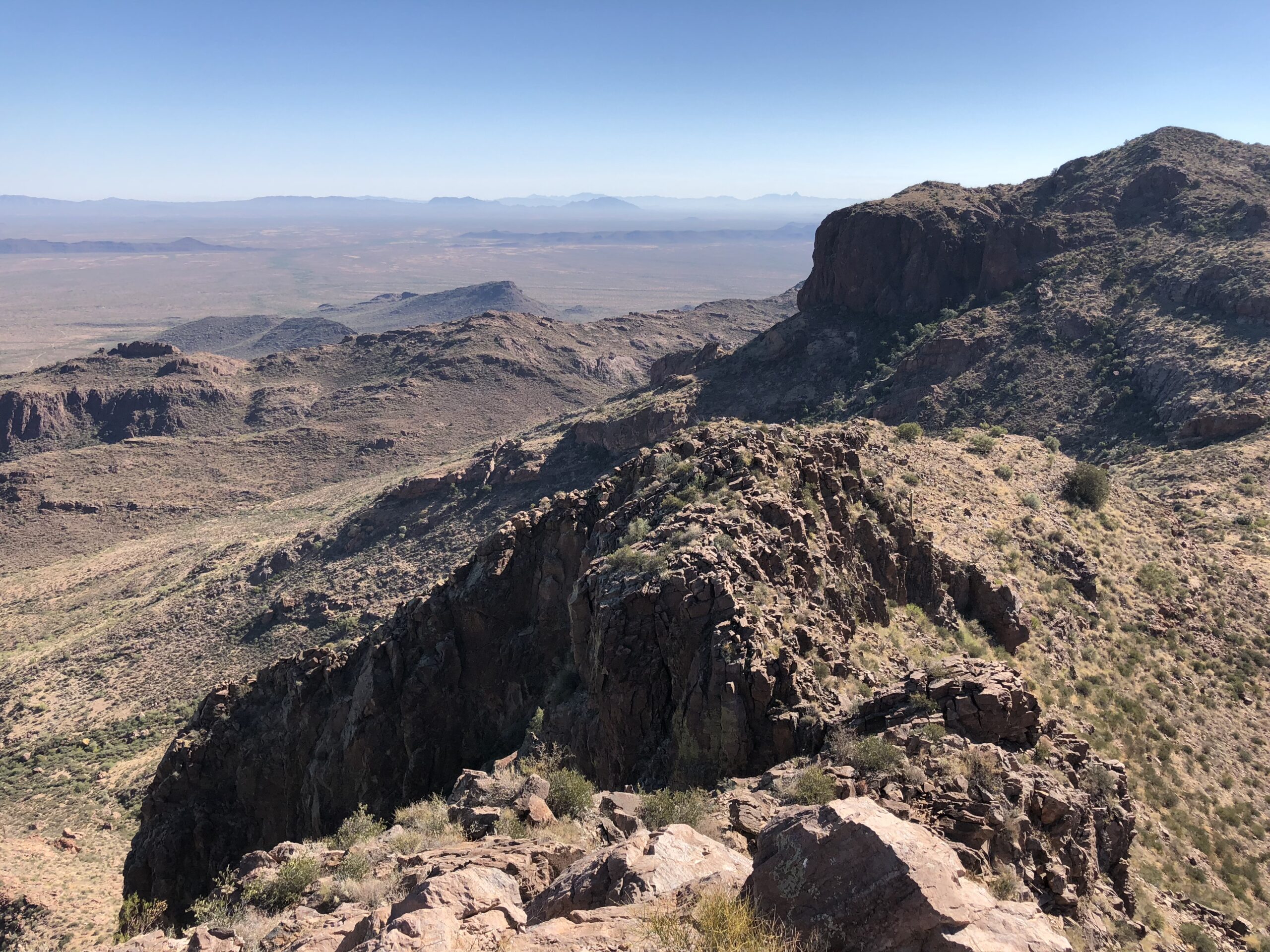
Coyote Wash – there are no fewer than 10 washes with this name in the state. The one I’ll discuss here may well be the most obscure of them all. Obscure, but major in its own way. To know it, we need to travel way down to the Camino del Diablo, down near the Mexican border. So picture yourself driving the Camino west from the Cabeza Prieta Mountains over to the Tinajas Altas Mountains. That stretch is straight as an arrow for 11 miles. I’m generalizing here when I say that most of the drainage south of the road finds its way into La Jolla Wash, which takes it all away south of the border into Mexico, crossing just west of the Sierra de la Lechuguilla. What I want to focus on is what happens on the north side of the road.
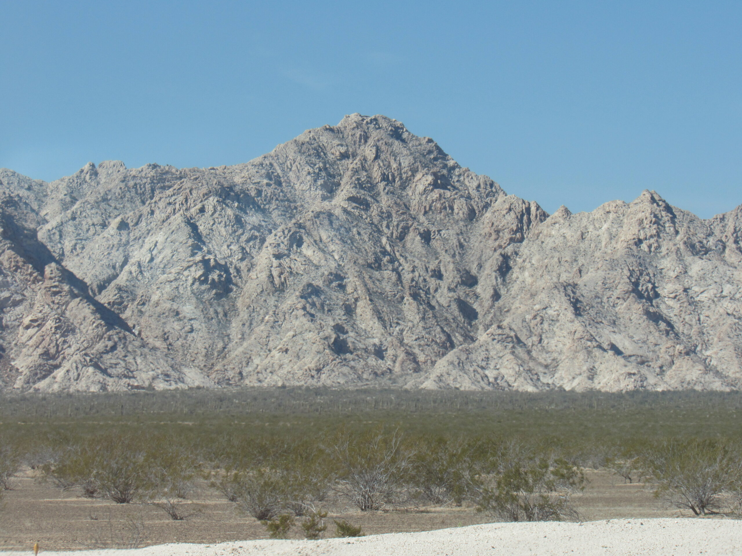
Looking west from the Camino to the high point of the Tinajas Altas Mountains.
So where are we, exactly? Well, right in the middle of the Lechuguilla Desert, that’s where. It’s not a big desert, averaging only about 8 miles wide, but virtually every bit of runoff in it runs into the middle, the low area, where Coyote Wash sits and flows north. As mentioned earlier, where we start is between the Tinajas Altas Mountains on the west and the Cabeza Prieta Mountains on the east. The smallest of washes gather and drain north, and after 10.0 miles we come to a spot shown on the map as Coyote Water. A 1925 Water Supply paper had this to say: Water can be obtained at this locality by digging in the sand of the arroyo about 4 feet. The water has an unpleasant taste, probably because of decaying roots. (Thanks to Andy Martin for researching this).
Continuing north, our wash carries on, undisturbed, staying out in the middle, the low point, of the Lechuguilla Desert. At around 19 miles, we are located between Cipriano Pass to the west (which separates the Tinajas Altas Mountains to the south and the Gila Mountains to the north) and the Copper Mountains to the east. We have been in the Barry M. Goldwater Air Force Range the whole time – this western section is managed by the U.S. Marine Corps unit based in Yuma. In this next photo, Coyote Wash is out in front of us on the flats, only about 2 miles away.
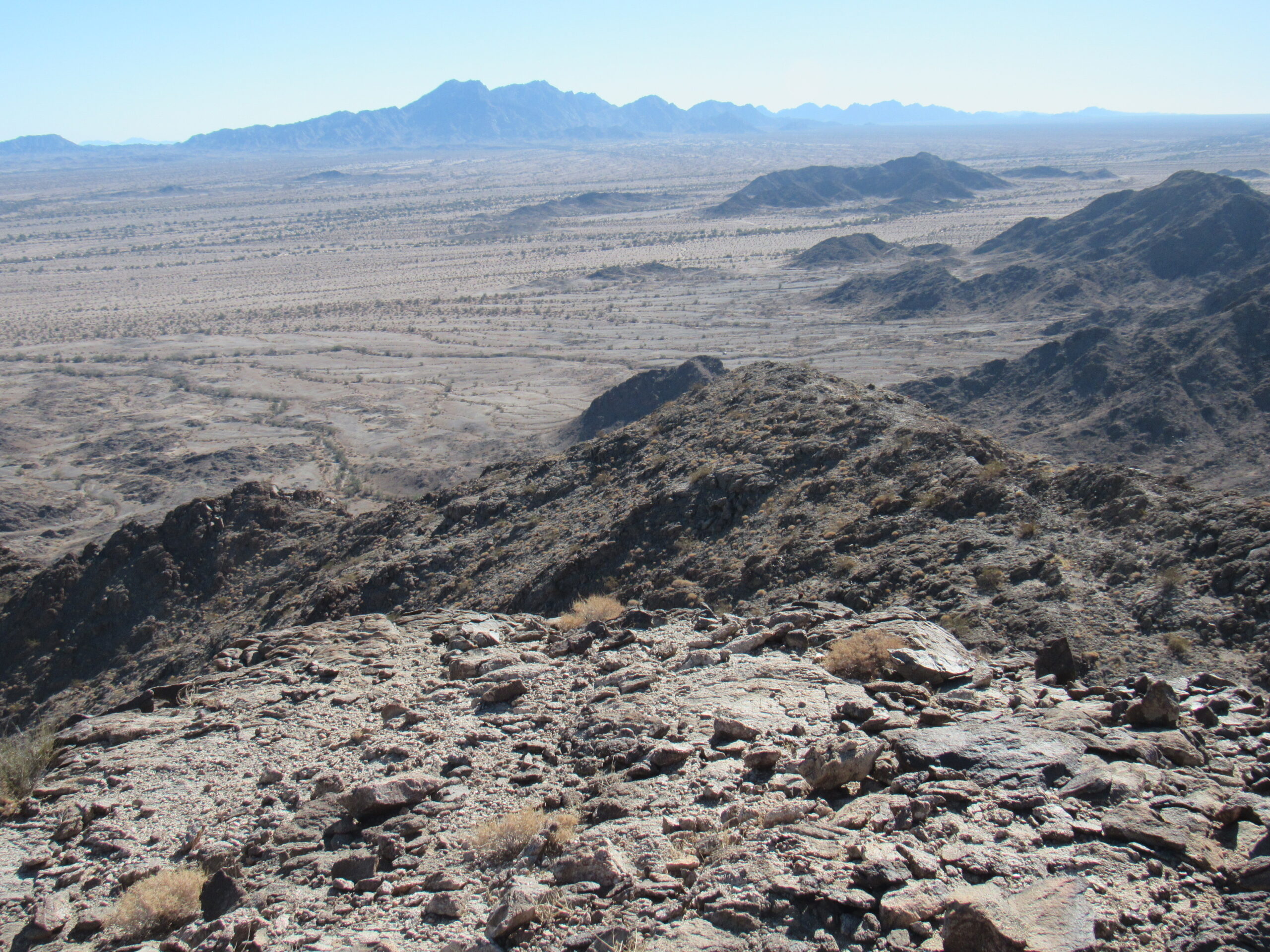
Looking southeast from the Wellton Hills to the Copper Mountains.
At the 30-mile mark, we arrive at the Wellton Hills, and stay on their east side until 35 miles into our journey. The Marines have a definite presence here.
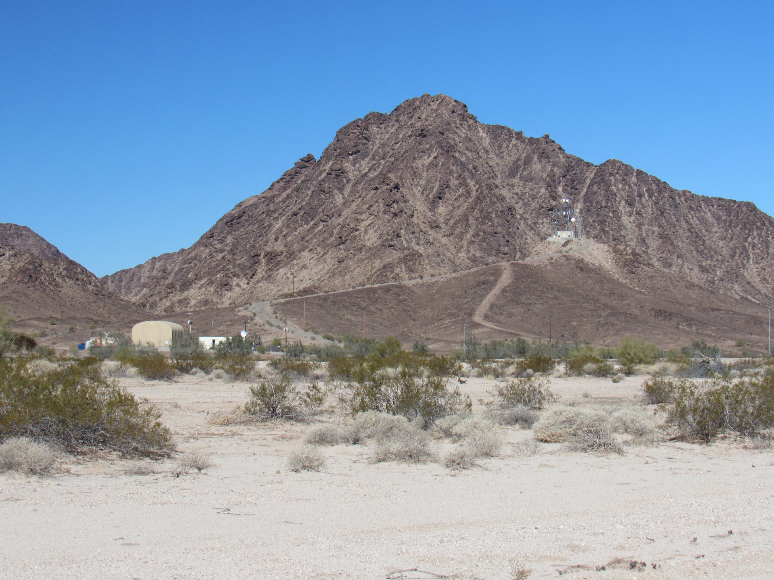
In the Wellton Hills
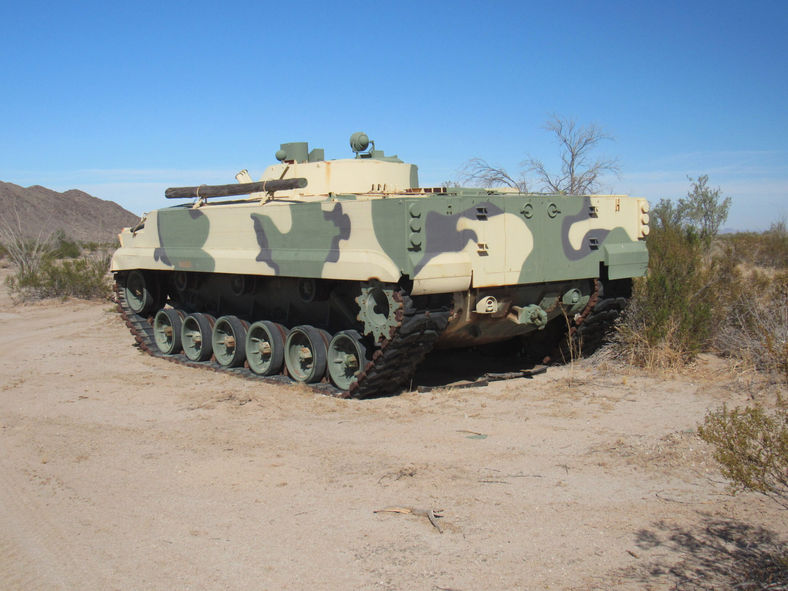
A tank discarded by the Marines.
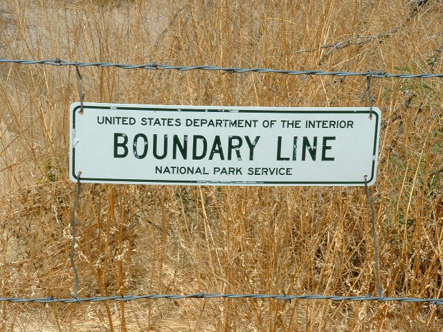
A few short miles after passing the Wellton Hills, in fact at Mile 37, we leave the military land behind, and at Mile 38.5 we reach the Mohawk Canal. This is man-made, and carries water piped from underground near the Gila River to irrigate crops. At Mile 40.5, we pass the Wellton Canal and go under Interstate 8, passing the Coyote Wash Condominiums along the way. At Mile 41.0, we reach the main line of the Southern Pacific Railroad, pass beneath, and then travel along the east side of the town of Wellton. To keep flooding to a minimum, Coyote Wash is now confined to a channel, heading straight north to Mile 42.7 and then made to turn west in the Coyote Wash Channel for another 2.9 miles. There, it crosses South Gila Levee Road and empties into the Gila River 200 feet later. That’s it – 45.6 miles after its humble beginnings, our Coyote Wash dies a natural death. We need to keep in mind, however, that 99.9% of the time, there’s no water running in this wash or most others in our southwest desert.
Growler Wash
This is a wash with an interesting pedigree. It drains land in the Tohono O’odham Indian Reservation, Organ Pipe Cactus National Monument and Cabeza Prieta National Wildlife Refuge. It does that with the help of several subsidiary washes and they need to be discussed as well. Let’s have a look at those lesser drainages and the part they play in creating Growler Wash – they all play an important part in coming together to form Growler Wash..
Let’s begin with one called Alamo Wash. Climbers who have explored the west side of the Ajo Range in its northern parts will know parts of this wash. It has 3 distinct branches. The North Fork rises by Peak 4220 and also near the exciting Peak 4180. The Middle Fork is short but originates in high dramatic country in the Ajo Range which is much traveled by drug cartel folks.
Looking southeast from the summit of Peak 3940
The South Fork is a nightmarish jungle of a bushwhack and is to be avoided at all costs, but it is the longest branch and I think I’ll start the odometer from there. Its headwaters are on the west slope of Peak 4540, so at Mile 0.0. In the first 2 miles, we drop almost 2,000 vertical feet. At Mile 3.0, we collect the waters of the Middle Fork, itself only a mile long. A short distance later, the North Fork joins us. So, at Mile 3.3, all branches joined, we are now simply called Alamo Wash. Now heading west, at Mile 4.5 we leave the mountains and enter the open desert, at the same time passing by the nice primitive campsite set up by OPC (Organ Pipe Cactus National Monument). At Mile 8.6 we pass beneath Highway 85. We are in the Valley of the Ajo, and at Mile 10.4, we pass under a power line. Alamo Wash ends at Mile 16.9 where it enters Cherioni Wash.
Cherioni Wash is pretty considerable in itself. It originates west of Highway 85 and a bit north of Puerto Blanco Drive in Organ Pipe Monument, then flows north. In a few miles, it swings to the northwest and across the Valley of the Ajo, passing east of the Bates Mountains, and finally at Mile 17.0 flows into a bigger wash on the east side of Growler Canyon. There’s not much to tell about it – it mainly flows through open, boring desert.
That bigger wash at the canyon mouth is the Cuerda de Leña Wash. Let’s trace its path. It starts near Highway 85, about a mile south of the village of Why. No, that’s not a misprint, it’s an actual community of about a hundred people. Our wash flows northwest, and at Mile 4.9 it enters Little Eberling Tank, a man-made water catchment for cattle. Now we experience an abrupt change of direction, and head southwest. At Mile 6.2 we reach Eberling Tank, and just south of there is where a major wash (Gunsight Wash) enters Cuerda de Leña. We’ll come back to that one later. At Mile 12.4, we cross into Organ Pipe Monument. At Mile 14.3, another major wash enters (Kuakutch Wash), and we’ll come back to that one too. At Mile 17.7, Cuerda de Leña wash joins Cherioni Wash at the canyon mouth. Okay, let’s discuss those 2 other major washes mentioned in this paragraph, as they’re important.
Gunsight Wash forms out on the Tohono O’odham Indian Reservation, miles to the east and on the north slope of Peak 2790, the high point of the Gunsight Hills. It passes some old mining activity, then a few man-made tanks for watering cattle, then almost reaches Highway 86. At this point, it has traveled 9.0 miles. At Mile 9.6, it crosses Indian Highway 5, then passes the village of Schuchuli, population 83. Heading west, then northwest, our wash crosses under Highway 86 at Mile 15.9. Through open desert, Gunsight Wash empties into Cuerda de Leña wash after a run of 21.1 miles.
Kuakatch Wash is one of my favorites. It has its origins up in the high country of the Ajo Range near Peak 3820. That is in the Tohono O’odham Indian Reservation.
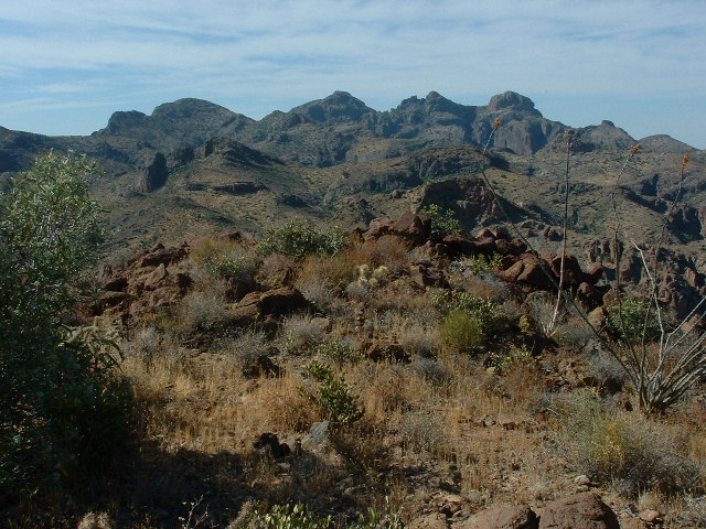
Looking south along the spine of the Ajo Range
Once the wash has traveled 4.0 miles, we find ourselves at Barajita Well. Look at the beautiful stone water tank.
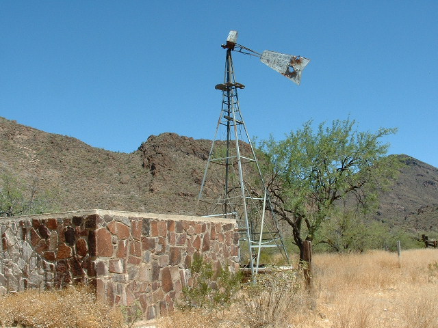
The windmill doesn’t pump anymore.
The well is surrounded by 4 very scenic peaks all close by. They are Peak 3542, Peak 3340, Peak 3137 and Peak 2900. After leaving the well, the wash heads east a bit, then swings north along the eastern edge of the Ajo Range, and stays there until Mile 9.4 where it enters Kuakatch Pass. Here, it squeezes between high dramatic mountain walls, then pops out again to deposit us at the hamlet of Kuakatch at Mile 10.4. By the way, in the O’odham language, the name means “End of the mountain”, which is apt because the Ajo Range comes to an abrupt end right there by the hamlet. There are a few houses there, mostly abandoned, but a few people might still live there. Like nearly every O’odham community, no matter how small, there is a tiny Catholic church.
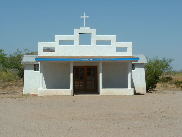
The little church in Kuakatch.
Right next to the hamlet (I love that word) at Mile 10.7 we enter Organ Pipe Monument.
The edge of the national monument.
Google says that in Britain, a place cannot have a church if it is to be called a hamlet – otherwise, it is a village. Oh well, it’s no village to me, with only half a dozen people living there, and that’s on a good day.
Our wash now heads northwest across open desert to the south of the Gunsight Hills, and crosses under Highway 85 at Mile 18.0, and a mile later crosses below a power line. We pass by the old Armenta Ranch at Mile 23.5 – there’s nothing there these days, an old building and what’s left of a corral. No matter, in 3 more miles our wash comes to its end when it enters the Cuerda de Leña Wash.
So now what should we do? This piece was supposed to be about Growler Wash, right, but so far all we’ve discussed are its tributaries. All of them have ended by the time we reach the mouth of Growler Canyon, which is where the name “Growler Wash” actually begins. So here’s what I’ve decided to do. I’ve always felt that if you are to determine the length of a river, you should start the odometer at the beginning of its longest tributary. So, staying true to that idea, I’ve calculated the length of each tributary by how far they run from their source until they reach the mouth of Growler Canyon. If I do that, here’s what I come up with.
Cherioni Wash runs for 17.0 miles. Alamo Wash runs for 16.9 miles plus 5.0 miles in the Cherioni for a total run of 21.5 miles. Cuerda de Leña Wash runs for 17.7 miles. Kuakatch Wash has a run of 26.5 miles plus another 3.3 miles in Cuerda de Leña Wash for a total run of 29.8 miles. Finally, there’s Gunsight Wash – it runs for 21.1 miles, then 10.4 miles more in the Cherioni Wash channel for a total run of 31.5 miles. Therefore, the winner as the longest tributary of the Growler is Gunsight Wash. Since we must consider it as a part of the drainage of Growler Wash, we need to reset the odometer at the east end of Growler Canyon at 31.5 and keep counting from there as we follow Growler Wash downstream. Here we go.
At Mile 31.5, we enter Growler Canyon. Here, the wash flows between steep mountain walls 500 feet high, the canyon at times narrowing to only 575 feet in width. Remember, water rarely ever flows in these desert washes, but when it does it can be substantial. It’s enough in Growler Wash that the channel sports lush vegetation along its sides. It’s a lush tangle of growth which you have to fight your way through. I know, I’ve done it several times, both in daylight and also by the dark of night. This photo doesn’t do it justice, but it does show how wide and major a wash Growler is by now.
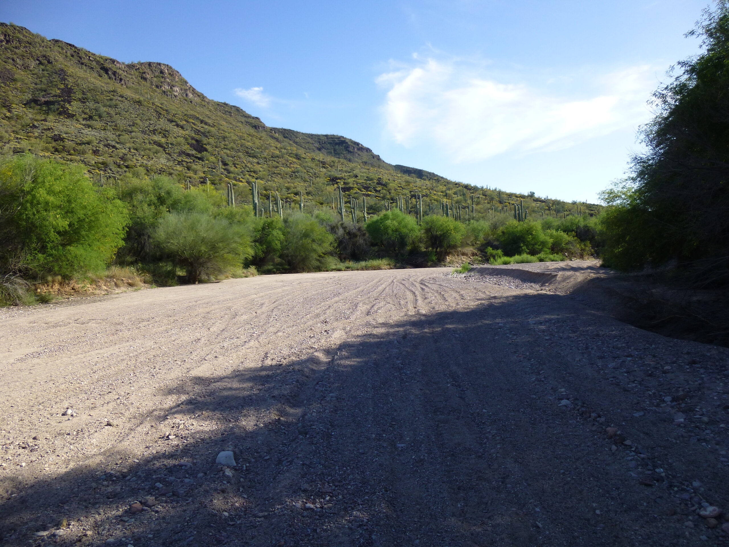
Growler Wash near Bates Well
At Mile 33.0, our wash passes near Bates Well. The Gray family ran cattle on Organ Pipe Monument until 1976, and did so for 60 years. This little house was part of their camp at this one location.
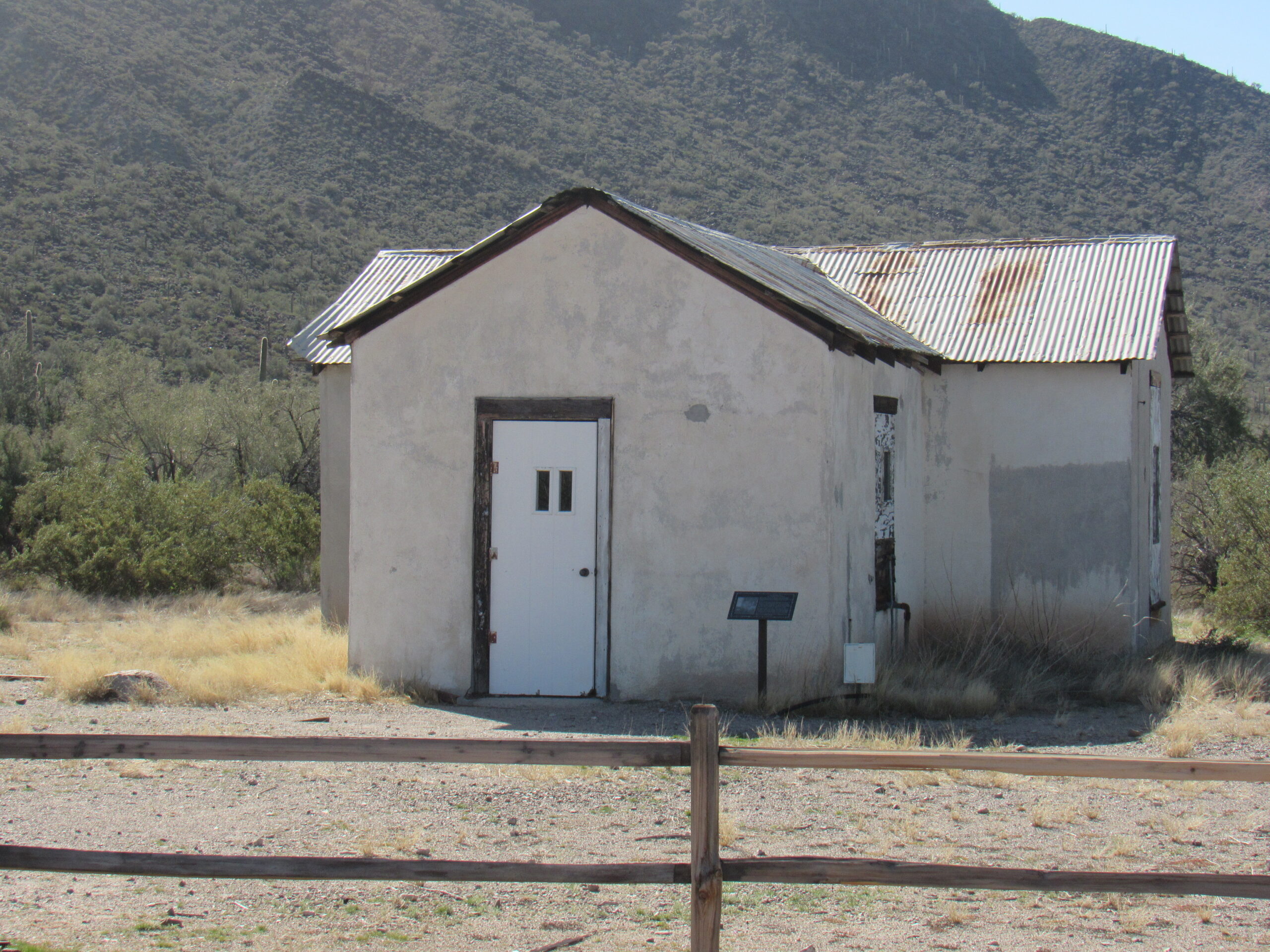
At Bates Well
By the time we reach Mile 37.6, we have left the closeness of the Bates Mountains and are heading out into open desert. At Mile 39.7, we cross the Camino del Diablo (you can read in detail all about this famous historical road on this website by searching for “Camino del Diablo”). From now on, the miles we travel in the wash aren’t too exciting. We leave Organ Pipe Monument and enter the Cabeza Prieta National Wildlife Refuge at Mile 44.2. We need to travel all the way to Mile 52.0 before we reach Redtail Tank, a man-made water catchment. It goes long periods with no water in it. Around Mile 57.2, we pass to the east of Saguaro Gap and southernmost peaks of the Granite Mountains. Here’s a photo taken in the gap – it’s a place none of you will ever visit as long as you live.
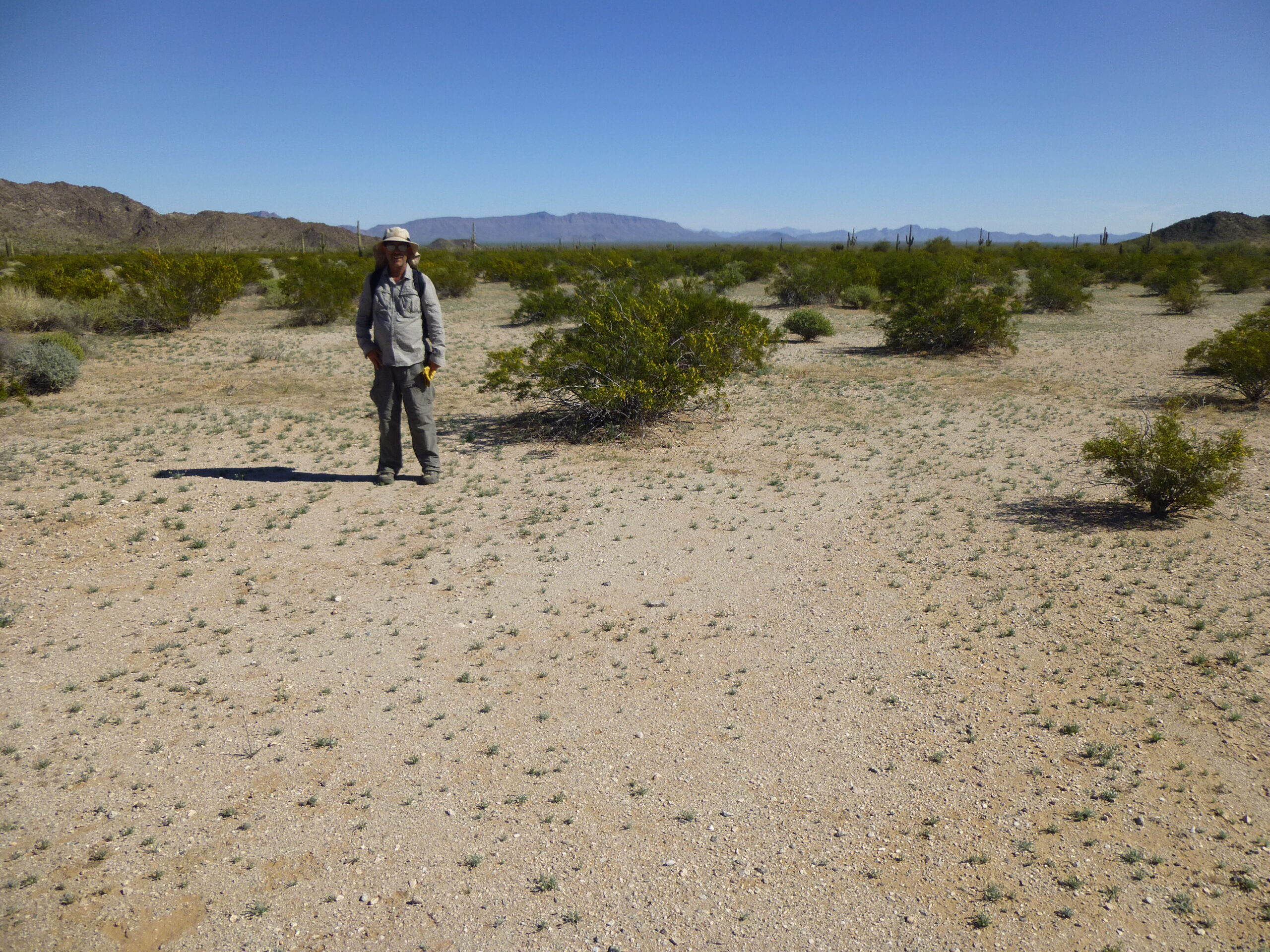
The Desert Mountaineer standing in Saguaro Gap
Continuing north, at Mile 60.0 we cross a road which heads west up to Granite Pass Tank. This is the only water supply in the entire Granite Mountains, but it is highly unreliable and even Bad Guys passing through the area don’t count on it as having any water.
Our wash sits squarely in the lowest channel of the Growler Valley, and at Mile 66.7 we leave the Cabeza Prieta Refuge behind and cross into the Barry M. Goldwater Air Force Range. We are still heading north through the Growler Valley – the Granite Mountains sit off to the west and the Growler Mountains fill all our view to the east. Near Mile 78, we arrive at Tony Tank, which is dry. Any indocumentado heading north on foot through the Growler Valley and hoping to find water at either Granite Pass Tank or Tony Tank will be saying Díos, ¿por qué me has abandonado? by the time they arrive at Tony and find the tank dry, the old well dry and the old corral standing bleakly, none of them offering any succor. Daniels Arroyo, itself very long, enters Growler Wash here but it doesn’t offer any reliable water either.
Just north of the tank, we cross into Maricopa County (we’ve been in Pima County so far in our journey). Now we swing more or less to the west, and at Mile 81.0 we pass near Indian Well. The old corral is still there, but the well is dry. This is one parched land, Folks. At around 83 miles we pass between the Aguila Mountains to the north and the Granite Mountains to the south, and it could be safely said that we leave the Growler Valley and enter the San Cristóbal Valley. There are no features of note out there, nothing but flat, empty desert. Finally, at Mile 90.2, our Growler Wash enters into the San Cristóbal Wash. What a run we’ve had! If you go to the search bar and type in San Cristóbal Wash, you can read an entire piece just about that watercourse. I hope you’ve enjoyed my little story, and thanks for keeping me company.