
To get the most from this story, please read the previous instalments, Glaciers I Have Known – Part 2 and Part 3.
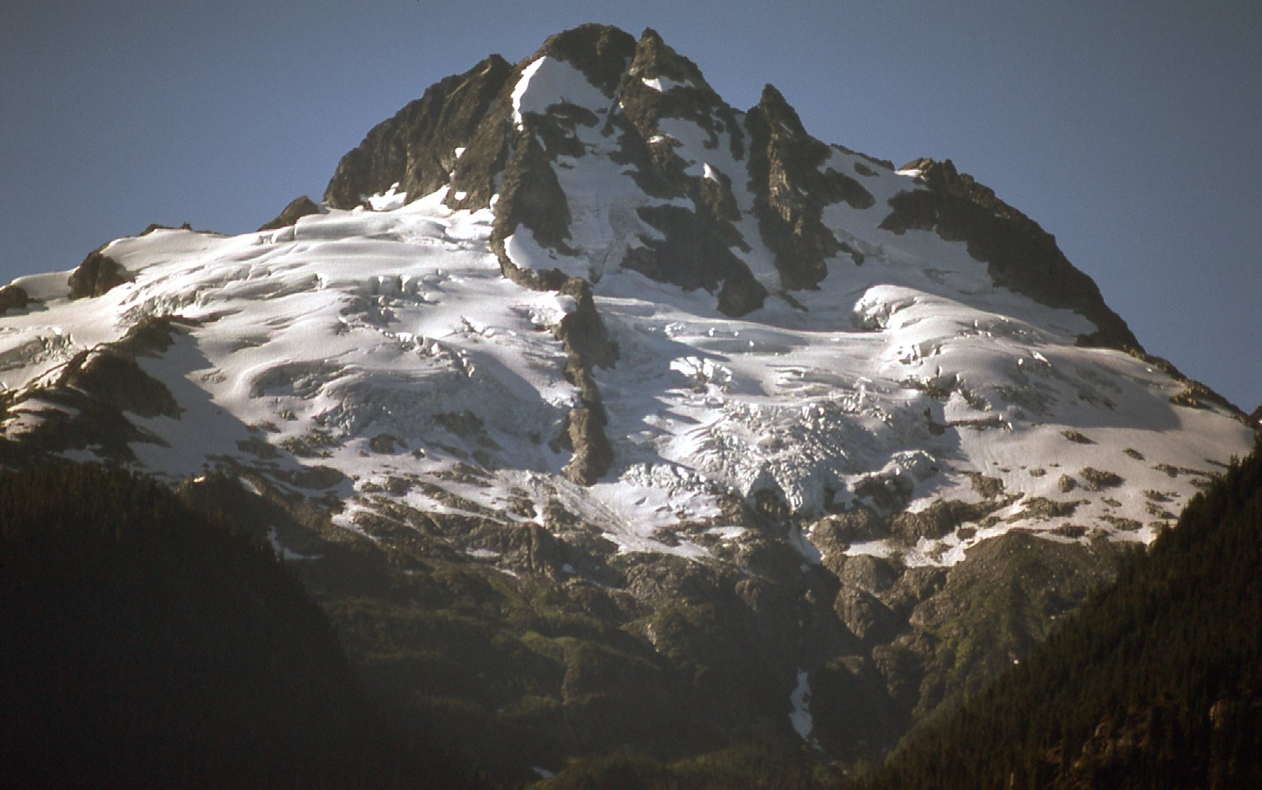
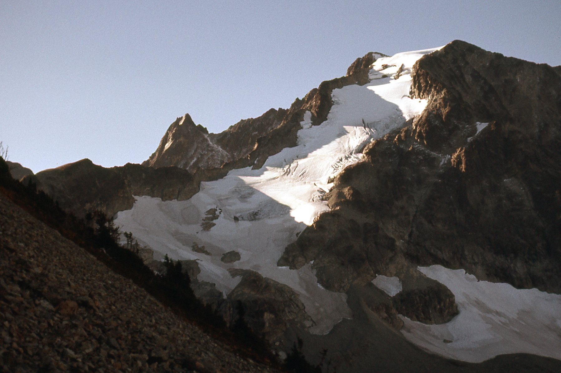
Where we left off, I was taking you on a tour of my glaciated peaks of 1976. One of my favorites was Mt. Shuksan in Washington state. It was a short drive from my home in BC. Here is a classic view of it from the road up to the Mt. Baker ski area.
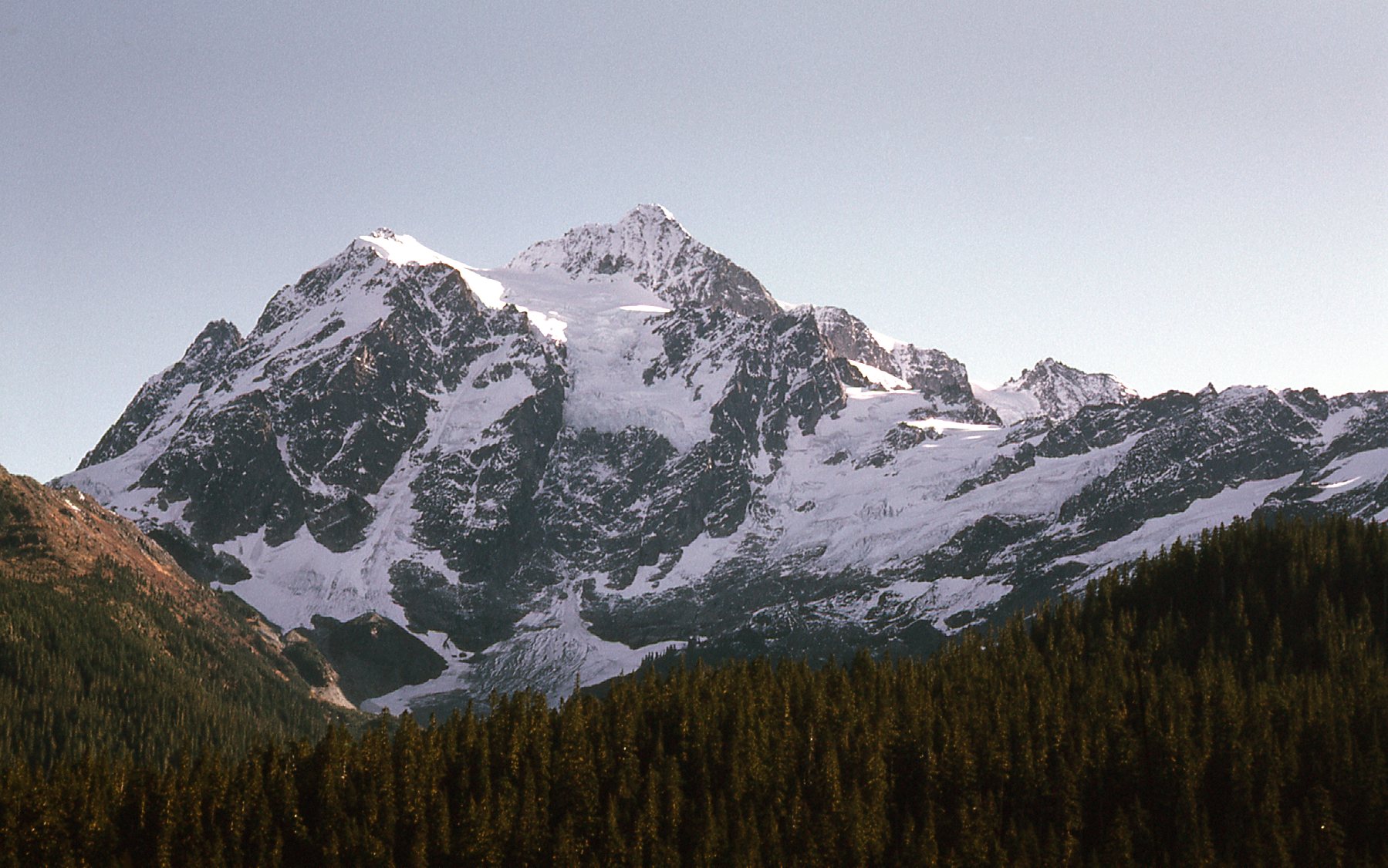
The west side of the peak.
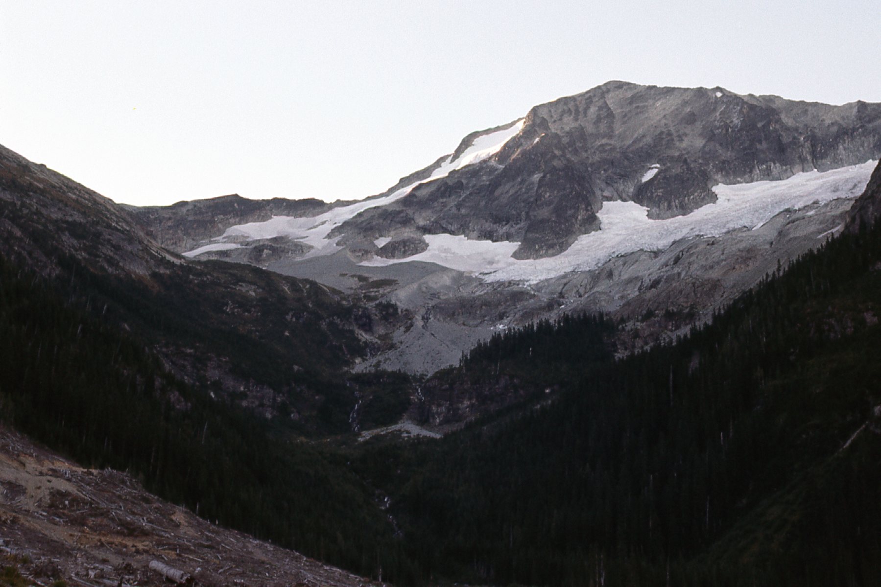
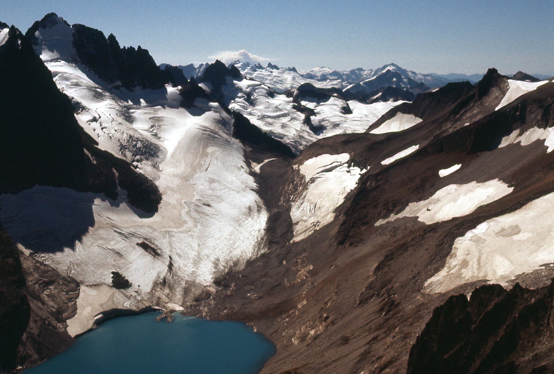
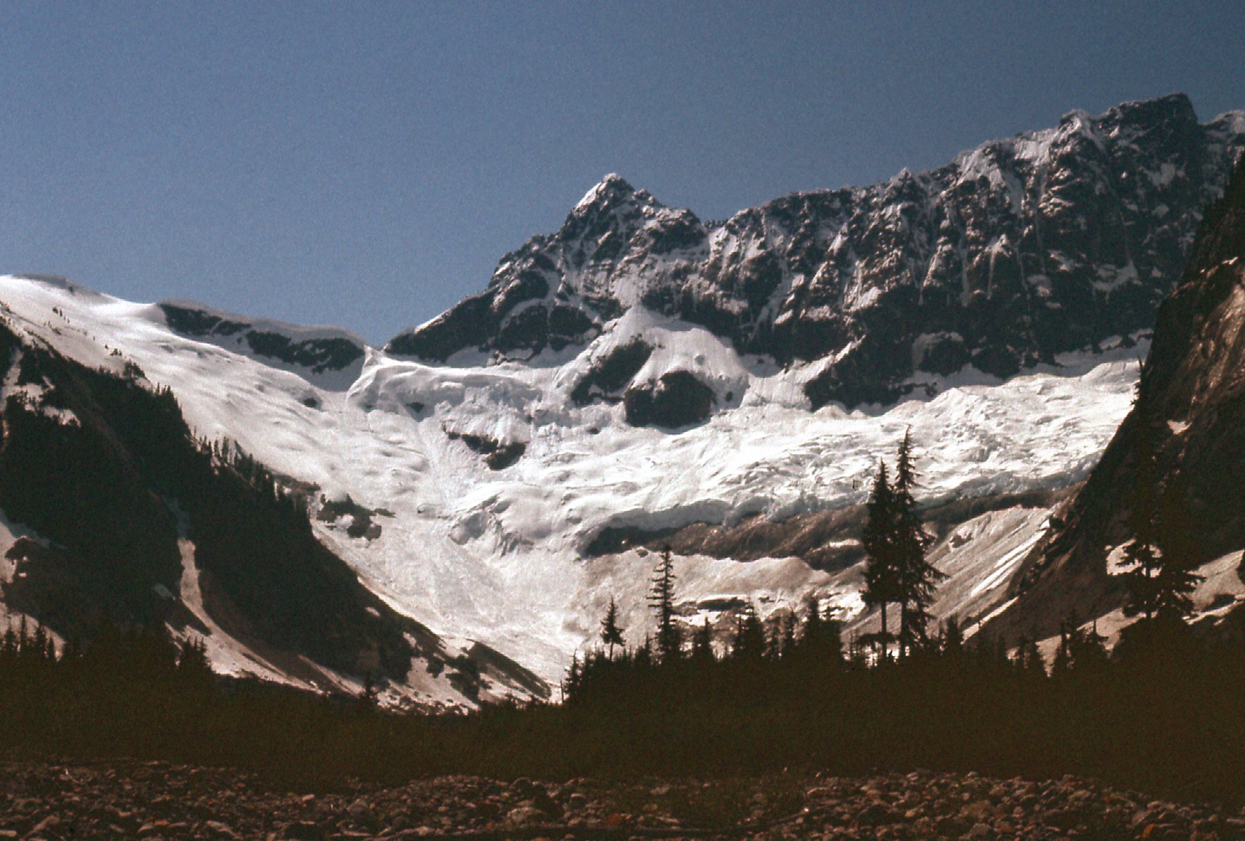
On my first attempt on October 20th, I went there solo. The problem was that, so late in the season, the glaciers had lost their snow cover from earlier in the year and a great many crevasses were exposed and menacing. There are at least 7 glaciers on Mt. Shuksan and you can’t climb it without some glacier travel. Here’s one of them as seen from Lake Ann, a popular camping spot for those contemplating the climb.
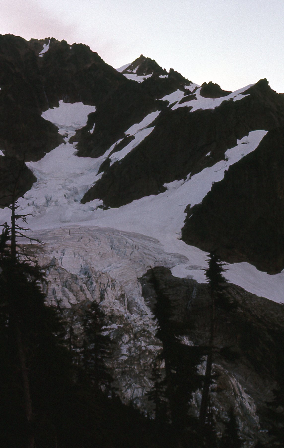
Lower Curtis Glacier
On the normal route from Lake Ann, you must first ascend the Fisher Chimneys, a thousand feet of Class 3-4 climbing which can be icy at times.
Here is a view of the Lower Curtis Glacier as seen from the Fisher Chimneys.
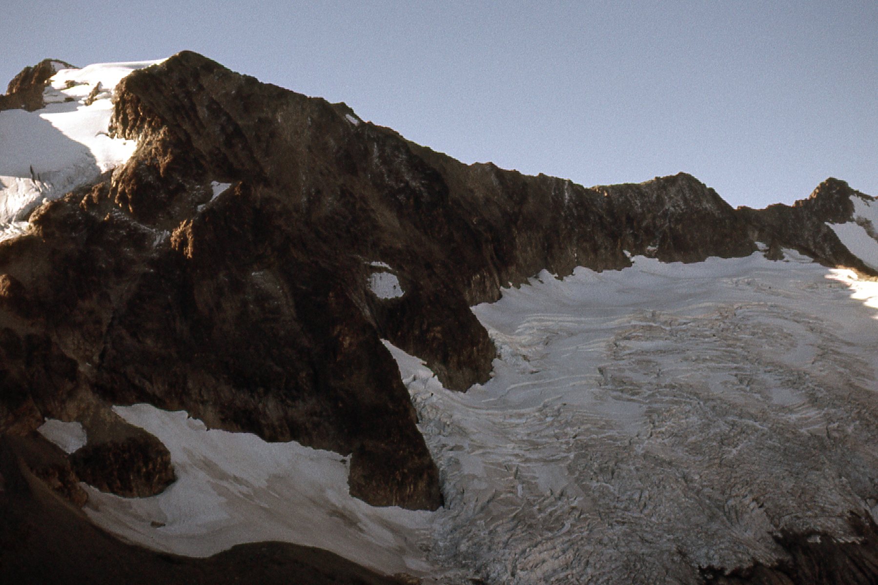
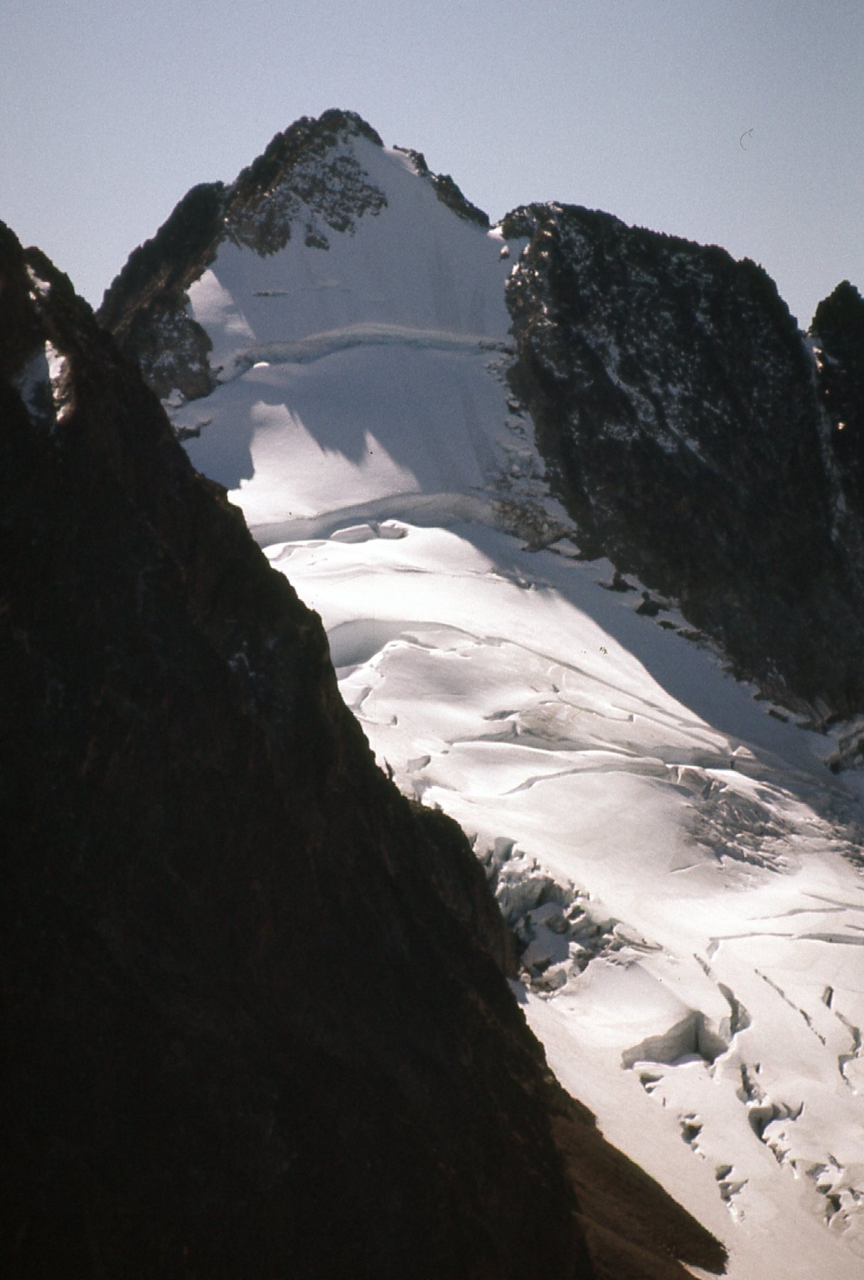
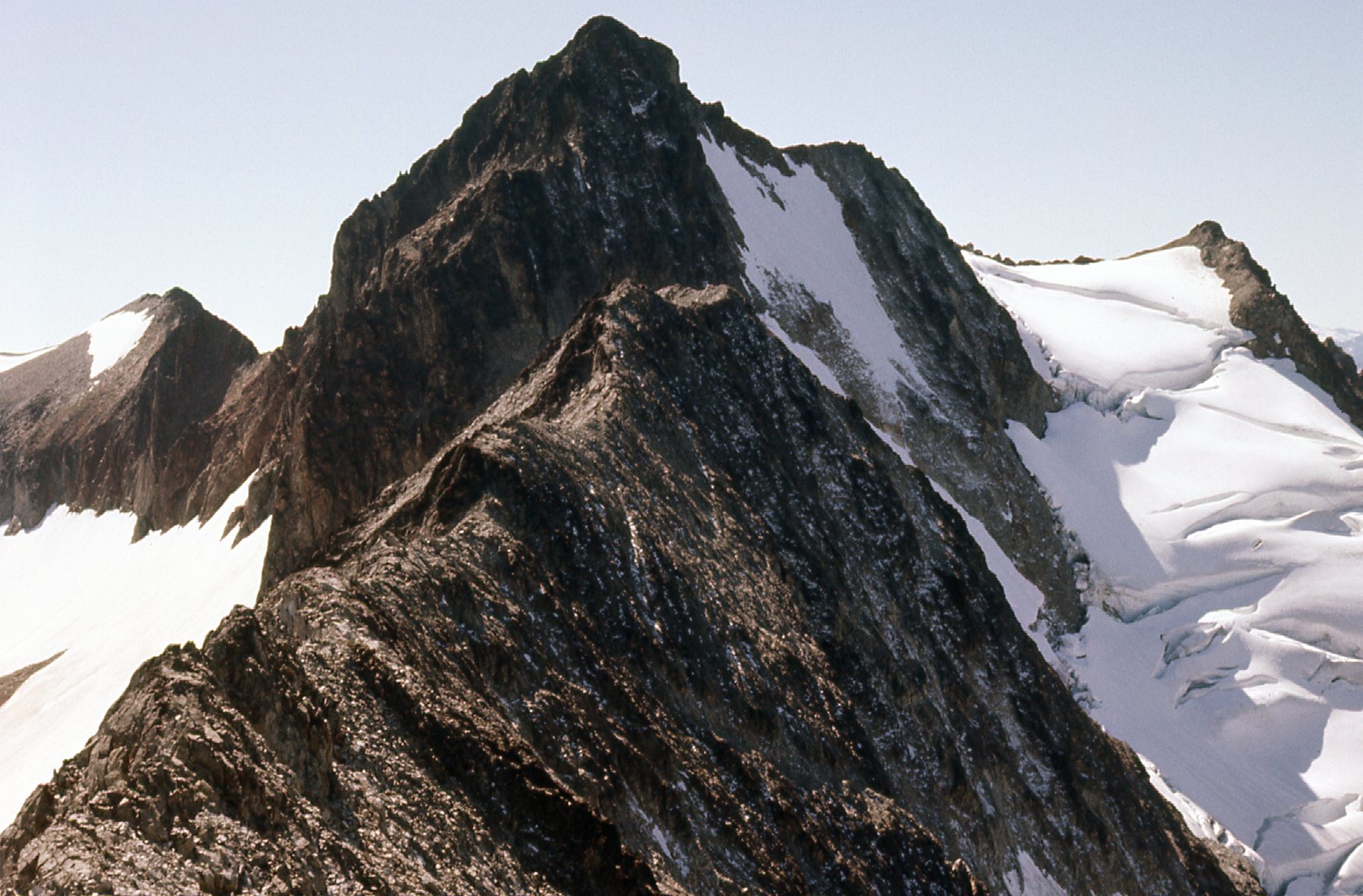
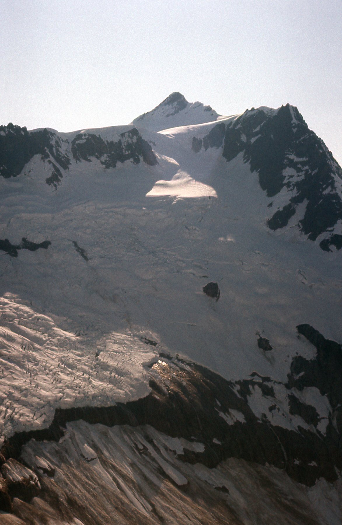
This next photo shows what you see when you’ve topped out above the chimneys.
Looking up towards the summit from the top of the Fisher Chimneys
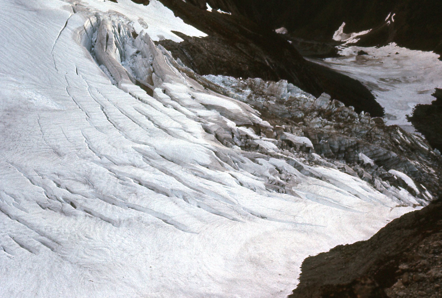
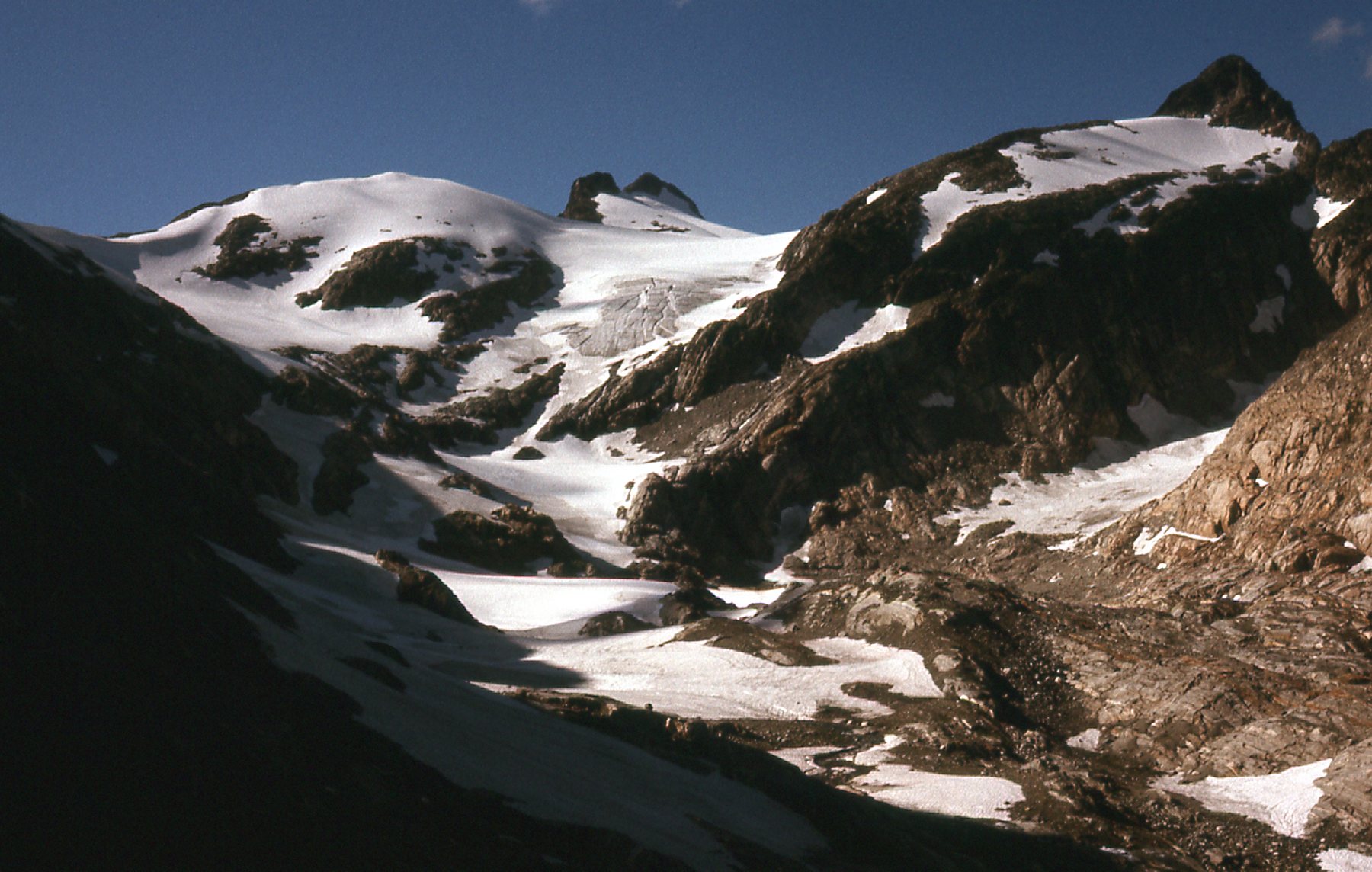
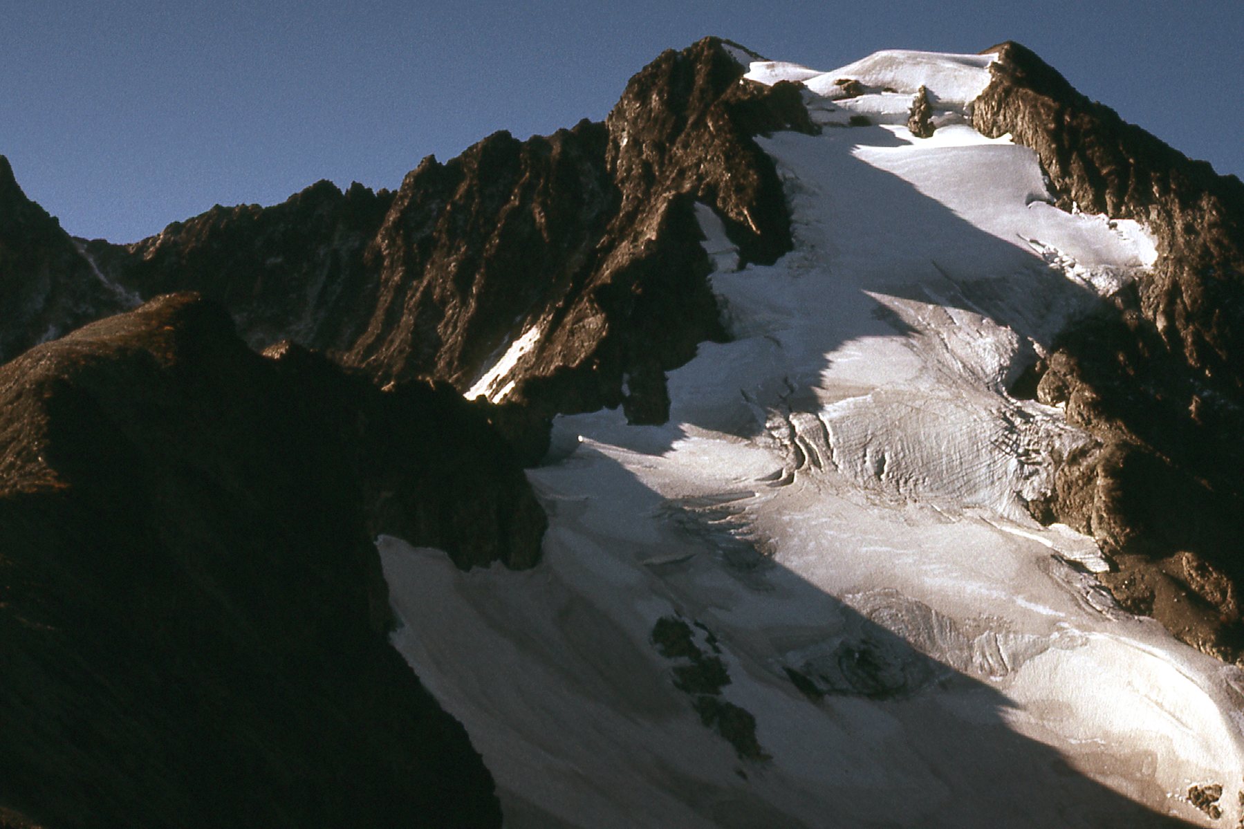
A bit farther along in the climb, here is what I came to.
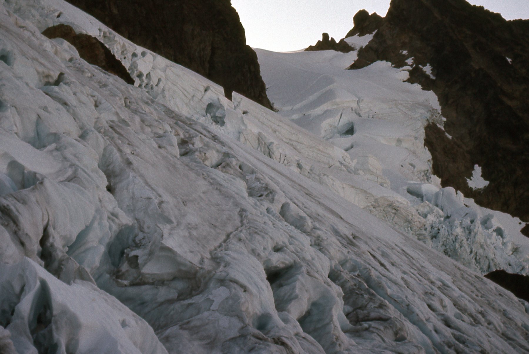
Looking southeast across the Upper Curtis Glacier
As you can see, the route is highly broken, and I was thinking that it was no place to be for a solo climber. Early in the season, deep snow usually covers the crevasses, making a smooth surface for travel.
On the Upper Curtis Glacier
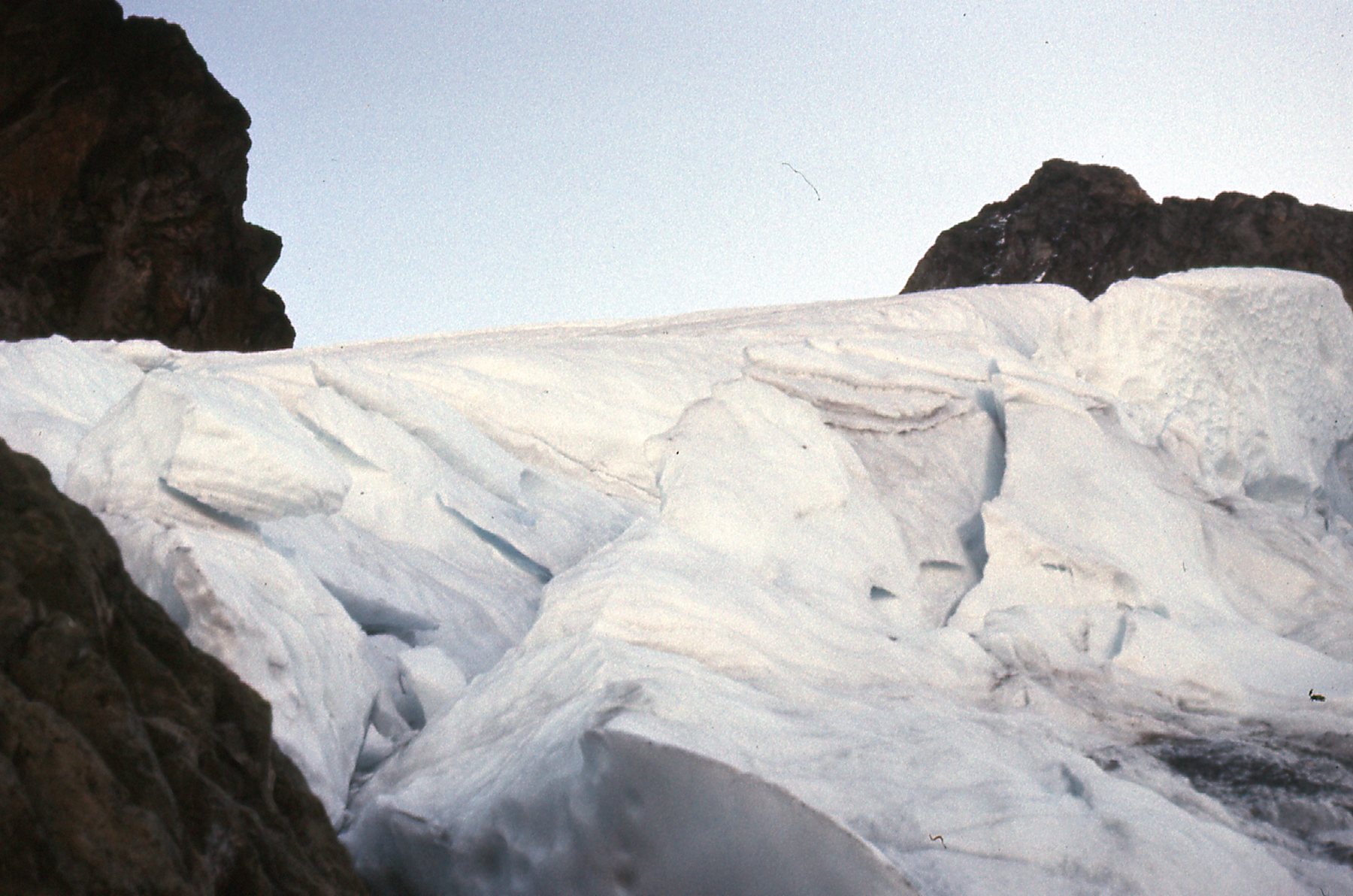
Here’s another view of the same area.
At 7,200 feet on the Upper Curtis Glacier
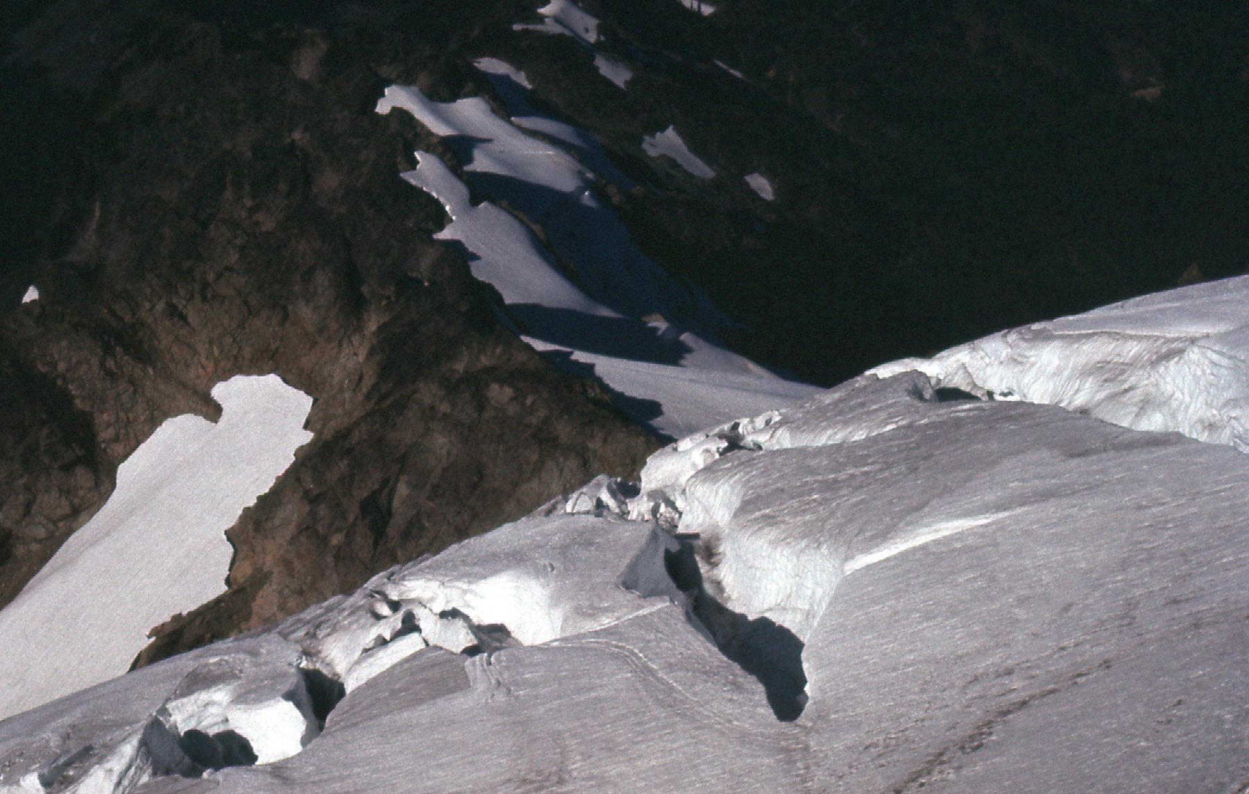
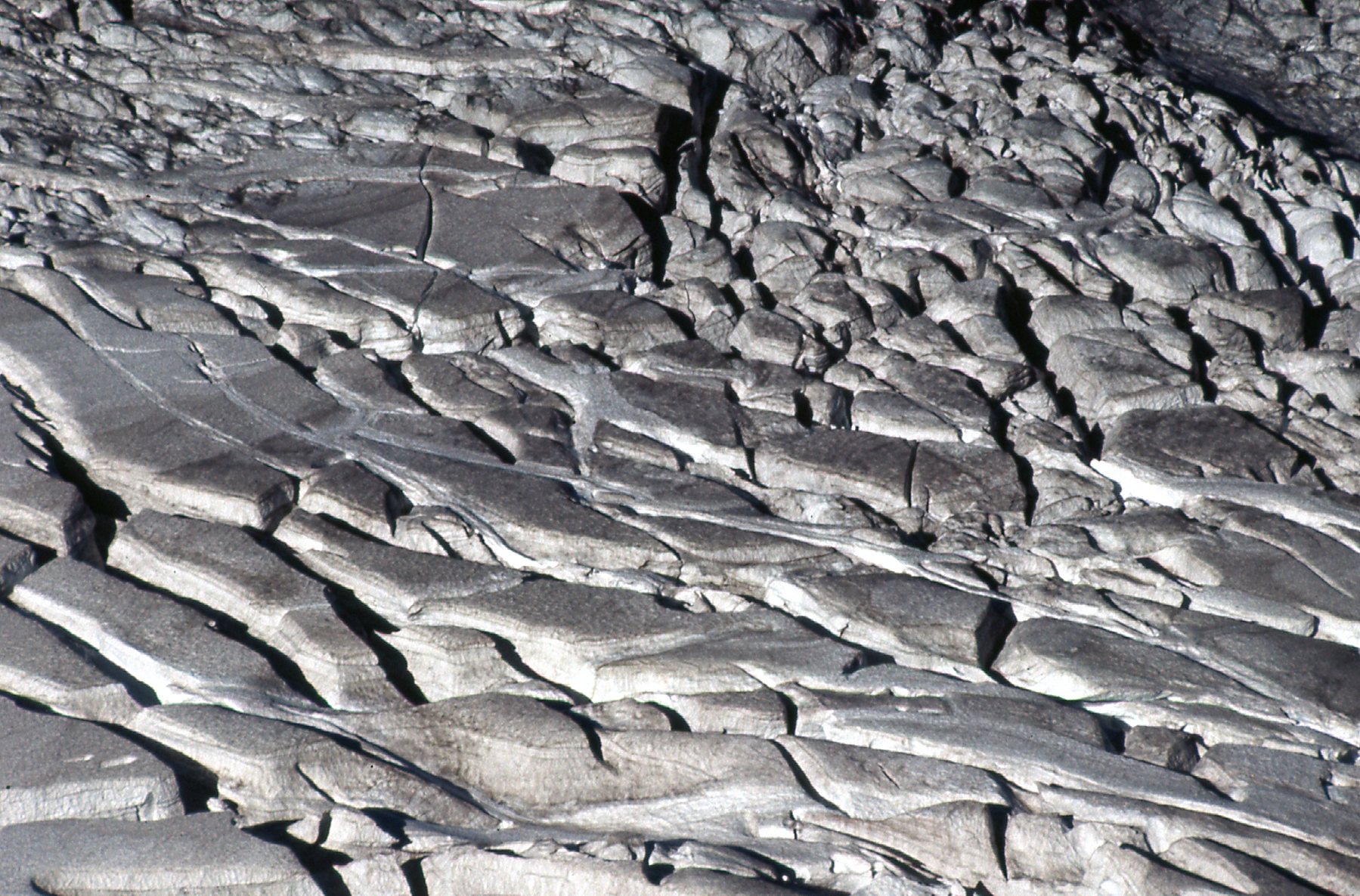
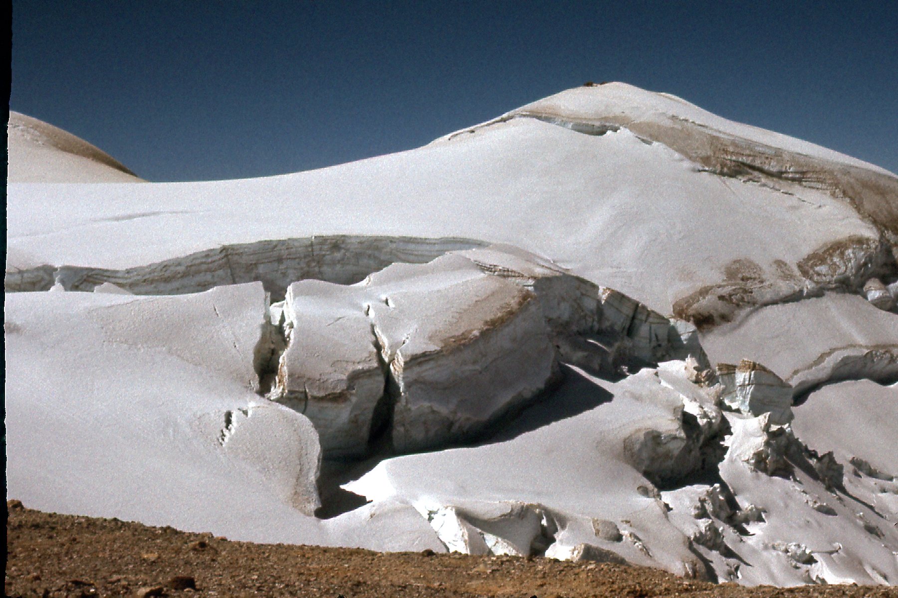
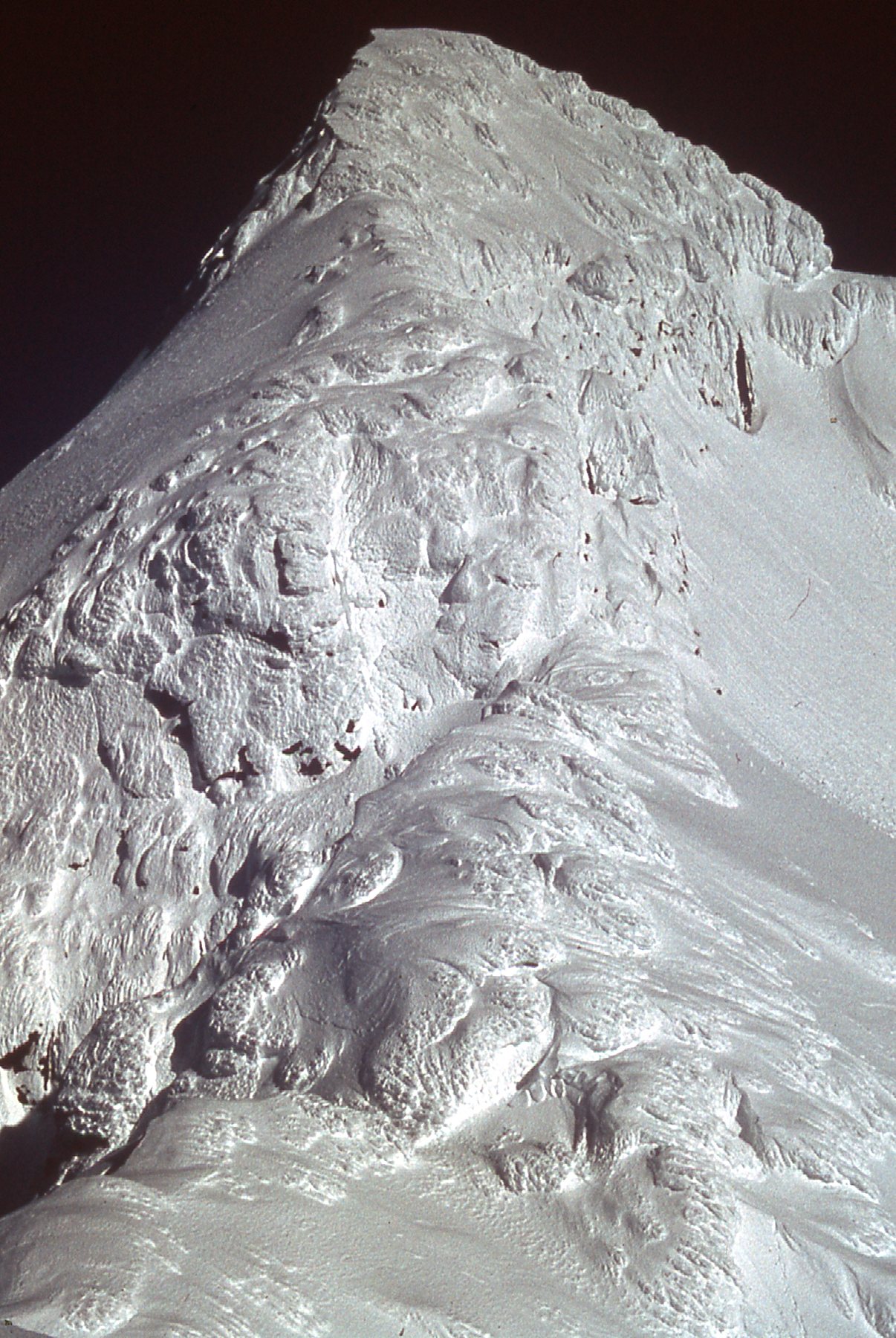
Here’s a close-up of a detail on the glacier.
A detail.
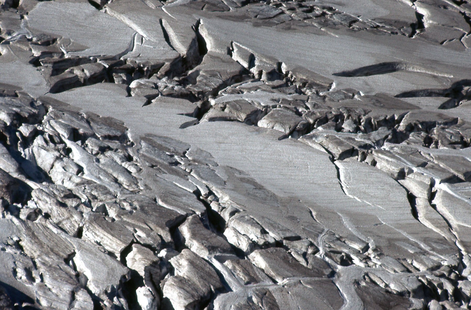
Here’s another detail.
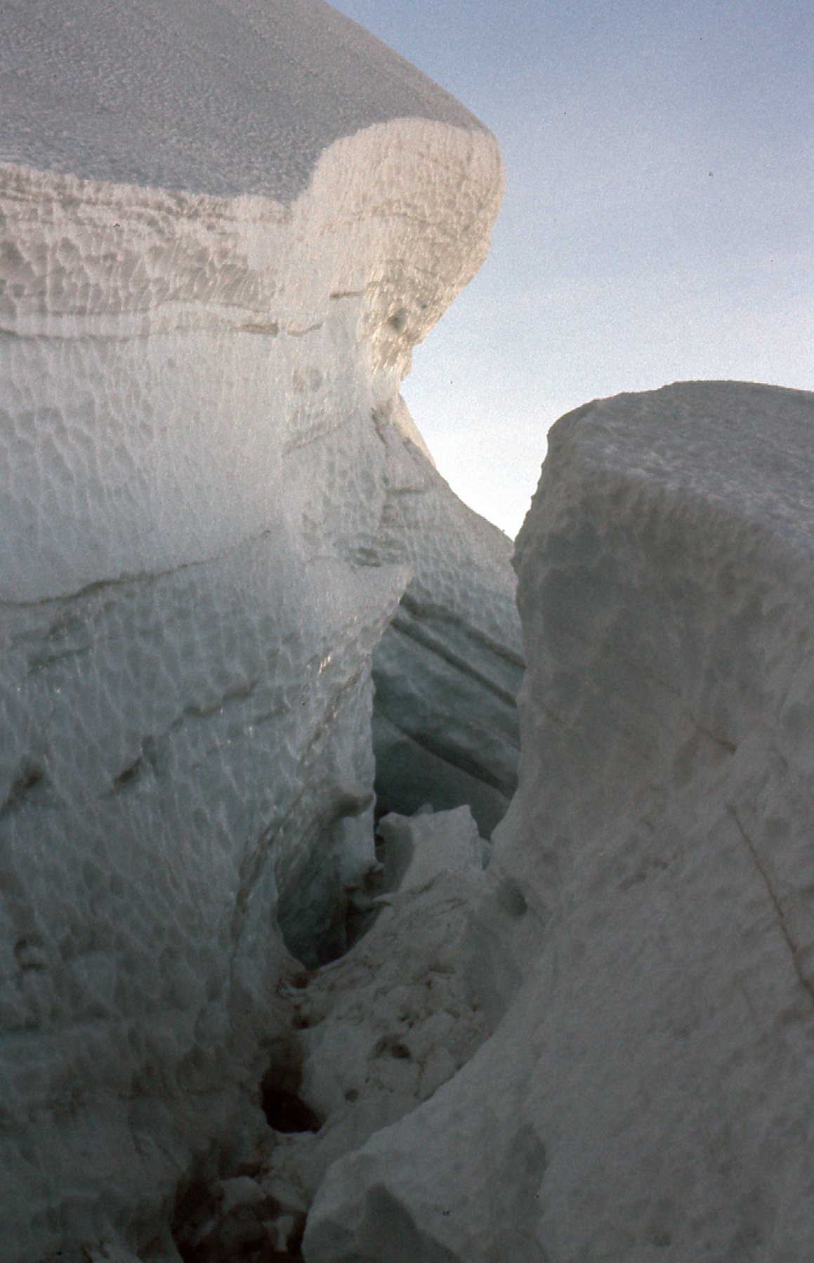
Another detail.
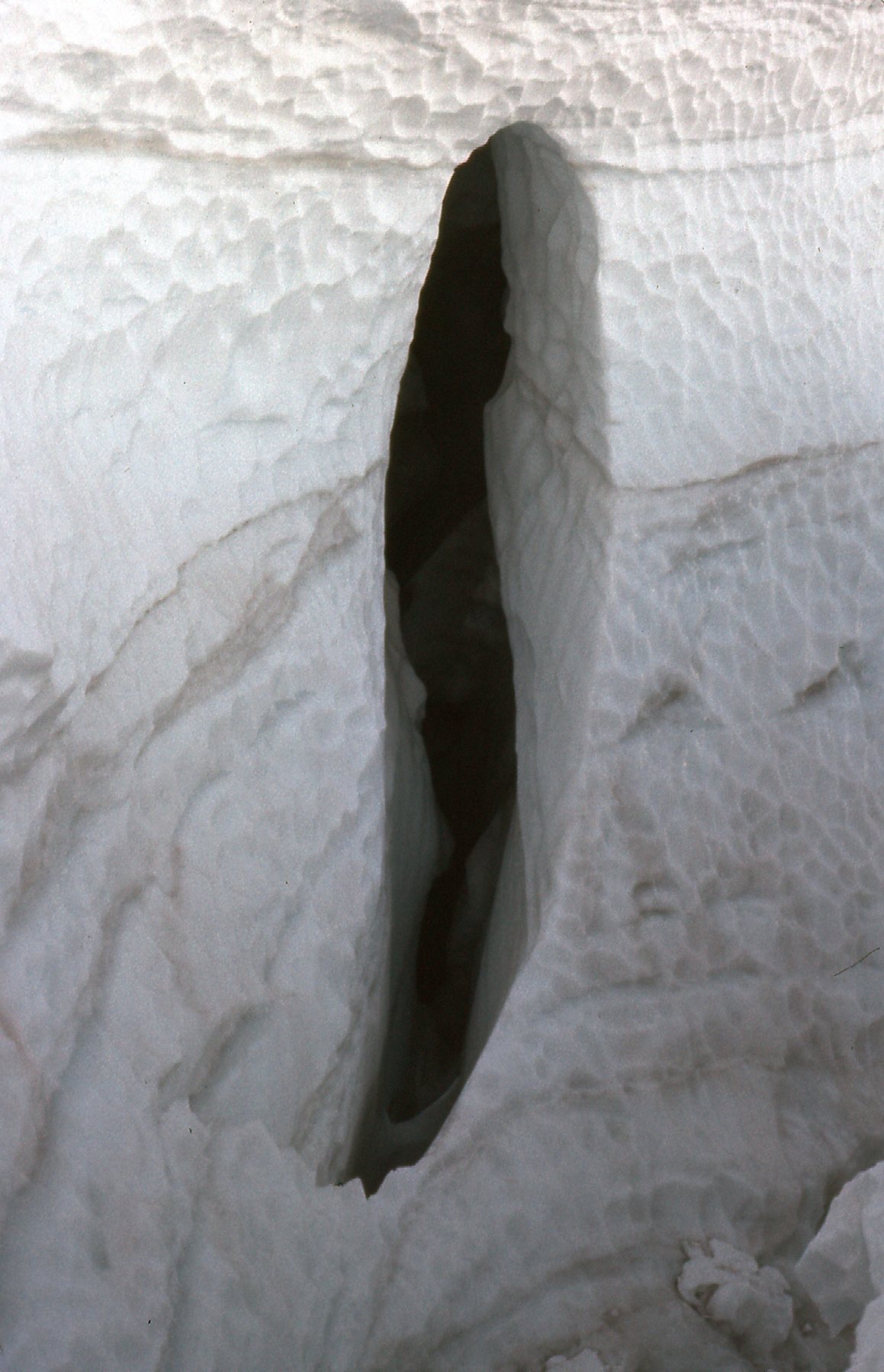
Hidden crevasses were showing up as the snow cover melted.
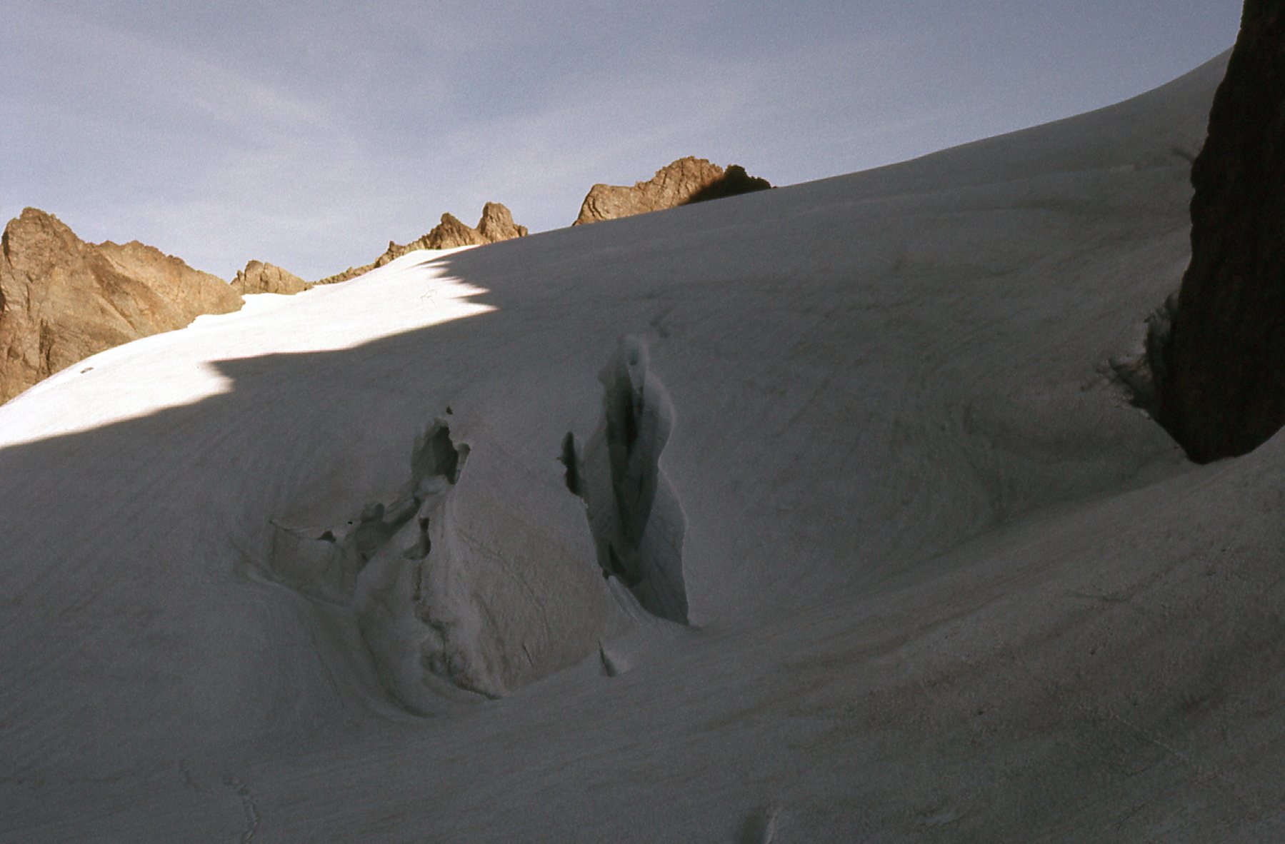
Crevasses
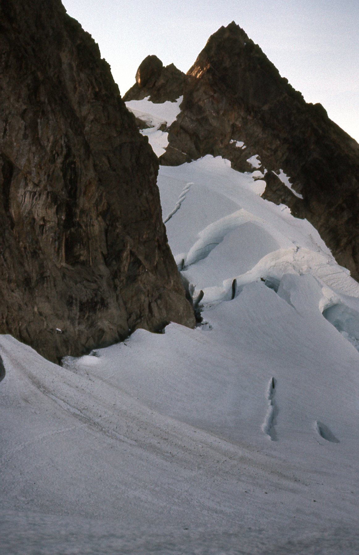
And there was this frozen waterfall near the Hourglass.
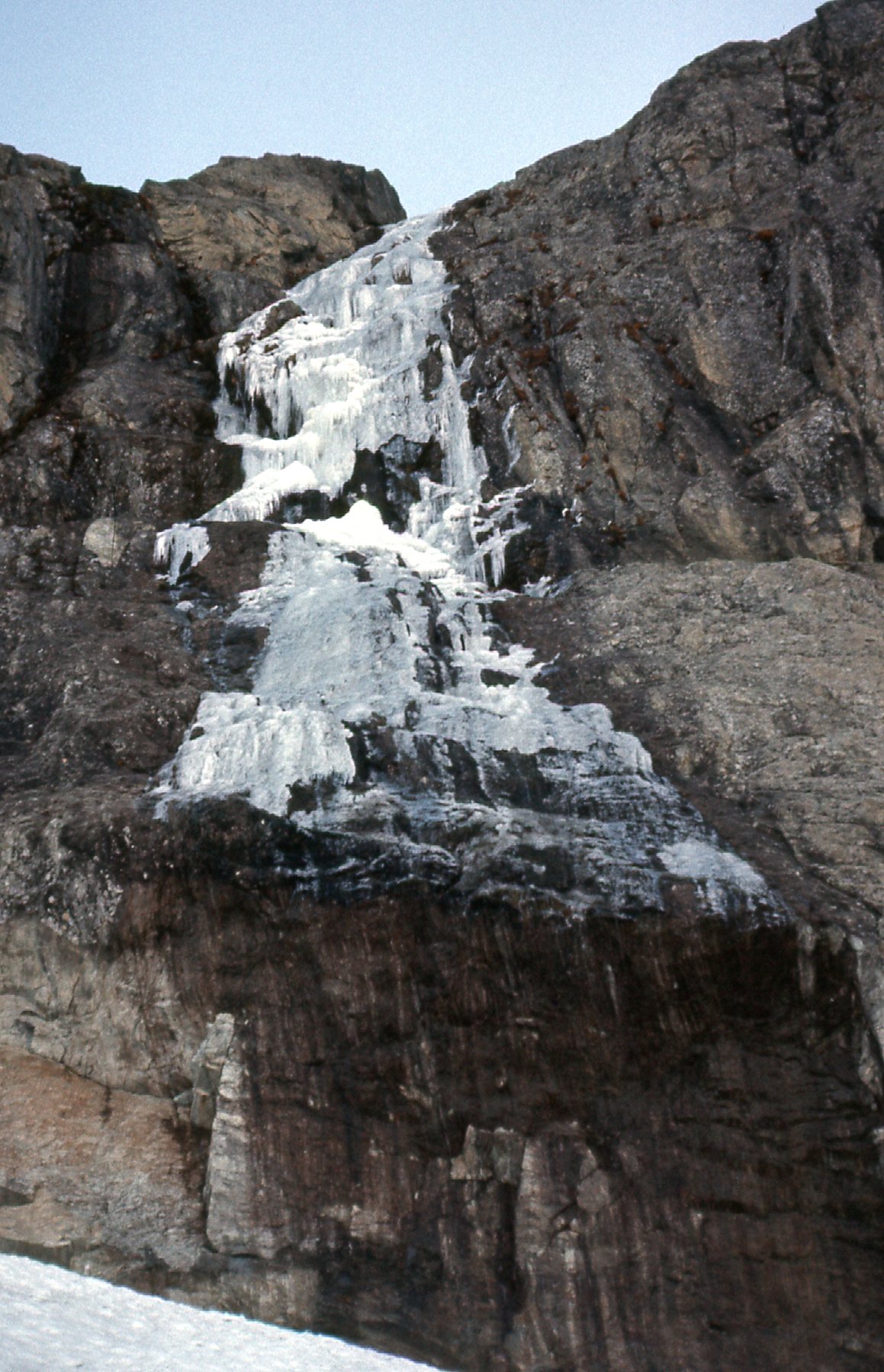
Frozen
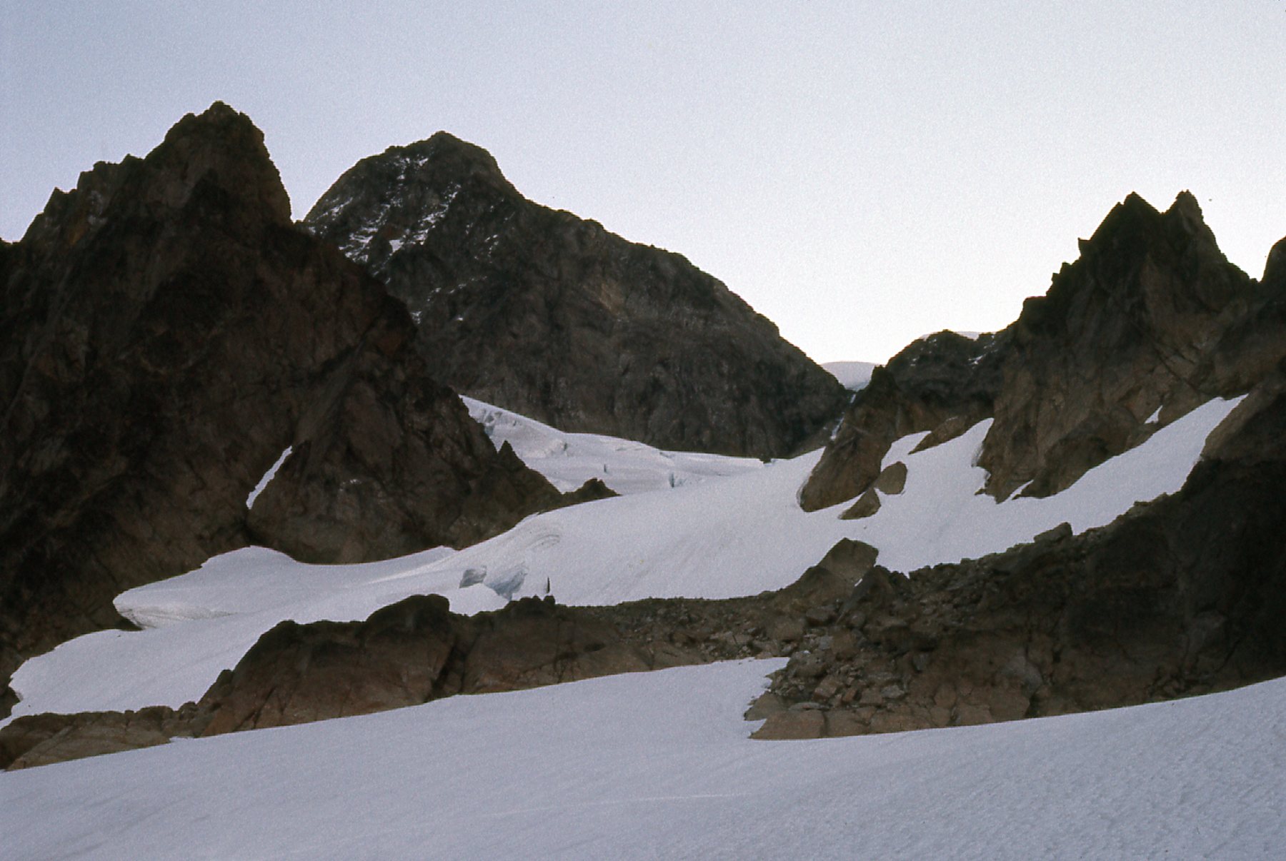
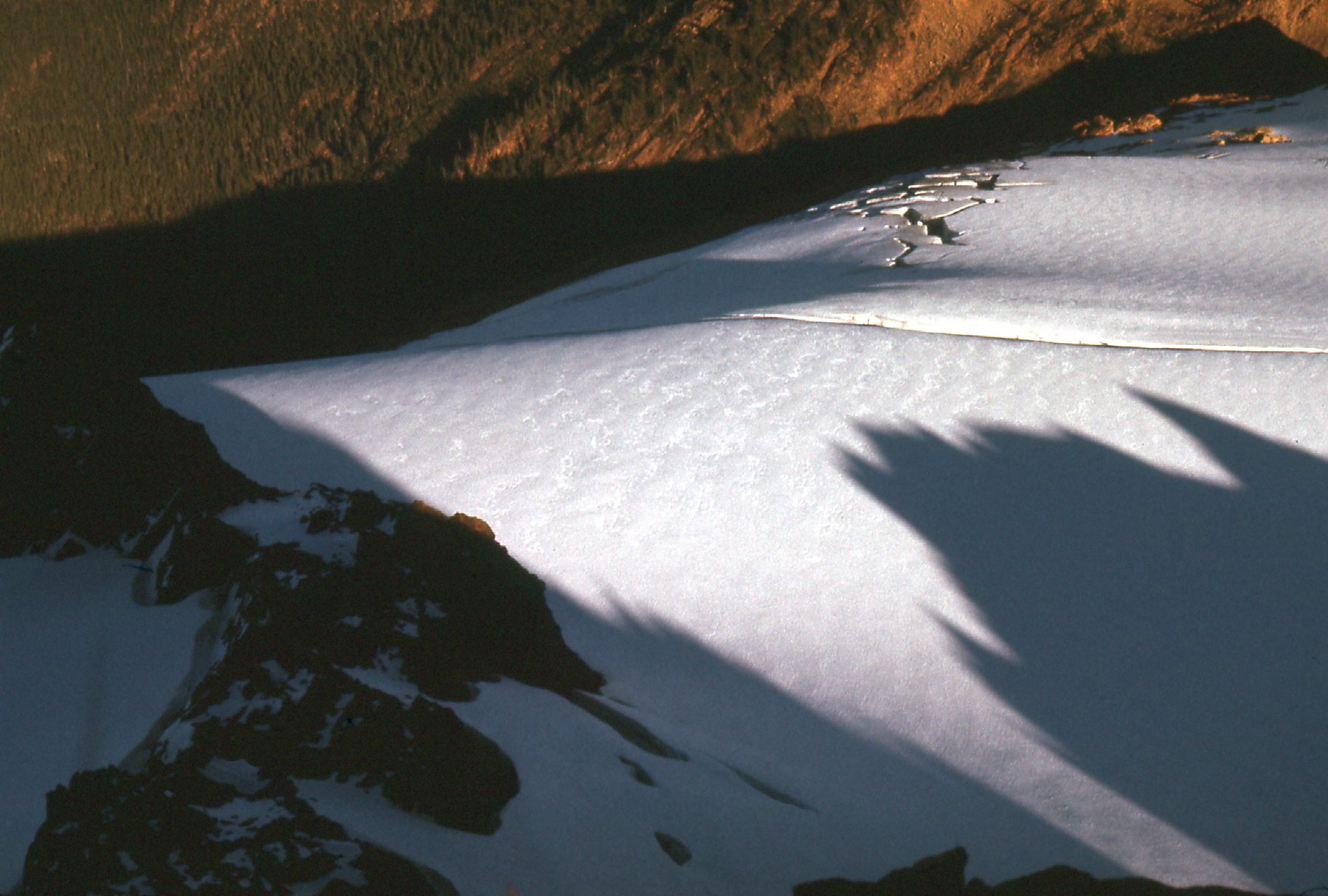
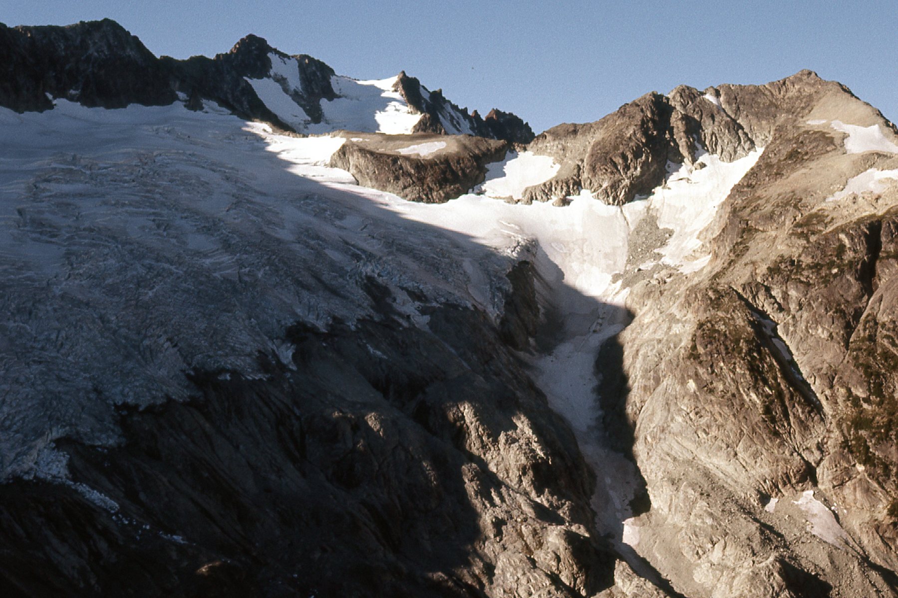
Here’s another view from around my high point.
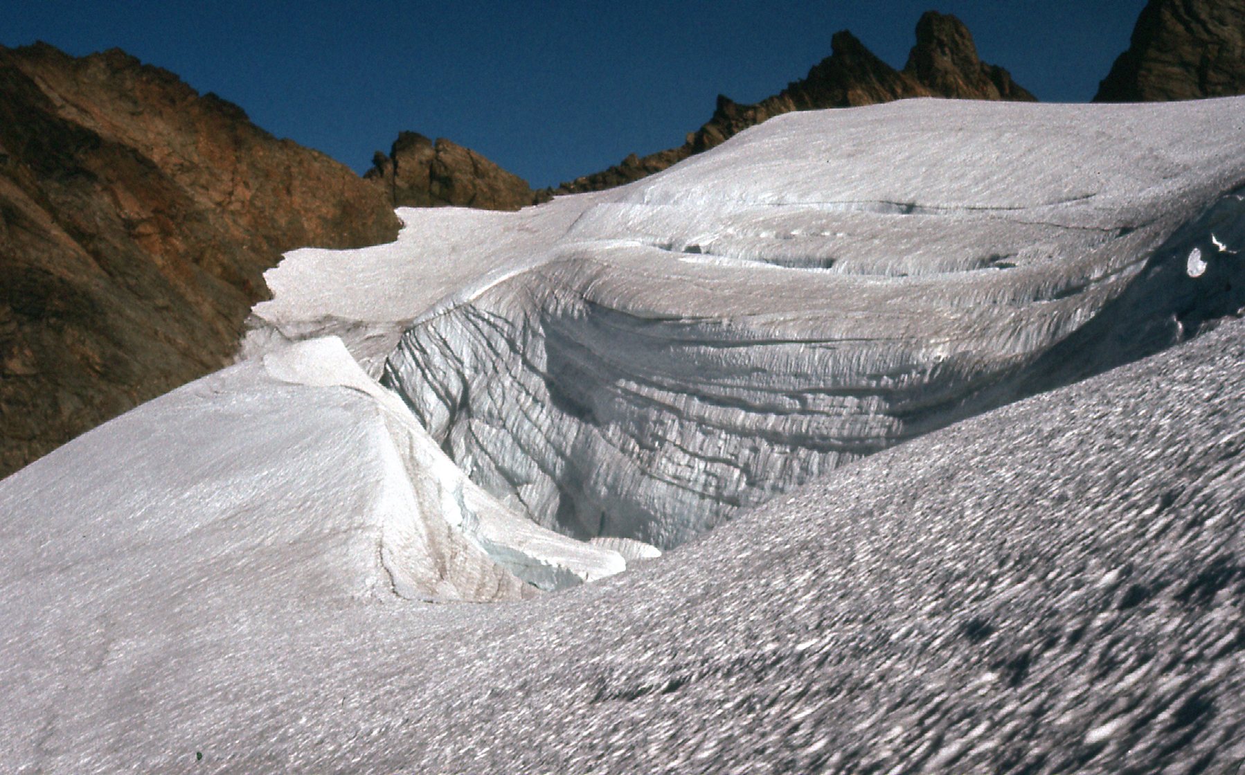
The Upper Curtis Glacier
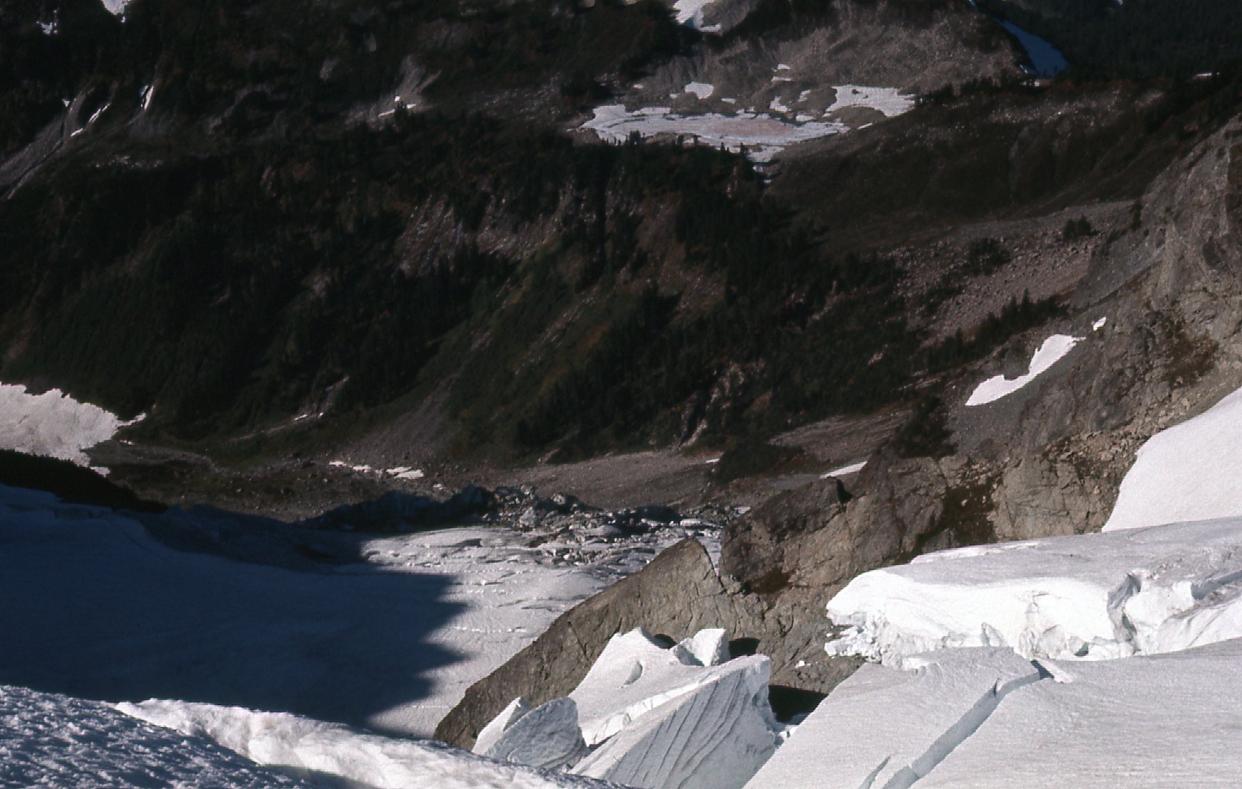
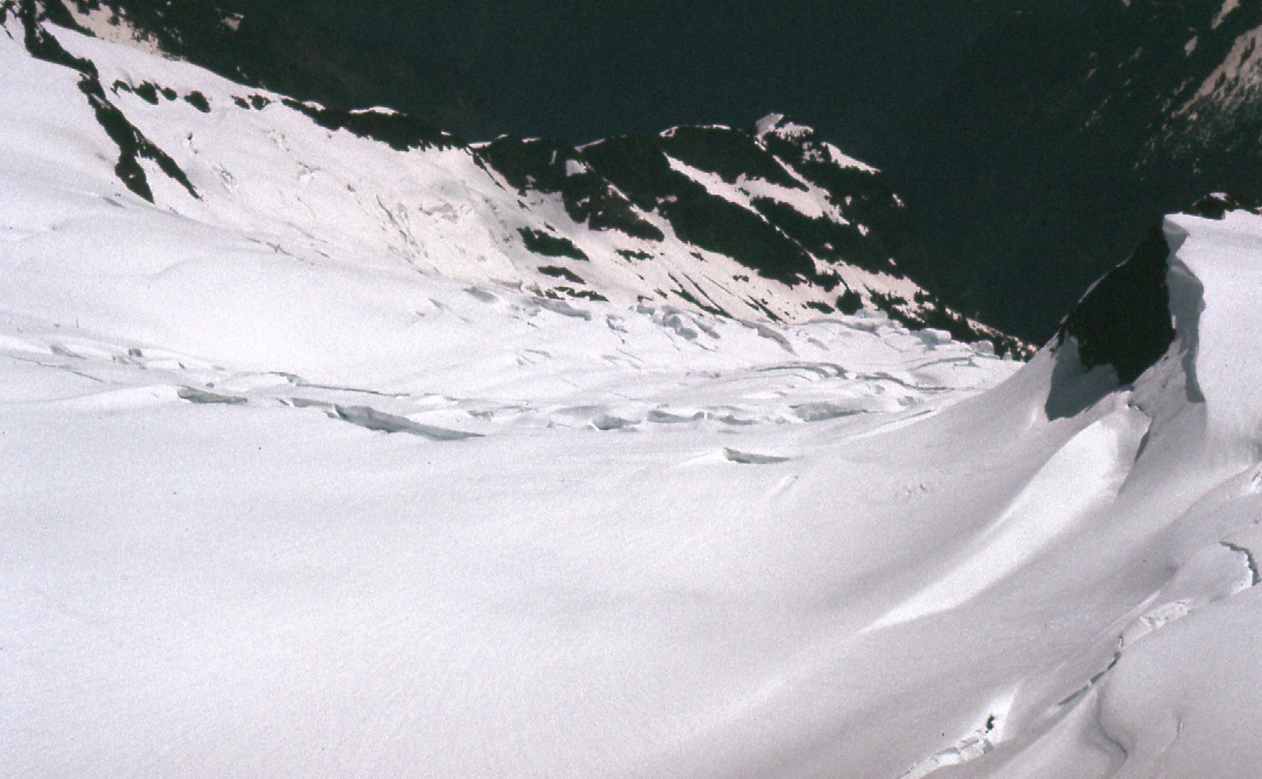
Here’s a view looking downhill – glaciers tend to break up when creeping downhill, especially when the underlying rock is badly broken.
On the Upper Curtis Glacier.
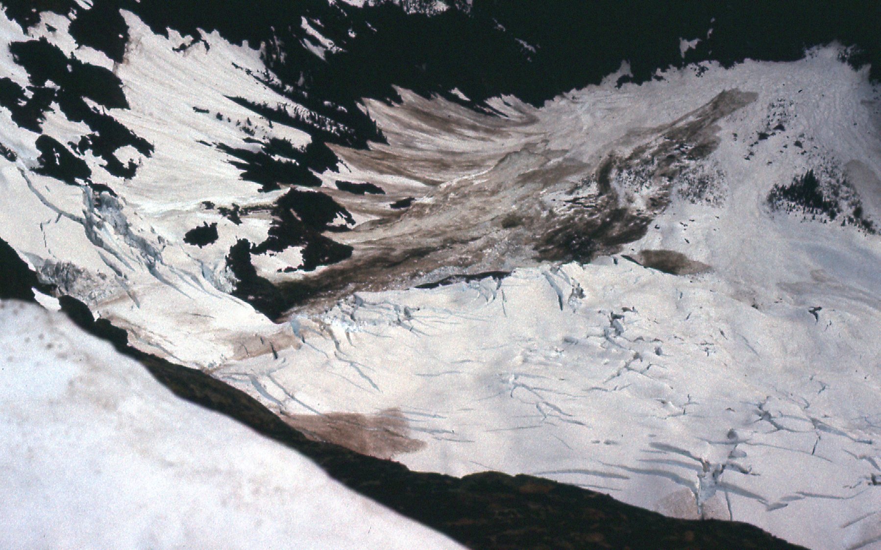
Here’s a view looking down 2,500 vertical feet to a frozen Lake Ann.
Lake Ann is the white patch in the upper part of the photo to the right of center.
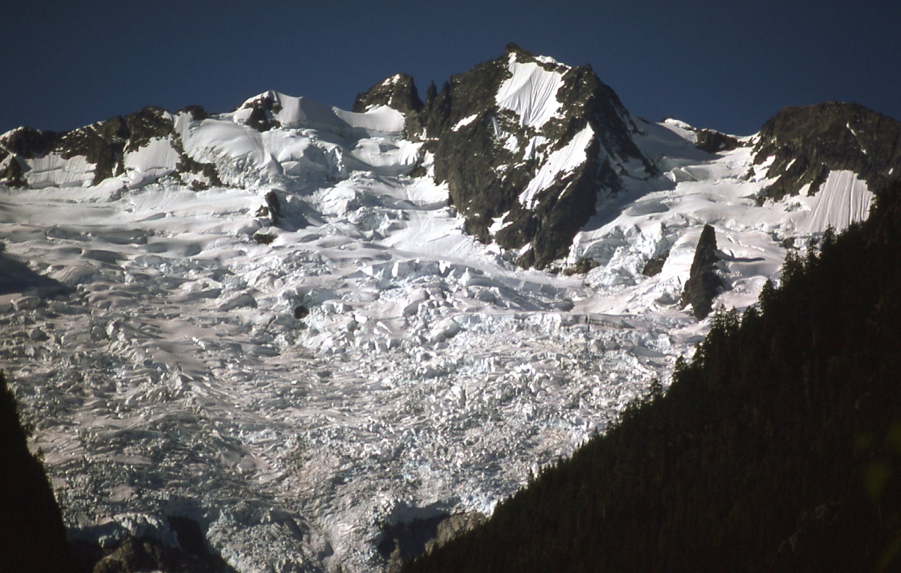
So my first visit to Shuksan proved unproductive – I only made it to 7,200 feet. However, in June of 1977, only 8 months after that first attempt, I returned with Brian Rundle. After camping at Lake Ann, we set out early the next morning and climbed to the summit via the Hourglass. Pretty bold for a couple of guys who had barely climbed together but once before. Here’s a good photo taken from Lake Ann.
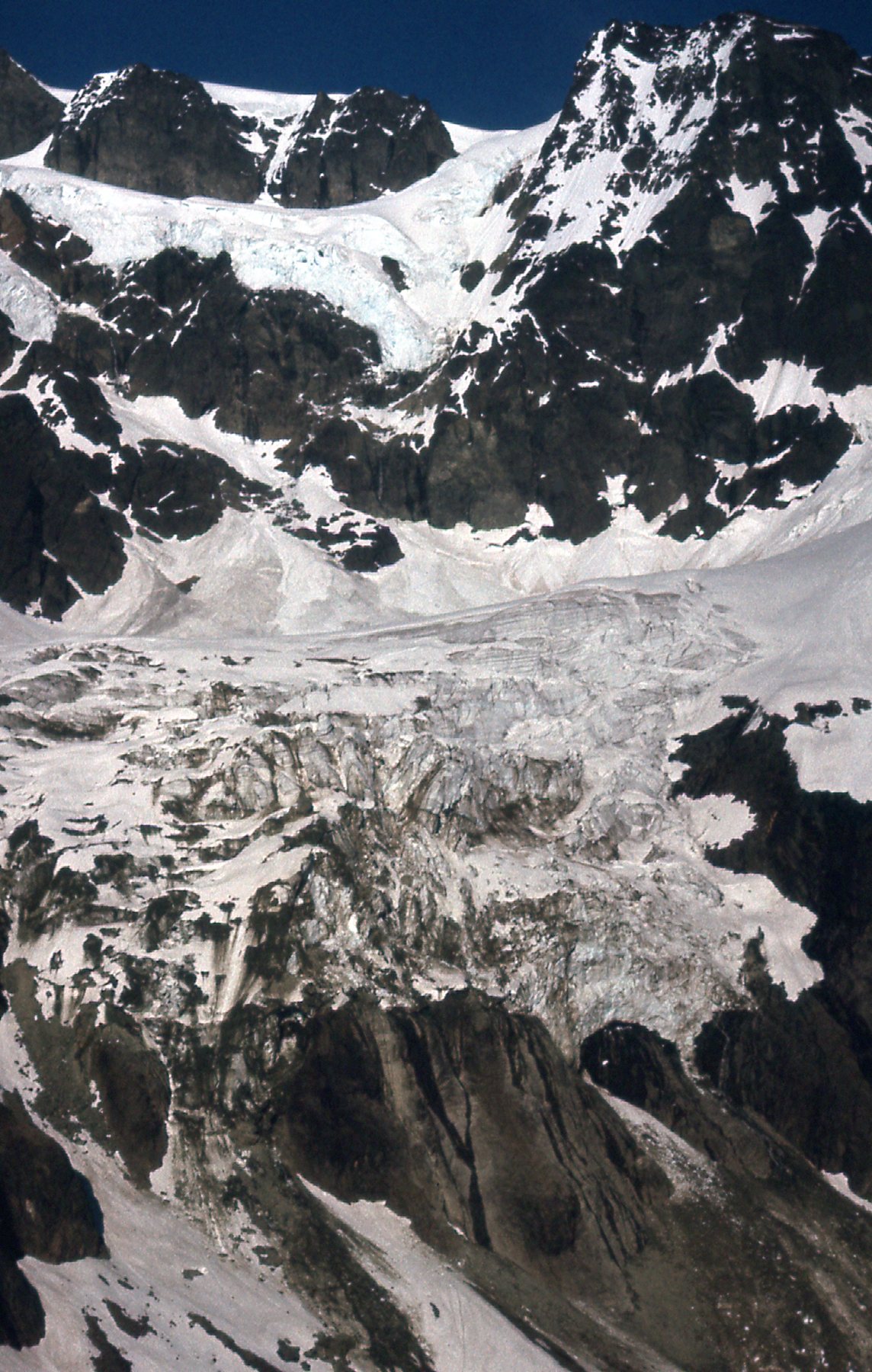
The Lower and the Upper Curtis Glaciers.
I took a couple of photos from the summit of Mt. Shuksan (elevation 9,131 feet). Here’s one looking south-southeast.
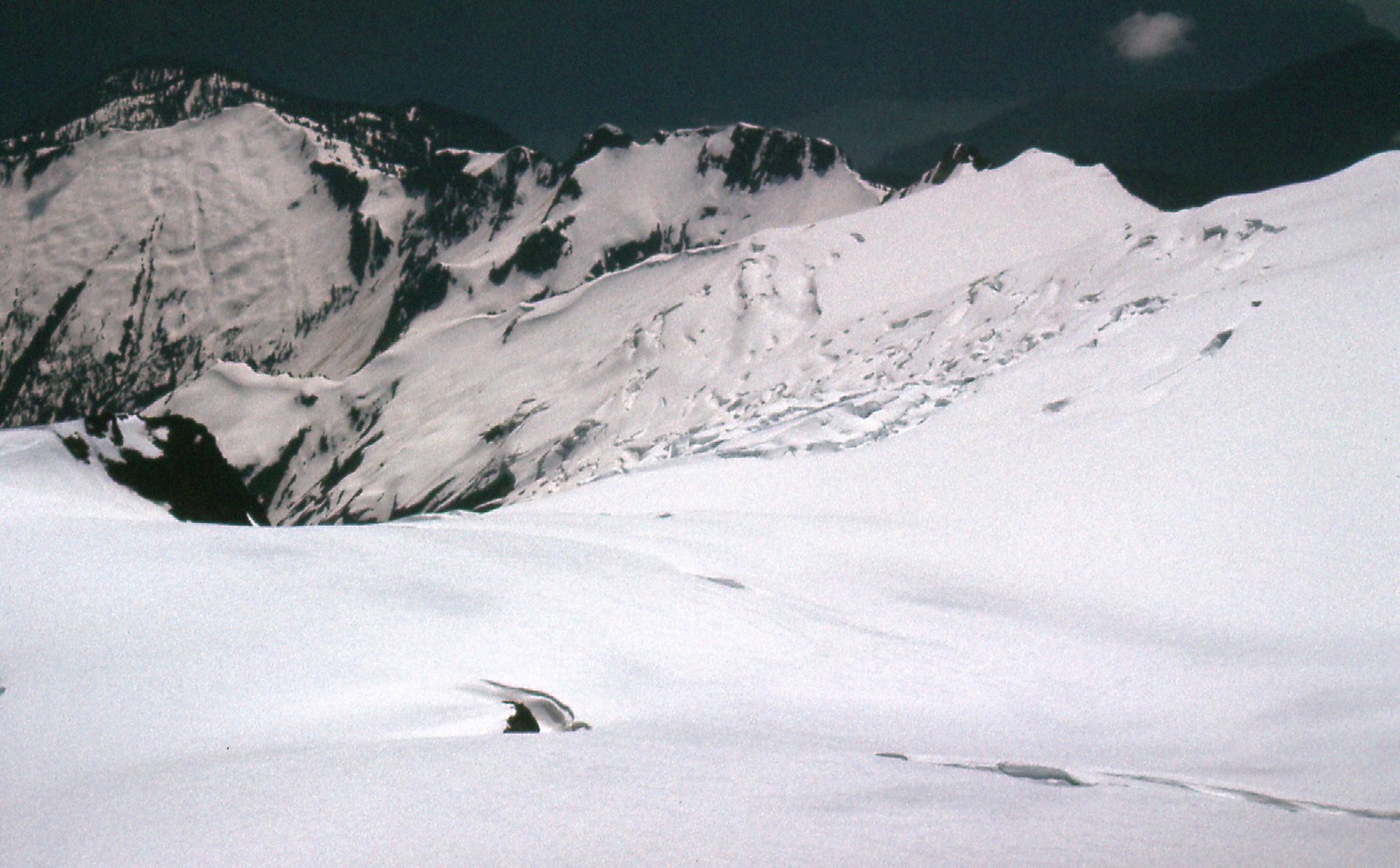
Looking SSE.
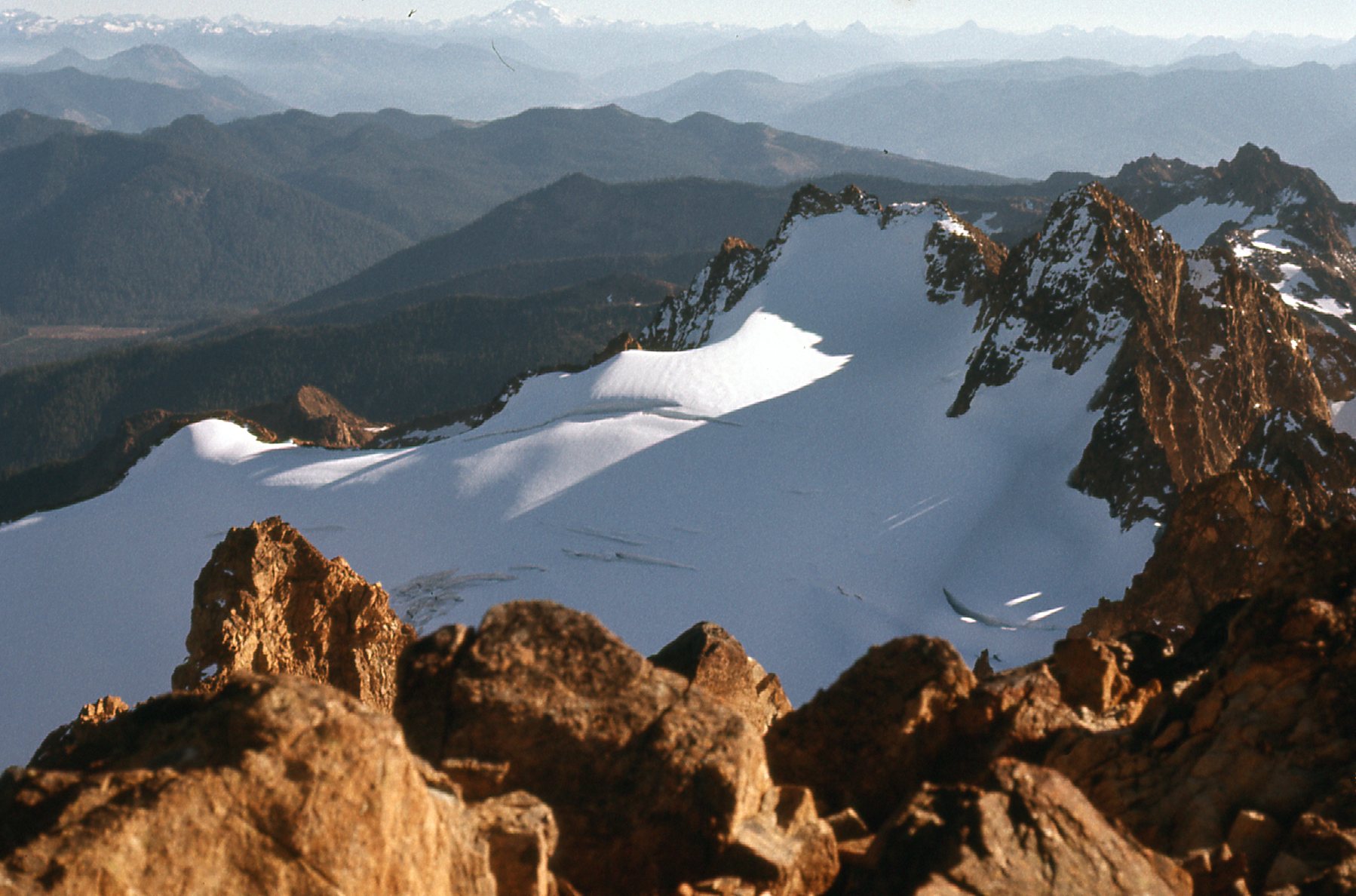
One more, looking east.
The Crystal Glacier
Our descent was quick, via Hell’s Highway and the Curtis Glacier. Okay, I know I’ve devoted a lot of space to Mt. Shuksan, but there are so many good glacier views that I just had to share them with you.
Another glaciated peak that was close to my home in BC was South Twin Sister Peak. Although we climbed it late in the year, November 12th of 1976, it was quite free of snow. We didn’t have to cross any glaciers here, but we could see a few from the summit.
A glacier to the northeast of the peak.
Here was another.
Looking southeast along the Sisters ridge.
I have a feeling that those glaciers have dramatically receded in the 50 years since we made the climb. We also had this great view of Mt. Baker.
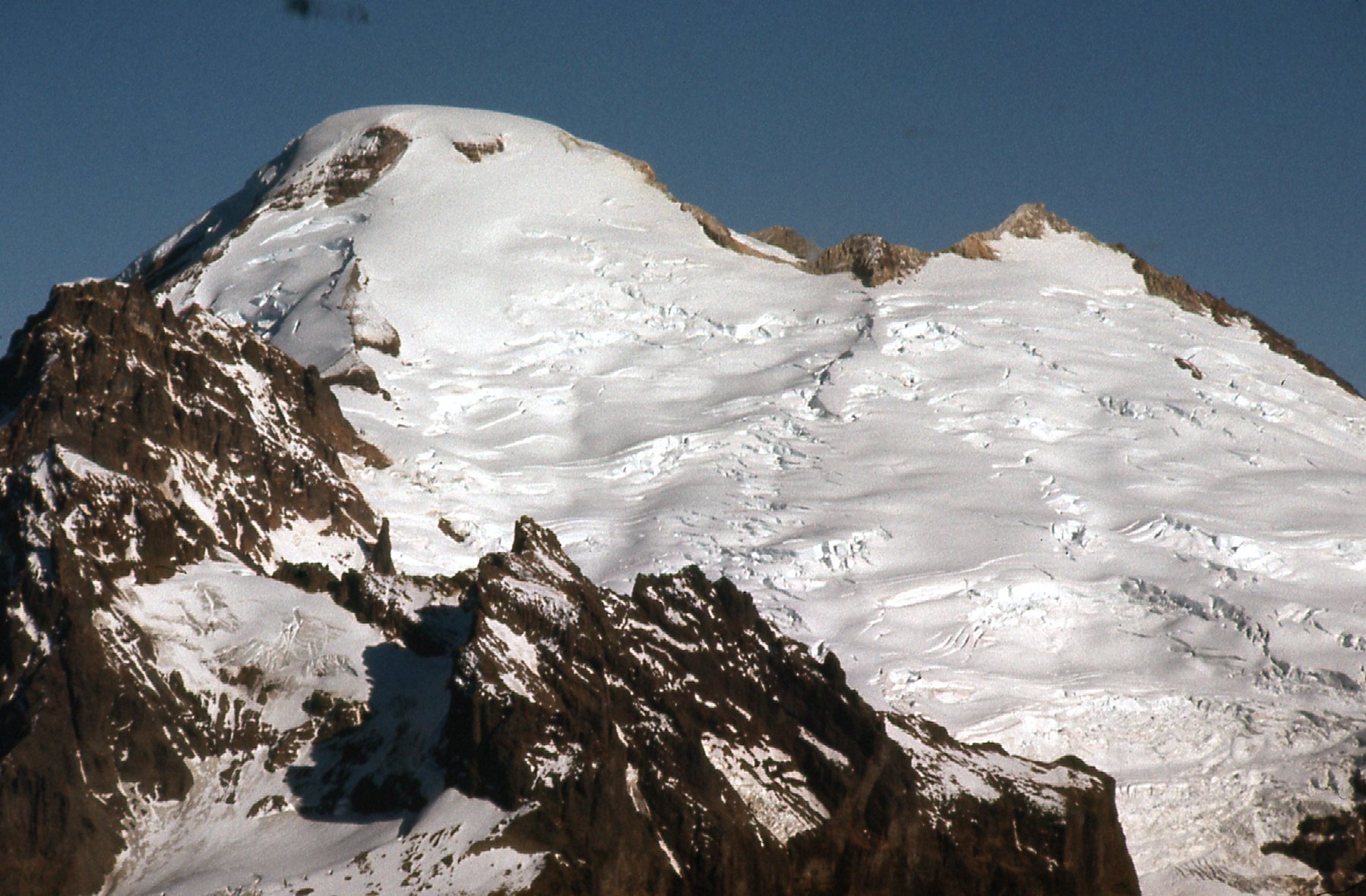
Looking at the south side of Mt. Baker – glaciers galore!
A mere 40 miles north of Vancouver sits the Tantalus Range. Plenty of glaciers there. Here’s a view of Omega Mountain, elevation 6,293 feet. This is the east side.
Omega Mountain
And here’s a view of Mt. Tantalus, elevation 8,556 feet, the highest peak in the range. Both of these pictures were taken from the Squamish River, down around sea level.
The east face of Mt. Tantalus – talk about ice!
The Cheam Range was close to my home in BC, and this glacier sat below Welch Peak.
Looking down to the northeast side of Welch Peak.
In late July of 1977, Brian Rundle and I chartered a Cessna with pilot and flew north from Langley to make a couple of food drops on to glaciers. We had some good views from up on high, like this one.
Mt. Clarke was not often climbed back in the 1970s, and here is a view of its NW side.
Here’s another air photo, this time of Grainger Peak. That’s Mt. Baker in the distance.
The north side of Grainger, more glaciated than Clarke.
Only 4 days later, we found ourselves in the Lillooet Range. This was a pioneering trip covering new ground and climbing some virgin peaks. We often found ourselves on glaciers. Check out this scene, glaciers on the north side of Mt. Breakenridge.
The north side of Mt. Breakenridge.
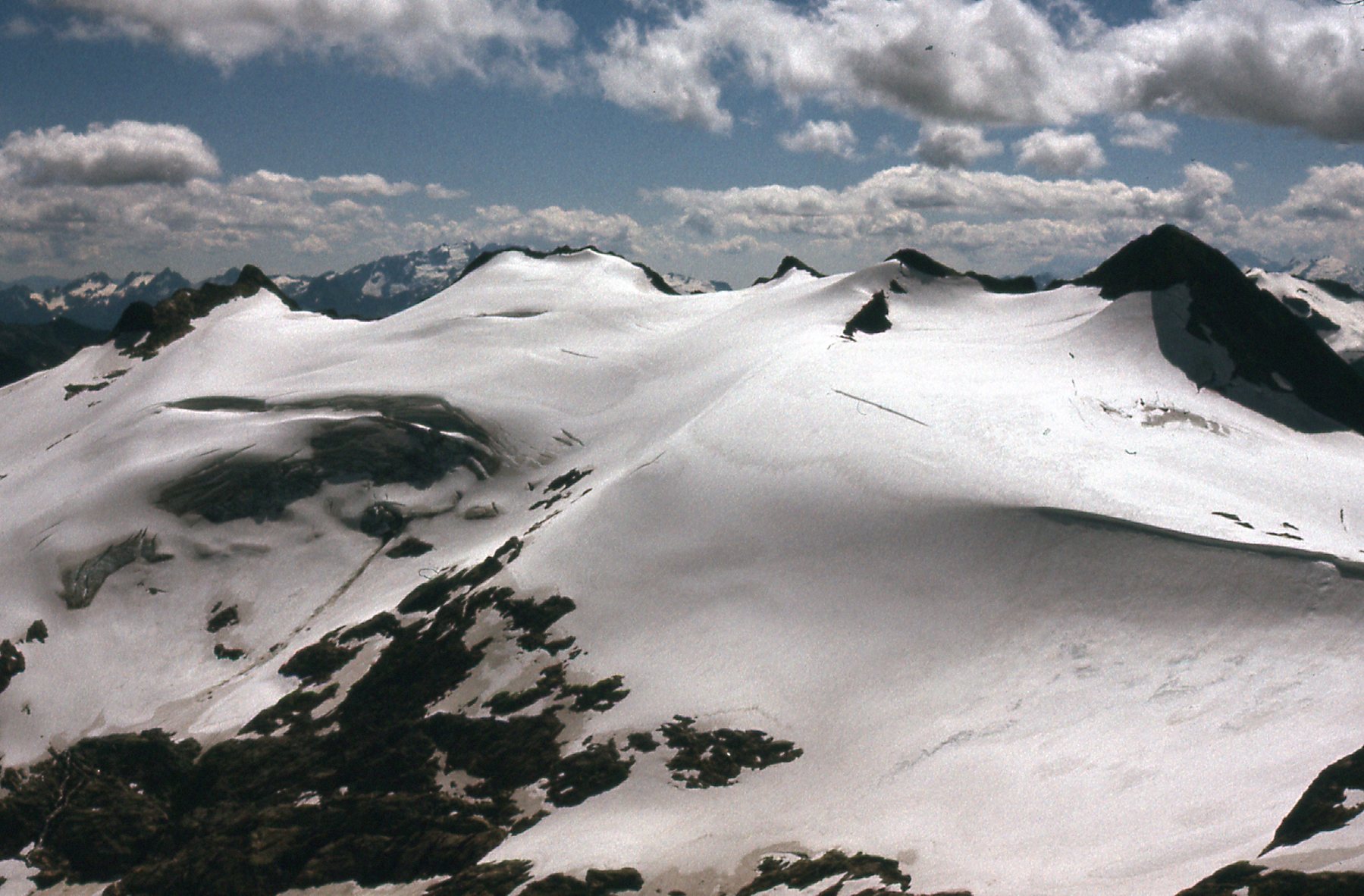
This next one shows the icefield to the north of Peaks 7900 and 8000.
More ice.
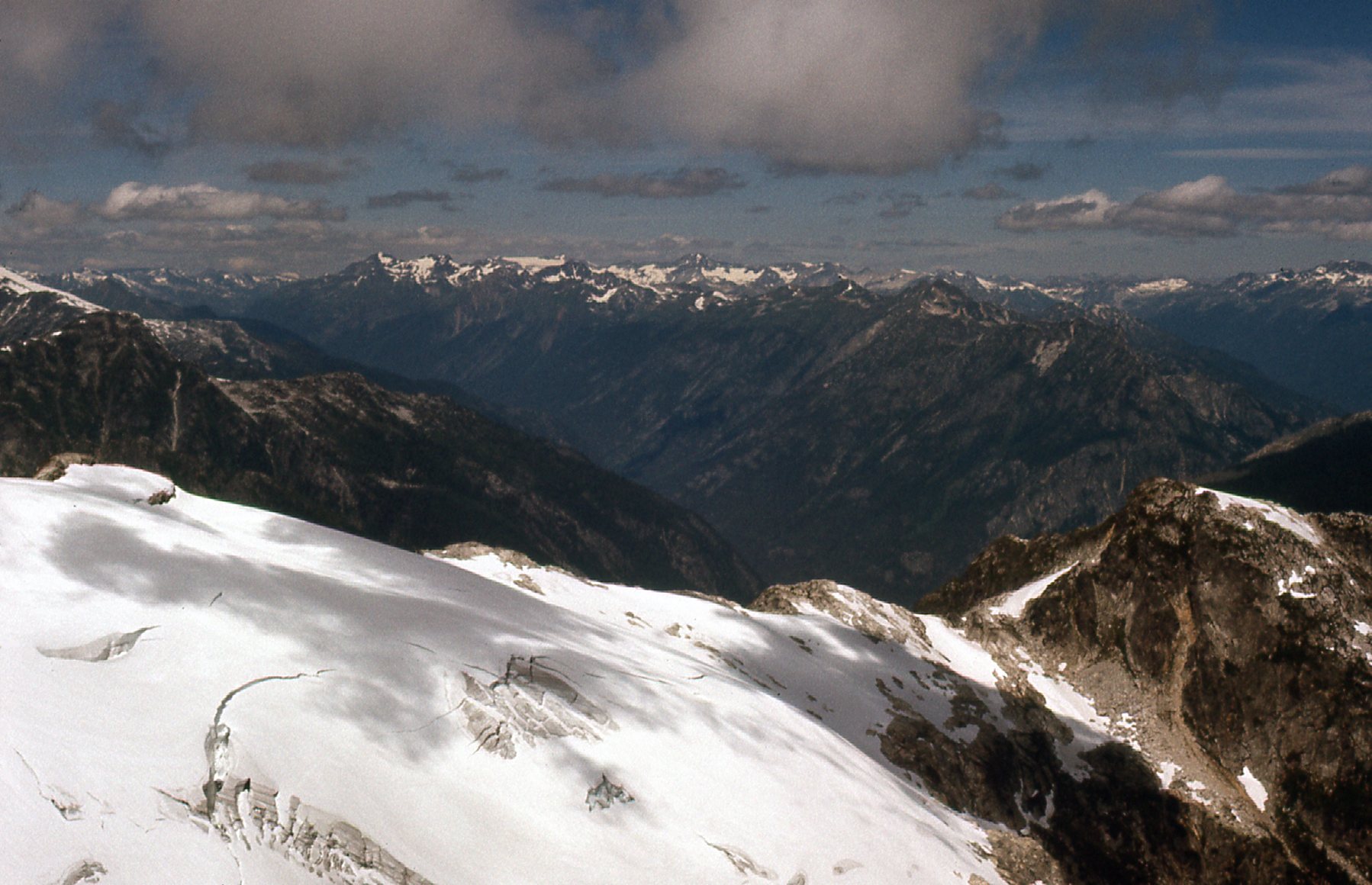
Look closely at this next shot. See the little pink mark? That’s where we were pinned down for 2 days and nights in a storm.
Looking west of south from Peak 7900
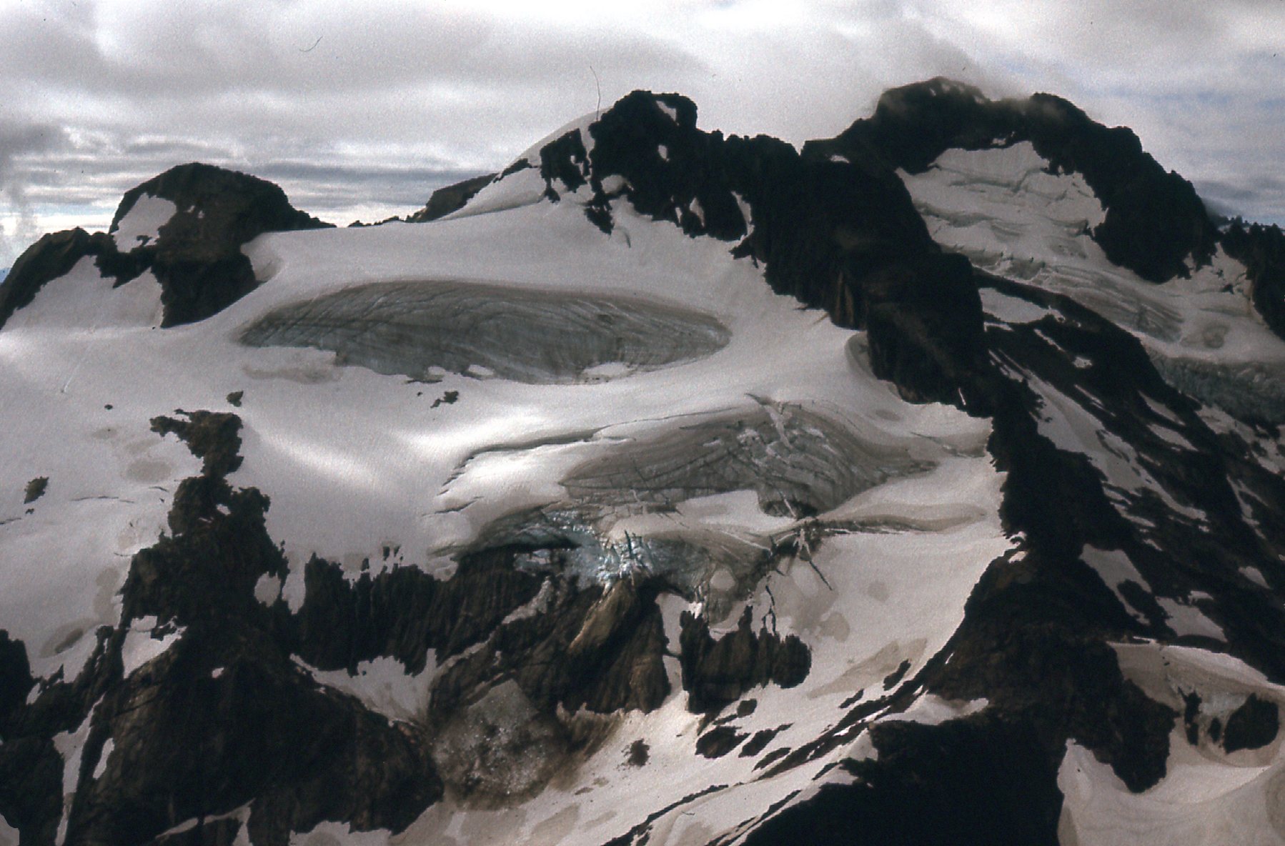
Here, we are looking from Peak 8000 to Peak 7900. A few small glaciers, still mostly snow-covered.
Looking southeast
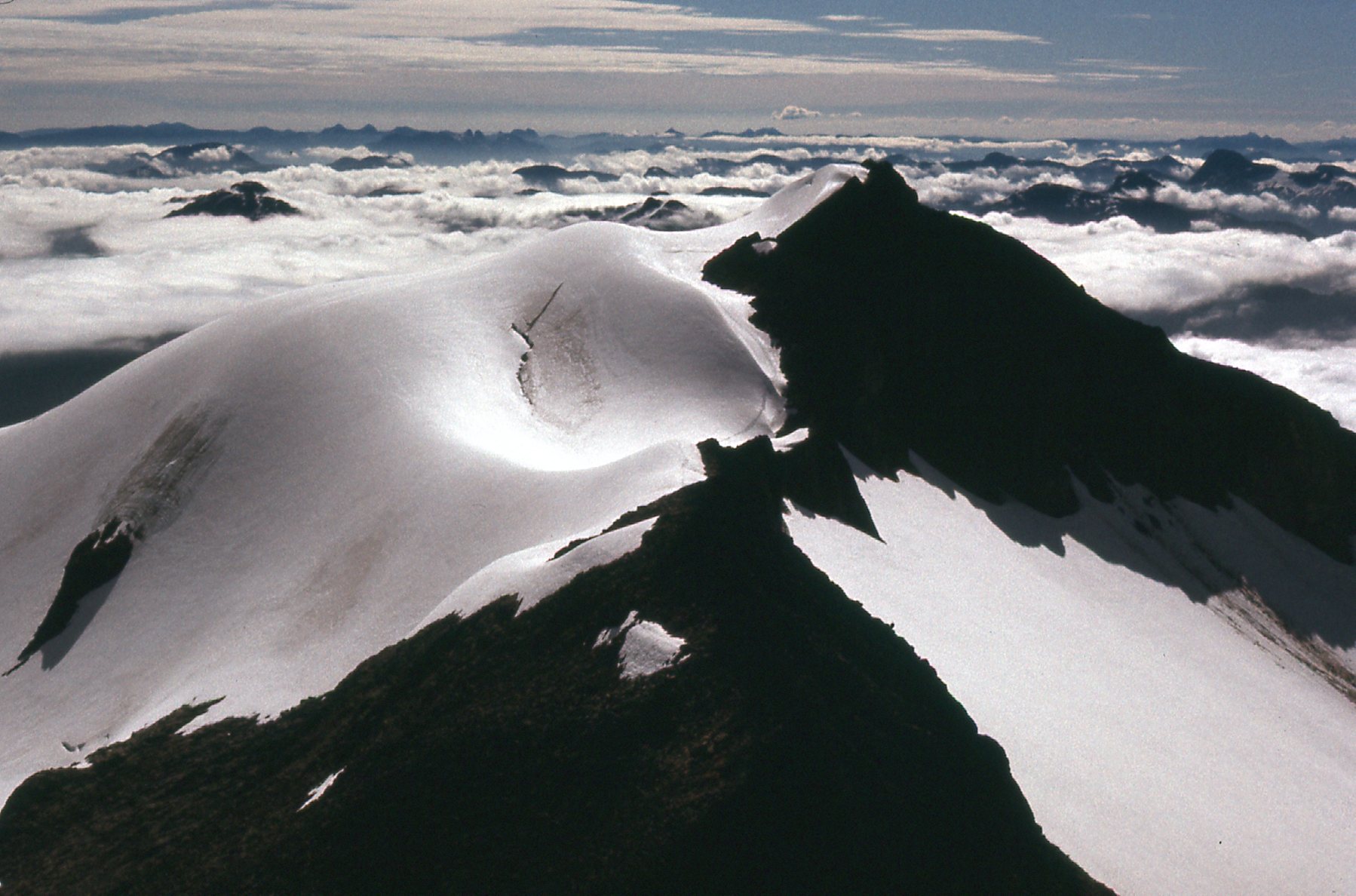
Here, we are looking back south. In the northern hemisphere, the north side of peaks is the most heavily-glaciated. This is because the north side receives less sun, and glaciers can build up quicker and last longer. In the middle of the photo, you can see some blue ice. Chunks of it have broken off and fallen down and a bit to the left as a debris field.
Peak 7300 is on the left; Peak 7600 is on the right.
In the Lillooet Range, we crossed miles of icefields.
Looking north into Nahatlach country.
Fresh new peaks were just ahead.
Enough ice for anyone.
This was one of my favorite days. From higher country, we dropped down thousands of feet back to our camp, crossing more glaciers en route.
An amazing, peaceful valley.
In southwestern BC, there are many glaciated peaks. Some of the American ones are best approached by crossing the border in remote country from Canada. Climbers routinely walk across the border to climb these, and I don’t know of anyone who ever got into trouble doing so. These next photos show just how wild this area is, and were taken on a climb of what we used to call International Peak.
This photo is taken from Canada but the peak is in the United States.
Here’s a glacier on the north side of a peak.
Looking south to Matsaac Peak
Badly-broken ice is apparent in this next one.
One messy glacier.
This glacier dropped steeply along the north ridge of my peak.
Devil’s Tongue is the sharp peak sticking up on the left side of the photo.
The route I climbed is up the rocky ridge on the left side of the glacier all the way to the skyline.
My route.
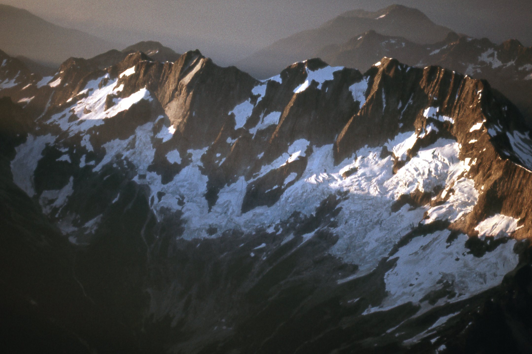
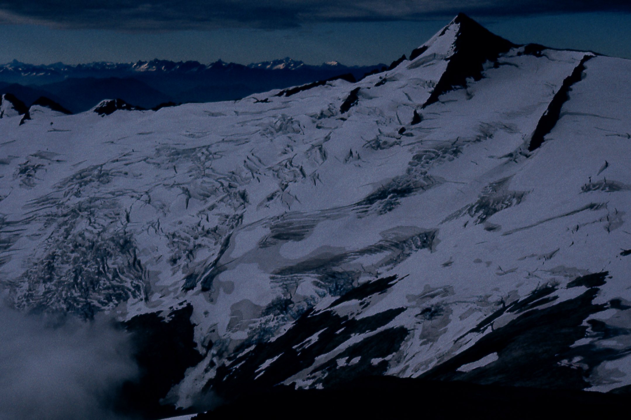
Once atop my peak, I had this exciting view to the north side of Mt. Spickard, elevation 8,979 feet.
The north face of Mt. Spickard – no country for old men..
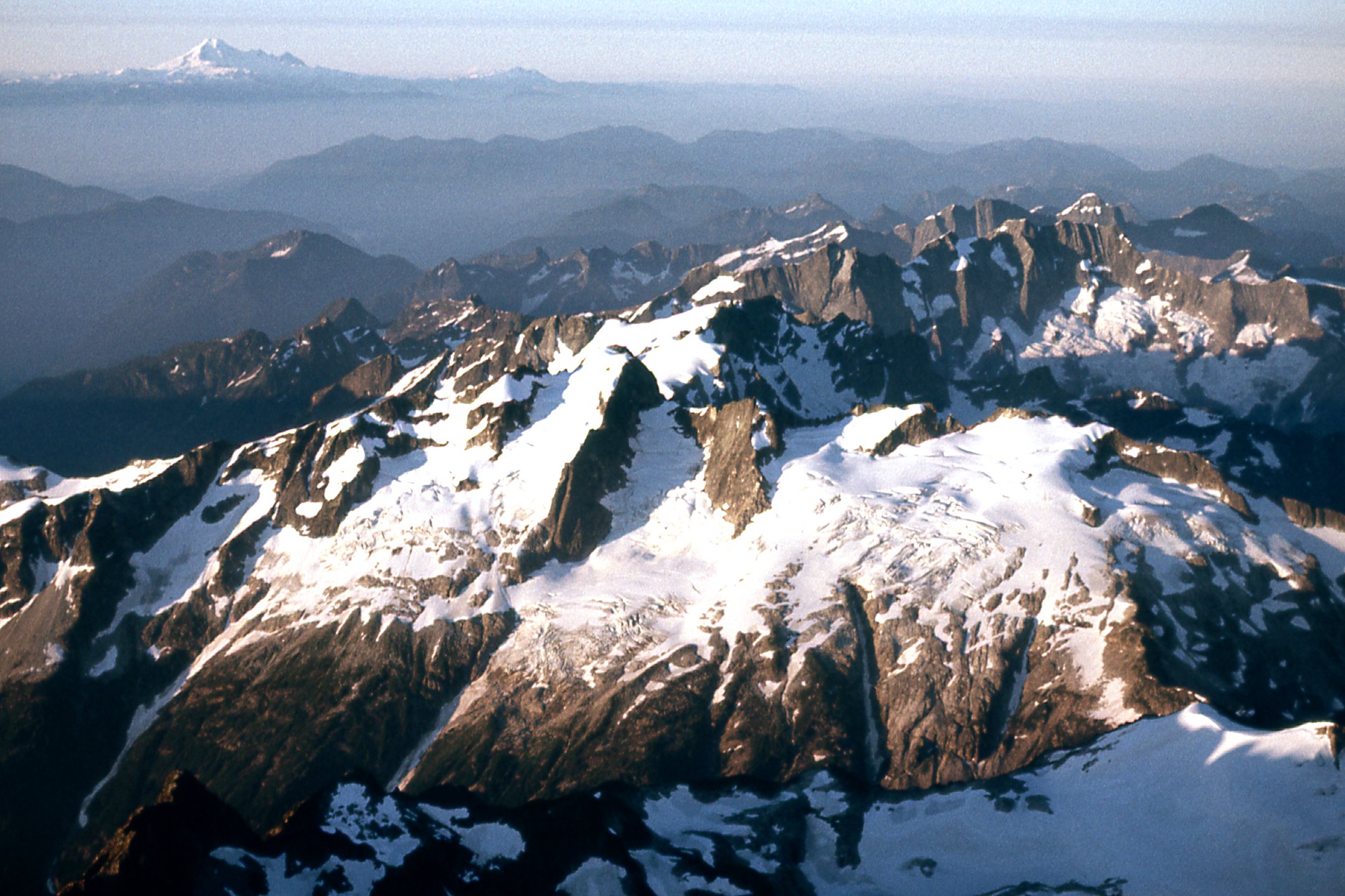
From the same viewpoint, I had this amazing view south into the Pickett Range, a veritable ocean of ice.
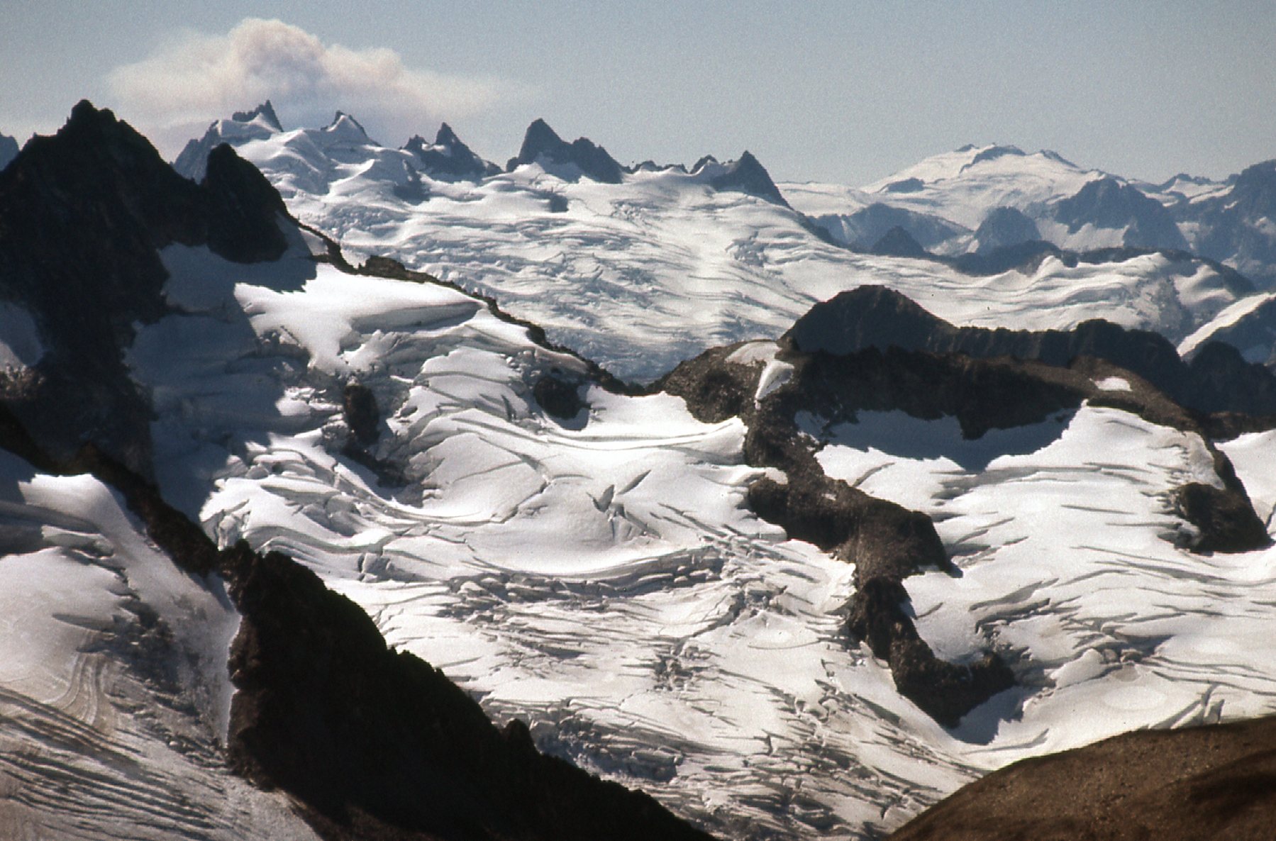
Ice, ice and more ice.
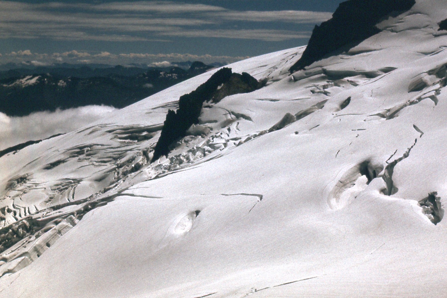
I descended my peak by a different route and had this exciting view on to another glacier.
Talk about a broken surface. No pleasure walk trying to cross that.
Here’s another view of a different part of the same glacier.
A troublesome spot.
Enough ice to satisfy just about anyone.
Another view south.
Here, we can see a steep glacier on the right side of Matsaac Peak.
The glacier is mostly on the north side.
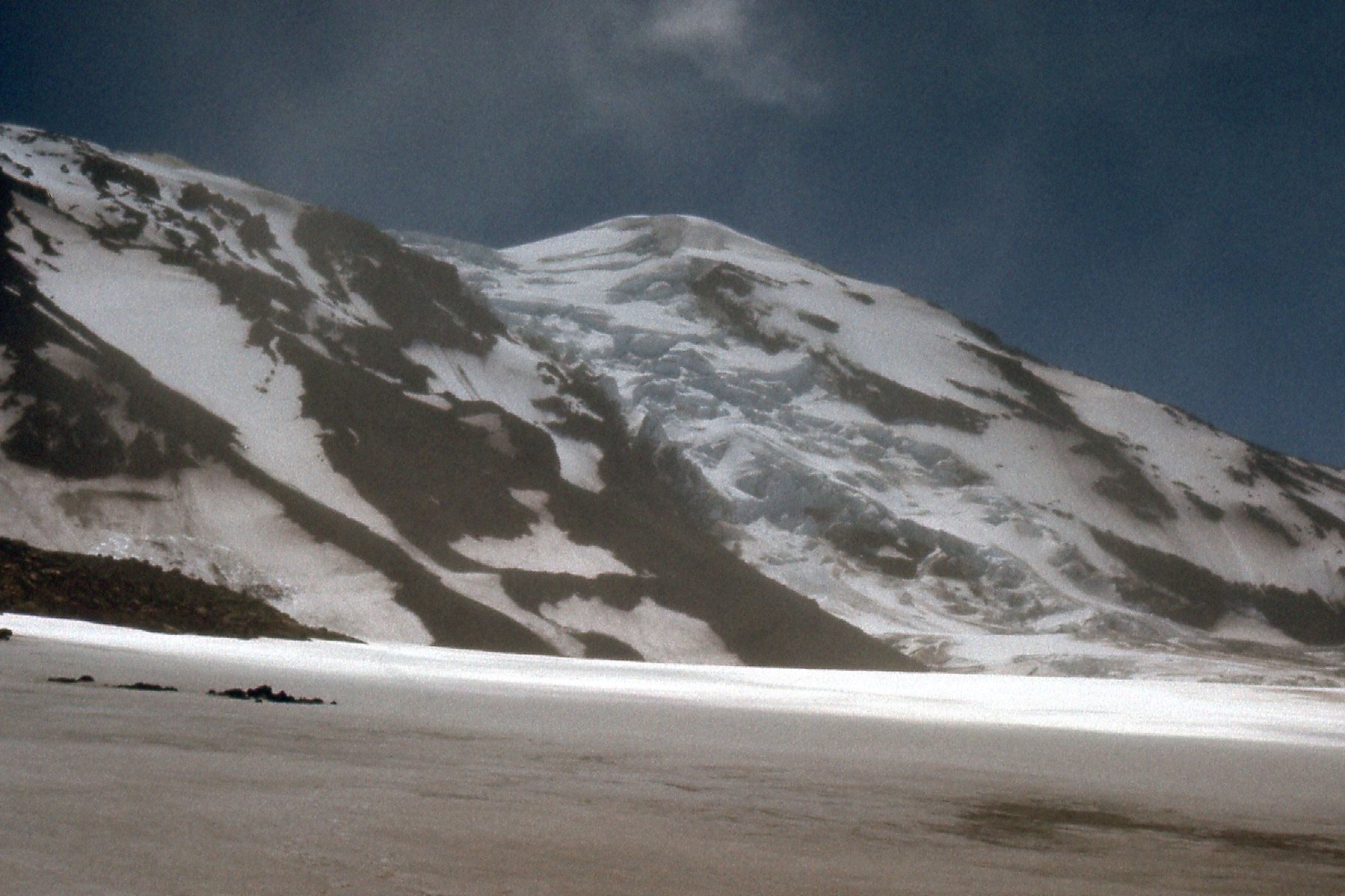
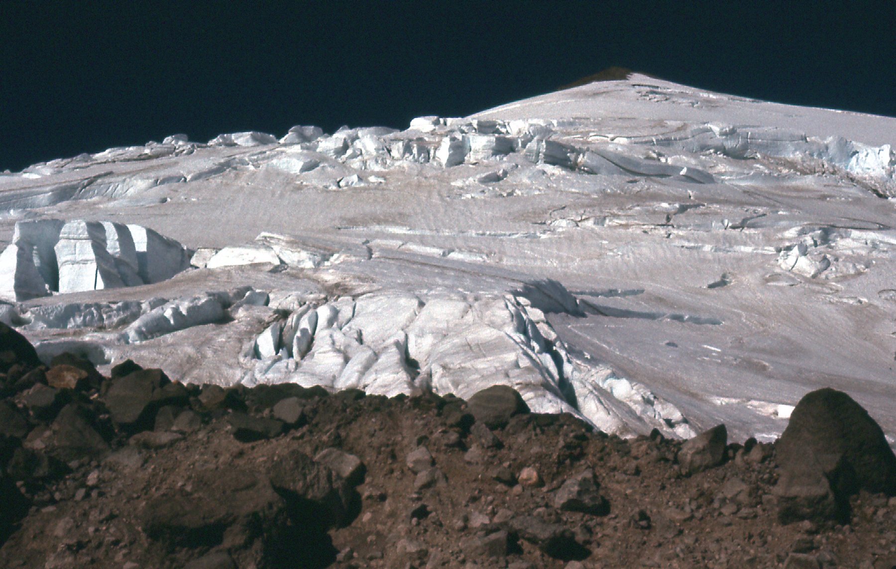
The big volcanic peaks of the Cascade Mountains in Washington state were a big draw, and we BC climbers visited them all. On a 1977 climb of Mt. Adams, at 12,276 feet and the second-highest peak in the state, we saw this feature near the summit. The ice is breaking badly as it starts its journey downslope.
At the top of the Adams Glacier.
This view is taken from much lower down and shows the Adams Glacier dropping thousands of feet down the slope.
Looking southeast to the Adams Glacier.
Only 34 miles west of Mt. Adams, we find Mt. St. Helens, best known for its horrific explosion of May 18, 1980. Before it blew up, it was known for its classic shape and often referred to as the Mt. Fuji of the USA. It boasted 11 named glaciers on its flanks, all of which disappeared in the explosion – its height dropped from 9,677 feet down to 8,366 feet in a few moments. In 1977, three years before the explosion, I climbed it with friends via the Dog’s Head route which involved travel on the Nelson Glacier.
From 7,900 feet on the peak. Everything you see is gone forever.
Back in BC, a favorite group of peaks close to home was the Cheam Range. It’s highest was Welch Peak, elevation 7,976 feet. This is the north side as seen from The Still. I show it because it’s so steep that it appears unable to allow proper glaciers to form.
The north side of Welch Peak.
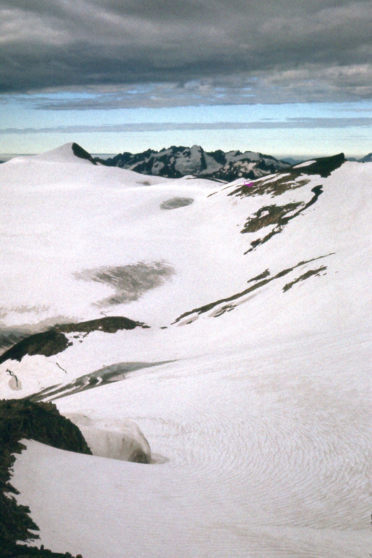
In 1978, I climbed Icy Peak in the Cascades of Washington. Just below the Canadian border, the mountains there are simply bristling with glaciers, even though they are not of great height. Standing only 7,073 feet, it boasts its share.
Here we see nearby Seapho Peak in the center, and Jagged Ridge ascending to the skyline on its right. We are standing in Nooksack Cirque. The West Nooksack Glacier fills the frame.
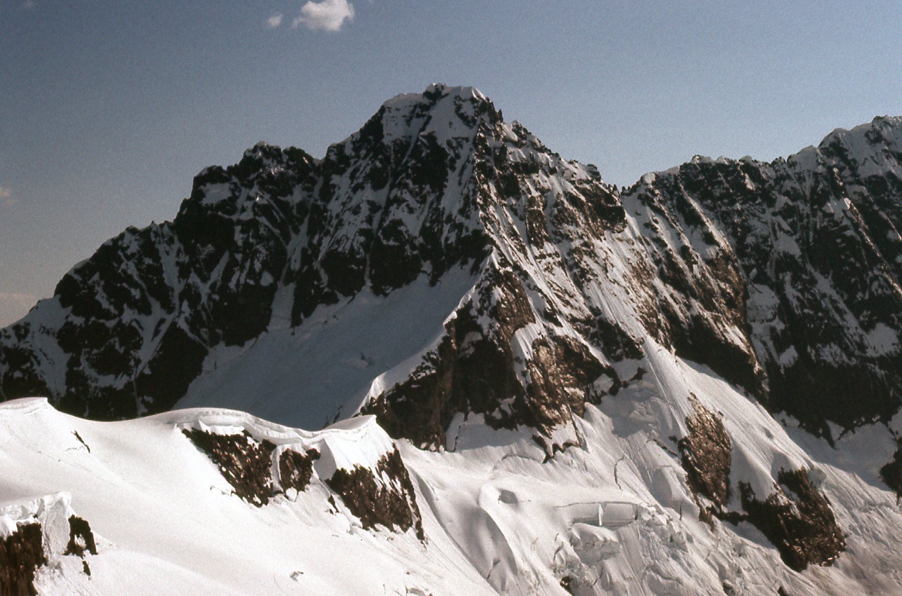
Here’s more ice, which is sitting below the north face of Mt. Shuksan.
The sharp peak in the center is the summit pyramid of Mt. Shuksan. Nooksack Tower is the dark rocky mass to its right.
Here we see the north side of Seapho Peak (elevation 7,313 feet, also called Cloudcap). This is taken from high up on Icy Peak.
The north side of Seapho.
And then there’s this one. Feast your eyes on the north side of Mt. Shuksan and the Nooksack Glacier. This is what a glacier should look like, right?
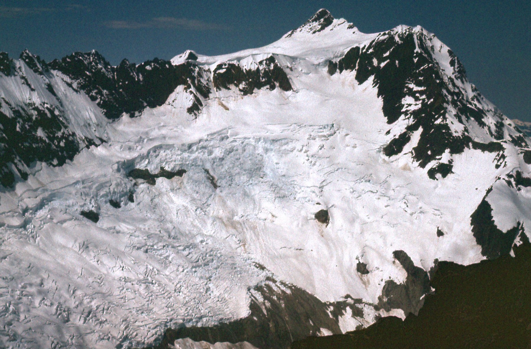
Glacier!
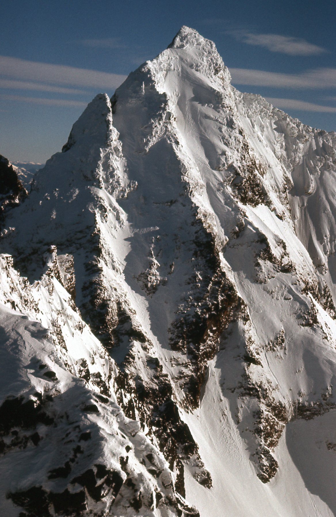
Earlier that year, Ross Lillie and I completed a winter ascent that was one for the ages. In February, over a 5-day period, using snowshoes and crampons, roped and unroped, we unlocked the secret of climbing Robertson Peak (elevation 7,389 feet). This unknown ultra-prominence peak had sat there through the ages, waiting for its first ascent until we came along. To save on weight, we threw out the stove, pot and cooked food. Instead, we survived on frozen sandwiches for the 5 days and drank the water from Tretheway Creek – truth be told, I don’t remember it being such a hardship. The land was deep in snow, and there were glaciers on the north side of the peak but we didn’t have to cross any of them. Our route stayed mostly on the south side. My favorite picture of the trip is this one, which shows our final ascent route up the west shoulder of the peak.
Our route went up the center of the photo through all of those strange bulges, called rime mushrooms, then a bit out onto the face near the top on the right side to avoid the cornices.
Although the picture shows no glaciers, I think it’s such a good one that I had to share. I’m going to end this chapter now because I’ve reached the comfortable level of words I like to use in a piece. But stay tuned for the next chapter, to be called Glaciers I Have Known – Part 4.