
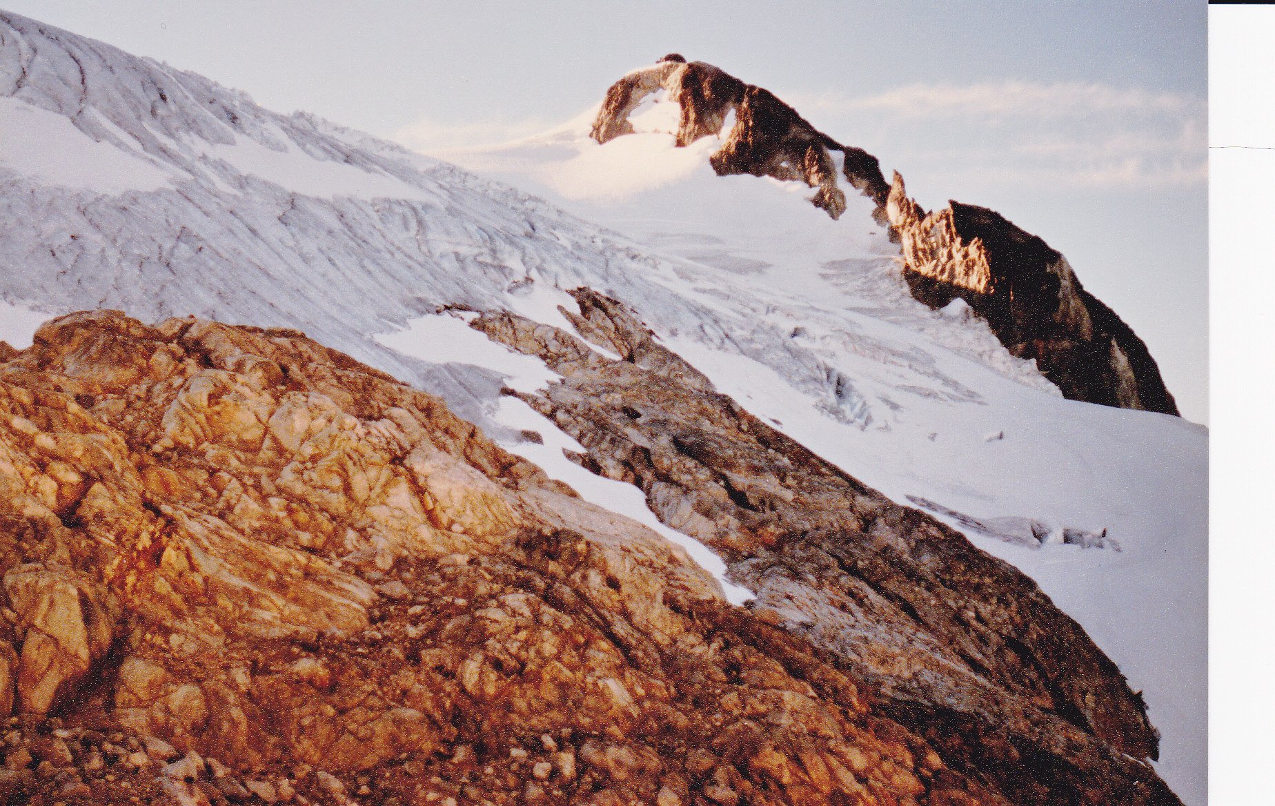
Before diving into this piece, please be sure to read the 3 previous instalments called Glaciers I Have Known – Parts 1, 2 and 3.
Most of what was shown up until now were glaciers in British Columbia and the Pacific Northwest of the USA. In this final segment, I’ll spend more time showing you glaciers I visited in foreign countries.
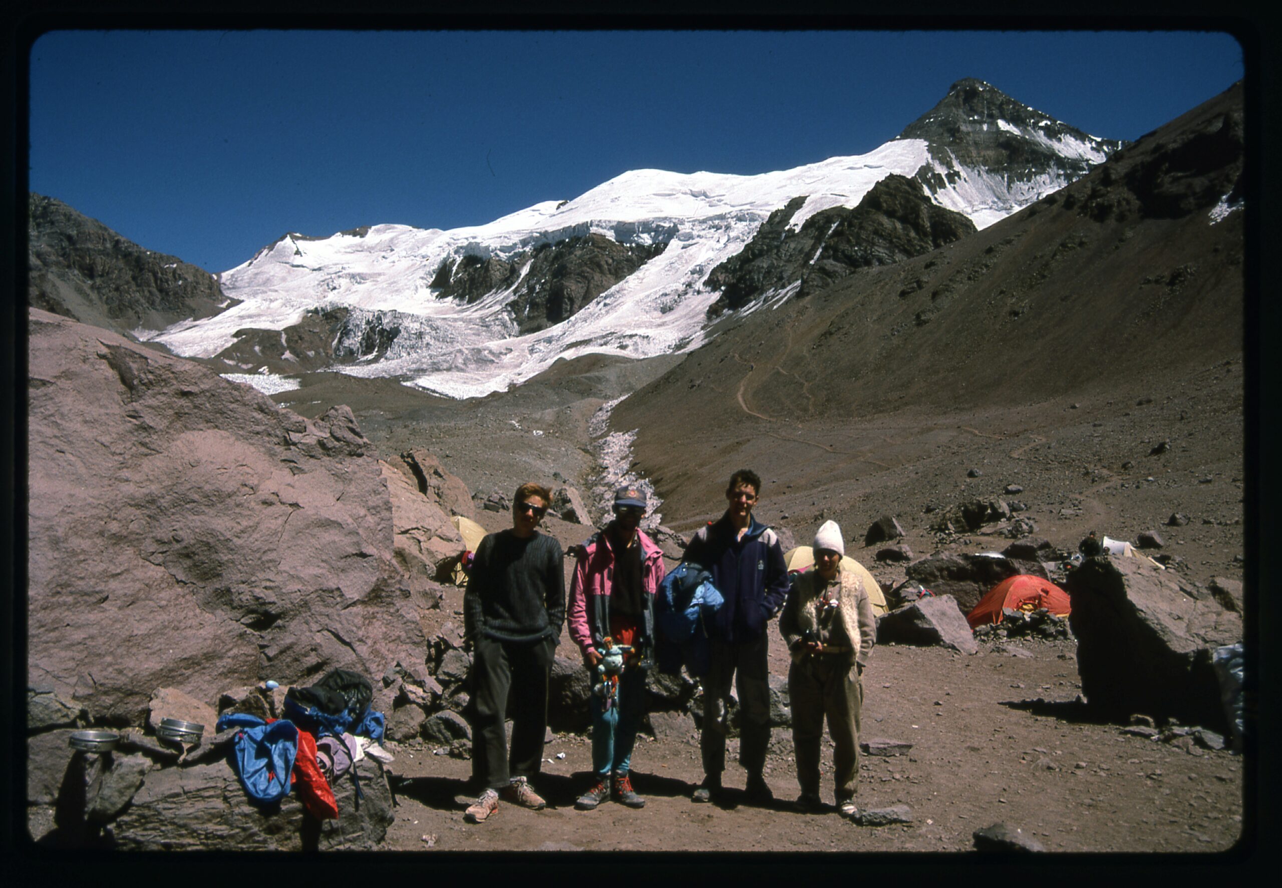
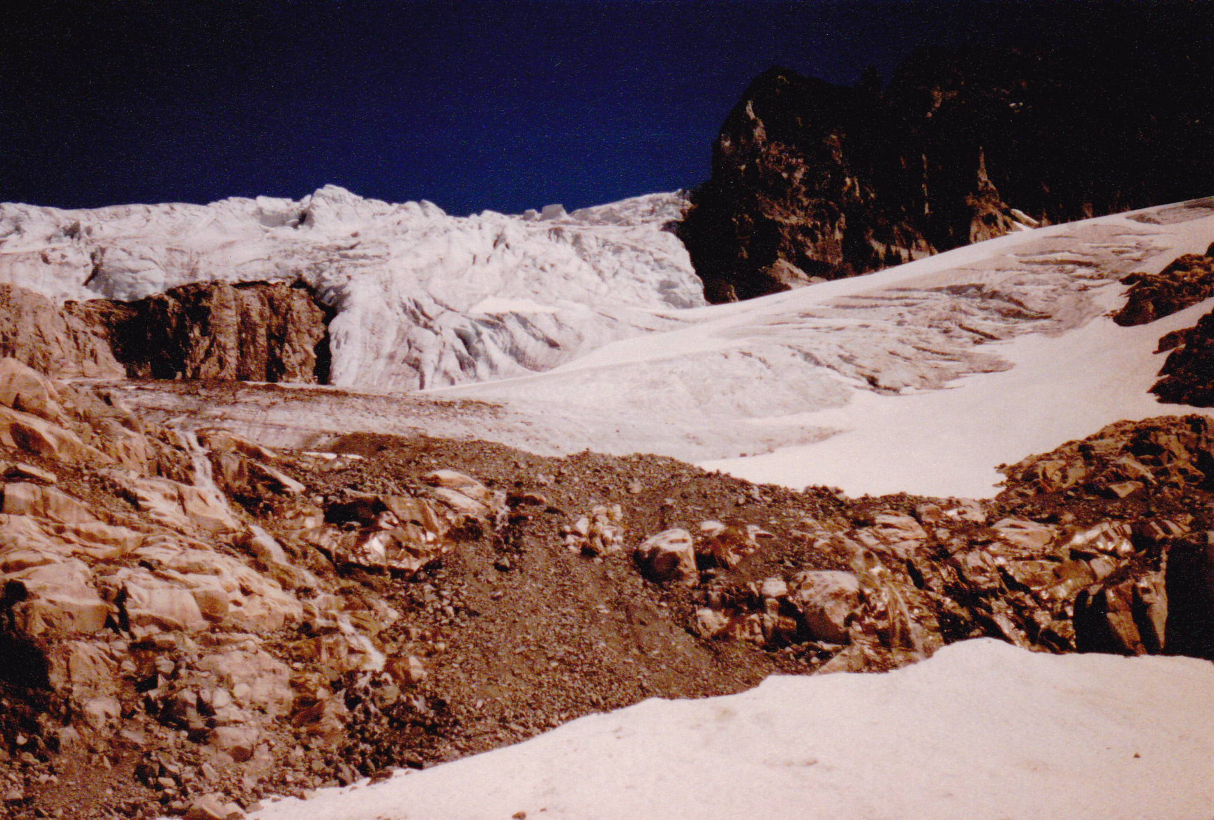
When I first visited Cerro Aconcagua in Argentina, in January of 1990, I spent a lot of time at Plaza de Mulas, the base camp of the Ruta Normal. Nearby sat the toe of the Lower Horcones Glacier which, at that time, came down to about 14,000 feet. The toe, or lowest part, of the glacier was covered with dirt. From beneath it flowed a steady stream of meltwater in mid-summer, and all of the camp’s occupants got their water from there
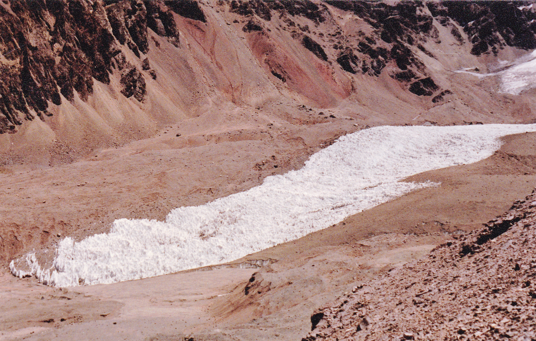
The lower part of the Horcones Glacier.
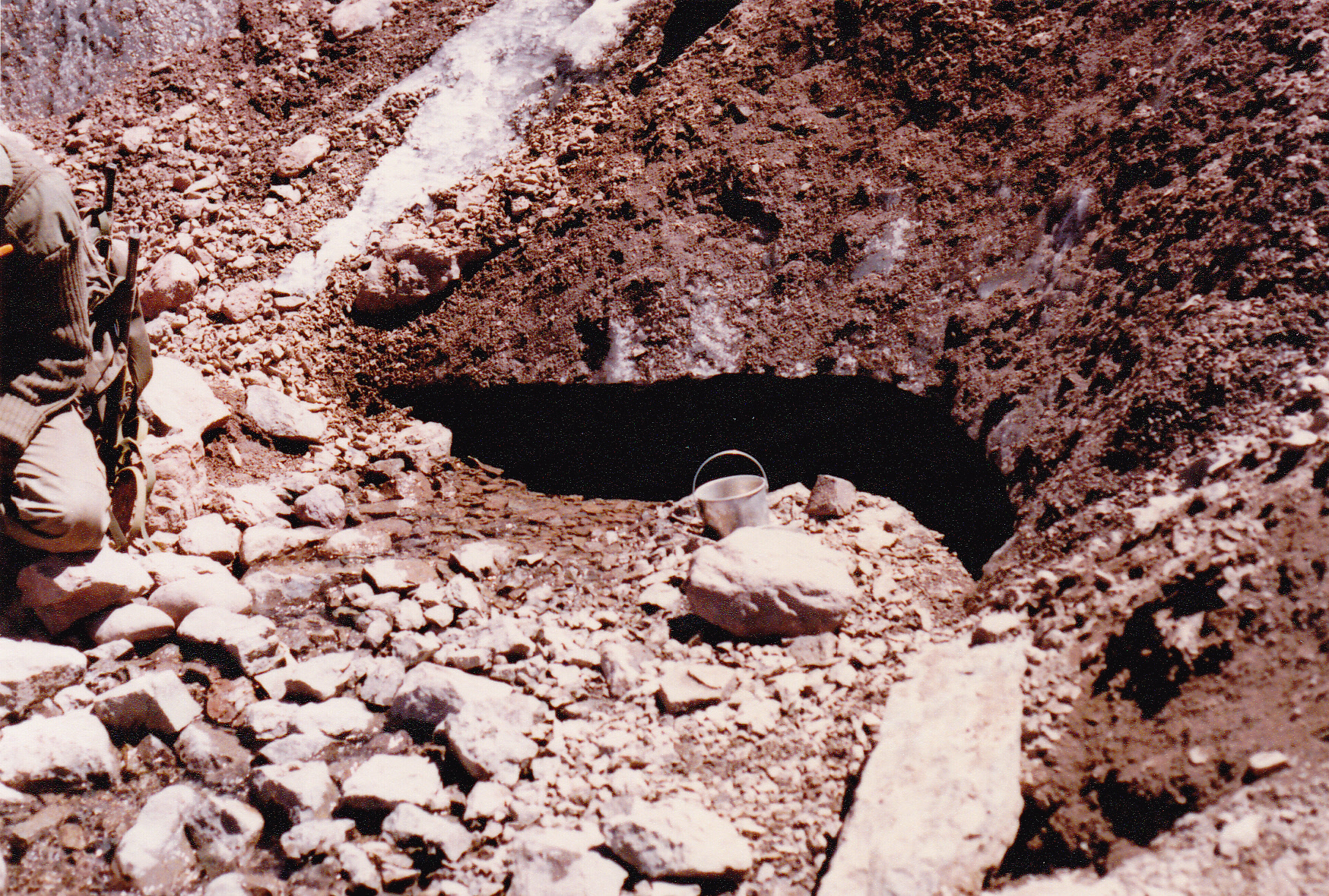
Water flowed out from the dark hole beneath the ice, which is covered in dirt.
Not far above Base Camp, one had this view of the Upper Horcones Glacier.
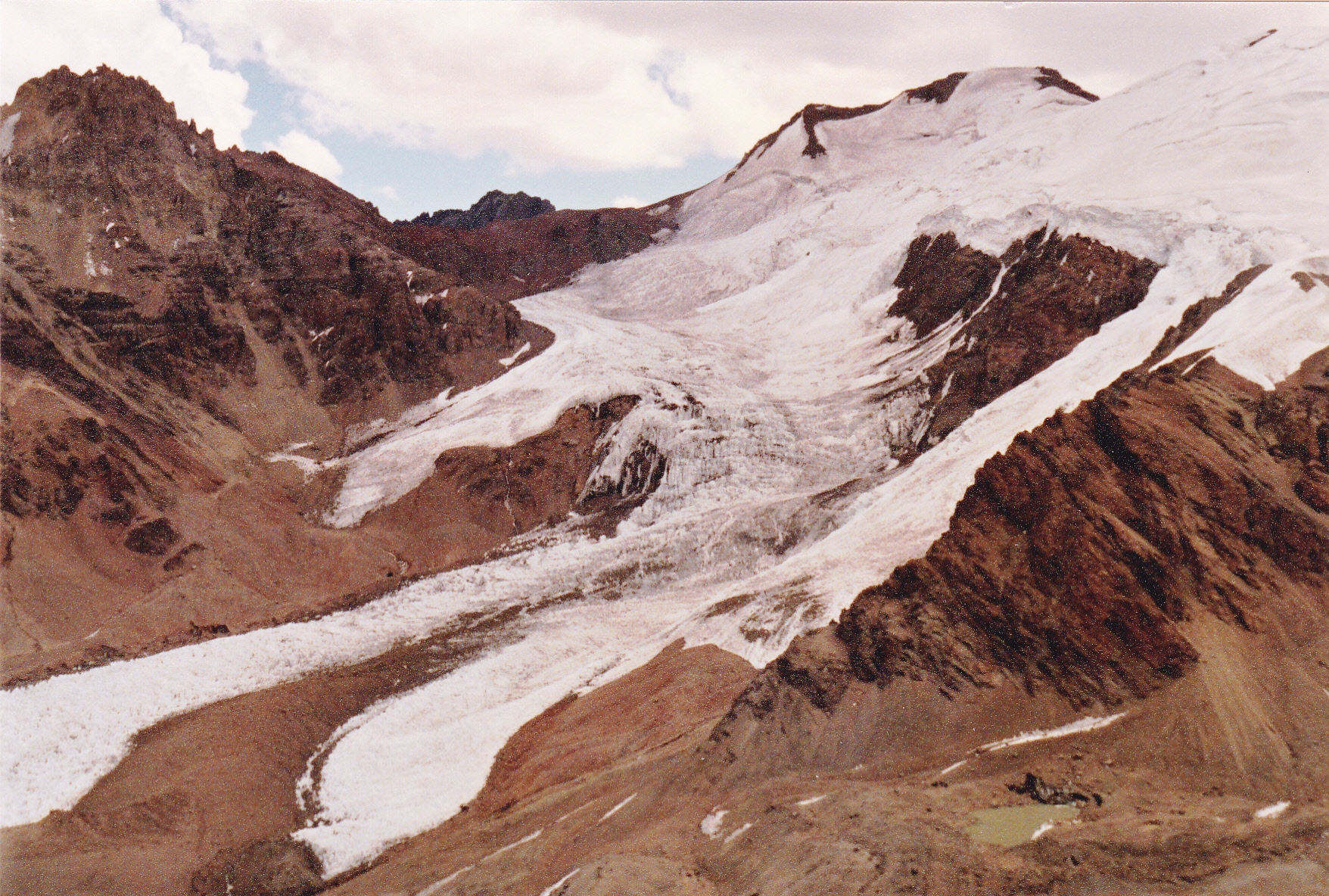
The Upper Horcones Glacier
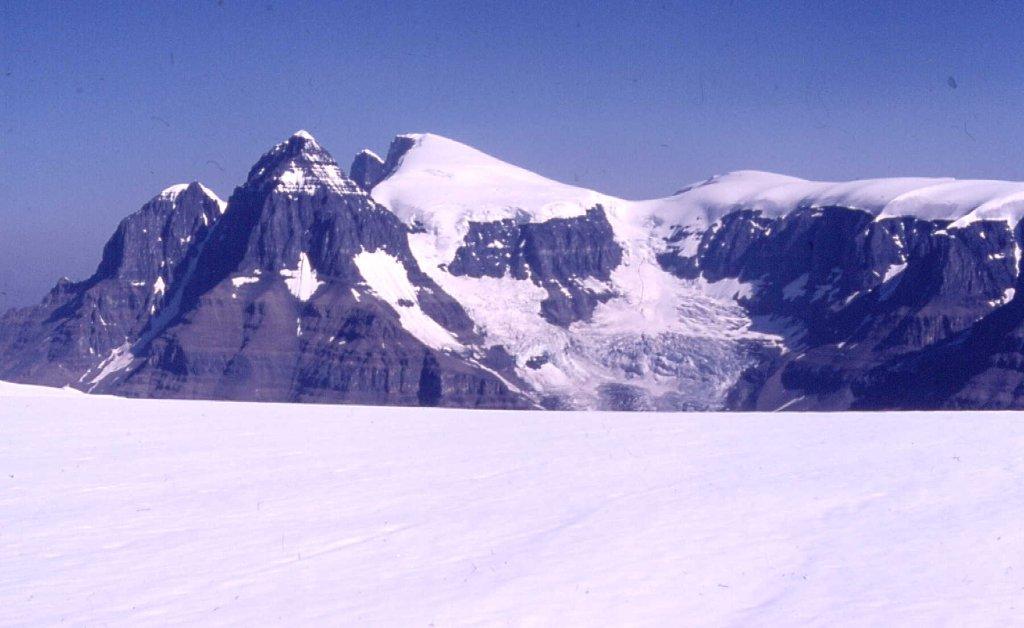
Climb up to an upper campsite at 16,000 feet, known as Plaza Cánada, and you had an expansive view of Cerro Cuerno’s south face,
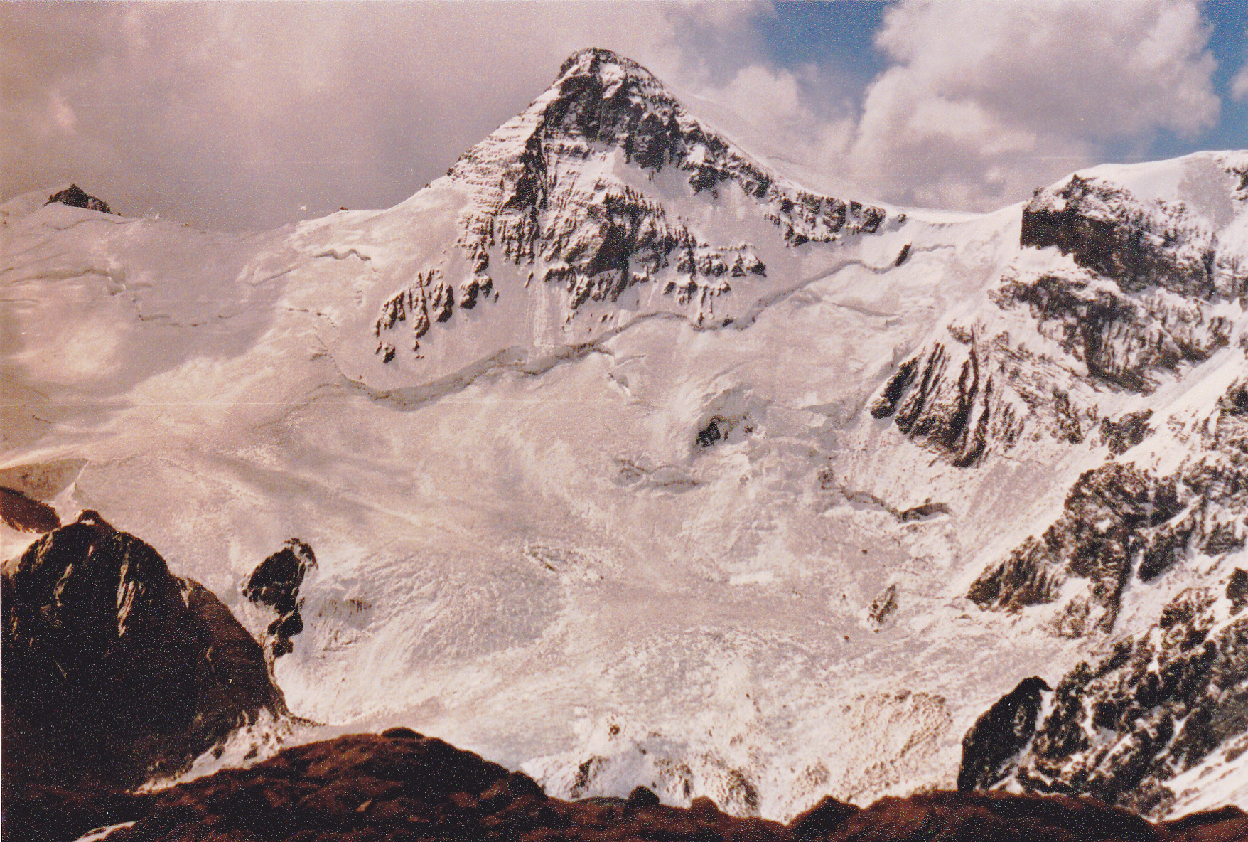
17,921 feet is the elevation of Cerro Cuerno.
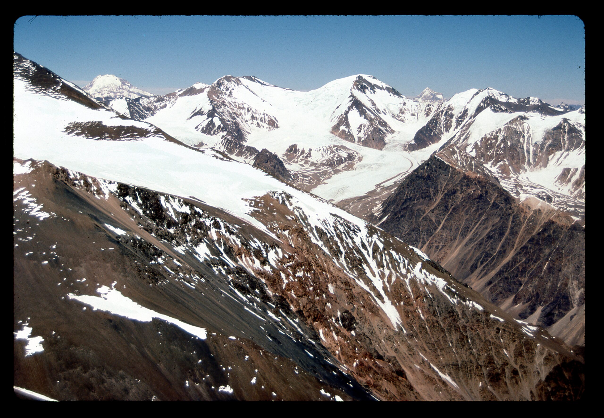
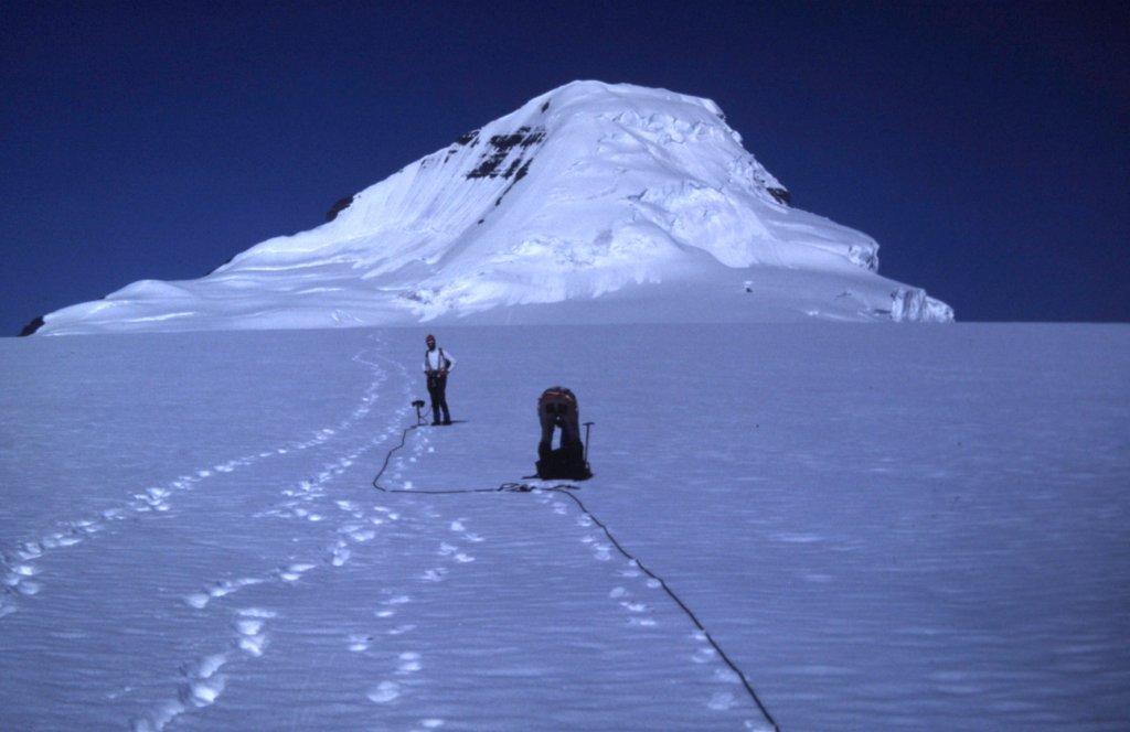
This next photo was taken from a higher camp known as Berlín, at around 19,500 feet. In the distance on the horizon can be seen Cerro Mercedario. Plenty of glaciers nearby, though.
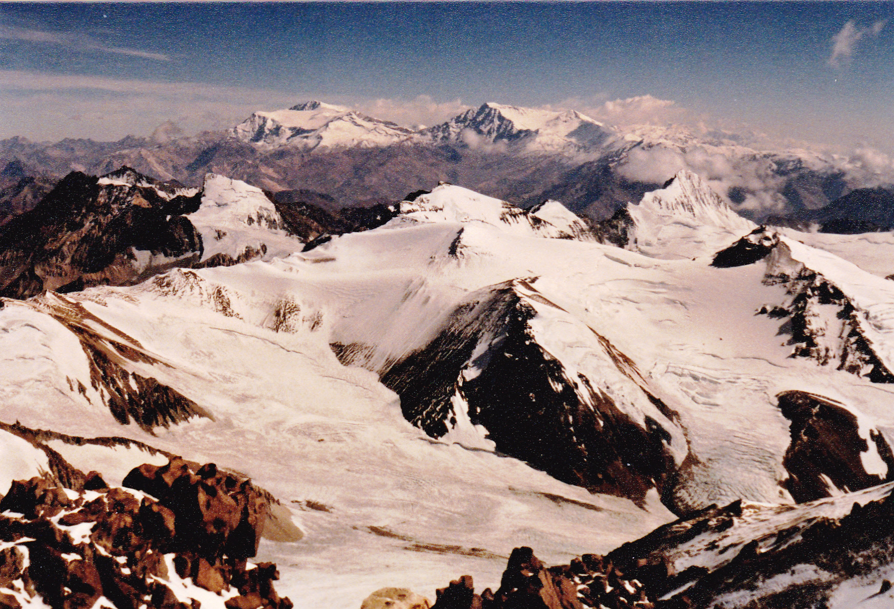
Looking north to Cerro Mercedario, the 8th-highest peak of the Andes, about 50 air miles distant.
Here’s a better view of how the glacier looks from Base Camp.
The Horcones Glacier as seen from camp.
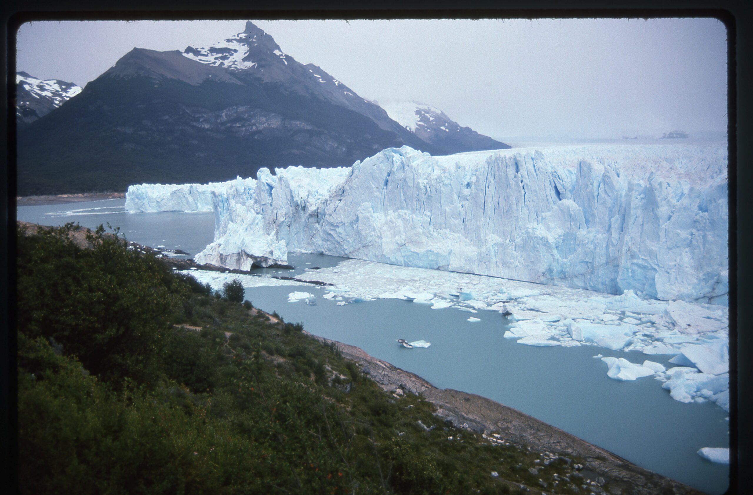
One of the world’s most accessible glaciers is the Perito Moreno Glacier in the Patagonia region of Argentina. Tourists can easily drive to a place where they can obtain terrific views of the snout, or leading edge, of the glacier. In January of 1991, I was fortunate to spend some time there. Chunks of ice break off and float around until they are grounded or melt. Here is one in the Canal de los Témpanos not far from the glacier.
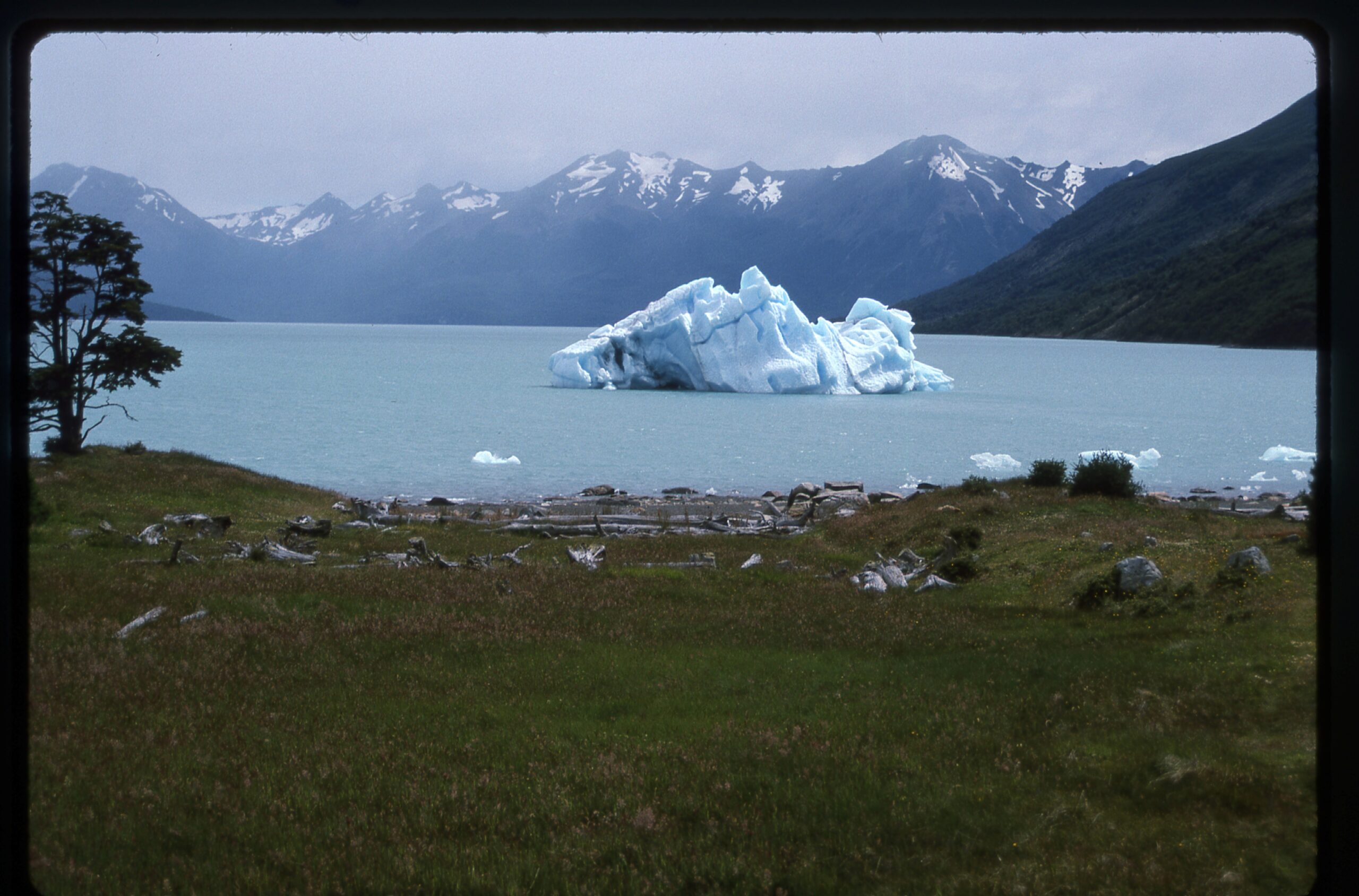
A grounded iceberg.
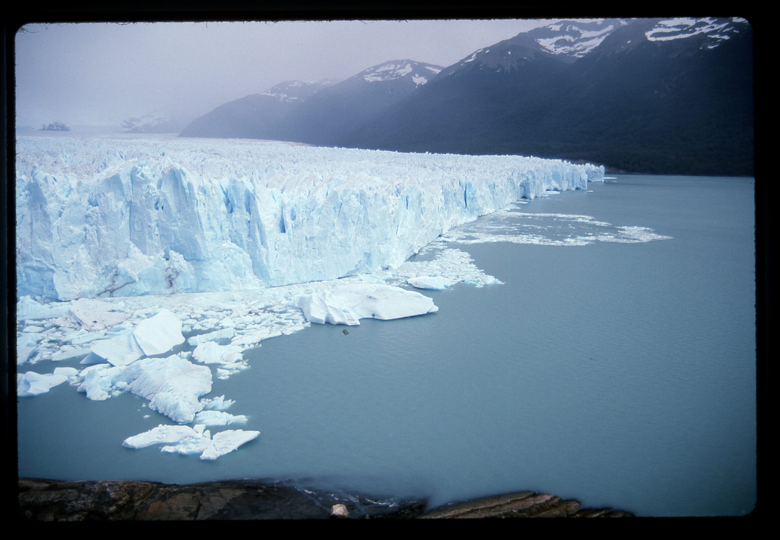
The Perito Moreno Glacier is 19 miles long and 3 miles wide, and is fed by the Southern Patagonian Icefield, which happens to be the world’s 3rd-largest reserve of fresh water after Antarctica and Greenland. The snout of the glacier is 240 feet high.
The north side of the snout.
Here’s looking the other direction, down the south side.
Looking down the south side of the snout.
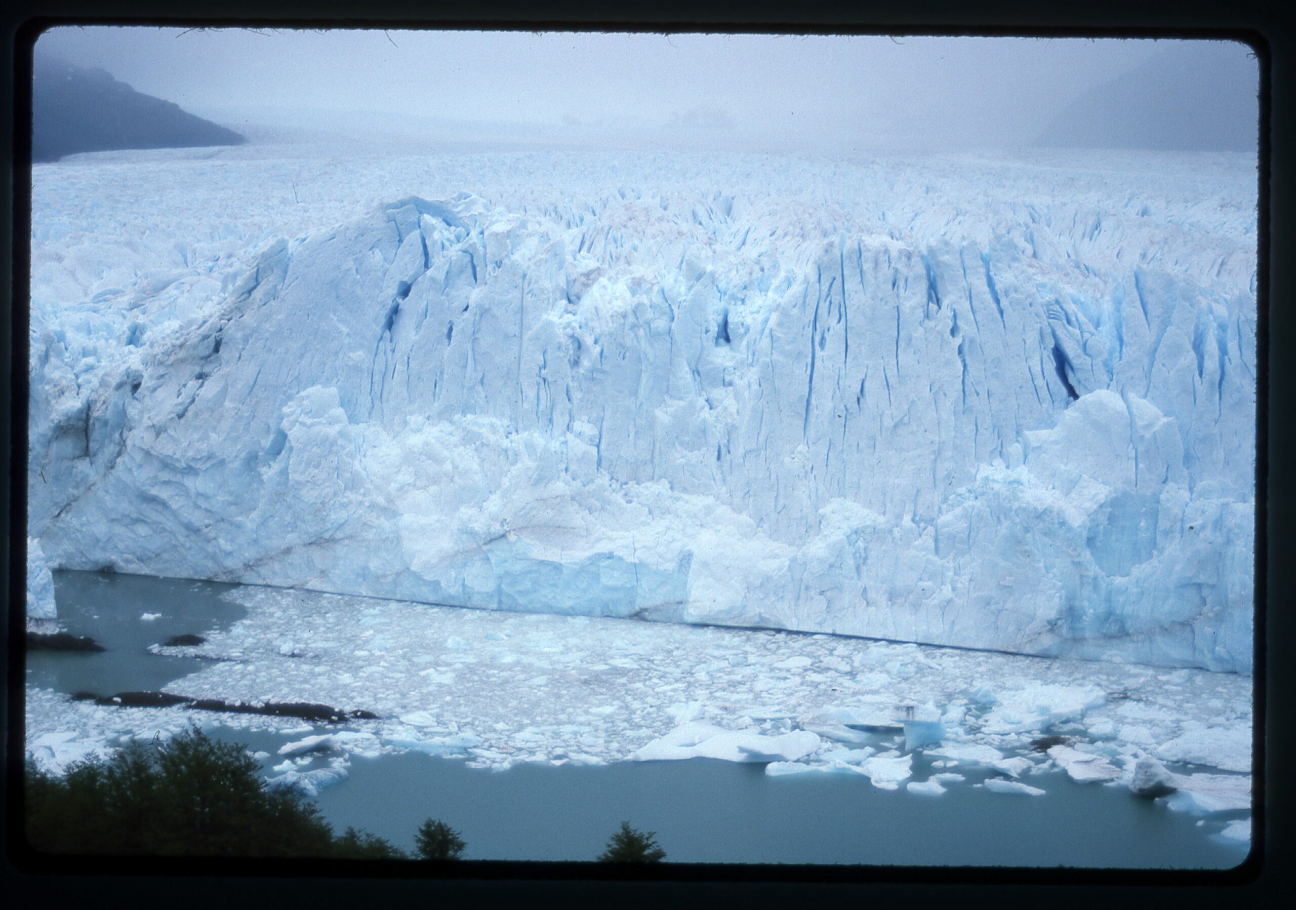
And here’s looking straight on at the center of the snout. Big chunks of ice are constantly breaking off and falling into the lake, sometimes causing large tidal waves to rush across the channel and up on the shore below where tourists gather. Signs in several languages warn you to stay away from the shore itself, as waves have swept people to their death.
The snout.
Farther south, we come to the area of Monte Fitz Roy. Known the world over for its spectacular vertical real estate, the area is beset with foul weather and is heavily-glaciated. It sits right at the east edge of the Southern Patagonian Icefield. Lots of glaciers there.
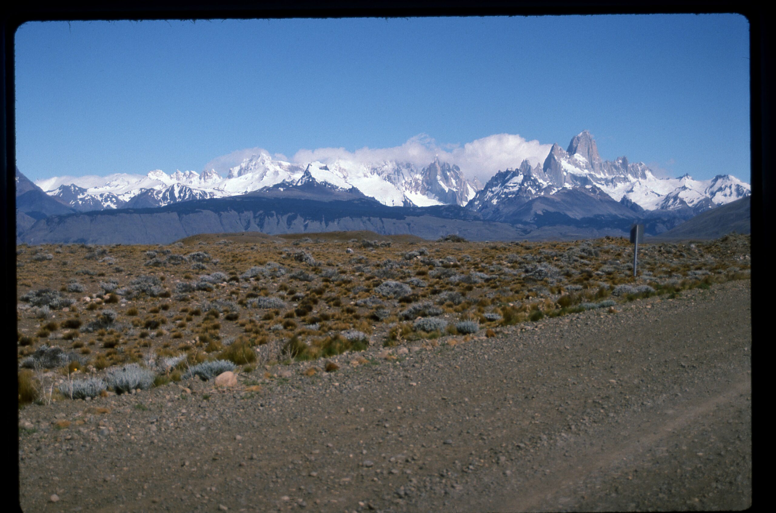
The Fitz Roy group
Monte Fitz Roy and its associated peaks draw climbers from all over the world. The scenery is spectacular and the peaks are a huge challenge.
Lago Sucio, with Aiguille Poincenot on the right and Aiguille Rafael on the left.
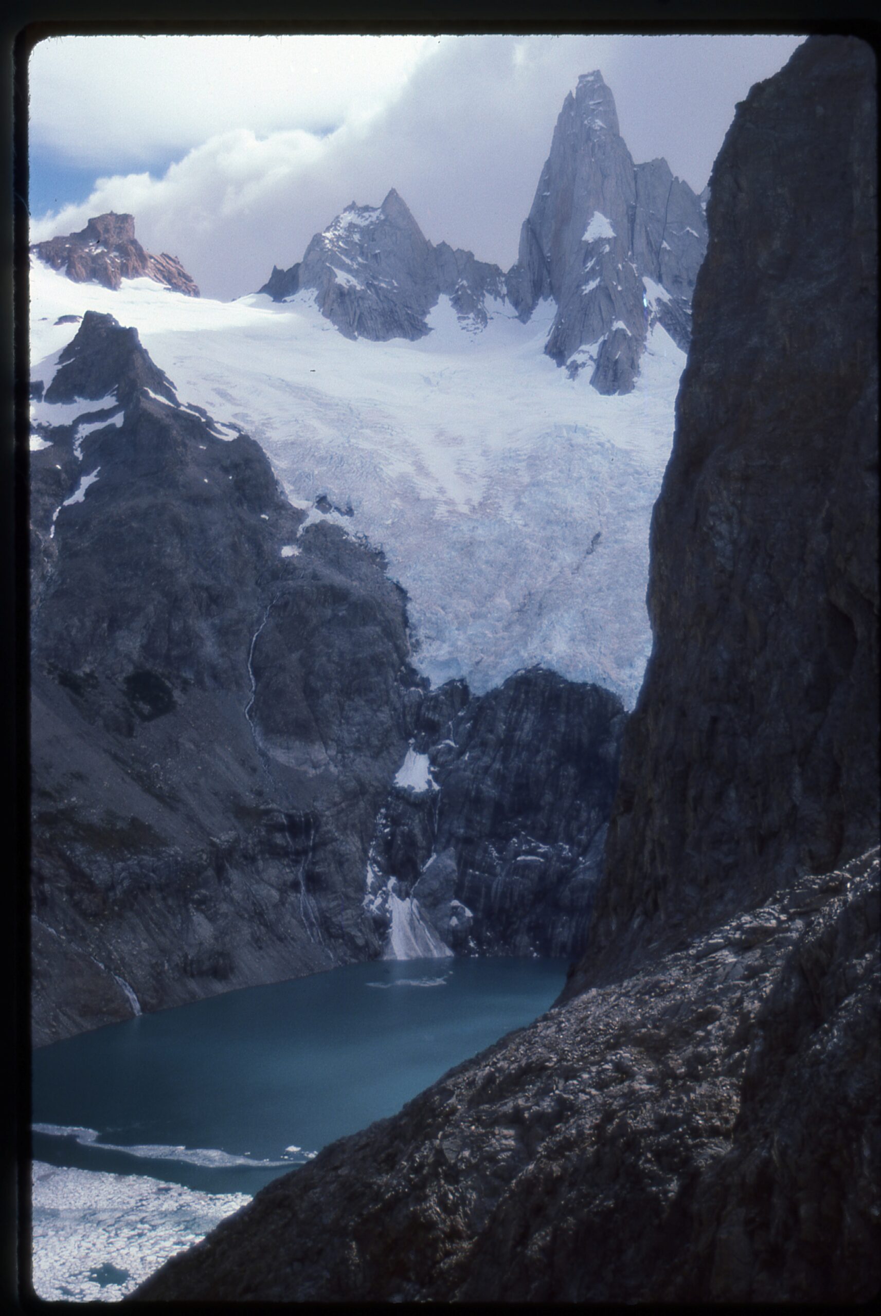
Here’s another view I was fortunate to get.
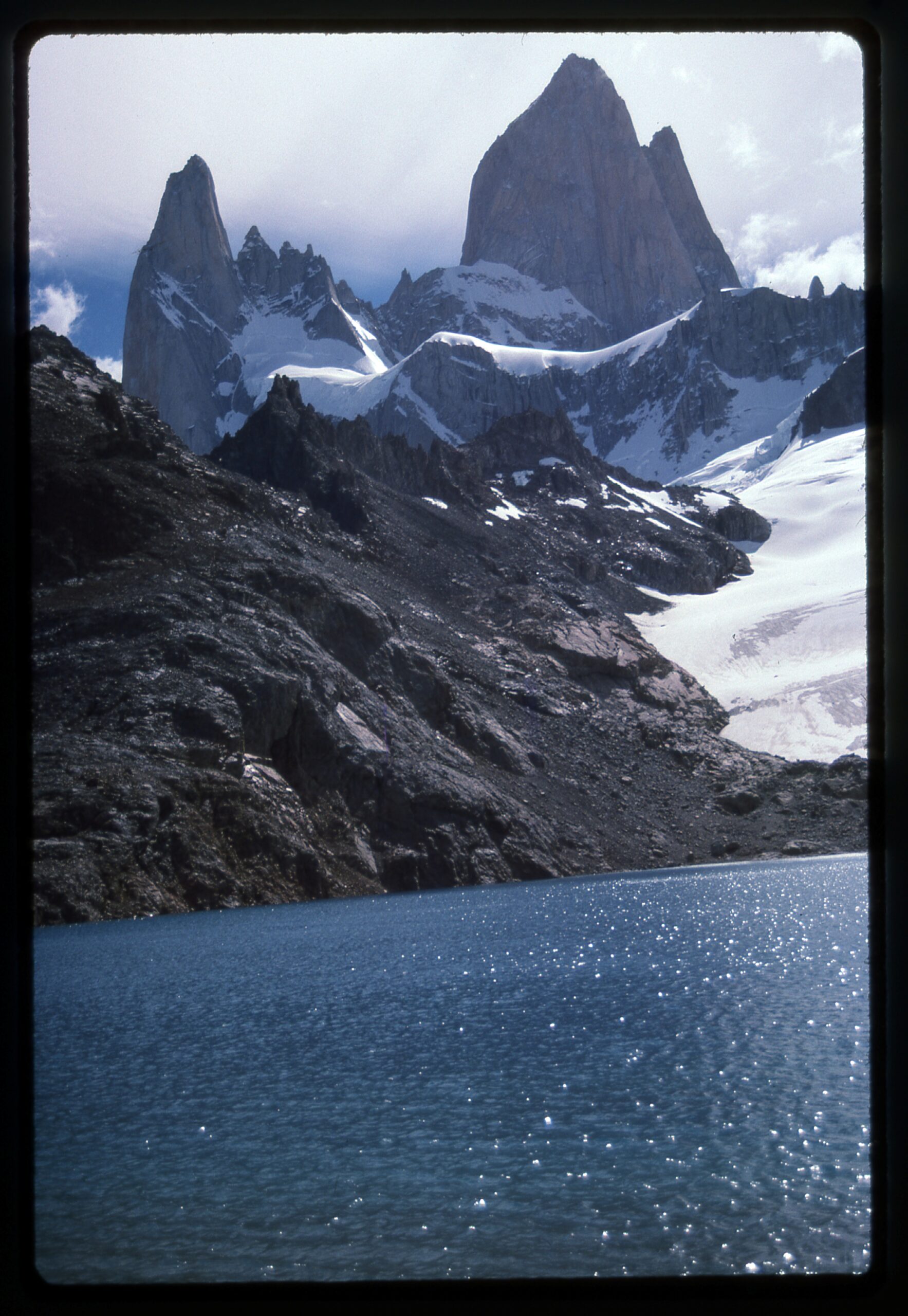
Here, we are looking west to Aiguille Poincenot on the left and the mighty Cerro Fitz Roy on the right. The view is from Laguna de los Tres. Things can be deceptive here. Fitz Roy towers 7,180 vertical feet above the lake.
Here’s another of my favorites, a wider view of the immediate Fitz Roy group. I saw this as I was walking back out of the area.
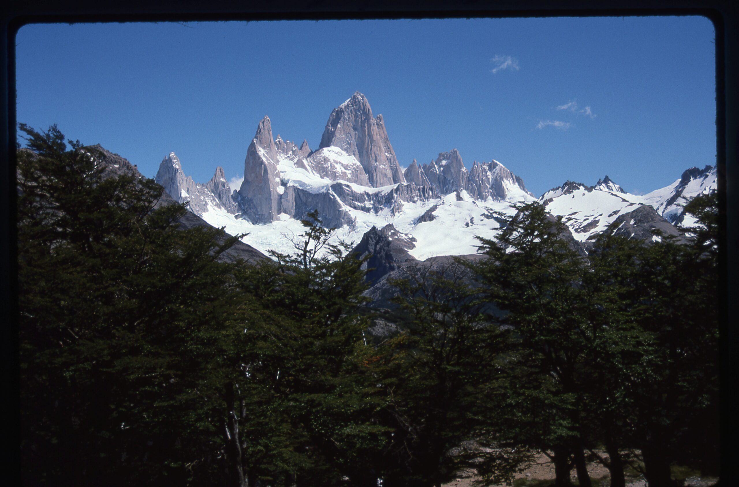
From left to right: Aiguille Saint Exupery; Aiguille Rafael (tiny); Aiguille Poincenot; Cerro Fitz Roy; Aiguille Mermot; Aiguille Guillaismet
The same day, I caught a tourist bus that left the area for the trip back to El Calafate. But a few miles into the journey, the driver stopped the bus on the side of the road. He informed us that he made the trip 7 days a week during the months-long tourist season, and that it had been a full month since he had seen a day so clear. He told us to take lots of pictures, because it was a rare day indeed and that we may never have such an opportunity again. In fact, friends of mine had been waiting that entire month at the Fitz Roy climbers base camp for the weather to clear enough for an attempt.
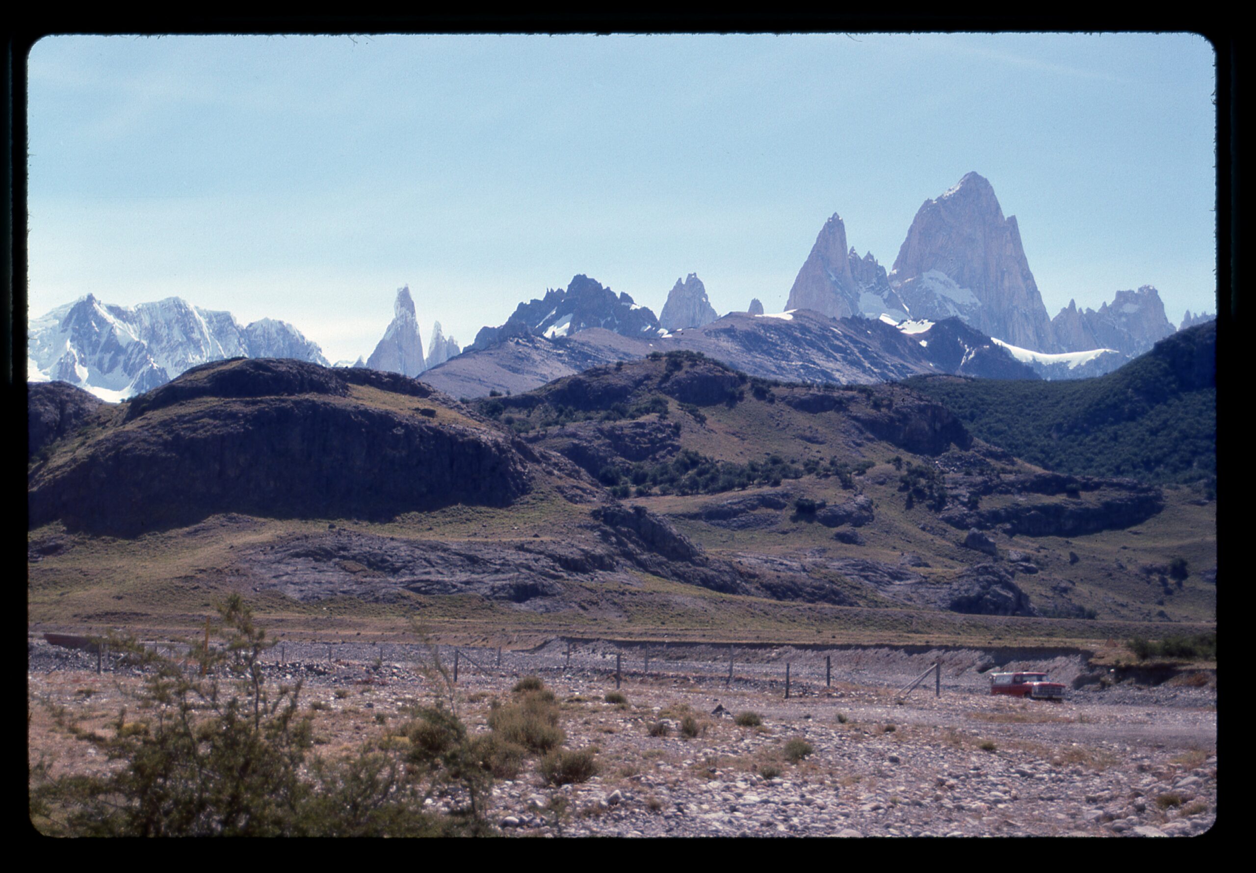
On the left, about a quarter of the way in, is an impossibly thin and steep peak known as Cerro Torre. The rest of the Fitz Roy group occupies the right half of the picture.
From a bit farther on, we had this amazing view west over Lago Viedma. We can see the Viedma Glacier. It is 43 miles long, the largest in South America, and has an area of 375 square miles. It is one of the 48 outlet glaciers of the Southern Patagonian Icefield. Please zoom in to see more detail.
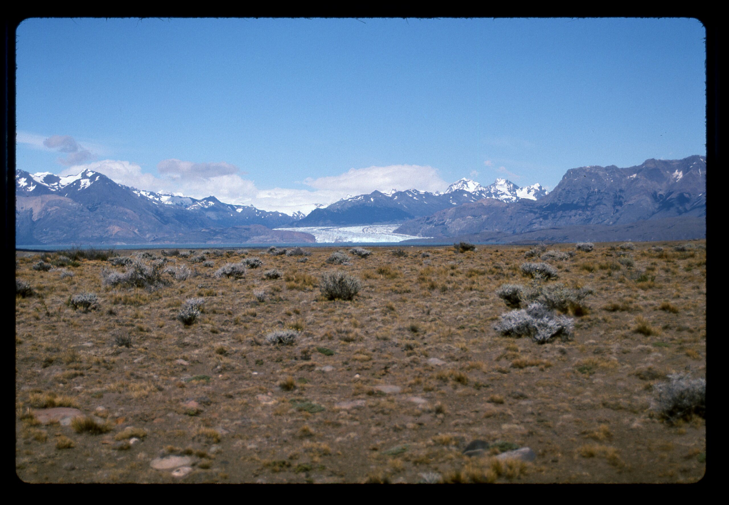
Looking west to the Viedma Glacier.
Farther south in the area of Torres del Paine, I visited Lago Grey. Although it sits a mere 200 feet above sea level, a large glacier calves icebergs into it.

Lago Grey
In the Lakes District of Argentina, near the city of Bariloche, sits a beautiful peak known as El Tronador (in Spanish, the name means “The Thunderer”). Here’s a picture of the north side of the peak. Remember, in the Southern Hemisphere, the side of a mountain that is most heavily glaciated is the south side (the opposite of what we find in the Northern Hemisphere). So this north side of El Tronador is the least glaciated side, yet it still looks pretty icy, right?
The north side of El Tronador
Not far away, but in Chile, we find the striking volcanic peak known as Osorno. There’s plenty of glacier on the upper part of the mountain.
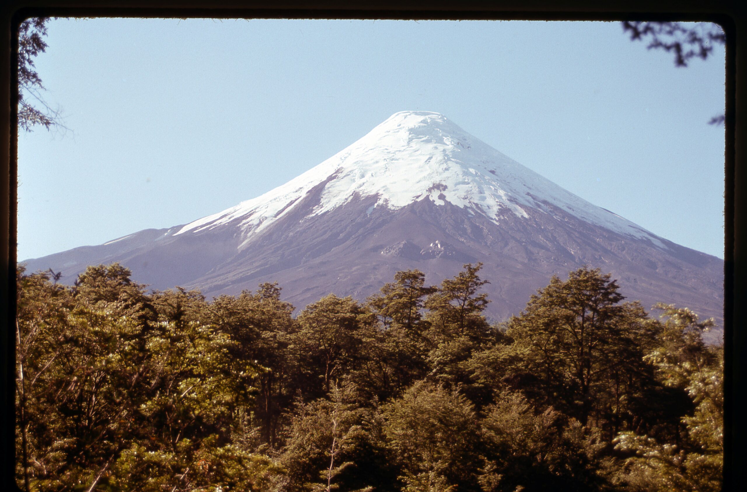
Osorno
Still in Chile but a bit farther north, we can find the lovely town of Pucón, and next to it, quietly rumbling away and often putting on quite a show with its eruptions, sits the Volcán Villarica. Here, you can see it smoking in a quieter moment. It is one of only 7 mountains in the world with a persistent lava lake within its summit crater. Plenty of glacier on this one.
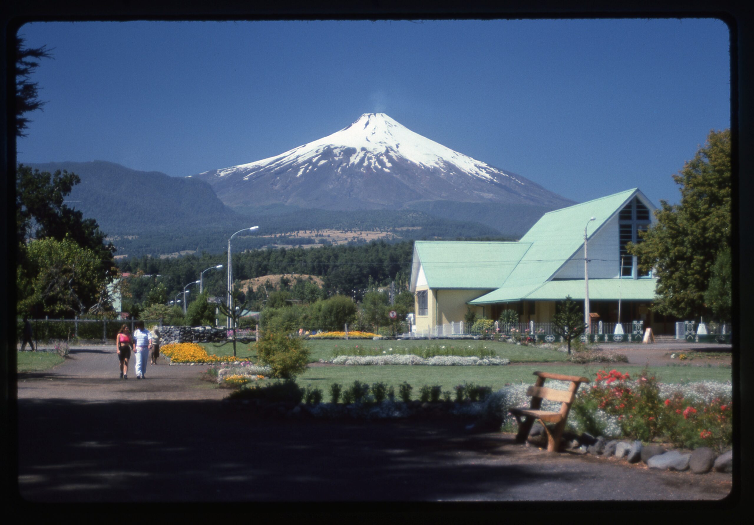
Villarica Volcano, elevation 9,341 feet
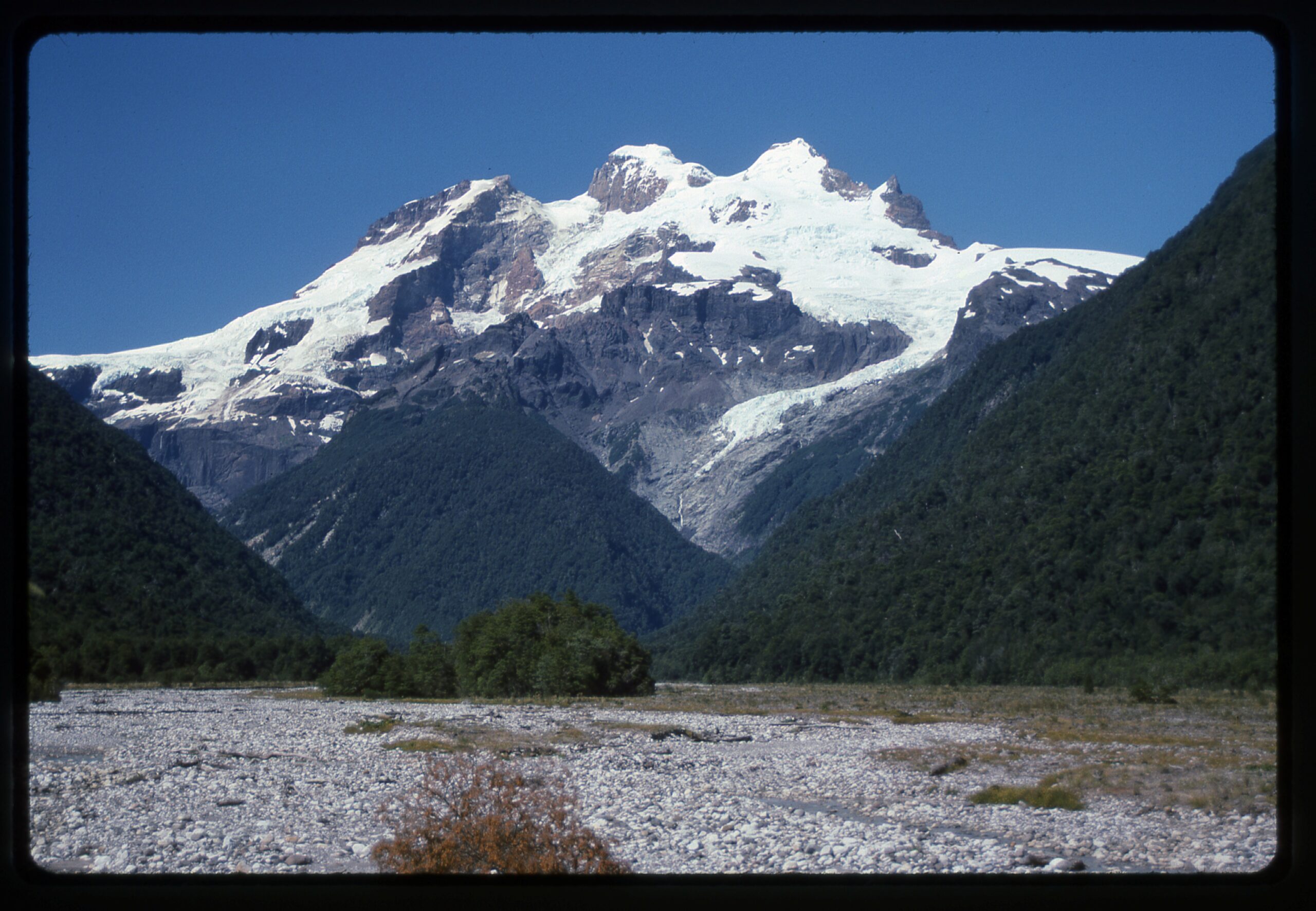
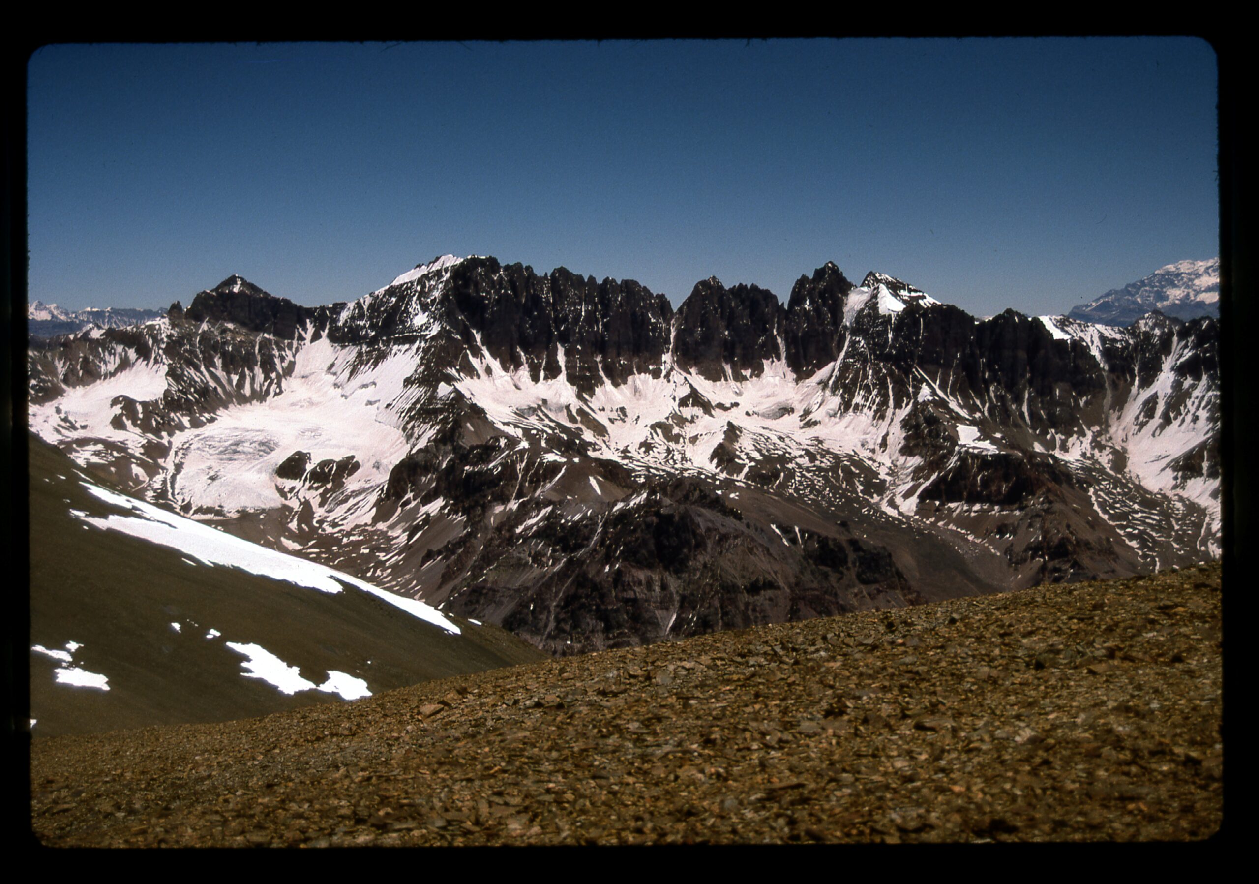
A beautiful mountain range not far from the city of Mendoza in Argentina is the Cordón del Plata. There are some nice glaciers there, but like in many parts of the world, they are shrinking. This next photo shows Cerro Rincón.
Rincon
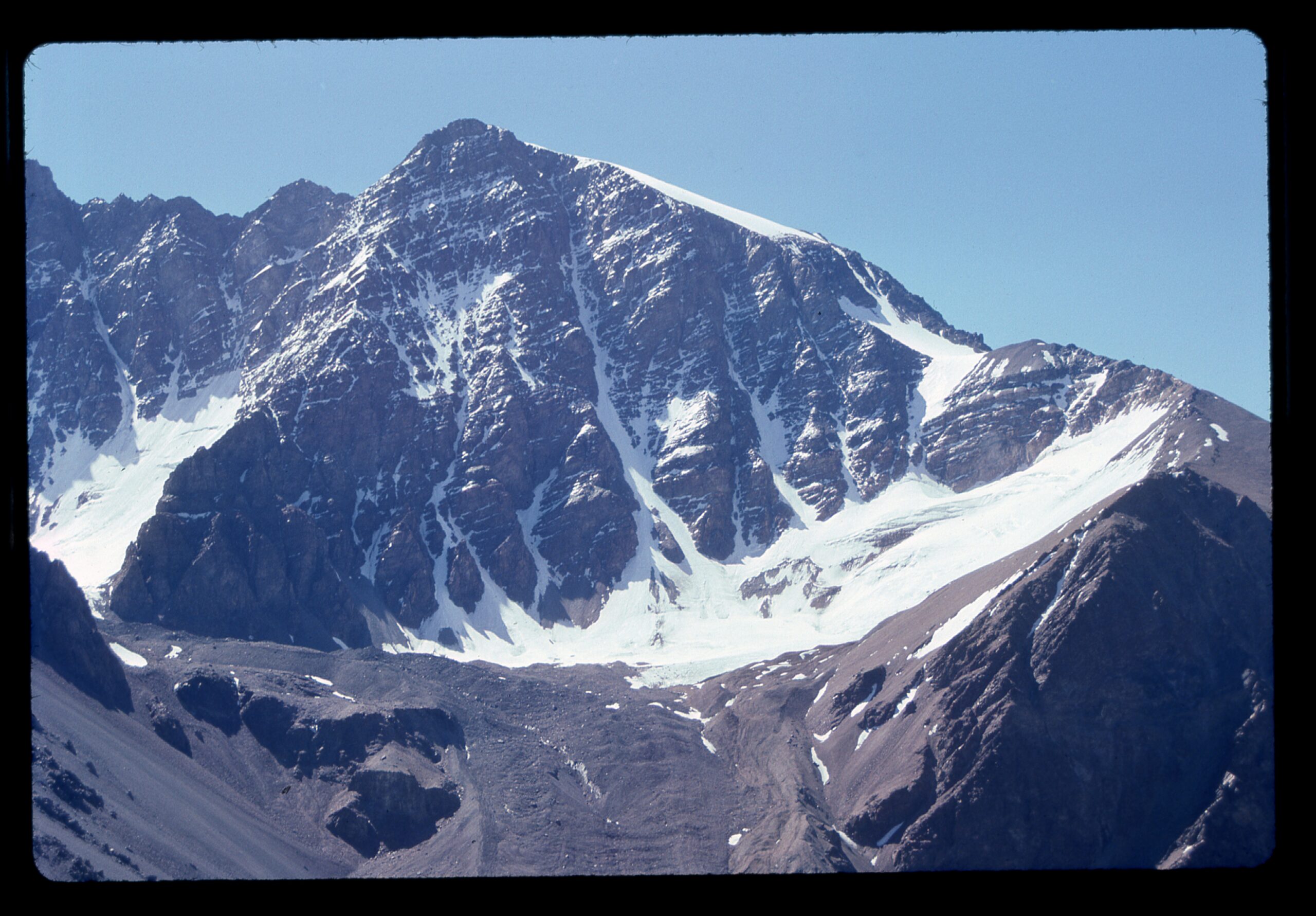
From atop the highest peak in the range, I had this view southwest to a big mountain called Tupongato. That’s it on the far left in the distance, elevation 21,555 feet. Plenty of glaciers in this view.
Looking southwest to Tupongato
These nearby peaks in the Quebrada de la Jaula have their own set of glaciers.
Glaciers tucked into every recess.
Here’s a nice glacier tucked into a corner of Cerro Rincón at around 16,000 feet.
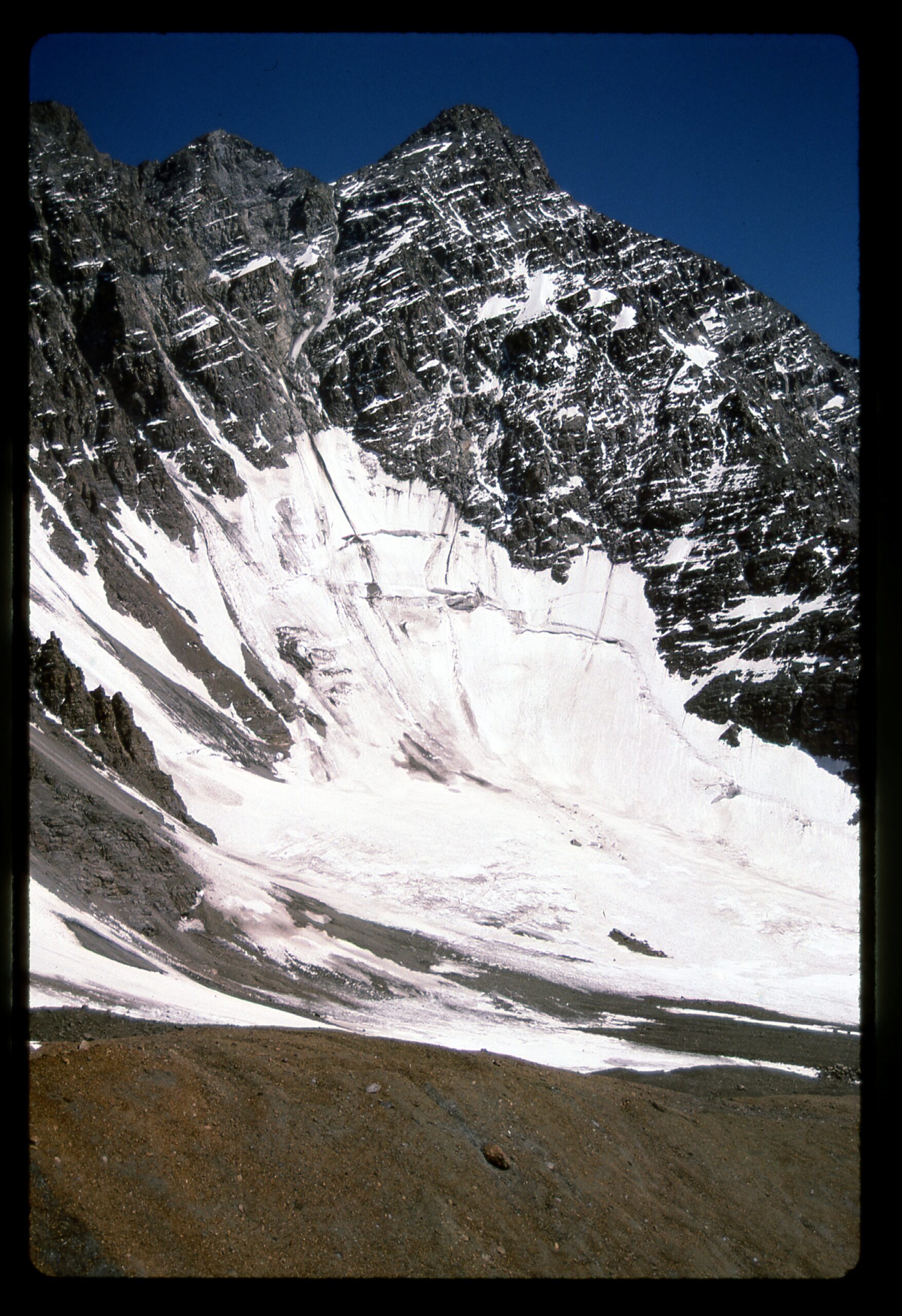
A glacier on Cerro Rincon
I have a few pictures taken by others who have climbed in some remote parts of the world, places that are very glaciated. Climber friend Barbara Lilley has shared these photos – all 3 of these and many more excellent photos can be seen in the piece entitled “Barbara Lilley – A Climbing Life, Part 2”. Here’s one from Denali. It may just look like snow, but it’s glacier covered with fresh snow and plenty of it.
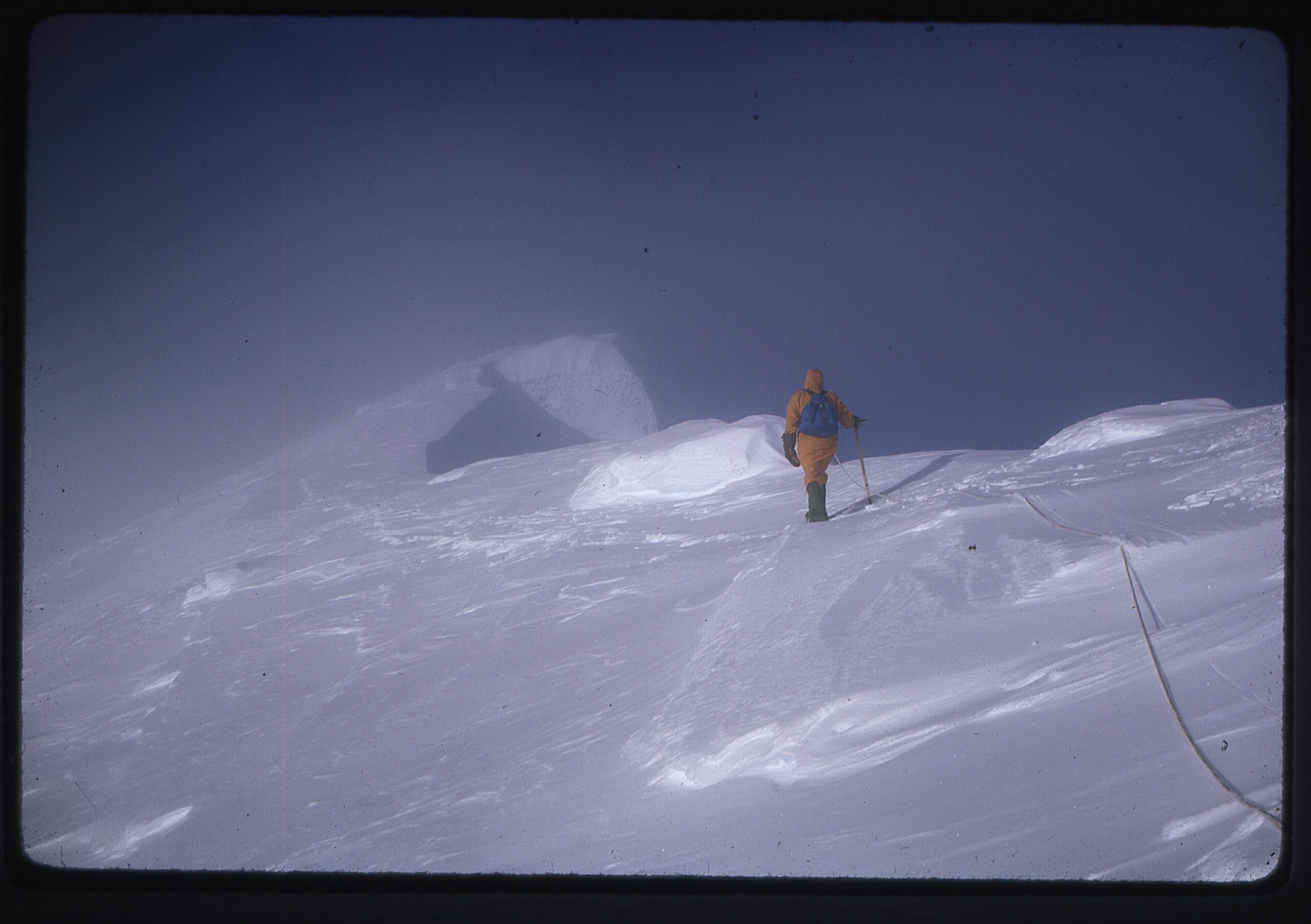
Approaching the summit.
Here’s a shot of Mt. Logan.
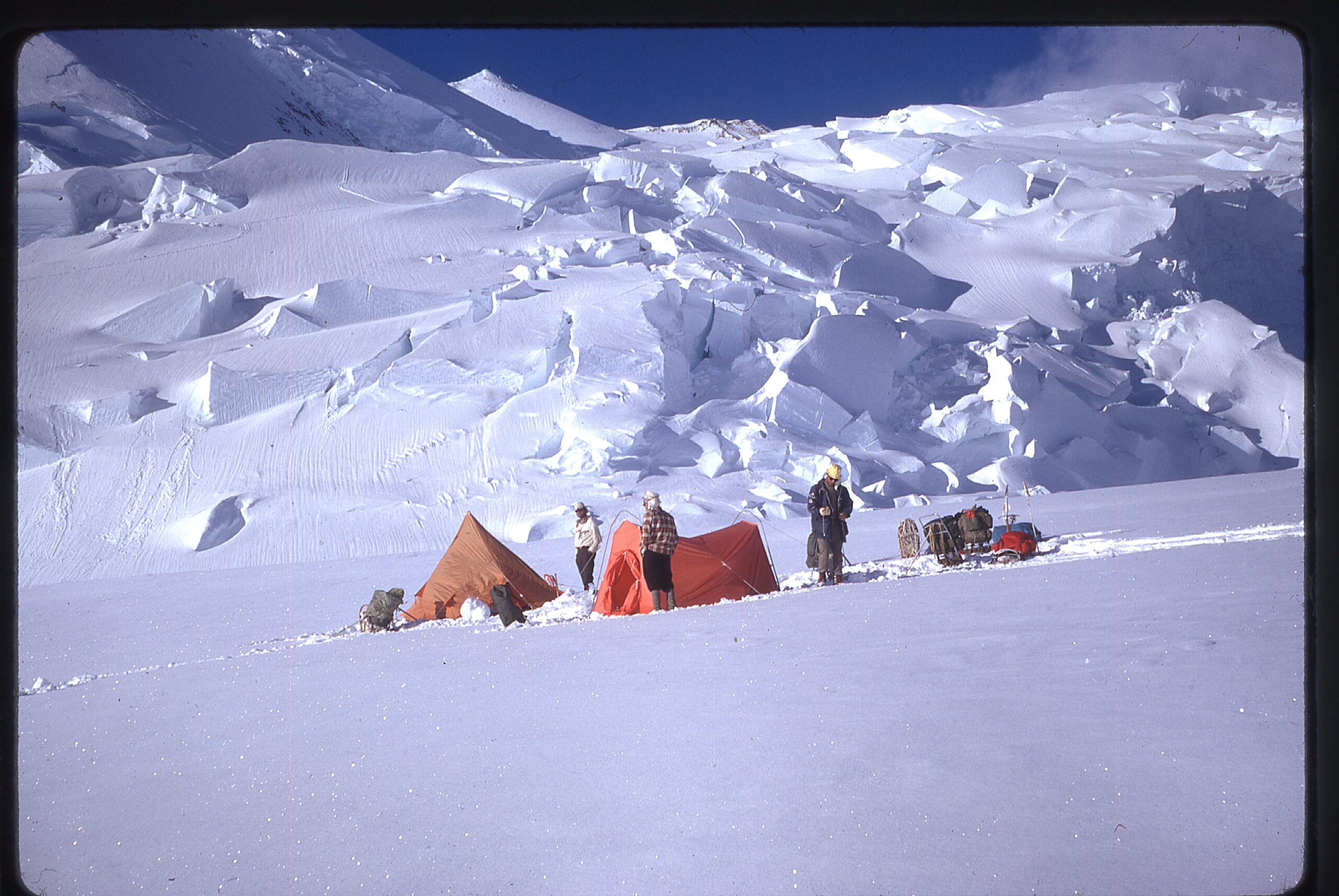
Camp in King Col at 13,500 feet. Serious ice.
And here’s one from the toughest climb of the 3 – Mt. St. Elias.
The icefall on Newton Glacier.
I also recommend having a look at the piece entitled “Vinson” on this website for more amazing glacier photos.
In 2024, I had the good fortune to visit Antarctica, which holds the vast majority of the world’s ice. I posted a series of essays on this site, but one which shows some nice examples of glaciers is “The Bucket List – Chapter Four – Stonington Island”. Have a look at it and the others in that series to see more glaciers than anyone has a right to, like this one.
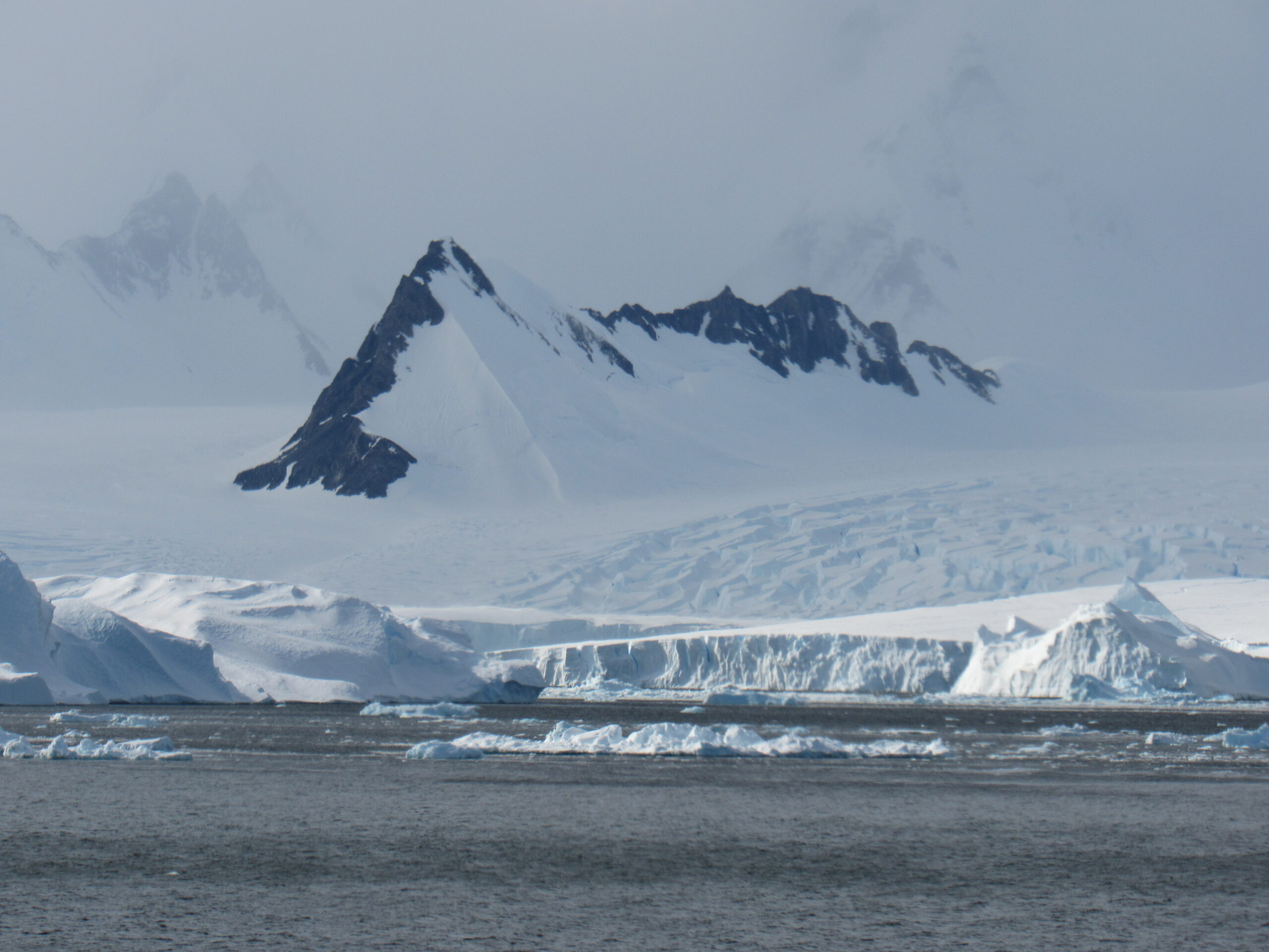
Glaciers coming right down to the sea are common in Antarctica.
I thought of a few more good examples from Canada that I share with you here, like these shots from the Columbia Icefields.
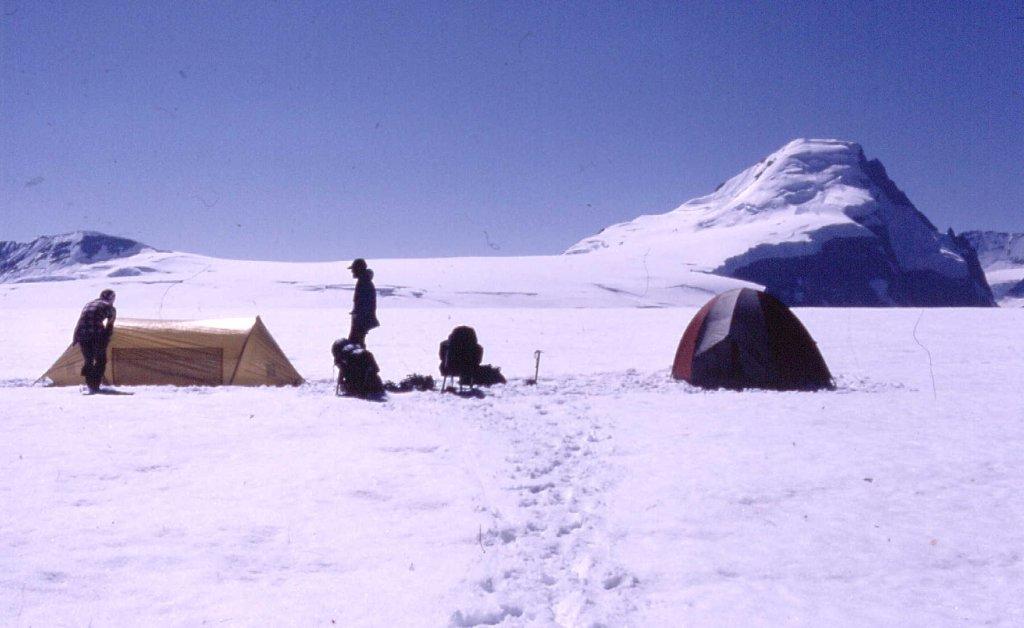
A camp on the ice. Miles of it stretch in every direction.
Here’s Mt. Columbia, the highest peak in Alberta. Distances are so great here that you never seem to get any closer to the damn thing.
Ice, ice and nothing but ice.
The North Twin is the 3rd-highest peak in the Canadian Rockies, after Mt. Robson and Mt. Columbia.
Plenty of ice on the Twins.
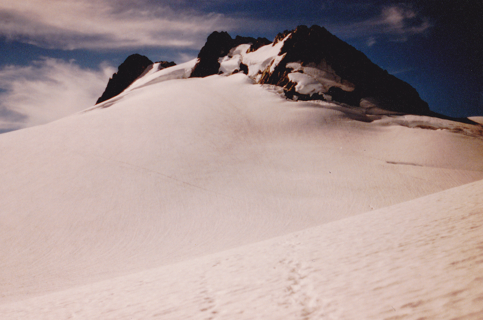
Mamquam Mountain is another beauty with plenty of glacier fun. Here’s a view from 6,500′. The glacier is seen creeping down the slope.
Looking southeast to Darling Peak.
Here, we’re looking up 2,000 feet of ice. Enough challenge for anyone.
More ice.
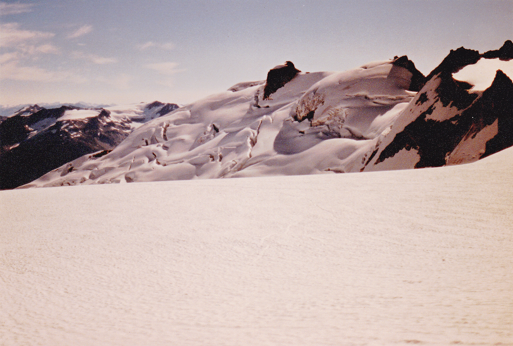
Up on the Mamquam Icefield. The 8,491-foot summit is the dark area ahead.
That’s the summit out there.
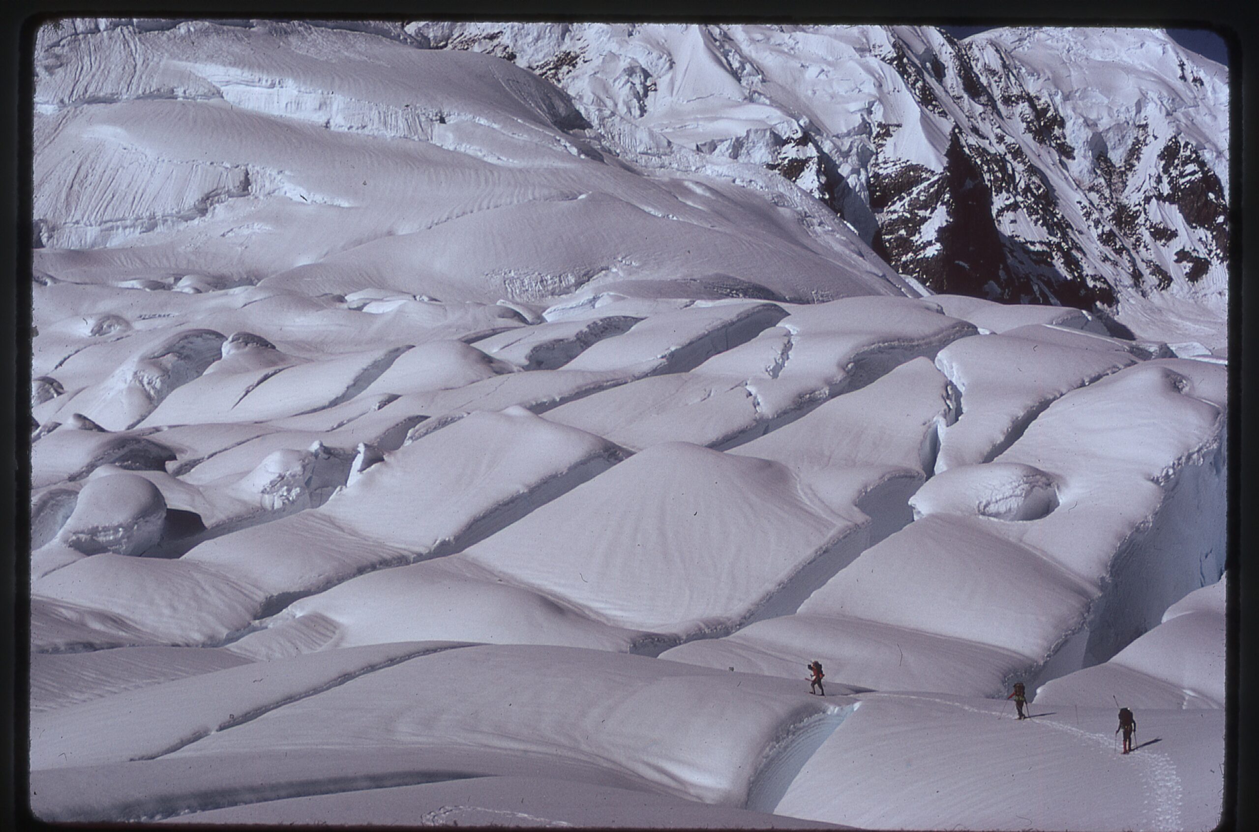
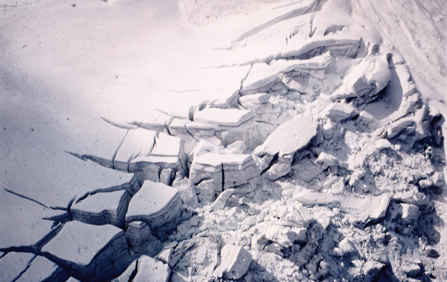
The icefield has both smooth traveling and also highly broken areas, as seen in this view to the northeast.
Very broken ice.
Another important peak in my life has to be Mount Robson, the highest peak in the Canadian Rockies. They don’t call it “The Great White Fright” for nothing. Here’s a classic view of the peak from Berg Lake.
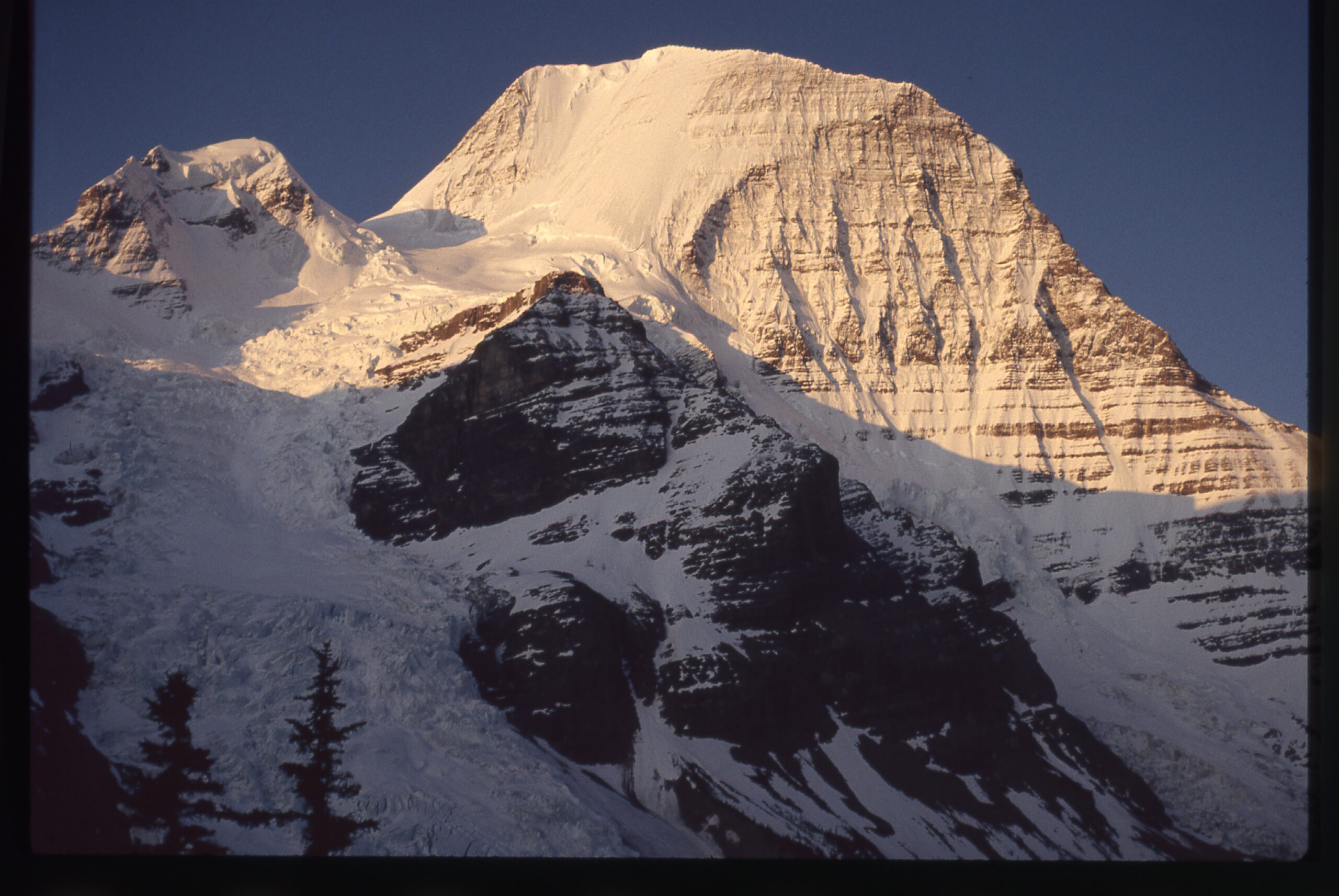
The north side of Robson.
Here’s Brian Rundle on the peak in 1989. There are enough glaciers for everyone, no doubt about it.
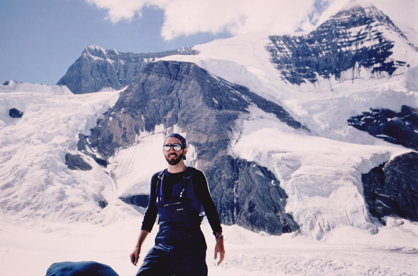
Getting ready to climb.
Our camp was on a glacier with plenty of hidden crevasses.
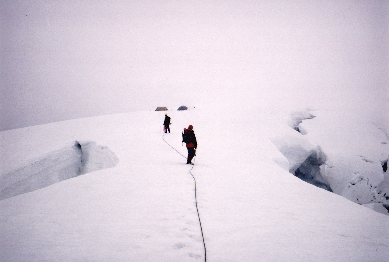
Heading out from camp.
One more. There are just too many glacier shots from that trip, so to see more please go to the piece entitled “Mt. Robson” to see them all.
A view of the highly-broken Upper Robson Glacier.
Let’s head back down to the Southern Hemisphere for a few more. The highest peak in New Zealand is Mt. Cook. It has several sizeable glaciers on its flanks.
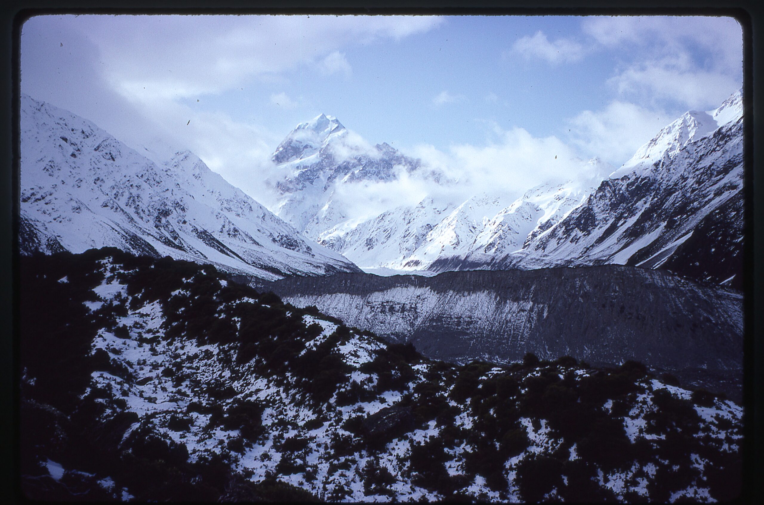
Mt. Cook
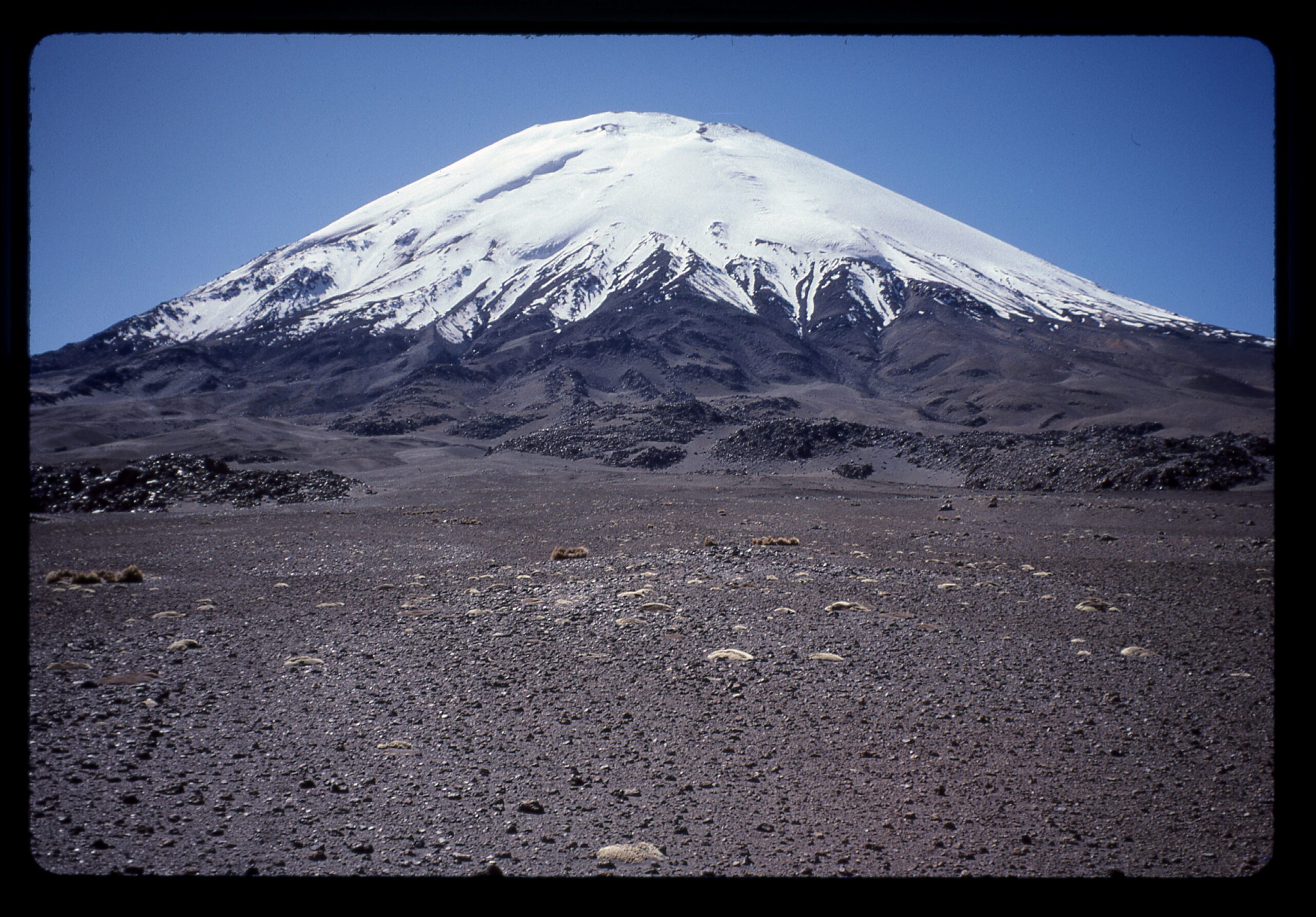
One of my favorite countries is Bolivia. In 1996, Brian Rundle and I paid a visit and did a bit of climbing. We first went to Nevado Sajama, the highest in the country. We didn’t summit, but did get a few good views of the icefield that crowns the mountain.
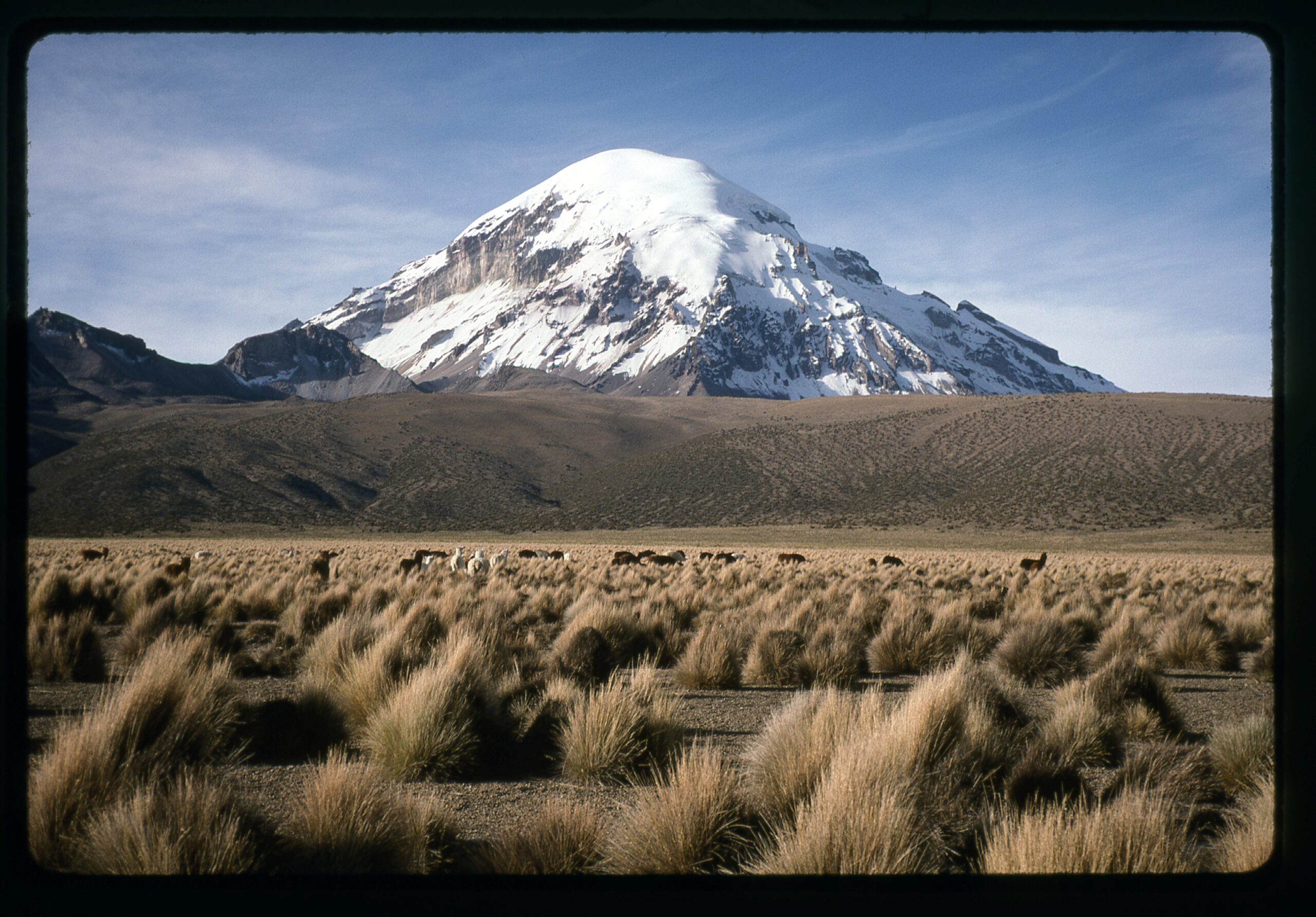
The south side of Sajama.
Here’s a view of Nevado Parinacota and its sister peak, Nevado Pomerape. Both have plenty of glacier. This view is looking west.
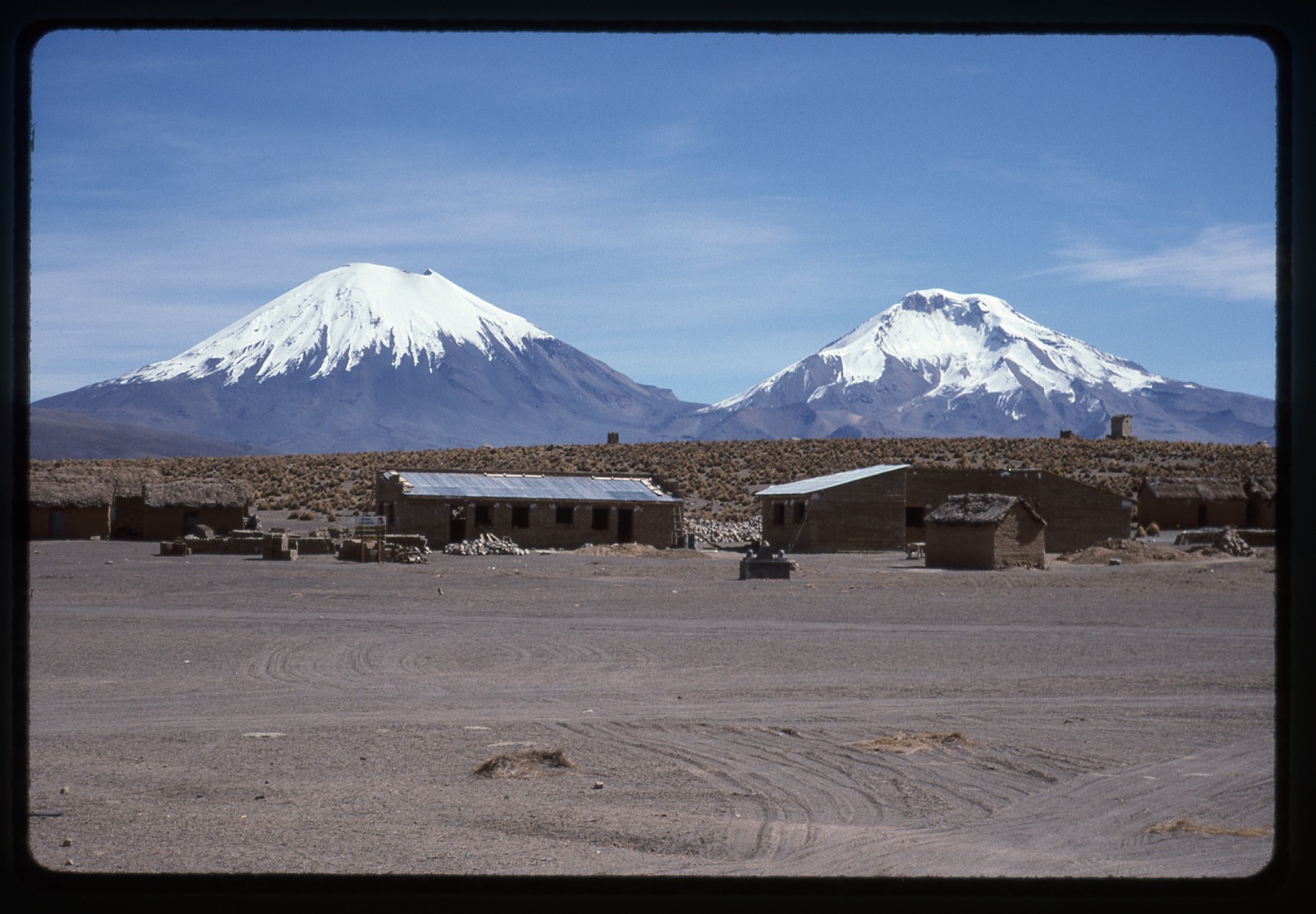
Parinacota on the left is 20,932 feet in elevation; Pomerape is 20,610 feet on the right.
We had this view of the usual climbing route on the southwest side.
The southwest side of Sajama
This next photo is more on the west side.
The west side
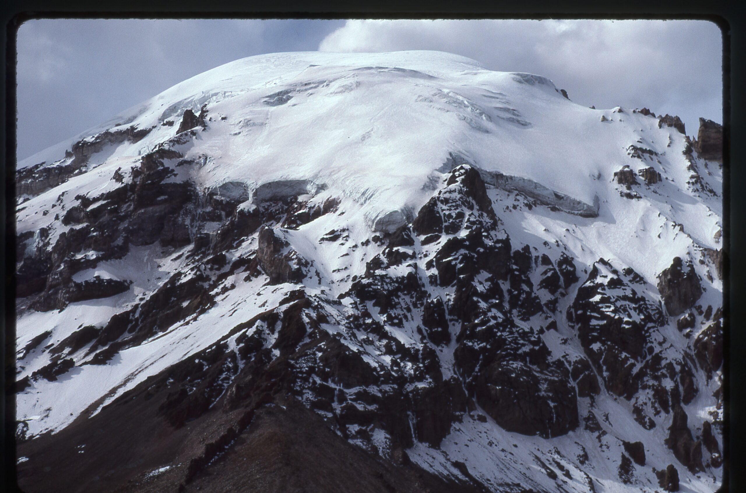
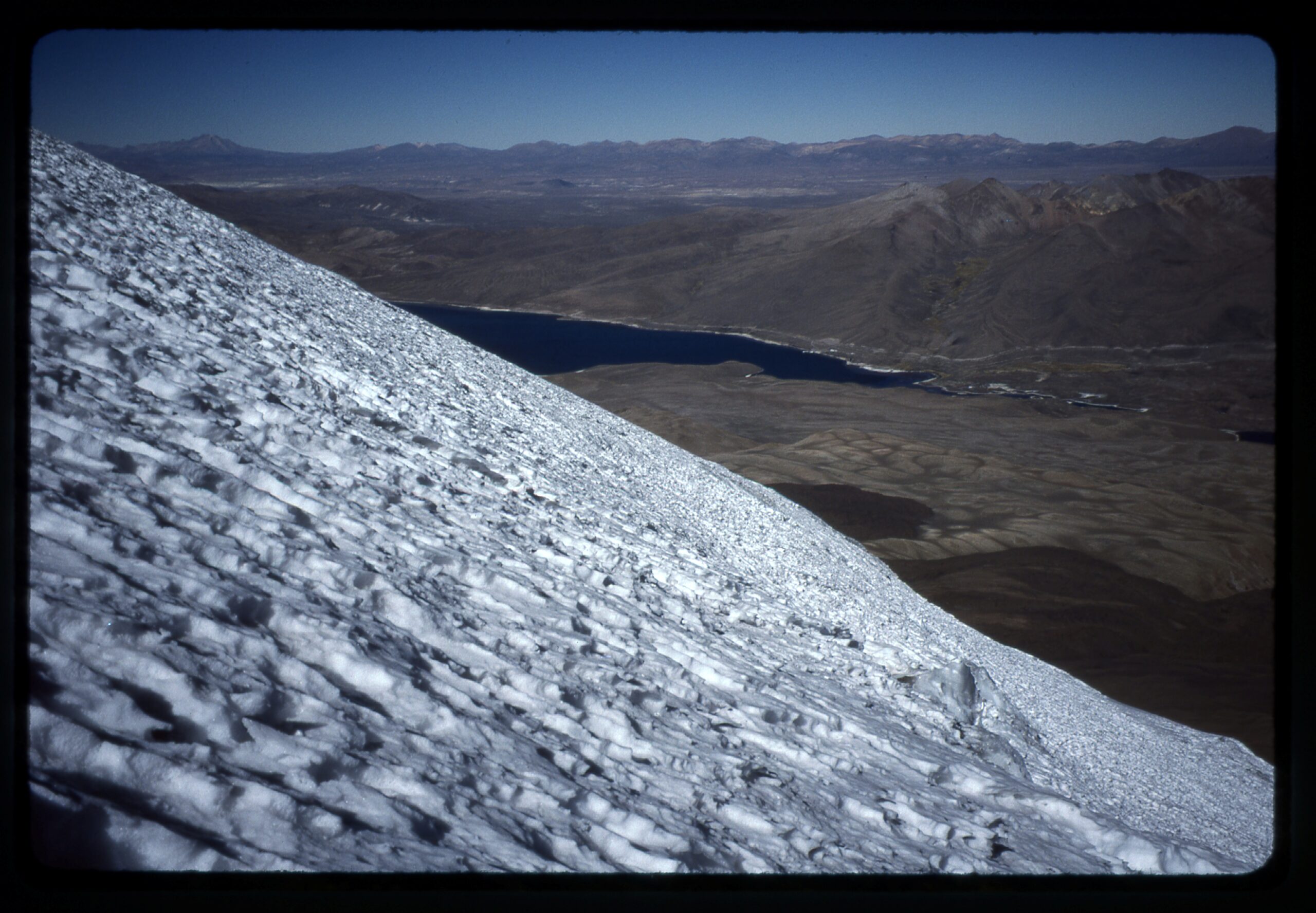
We then moved across the border into Chile to attempt a climb of Volcán Parinacota. As we started out, here is the view we had from lower down, at 14,900 feet.
Looking northeast from 14,900 feet.
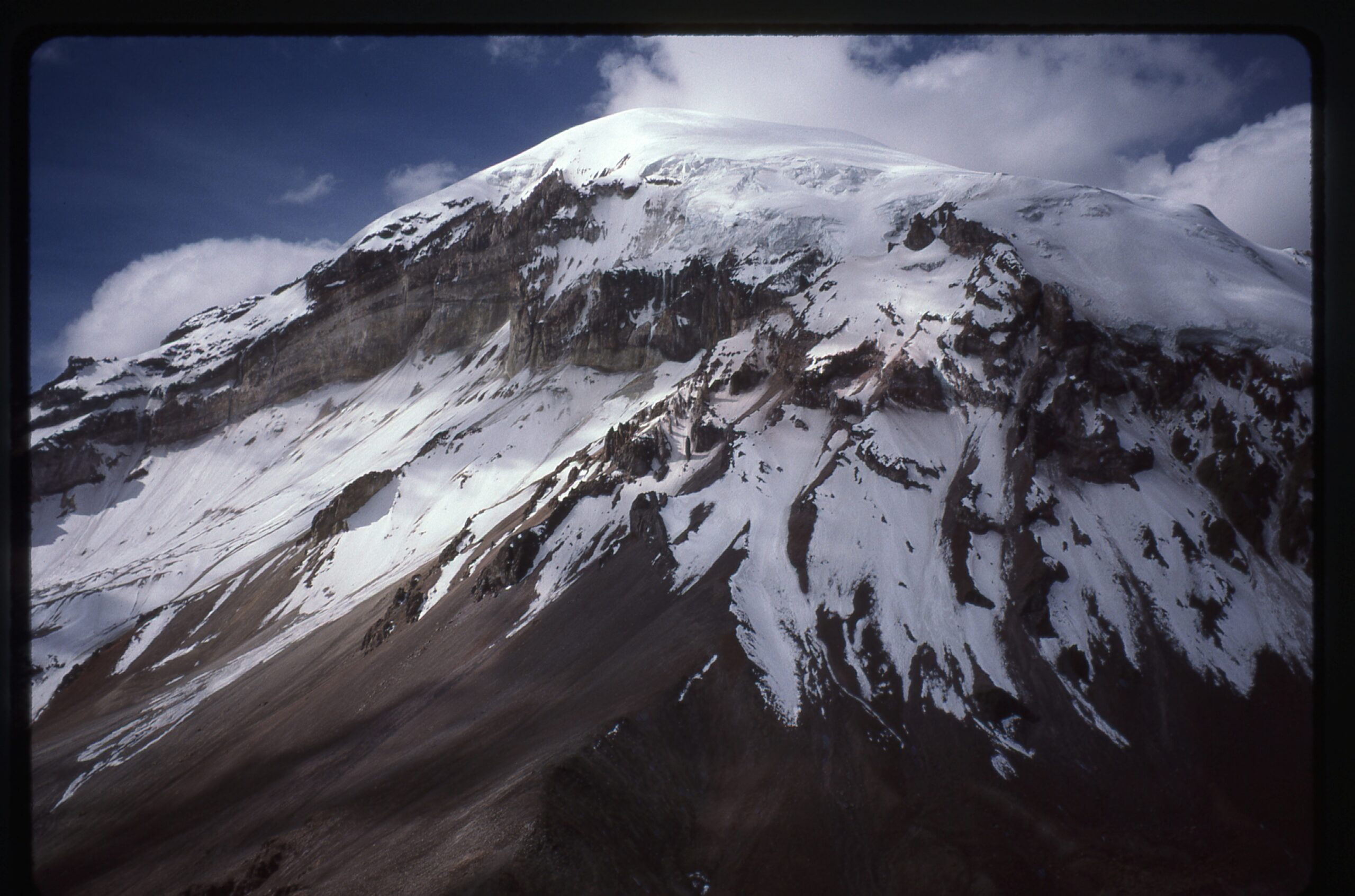
Here is what the glacier looked like at 18,500 feet. Quite smooth and no crevasses.
At 18,500 feet on the west slope
Here is a view across the crater at around 20,700 feet.
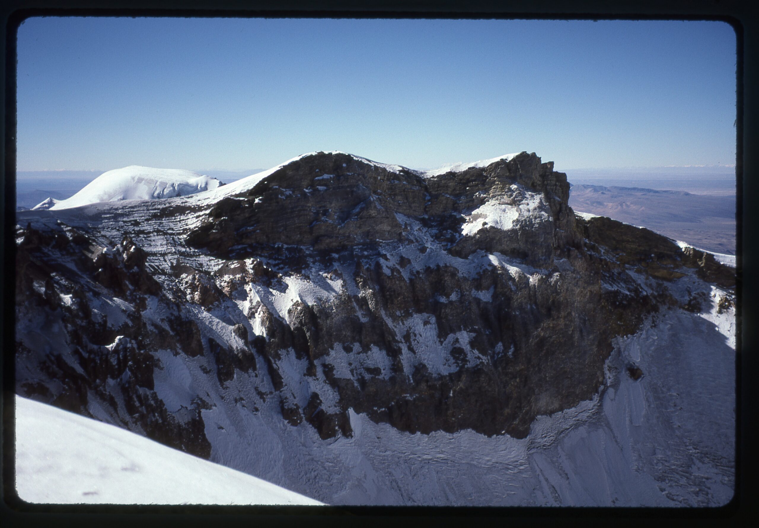
A view across the summit crater. That’s Pomerape sticking up over on the left side.
And one final view, at sunset, as seen from Lago Chungará. Truly one of the most beautiful peaks in the Andes.
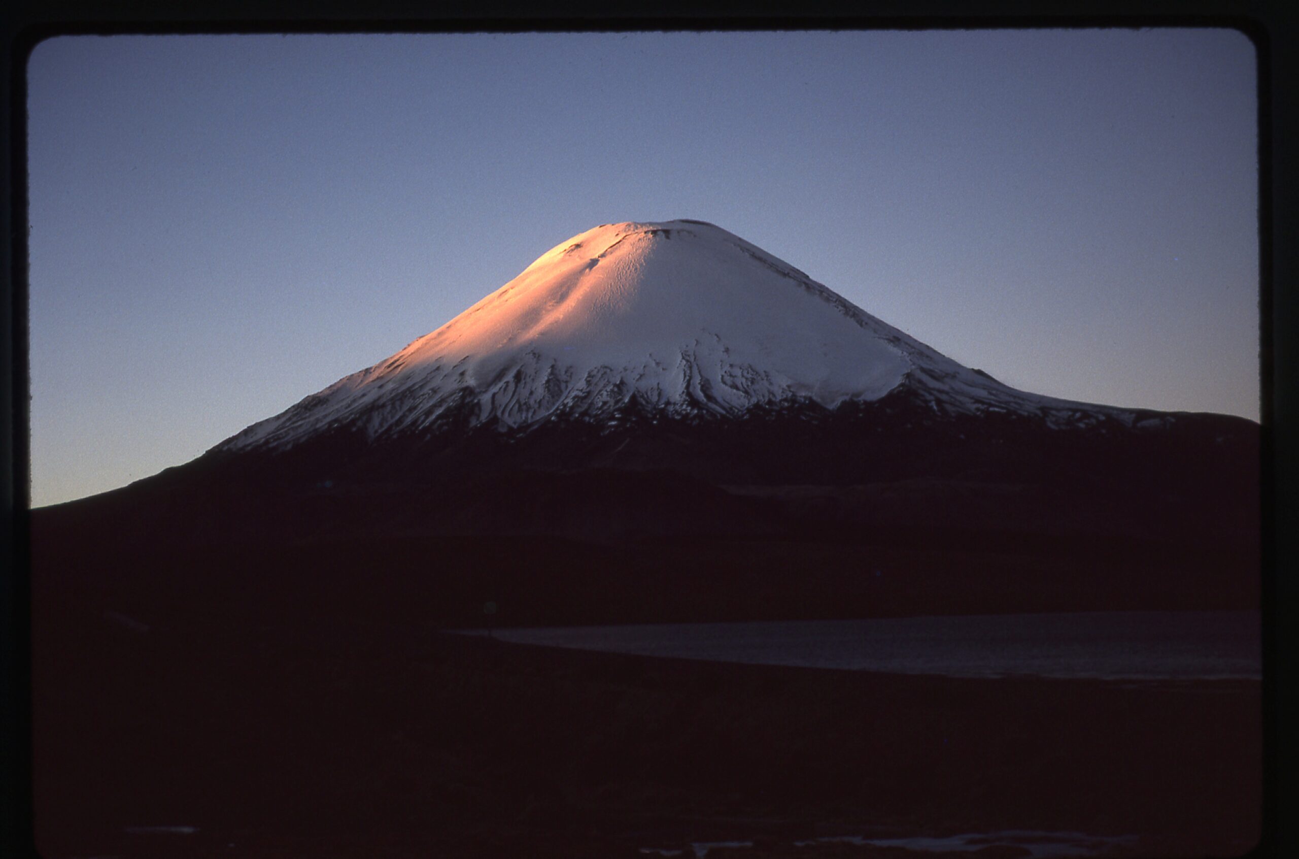
Sunset
So, after all this talk of glaciers, I should say a few words about what a glacier actually is. A glacier forms when snow accumulates faster than it melts. Over time, layers of “excess” snow are compressed by their own weight into ice. Glaciers flow, due to the immense pressure of the ice, kind of like a slow-moving river, and will move downslope. Sadly, world-wide, most glaciers are shrinking due to climate change.
So there you have it, Folks, my grand tour of glaciers. I hope you enjoyed the photos.