In mountaineering, the idea of climbing 2 or more mountains in one trip, which may often cover multiple days, is nowadays called enchainment. By one trip, I mean in one push. And by that, I mean in one steady effort. For example, setting up a camp, then climbing a peak, and coming back down to camp for a break before starting out again for your next peak, wouldn’t count as an enchainment in my humble opinion. Continuous is the operative word here. So, for a proper enchainment, you’d climb your first peak, then continue directly to your next one or ones, maybe only descending to a pass or saddle between the 2 peaks (if they are close together), or even covering some distance down low on foot and then proceeding directly up the next peak. Years ago, I used to use the word traverse for the linking of multiple peaks, but nowadays I like the word enchainment instead. The word comes from the French enchaînement (the French have contributed many words to mountaineering that are in use today). To me, the idea of enchainment makes a lot of sense. It can save effort, in that you’re not doing a bunch of separate trips (camp to summit to camp to summit to camp to summit to camp), but rather going from camp to summit to summit to summit to camp). It can save time as well – if, for example, you simply must climb those peaks near each other, doing it in one big push can involve less time than multiple round trips.
It goes without saying that enchainment is a bigger commitment – it requires more of an outlay of energy, may force you on to routes that you’d otherwise not take, may expose you to weather you could otherwise avoid. You may need to re-think everything you’re carrying – how much can you pare down your load so the weight won’t do you in, yet still carry enough to survive? If you can’t find a partner willing to enchain with you, you’ll find yourself doing the whole thing solo – not that there’s anything wrong with that, it’s done often enough by strong men and women alpinists. If you’re enchaining solo, you’ll need to make all decisions by yourself, and your route-finding skills better be top-notch. I think it’s safe to say that only a small minority of climbers are willing to play the solo game, especially where the peaks may be remote and far from any assistance in case of emergency.
During my first 20 years of climbing, when I lived in British Columbia, I found myself doing a few enchainments, only because it seemed like the practical thing to do at the time. Some peaks are remote enough and involve a big enough commitment of time and resources that you might as well try and do them all in one big push, and that’s what drove me to try a few. My first one, as far as I can recall, was a climb of Mt. Garibaldi in mid-July of 1976. I hiked in to the Elfin Lakes shelter, then set out north from there and climbed Garibaldi by its northeast face. From there, I dropped down to the northeast past Glacier Pikes and arrived at the south end of Garibaldi Lake. I continued along the west shore of the lake, climbed over Mount Price and made it to the campground at the northwest end of the lake. My trek ended by walking down the trail to Highway 99. One night out en route, with 7,700 feet climbed and 48 miles distance.
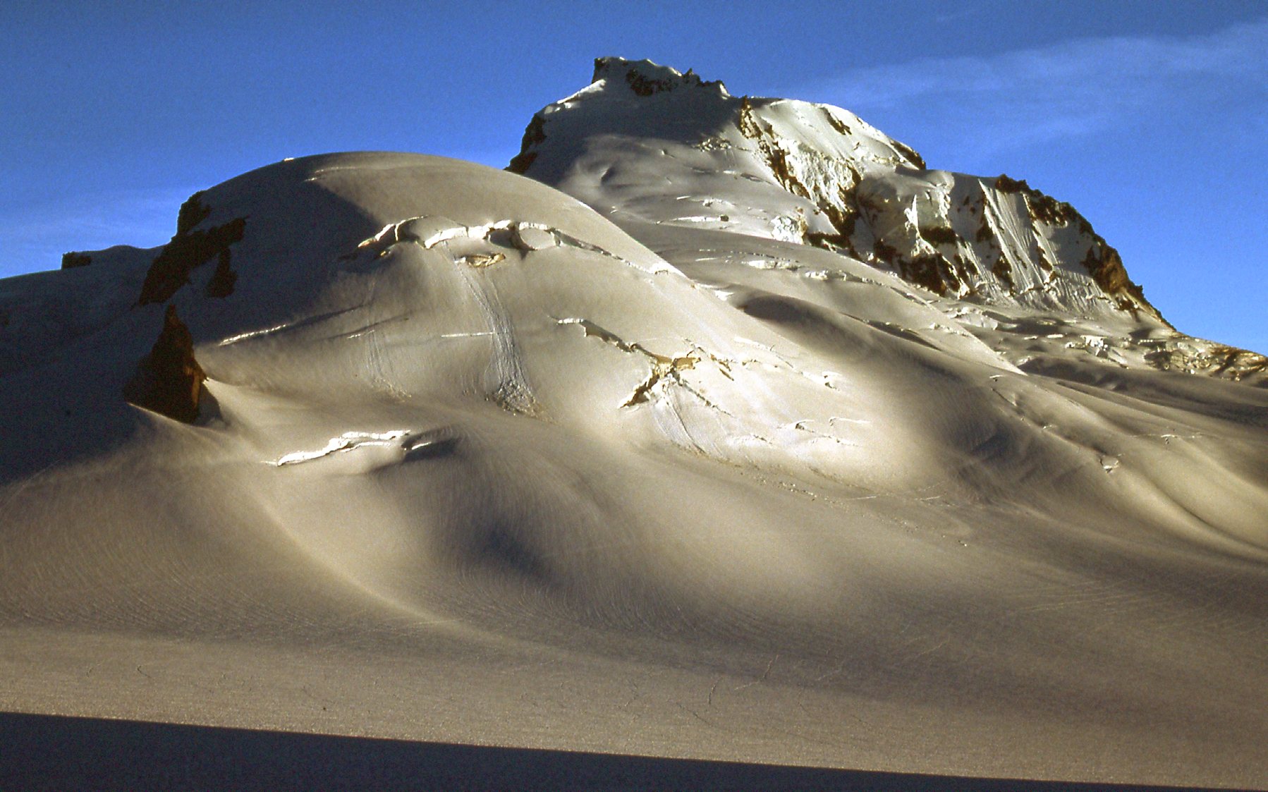
The northeast side of Mount Garibaldi.
Barely over a week later, I headed into the Cheam Range and climbed Lady Peak. After a night spent out high on the peak, I then climbed to the summit of Knight Peak for an easy 2-peak enchainment.
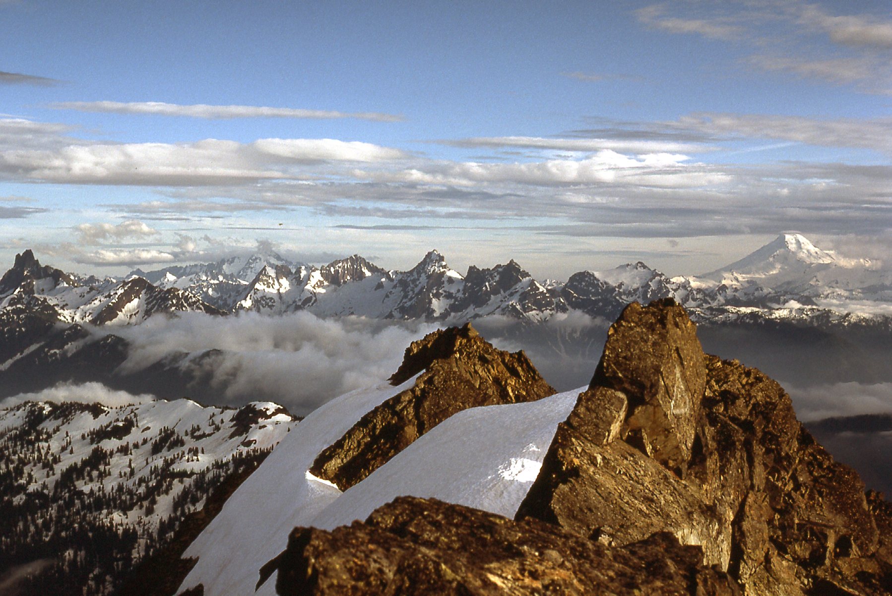
Sunset from the top of Lady Peak.
About 3 months later, on October 16th, I headed into the Statlu area and climbed Mt. Ratney by its northeast side, then went east and climbed Mt. Bardean before calling it a day and heading home.
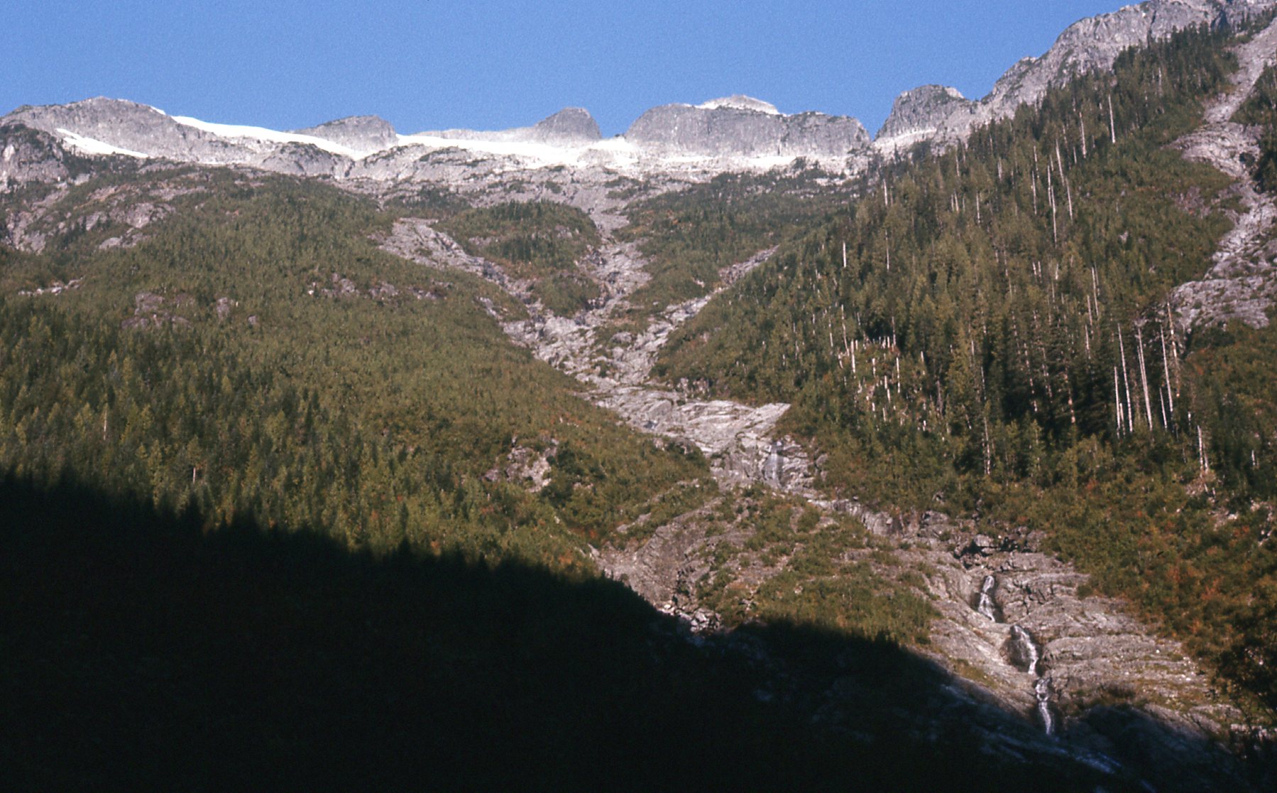
Looking up 4,500 feet to Ratney and Bardean
So 1976 ended with 3 enjoyable enchainments. The idea made sense, and I couldn’t wait to see what the next year would bring.
I didn’t have to wait long. On January 6th, 1977, I made the first winter ascents of Stewart Peak and The Still with 2 friends – good fun deep in the heart of winter.
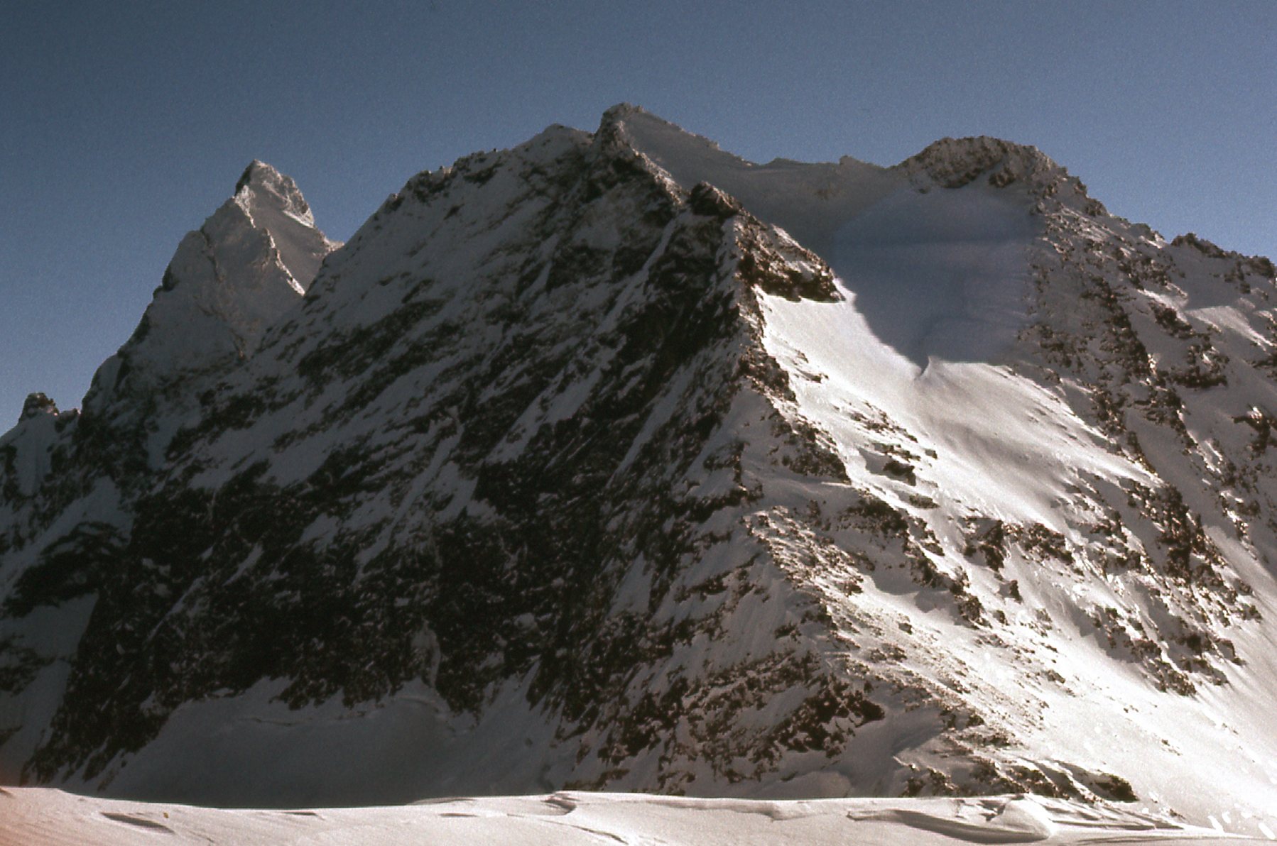
Welch Peak is on the left. The Still is the large massif in the center. The photo was taken from the Stewart- Still col.
Three weeks later, I went in and climbed Alouette Mountain and Blanshard Needle. Seriously winter, and exhilarating fun.
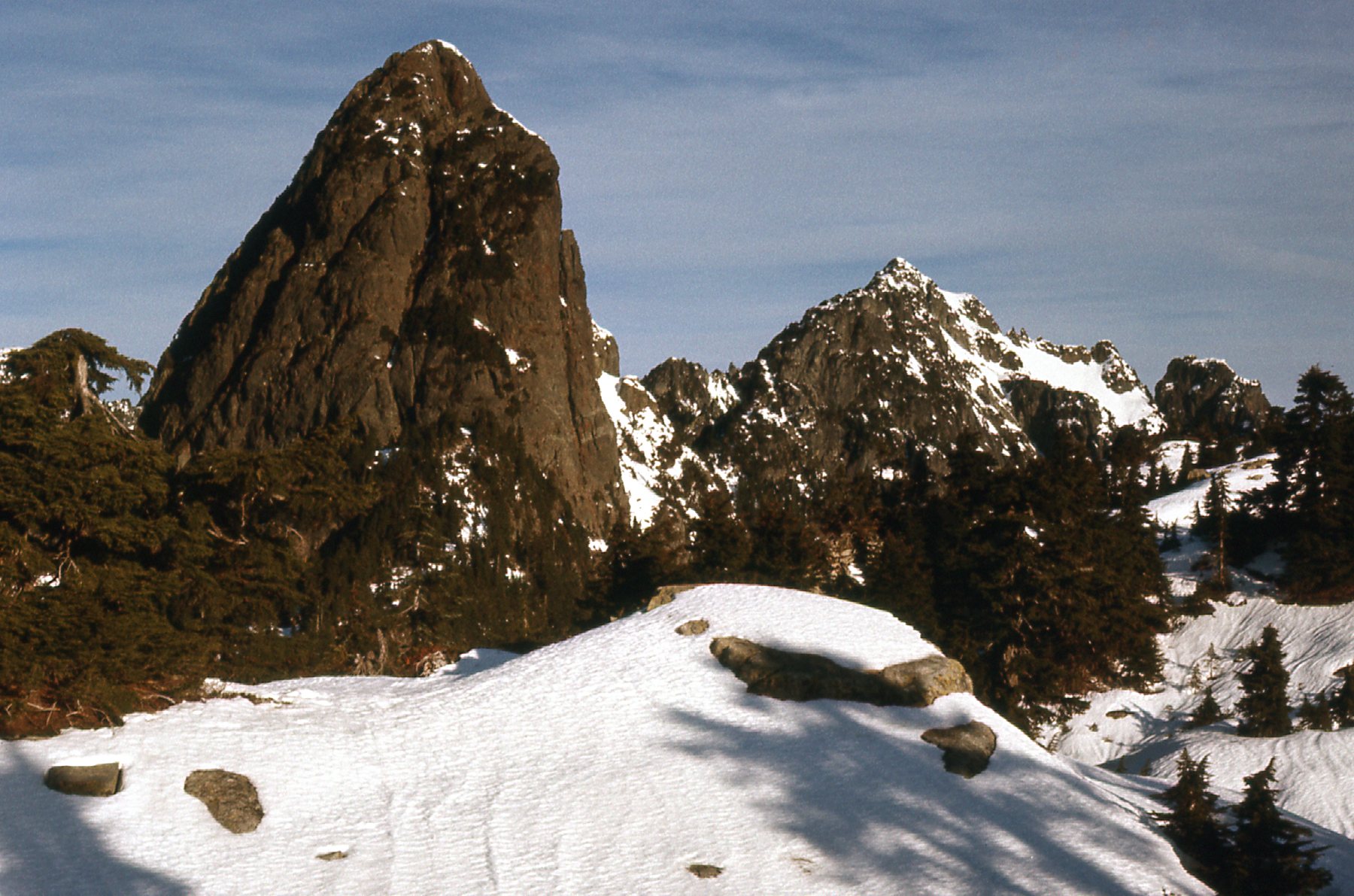
The south side of Blanshard Needle, the dark tower on the left. My route was up the rock just left of the deep groove in the center of the face.
On May 1st, I climbed Silver Peak and Isolillock Peak together with 2 friends as a day climb. This was near Hope, BC and things were still pretty wintery up there.
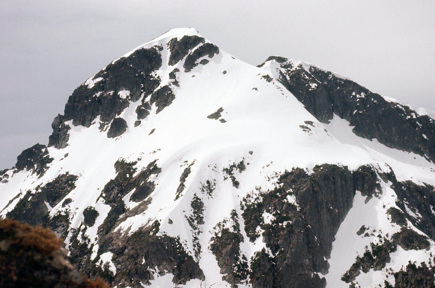
The east side of Isolillock Peak.
On April 30th, Brian Rundle and I made a ropeless ascent of Baby Munday under very wintery conditions, and then climbed Stewart Peak and The Still after a night high up on Stewart.
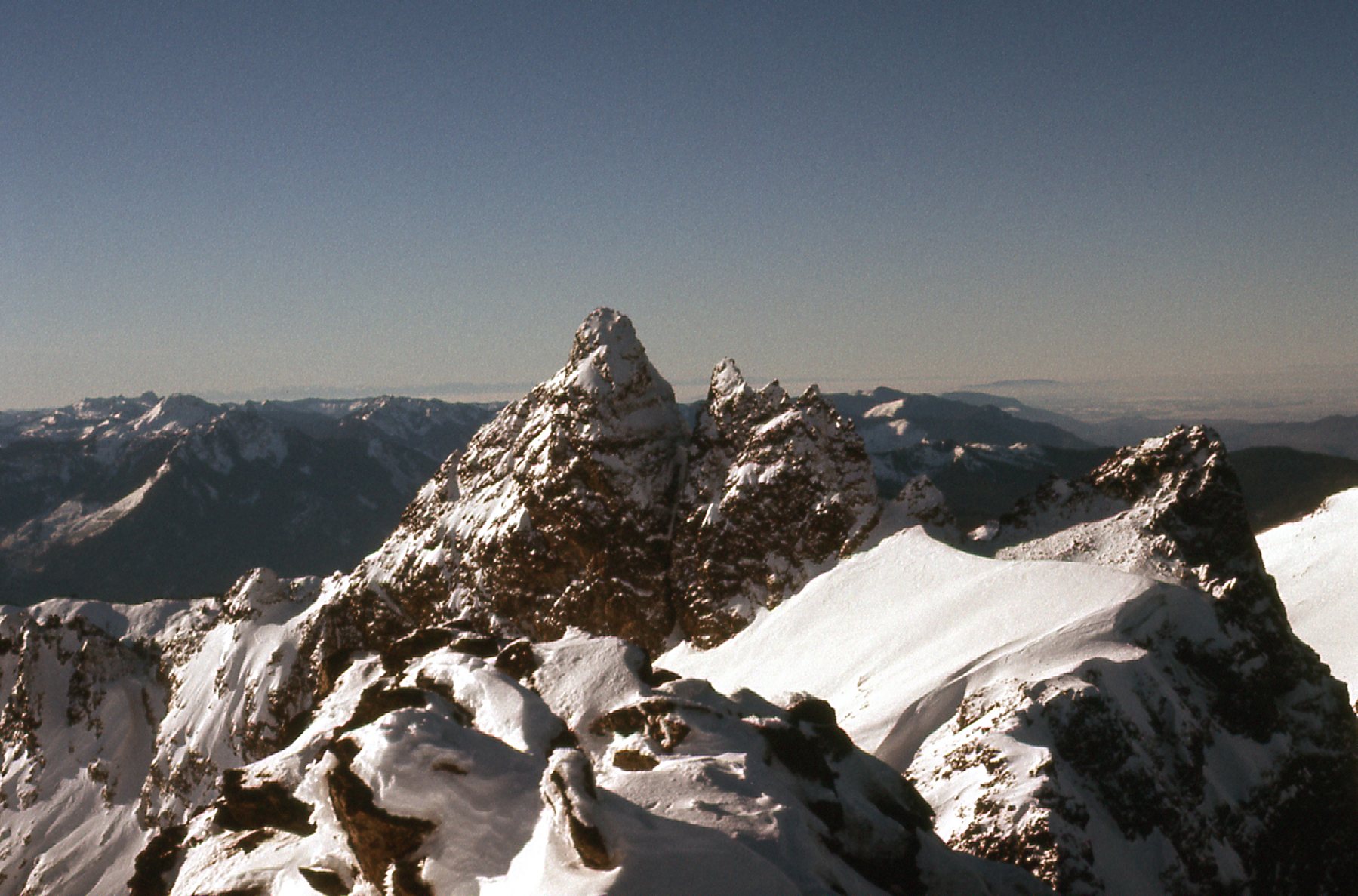
The pointy one out there is Baby Munday, as seen from Stewart Peak. We climbed its left profile.
Also in 1977, I made the first of several trips back into the Statlu area. On May 7th, I climbed Peak 4900 and Peak 4600 above Blinch Lake. Winter hadn’t yet left when I was there. My Peak 4900 is now known as Blinch Peak.
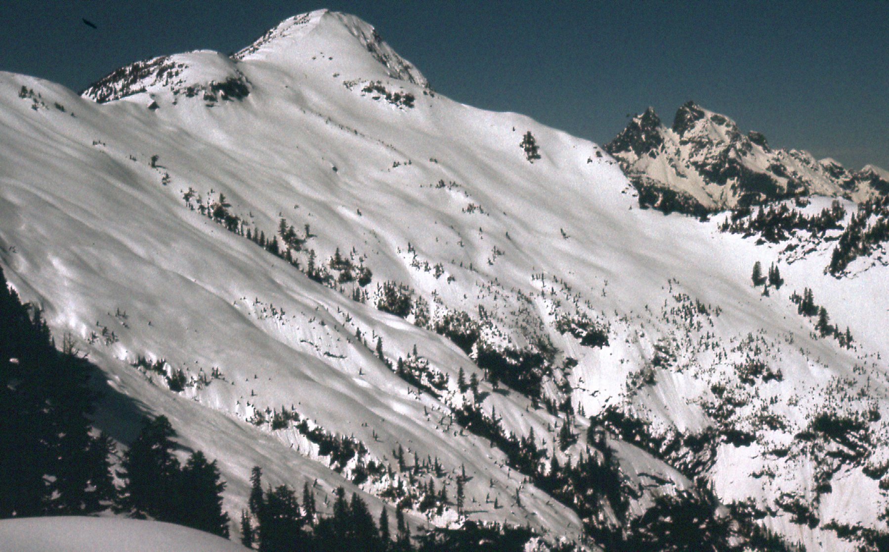
The east side of Peak 4900
In July of 1977 came the best enchainment yet. Brian Rundle and I spent 8 days in the Lillooet Range and climbed everything between Mount Breakenridge and Cairn Needle. This was pretty groundbreaking stuff, and on that trip we climbed the following: Peak 7385 (it had no name when we climbed it – it is now known as Breakenridge SW2); Peak 7120; Peak 7900; Peak 8000 (now know as Traverse Peak); Peak 7300; Peak 7030; Peak 7120; Peak 7200; Peak 7200 (now known as Vista Peak); Peak 7500 (now known as Surprise Summit); Peak 7200. Those aren’t typos – 3 of them contoured at around 7,200 feet. There are so many good photos we took in that amazing area, and it was hard to limit it to just 2 of them.
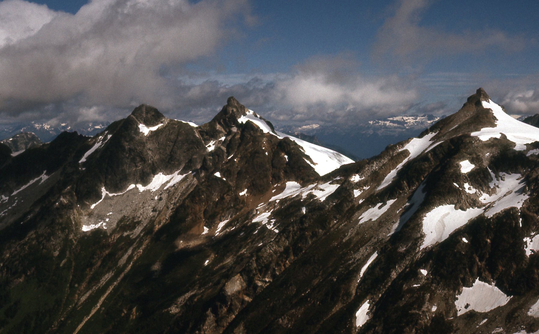
That’s Cairn Needle in the center, and Peak 7500 (Surprise Summit) on the right.
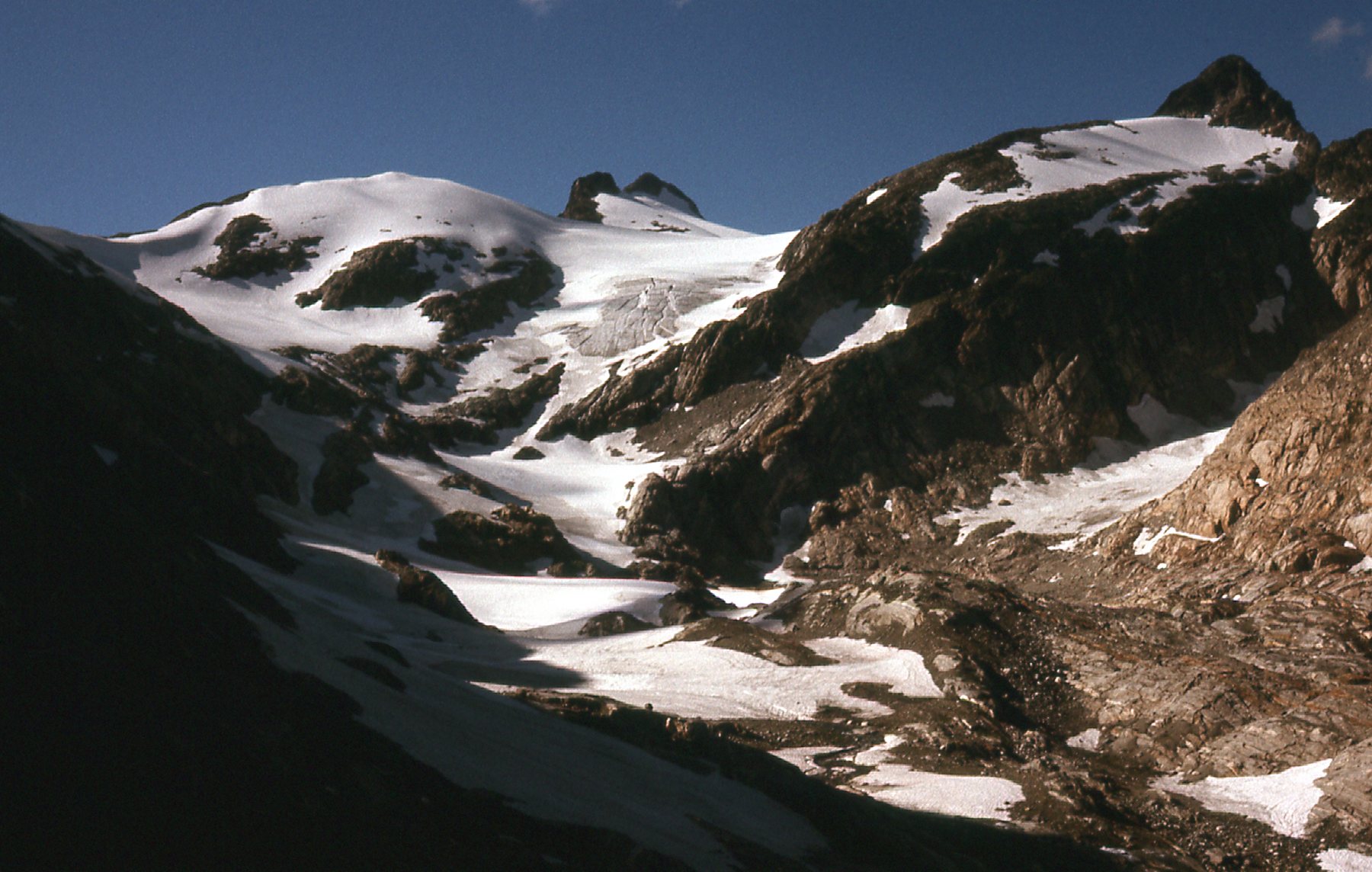
That double peak in the center is Peak 7200 (Vista Peak)
I had barely returned from the Lillooet Range trip when I decided to climb another group of peaks. On August 10th, I caught a ride on a supply boat to the north end of Stave Lake. I walked the logging road up the Stave River, thinking I’d ford the river and climb Mt. Judge Howay. Hah!! When I saw the swirling white water in front of me, I chickened out once again – I had been there twice before and both times I had lost my nerve. I walked the miles back down to the logging camp. The boss offered to drive me up the road up Roaring Creek and then up to its end by an alpine lake. I spent the night there and on the 11th, spent an epic day climbing all of the peaks around Mt. Breier. They were: Peak 1463M; Peak 1402M; Peak 1430M; Peak 1570M; Peak 1570M; Peak 1585M. All of those elevations are extrapolated from the 100-foot contours on the only topo maps we had at the time. After the 6th peak, I dropped 2,500 feet down to the lake where I spent another night after my 15-hour round-trip circuit. The next morning, I walked down and out to the lake where I caught the supply boat that took me back to civilization.
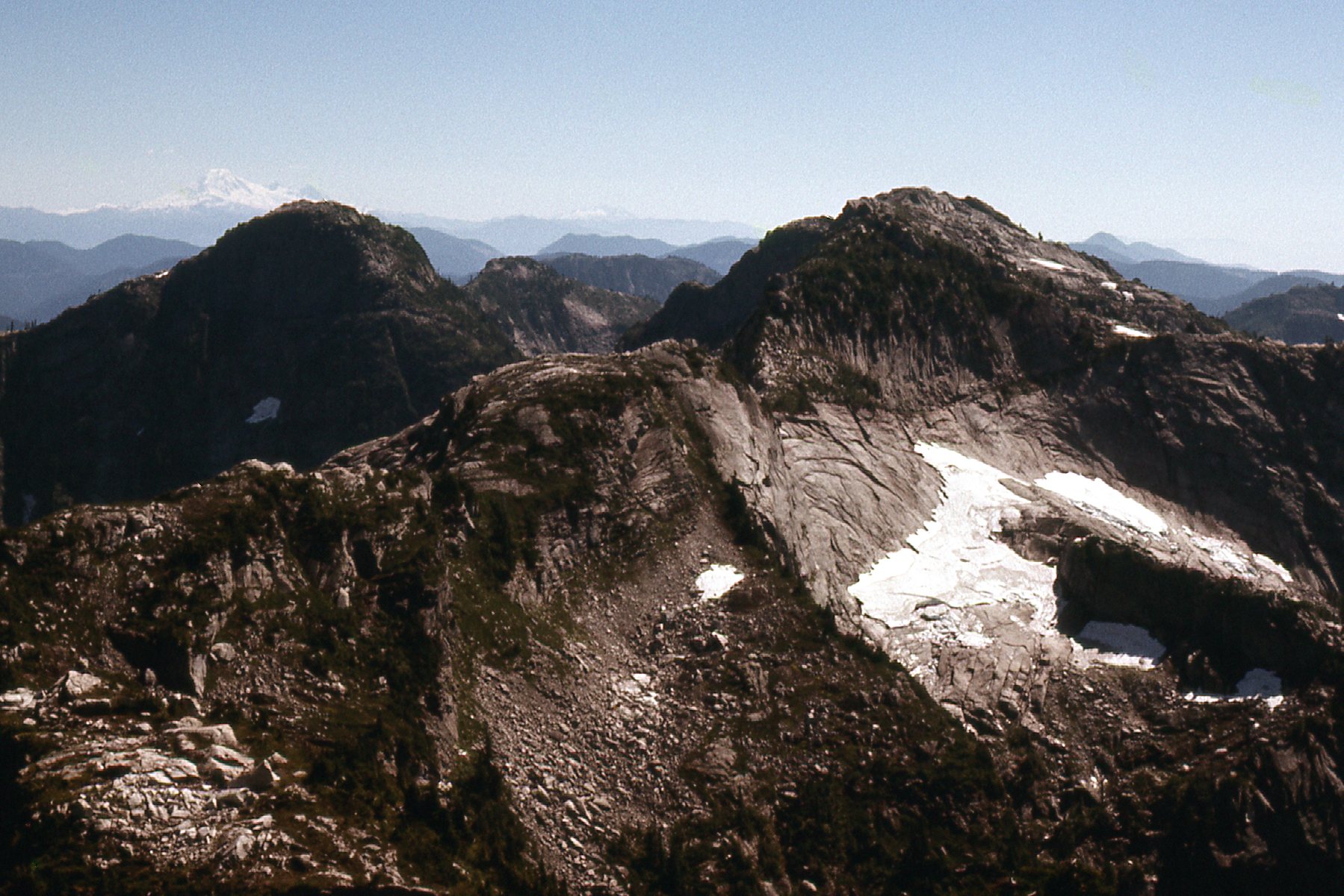
A couple of the peaks I climbed that day.
Less than 3 weeks passed. Brian Rundle and I headed in to Wedgemount Lake, spent the night at the shelter, then headed our the next day for some big fun. We climbed Wedge Mountain via the Weart Glacier on the mountain’s northeast side, then descended the same way. In the Wedge-Weart saddle, we thought “In for a penny, in for a pound” and decided we might as well climb Mt. Weart since we were so close. We did just that, and by the time we finished and made it back to the shelter at nightfall, we were totally knackered and had that thousand-yard stare.
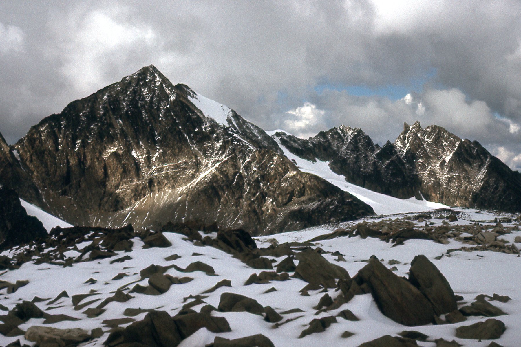
Looking north to Mt. Weart (on the left) and the Owlets in the distance on the right.
Some enchainments, even though they may only involve 2 peaks, are more substantial, like the Wedge-Weart escapade mentioned above. Others are less of a commitment, like this next one.
On September 6th, back in Statlu country, I did a day climb of Mt. Fletcher, directly followed by a climb of its neighbor, Peak 5100. Not a big day, only 2 peaks, but fun just the same.
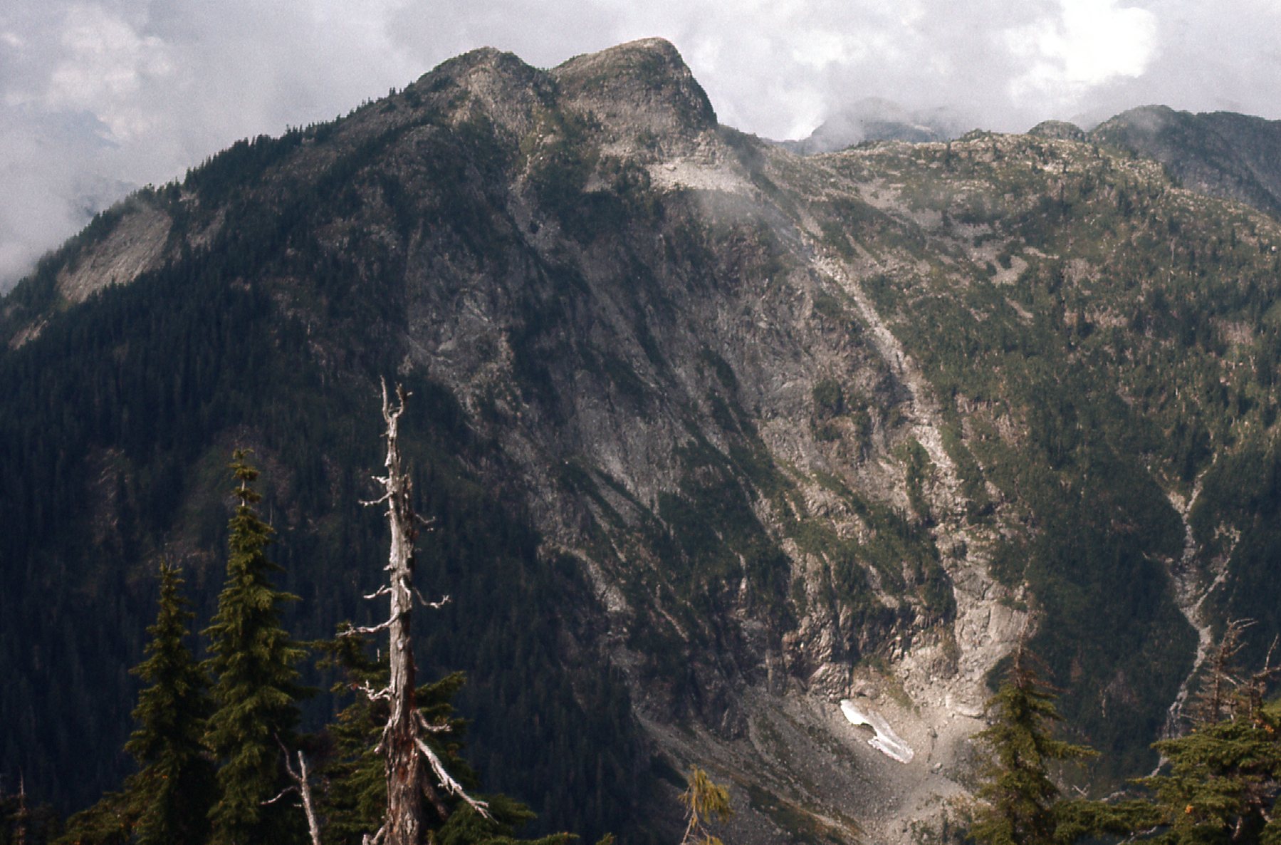
Peak 5100. We are looking northwest from Mt. Fletcher.
On October 4th, I returned to the Statlu area and spent the day climbing all of the peaks surrounding Olive Lake. In a clockwise loop, they were: Peak 1500M; Peak 1585M; Peak 1554M; Peak 1463M; Peak 1432M; Peak 1432M; Peak 1493M. This was another group of fine peaks. Here’s one of them.
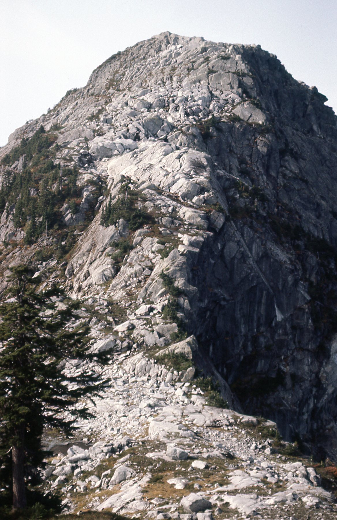
This is the north side of Peak 1585. Nice, huh? I crossed right over it and came down on this side.
Eleven days later, I headed into the drainage of Scuzzy Creek, all new country to me. By the time I had driven to the end of a road and parked, it was noon when I headed out on foot. My first objective was Cam’s Peak (2,000M); then a climb of Peak 2073M, with an overnight bivi on its shoulder. The next morning, I continued on to Scuzzy Mountain (2217M). From its summit, a messy descent, then over to Fraser Peak (2103M), followed by a climb of its 2103M south summit. Then an ascent of Peak 2000M and finally Peak 2012M. It was 5:00 PM by the time I returned to my vehicle and headed home. A good day in a really nice area.
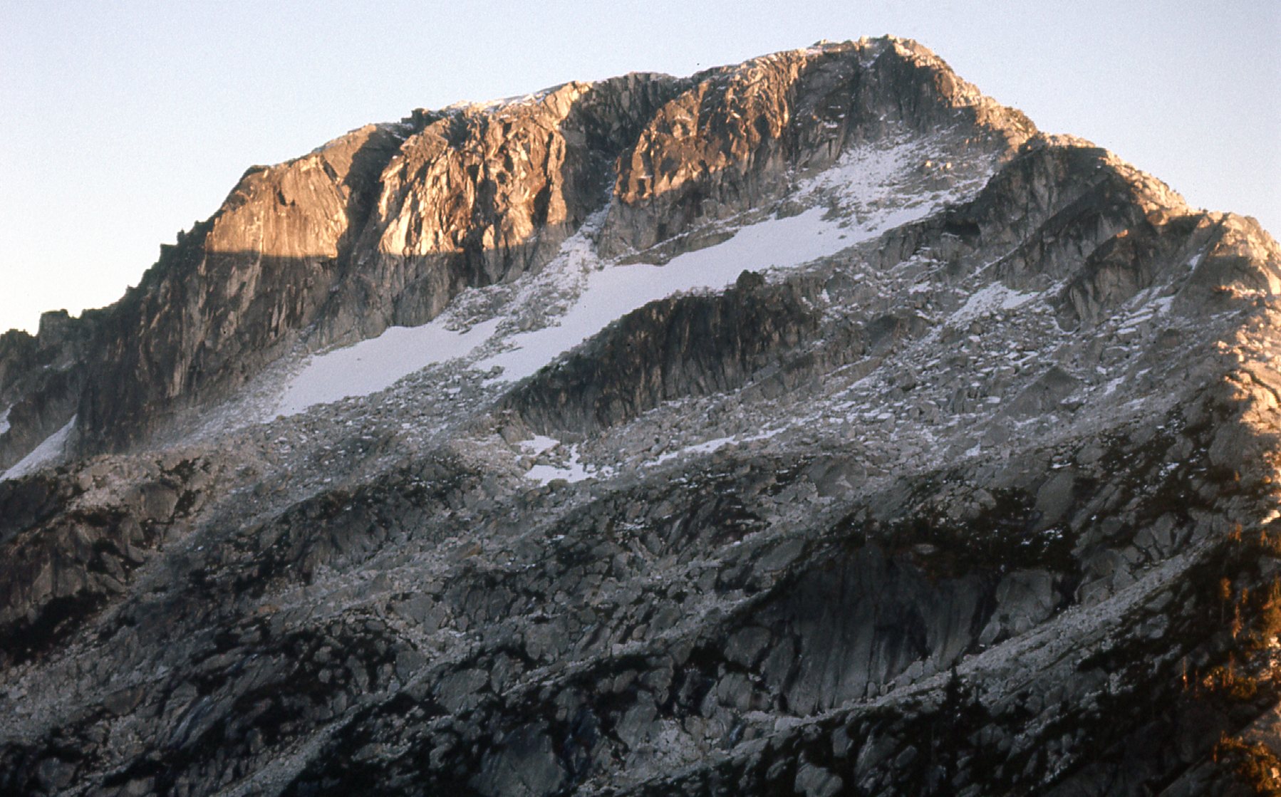
The north side of Peak 2073M
One week later, with a guy I hardly knew, I headed up the Fraser Canyon and crossed the Fraser River just north of Lytton. We then climbed the impossibly long southeast ridge of Stein Mountain, taking us from 450 feet elevation to 9,010 feet at the summit. On our way up the ridge, we bivied overnight, then climbed Stein Mountain. From Stein, we headed west and did Peak 8700, and then Peak 8800. That done, we headed back down to our bivi site, where we spent another night, fighting to keep the falling snow off of the tent. The next day, we retraced our steps back down the ridge to the car and then drove home.
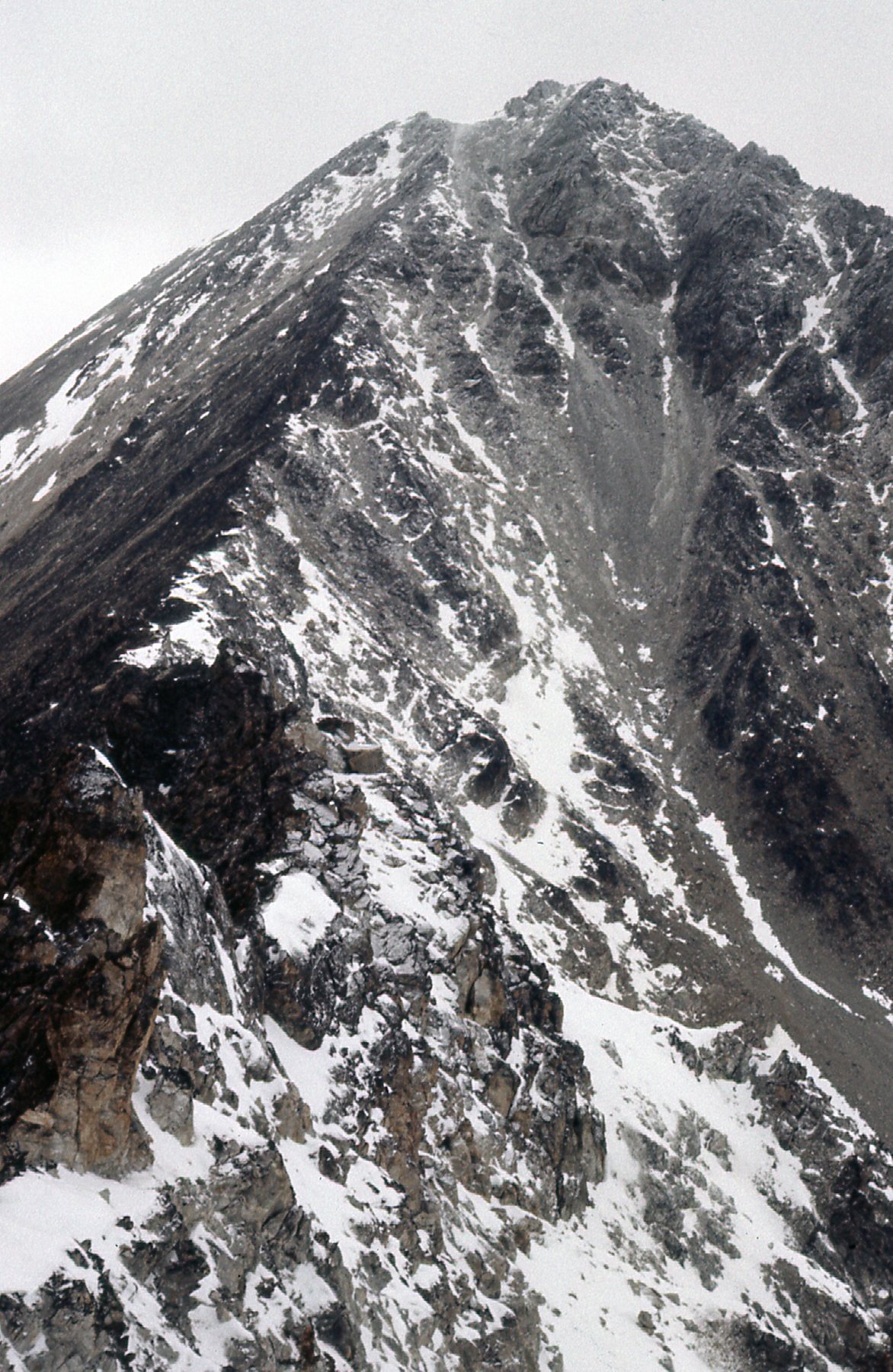
The upper part of the long southeast ridge of Stein Mountain.
So ended the enchainments of 1977. Little did I know what awaited in 1978. I didn’t have to wait long to find out, though. On February 17th, Ross Lillie and I set out on a 5-day-long first ascent of Robertson Peak in a remote area west of Harrison Lake. On the 19th, our third day of effort, we reached the main summit, then ascended the west summit as well. We returned to our high camp for the night, then spent the next 2 days making our way back to civilization. It was epic, for sure. Here is my favorite photo from the trip.
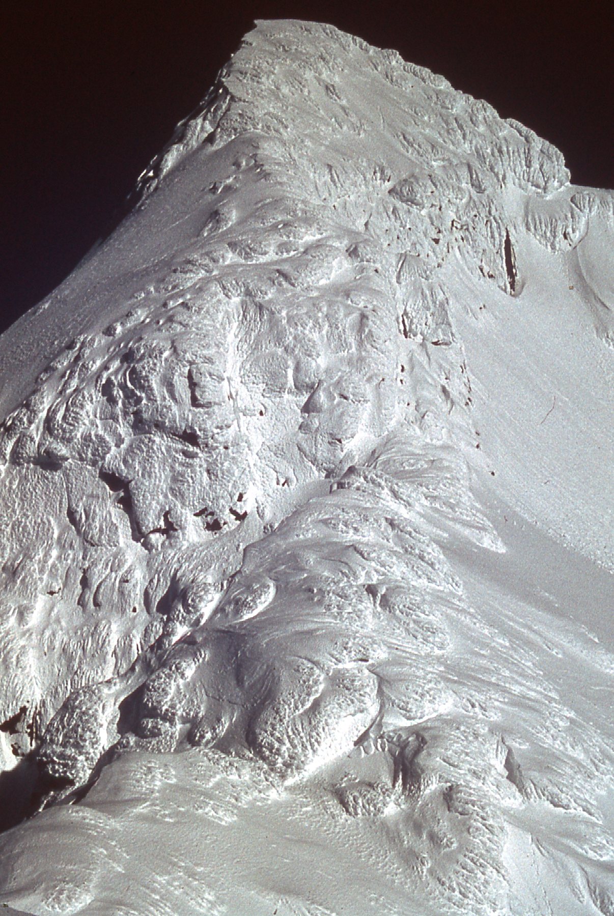
This view of the west ridge of the main summit of Robertson Peak. Check out the hundreds of feet of rime mushrooms along the route.
To make our climb of Robertson, we used the Tretheway Creek drainage as our approach route. Five days spent in that area really got me thinking about all of the alpine country surrounding that valley, high up on both sides. On July 7th, I headed in alone and did a multi-day enchainment of peaks from north to south along the east side of Tretheway Creek. These were all peaks that hadn’t been visited by climbers before, and it was fine stuff, like you see in this picture.
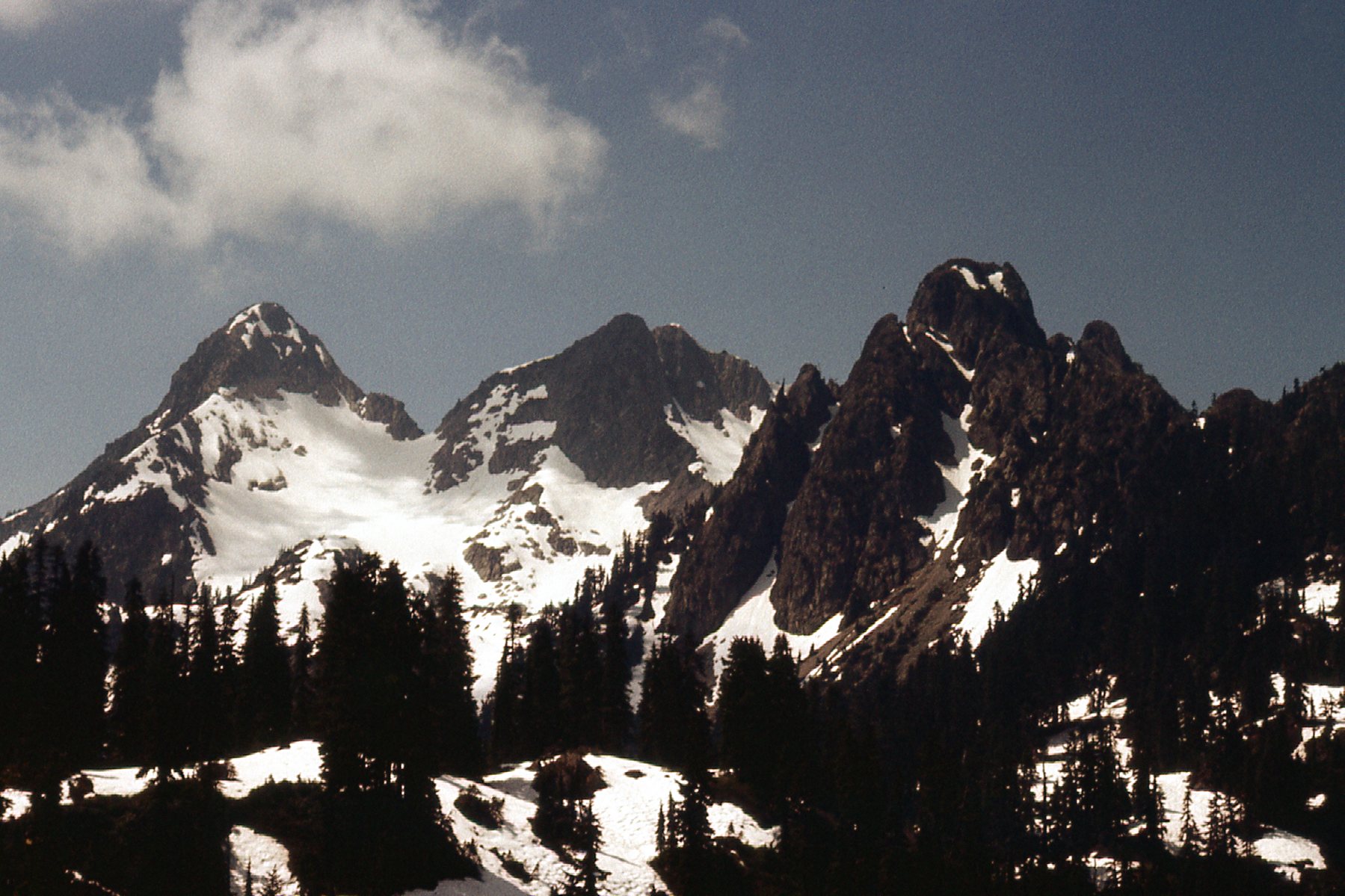
On the left, we see what is now known as Coon Peak.
The peaks climbed on that trip were as follows: Peak 5700; Peak 6000; Peak 6080 (now known as Coon Peak – it had no name when I climbed it); Peak 5700; another Peak 5700; Peak 5800; Peak 5900 (it has since been named Bremner Peak).
On July 20th, I made my way back to the Tretheway area. This time, I wanted to do an enchainment of all of the peaks along the west side of the creek. This was some fine, alpine country with peaks generally higher than the ones I had climbed 2 weeks earlier on the east side. I mean, just have a look at the beauty of the place.
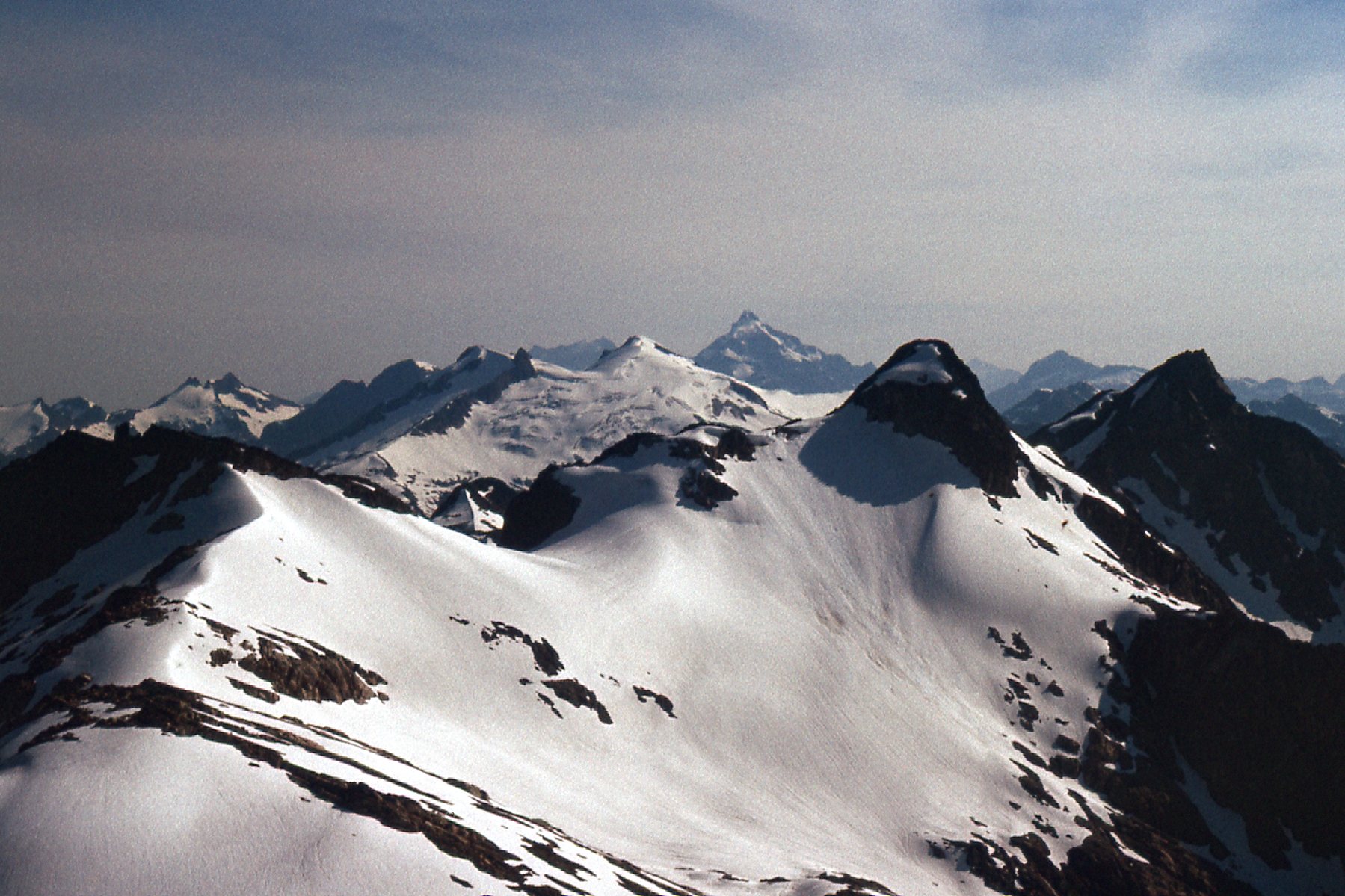
Some of the peaks along my route.
Here’s a list of the peaks I climbed on that trip, with 2 bivouacs along the way: Peak 5400; Peak 6000; Peak 6100; Peak 5800; Peak 6500 (it had no name back then, but it is now known as Tretheway NE2); Peak 6300; Peak 6500 (un-named when I climbed it, but now called Tretheway Peak); Peak 6400 (now known as Tretheway SW1); Peak 6200; Peak 5800. It was an amazing trip. Little did I know at the time, but it would be among the last climbing I would do in BC, but there was one more enchainment to do.
On September 24th, Ross Lillie and I went in to the Pinecone Lake area east of Squamish and climbed both Pinecone Peak and Peak 6500 in a single push. That finished up my list for British Columbia. In retrospect, a lot of good peaks climbed and a few adventures along the way. Thanks for keeping me company.