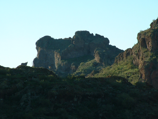
Well, as those of you who do not live here in the desert can probably guess, it has been hotter than the hinges of hell here lately. On June 29th, Andy and I went out to do some climbing in the Castle Mountains – actually it wasn’t too bad, only 97 degrees that afternoon! Since then, it is rare to have such a cool day – it is always over 100, and will be until the end of September.
Andy has had a love affair with the Castles as much as I have. Who wouldn’t? Spectacular rocky peaks, wonderful and inspiring to look at, that conjure up daydreams of how one might reach some of the summits.
I think he was glad that I suggested going there to try some of the tough-looking peaks, even though he did hesitate a bit when we discussed the fact that it would be very hot, somewhat complicating the issue. But his hesitation lasted only a moment – the prize was just too good to turn down! Andy is a skilled technical climber, and has had a great deal of experience for someone his age. And I can attest to the fact that he is deliberate, measured and safe. I felt good following his lead on the two peaks we did together.
A footnote to this write-up: based on hand level, GPS and good old-fashioned eyeballing, Andy and I came up with what we hope are fairly accurate heights for the two summits we climbed. Neither of the peaks has a spot elevation, and trying to decipher the contours will make you crazy. So here is what we concluded:
Peak 3055′ – at a bearing of 224 degrees from the end of the very short road to the gravel pit just east of Ventana Pass, it is 2,420 feet distance to the summit. This is called Peak 3010′ at the start of Andy’s write-up.
Peak 3057′ – at a bearing of 096 degrees from the end of the very short road to the gravel pit just east of Ventana Pass, it is 3,750 feet distance to the summit. This is called Peak 3050′ at the start of Andy’s write-up.
Either of these climbs can be reached within an easy hour from the parking spot. I strongly encourage anyone who is looking for a great desert climb with some challenge to try these peaks, especially Peak 3057′. Doing them both took 8 1/2 hours, most of that time spent on Peak 3057′. So, without further ado, here is Andy’s excellent account of our day in the Castle Mtns.
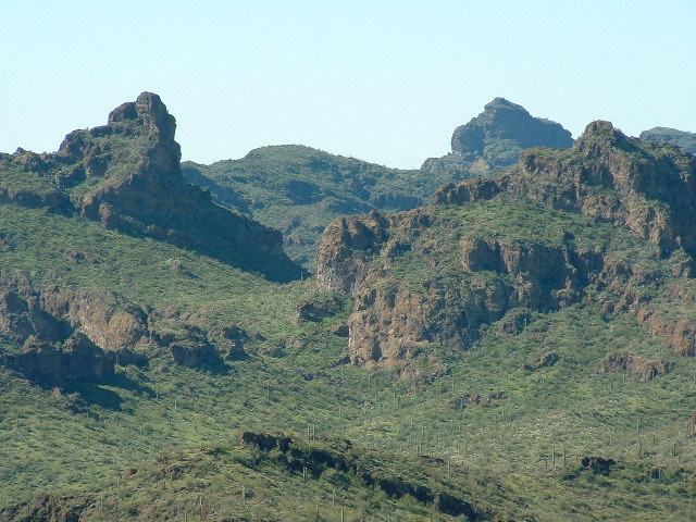
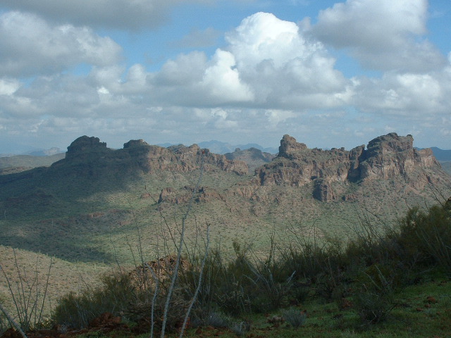
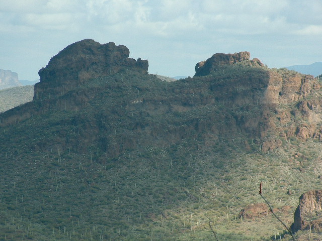
When the Desert Mountaineer (DM) asked if I was interested in helping him try to climb a technical summit over in the Castle Mtns. about 70 miles west of Tucson, he didn’t have to mention what peak he had in mind. Anyone who has driven Indian Route 34 on the Tohono O’odham Indian Reservation (the “TOIR”) can’t help but notice the small, but rugged summit that juts out of the low desert. This mountain range lives up to its name, and every peak contributes – especially this one. This particular summit rises just northeast of Ventana Pass, and from the highway gives no sign of weakness to attack at. Every visible side has large cliffs to contend with. Ramps that appear to offer some hope, start and stop between cliff faces, many overhanging. Volcanic rock adds to the uncertainty and risk. Although barely 700′ off the desert floor, this little summit puts up quite a defense. To make things more complicated, the peak has two separate points nearly identical in height. The topo maps don’t give any light on which point is the true summit. In fact a look at the topo quad makes matters worse. From the jumble of contour lines one can’t even determine the elevation of the peak for sure. “Peak 3050” was my best guess. My first sighting of the summit was probably back in Dec of ’97, on the way home from some peakbagging in Organ Pipe Cactus National Monument. It made its impression on me then, and I have planned to climb it one day ever since.
DM and Brian had scouted out Peak 3050 (revised to 3057) last November and learned first-hand there were certainly no walk-up routes. Without gear they were only able to approach the peak before getting cliffed out still some distance from the summit area. They also checked out Peak 3010 (revised to 3055), a half mile to the northwest, and learned it would need some rope protection to be climbed safely too.
DM’s project includes climbing all peaks within the TOIR, so both were on the agenda. DM loves to make a climb even more fun by adding an extra dimension to it. Why not climb it in late June so we can enjoy the hearty desert heat and soak up some sun? “Sure, sounds great” – any reason to do some desert climbing.
Slightly after 3 AM on June 29th, I met DM at his home in Tucson, and rode in his truck to the Castles. I was amazed by the large number of law enforcement and Border Patrol vehicles that were out and about all over the reservation at that time in the morning. We arrived at Ventana Pass shortly after 5 and proceeded to slap the sunscreen on. Parking for the peaks couldn’t be easier. We pulled off the road a few hundred feet near a small west-flowing drainage in plain sight of the highway. Since the peaks were close, DM hauled the gear (various chocks + nuts, some hexes, a couple of cams, and hey – even a grappling hook) in a large handbag while I lugged my old 50M rope in a separate backpack. DM and I both concluded that we should climb the easier Peak 3010 (now 3055) first, getting it out of the way, and allowing us to view the northern side of Peak 3050 (now 3057) to search for routes. We would also be in a good position to use DM’s new sight level to determine which point on Peak 3050 (now 3057) was indeed the highest. The hike up to the short climbing section was not difficult, but care had to be taken to avoid being impaled on the cholla cactus that grows abundantly on the scree slope below the summit cliffs.
A Border Patrol (BP) SUV quickly spotted DM’s truck and went to investigate. We watched the scene play out from halfway up Peak 3010 (now 3055) as the BP agent walked around DM’s truck and failed to notice his Hickiwan District permit plainly in sight on the dash. Clearly the man couldn’t tell why we had parked there and even sounded his horn twice, as if he expected us to respond somehow. Finally the agent noticed the permit, and within a few minutes headed on his way. He must have been a new guy – all of the BP recognize DM’s truck out on the TOIR!
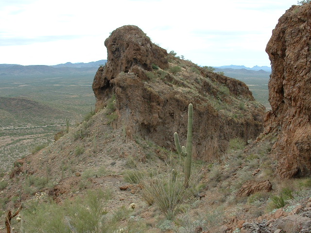
Upon reaching the climbing segment on the peak’s south side, we surveyed what we were up against. A short 12′ section of “moderately secure” rock led to easier slopes that would allow access to a notch. From his scouting trip in November, DM had entirely circled this summit and had not seen any other way up. It appeared to him though that once past the notch, a person could walk around on sloped terrain, essentially to the top, bypassing the other cliffs. The short climb didn’t offer any real protection and I opted to simply free-solo up it. There was an awkward move towards the top, but overall in the low 5th class range. The main concern was whether the rock holds would support full body weight as I shifted onto them. Fortunately the rock held (although it creaked some), and I found myself above that obstacle, where DM then tossed me the rope. A large boulder served as an anchor to
belay DM up. He quickly climbed the short vertical section, and we walked on through the notch. Sure enough, the way from the notch to the summit was unbarred, and we stood on the top within a few minutes. There was no sign of any previous human presence, and we built a little cairn to house the jar DM left for a register.
An interesting note about this summit is that, according to the map, we should have been on a lower point. DM’s GPS read 3055′, and standing on the western-most point, we could look down maybe 30 – 40′ to the interpolated 3010′ center point. One cannot tell this from the map. We also used his sight level to determine that the eastern point of our next
objective, Peak 3050 (now 3057), was indeed the summit. Having turned our attention to that peak, the search for routes began. The best-looking option appeared to be a big V- shaped crack that led from a large shelf to a 30-degree slope. This slope proceeded upward and ended at a minor saddle just east of the highest point. The V-shaped crack was immediately adjacent to the outside corner of two rock faces that lie almost perfectly perpendicular to each other. Getting onto the large shelf didn’t appear trivial either, for a distinct cliff band blocked access.
To be continued………………..
Please visit our Facebook page at https://www.facebook.com/pages/Desert-Mountaineer/192730747542690

