It’s hard to even know where to start with this story. To say it’s been an overwhelming experience is an understatement. Maybe I should first give you a bit of background.
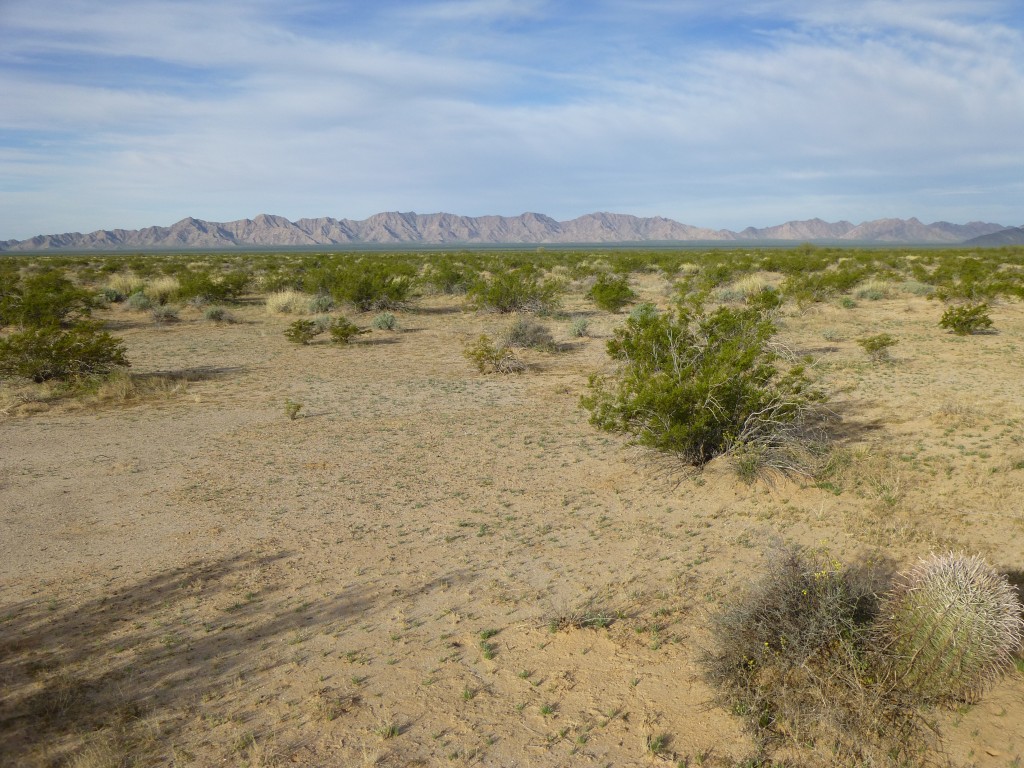
Deep in Arizona’s Sonoran desert lies a vast tract of land known as the Cabeza Prieta National Wildlife Refuge. At over 860,000 acres, it is huge, and not a single soul lives within its boundaries. In the heart of this refuge lies a rugged range known as the Granite Mountains, so remote that only a few determined souls have ever set foot there. Because access is so difficult, the range has developed a mystique – at least it had for me. There were 18 peaks in the range I needed to climb. I say “needed” because I was working on a huge project, that of climbing all of the peaks in Pima County. Climbing these was a crucial step to completing the project.
A real stopper is the lack of water, and that is exactly why nobody had done this before. You have two possible ways to try to climb all these peaks: make multiple shorter trips into the area, or carry all your water and do them all in one big push. Since I’m not getting any younger, I figured that doing the whole thing in one mighty push was the way to go. I put the word out to all the usual suspects, but at the end of the day, there was only one taker – Mark Adrian from San Diego. In February the past two years, Mark and I had done some great climbing in remote areas, so he was a natural for this. We felt we had a high degree of compatibility, something that was absolutely essential for a trip like this where you depended on each other completely for your survival.
After weeks of planning, the big day arrived – it was time to put boots on the ground.
Day 1: Mark arrived in the small town of Ajo, Arizona and then made his way out to Charlie Bell Pass, a remote spot which was as far as you could drive legally. Carrying all his gear, but only enough water for the day, he walked the 16 miles across the desert to arrive at Granite Pass Tank.
This tank was a water catchment, a place where, during rare rainfalls in the area, water might flow down a rocky canyon and collect. Sometime in the past, humans had built it up with concrete, so that it was better able to hold the water and protect it from evaporation. It hadn’t rained for three months, so what he found there was pretty bad. There was enough of it, though, that with careful filtration he could fill his jugs.
Mark had gone in a day earlier than I, because he wanted to climb a big peak in the range that I had climbed years previously. If he were able to get that one out of the way, then he and I could focus on climbing together all of the remaining peaks.
Day 2: So, early on the morning of February 16th, Mark headed north carrying a load of 30 pounds of water plus some food. Once he arrived at a spot near the peak he wanted to climb, he hid the supplies and then spent the day climbing Peak 2390. Once back down, he made sure the water cache was still okay and then started south back to the tank. He hadn’t gone far when he saw a man, alone, walking north. He gave him a wide berth, realizing that he was no doubt undocumented and heading north in the desperate hope of reaching the Interstate.
While all this was going on, I was setting out on foot from Charlie Bell Pass that same morning, crossing the desert as Mark had done, heading to Granite Pass Tank. En route, I stashed a 3-gallon jug of water in a remote and hidden spot in the Growler Valley – we felt it would be good insurance to have it there, in case we were running low as we finished our trip. My crossing went without incident – well, almost. When I was a mere 5 miles from the tank, I saw something under a lone tree on the desert floor. It was bright yellow, a quad that someone had hidden there. I didn’t approach too closely, as there was a chance its rider was asleep under the tree waiting for nightfall.
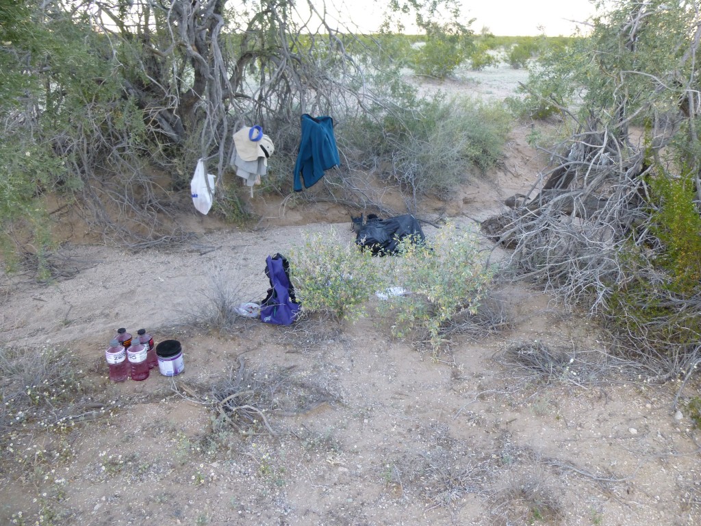
I arrived at Camp One, a third of a mile below the tank. Mark had chosen a good spot, hidden in a sandy wash and surrounded by trees, but only a hundred feet from the old road which wound its way up to the tank. This photo shows the camp. It may not look like much, but it would turn out to be luxurious compared to later camps.
He had used his time there well – it was stocked with an abundance of water, and all his gear was well hidden. He and I had kept in touch throughout the day by using a pair of small 2-way radios, so I was expecting him when he walked into camp at 3:10 PM. It was a hot day, 90 degrees, more than 20 degrees above normal. The long-range forecast was for a cooling trend – we hoped so, as this extra heat would force us to consume more water as well as slow our progress.
We celebrated that first night – we even had a bit of wine and tequila. This was the best it would be on the entire trip, because as we moved north through the range we’d be carrying everything on our backs and would have no such luxuries. A big day of climbing was planned for the morrow, so we turned in early. Sleeping soundly, we were suddenly woken from a sound sleep at 3:15 AM – a vehicle had just passed by on the road and scared the crap out of us. I called out to Mark – he had heard it too. We crawled out of our sleeping bags, and soon saw that the vehicle had driven past us and on up the hill to the tank. A bright floodlight was being shone all around, up the steep mountainside and everywhere else nearby, as if they were looking for someone. I gotta tell you, we were concerned. Were they drug-runners looking for their pals? After about half an hour of watching this, we decided to go back to bed. At 4:15, we were once again awoken by the sound of the vehicle approaching. What if it were the Border Patrol – it’d be nice to talk to them. But if it were bad guys, we sure as hell didn’t want to be talking to them!
Down the hill he came, and we crouched out of sight in some bushes near the road. As soon as he came close enough to identify, we saw the familiar white and green colors of the Border Patrol. I stepped out and shone my headlamp at him. He rolled to a stop, then put down his window on my side and called out “Párete!” (Stop!) I did, of course, keeping both hands in plain view. He then asked “Dónde están los otros?” (Where are the others?) I called out that we were Americans, mountain climbers out there for a week of climbing in the Granites. That broke the ice, and we talked for half an hour. He was pretty shocked to see us out there. I told him about the quad, and he said he’d go have a look. It was enjoyable talking to him, but finally he left and we slept fitfully until 5:30 AM.
Day 3: Shy a couple of hours of sleep, we began our day. To keep our weight to a minimum, we had no tent or bivi bags – we simply put black garbage bags down and laid our sleeping bags on them. I had a down-filled air mattress, which was very comfortable. Mark, on the other hand, had a blue, closed-cell foam, barely serviceable if he slept on something like sand. We had decided to start each day with oatmeal, plus coffee for Mark. He had brought the tiniest stove I’ve ever seen. It was basically a tiny burner with fold-out prongs to support a pot, It screwed into a small canister of a butane/propane mix. Tiny but efficient, it boiled water very quickly. The stove itself couldn’t have weighed above 3 ounces.
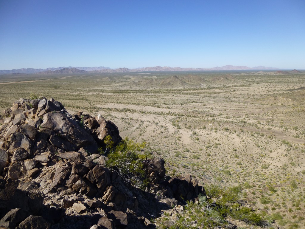
Today was going to be exciting. For many years, I had been eyeing a group of four small peaks in the southernmost part of the range. They were small, but very isolated. I had thought about trying to get to them before, but it was just too far to go to reach them. From our Camp One, we were perfectly situated. Mark and I talked excitedly about our day. At 6:30 AM, we walked out of camp at first light. It didn’t take us long to skirt a few low hills and arrive at the north side of Peak 1370. It was a straightforward climb, but when we arrived at the supposed high point, we quickly saw that a bump to the southwest was clearly higher. Down we went to a saddle and then up to our new-found high point. It was there we left our first register of the day. It was still cool and pleasant as we took in the view.
Even though these were four small peaks today, we had a feeling that they’d take quite a while, so we moved on. Down the south side we dropped, then across the flat desert floor to soon arrive at the highest one of the group. It was a steep climb up the north side of Peak 1550, but it too went without incident. At 9:30 we stood on top.
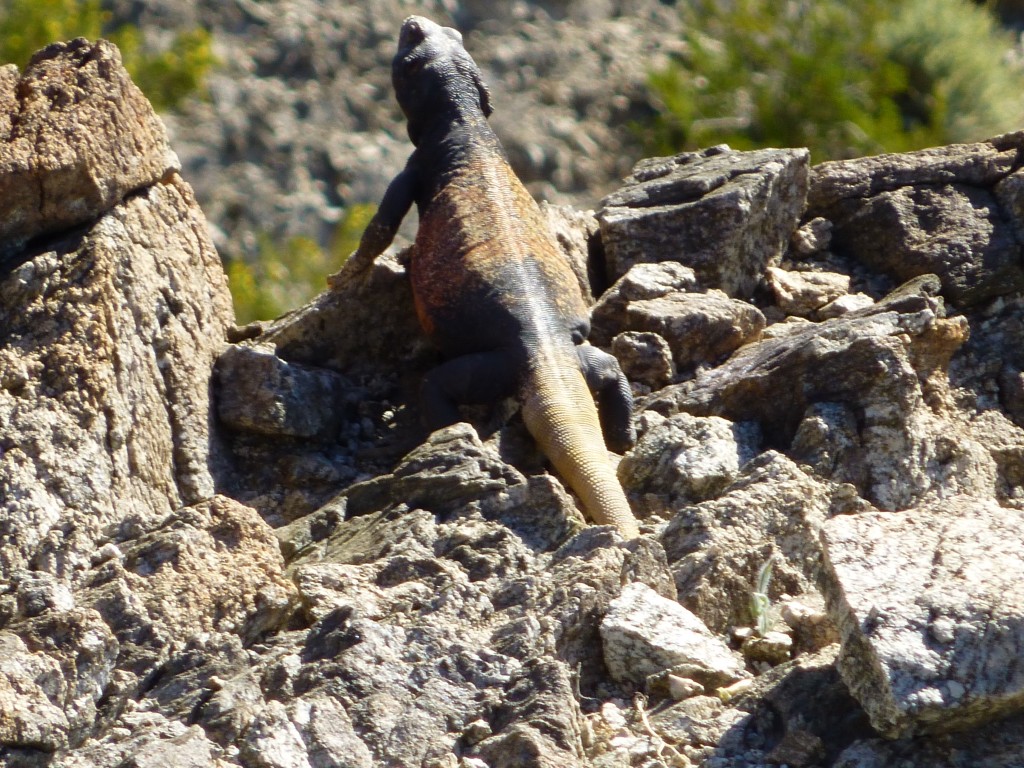
To avoid being repetitive, I’ll just say that we built a cairn and left a register on all of our peaks on the entire trip, unless otherwise stated. This was all virgin territory, not just for us but all climbers. We savored the moment. As we made our way down the south slope, I saw some movement just ahead. It was a huge lizard, which we later identified as a common chuckwalla. This thing was a full 18 inches long, quite the sight to see. It posed for a few photos, then we let it be and finished the descent to the desert floor.
One more push southward, and we stood at the base of Peak 1250. This was as far as you could go in the Granite Mountains, the last outlier of the range. No peak was farther south. We would spend the next week moving ever northward through the range, hopefully climbing everything in sight. It was a quick climb, and there we were on top. Years of staring at this peak on the map, and now here we were, so very far from anywhere.
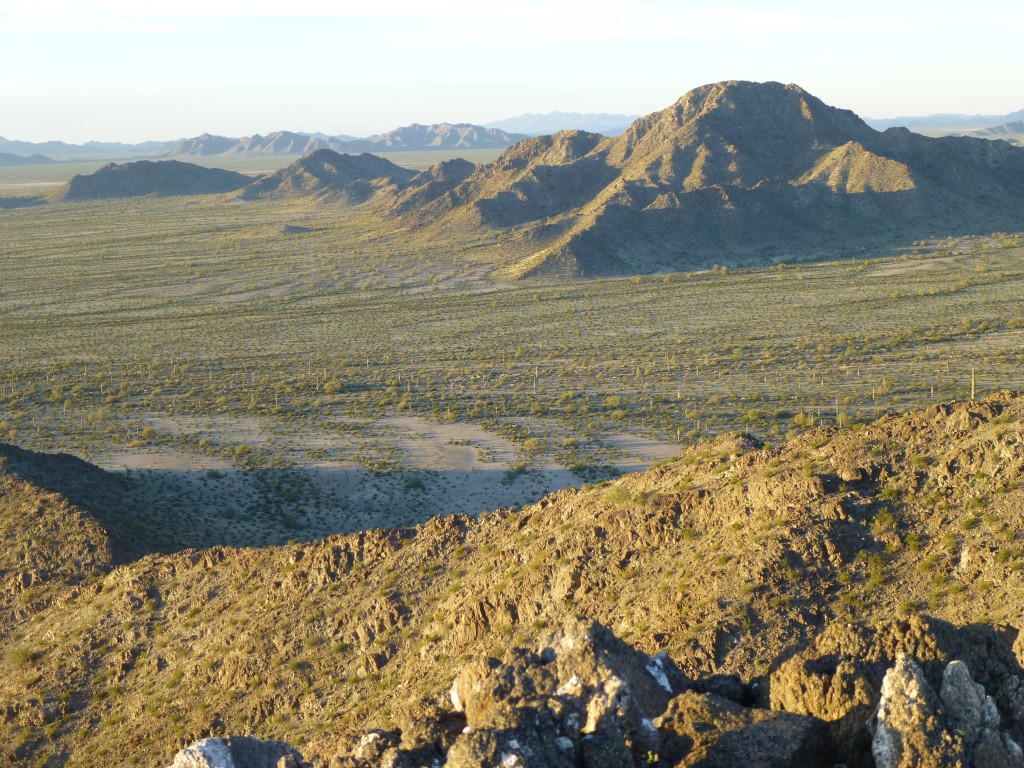
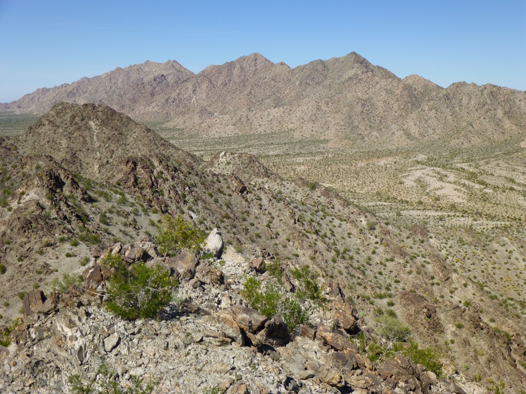
Photos, a snack, then down we went. One more to do today. We swung around the west side of the range, crossing several gullies, to reach our last peak of the day. Up we climbed by its south side, then stood on the summit of Peak 1350. Our attention was immediately caught by a bump nearby to the north, shown at 1353′ on the map. Crap, was it higher? We took out our trusty hand level, and each of us took two different readings on it. There was no question, where we stood was higher, probably close to 1,360 feet. That determined, we enjoyed the view. The next photo is important for what it shows. The dark peak on the left side in the middle distance is the nearby Point 1353. The three high peaks on the horizon are as follows: on the left is Peak 2350; in the middle is Peak 2190; on the right is Point 2053, which rises steeply to the west above our Camp One.
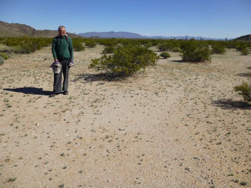
Below us was Saguaro Gap, and we were about to cross it for the second time in a day. Trust me, you will never meet, as long as you live, anyone else who has stood in the gap. Once down, we paused for a few photos.
Then it happened, when we least expected it – we saw an animal in the distance. It was unmistakable, even though it was several hundred yards away. A Sonoran pronghorn antelope, extremely endangered – only 160 of them exist in the United States. This was the first time in almost 30 years of wandering in the desert that I had seen one. I wish it had been closer, but its white rump was unmistakable. It made our day.
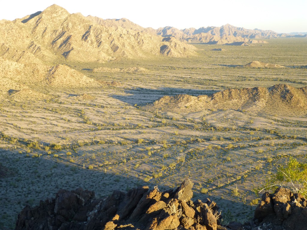
Saguaro Gap is a 1-km.-wide valley, a low pass if you will, that separates the three southernmost peaks from the rest of the range. Since there’s nothing else out there, they even named an entire map quad after it.
Once across it, all we had left to do was walk through another pass, then head back to camp. By the time we got there, nine hours had passed since starting out. Early enough for a bit of a happy hour.
We knew that this was our last night in this camp. Much time was spent organizing our gear and packs, and eating lots of food. Little did we know that the ease and comfort of this camp would soon become a cherished memory. If we had known the rigors that lay ahead, I wonder if we would have continued.
Please stay tuned for the next part of the story, entitled Granite Mountains Expedition Part 2
Please visit our Facebook page at: https://www.facebook.com/pages/Desert-Mountaineer/192730747542690

