
The mountains were beckoning, so on Saturday, September 17, 2005 I drove from Tucson to the area of Pia Oik, a small village in the southern part of the Gu Vo district on the Tohono O’odham Indian reservation. It is about 140 miles from my home to the spot where I left the paved road. It was light enough to see by the time I started down the dirt road to Adams Well, which I passed after about two miles, then drove across flat country for three miles more. The road became rougher as I entered the mountains. It didn’t require four-wheel drive, but high clearance was a must. I counted ten abandoned vehicles in less than a mile, all pieces of rusting Detroit iron that just didn’t have what it takes to negotiate these back roads. Today I was planning to climb three peaks on the west side of the Mesquite Mountains.
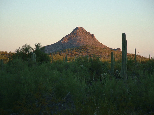
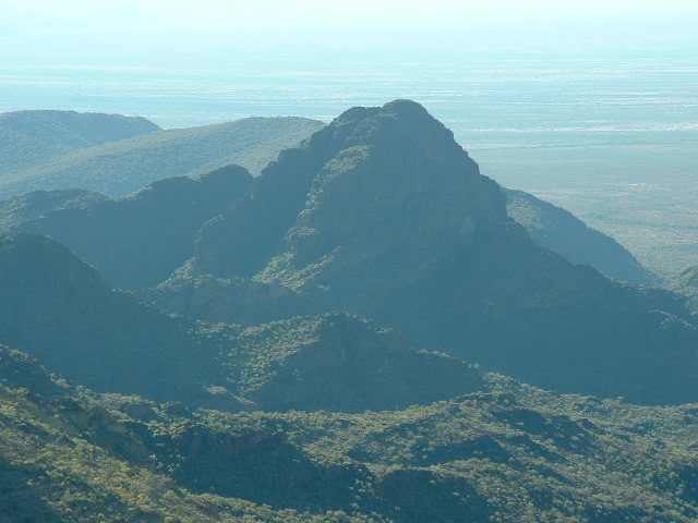
Looking north to Peak 2794 at sunrise
I managed another 3 1/2 miles through gullies and sandy washes until I decided to park in a remote area for my first peak. I could have driven another 2/3 of a mile but chose not to. I had a good reason – I was trying not to tempt fate. Here’s the story.
Way back on June 20, 1989 I had driven to this very spot. I was climbing the highest point of each of Arizona’s 193 mountain ranges and was sort of making it all up as I went, deciding on the best access to each of the range high points. I felt that I could approach the high point of the Mesquite Mountains (Mesquite Benchmark, elevation 3,789′) from the west. I had driven in to this same valley on this same road, but I had pushed my luck. I had tried to force my truck as far up the road as I possibly could, and I did get all the way to its end, but in parking it for the climb I pushed the sharp end of a branch through the sidewall of my tire. No big deal, just change the tire, right? I got out the tools and jacked up the truck. Then I discovered something interesting. This was the first time I had ever had to change a tire on that truck and it had one of those locking wheel nuts on one stud on each wheel, which you need a special attachment on your wrench to remove. I had already removed the other normal nuts and now it was time to remove the special one. As luck would have it, when I went to spin it off, the outside of it stripped. I tried everything – pliers, vise grips, anything I had, all to no avail. The very device which was there to prevent some thief from stealing my wheel was preventing me from changing my tire! By now I had been wrestling with this thing for a long time. I knew it was going to require drastic measures. I found a baby sledge hammer in my tool box and started beating on that lug. I was able to beat it all the way to one side, then back the other way. I did this several times – the metal started to fatigue, and soon it fell off. Hallelujah!!! At least I wasn’t going to have to abandon my vehicle and walk the 8 1/2 miles back out to the pavement for help. I finished changing the tire. Three hours had passed, it was about 8:00 am, and already 93 degrees. It was the very hottest time of the year, and they said it would hit 105 degrees that day. I had come here to climb, so that’s what I did. I was on top by 9:45 AM and it was almost noon by the time I got back to the truck.
So, fast-forward to 2005, 16 years later. As I said earlier, I parked today in a safer place, a nice flat open area where I couldn’t possibly get a flat. It was a nice cool morning, and I was able to leave on foot by 7:10 AM. I walked up the very faint trace of the old road (shown as a “pack trail” on the map). It ended at a large dam made of stones.
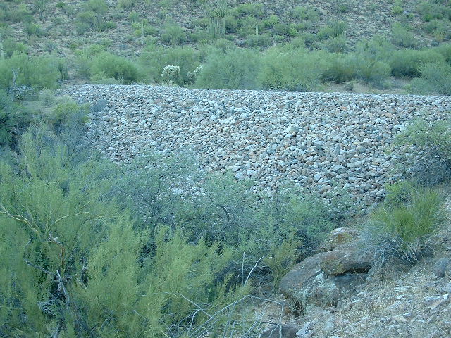
The dam made of stones
This is quite the structure It is about 150 feet long on top, stands about 20 feet tall, and is at least 50 feet wide at its base. I drew this on graph paper and I think the volume of the dam is about 68,000 cubic feet. If the average stone in the dam is about 8 inches in diameter, how many stones would it take to make the dam? Can any of you do the math? I bogged down at that point. I heard somewhere that this might have been built back in the 1930s by the Civilian Conservation Corps.
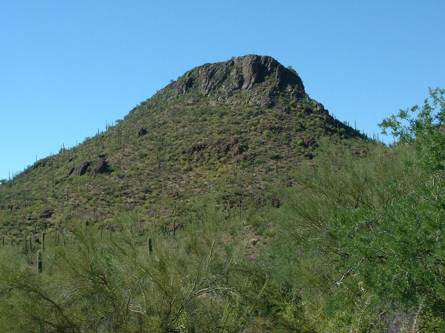
Up the valley to the south, I had this view of the peak to which I was heading.
Peak 3375 in the middle in the distance
I thrashed my way up the brushy valley bottom for a while until I tired of that and decided to head up to the ridge to the west. That was much better going. The views were great and there was a nice breeze. My ridge took me directly to the summit block, about 100 vertical feet of nice exposed Class 3 on its north end. I was surprised that it had only taken an hour and six minutes to climb the 1000 vertical feet. No sign of any previous visit.
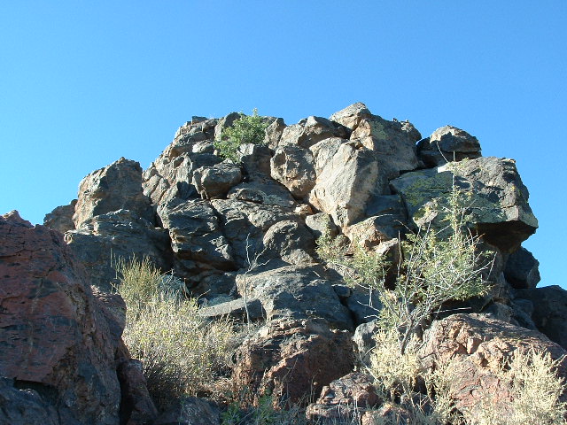
Nearing the summit of Peak 3375
Terrific views from this, Peak 3375, the highest on the entire west side of the range – here’s one looking southeast to Bailey Peak, which has only one ascent.
Bailey Peak
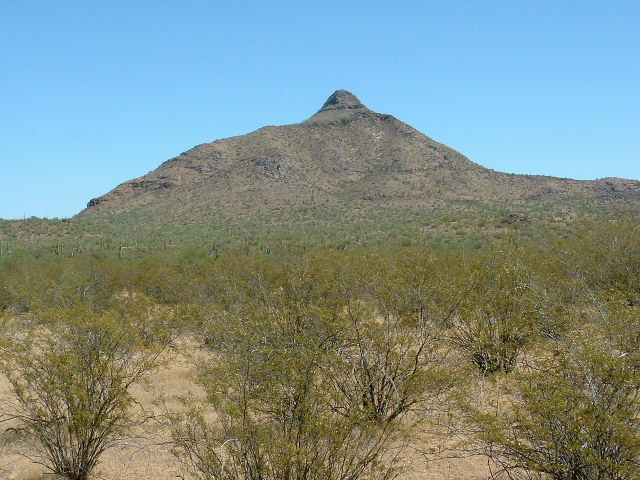
I returned to my truck. “Drink lots, all day long” was my mantra, and that is what I did. I drove a few miles back the way I had come and parked for my next climb, a pretty summit called Peak 2574. It creeped me out that from my parking spot I could see at least 3 abandoned vehicles nearby. I couldn’t help but wonder what stories they would tell if they were able. It was a short walk to the Class 3 rock at the north end of my summit. I built a cairn and left a register on top and was back at the truck in less than 45 minutes round trip.
The north end of Peak 2574
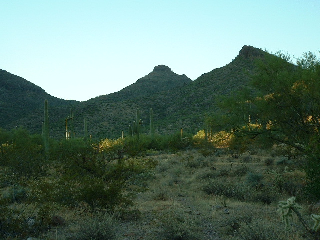
Now it was time to do some exploring. I had been looking forward to trying to drive through an area of the western Mesquites which was unfamiliar to me. Dave Jurasevich and I had spotted a road from the summit of Chupan Mountain, elevation 3,044′, which looked like it could provide useful access, but where to pick it up?
Looking east to Chupan Mountain
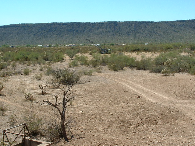
I drove north for about four miles and entered a very flat area which is bounded by the two arms of the Mesquite Mountains which extend to the north. I was sure I had found the road which Dave and I had seen, and it was a good one too, easy to follow. A faint track left it and headed right over to my next objective, Peak 2794. I had been concerned that I wouldn’t be able to drive in close to this one, but I was able to follow the faint road right up on to its eastern slopes. What a lucky break! It was now 11:30 AM and really warming up. It was to be about 102 degrees in that area today, but I decided that since I had been riding around in an air-conditioned cab, drinking lots of liquids and was parked partway up the mountain it’d be okay, so away I went. The upper slopes were nice solid rock. There was trash on top left by smugglers, but I left a register anyway. I was back down to the truck only 45 minutes after starting the climb.
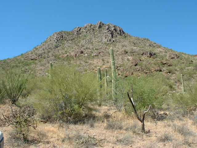
The east side of Peak 2794
I continued north on my new-found road, traveling 3 more miles to a large waterhole used for cattle. I was sitting in the truck studying my map, using the GPS to mark a series of waypoints on it (this road I was traveling was not shown at all on the map) when I saw something out of the corner of my eye. It was another vehicle approaching me very slowly, a white Ford F-350 flatbed of recent vintage. I could see as it approached that two O’odham were in the cab, so I got out to speak to them. We visited for a while.
Albert Lewis and his nephew Michael both live in the village of Gu Vo and were out “having a look around”. They were most friendly and even invited me to stop in to see them sometime at their home. We discussed some of the roads in that area and they gave me helpful information. We said our goodbyes and I continued west and then south, after a while arriving at the village of Pia Oik. I had completed a large loop of over 25 miles on dirt roads – three good peaks and a lot of nice country covered.
Near Pia Oik
As I drove into the south side of the village of Gu Vo a while later, I stopped at a large compound surrounded by a sturdy chain-link fence. Inside it are literally hundreds of cars, trucks and vans, most of recent vintage. A reliable source tells me that all of the vehicles abandoned on the reservation are stolen, and in time will be towed out so that insurance can settle claims.
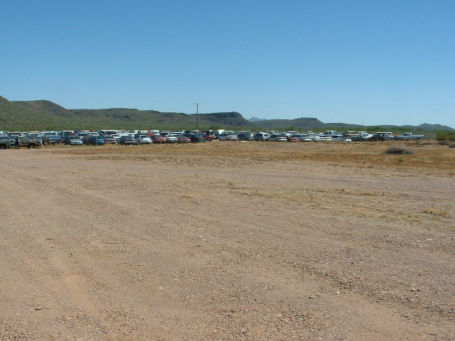
Impound lot at Gu Vo
As I continued through town, I saw that the Gu Vo restaurant was open. I have passed by here dozens of times and have never seen it open before. I stopped in and had a quick bite.
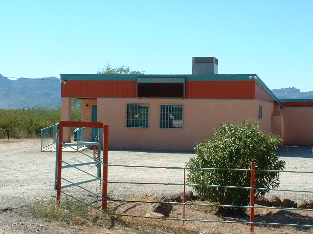
The Gu Vo Restaurant
There are very few places on the reservation where you can buy a meal, so this is a bit of an anomaly. I then headed home without incident to Tucson. Another one of many great days spent in the Mesquite Mountains.
Please visit our Facebook page at: https://www.facebook.com/pages/Desert-Mountaineer/192730747542690