
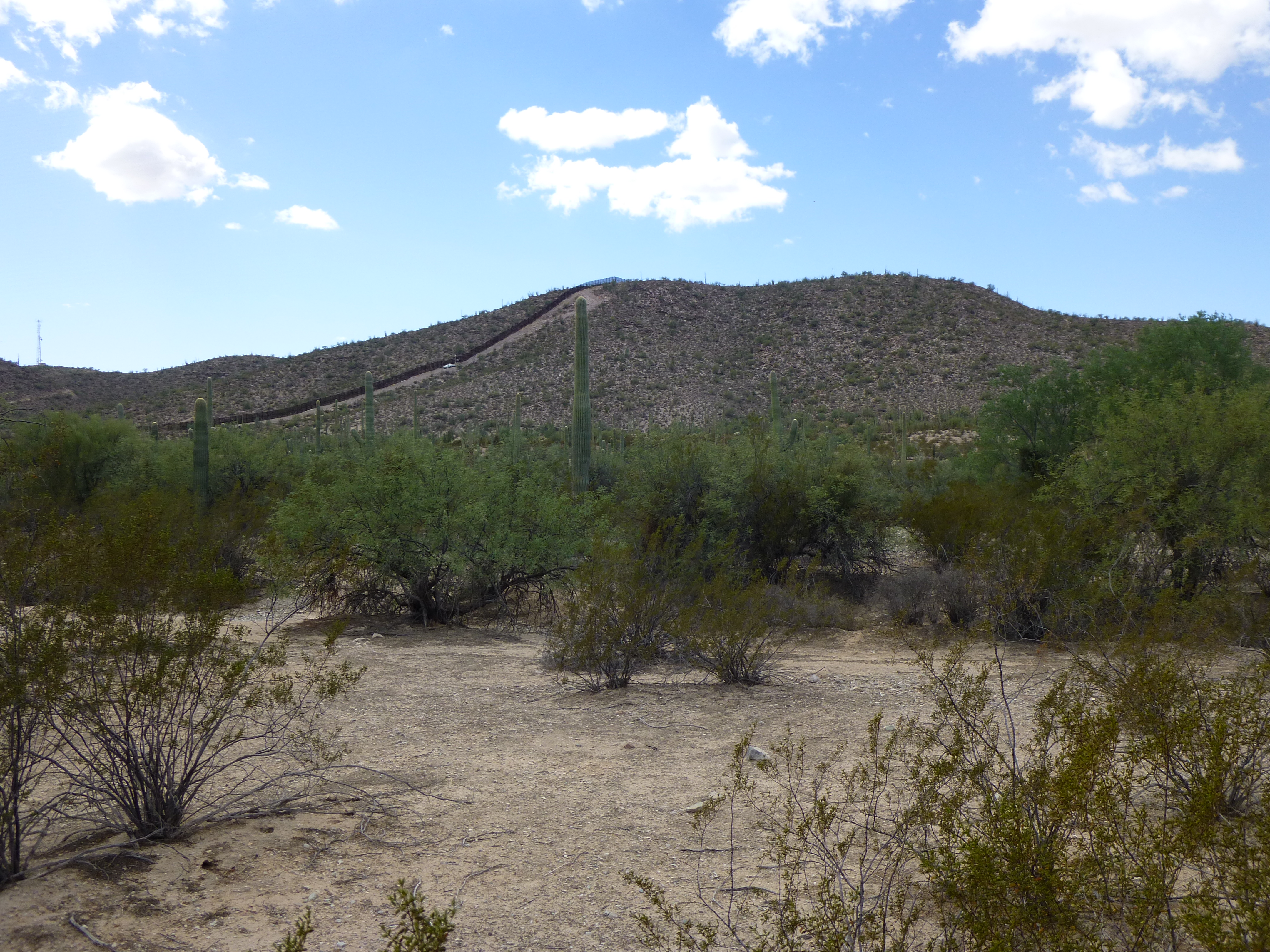
One October day, on my way to someplace else, I had a couple of extra hours on my hands. I was driving along the south Puerto Blanco Drive in Organ Pipe Cactus National Monument and realized a peak I still needed to climb was straight ahead of me. Jake and his father Jim had been up it in March and said it was hard by the border. They weren’t kidding – the border fence went right up and over it – interesting.
Looking west to Peak 1883
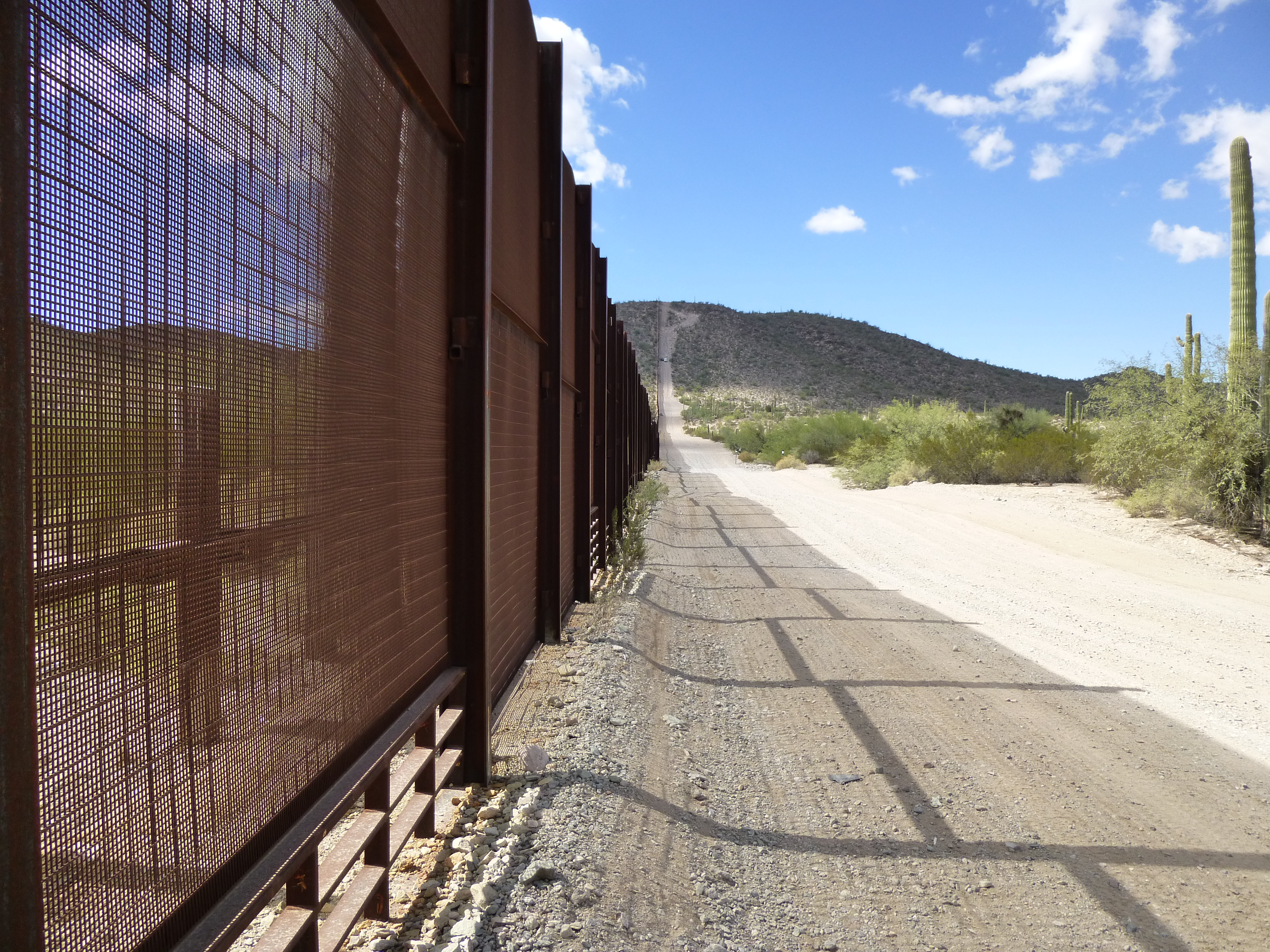
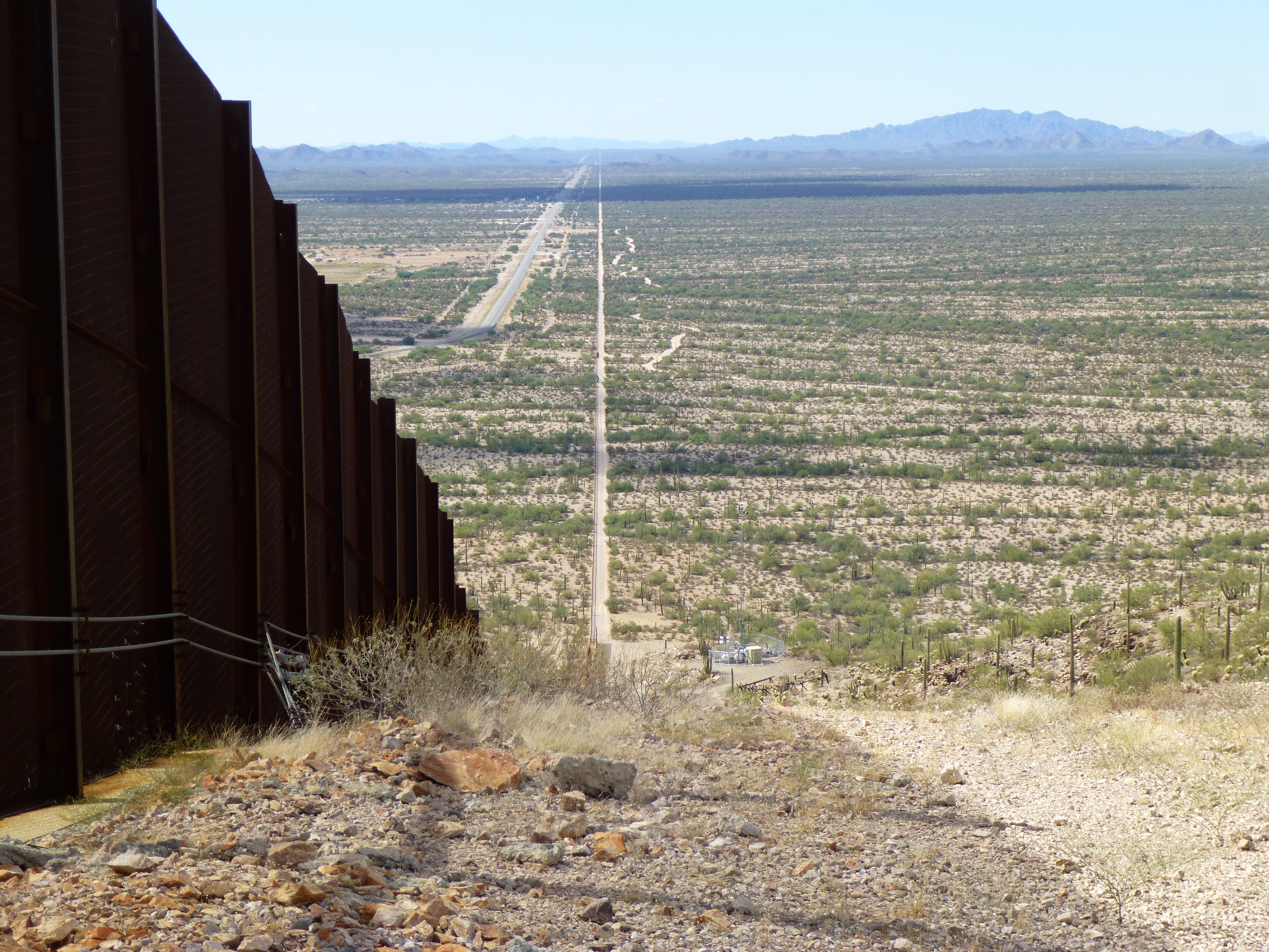
I parked near a sign that said “Dowling Ranch Road” and walked the quick half-mile over to the border, figuring it was easier to walk the steep road along the border fence than through the desert brush, so up it I went.
Looking west along the border
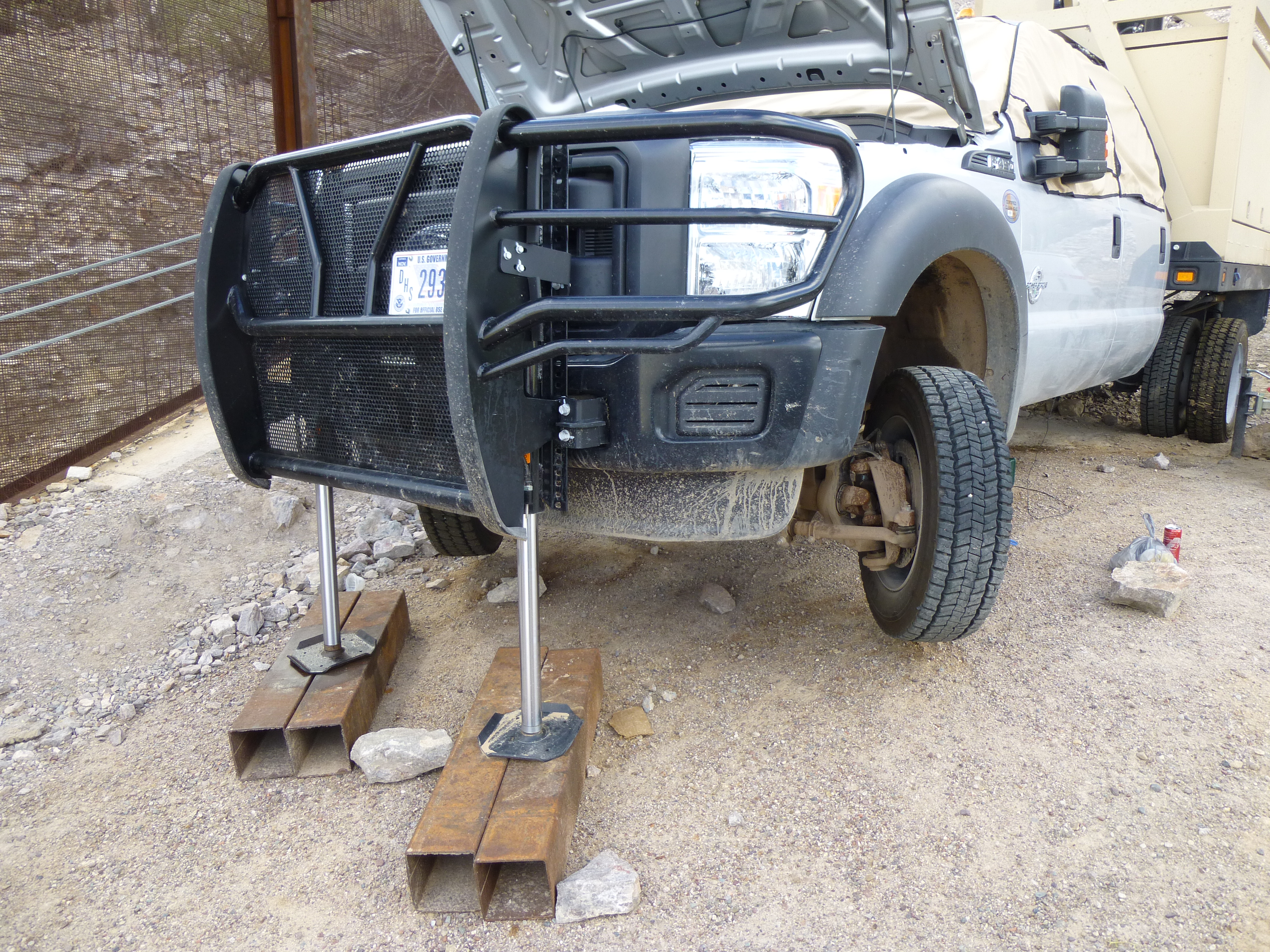
The higher I went, the steeper it got. There was some sort of vehicle parked in the road – two, actually, as I saw when I got closer. The next photo shows the truck with the mast and the eyeball on top. They had leveled off a spot which supported much of the vehicle, but as you can see, the front of it is still jacked way up off the ground. The truck was custom-made for the purpose of sitting on steep slopes.
The truck with the eyeball on the mast
One of them had a mast, with a big eyeball-like device which moved as I got closer – it seemed to be looking at me. Here is a view looking back down on it. On the right is the jacked-up truck; on the left is the regular Border Patrol truck; the white rig on the left in the shade is a big generator.
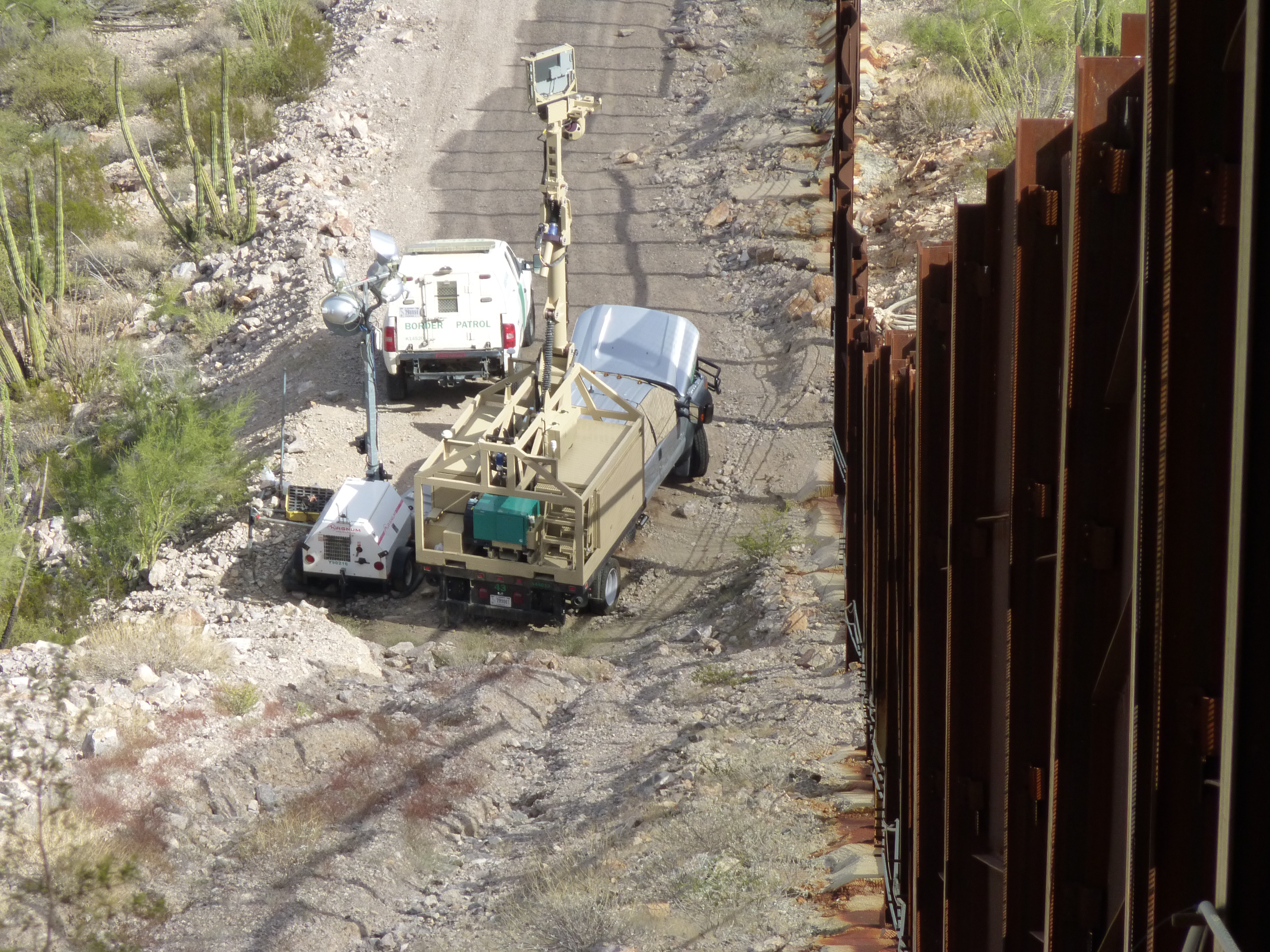
Looking down on the whole affair.
When I’d almost reached it, a man got out of the other vehicle – it was a young BP agent. I was surprised to see him, because for some reason I thought the eyeball in the sky was being operated remotely. He said that this equipment was manned 24/7. Visually, we had a straight shot to the Port of Entry at Lukeville, only 1.5 miles away. It seemed crazy that people would try to sneak into the U.S. along this stretch under such close scrutiny. He then told me that every single mesh panel in that stretch of fence had been cut through and had to be repaired. Man, that’d take some brass to try that! I mean, how obvious can you get!!
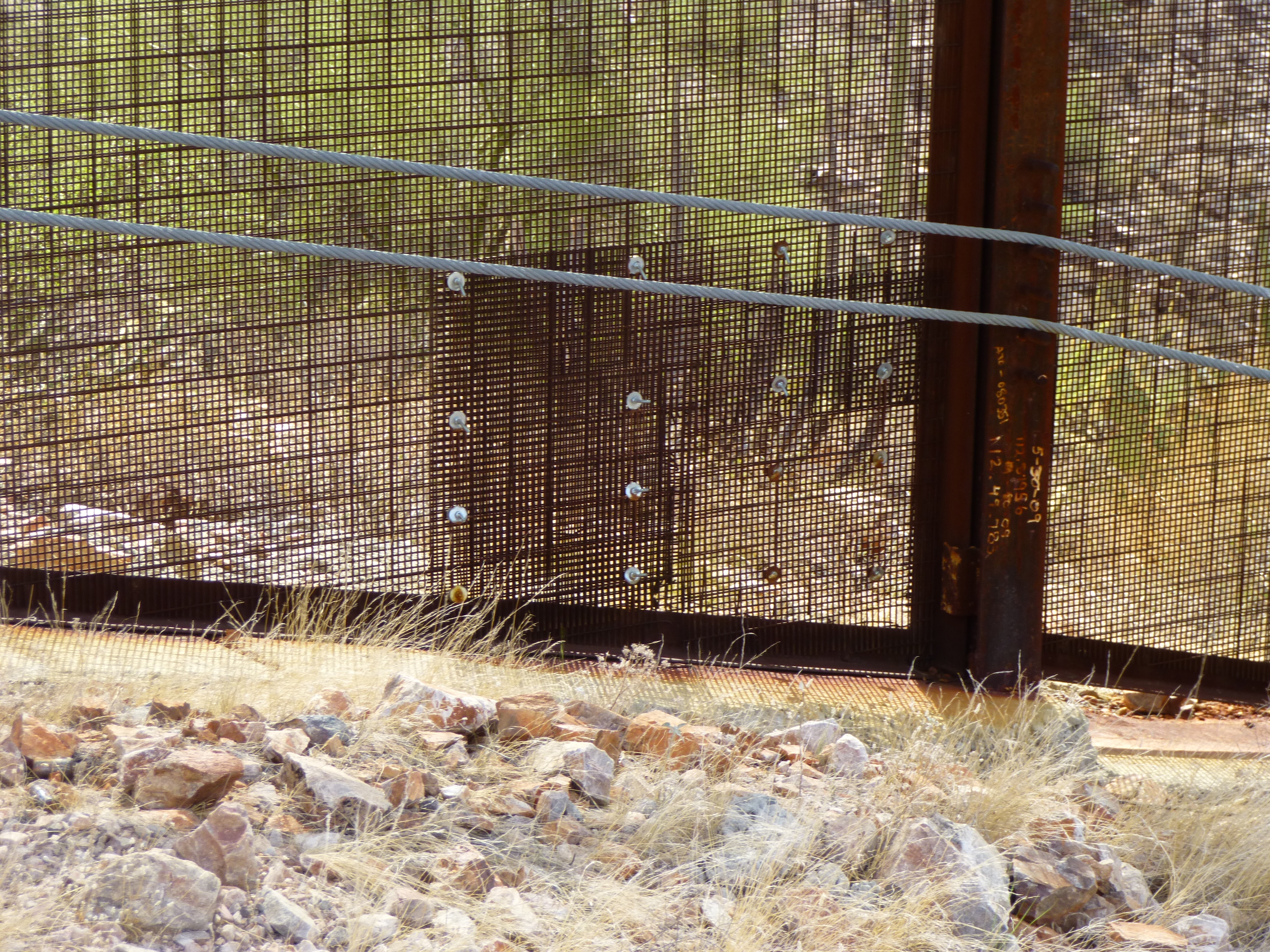
A patch in the border fence
The agent suggested using the cables along the fence to hang on to to help me up the rest of the very steep slope – hey, it worked well. I guess that made it an aid climb. I walked on the concrete footing and made my way up the 51% slope and before long stood next to Border Monument 168. Well, sort of – it was on the other side of the fence. There was a door there, the most big-ass door you’ve ever seen – and it was welded shut. I could see that the 12′ monument had been defaced – among other things, its number was missing. It’s obvious the U.S. no longer cares about it, abandoned forever on the Mexican side in terra incognita.
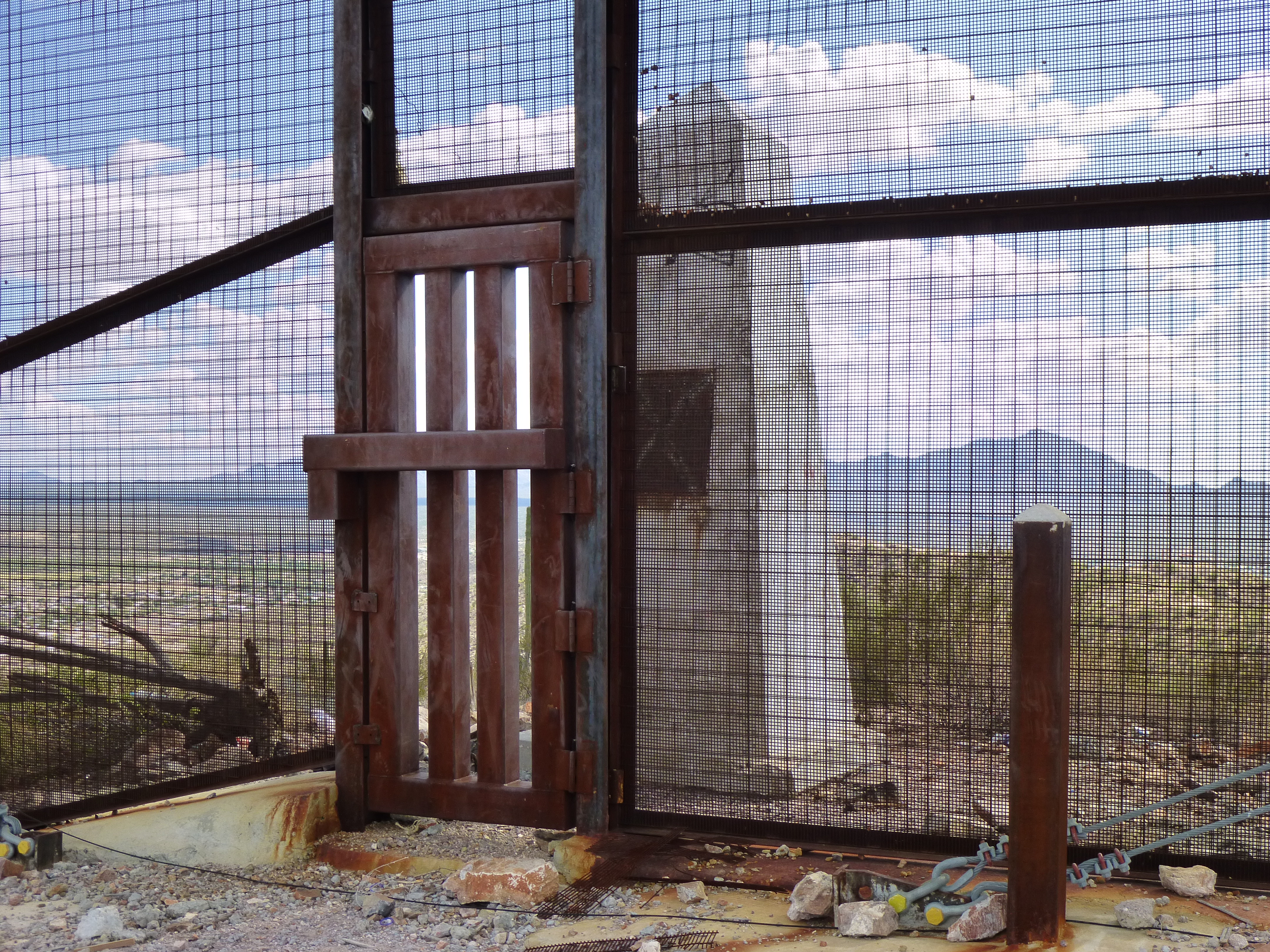
The border monument behind the closed door
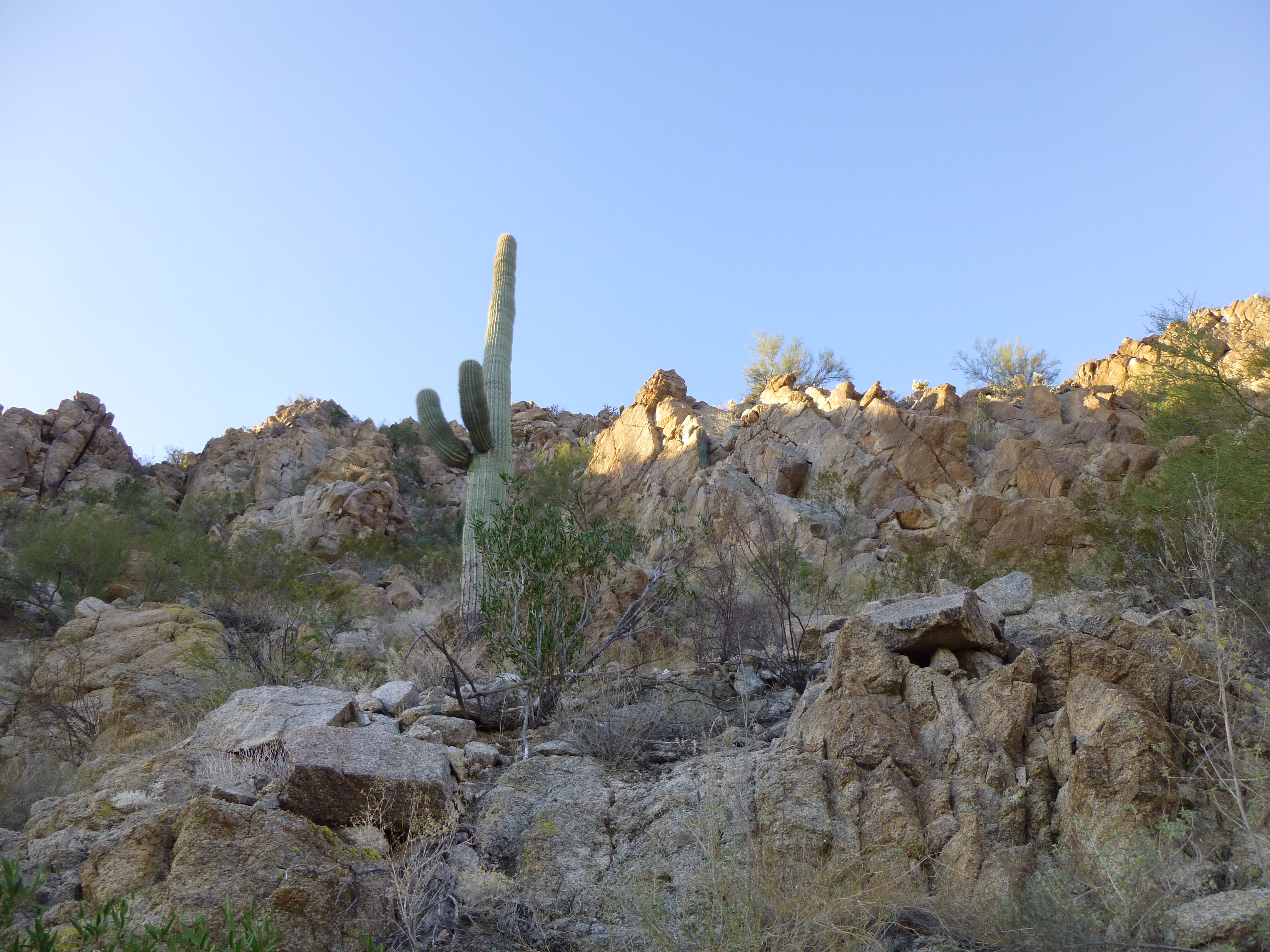
I walked the 700 feet to the north to the actual summit of Peak 1883.
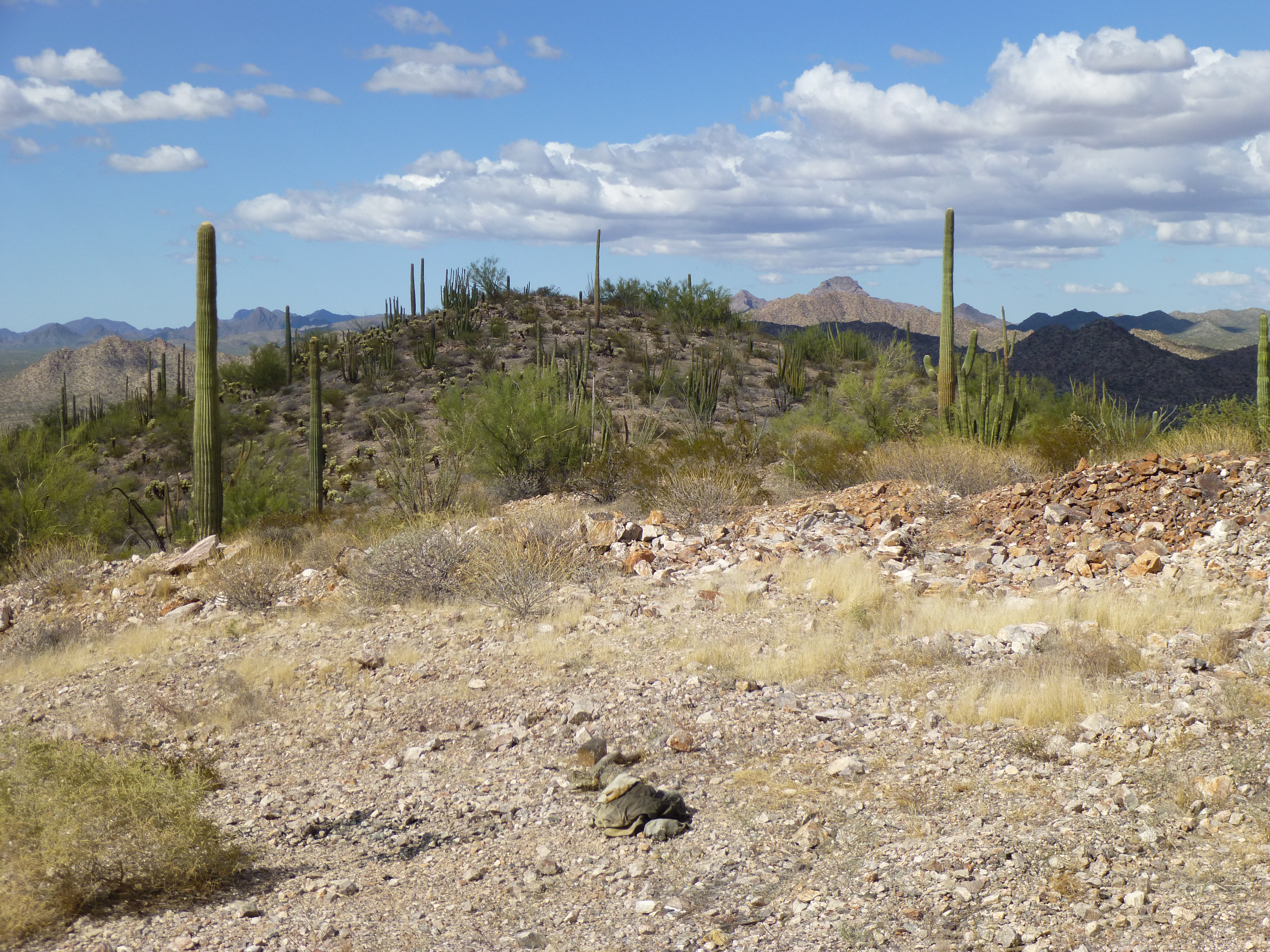
Peak 1883
The whole area was littered with cast-offs of border-crossers. The register had long since vanished. Here’s a look from the summit east down the fence – you can see much of the town of Sonoita, Sonora. Follow the fence, and you’ll see in the distance, on its left side, a large white thing – that’s the U.S. port of entry at Lukeville, Arizona.
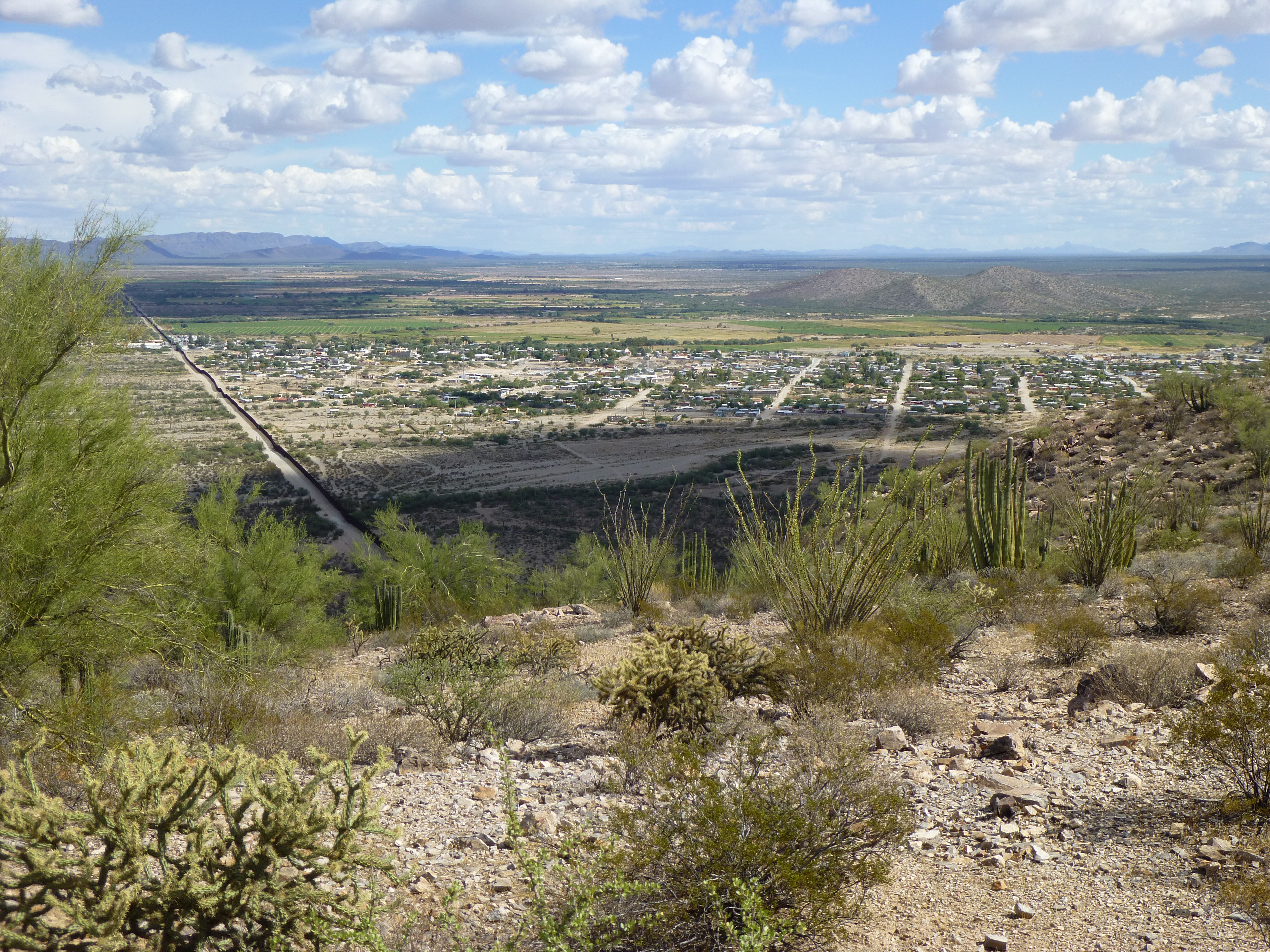
Sonoita, Mexico across the border
Here’s a look down the west side of the mountain. The line on the right is the border road, but to its left is Mexican National Highway 2.
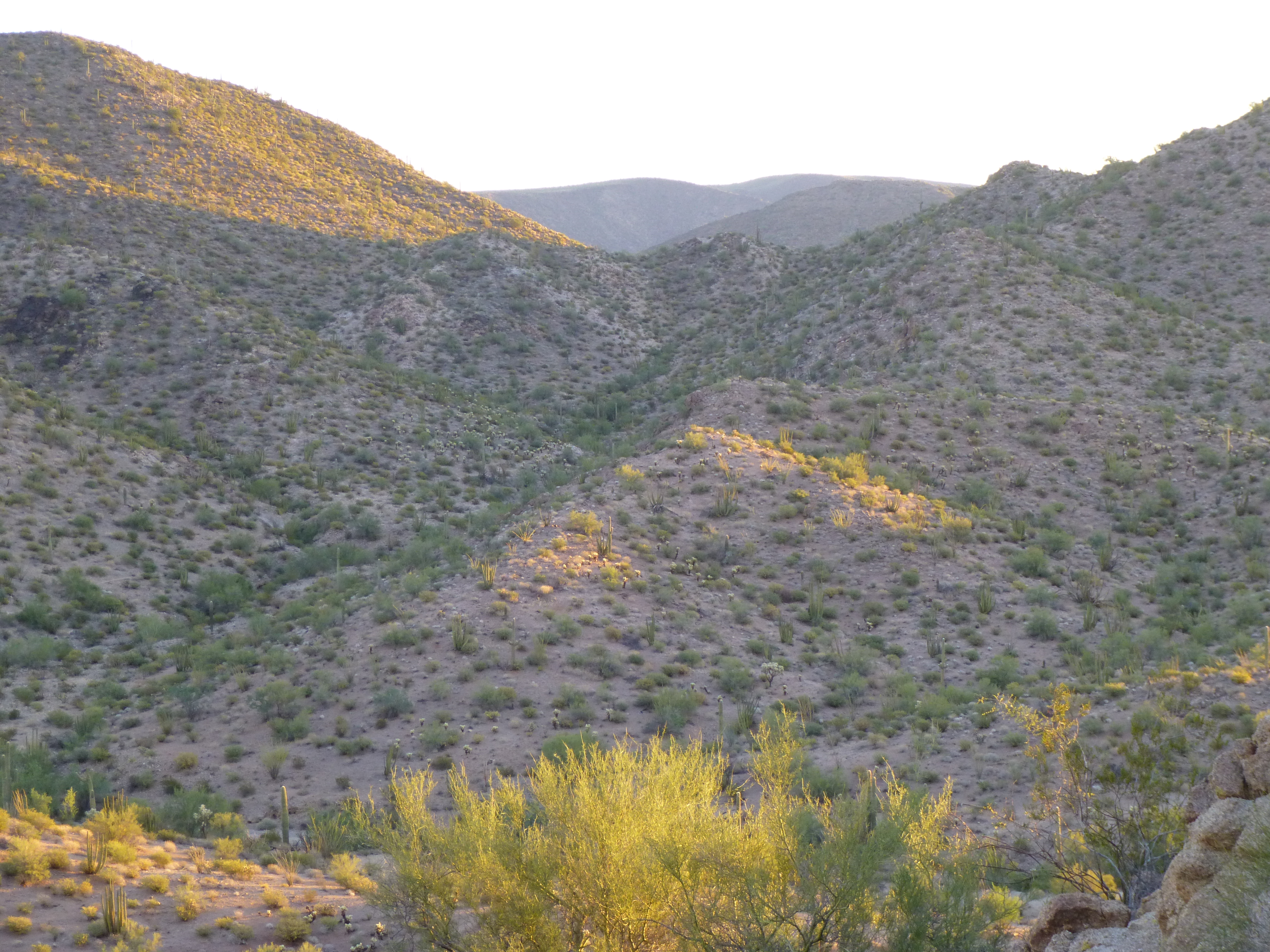
Looking west along the border
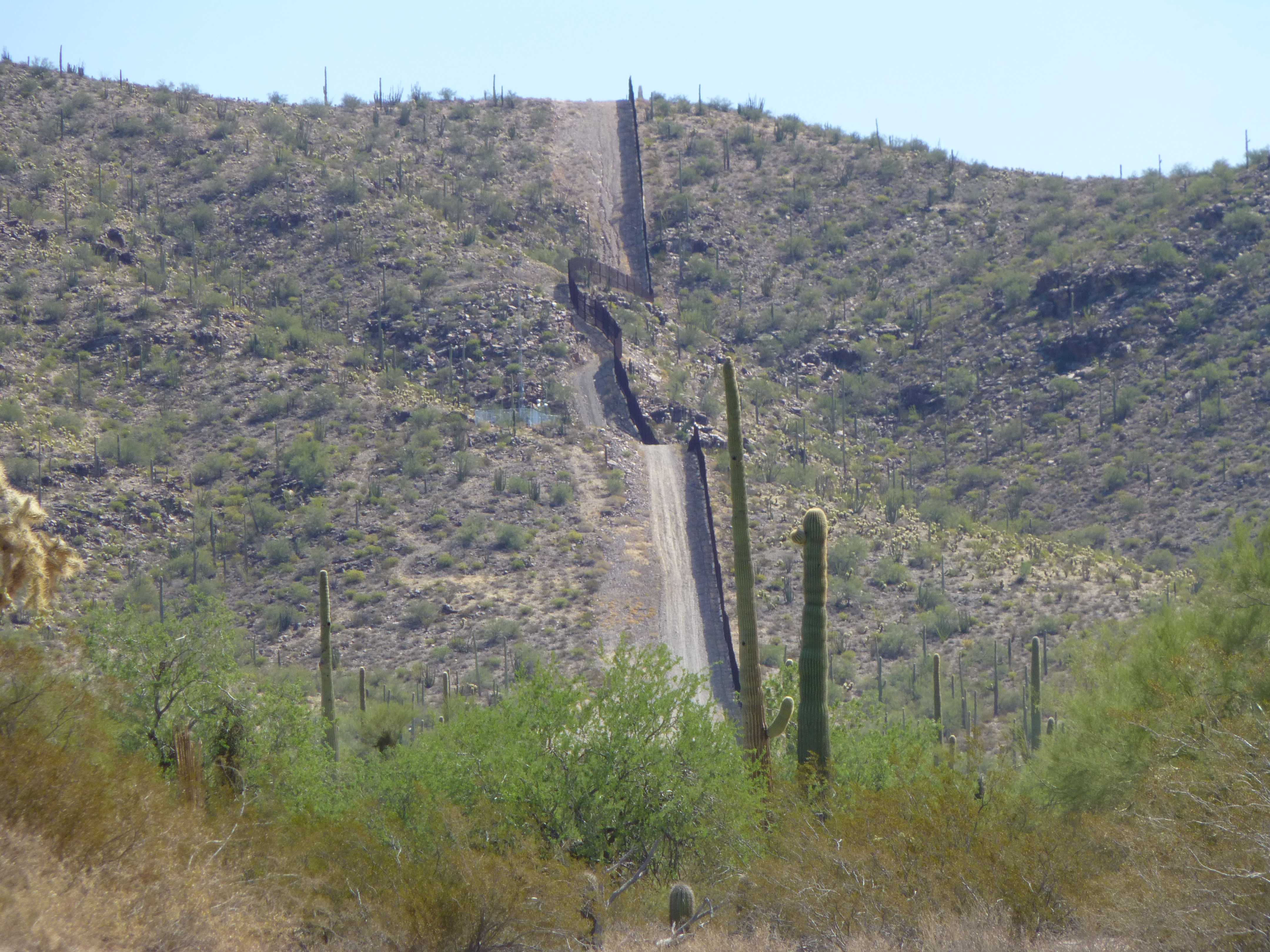
Returning to the wall (that has to be a more proper name than fence, at least here) I made my way back down to the vehicles. The agent said his shift was over and his replacement was waiting at the base of the hill. He offered me a ride back to my truck, which I gladly accepted. Little old Peak 1883 turned out to be more interesting than I’d expected. Here’s one more view I want to show you. It was taken from the desert floor that you can see in the above photo, looking back up to the mountain-top where I’m standing to take the photo. There’s something remarkable visible here – the terrain was so steep and rocky that the fence had to take a big detour into the U.S. It’s as if we ceded a chunk of Arizona to the Mexicans. Since I wrote this story, a Border Patrol friend informed me that their name for this peak is “Monument Hill”, which seems appropriate. Also, he said that the vehicle with the mast and eyeball is called an MSC (Mobile Surveillance Capabilities) truck, and they have the ability to see any movement over a long distance at night.
Looking east up the border road
Two days later, I went to climb two other peaks quite close to the border, so it seemed right to cobble them together with this one – here’s that story.
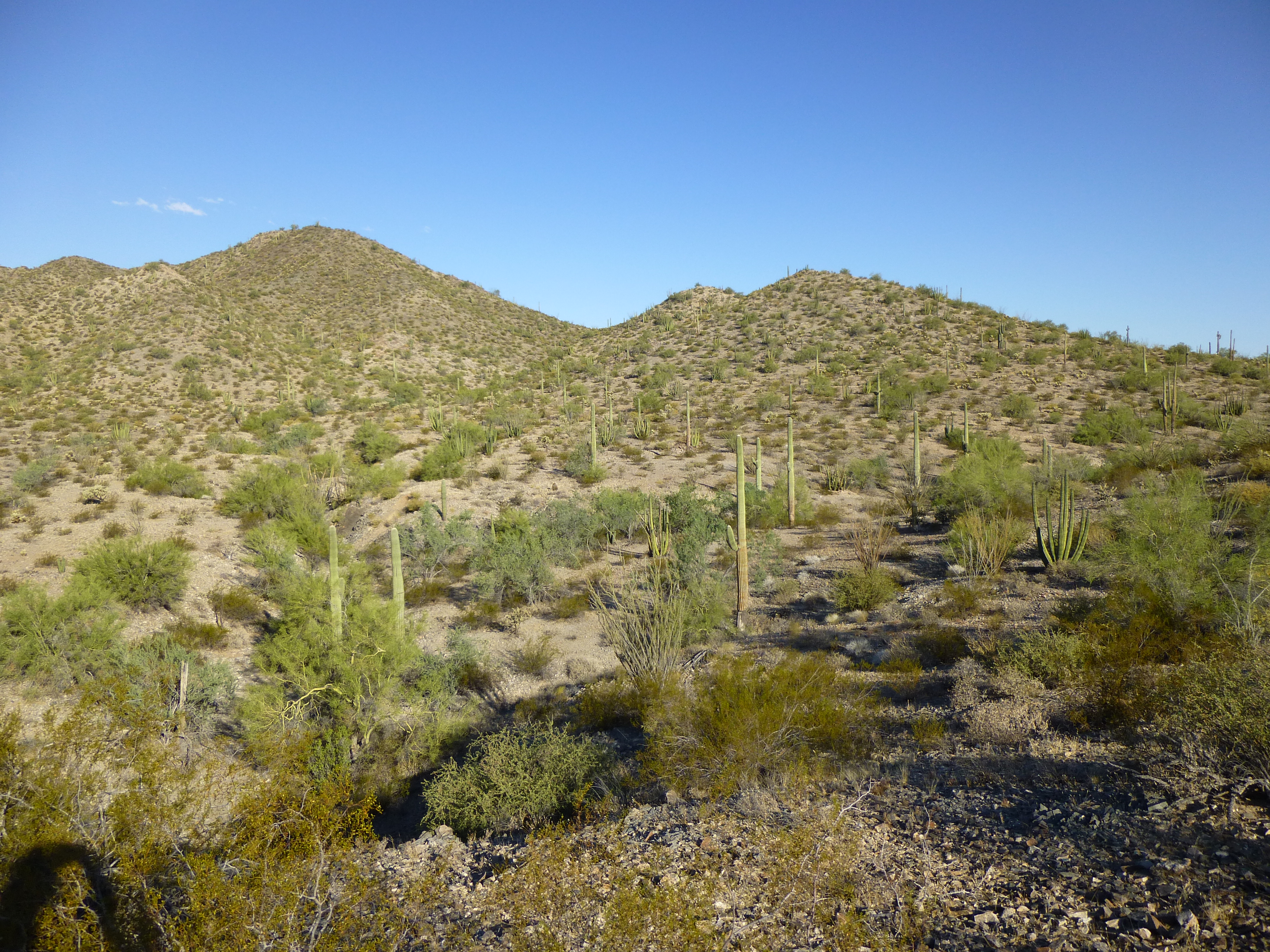
The Quitobaquito Hills, by their very location, are just asking for trouble. I was a bit apprehensive to be here – truth be told, I had been for some years. Anything this close to the border makes me nervous. As time goes by, I find myself conjuring up things that probably don’t even exist, so by the time I go in, I could be a bit jumpy. Before the area had been re-opened to the public, I’d been in a quandry as to how I could ever climb these two peaks, tucked away in a quiet corner of Organ Pipe. Bob Martin and Bob Packard had been here in the 1990s and done them legally, but in 2002 park ranger Kris Eggle had been murdered by Mexican drug smugglers and much of the park had been closed to the public. That changed in September, 2014 when the new superintendent, Brent Range, opened all areas of the park, much to the delight of back-country aficionados.
So now it was legal to climb here, but I was still concerned. A flat stretch of 2.5 miles separated the higher peak from the border – that’s nothing, only an hour’s walk even on a bad day. It seemed to me that border-crossers would make a beeline for these two peaks and the shelter they provided – a place to re-group, to plan their next move. Most of them would travel under cover of darkness, unaware that the Border Patrol’s infrared technology could easily spot them even then. During the day, they’d lay low, resting in caves or in shady spots wherever they could find them. Since I was climbing during the day, that’s when I was most likely to run into them. Still, these peaks are so close to the border that there’s nothing much to prevent mayhem from going on in the area.
I’d driven in early, in the dark – the 17 miles along the south Puerto Blanco Drive, then 3 more over Cipriano Pass and down to Cipriano Well. When I stepped out of my truck, it felt like it hadn’t cooled off much at all, even though the sky was clear. Today’s forecast promised a balmy 94 degrees F., so I wanted to get this done before I char-broiled out here. Three quarts should do it. Okay, pack ready, let’s get a move on – 6:00 AM, first light, time to go.
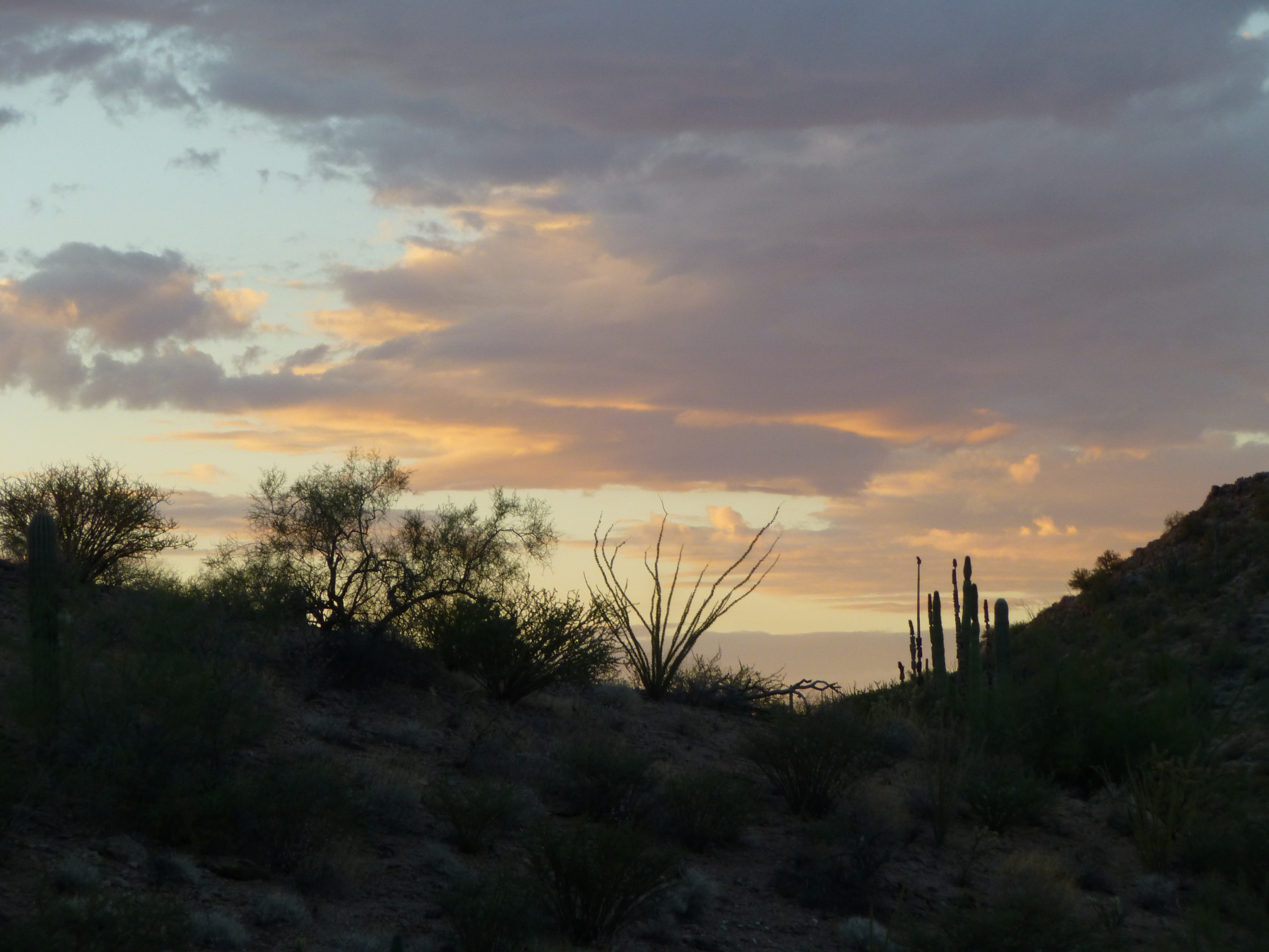
Daybreak
As I headed southwest, the faint footpath I was on became better-defined. By the time I reached the pass at 1,450 feet, you could have followed it in your sleep. Plenty of crossers had been here, their leavings were everywhere. Once beyond the pass, I’d be more in their domain, as park officials never ventured this far. Whenever I’m in such an obviously-well-traveled area, my senses are on high alert. I’m looking and listening more acutely than usual; I’m even sniffing the air for traces of recent cooking activity or a fire lit for warmth.
Beyond the pass, the ground dropped steeply for 200 feet. I was on a well-trodden path, and I could see others nearby criss-crossing the whole area. I made my way over to the base of Peak 1844 just as the sun was rising.
Sunrise on Peak 1844
The 600 feet to its summit went without incident, but I was sweating like a pig.
Looking back to the pass I’d come over earlier
Keeping to the shaded areas was more comfortable, and I was able to do that most of the way up. One advantage of climbing alone is that you’re not carrying on a conversation (usually), so you move through the mountains more quietly. This allows you to get closer to wildlife, and it lets you sneak up on any people out there (whether you intend to or not). There have been times when I’ve walked right up to others, much to their surprise and, even more so, to mine.
On the steep mountainside, approaching the shoulder
When I reached a windy shoulder a hundred feet below the summit, there was a lot of trash – an obvious lookout point. The view from the top was commanding – if anyone were approaching, by quad or chopper, you’d certainly see them. The register was long gone, and I didn’t leave one. Here’s what I meant by a straight shot across the desert to the border, which is by the near edge of the dark band which runs from side to side across the upper side of the photo.
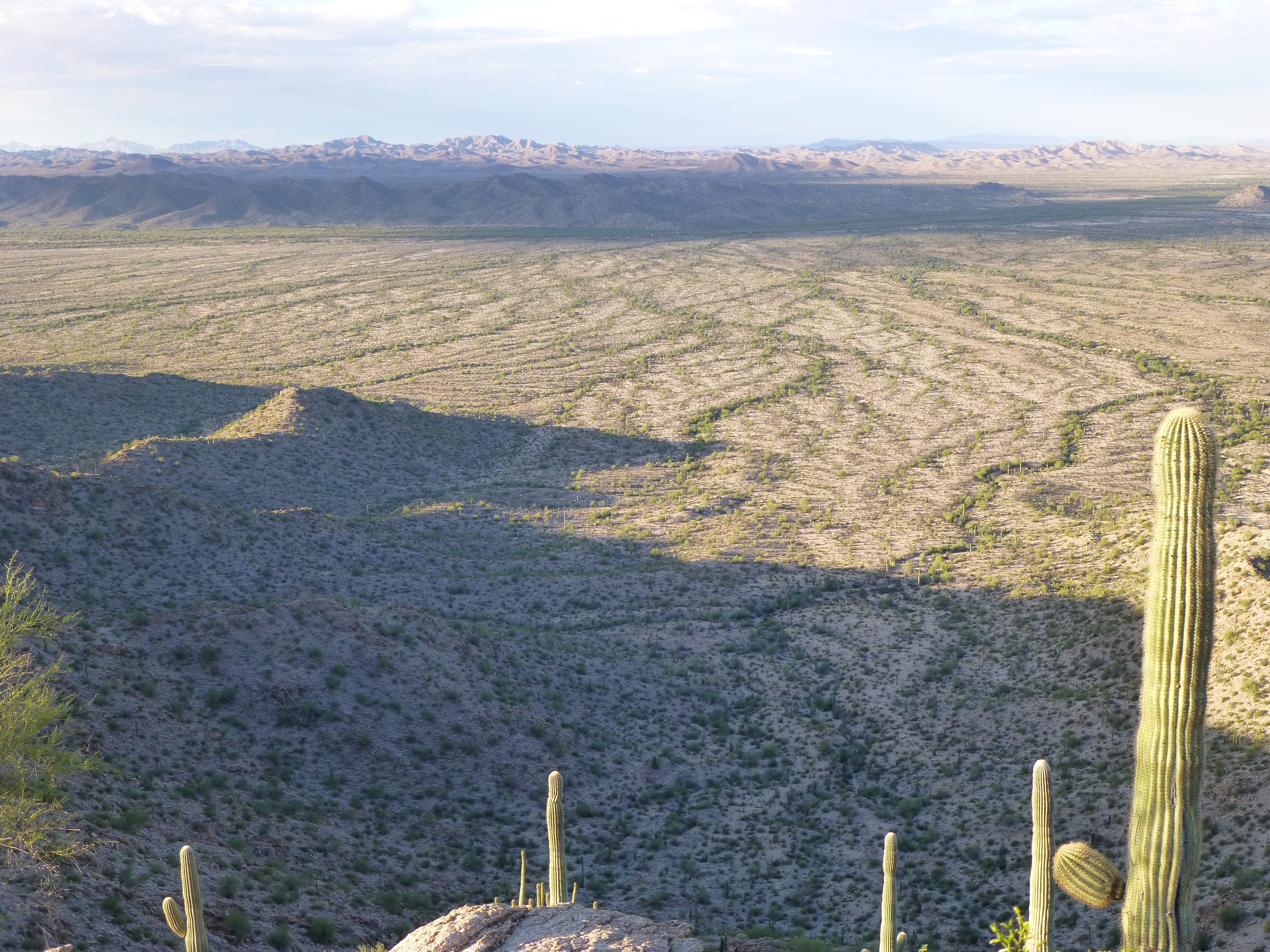
The stretch of desert between my peak and the border
To show you how close I was to the border, here’s a telephoto shot of a truck on the highway.
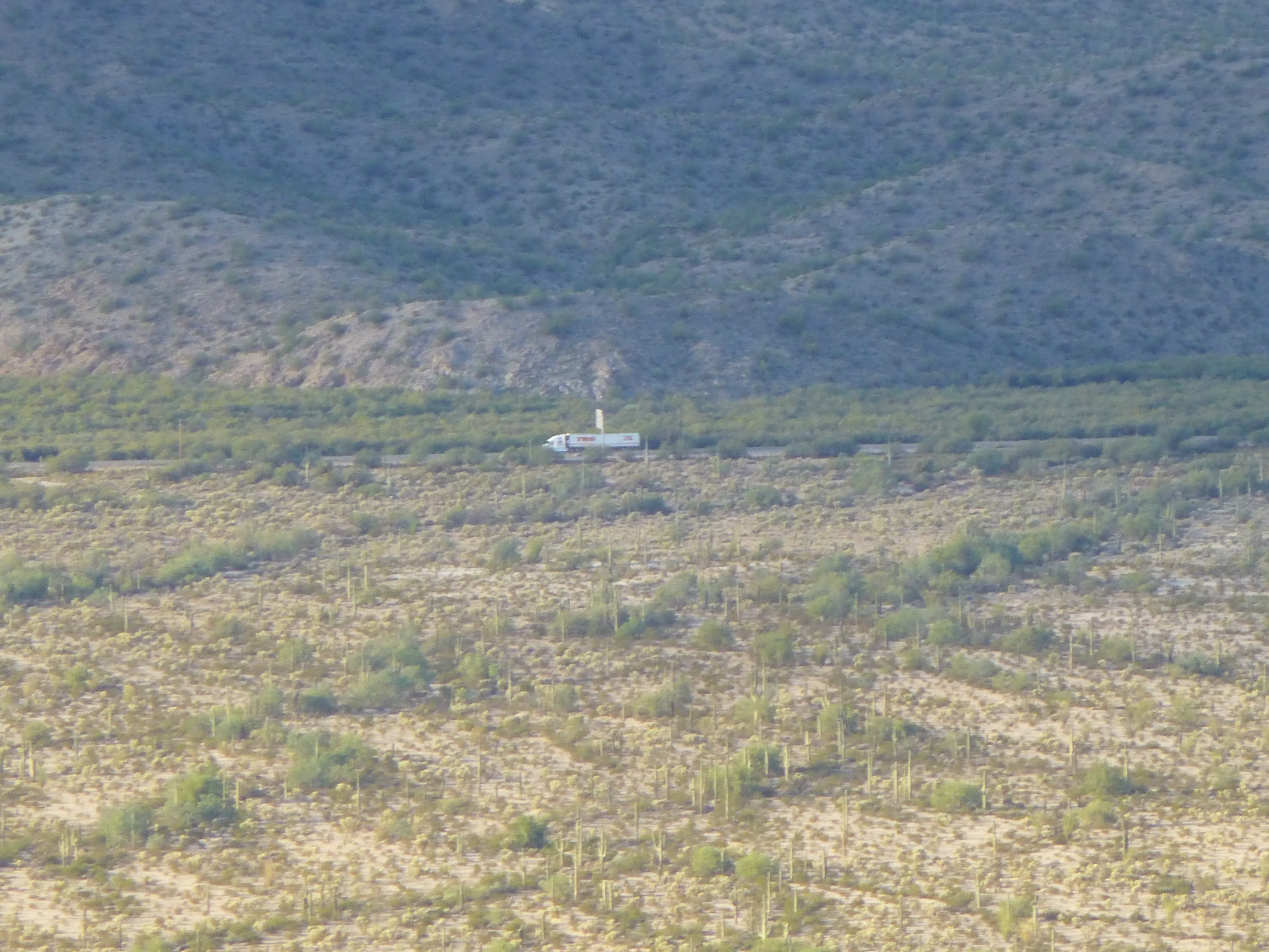
A truck on Highway 2
It wasn’t far to my other peak, one mile as the crow flies, one and a half on foot. After ten minutes on the summit, I returned by the same route and soon stood in the valley below. It was deeply incised by washes – I quickly found the main one and started to follow it. What a perfect place to avoid prying eyes! Others had been here before me, as attested by the dozens of black plastic water jugs from Mexico and also the quad tracks.
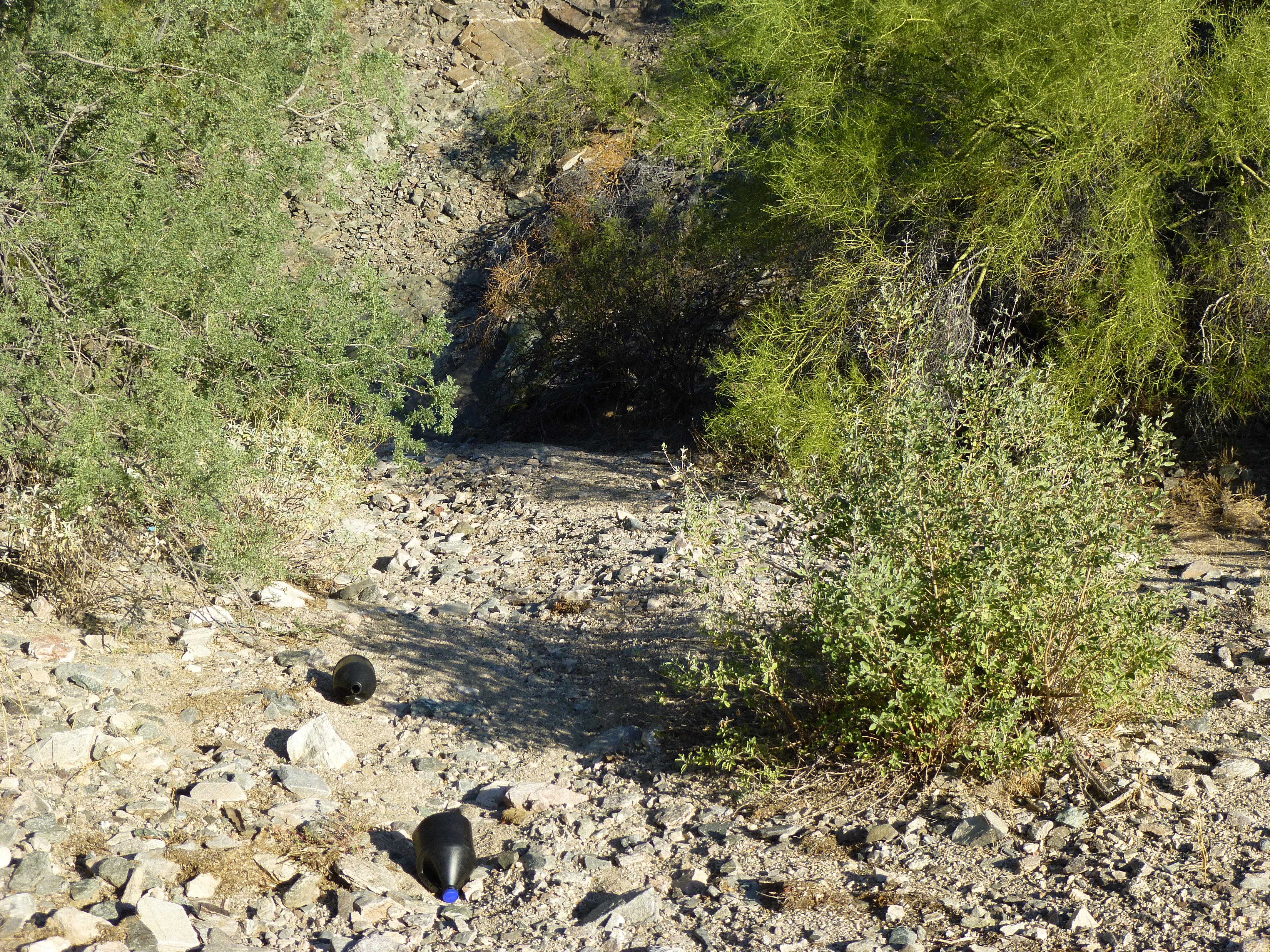
Water jugs and shady overhangs in the wash
Plenty of overhanging tree-branches offered cover. The wash was a great conduit, with no bushwhacking at all.
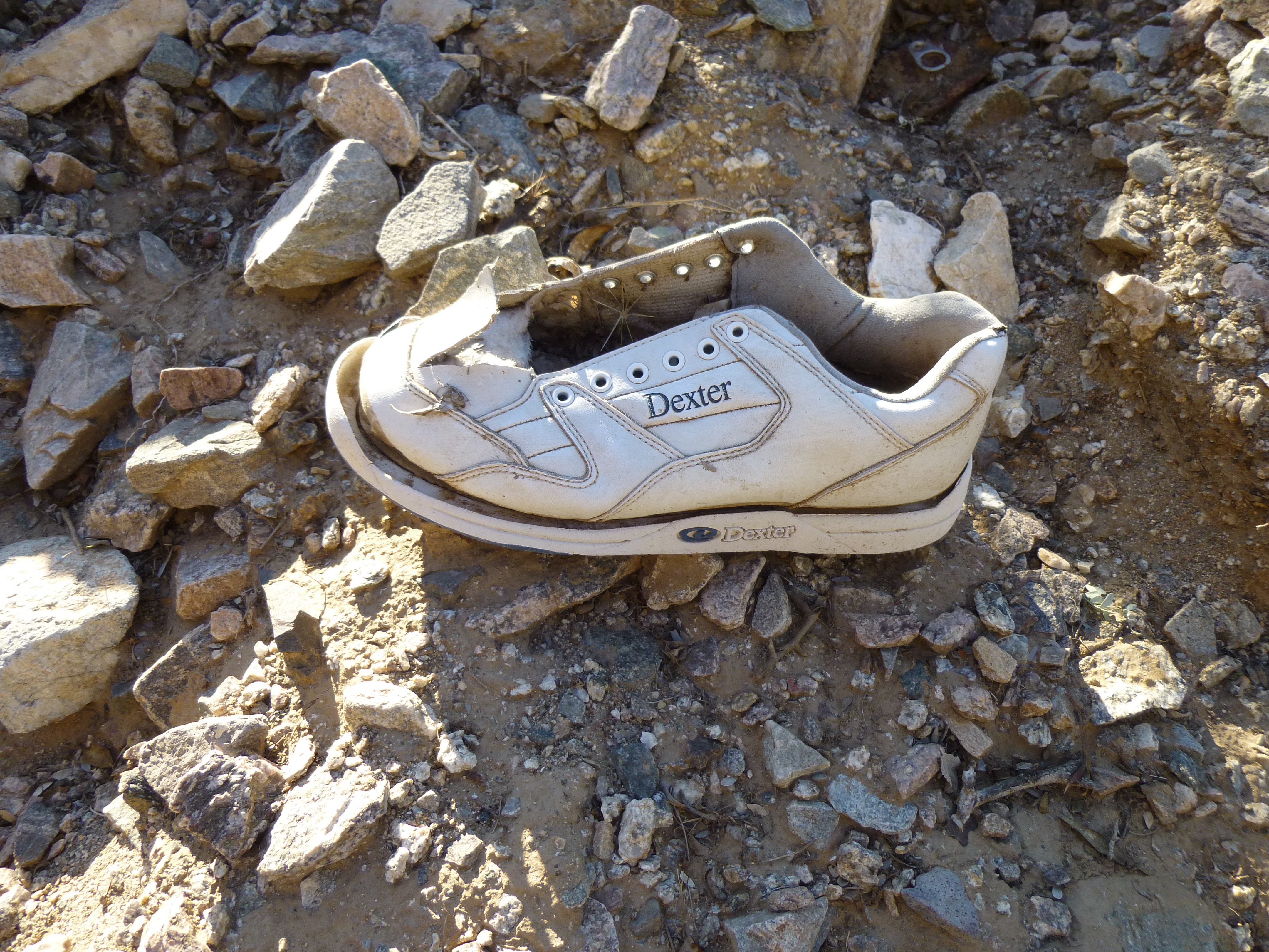
A sneaker left by a border-crosser
I followed it downstream for half a mile, then climbed up a steep bank and left it behind. Now it was just an easy walk across some hilly country to my next peak.
An easy walk to Peak 1633
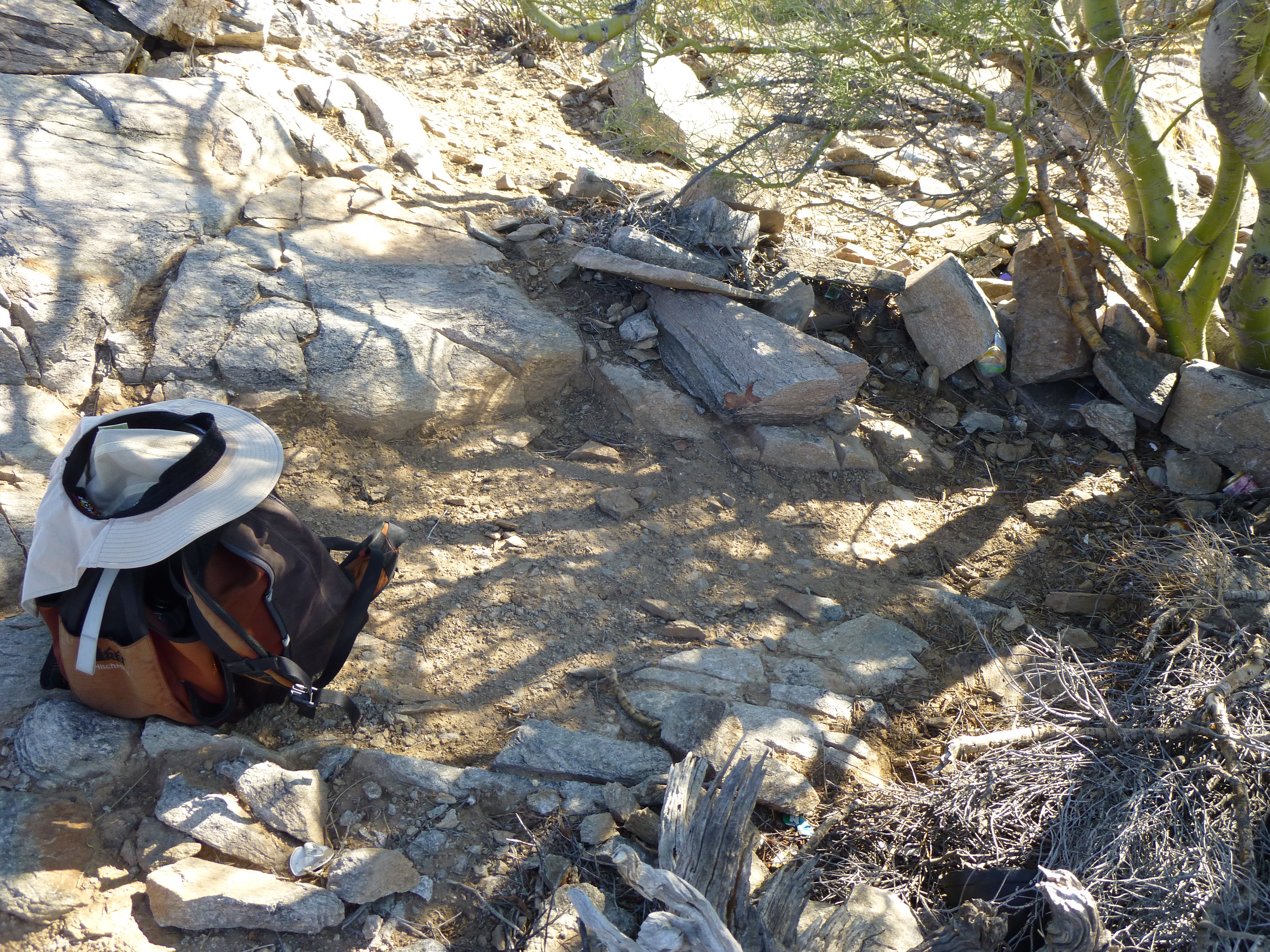
An easy stroll brought me to the east shoulder of Peak 1633 and a path of sorts which led to the summit ridge. This top was also littered with trash, but at least they’d made an attempt to hide it, making it less visible from the air. Someone had crafted a spot to rest under a Palo Verde tree, a place to while away the hours before making their next move. No register here either.
On the summit of Peak 1633
After twenty minutes, I headed down to a saddle at 1,370 feet on the east ridge. Rather than heading back to my truck the way I’d come in, I opted to walk through the flat desert to the north. Here’s a final look back to Peak 1633.
Looking southwest back to Peak 1633
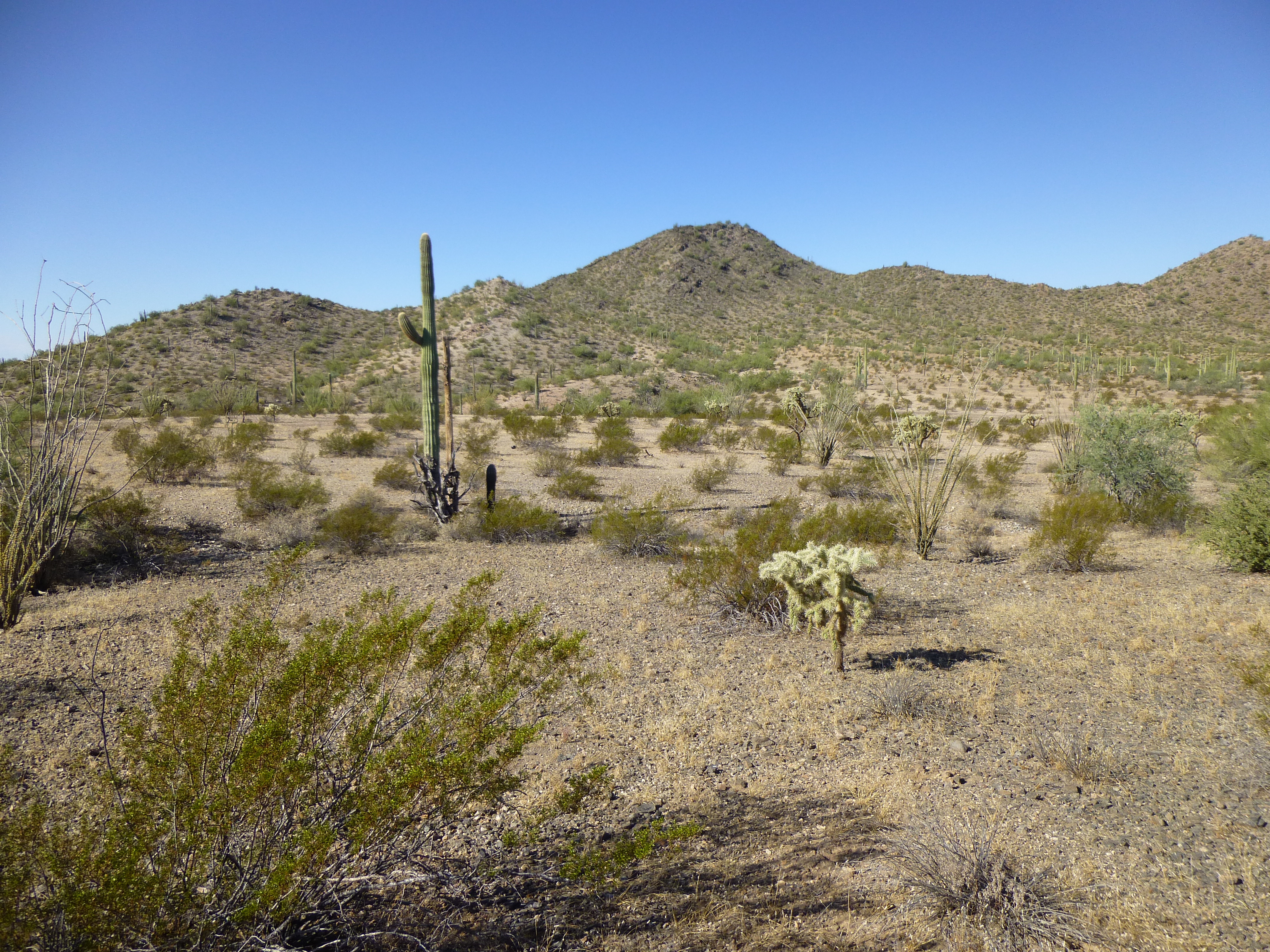
In a little over a mile and a half I reached the Pozo Nuevo Road, then followed it for five minutes to my truck. Four hours had passed and I’d beaten the worst of the heat. I was happy to not have run into anyone, as I easily could have. With nothing but a patch of empty desert between these two peaks and La Frontera, I consider them to be border peaks.
Please visit our Facebook page at: https://www.facebook.com/pages/Desert-Mountaineer/192730747542690