
One Cinco de Mayo many years ago, instead of sitting around and celebrating in some
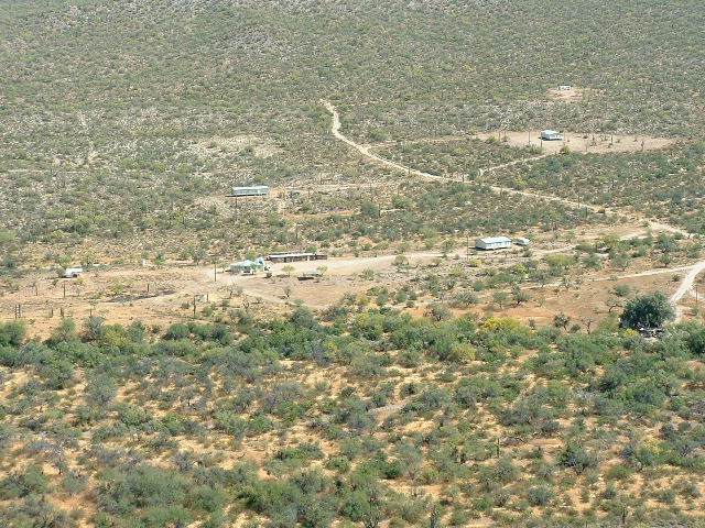
appropriate fashion such as drinking tequila, I decided to go climbing. I drove away from my home at 3:00 AM – it was to be almost 90 degrees that day, so I thought I’d better get an early start. By 5:00 AM, I had driven all the way across the reservation on Arizona Highway 86 and turned south on the good dirt road at Schuchulik (known as S-chuchuligk in the O’odham language, which means “Many Chickens”). This dirt road is also known as Indian Highway 5. It was just starting to get light out. I drove the few miles south to get through the Gunsight Hills, then headed southwest from this main road on a lesser dirt road. I was now in the infamous Gu Vo District. After 1 1/2 miles, this lesser road brought me to the village of Kuakatch. (Click on the link, then zoom way in with the control in the upper left to see the village). Much to my surprise, there was a lot more to this village than I was expecting. The map shows two windmills and one house. Since the map was revised in 1990, I suspected that the place would be deserted, as tiny settlements such as this one tend to lose population. The inhabitants usually move to larger communities with more amenities such as electricity and telephone service. Well, the place had electricity! Here’s proof.
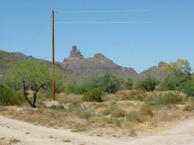
Power lines in Kuakatch
And, probably because it did, I discovered, in addition to the old house shown on the map, four trailers, two manufactured homes, a church and an old flimsy building next to the church.
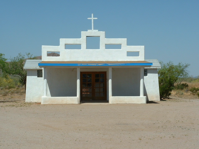
The Kuakatch church
I think this surge in population must be quite recent, because I have a list of inhabited communities on the reservation from the last census and Kuakatch isn’t even on it. Hell, there could be ten or maybe twenty souls living there now – it’s become a real boomtown.
Okay, now I’m going to digress a bit. You know how, when you’re watching the local weather report on television, they show a map of your area and predict high and low temperatures for cities on the map. Well, one of our Tucson channels has Kuakatch on their map – why, I have no idea. Of all the gin joints in all the towns in all the world………. I mean, there are bigger places nearby. For that matter, any place, every place has more people.
At any rate, this village is in a very pretty setting. It sits at the base of a steep slope of the Ajo Range. In fact, the name (which is properly spelled “Kuhkaj“) means “End of the Mountain” in the O’odham language, and, in fact, it literally is at the end of the mountain. The Ajo Range comes to a dramatic end here. The village sits on flat land along Kuakatch Wash which is heavily vegetated along its channel. Another interesting aspect of Kuakatch is that it is at the extreme western edge of the reservation. I parked my truck by an old well only 300 feet from the boundary fence of Organ Pipe Cactus National Monument and left my permit on the windshield. Here’s a marker sign on the simple fence at the Organ Pipe boundary.
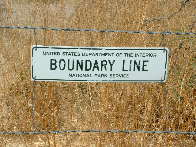
The edge of Organ Pipe
When I drove through the village at 5:30 AM, not a soul could be seen. What was even more odd was the fact that no house had a vehicle of any sort parked there. It made me wonder if this place was only seasonally occupied, as are some on the reservation.
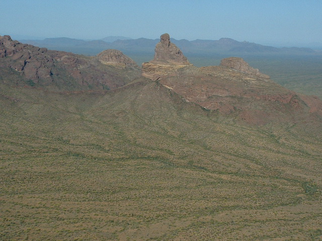
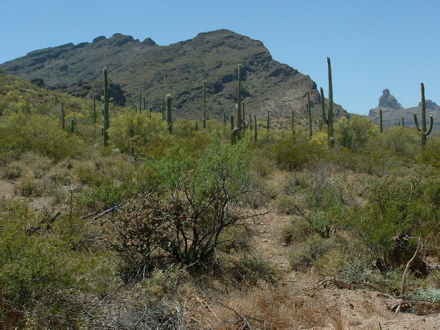
In any case, I got ready for the climb – I was carrying more water than usual, as I expected the climb would be a long one. I started walking at 5:50 AM, thrashing my way through the thick brush along the wash, then heading across easy ground to the base of the slope. Once there, it was just a matter of continuing south-southeast up the steep slope to a low saddle at 2,530′. I then turned west and continued up-slope through rocky country. This ridge rises 1,100 feet above the village. Near the 3,100′ level, I took stock of my situation. I also had this view of the path ahead, and the peak for which I was heading.
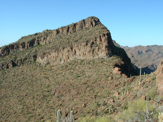
Looking south to Peak 3650
If I were to follow the true crest of the ridge to my goal, Peak 3650, I would have to go over several bumps which had steep cliffs. It was not worth the frustration, so I decided to do a long ascending traverse on the east side of the ridge. I had to lose a total of 325′ of elevation while doing this, but, other than two cliff bands which were steep enough to give me pause, all went without incident.
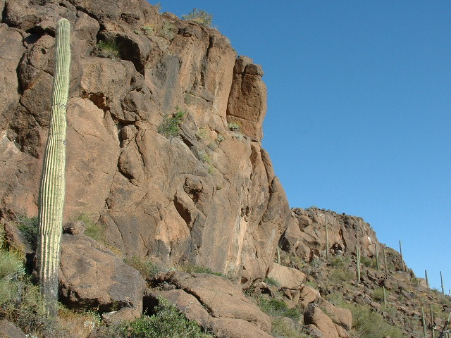
The cliffy bits
Here’s a view I had looking back down the ridge I’d climbed.
Looking back down the ridge towards Kuakatch
The higher I climbed, the better the view became. Once on top, I saw no sign of any previous ascent. I built a cairn, filled out a register, phoned my wife, and took lots of pictures. Here’s the rocky summit.
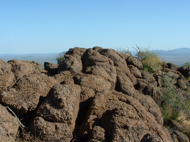
The summit of Peak 3650
Peak 3650 is in a unique location. Two of the area’s most spectacular peaks are very close at hand. Peak 4088, known to a few of us as “Montezuma Peak”, is a mere 1.1 miles to the south-southwest. Although it rises only about 400 feet above Peak 3650, its steep sides and its prominence above all surrounding terrain make it a sight to behold. It saw its first ascent on February 17, 2001 up the left hand slope, then out of sight behind the summit. It was Class 4. Some of us roped up for the final moves on the summit block. This peak is striking to look at from any side.
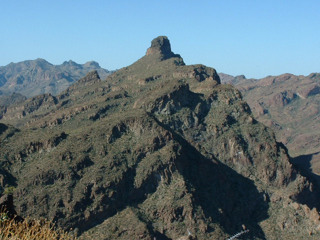
Looking south to Peak 4088
And only two miles to the west rises I’itoi Mo’o (Montezuma’s Head), a challenging technical rock climb in Organ Pipe National Monument. This is a real hair-raiser, and is only climbed once every few years. You can read a detailed account of this climb on my website in a story called “Montezuma’s Head”.
Montezuma’s Head
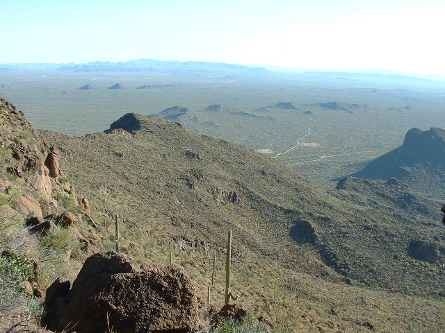
Being on Peak 3650 was like having the best seat in the house at an exciting action movie. Here’s a view from the summit looking south, deep into the heart of the Ajo Range with its highest peaks.
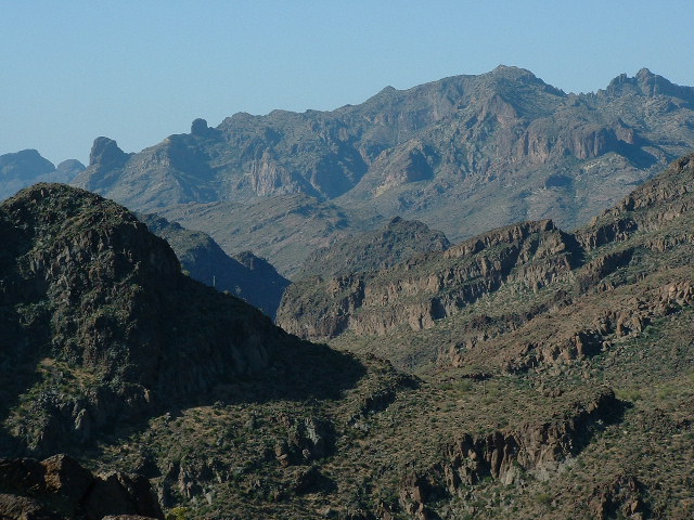
Looking south towards Mount Ajo
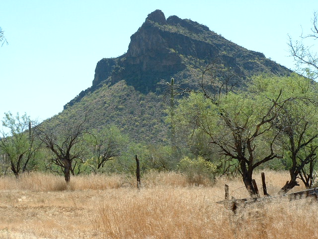
I spent quite a while on the summit before I left, returning the way I had come. When I was back at the 3,100-foot level, looking steeply down on the village, without warning I was attacked by a bee. I wasn’t doing anything wrong, honest! I saw or heard no evidence of a nearby hive. This bee just came out of nowhere and kept buzzing at my face, the only exposed skin on my body. It’s amazing how such a tiny creature can cause such a strong emotion. Immediately my adrenaline was pumping. I started flailing my arms, trying to keep it away from my face. If a bee can land on you, it can sting you in a fraction of a second. I was almost resigned to the fact that this was an Africanized bee (what we now call a “killer bee” here in Arizona), and if it were, it would continue trying to sting me until successful or until I killed it. I was in a bad location to be fighting a bee. I was on steep rocky ground. I didn’t want to just stand there and get stung, so I was trying to run away downhill while I was flailing at it. I must have gotten lucky, because after what seemed like a lifetime of flailing but what was in actuality probably only one to two minutes, the attack stopped and I had not been stung. I didn’t wait around, but moved as quickly as I safely could downslope. But my little bee incident was not over. Within a very few minutes, I was attacked again, as furiously as before. I couldn’t tell if it was the same bee or a new one. It even got under the cotton veil that hangs from my cap (which acts as a sunshade for my neck) but I managed to get rid of it by removing my cap and flailing madly. Somehow, I didn’t get stung by this one either. I was more ticked off than scared at this point. I hurried downhill, only to get attacked a third time. This final event was briefer, and miraculously, I won that one too. I considered myself lucky – either I am getting more spry (unlikely) or the bees were having a bad day. I descended the rest of the slope and made it back to my truck. When I was almost down, I had this view of the village.
Kuakatch
I had been gone a total of 4 hours 20 minutes. I drove back through the village, which was eerily quiet – no person, no vehicle was in sight. There is a good dirt road which leaves the village and heads east, following the power line. I drove along it and parked after about half a mile, right at the base of Peak 2894.
The west side of Peak 2894
Here’s a view looking back to the ridge I’d climbed earlier to get up to Peak 3650.
Looking southwest back towards Peak 3650
I climbed its steep north side directly to the summit. There, I found a cairn, no doubt due to its proximity to Kuakatch. This peak sits just to the north of Kuakatch Wash. I left a register and descended. The 700-foot climb had only taken 54 minutes round trip. It seemed odd that I had not seen one other vehicle all day. I continued east to join the main road, then went north back to Highway 86 and to Tucson. I hope that meeting no one else out in the Gu Vo district will happen on other days, as I have 37 other peaks yet to climb in that area. Law enforcement in the Gu Vo district are notorious for disliking outsiders. I guess I can’t blame them, as they are overrun with drug smugglers and indocumentados.
Please visit our Facebook page at: https://www.facebook.com/pages/Desert-Mountaineer/192730747542690