
This story was written on May 3, 2004 but is published here for the first time.
On January 22, 2001 Dave Jurasevich and I climbed the high point of the Kupk Hills in the western part of the Tohono O’odham Indian Reservation. This was part of a multi-day trip that Dave organized out there where we climbed all of the Hills high points on the res. Two vehicle incidents from that trip linger in my mind. The first was that my alternator went bad and we left my truck at a shop in Ajo, Arizona for four days to have a new alternator put in (which turns out to have been a piece of crap as it didn’t last even two years). We both rode around in Dave’s truck for the whole climbing trip. The second incident was that, while driving around late in the evening south of the Vaca Hills, Dave drove over a fallen saguaro cactus. He didn’t know it until he returned to LA but the long saguaro spines had pierced the sidewalls of two of his tires and ruined them. Thankfully the leaks were so slow that he didn’t get two flats out on the TOIR. If that had happened in a really remote area, the truck would still be out there with our bleached bones beside it! You would think I would have learned a lesson from that, but within a year of that incident, I too had driven over fallen saguaros as they lay rotting on the ground and had punctured my sidewalls. So that’s why I now carry two spares and will not drive over a saguaro – it’s a surefire way of ruining a tire.
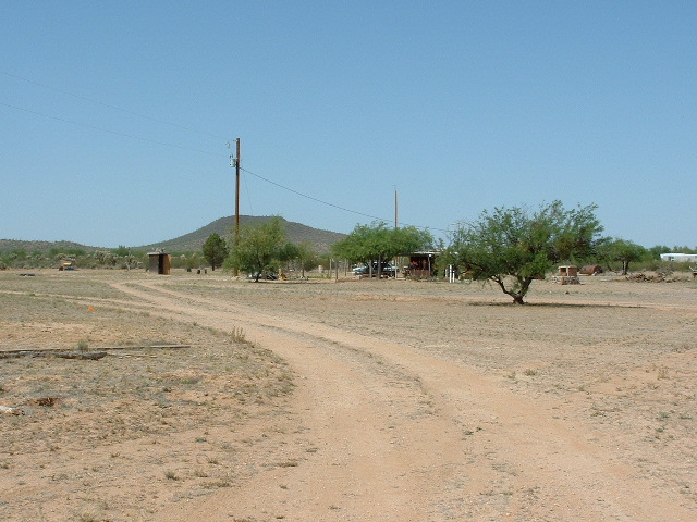
Anyway, I digress. The Kupk Hills are a beautiful area and I had wanted to go back there ever since. So, on Wednesday the 28th of April, 2004 I drove across the res to Pisinimo, then south to Santa Cruz. From the pavement, an unmarked dirt road (the Kupk Road) heads east. For such an important road, it is easy to miss, as the start of it is rather small and plain. A few miles of driving east brings you to the first of the Kupk Hills. On the north side of the road is Peak 2134. You can drive close to it. I climbed it at sunrise, phoned Dottie from the top, left a register, and was back at the truck 34 minutes after I had left.
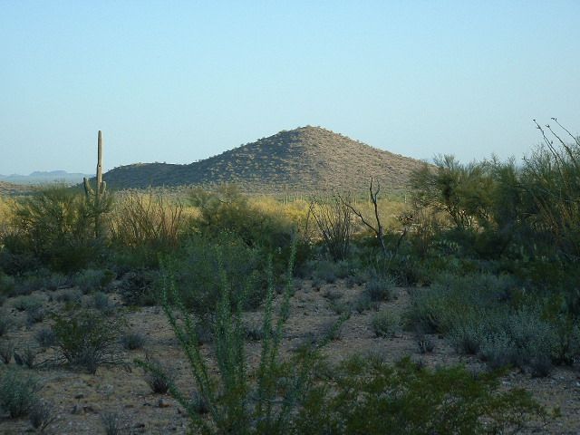
Looking north to Peak 2134 at sunrise
Another mile down the road, I headed south on a road Dave discovered in 2001 (not shown on the map). It leads right into the valley between Kopeka Benchmark and Peak 2676. I drove it to its end and parked. From this spot Dave and I had climbed the interesting Kopeka BM, some nice rock scrambling.
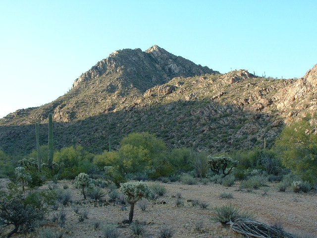
The high point of the Kupk Hills, Kopeka Benchmark
So here I was back again. The climb of Peak 2676 was pretty quick – I left a cairn and register on top. From the summit I could see the road heading farther east and was excited to head out there into new territory.
Once back down to the truck, I headed out to the main road. Then I continued east along the Kupk Road – it stays north of the Kupk Hills for several miles. Just west of the village of Kupk, after a lot of searching and using the GPS, I found a very faint track which heads southwest into a very pretty part of the Kupk Hills. There, I had this view to the Mesquite Mountains 12 miles to the west.
Looking west to the Mesquite Mountains
I parked just east of Peak 2347 and quickly climbed it. I built another cairn and left a register, and also phoned Dottie one last time. The winds were picking up – it was the beginning of a few days of strong winds where gusts of up to 70 miles per hour hit our part of the state. I then returned to the truck.
Looking west to Peak 2347
I drove back to the main road and into the village of Kupk (which means “The Dike”). For years I had wondered what I would find here. The first thing I noticed was power poles coming from Pisinimo across the desert. Kupk had electricity! The map also shows a “St. Francis Mission”, so I thought this might be a sizeable village. Alas, it was not to be. There were two or three derelict homes there, and one that actually was occupied. His was the only home hooked up to the electric line. He even had a television antenna, and a car.
In the village of Kupk
I pulled into the village and parked by the church, which was the one shown on the map. The only person I saw came out of the house and walked a hundred feet to an outhouse, ignoring me completely. Realizing that Kupk was now only a shadow of its former self, I took a few pictures and left.
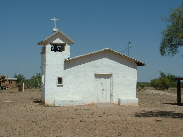
St. Francis Mission
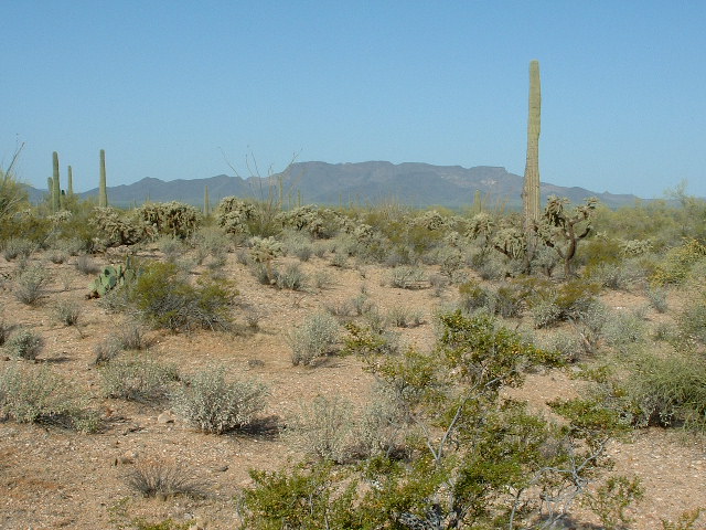
The main road continues southeast of town, then heads way east across the desert and regains pavement at Gu Oidak, a town west of Sells. I drove along this well-traveled road for a few miles, then left it and drove a lesser track to the site of the village of Chicli Vo (abandoned). From there, I had this view across the desert to South Mountain.
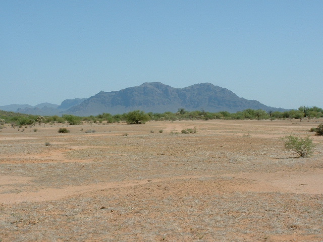
Looking north-northeast to South Mountain
A mile farther south, I parked beside Chiweton Hill, which is comprised of 8 to 10 distinct bumps.
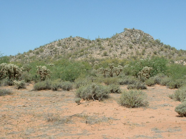
The east side of Chiweton Hill high point
The easternmost bit is shown as 2021′ on the map, but the true high point is a bump 325 feet to the southwest, at what I estimate to be 2025 feet elevation. I built a cairn and left a register. The area was littered with trash left by border-crossers.
Now the most adventuresome part of the day would begin, in the sense that I was to drive many miles across unknown terrain. I continued south, leaving the Pisin Mo’o district and entering the Chukud Kuk district, the almost uninhabited district which comprises nearly all of the area along the border with Mexico on the reservation. I was now driving across large flat areas which you could tell would flood in rainy periods – the road was hard to find and follow at times. Finally I arrived at a ranch comprised of many buildings, big sheds and a few barns. It was Kots Kug (which means “Cross Standing”).
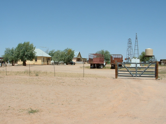
Kots Kug
As I drove up to a fence which surrounded the group of buildings, I saw someone riding on an ATV inside. I got out and waved to them and they came over. Land o’ Goshen, it was a girl, and a cute one too! She was O’odham, probably thirty-something. We talked for a while across the fence. I asked her if many undocumented came through there and she said not too many lately, especially since the Border Patrol had increased their presence in the area. Like all O’odham I have met out on the res, she was polite, friendly, yet a bit reserved. She said her name was Evelyn. I told her I was climbing, and verified with her the proper road to my next destination.
So away I went, heading southeast for many miles. But the road was pretty good, enough to get up into third gear at times. I passed a few cattle and horses as I drove along, listening to great tunes on the cassette player. Then something caught my eye – miles to the southwest sat this striking peak. Although I didn’t know it at the time, it was Peak 2650, sitting exactly on the border with Mexico. Little did I know how much of my time would be spent trying to climb this mountain in the years to come.
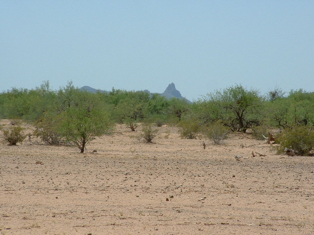
Peak 2650
In a while, I arrived at a place called Chukud Kuk. It must have been a place of some significance, as the entire district was named after it. It was a couple of ponds which were man-made, and that’s about it.
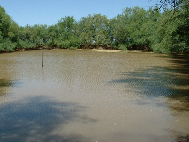
The pond at Chukud Kuk
On one of the dikes which had been bulldozed many years before to form the ponds was my last objective of the day, an elevated benchmark called Tecolate RM1. I have no idea what the RM stands for. Anyway, I found it easily and left a register beside it.
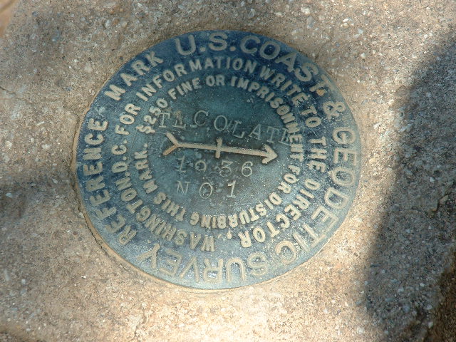
Tecolate Benchmark
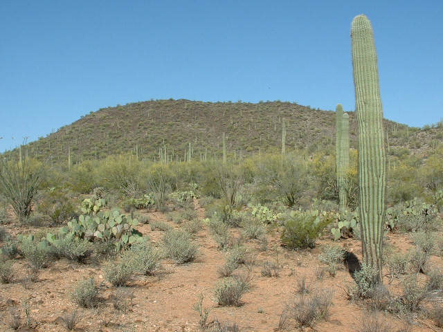
By the way, Chukud Kuk means “Owl Hooted” in the O’odham language. I love how their culture ties simple events into place names. Close by the benchmark was this strange grouping of saguaro cacti – they looked like they had been placed there by the hand of man.
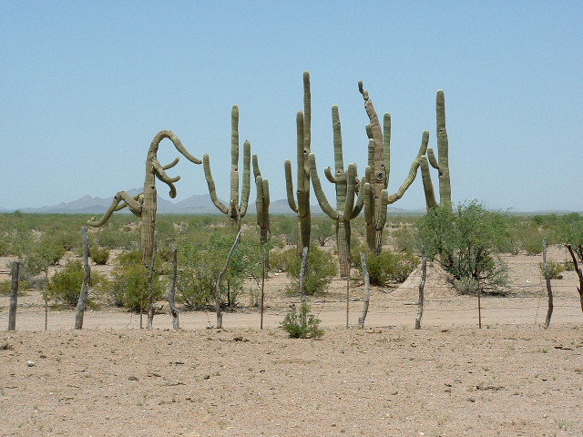
Saguaro cacti
Since I was only about two miles away from the Tecolote Ranch, I thought I’d drive over there. When I pulled up to the gate, I saw a vehicle within the ranch compound drive quickly over to me. It was the Border Patrol. I breathed a sigh of relief, and opened the gate for the officer in his Jeep. He drove through and parked. As he got out, I saw the big grin on his face – it was officer R. Frias. I recognized him immediately from previous encounters in that part of the res. I asked him what the heck he was doing way out here, and he said “Well, I could ask you the same thing.” I told him I was climbing, of course. He asked me where I had been that day and he listened with interest to the account of my travels. He said that they would often stop in at the ranch to check that everything was okay as they made their rounds. He gave me some very useful information about the best roads to take to reach the village of Cowlic. So we said goodbye and I drove northeast, crossing into Komkch’ed e Wah’osithk Chekshani (which means “Turtle Got Wedged District” . Sells is the district office for that district. I reached the pavement at Cowlic in less than an hour and drove home. It was a wonderful day – I did five more of my objectives (262 peaks were now completed on the TOIR), saw some beautiful country and met some nice people.
Please visit our Facebook page at https://www.facebook.com/pages/Desert-Mountaineer/192730747542690