
In order to finish climbing all of the peaks on the Tohono O’odham Indian Reservation, I needed to climb several more on the eastern edge of the Sauceda Mountains. Kaka Wash has its headwaters in a tumbled area between the Sauceda Mountains and the Sand Tank Mountains, and could easily serve as a boundary between the two ranges. The Sand Tanks span an area 34 miles long and include 62 peaks; the Saucedas, 30 and 92. Neither range is trivial, by any measure, and time spent in them can exact a serious commitment on the part of the climber.
I long thought that the only O’odham peak that could be considered to be within the Sand Tanks would be Thorn Benchmark, just north of the gas pipeline road. Although the boundary between the two ranges is not obvious, I’ve come to believe that Peaks 3667, 2679 and 2913 also fall within the confines of the Sand Tanks, but it is difficult to know with absolute certainty. Over the years, I’ve spent what many might consider an inordinate amount of time in both of those ranges, but their beauty and solitude draw me back again and again.
So, on Wednesday, March 1, 2006 Jim and I left Tucson at 4:00 AM. We drove for hours in the darkness, finally passing through the sleeping community of Kaka (Gagka, in the O’odham language, which translates as “clearing”), then heading west along the pipeline road. The faintest strip of dawn was breaking beneath an overcast sky as we turned up the now-familiar dirt road heading northwest up Kaka Valley, along the eastern edge of the Sauceda Mountains. We drove for many miles until we parked at the boundary of the bombing range. A strongly-worded sign on the fence warned us against entering the bombing range without permission from the base commander, but Jim crossed the fence anyway and posed for a picture on forbidden ground. A few short miles away, deafening explosions could be heard and mushroom clouds boiled high into the air. Here’s a photo of Jim, debating whether or not he should go farther in and dodge some bombs.
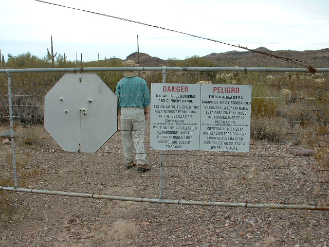
Jim pondering his next move
We left the truck and headed southwest, arriving a kilometer later at the summit of Peak 2580. This interpolates to 2,580′, but in actuality could be only inches over 2,560′. There is a spot elevation of 2562′ nearby – we visited them both and it is anybody’s guess as to which is higher. We left a cairn and register on 2562. Once back at the truck, we drove a few miles southeast and parked again. We started on foot southwest and were soon climbing up to and over a saddle, then down the other side we went into a nice little valley. Once there, we climbed the east slope of Peak 2860 with no problem. There was no sign of any previous visit, so we soaked up the view and filled out a register. It looked like the clouds were starting to lift as we started back to the truck. On the way back out, we drove past the abandoned site of Moivayi. I don’t know when this site was abandoned, but all that remains is a metal water tank and a dry well. A little cemetery sits 2,000 feet away. Moving on, we covered another two miles on the old road, then parked and ate a quick lunch.
Jim wanted to sit this one out, so off I went, crossing several small bumps and washes, then ascending a short valley to a saddle. From here, I climbed steeply up to a band of cliffs guarding the summit area of Peak 3335. I worked my way up through them and was on the summit in time to radio Jim. The day was wearing on, so I left a register and descended. This was another of the fine-looking (and never-visited) peaks of the eastern Saucedas.
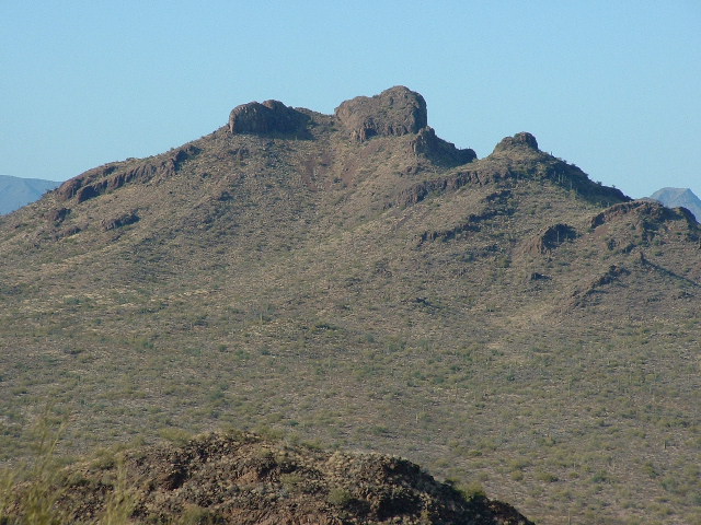
Looking north to Peak 3325 from Peak 3102
Once back at the truck, we drove on, almost all the way back to the pipeline road, then turned west on an old road and drove for about 3 miles. This road almost gave us the slip a few times, it was so badly overgrown and faded. We finally gave up about a kilometer before its end. Once parked, we headed west on foot up a valley and then a ridge to the summit of Peak 3102. Jim steamed ahead of me on this one – I was really dragging. By now, the sky had cleared. The views from the top in the late afternoon light were crisp and clear. To the northwest loomed the impressive south face of Moivavi Benchmark. We left a register and descended to the truck.
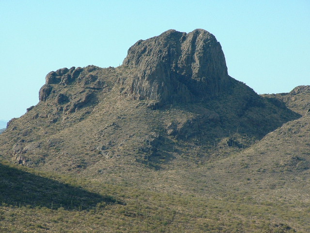
Looking at the south face of Moivavi Benchmark
The day was wearing on as we drove back out to Kaka Valley, then down to the pipeline road.
I had a wild hair and thought we might be able to get in a climb of Toapit Benchmark which was 7 kilometers to the west. Jim was okay with it, so away we went. Before long, however, it became apparent that we wouldn’t even get to a parking spot before sunset, and that the climb itself would be mostly done in the dark. Forget it! We turned around and drove many dusty miles back to Kaka, where the pavement looked awfully good. We drove back to Tucson in the dark, arriving around 8:30 PM. It had been a 16 1/2 hour day, to bag four peaks – at least that was better than one or two. Another great day in the Tohono O’odham Nation.
Please visit our Facebook page at: https://www.facebook.com/pages/Desert-Mountaineer/192730747542690