
In order to get the most from this story, please be sure to read the previous 16 installments which have already been posted on this website.
The Lake District covers a part of both Chile and Argentina, and is about 125 air miles from north to south and about 100 miles from west to east. It includes all the area from Puerto Montt north to Villarica, and from Puerto Montt east to Bariloche. It’s called the Lake District for a good reason – dozens of lakes, large and small, can be found throughout the entire area. I’d had a taste of the district around Bariloche, but now it was time to explore more of it.
After a good night’s sleep, I awoke early and quickly packed. I met Alan and Suzanne and we walked together down to the Catedral Bus office, where we boarded our bus and left shortly afterwards. As we headed west out of town, we picked up a few more people. Our route followed the shore of Lago Nahuel Huapi for several miles, until we reached the community of Llao Llao, which must have been founded by a musician, as its streets had names such as Chopin, Bach, Mozart, Brahms, Vivaldi and Beethoven. Nearby was Puerto Pañuelo, with a dock where our boat awaited. Everyone got off the bus and boarded the ferry, El Condor.
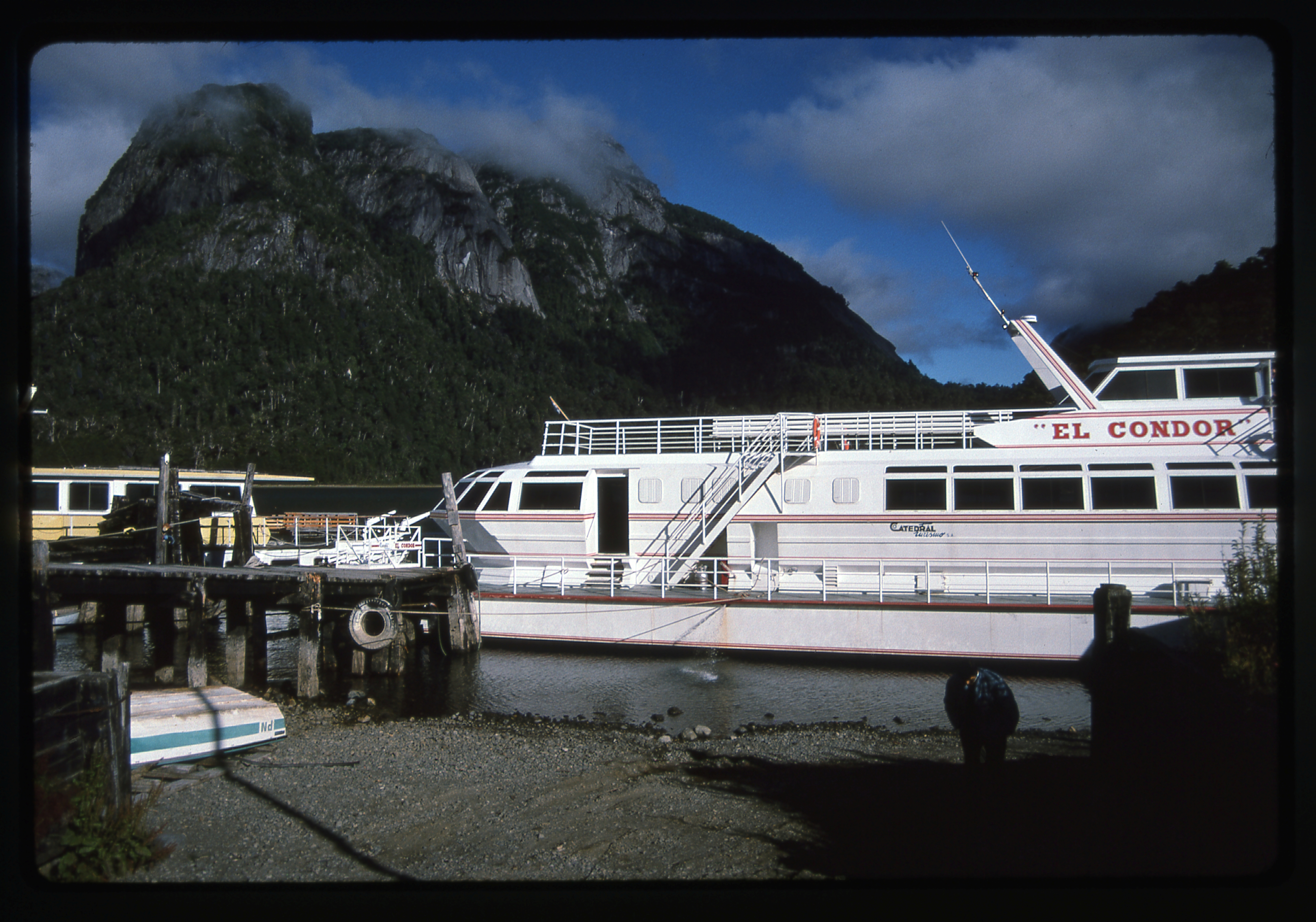
The first boat of the day, El Condor
A 45-minute ride through magnificent mountain scenery took us to the westernmost end of Lago Nahuel Huapi, The area around this lake became Argentina’s first national park back in 1903, and it certainly was worth preserving. The name of the lake comes from the local Mapuche language, and it means “Island of the Puma”. The lake is world-famous for its trout fishing.
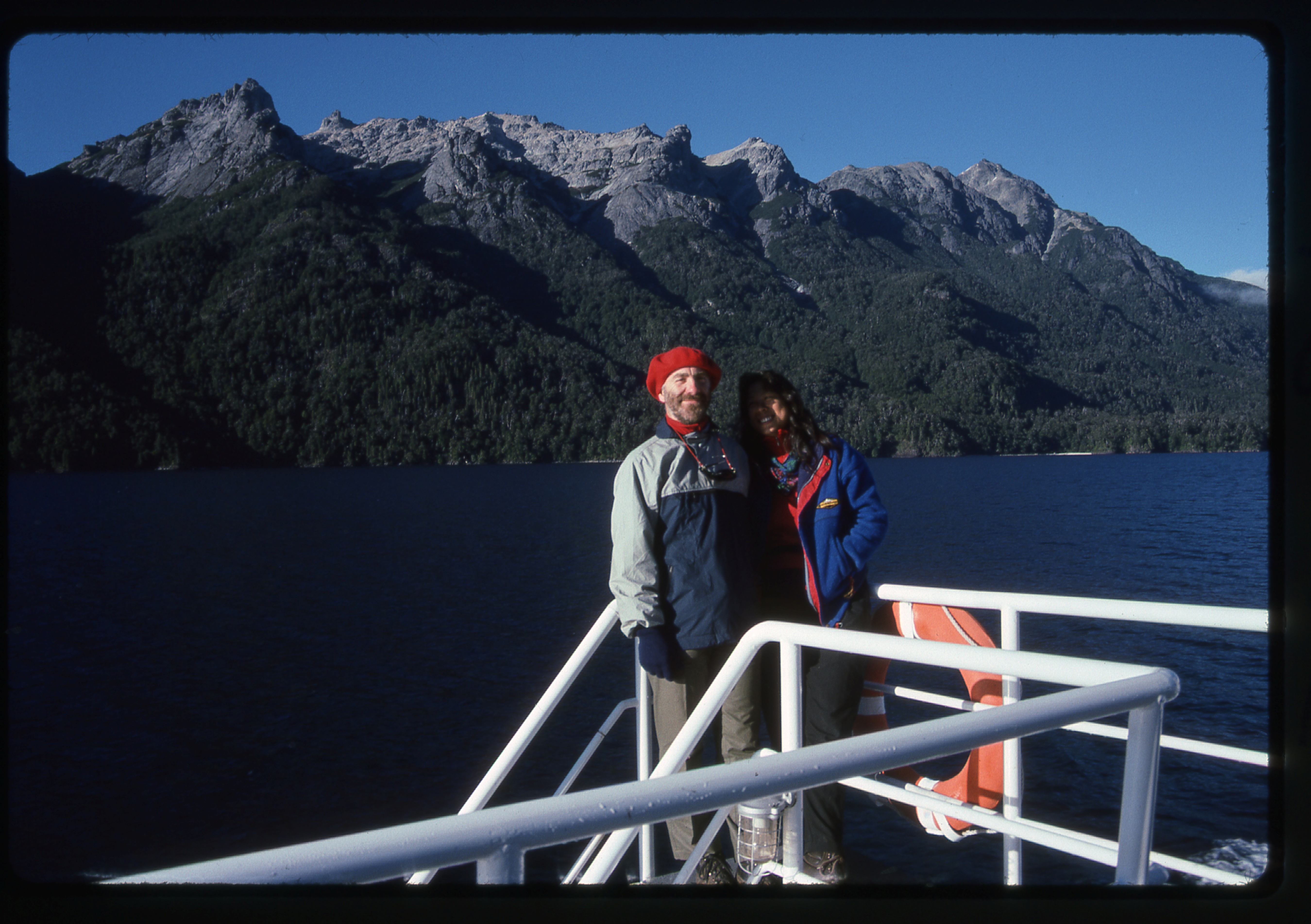
Australians Alan and Suzanne, on the ferry along the Brazo Puerto Blest of Lago Nahuel Huapi in Argentina
We docked at a spot called Puerto Blest, then boarded another bus for a ride through thick forest to arrive at a place called Puerto Alegre. Here, we all got on to a smaller ferry for a ride south down Lago Frías.
This lake sits at 2,625′ above sea level, and affords this amazing view of Cerro Tronador (remember my half-hearted attempt of a few days ago?). What you see here is the mountain rising 8,800 vertical feet above us. Notice all the glaciers? This is the least glaciated side of the mountain, the north side. Since we are in the Southern Hemisphere, the north side faces the equator and gets more sunlight, just the opposite of the Northern Hemisphere where a mountain’s south side gets the most sun. In the Northern Hemisphere, it’s always the north face of a peak which is the most glaciated, the most in shadow, the coldest. I found it hard to get used to this concept, that everything was the opposite down here south of the equator.
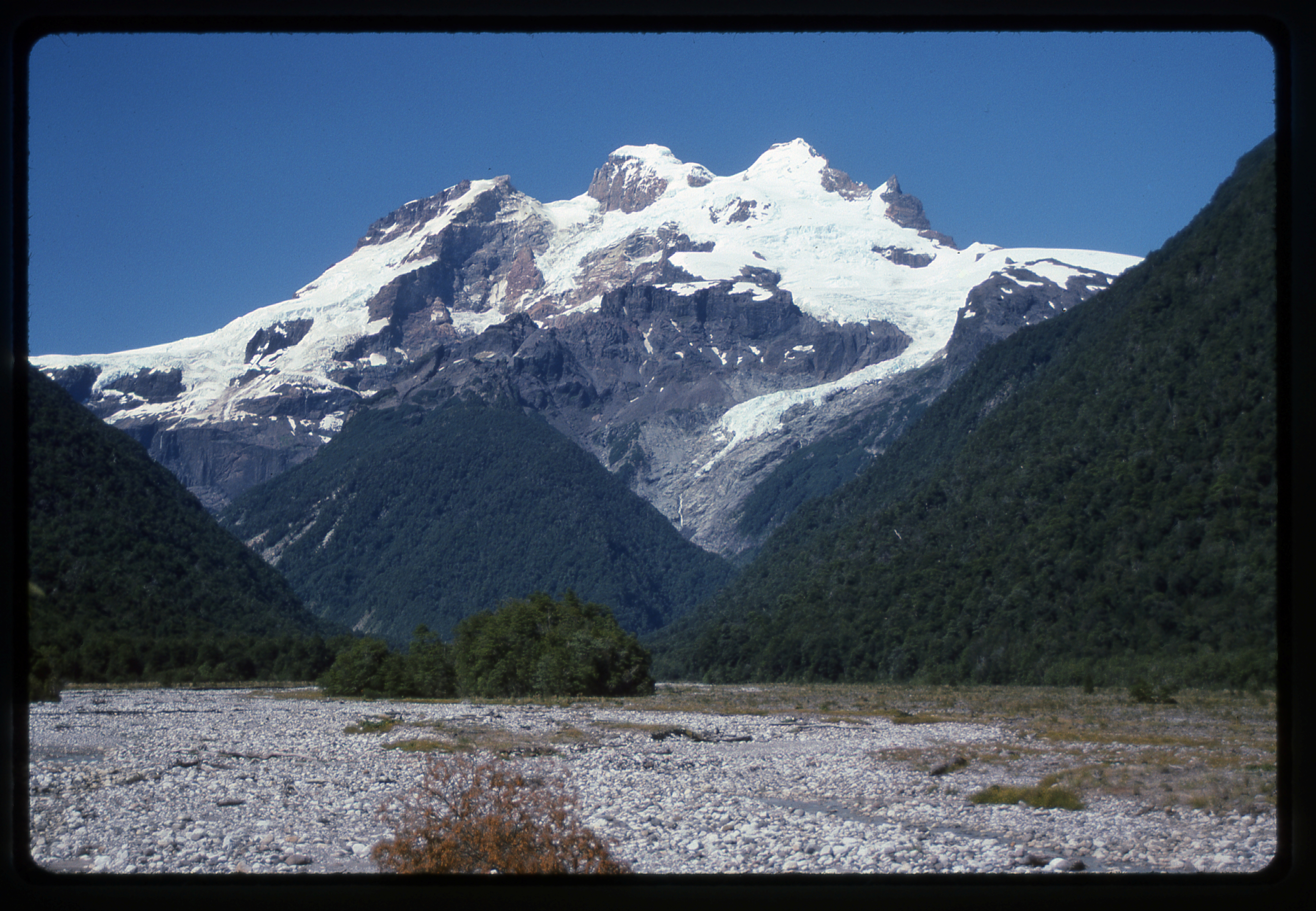
The north side of El Tronador
Once we reached the south end of the lake, we disembarked at a spot called Puerto Frías, and it was here that we cleared Argentine customs in order to leave the country. That bit of business complete, we boarded yet another bus, which wound along a narrow road through the forest, crossed a divide at around 3,350′, then began a long descent into Chile. For miles, we followed the Río Negro until arriving at a spot called Peulla. There was nothing there but a nice hotel and a guardaparque. We stopped for a full 2 hours for lunch.
Looking northeast from near Peulla
After this leisurely stop, we all boarded another ferry, this one smaller and thus more crowded. We were now cruising west along Lago Todos los Santos at an elevation of 650′. The weather couldn’t have been more perfect – it was clear, warm and we were surrounded by beautiful mountains. Here’s one of the ones that came into view. This is one striking mountain, and its name means “pointed” – apt, right? Its elevation is 7,474′ and they say it’s a pretty tough climb. It didn’t see its first ascent until 1937. Locals say that in the great earthquake of 1960 which struck Chile, part of its summit fell away, giving it the appearance you see in my photo. It is said that before the quake, it was even more pointed. That’s easy to believe, as that quake was the strongest ever verified with instruments on our planet, with a magnitude of 9.5 on the Richter Scale. Its epicenter was in the nearby city of Valdivia. Those are glaciers on its slopes, and the view is looking north.
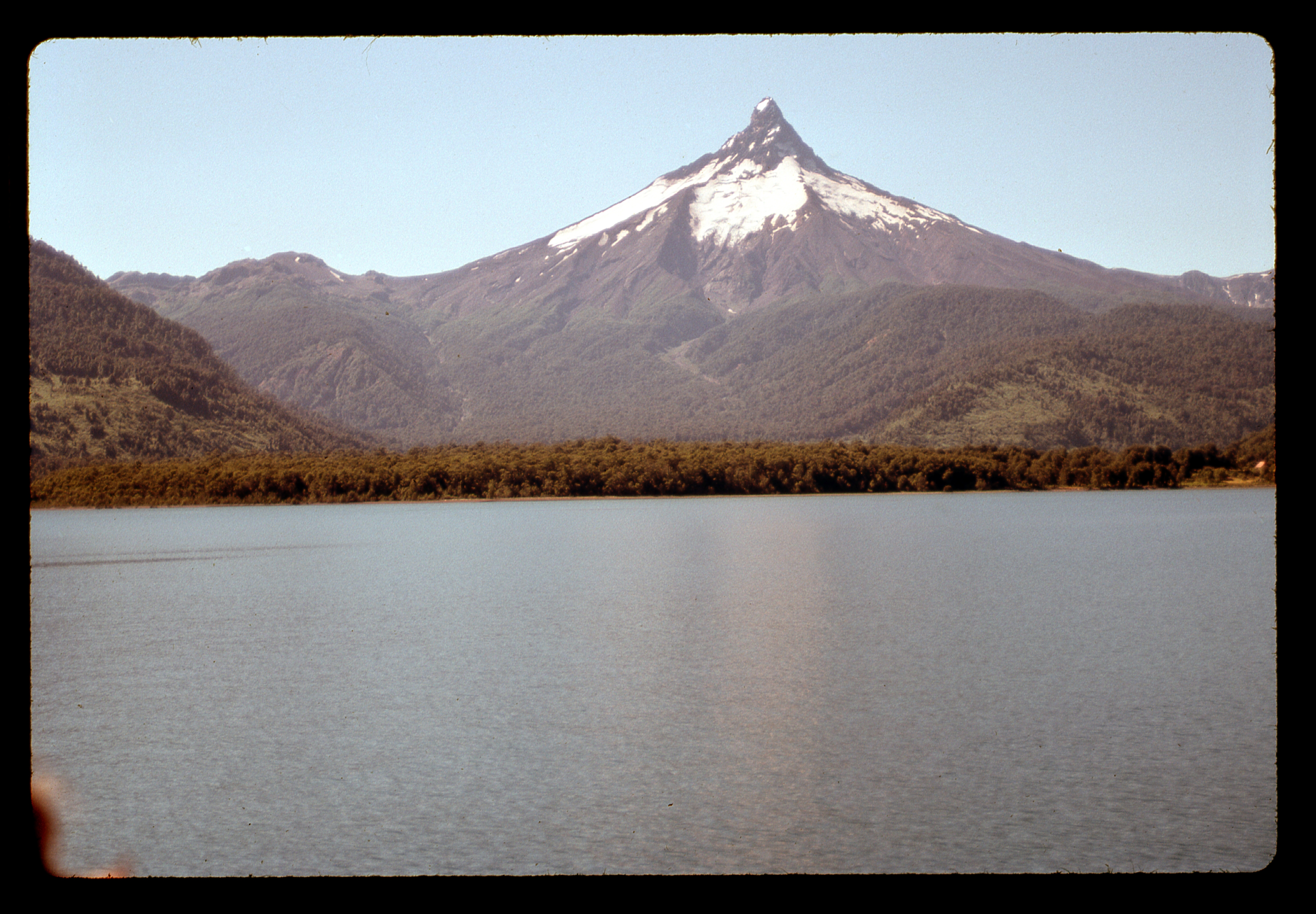
Volcán Puntiagudo
A little further along in our 2-hour ferry ride, an even more famous volcano hove into view, Volcán Osorno. This one boasts a perfectly symmetrical cone and is often compared to Japan’s Mt. Fuji. It stands 8,701′ in elevation and is covered with a surprising amount of glaciation for a mountain its size. It is one of Chile’s most active volcanoes, with 11 recorded eruptions since 1575. One of them was witnessed by none other than Charles Darwin in January of 1835 during his second voyage of discovery on the Beagle. Here’s one of the pictures I took, looking northwest.
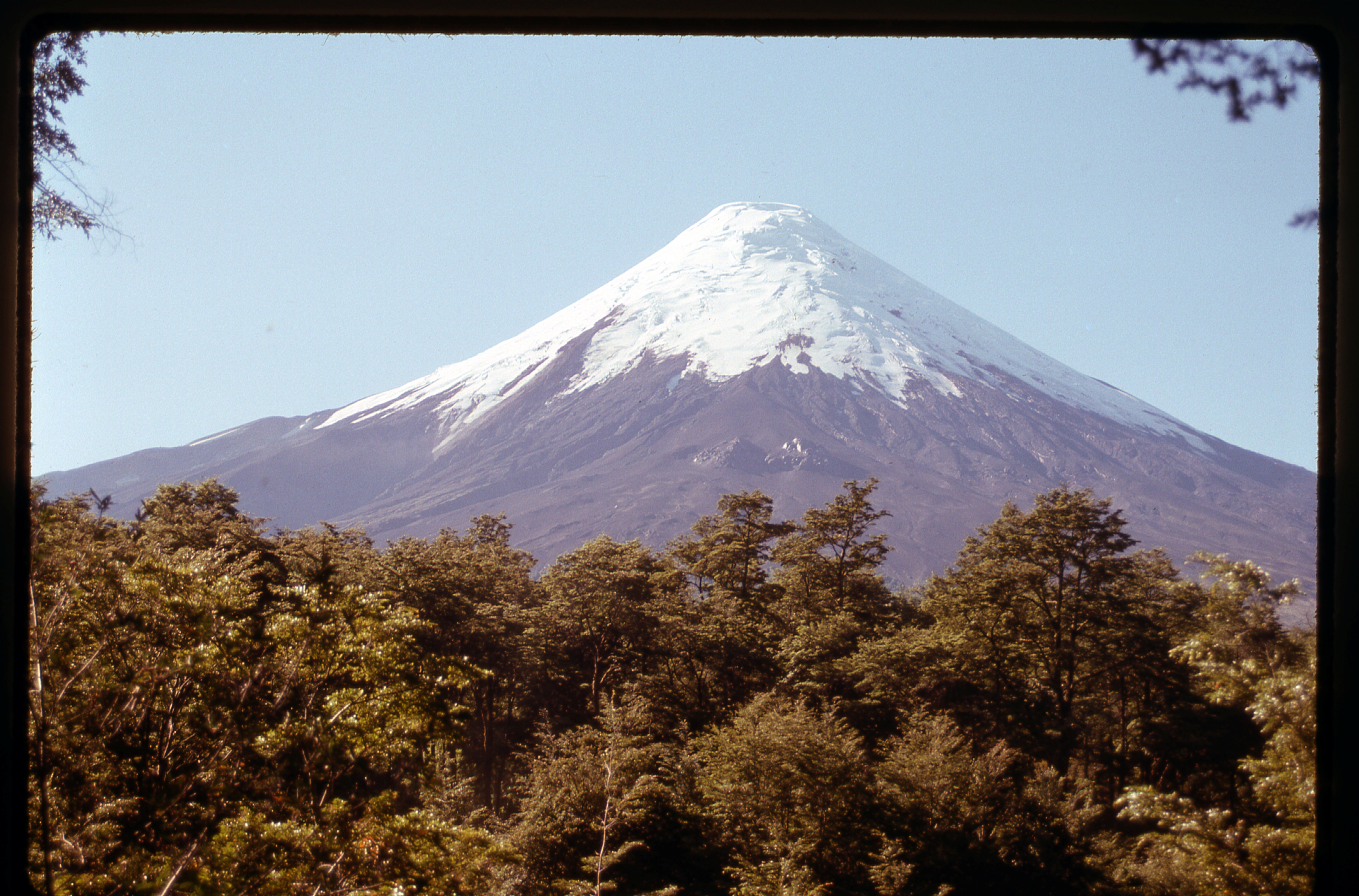
Volcán Osorno
Finally, we reached the western end of the lake and docked at a place called Petrohué. There wasn’t much there, just a small settlement, but once we boarded another bus, we headed down the Petrohué River on Highway 225 for about 4 miles where we stopped at a series of waterfalls known as Saltos de Petrohué. It was a pretty touristy spot, but beautiful to look at, nonetheless. I shared a beer with a girl named Sarah from Toronto. It was here that I said goodbye to Alan and Suzanne, as they were going to camp here for a while. The rest of us continued in a really nice bus through pastoral country for many miles along the shore of Lago Llanquihue, from Ensenada to Puerto Varas. Once there, I had to say goodbye to more of my fellow travelers from this fine day. Another 20 minutes in the same bus took us to the city of Puerto Montt on the Pacific Coast. What a trip it had been – alternating between 4 buses and 3 boats, it had been varied and scenic, and never boring – in short, 13 1/2 hours of spectacular. Surprisingly, the entire trip had only cost 45 dollars US.
I had the good fortune to visit Alan and Suzanne in their home town of Melbourne, Australia in July of 1992, and very much enjoyed their hospitality. Even better, in December of 2013, they visited us in Tucson, Arizona with their 2 teenagers, who had not yet been born when I met them in Argentina.
The moment the bus stopped, we were besieged by people hawking rooms for the night. I insisted on paying only 1,000 pesos (about 3 dollars) and a young man led me to a private home. It looked okay, so I paid for one night and then headed out to eat. My meal was a typical Chilean bargain – for four bucks, I had a bowl of nice home-made vegetable soup with bread; a big salad; a nice pan-fried fish; french fries, and 1/3 liter of good Chilean wine. Sated, I walked over to the station and saw that a train was leaving at 8:00 AM the next morning, heading north – I think I’ll be on it. Puerto Montt struck me as a particularly unattractive town, one in which I didn’t want to spend any time. I felt sad that I had to say goodbye to some good people today.
Wednesday, February 6, 1991
Waking up early, I quietly left the house and walked through the near-empty streets of the town. Close to the train station, I noticed this old building. There was a lot of German settlement in the area in the mid-1800s, and they built their homes of wood – some of the oldest still stand, such as this one from 1860.
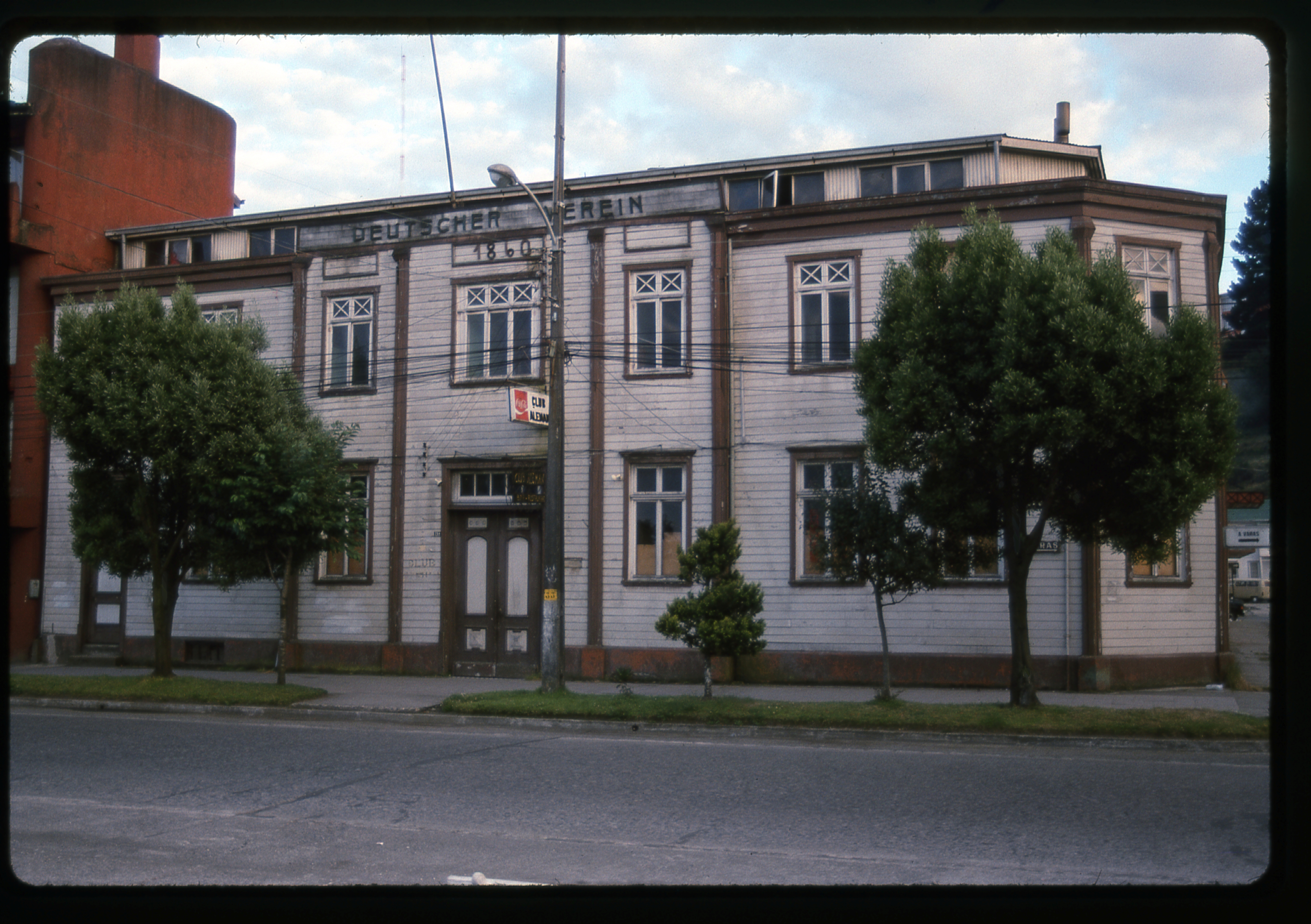
Old house in Puerto Montt, Chile
I wished I’d had more time. Puerto Montt is the jumping-off point for travel south into an area know as Fiordland, a vast archipelago of mountains, glaciers and wilderness that stretches a thousand air miles to Cape Horn. A lucky few ever get to travel this spectacular region, and I wished I’d been one of them, hopping on to a ship and making the 4-day 3-night voyage down to Puerto Natales. Since my visit to Puerto Montt 25 years ago, I’ve spent many hours day-dreaming over maps of the area, making fanciful plans of peaks to climb and glaciers to visit.
The train pulled out at 8:15 AM, heading north. I’d bought a seat in first-class, and was glad of it – even though all that got me was a padded, non-reclining individual seat, it was better than the primitive wooden benches in second. I was able to open my window for fresh air. We headed north through lush farmland. I learned that this area produces a lot of Chile’s vegetables, cattle and milk. Soon, we reached Puerto Varas, where we had great views across the lake to the volcanoes. The day started out partly cloudy, but as we continued north, stopping briefly at small towns, the clouds burned off to reveal a clear, blue-sky day.
When we reached Osorno, a city of 150,000, at 11:00 AM, we stopped for half an hour. This place was founded way back in 1558, and still preserves some of its oldest buildings. Our journey was a leisurely one, as we were still only 65 miles north of our starting point in Puerto Montt. Happily, I noticed that so far today there was not one smoker in my rail car, for which I was grateful. In my spare time, I had been reading Aztec by Gary Jennings, and today I finished it – it was one of the most memorable books I’d ever read, and had been my constant companion as I traveled Argentina and Chile. There were lots of little kids running up and down the car, letting off steam, and they were fun to watch.
By 2:30 PM, we had reached a village called Antilhue on the Calle-Calle River. It’s main claim to fame are the two large power plants located there. I had to get off the train and board another, which would take me west to the Pacific coast once again (all of today’s journey so far had been inland). This train was slower, and passed down the picturesque valley of the Calle-Calle. I’d made the acquaintance of Juan and Jorge, two young fellows from Buenos Aires, and we rode together and remarked on the peaceful, pastoral scenery. At 4:30 PM, we completed the 150-mile trip from Puerto Montt and pulled into the train station at Valdivia.
At the station, a young girl escorted us to her aunt’s hospedaje at Hettich 419, an address just a short walk away. It was agreed that Juan, Jorge and I would share a large room for 3 dollars each for the night. Here’s a view of the street it was on – it’s the house by the 2 cars.
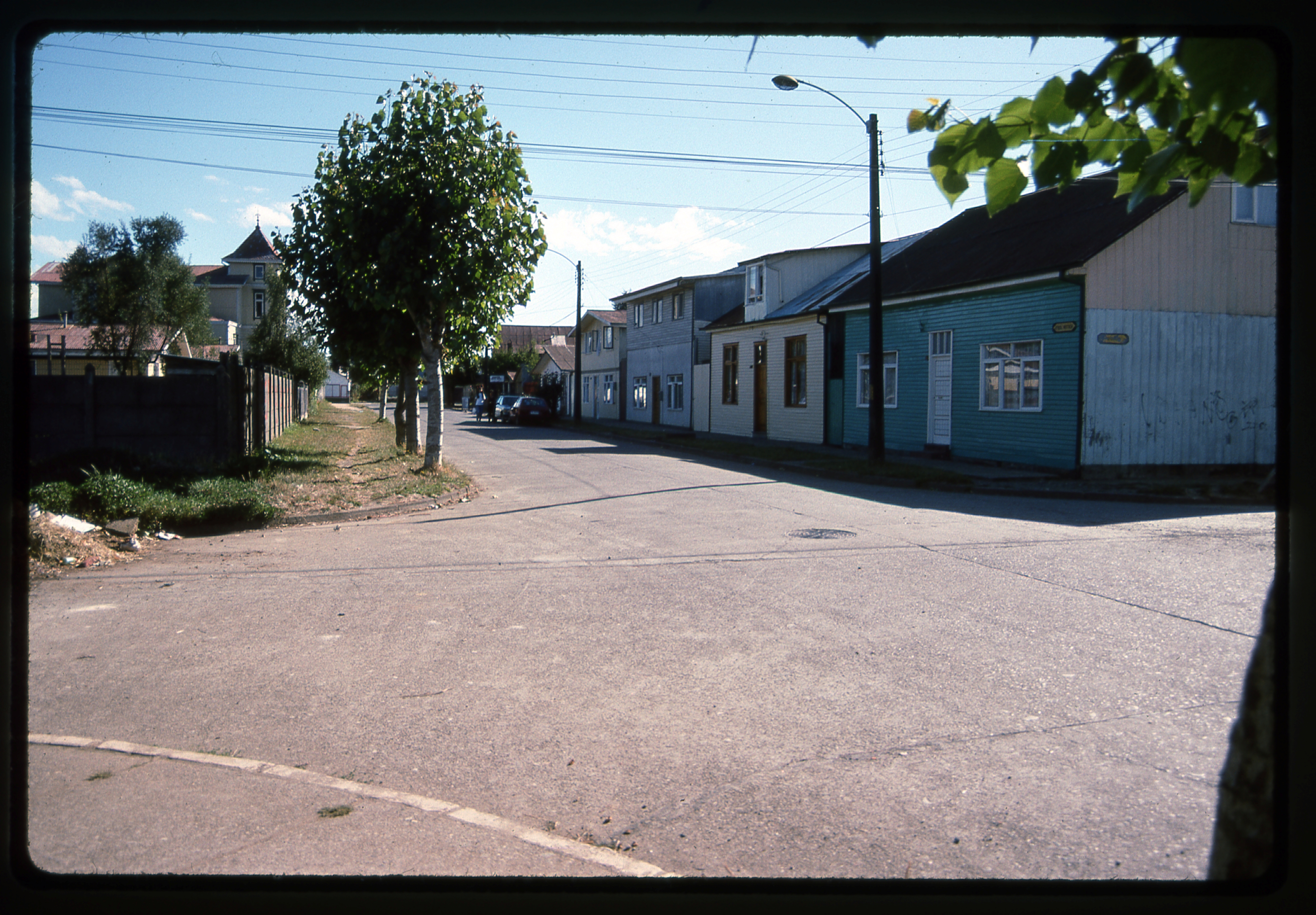
The rooming-house at 419 Hettich in Valdivia, Chile
That done, I figured I’d better make travel arrangements for tomorrow, so I caught a micro to the town’s main bus station and bought a ticket to Pucón, nearly all the way back east to the border with Argentina. That bit of business complete, I caught another micro back to the hospedaje, took a shower and changed into clean clothes. Then, in the kitchen, I visited with Ingrid and her sister, both from Santiago, and we had tea. They suggested we go out to a place called Niebla, right by the ocean – it seemed like a good idea, so away we went.
It took 2 different city buses to get us there, but it was worth the effort. This had historically been a huge fortification, and this link can tell you all about it. Here is one view of some of the cannons which defended the fort. Actually, this was one of 10 different forts built in the area, and together they would become the largest fortification built along the entire Pacific coast of the Americas. The main reason for its construction was to defend against invaders coming in from the ocean, and also from the local Huilliche native people.
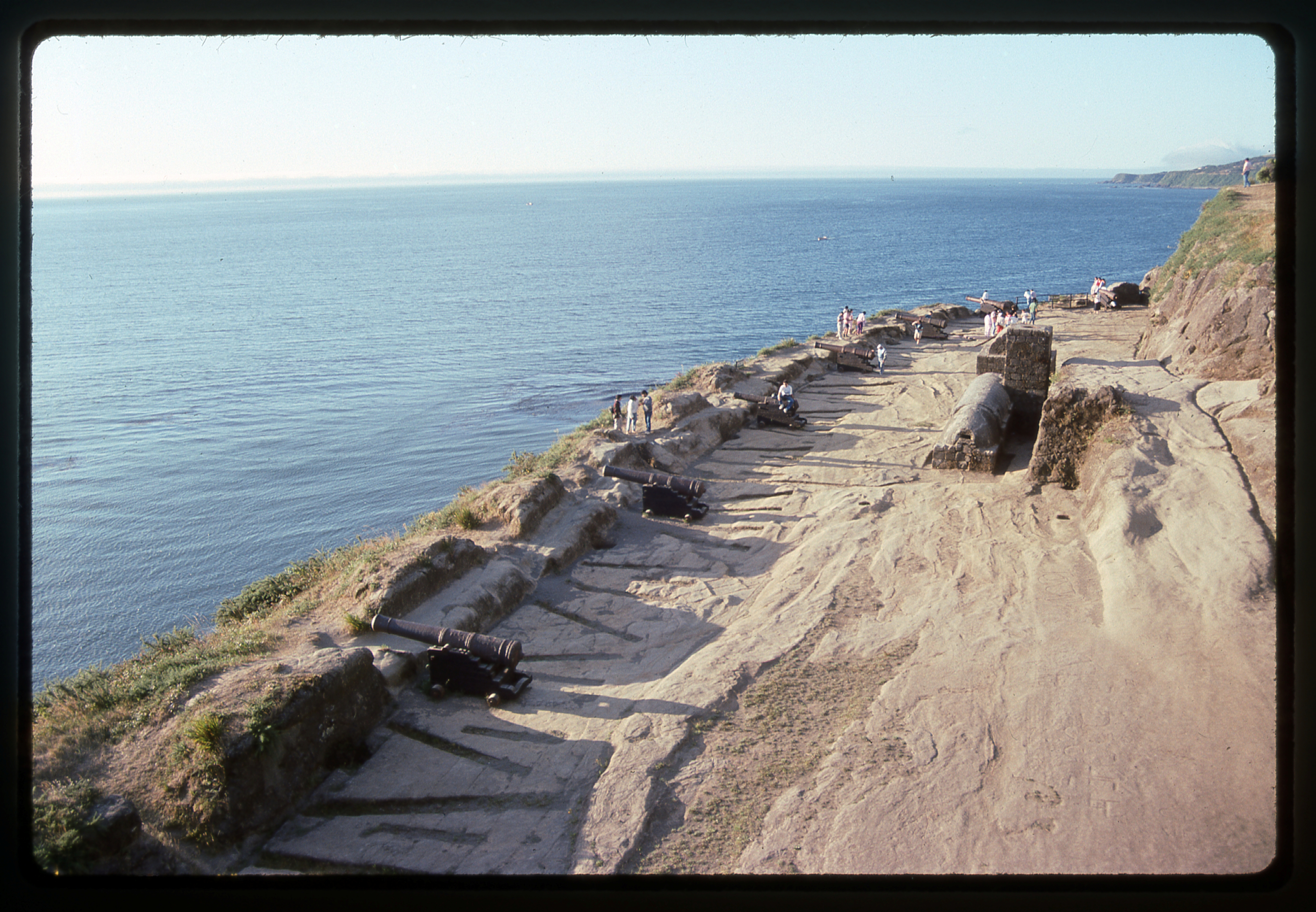
Niebla, Chile
I had someone take this picture of me with my camera – it’s hard to believe how skinny I was back then, 140 pounds dripping wet. Ah, the good old days.
The Desert Mountaineer at Niebla – he’s the one on the far left.
The black sand beach by the fort was practically deserted. I was really charmed by the place, and I guess I have to admit that I’m biased in favor of the Pacific Ocean over the Atlantic – it just has a different vibe.
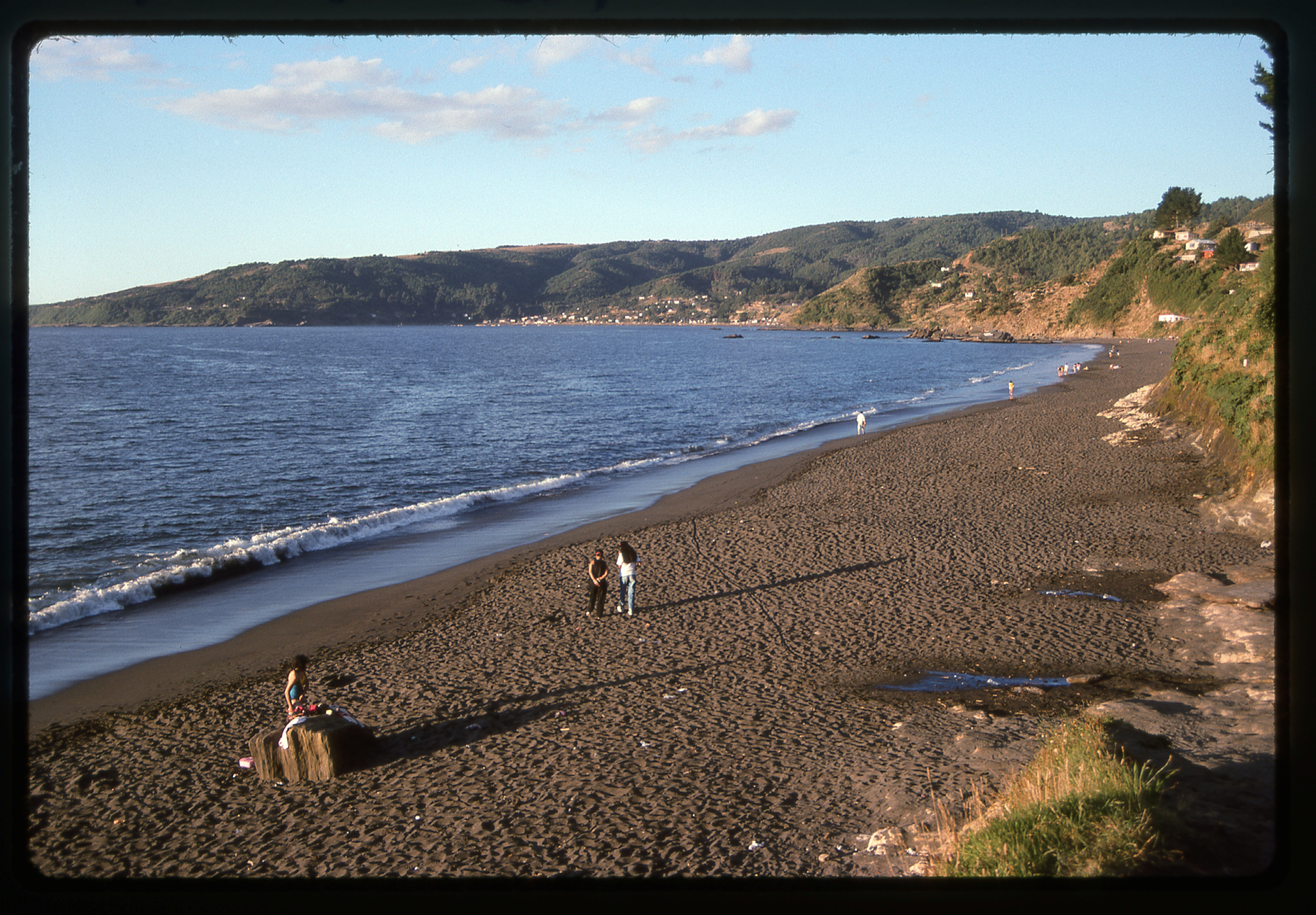
The Pacific Ocean at Niebla, Chile
The girls and I finally boarded the bus and returned to town, where I bought some groceries and ate in my room. It didn’t take much to keep me happy; some bread, some cheese, and a little wine (okay, maybe more than a little). Combined with the fact that I did a great deal of walking, a lot of it with my big pack, I managed to keep my girlish figure. My two Argentine room-mates were fun, interesting guys and we talked animatedly late into the night.
Thursday, February 7, 1991
After a good night’s sleep, I shouldered my pack and headed out into the street. It wasn’t far to the bus station – I boarded early, and we headed out at 9:30 AM. As we headed east, the terrain strongly reminded me of British Columbia, my old stomping grounds. It was a thoroughly-enjoyable 2 1/2-hour ride to the city of Villarica, where nearly everyone disembarked. This part of Chile has a long history of European settlement, and Villarica was no exception, having been founded in the year 1552. I stayed on the bus while it continued, following the south shore of Lago Villarica, until we arrived at the station in my destination of Pucón, Chile. Since I was right there, I bought a ticket for the next leg of my journey on Saturday.
I quickly learned that since this was a popular tourist town, a bed for the night commonly cost about $7.50 US. I had become spoiled by Chile’s low prices, so I was determined to do better – I asked around and found a sweet old lady who rented rooms in her home, and she agreed to let me have a single room for 3 dollars. I paid her for two nights, left my stuff and headed out.
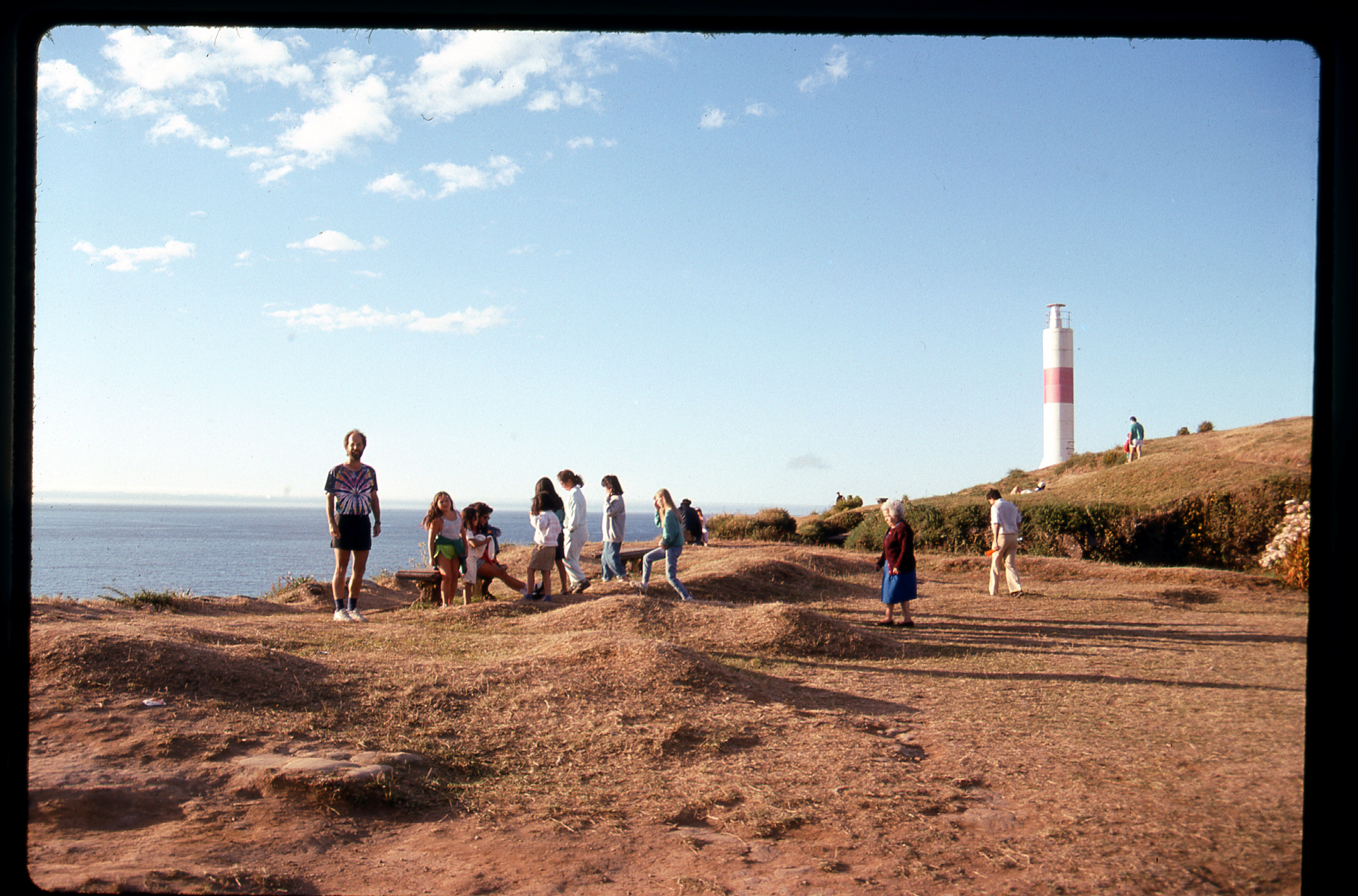
One of the first things that happened was meeting Claudia and Marcello from Buenos Aires, here for a short vacation. They wanted to climb the Villarica Volcano, as did I, so we set out to learn more about the possibility of doing just that. Chile has more volcanoes than almost any other country, and you many find this list interesting. There are 500 or so, and 123 of them are considered more-or-less active. By contrast, Argentina has only 57 volcanoes. Volcán Villarica sits in a national park called, appropriately, Parque Nacional Villarica. It is considered one of Chile’s most active volcanoes (check out this site – some pretty interesting and scary facts about its eruptions). It is one of the few volcanoes in the world with a lava lake in its summit caldera. My photo shows smoke rising from the crater. At night, a glow can sometimes be seen coming from the crater, and during eruptions, there can be quite a light show. The mountain towers almost 9,000 vertical feet above the town, and its summit is a mere 10 miles from the town. Here is a link to some impressive pictures of its eruptions.
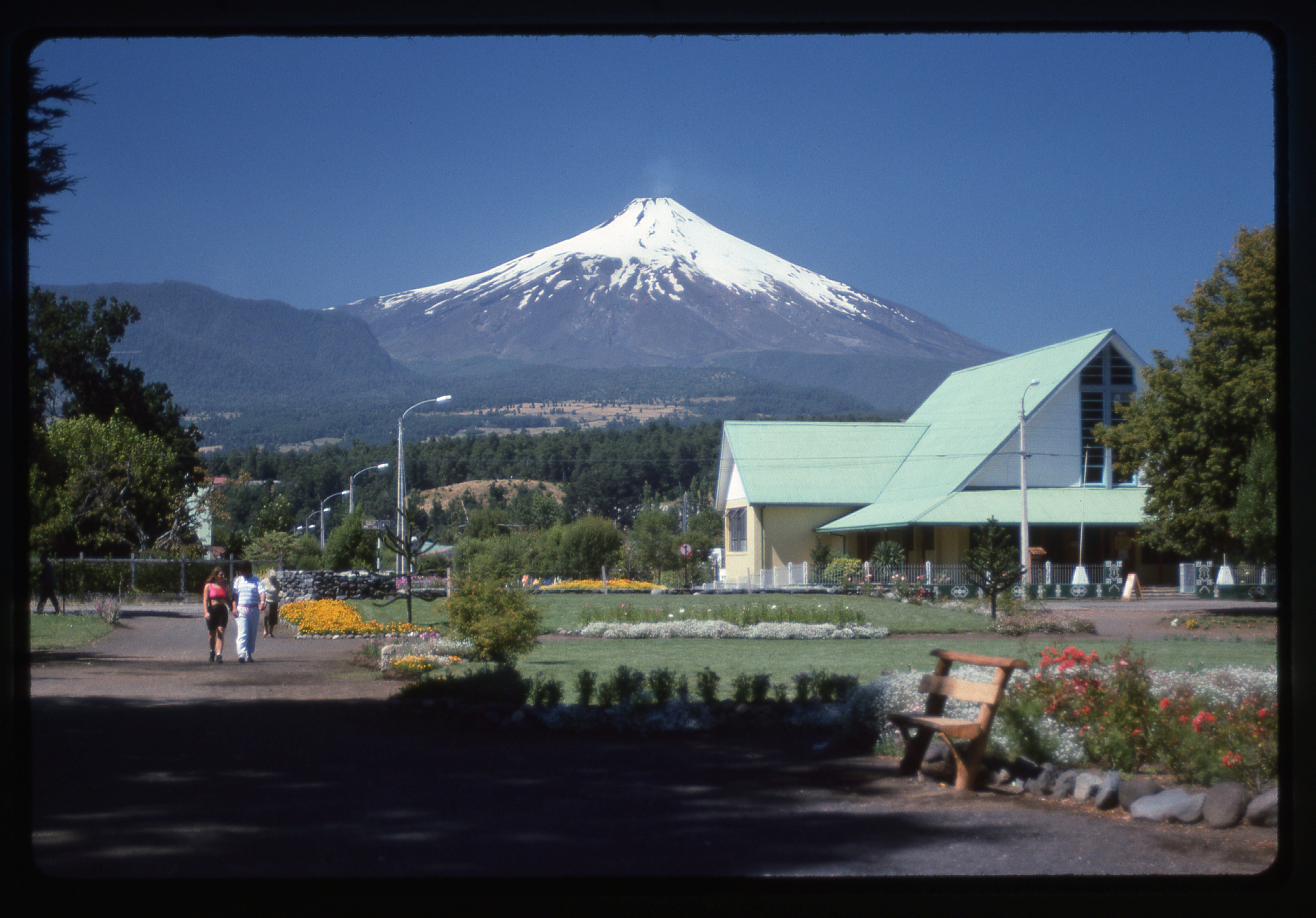
Villarica volcano, as seen from the town of Pucón
Because the volcano sits in a national park, the authorities have a pretty solid lock on what’s allowed and what isn’t. And since this volcano has killed people, they’re pretty paranoid about who can climb it. We went and talked to the folks at the park office and quickly learned that they only allow summit climbs on a tour with a paid guide. So, we thought about stealthing it. The town sits at 725′ elevation. There’s a road, 9.5 miles long, that goes up the north side of the mountain to about 4,080′ where there’s a ski lodge. The road continues from there up to 5,575′ to the top of the chair lift. Even from there, it’s quite a haul to the summit at 9,380′. We also learned that a different road goes up to a refuge at 3,740′, and from there it’s a straight shot of almost 6,000 vertical feet to the summit. Since we didn’t have a vehicle, it seemed problematic to get up on to the mountain, and if it was so forbidden to try the climb without a guide and there may have been prying eyes, I guess we chickened out on the idea of trying a stealth climb.
I spent the rest of the day walking around the town, which is brimming with tourists (like me) – most of them are Chileans. It’s a lovely town, and I’ve become quite fond of it already. The weather was perfect – warm and sunny – and it seemed the perfect place to just hang out and relax. One small luxury I’ve afforded myself is ice cream. Both the Argentines and Chileans have perfected the art of making it, and I often indulge.
Friday, February 8, 1991
I slept well, and very late. For breakfast, I ate a huge bunch of fruit – oranges, plums, papaya, bananas, avocado and pepino, all purchased at the local market for a dollar. Heading down to the beach on the shore of Lago Villarica, I quickly learned that the black sand was hot and the water very cold. The black sand had its origins in the volcanoes, the icy lake water in the glaciers. It was fun watching people learn to windsurf.
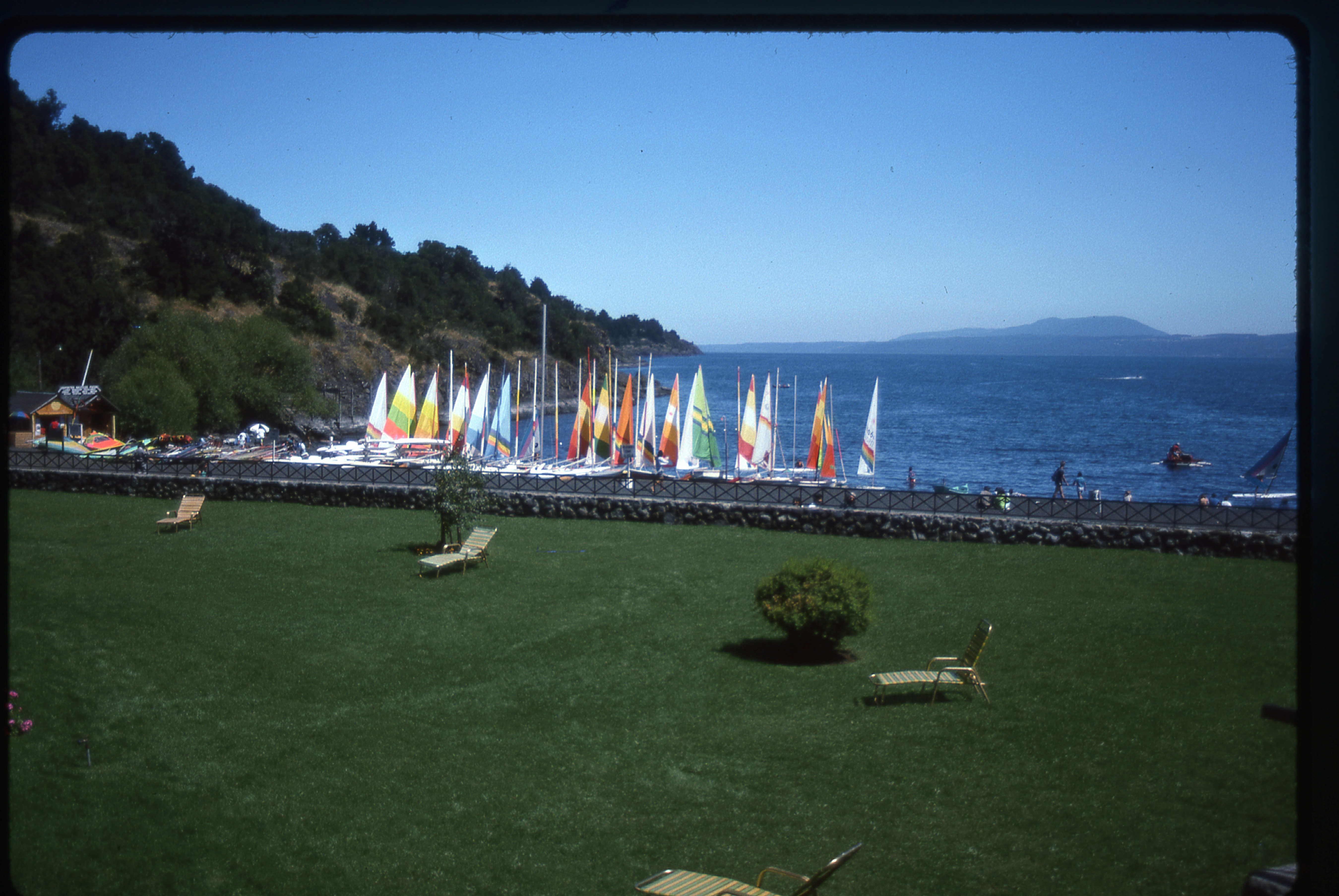
Windsurfing on Lago Villarica
All day long, I kept looking over my shoulder at the volcano, as it kept emitting big puffs of smoke. Someone told me about the Monasterio Santa Clara de Pucón, so away I went. It sits about 200 feet above the town on a hill and offers a commanding view of the whole place. What a tranquil oasis it was, and I spent some time there, reflecting on how lucky I’d been to have seen so much of the beauty of this friendly country.
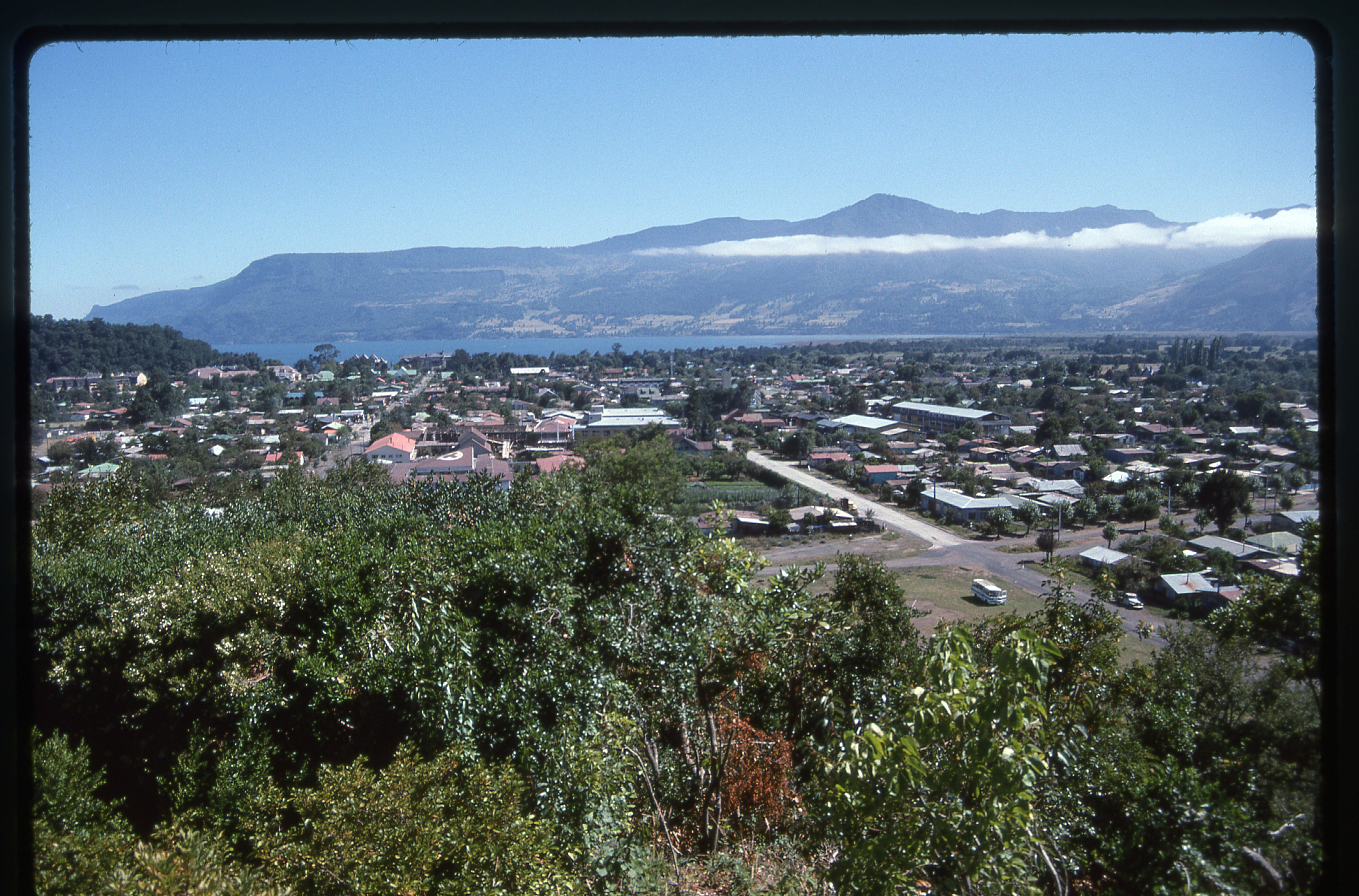
Looking northwest over the town from the monastery
I headed back down a path and into the town, where I whiled away the hours doing two of my favorite things in Chile – eating and walking. When evening arrived, I went to a free choral concert put on by the University of Chile from Santiago. They performed excerpts from Mozart’s Requiem and also a variety of South American songs, and it was thoroughly enjoyable. As I walked back to my room, I realized that this lovely town had really put a spell on me, and I was sad that I’d be leaving in the morning.
Please stay tuned for the next installment of this story, Part 18.
Please visit our Facebook page at https://www.facebook.com/pages/Desert-Mountaineer/192730747542690