
If a river, creek or wash has a tributary which is longer than the named feature itself, is the tributary then the true source of the wash? Of course out here in the desert, our washes (drainages) almost never have any water running in them, but if you think of things in geologic terms, say hundreds or thousands of years, then enough water does actually run in them enough times to cause some erosion. One of my favorite desert ranges is the Sauceda Mountains, and, no surprise, a major drainage there is called Sauceda Wash. A curious thing about the USGS topo maps which cover our desert areas is that drainages are shown in blue, as if they were running water (that only ever happens a tiny fraction of 1% of the time, and sometimes not for several years in a row). The wash has its humble beginnings high on the northeast shoulder of Moivavi Benchmark at 3,300 feet elevation.
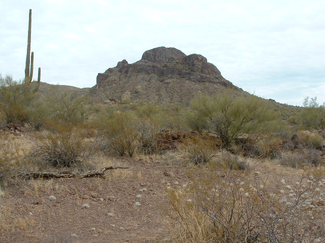
Moivavi Benchmark, west side
By the time the drainage has curled around the east, then the south, sides of the mountain and crossed a very bad road that time has forgotten, it has traveled 1.7 miles and dropped down to 2,535′. One note about this bad road – it comes from the south, from the now-abandoned village of Stoa Pitk. Perhaps an indicator of the heyday of this road is a group of old cars not 2 miles away to the south. Here’s one of them.
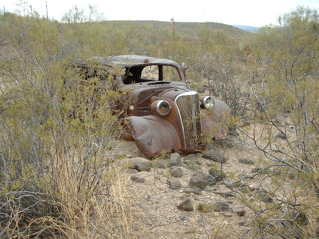
An old car from the 1930s
Already, this wash has “drained” Peak 3325 and Peak 3335, as well as Moivavi Benchmark. It is running north downhill and soon passes a man-made tank, or watering hole, for cattle, before trending more to the northwest. In this picture, it doesn’t look like much, and there’s not a drop of water in it. It’s the big, flat open spot.
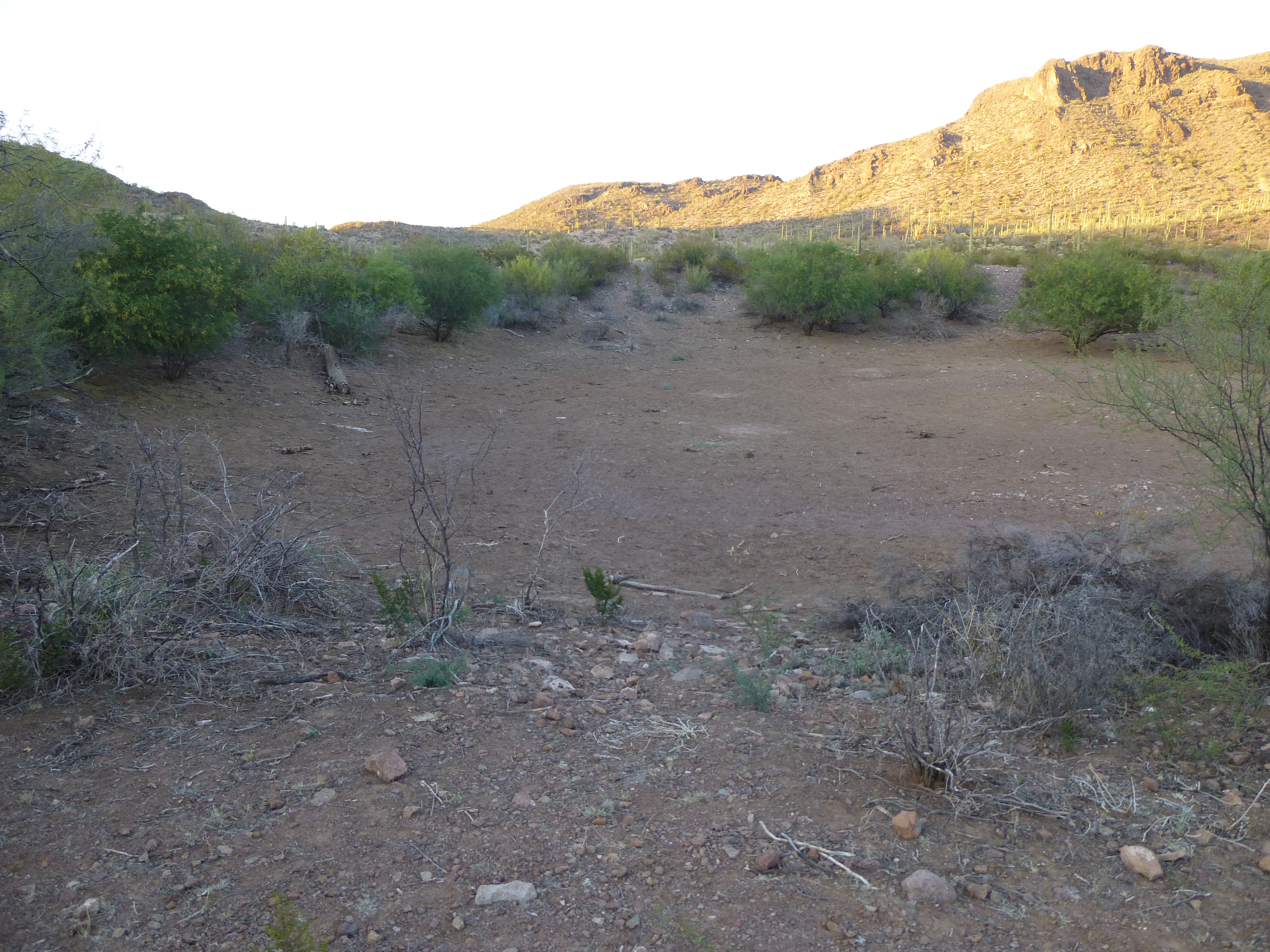
The tank
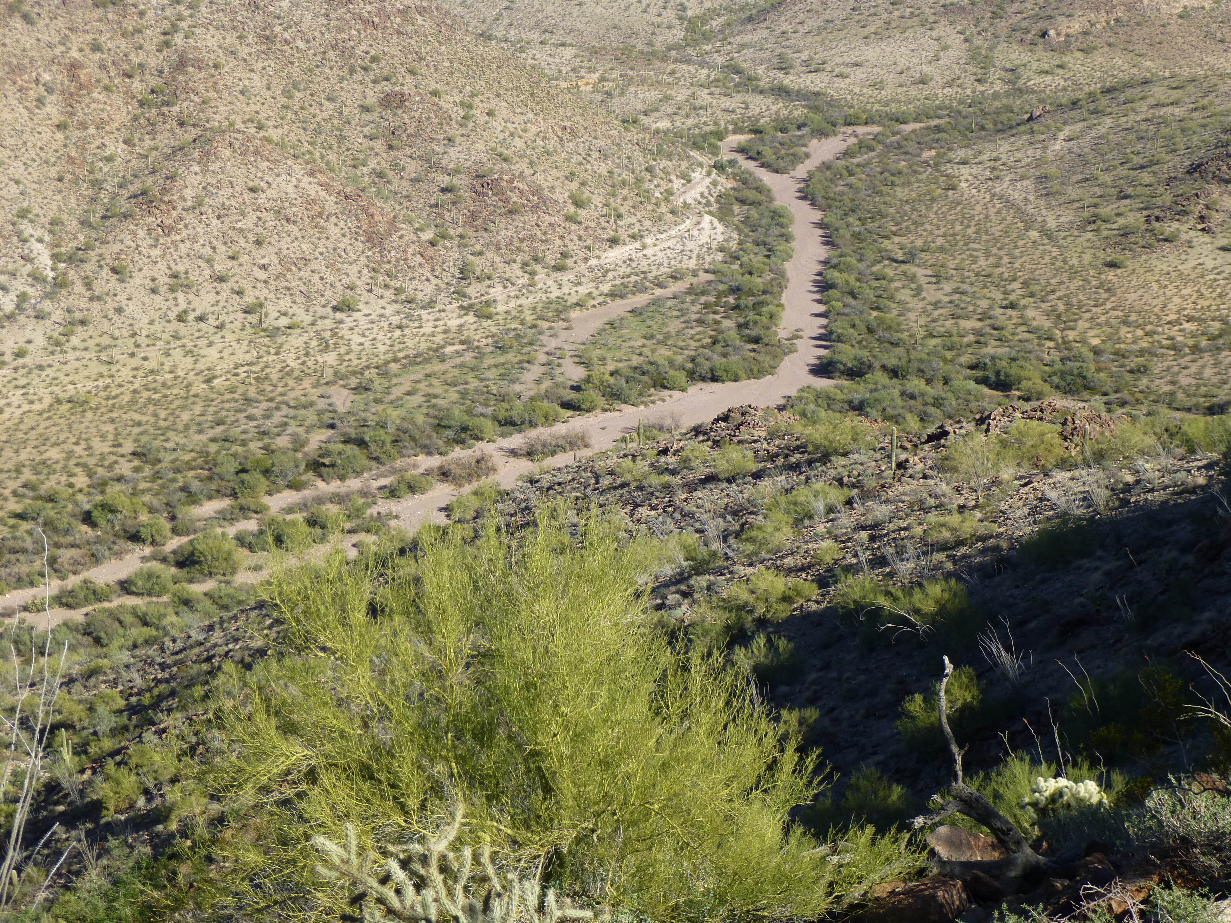
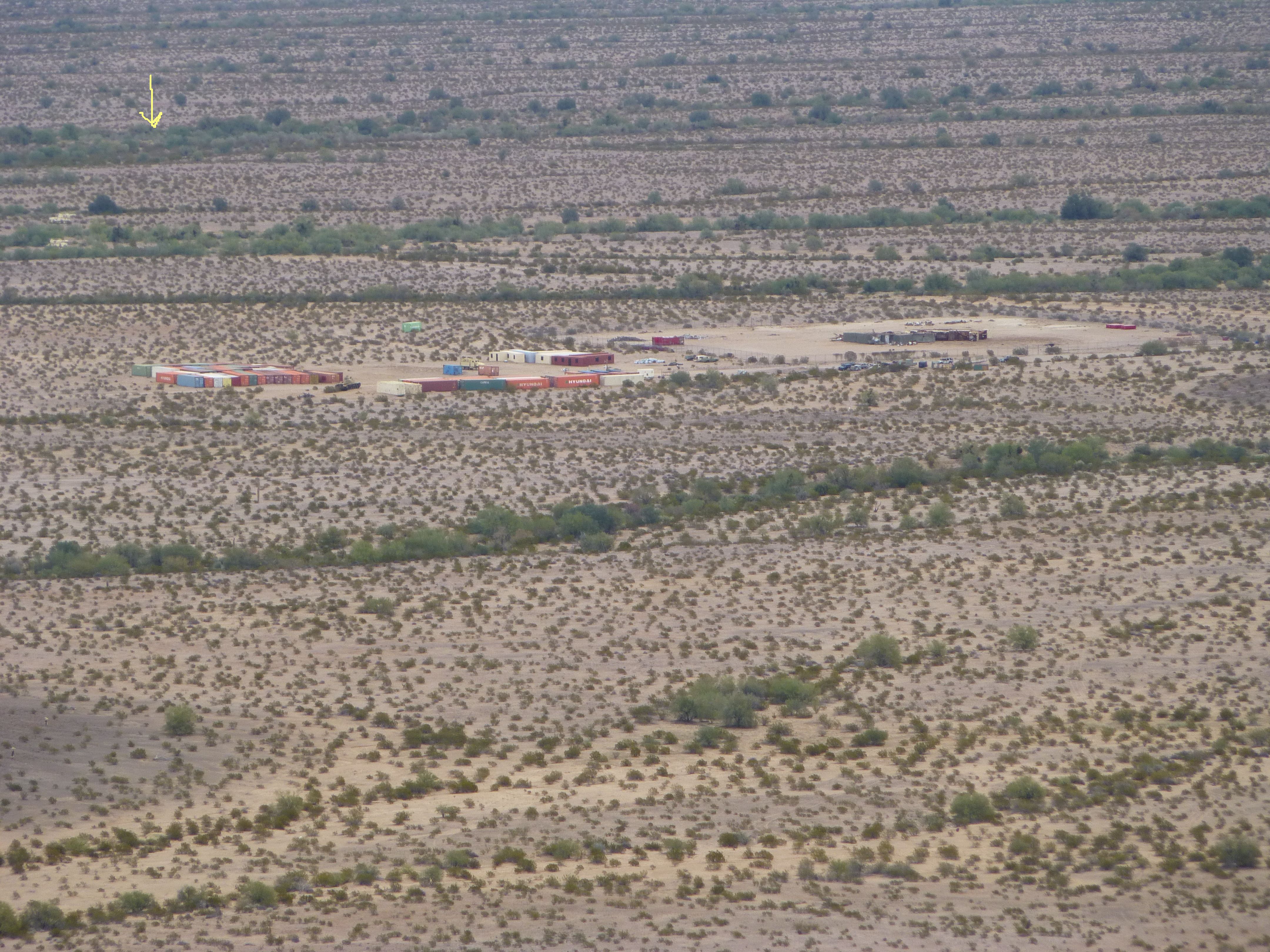
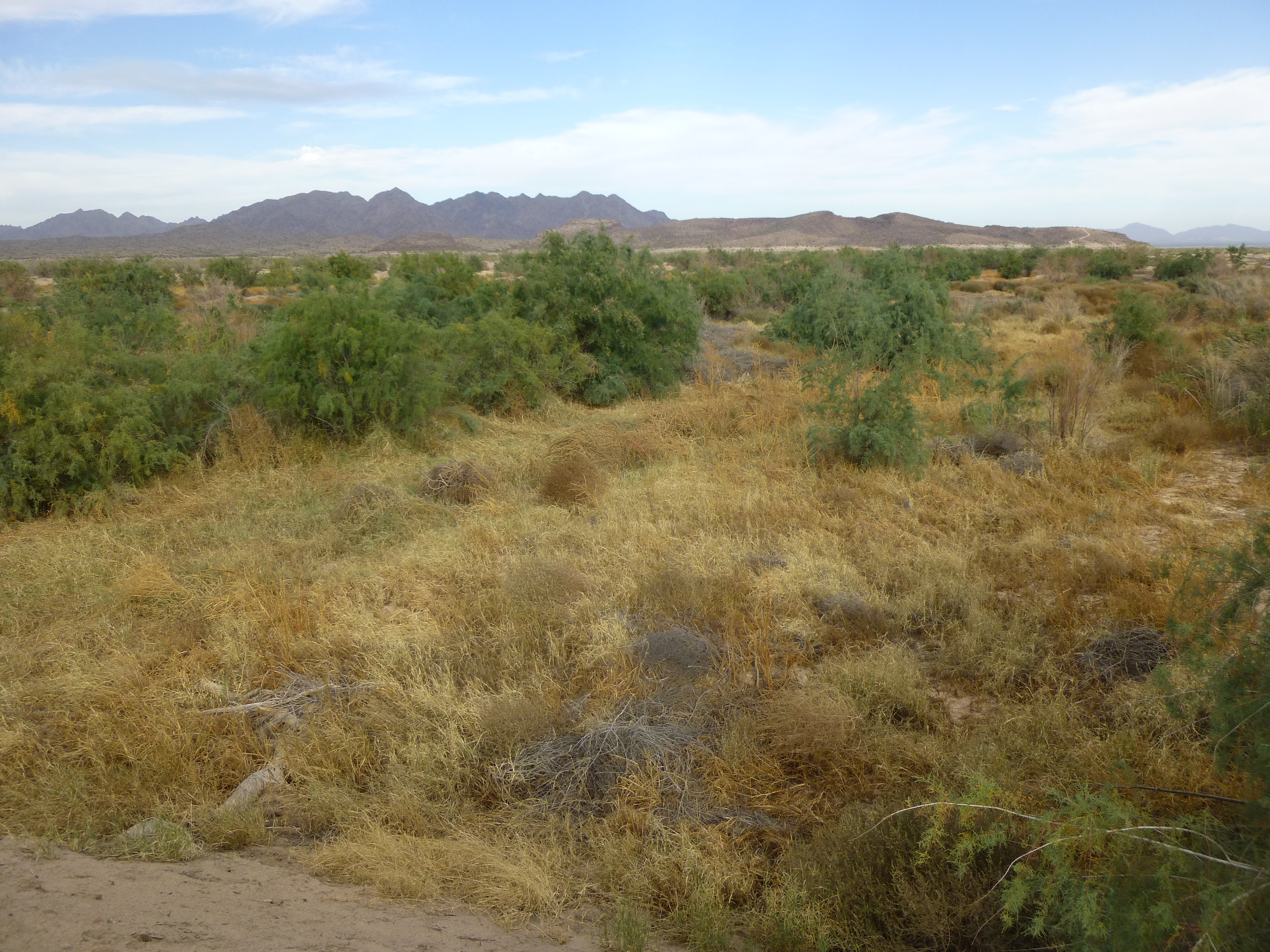
Peaks line both sides of this valley, rising as much as 1,200 vertical feet above its floor – peaks such as 3395, 2780, 3060 and 3563. A road follows the valley bottom, but it hasn’t been used by members of the Tohono O’odham Indian Reservation, on whose nation it sits, for many years. It is deteriorating badly, and is almost impassible in places these days. At around the 7-mile mark, the road crosses a low saddle and heads into another valley to the north. We’ll return to that valley later. In this next photo. I’ve put a yellow line showing the position of the road. It was taken from the top of Peak 3395.
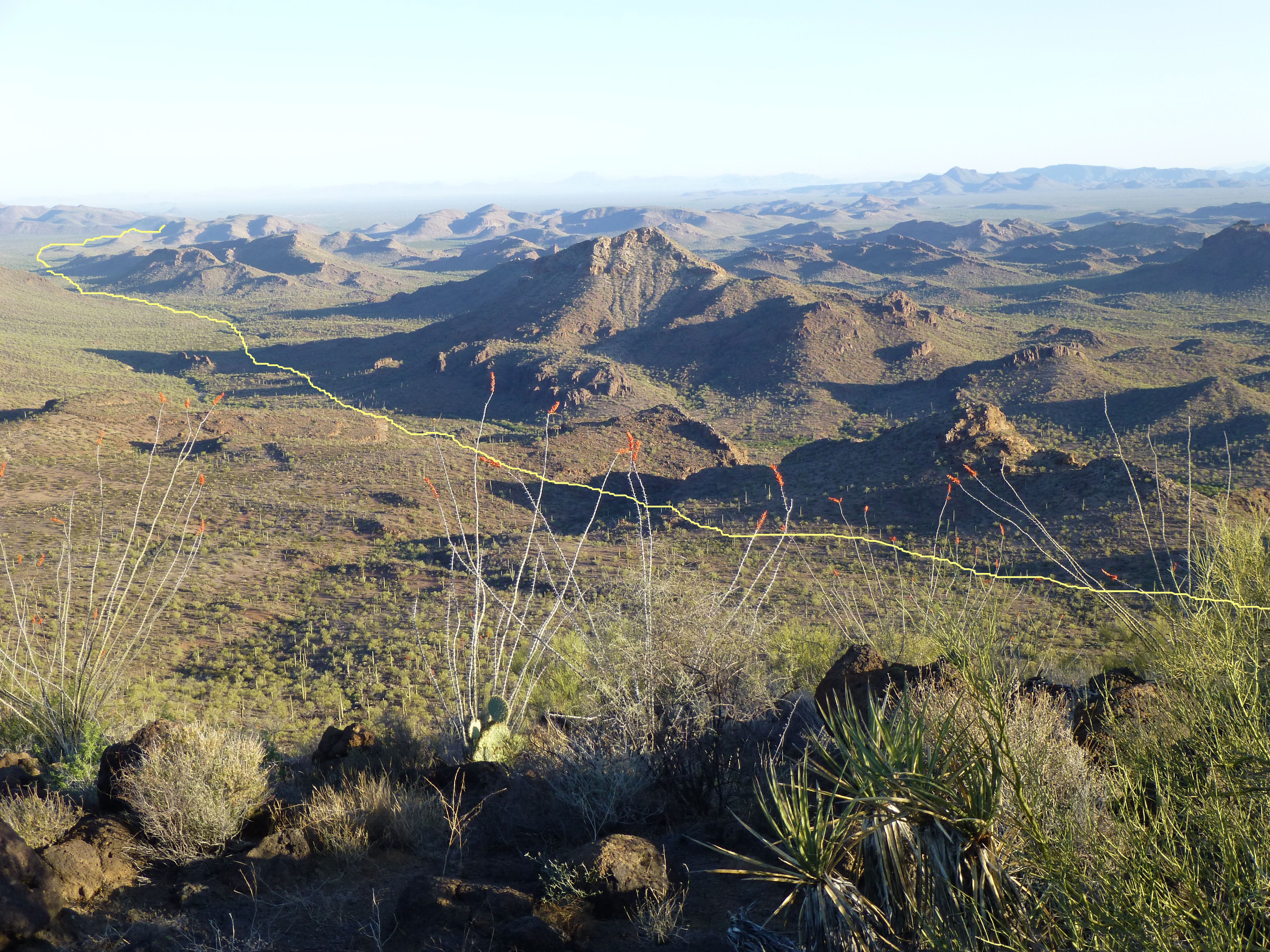
The road heading northwest
For now, let’s stay with this major tributary we’re following as it heads down a remote valley – it passes by Peak 2620, Peak 2660 and Peak 2505 before crossing another old road at the 10.3-mile mark. It is now passing through more open country, heading north, and then at 11.4 miles it leaves the reservation and passes into the Barry M. Goldwater Air Force Range, a place where aircraft shoot at things and drop bombs. At 12.3 miles, one of the most important things happens along the course of this drainage – this long tributary merges with what is actually named “Sauceda Wash” on the map. There is a military road nearby, but it hasn’t been used for years and is in really rough shape. Open this link, then zoom way in to see this meeting of the waters.
http://listsofjohn.com/qmap?lat=32.6034&lon=-112.5497&z=12&t=u&P=300&M=Desert+Mountaineer
By the way, all roads I’ve mentioned so far are just rough dirt – no pavement, of course, and never maintained in any way, just deteriorating more and more every year, until one day there’s a washout so bad that nobody will ever drive that road again.
So now, I’d like to talk a bit about that “other” branch of Sauceda Wash, the one that carries the name on the map. Let’s backtrack to Moivavi Benchmark, then look about a mile north of it. There, at 2,800 feet elevation high on the slope of an un-named peak at the head of a lonesome valley, starts this branch of the wash. It follows a tortured path northwest, dropping almost 600 feet in 3.5 miles, where it is even with Peak 2860. The valley is gentler here, wider too, and by the time our wash has traveled six miles, we come upon the only sign that anybody ever lived here along these upper reaches of Sauceda Wash – an old corral and a sad old well.
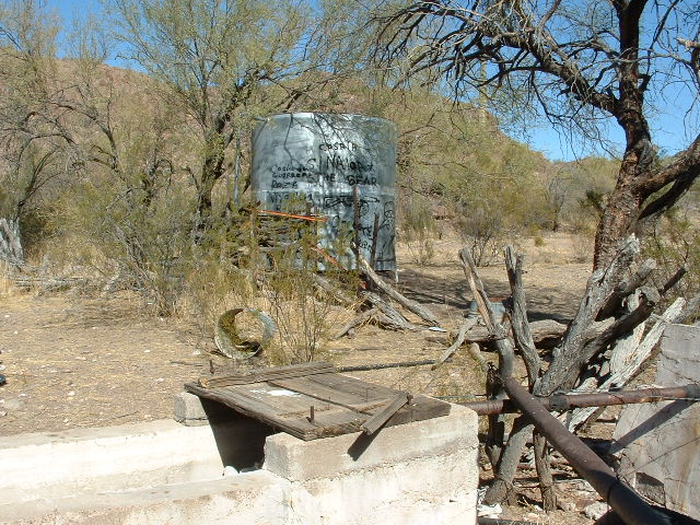
The old homestead
The old well, now dry.
Oh yes, and a shrine up on the hill across the wash from the well. Brian Rundle and I spent a while here years ago while climbing in the area and made a brief pilgrimage to the shrine – such an unusual thing to see out here. It was built to last, sitting on a massive concrete slab, and the shrine itself is made of concrete and rebar. This was probably an old homestead, but one long, hard drive to the nearest neighbor.
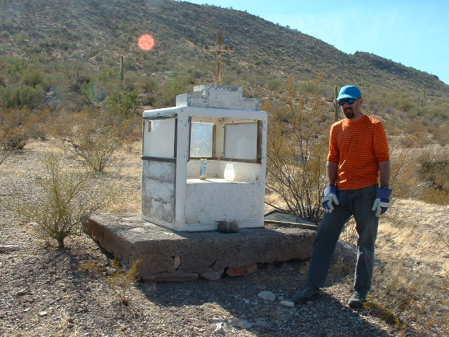
Brian at the shrine
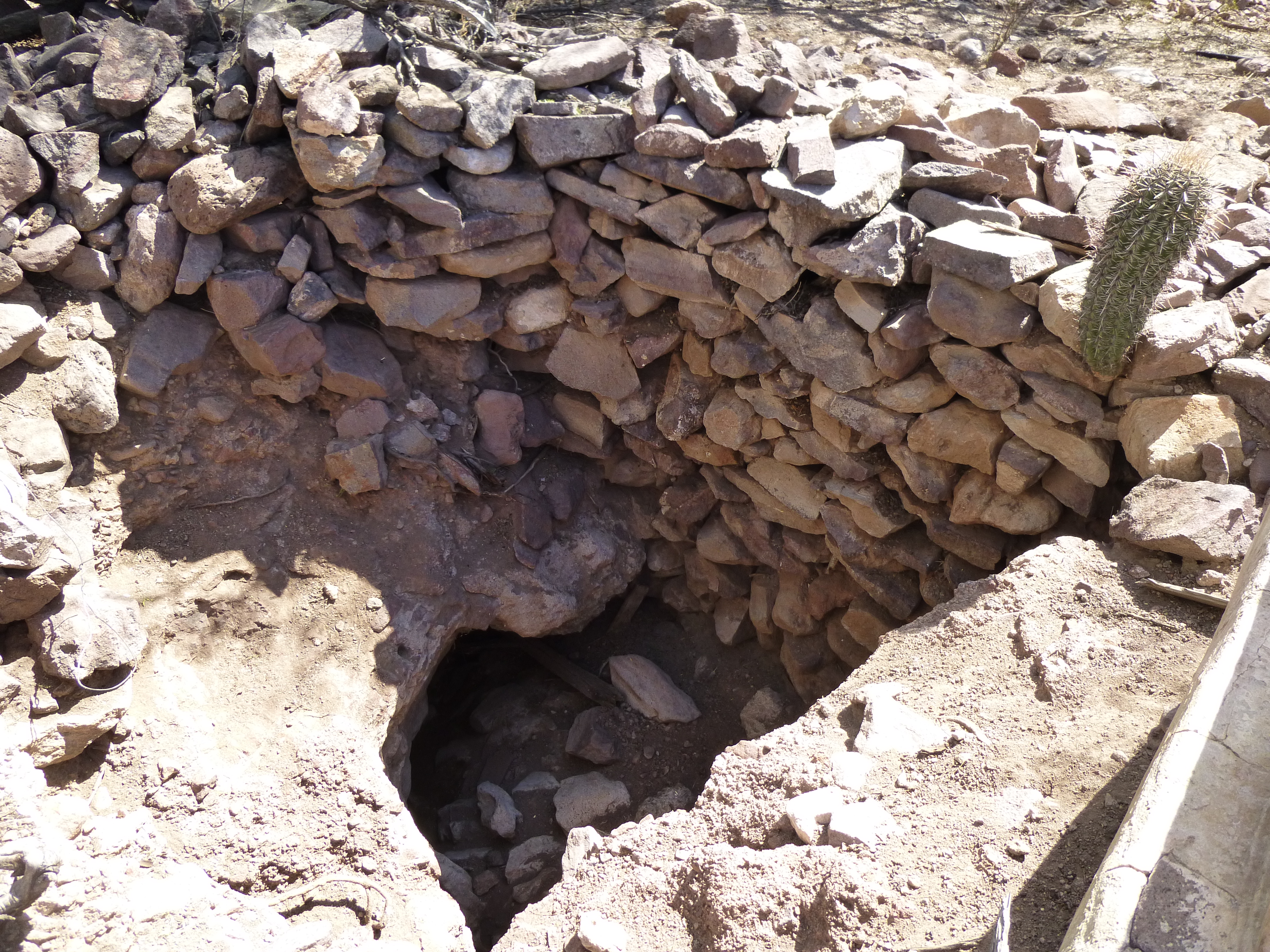
In this very localized area, there were other things of interest. For example, what was left of three structures, and I’m using the word loosely.
The crumbling wall
One of the locals hadn’t survived the summer.
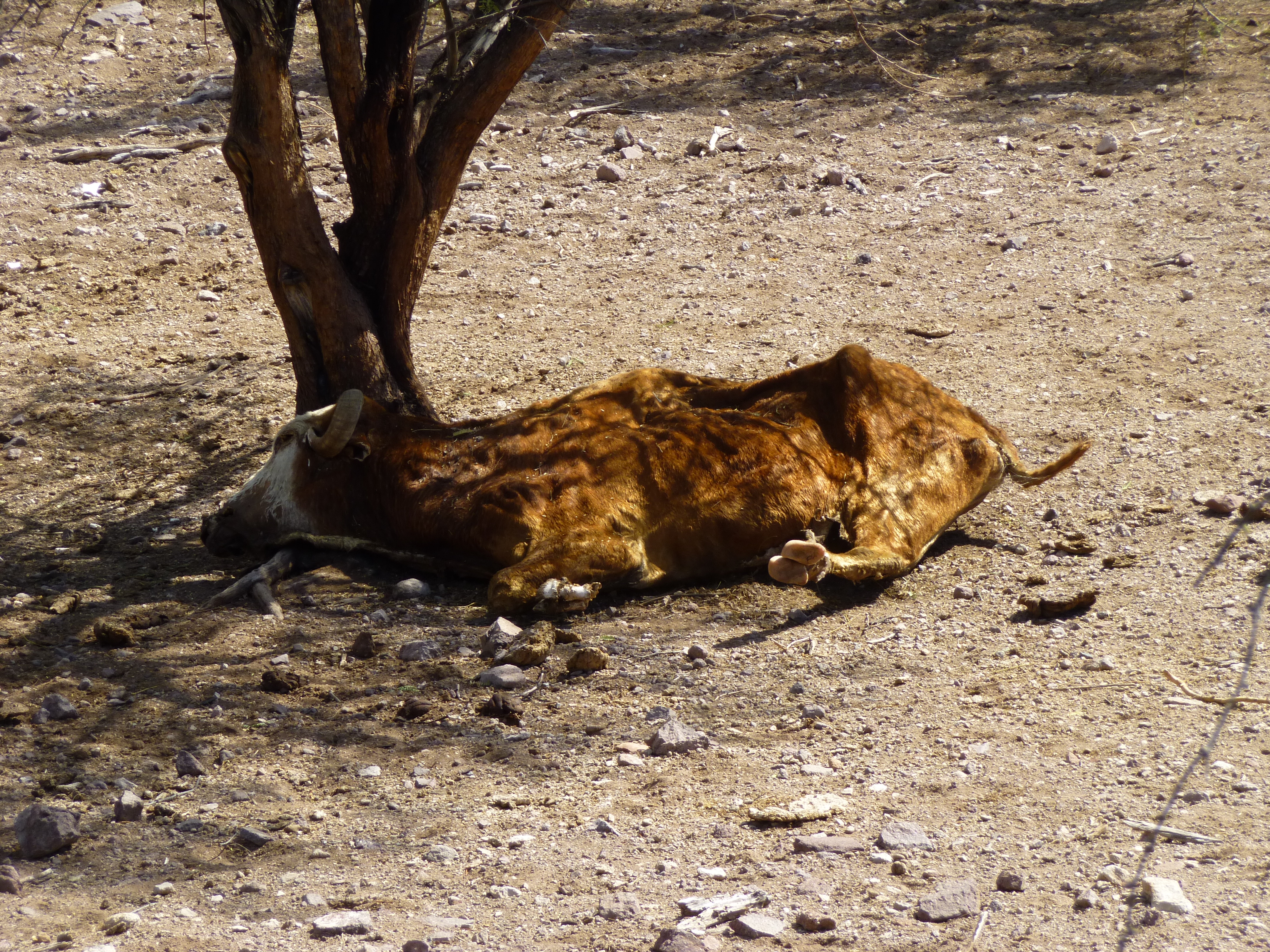
An ex-bovine
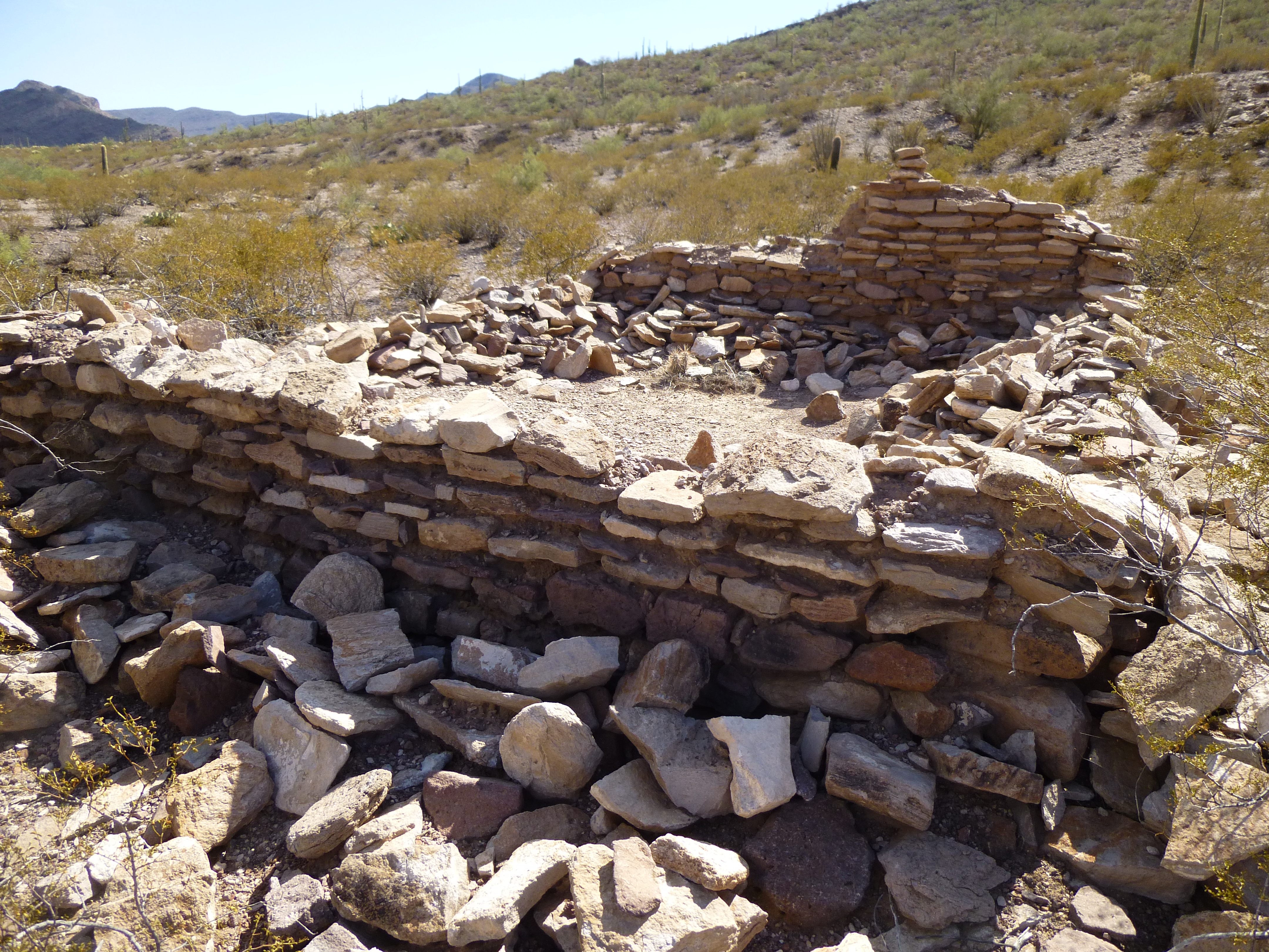
A mere kilometer downstream from the corral, an amazing bit of rockwork spans Sauceda Wash. If I had to guess, based on its size, I’d say it was built in the 1930s by the Civilian Conservation Corps, as they had a division which did projects on Indian reservations. It sits on the bedrock of the creek itself and is 140 feet in length. As with many such dams in the desert, it has completely filled in with sediment during its 80-odd years of existence.
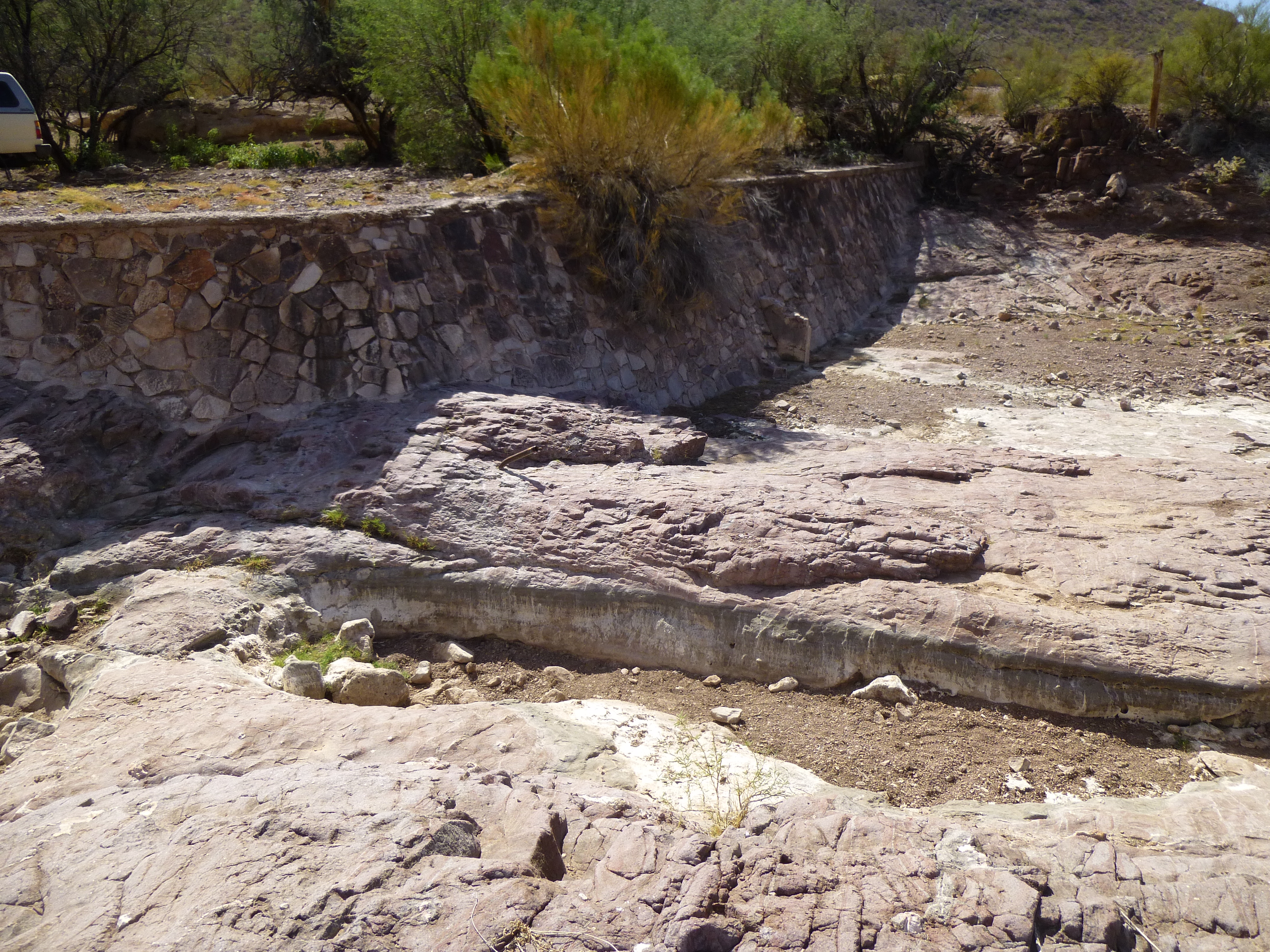
The beautiful rock dam.
Moving on, the wash is now less sinuous and predictable, but at mile 7, something unusual happens. The wash gets pinched as it squeezes between two opposing slopes, drops suddenly, twisting through a rocky defile. It was here on a lonely climbing trip years ago that I came upon a smashed pickup truck, wrapped around a tree while fleeing the law. These poor bastards tried to be prepared – they even had a bicycle in the back of their stolen truck.
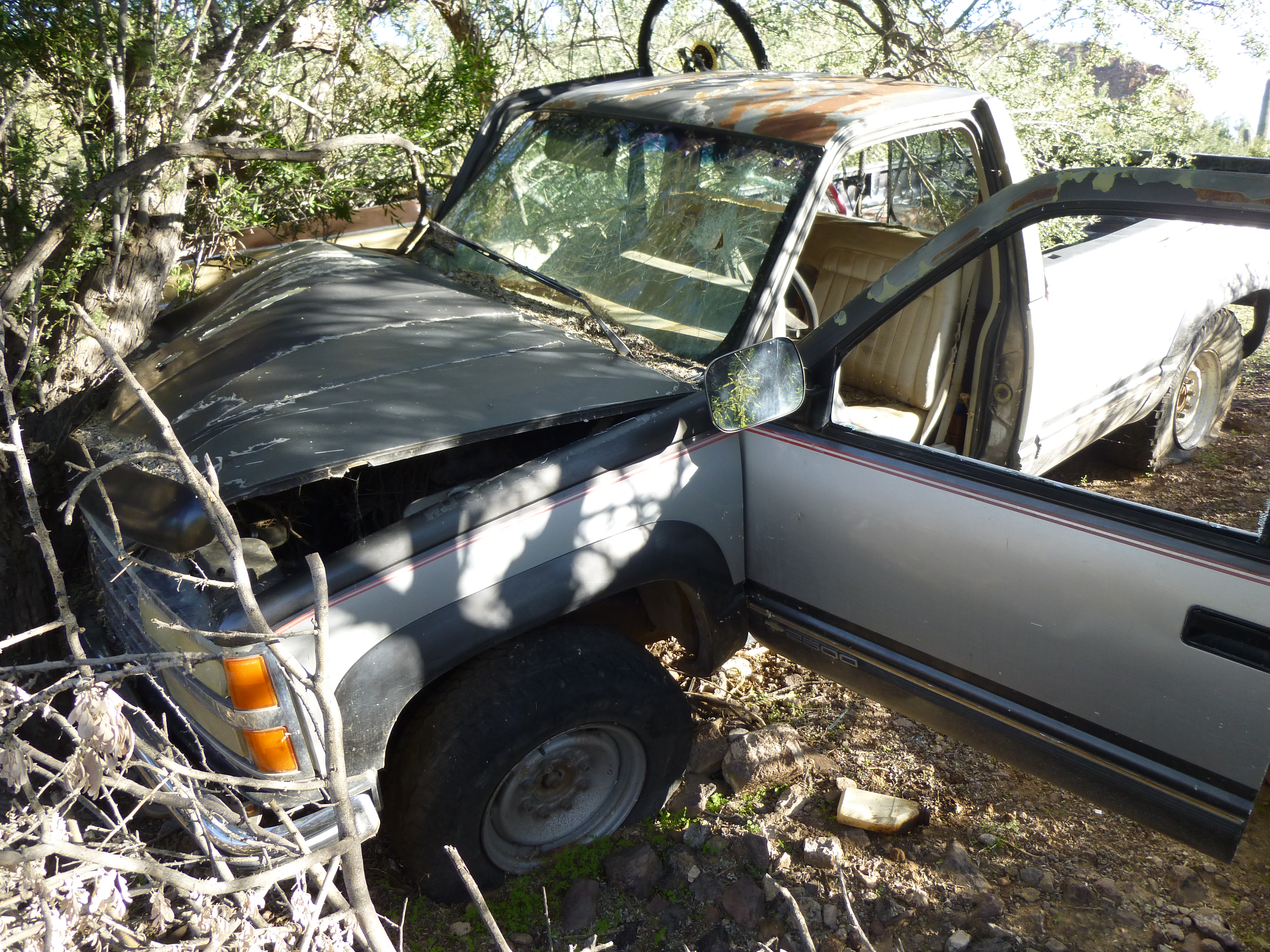
Poor old truck
Once past this throat, the wash widens out and its character changes for good. It broadens, becomes gentle and at mile 8.5 leaves the Indian reservation and enters the military bombing range I spoke of earlier.
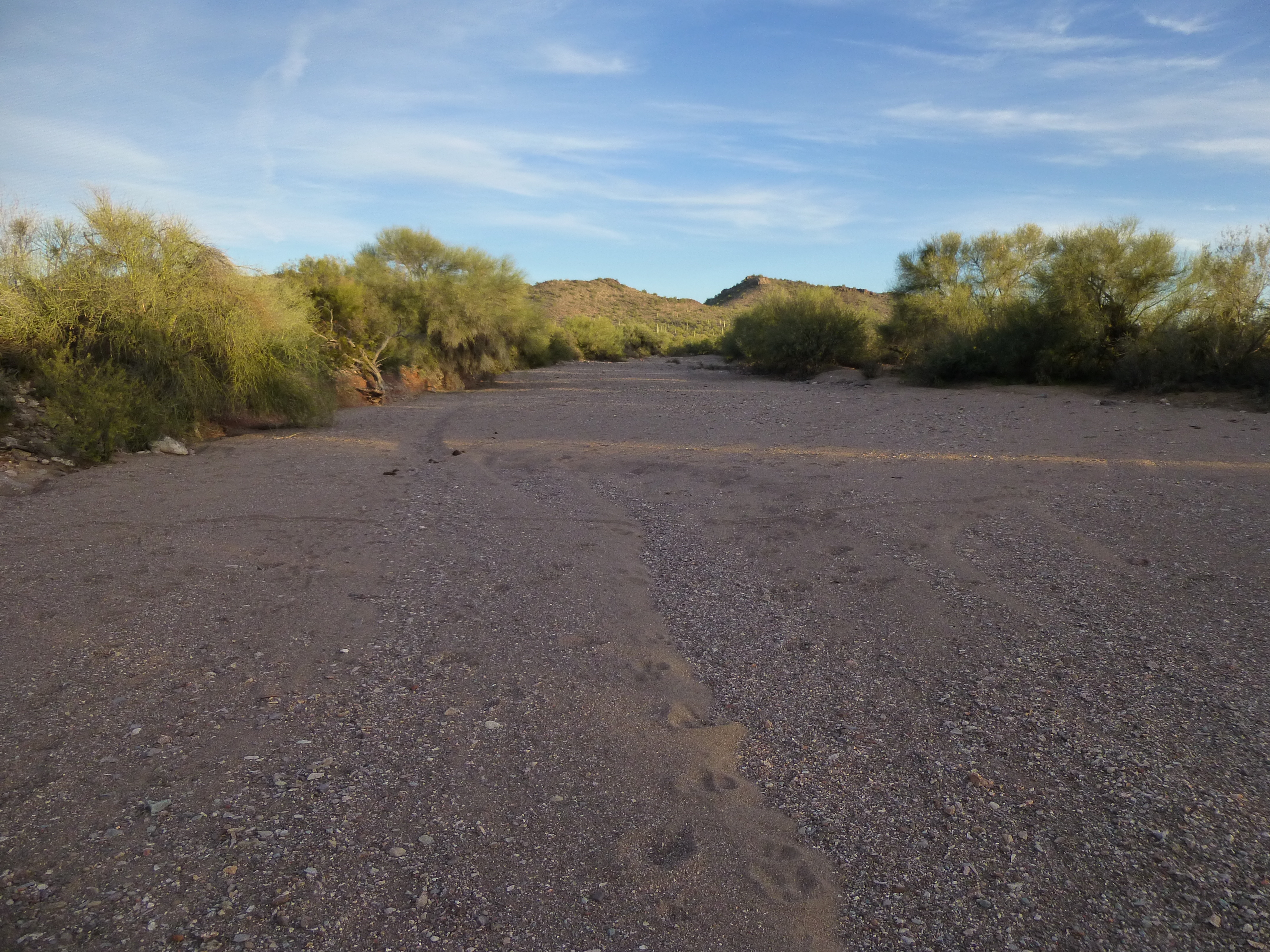
The broad sandy wash
Near that point, I found this bicycle, abandoned by some border-crosser in their futile attempt to use it to head north to the Promised Land.
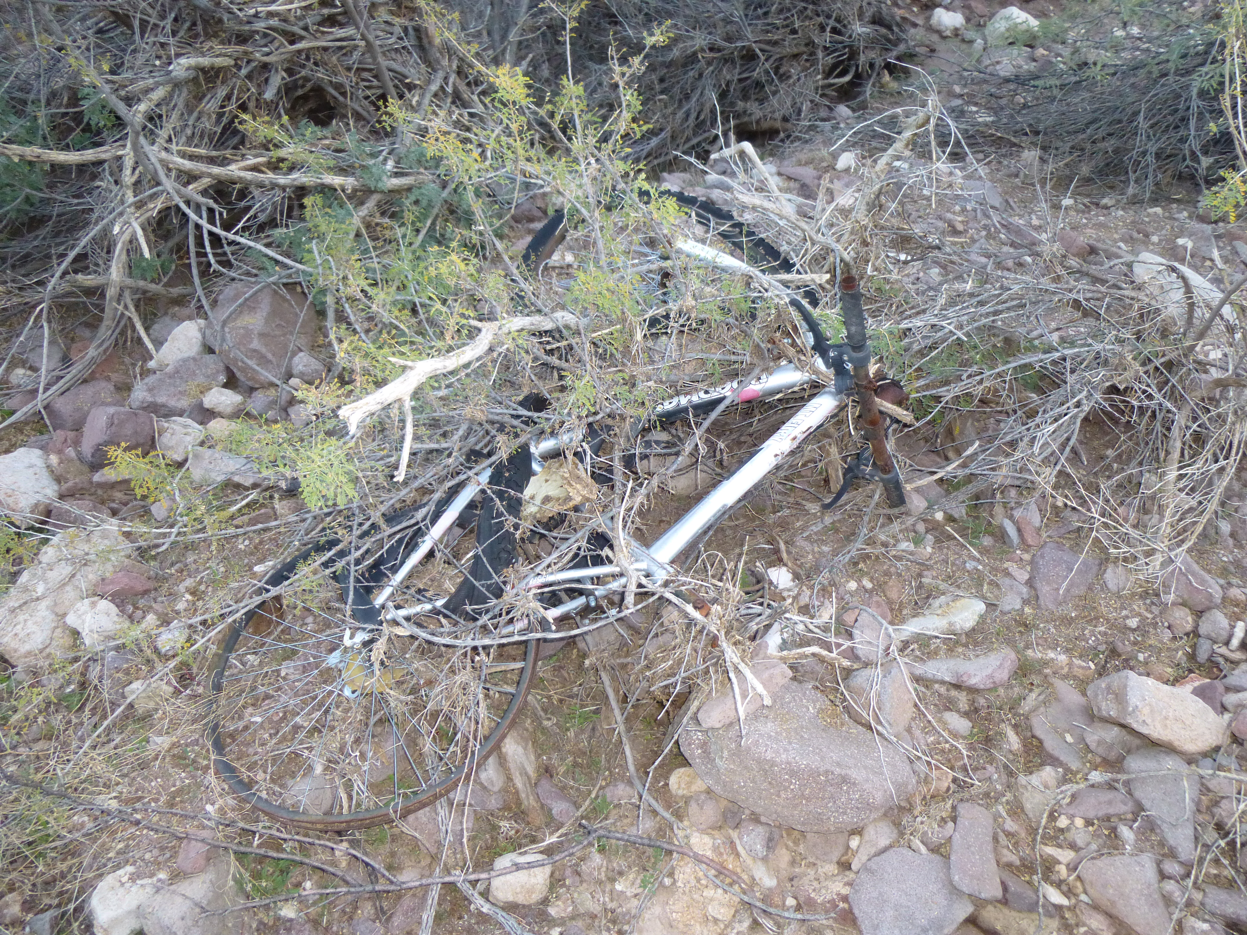
Not very usable
Remember that “meeting of the waters” I spoke of earlier in the piece? Well, we come to it once again, at the ten-mile mark. That’s ten miles along what is labeled “Sauceda Wash” on the topographic map, but 12.3 miles along its longer tributary. By now, once they meet, the wash is very wide and sandy. Check out the next photo. Sauceda Wash, wide and sandy, is approaching us just to the right of center near the top of the photo, and its even-longer tributary can be seen as a vegetated line coming in from the middle of the photo on the right side just above the shadow..
The meeting of the waters
From this point on, let’s use the higher mileage of the tributary, so we’ll start again from 12.3 miles. Our continuing journey takes us northwest, but a big change is about to take place. We pass between a small group of interesting peaks, namely 2525, 2490 and 2347, then spill out on to the flat desert. Not to say there aren’t any more mountains around – there are, but they’re off to one side, to the west. By 14.6 miles, that change has occurred and we are out on the open desert floor, very flat, at 1,825 feet elevation.
A major feature in these parts is the huge bulk of Quail Benchmark, off to the west. Climbers have only stood on its summit twice. A little farther on, at 19 miles, we’ve left Quail behind and have now entered an area criss-crossed with military roads. There are mock villages and mock aircraft out in this flat area, and the Air Force routinely bombs these for practice. Sauceda Wash must be worriedly looking over its shoulder as it passes through this part of the bombing range. This photo catches the flash of one of the bombs exploding.
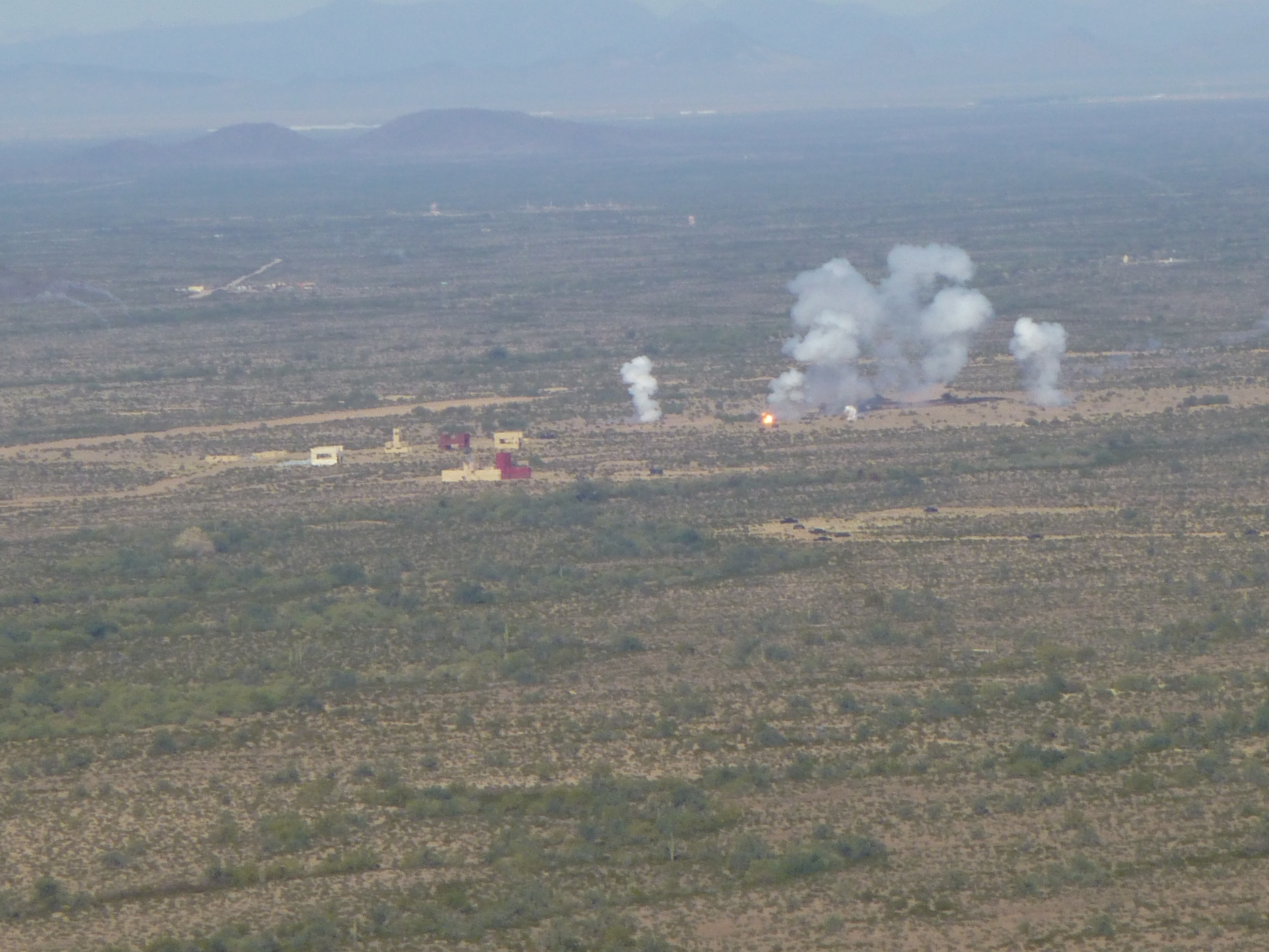
Bombing the fake village
The miles roll by, and the wash sashays back and forth. East of Black Butte, it is in places a 500-foot-wide bushwhack across its sandy bed.
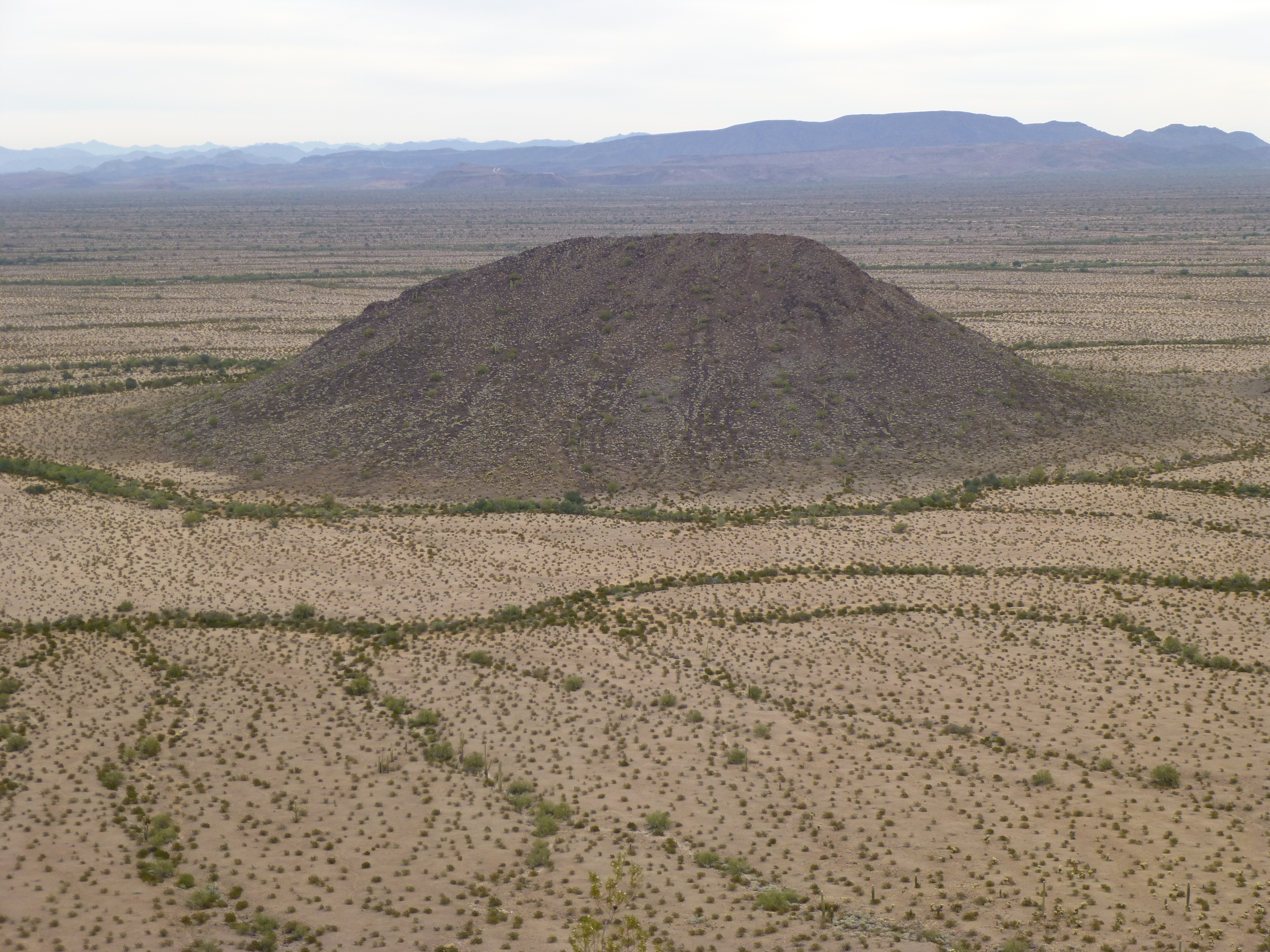
Black Butte
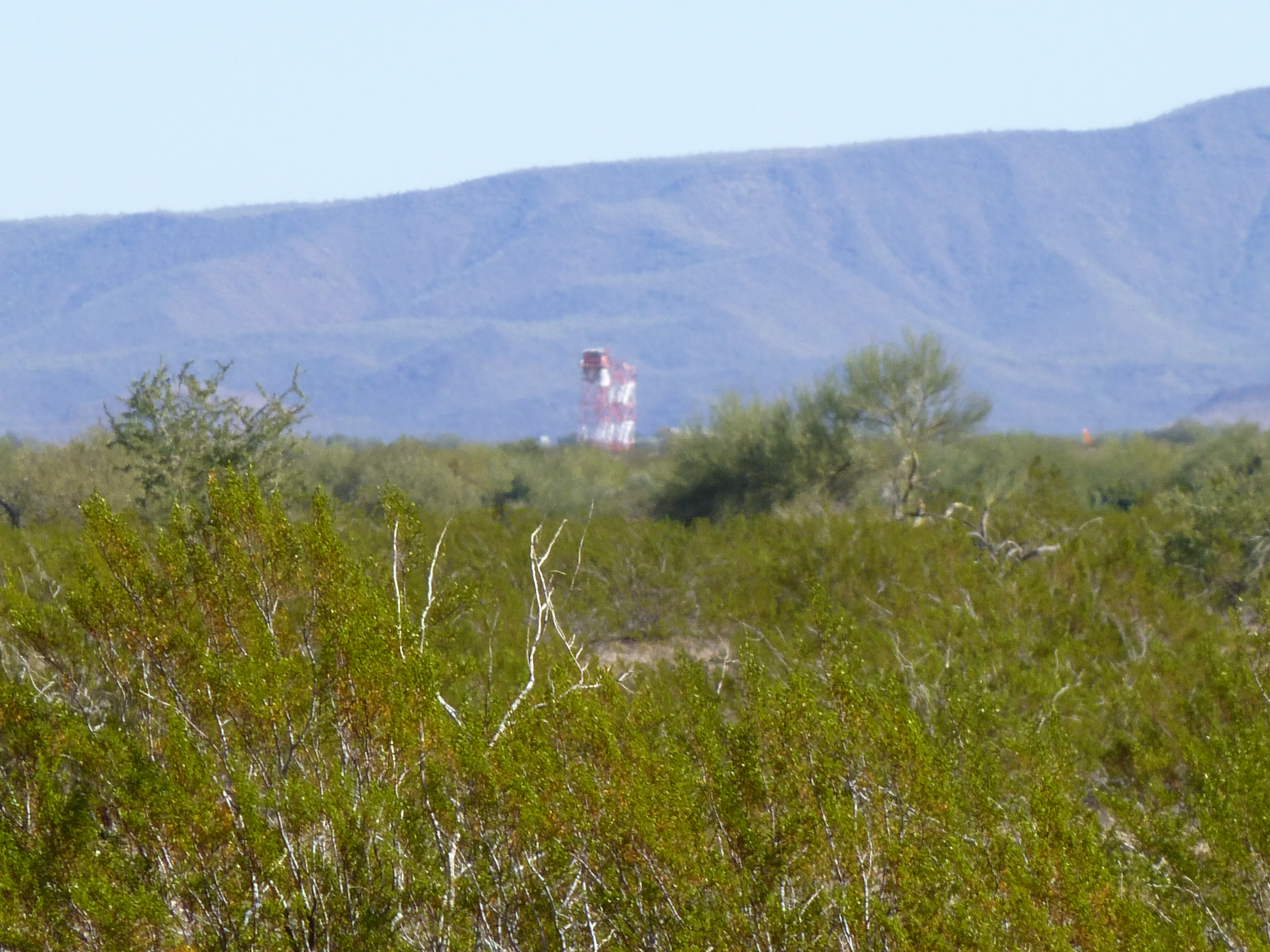
From Black Butte, here’s the view looking east over to Sauceda Wash, shown by the yellow arrow. It is one mile beyond the facility in the middle of the photo.
Looking east to Sauceda Wash
By this point, we have traveled 25.6 miles from the source. Many small washes are running across the desert out here on the bombing range, and they too are all heading northwest. Few washes in these parts have names, but one that does is Quilotosa Wash. It and its many tributaries drain much of the west side of the Sand Tank Mountains, a spectacular range which lies northeast of the Sauceda Mountains. Quilotosa is no slouch, broad and sandy like the Sauceda Wash, and approaches within 3,400 feet of Sauceda at one point (near the 28-mile mark), but the two never meet and never approach each other closer than that.
As we move on, the Sauceda passes by many more military roads, and observation towers dot the landscape.
One of many observation towers
This is Air Force country, plain and simple, and is their domain entirely. Regular folks aren’t allowed to go out there, ever. Near the 34-mile point, a forlorn grave keeps a lonely vigil, its occupant long-forgotten. More miles roll by, and then this amazing Sauceda Wash does something new – it enters civilization, and does so by crossing a railroad track and highway. We are now at an elevation of only 875 feet. The railroad doesn’t run any more (the Tucson, Cornelia and Gila Bend Railroad), but the highway is a going concern – Arizona State Highway 85 in these parts connects the towns of Ajo in the south and Gila Bend in the north. Vehicles roar by at 65 miles an hour, and completely ignore Sauceda Wash as they pass over it. That’s okay, its feelings aren’t hurt as it moves inexorably on towards the Pacific Ocean.
The old railroad bridge over Sauceda Wash
A mere hundred yards away sits the highway bridge.
The bridge over Arizona Highway 85
I’ve been telling you about the bombing range for quite a while now. It’s proper name is the Barry M. Goldwater Air Force Range (sometimes called the Luke Air Force Range, after Luke Air Force Base near Phoenix, Arizona). Once our wash crossed the highway, it swung to the north and passed within two miles of the Gila Bend Air Force Auxiliary Field. This is the place that regulates military movement out on the bombing range. Its one claim to fame in recent years was back in October of 2011 when Prince Harry spent a few months there. Already an accomplished pilot, Harry was there to receive training on how to fly the Apache helicopter. Here’s a view of the base – you can switch over to a satellite view to see it better – try clicking on the choices in the upper right corner, and zoom in using the +/- signs.
http://listsofjohn.com/qmap?lat=32.8841&lon=-112.7291&z=12&t=u&P=300&M=Desert+Mountaineer
Okay, let’s leave the highway and head north. Not much to report here – flat, boring ground for a bit more, when, at mile 44.6, we leave the bombing range once and for all. A simple wire fence marks the boundary, but that doesn’t stop our wash. There’s an old gravel pit near the fence, and a dirt track follows the wash as we head farther north. We don’t go far, though, before we arrive at another sign of civilization – something called the Gila Bend Canal cuts across our path. It is filled with water, a concrete-lined ditch to bring water to the thirsty cultivated fields of the Gila River Valley.
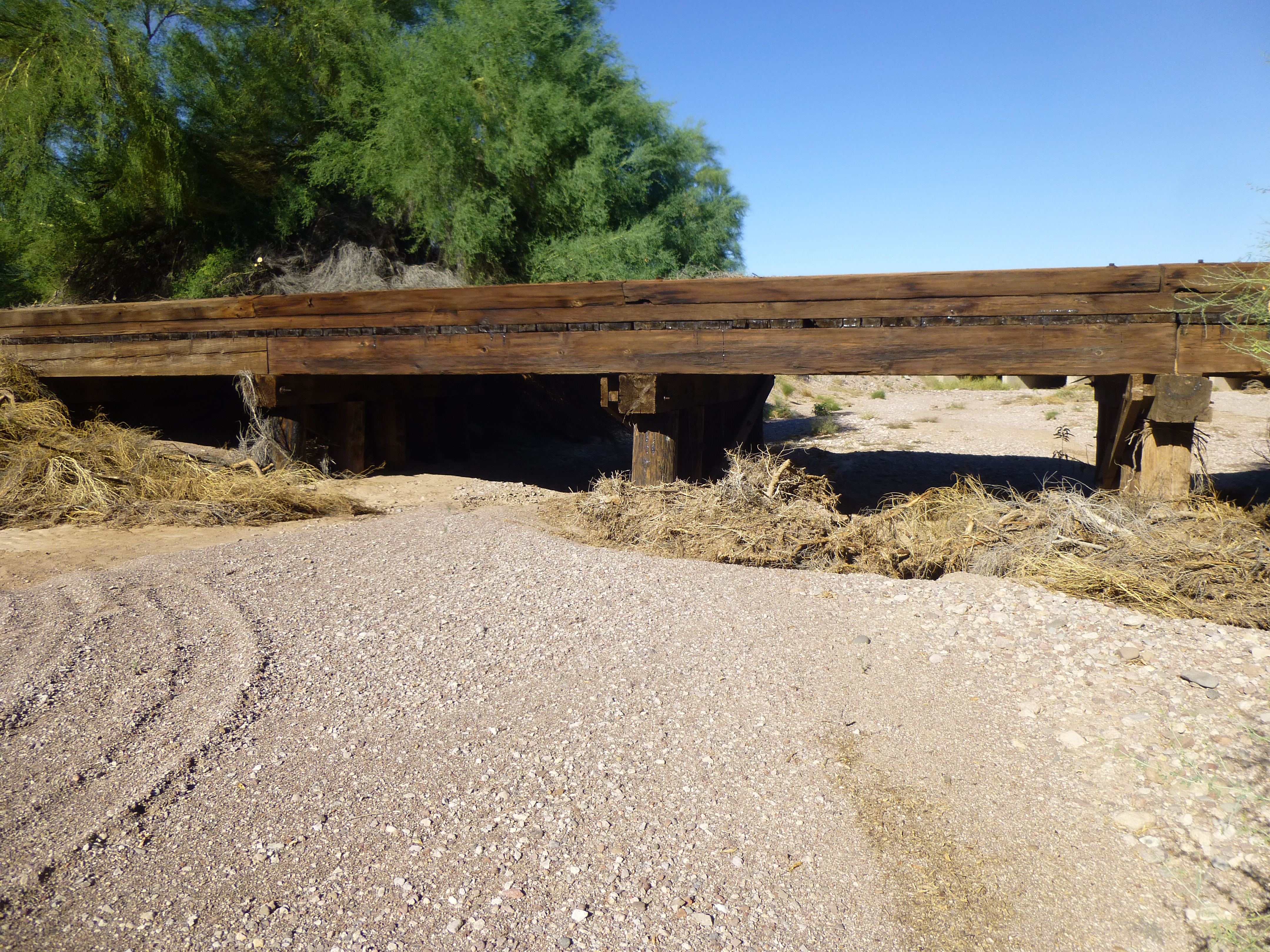
For the next half a mile, the wash travels through narrow banks in farmers’ fields, then beneath a trestle carrying trains of the Southern Pacific Railroad.
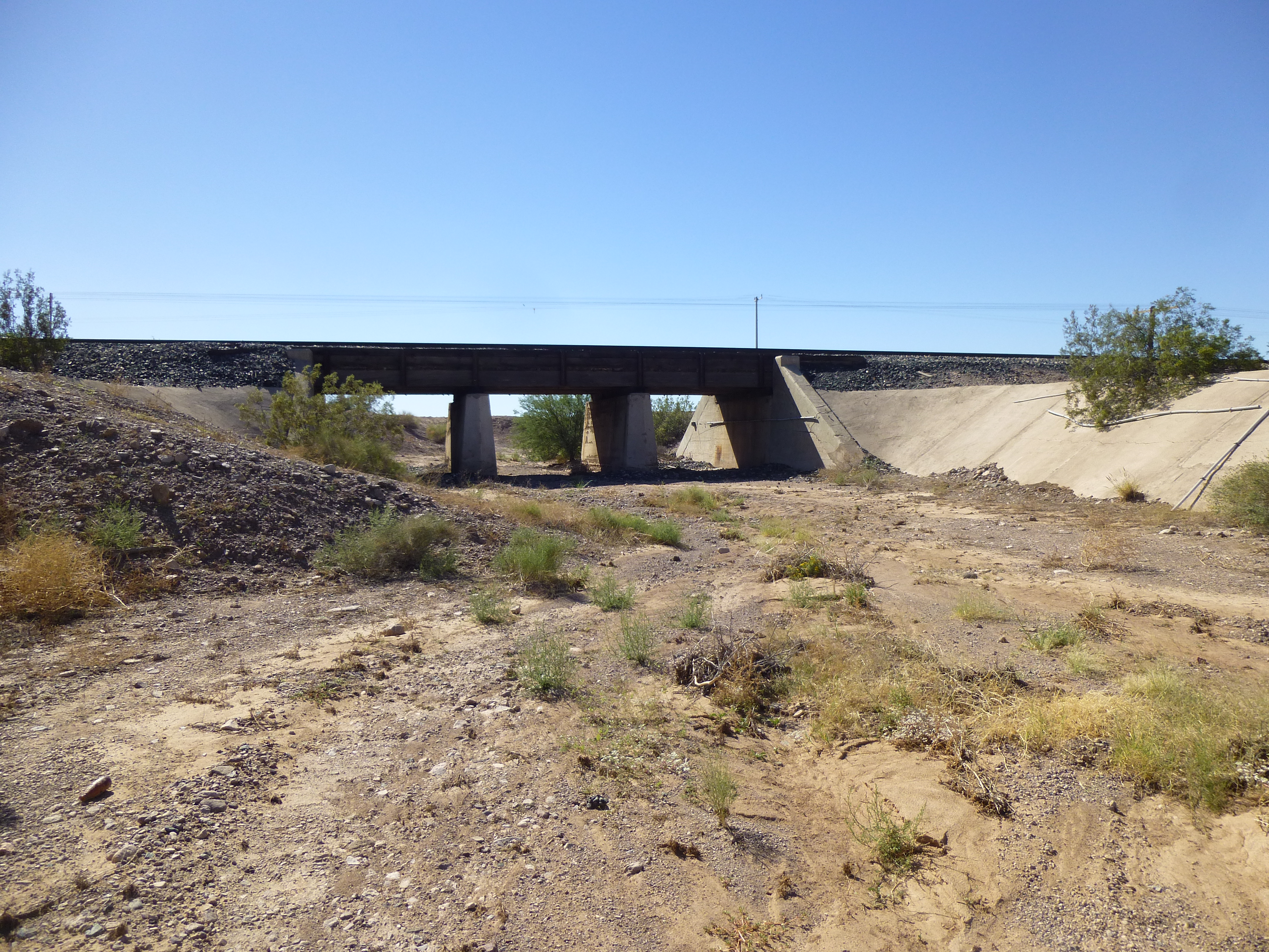
The bridge carrying the main line of the Southern Pacific Railroad
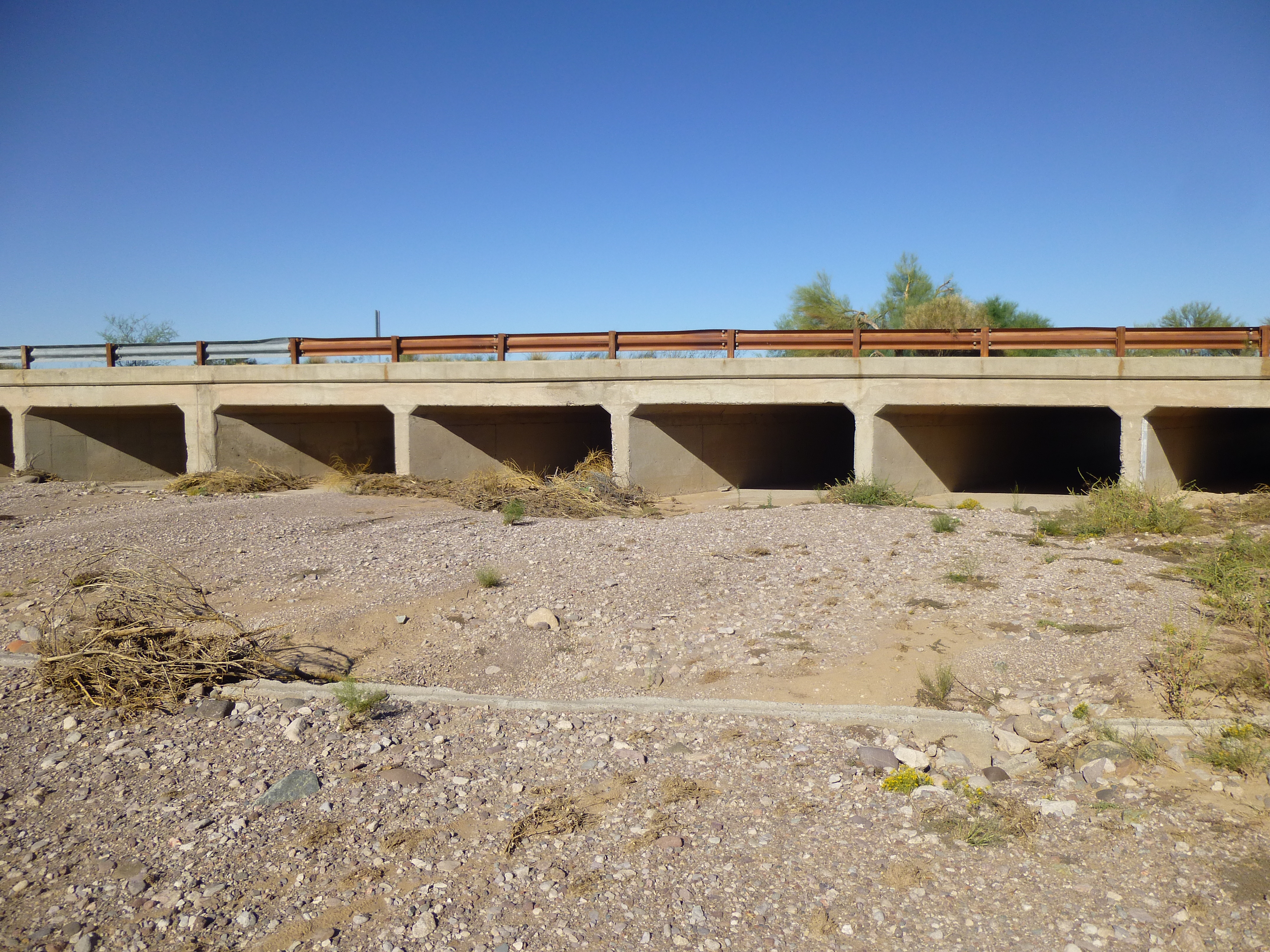
Another 500 feet takes it under a paved frontage road, then under all the lanes in both directions of Interstate 8. Wow, this is quite a change from the raw desert we enjoyed all these many miles.
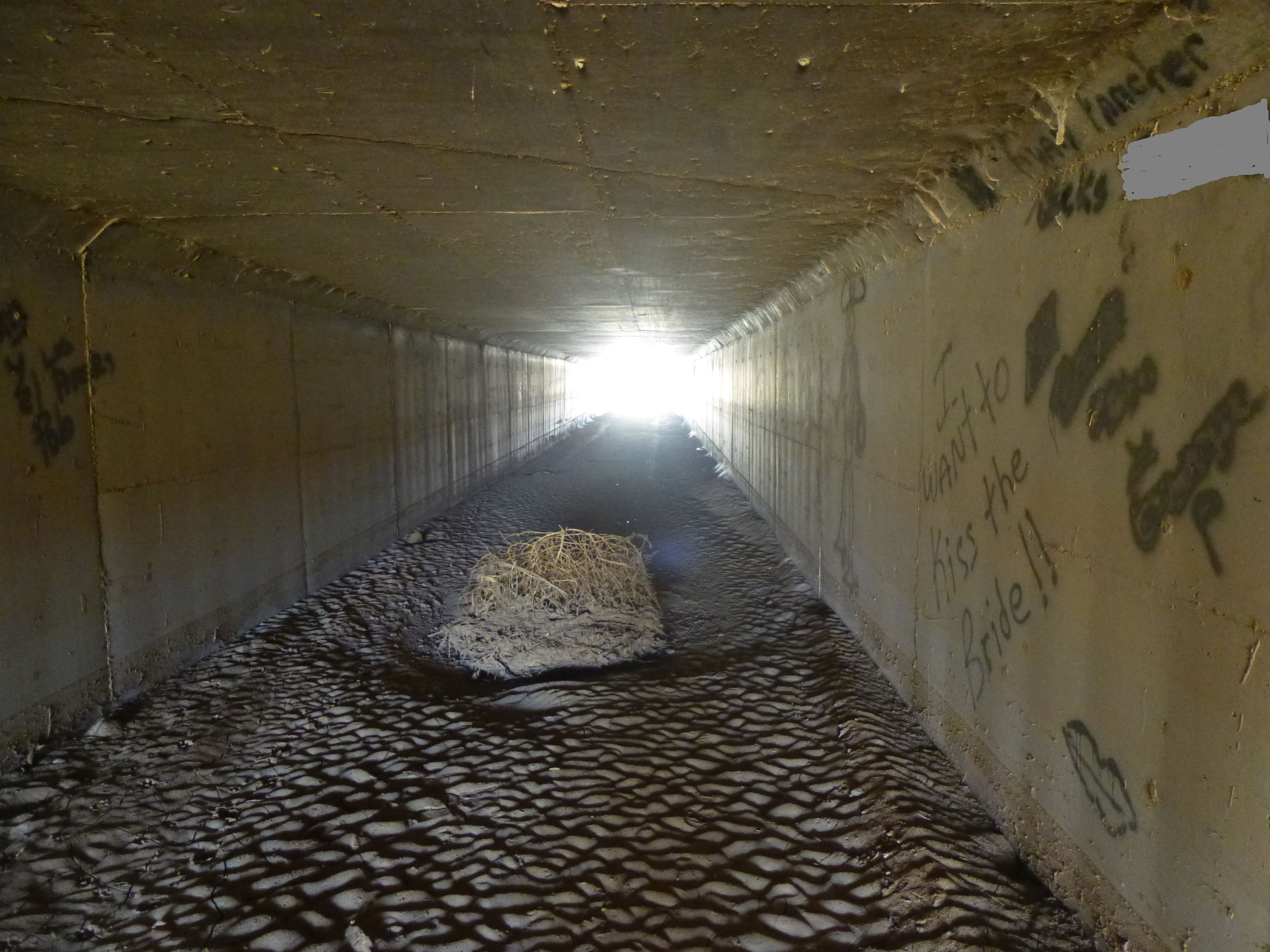
The tunnel beneath the full width of both lanes of I-8
At this point, the wash has been tamed – it continues north from the freeway, running straight as an arrow for 1.5 miles through manicured banks past more cultivated fields. After that, it meanders through open desert for 1.1 miles to arrive at Watermelon Road, where there is a big dip. A lot of concrete keeps the erosion of the road to a minimum. Here’s that spot, and we’re looking north, downstream.
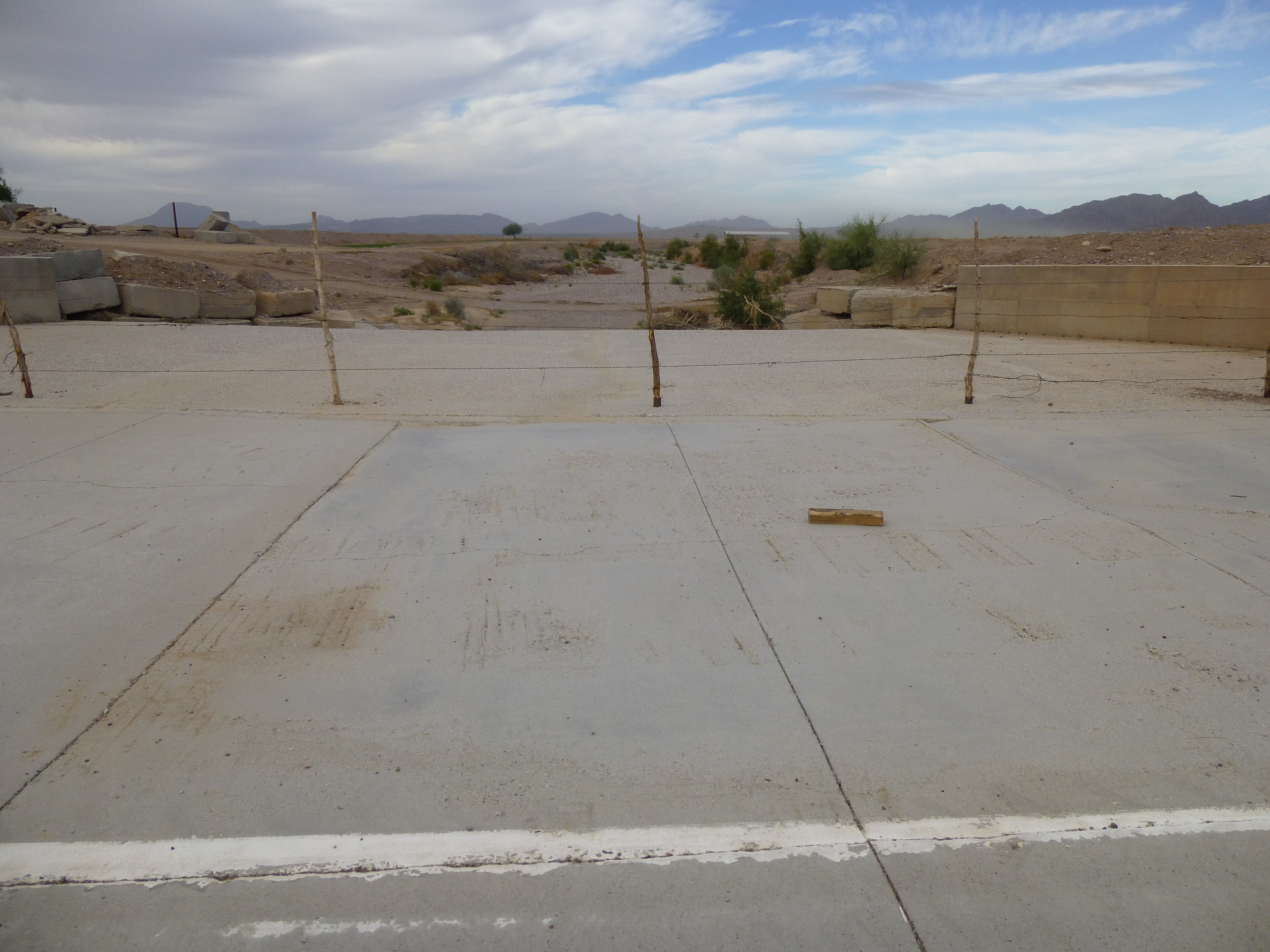
Sauceda Wash as it crosses Watermelon Road
Once again, irrigated fields flank the wash for another 1.7 miles. Beyond that, the wash reverts to a more natural form again, overgrown with brush and weeds. All that vegetation shows that, from time to time, water does flow here.
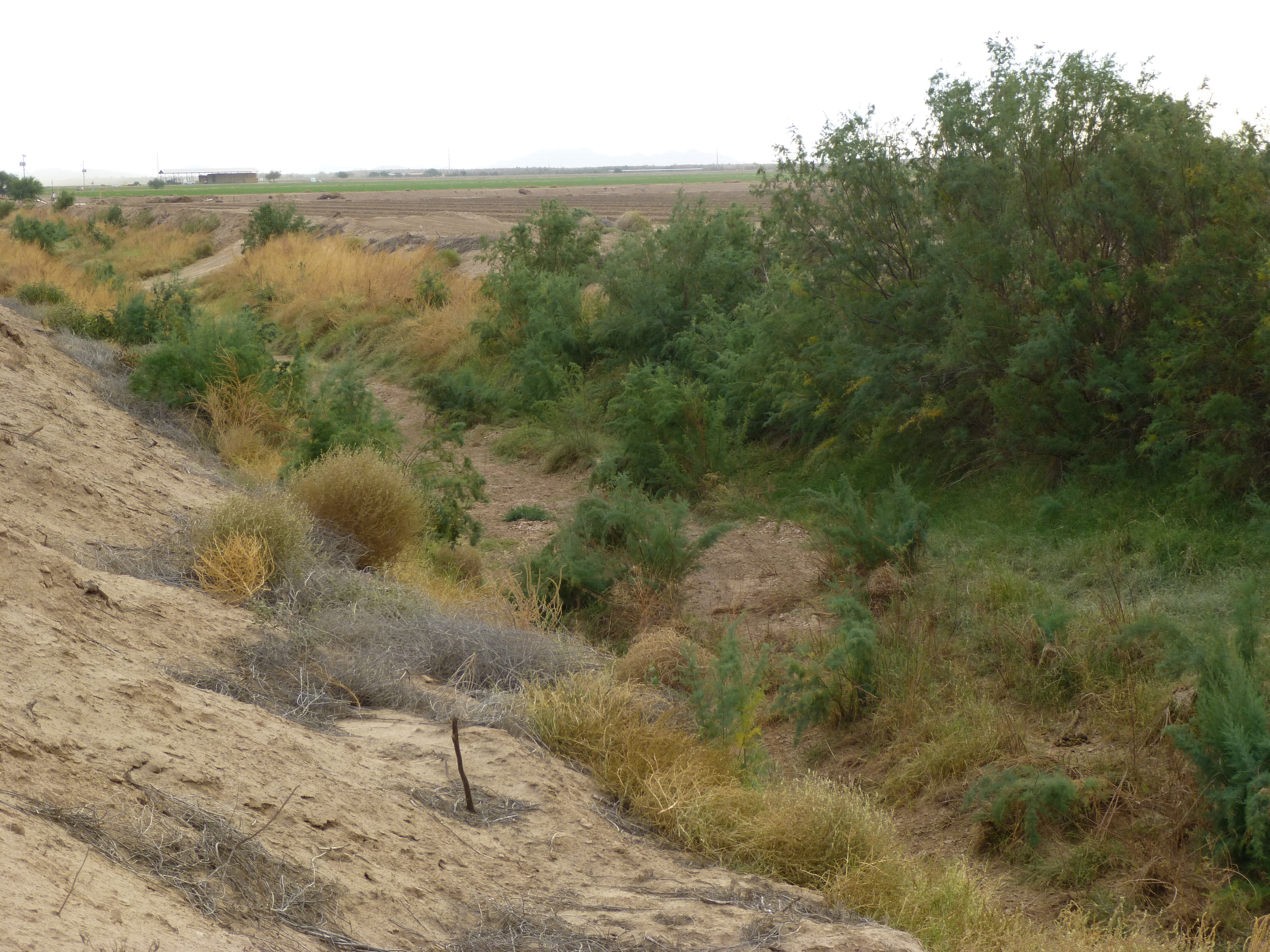
The last bit of Sauceda Wash
Finally, our journey ends. Sauceda Wash empties into the Gila River at an elevation of 620 feet above sea level after its journey of 50.9 miles. Here’s what that looks like.
The dry bed of the Gila River
The bed of the river is almost always dry, a huge overgrown tangle of vegetation. You’d never know that a river might flow there sometimes, but there’s plenty of water underground, which local farmers pump to irrigate their crops.
I hope you’ve enjoyed our journey down Sauceda Wash – I certainly have, and may research and publish more pieces like this one.