
It felt good to be a thousand miles from home, especially because it was the end of June. At that time of year, it was guaranteed to be well over 100 degrees in my desert home of Tucson, Arizona, so I was glad to be driving on cool mountain roads in central Oregon. Everything here was new to me, so it was all one big adventure. Today, I’d park at a trail head for something called Black Crater. I’d picked up a Forest Service map which had guided me to this parking spot at 5,040 feet elevation just off the highway.
What a day – pleasantly warm, a perfect blue sky. Wearing just shorts, T-shirt and sneakers, and carrying a tiny day pack, I set out on the well-groomed trail. It did feel a bit weird being on a trail at all, though, as I never had any on my climbs in the desert back home – it felt almost like cheating. The forest was nice and open, almost park-like, and I soon gained a thousand feet as I climbed up the north slope while Alvin Lee and his amazing guitar kept me company on my earphones with “50,000 Miles Beneath My Brain”. A few switchbacks near the top brought me to a more open area, and a bit of scrambling near the summit finished it all off. There I was on the top of Black Crater, elevation 7,251 feet. The views were terrific, especially to the south. I had designs on the Sisters, only 7 air miles to the nearest one, and I spent a while soaking it all up, then headed back down and drove to a quiet campground for the night.
The next morning, I parked at the Frog Camp trailhead (4,750′) at the start of another perfect day. Oregon must have made some good trails because here I was on another one, walking through the forest. My backpack wasn’t too heavy, as I was only carrying the minimum of gear to do a bivy – just the least I could get away with for a night out. No tent, just a bivi bag and a light down sleeping bag, plus an ice axe and crampons. The trail climbed up to 5,800 feet, then crossed a lava flow.
Looking ENE to the North Sister
Farther on, at around 6,200 feet, I had this view southeast to the Middle Sister from the Obsidian Cliffs.
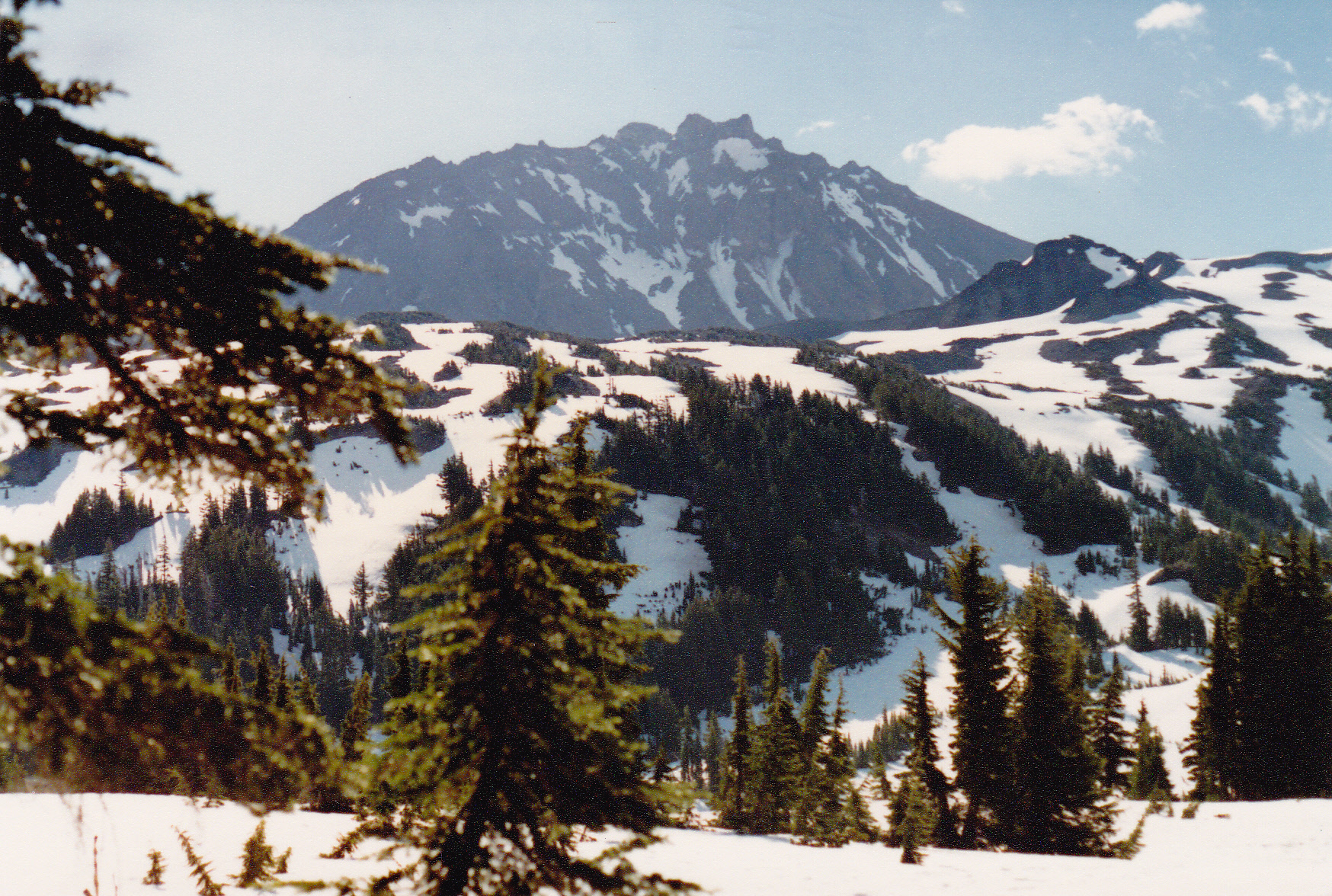
A bit later, near Obsidian Falls at 6,600 feet, I left the forest behind and entered truly alpine country. Now it was all open land, and I had a clear view up to the peak. I was walking on snow, and made good time. Another thousand feet higher, I started up the Collier Glacier, but there was no obvious transition, as it was covered with snow. I didn’t see any crevasses that couldn’t be easily avoided.
The west side of the North Sister
At around 8,900 feet, I reached the low saddle between North and Middle Sisters. Now the real climbing would begin – the last 4,150 vertical feet I’d just done were only a warm-up.
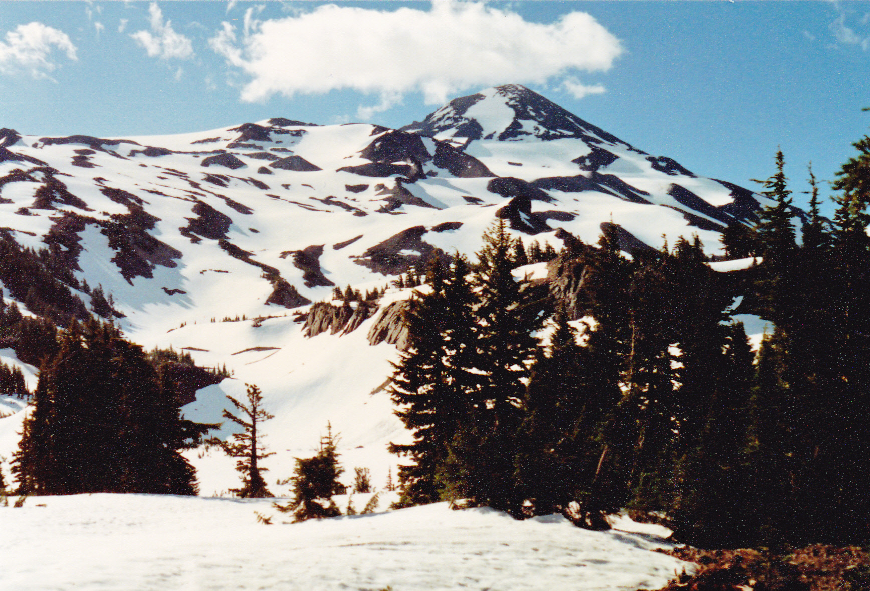
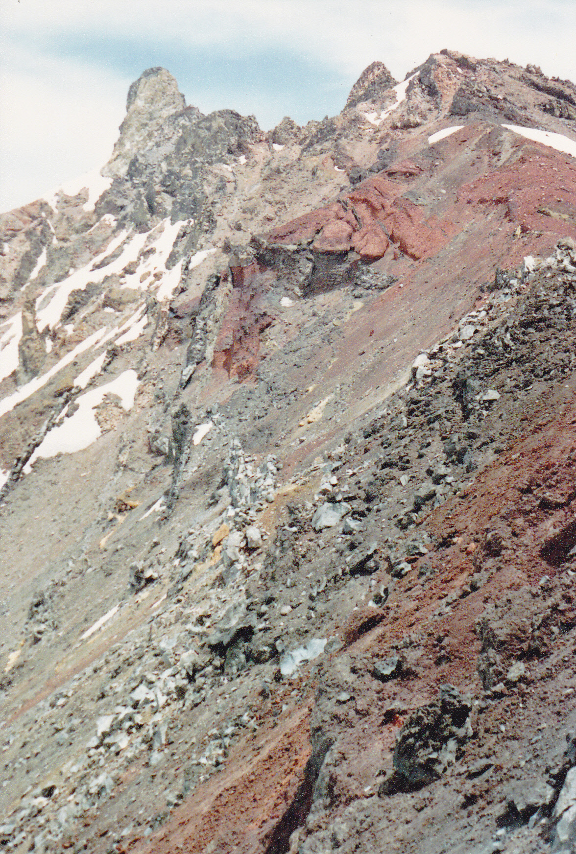
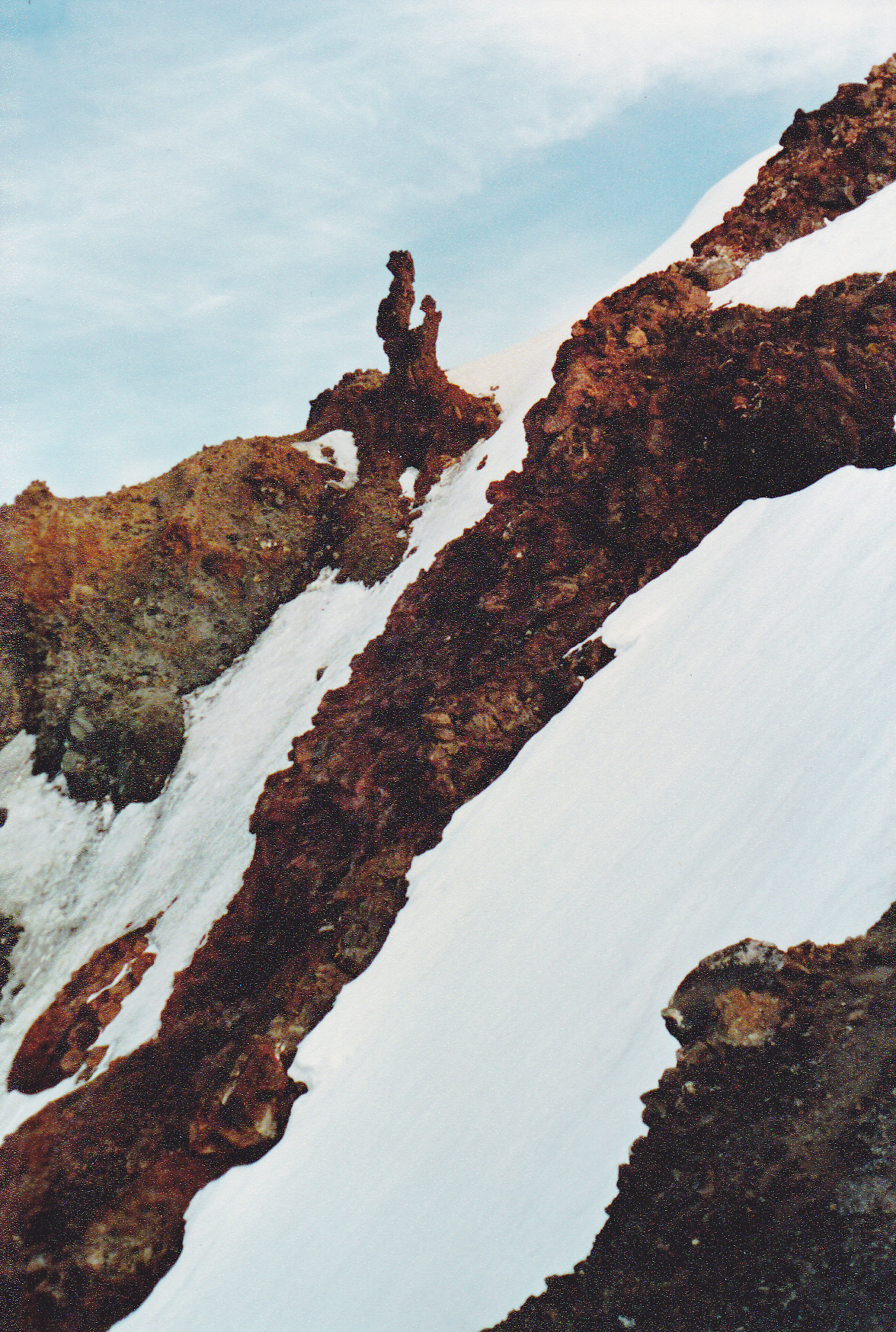
My goal was to climb all three of the Sisters – North, Middle and South, in that order. I’d spend the night as far as I got, then finish up the next day. I’d heard rumors that the North Sister might put up an argument, so I was a bit wary. The North Sister is the most rugged of the three – it’s also the oldest and least-climbed. It’s a huge pile of rotten, loose volcanic rock which involves steep climbing on very exposed terrain. Here’s a view of the entire west ridge from closer and higher.
A good view of the entire south ridge of the North Sister
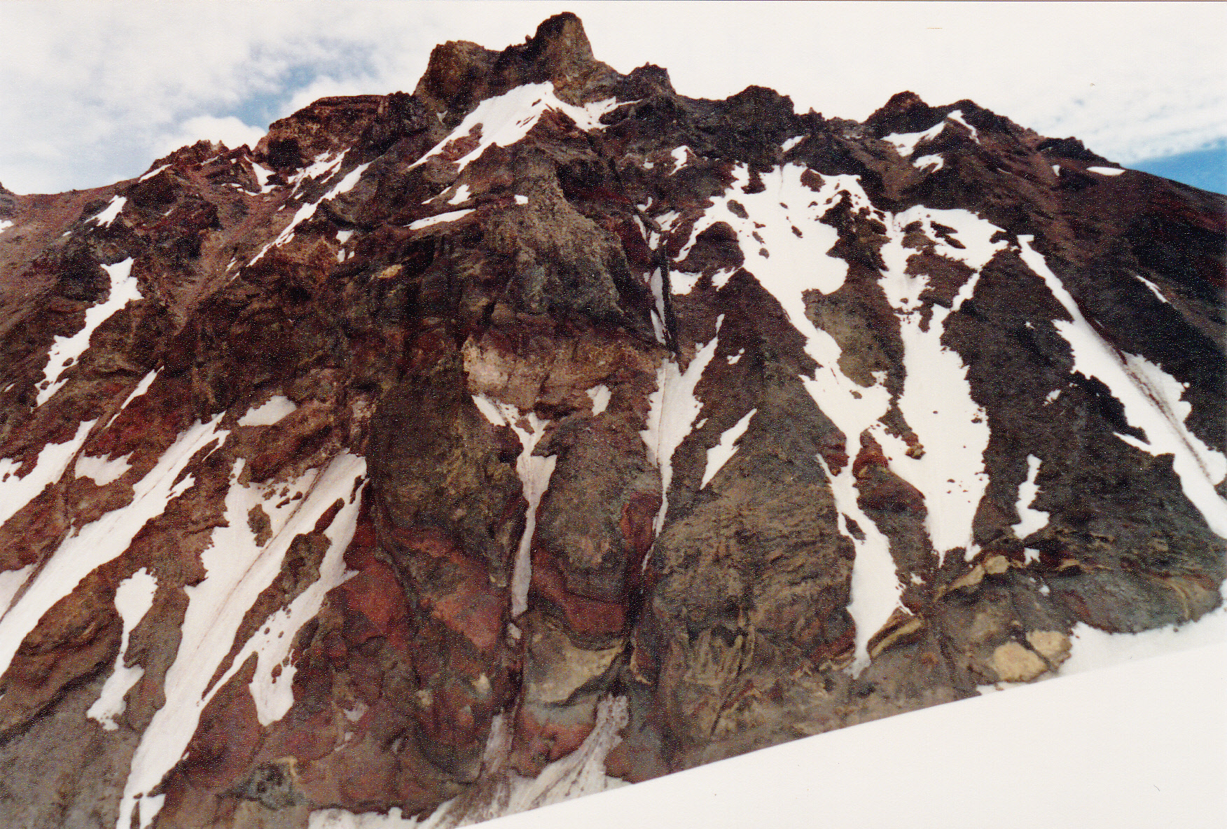
Once I started up the ridge itself, I had this better view. The actual summit is the rocky tower on the far left.
The summit is the far left tower on the skyline.
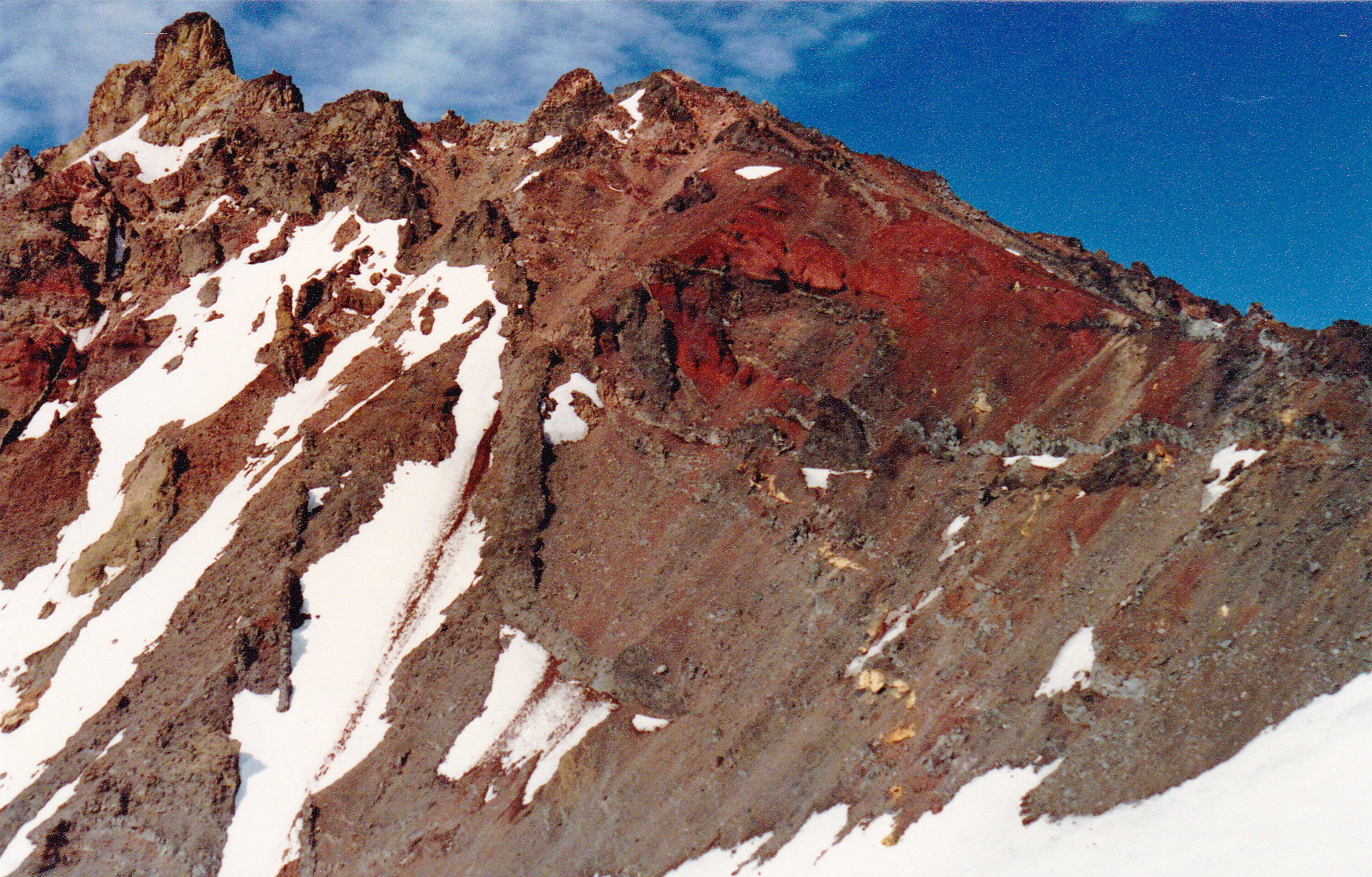
I wasn’t the only climber on the route this day – I met some of the others. They told me that these 3 lengths of fixed rope were put in place by the Mazamas.
There are some pinnacles along the way. To pass the first one, you need to do a traverse along a narrow, loose, crumbly rock ledge into a gully aptly named “The Bowling Alley” due to rockfall hazard. It is steep (as much as 70-80 degrees in places), loose Class 4 crap with breath-taking exposure. Here’s a picture I took at the top of the Bowling Alley. When I reached this spot, other climbers were going slower than I, so I went up a different way. Let me explain. I took this photo on my way down, not on the way up. See the 2 climbers in the photo – one in blue, one in white? I came up on ice to the right of the guy in white, a route not very visible here. It was steep and scary, all in an effort to pass other, slower climbers. I didn’t descend the same way I went up, as I didn’t relish the idea of risking a fall on the steep ice. Instead, I went down the way these climbers are coming up.
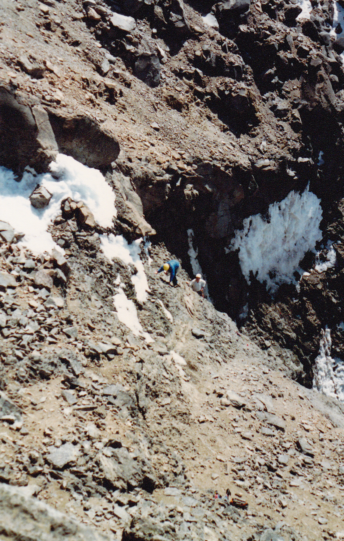
People have fallen to their deaths here. There was ice on the rock in places, so I was being oh-so-careful. My adrenaline was really pumping. As I was climbing up this dangerous rock, I kept thinking how I didn’t want to descend this same way, but there was no alternative – I was committed. Once at the top of The Bowling Alley, I was pretty much done – all the hard part was over. Only one last obstacle to surmount, the summit pyramid itself – see the 3 climbers?
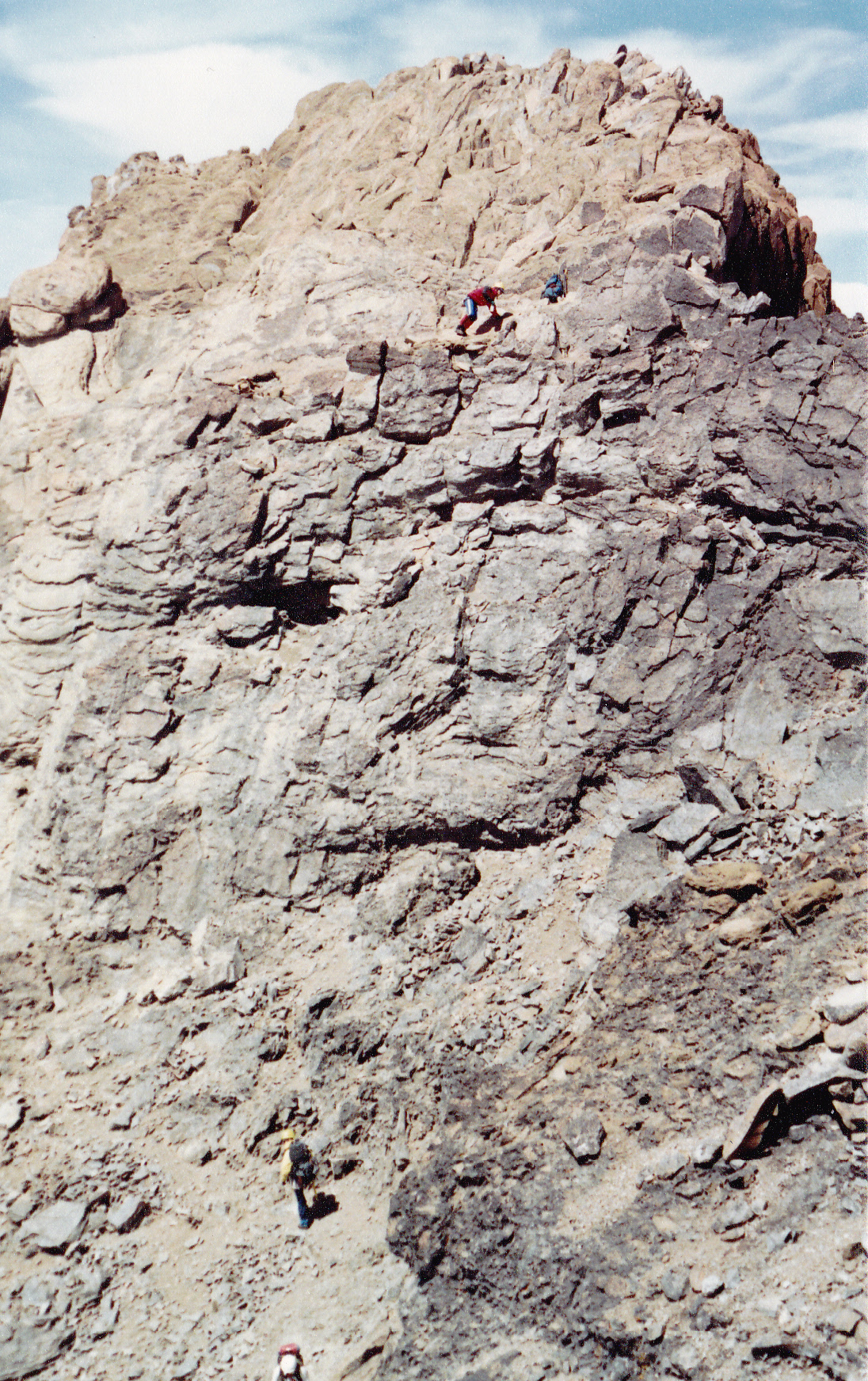
The summit block of the North Sister
Once up that, I stood on the summit. The North Sister stands 10,085 feet. Whew, what a rush! Needless to say, I had great views over a large area. The day was wearing on, though, so it was time to start down.
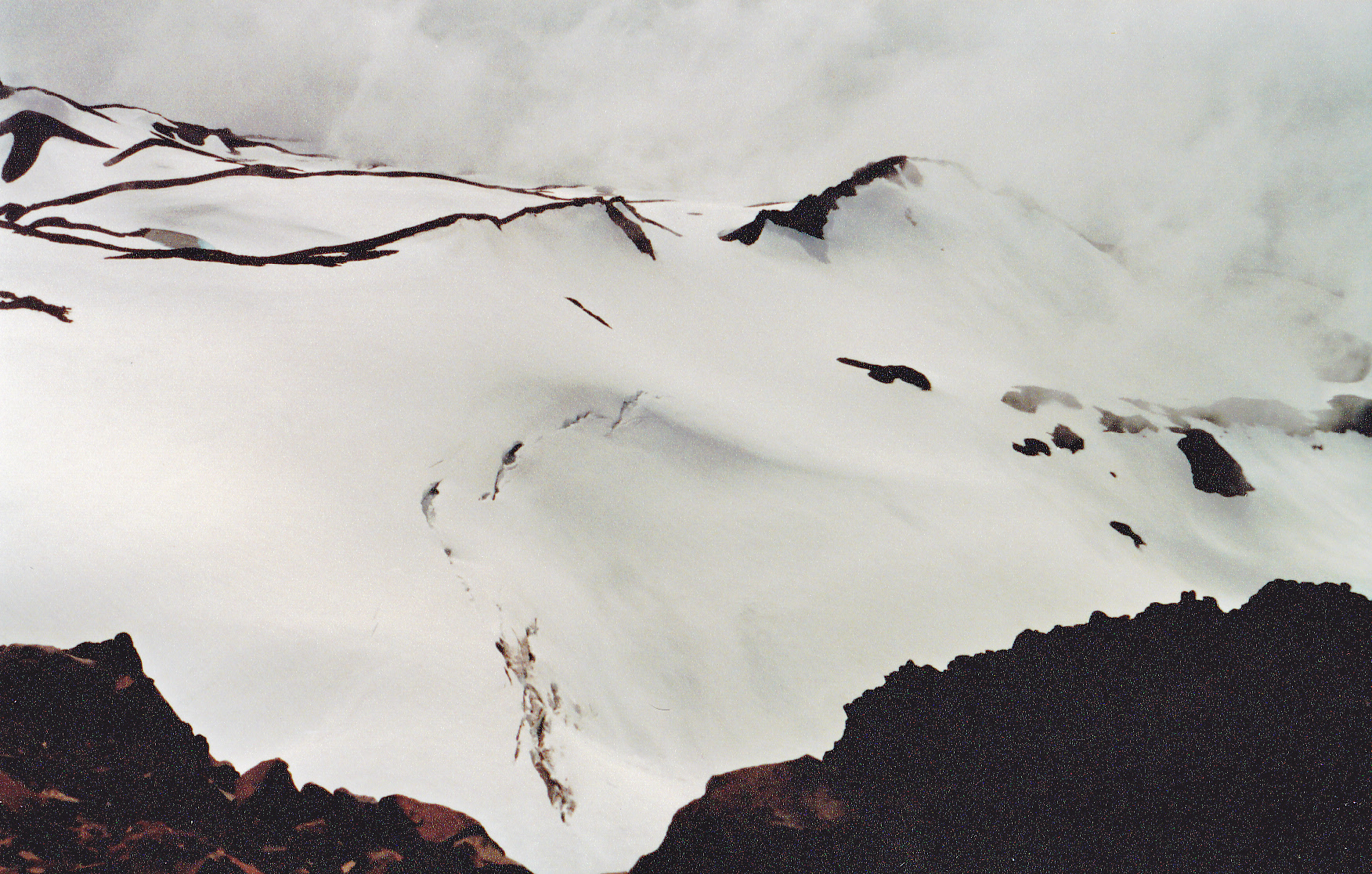
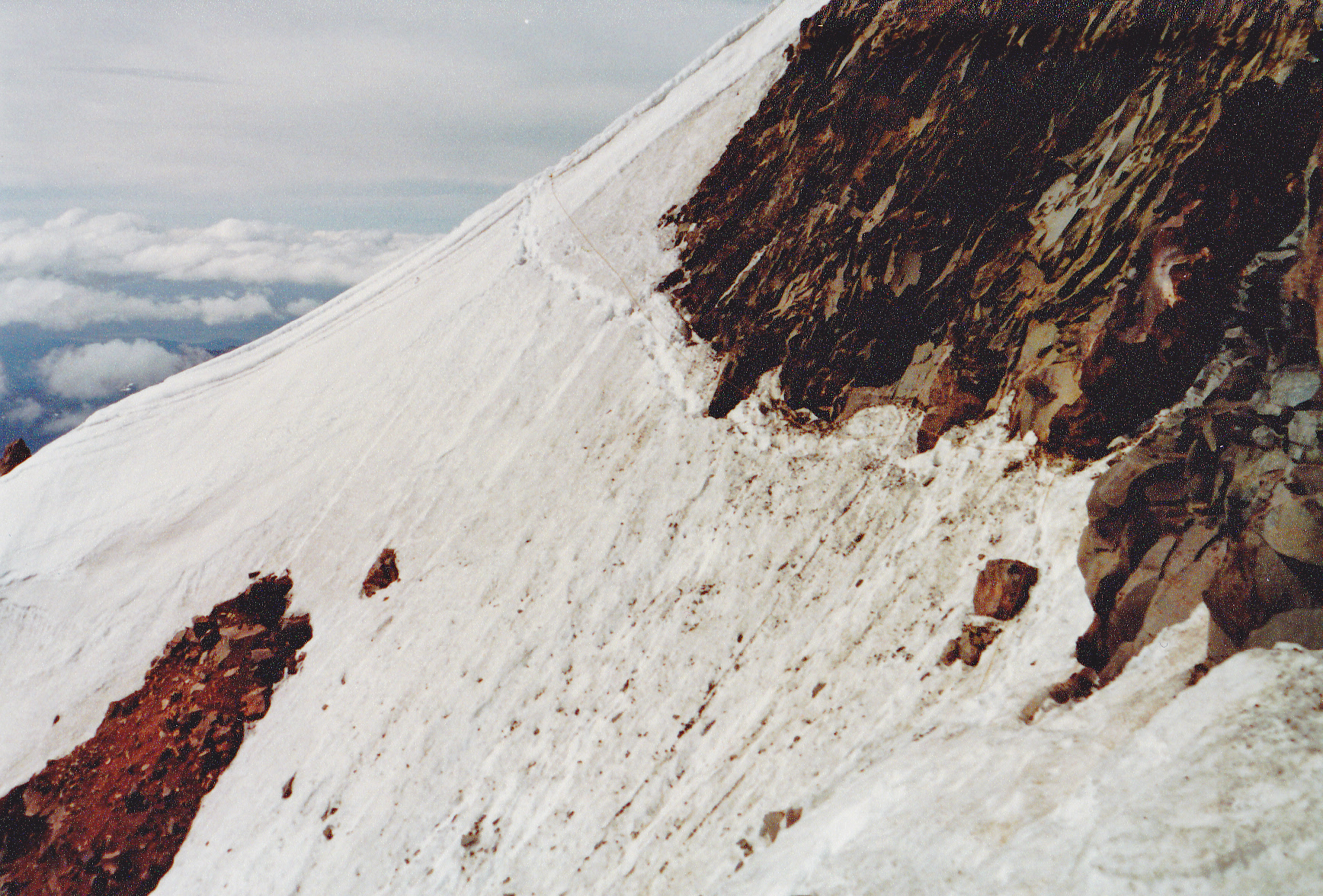
From 9,900′ on the North Sister, looking west across the Collier Glacier
Ever so carefully, I down-climbed The Bowling Alley, and made it back across that insane, exposed traverse on the ledge. Here are a couple of photos taken at 9,100′ on the south ridge of the North Sister.
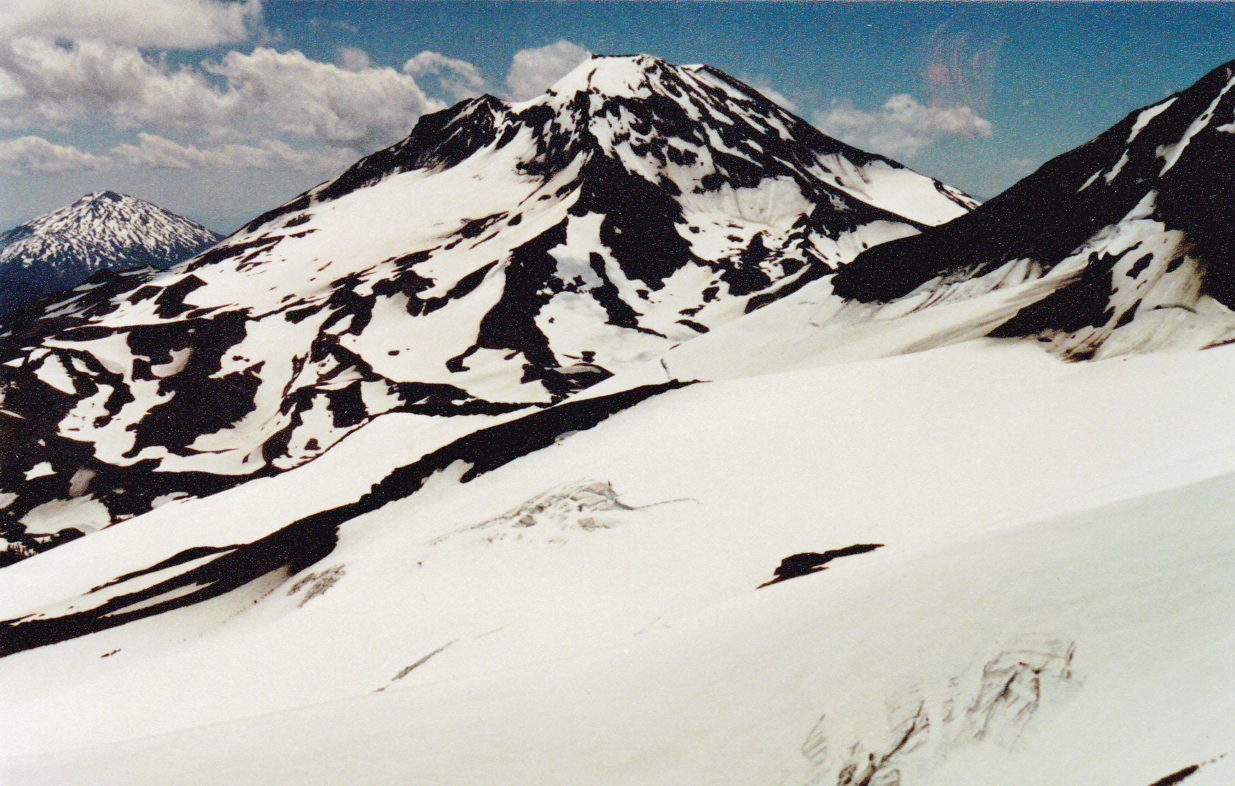
From 9,100′ on the North Sister: left to right – Mt. Bachelor (9,065′); South Sister (10,358′); the shoulder of the Middle Sister. We are looking over the Hayden Glacier.
From the same spot, here’s a view of the Middle Sister.
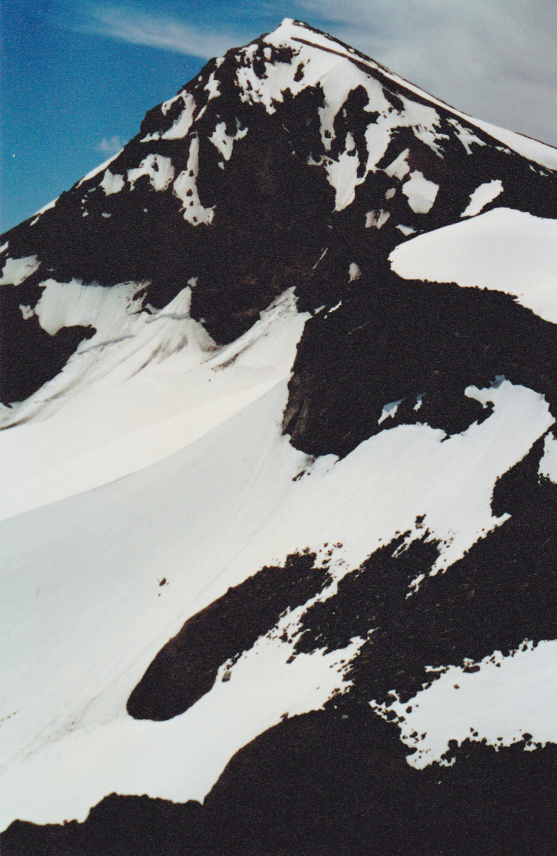
The north side of the Middle Sister
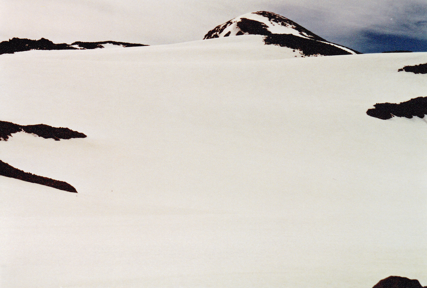
Before long, I found myself in the saddle between North and Middle Sisters once again at 8,900 feet. Here’s the view from there.
The north slopes of the Middle Sister
All I had to do now was climb another 1,100 feet across the tops of the Collier and the Hayden Glaciers and I’d be on my second summit. At about 9,800′, I passed this pinnacle.
On the north ridge of the Middle Sister
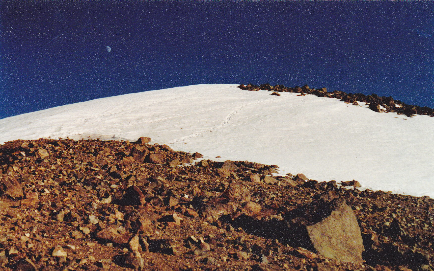
The day had kind of gotten away on me, so it was late by the time I stood on top of the Middle Sister, elevation 10,047 feet. You can see the moon, and the footsteps of others.
Here is the summit of the Middle Sister, the north side.
With the daylight fading, I thought it best to stop for the night. I had no tent, but had brought a light-weight down sleeping bag which I tucked inside a simple Gore-Tex bivi bag. I pulled the top of it over my head and soon fell asleep.
What the hell – something had just touched my face and woken me with a start! I opened my eyes, but everything was really dim – was something wrong with my vision? I soon realized that the hood of my bivi bag was still over my face, so I pushed it aside, looked out and saw that I was covered with more than a foot of soft, fluffy snow. The day was breaking, but it was overcast. More than that, the mountain-top was completely socked in, and it was still snowing lightly. Hmmm, change of plans.
No matter what choice I made, it would involve heading downhill. As much as I wanted to climb the South Sister, it seemed unwise to try that in zero visibility over unfamiliar ground. The lesser of two evils would be to backtrack, make my way down this Sister and back to the trailhead. This was long before the days of GPS, so even with altimeter, map and compass, but no visibility to help me take a bearing, it would be hard to pinpoint my location. All I could do would be to make my way back to yesterday afternoon’s saddle, then make my way down from there.
I packed up my meager gear and started down. The snow had drifted a couple of feet deep in places. Reaching the saddle wasn’t too hard, but from that point on things became more challenging. At least the saddle was a known point on my topo map, so using my compass and keeping a sharp eye out for any usable features, I was able to drop 2,300 vertical feet in the mist and reach treeline, where I once again picked up the trail. There was fresh snow all the way down to treeline and even below, so all trace of my footprints from yesterday had been obliterated.
The sky was leaden and it was snowing lightly at 6,500 feet, plus there was an accumulation from last night’s storm. I was following trail markers attached to tree trunks, but at some point I realized I couldn’t see them anymore – daydreaming and not paying close enough attention – not a smart move, as I still had 2,000 vertical feet to drop and miles to travel. There I stood in the forest and realized I was lost! A feeling of panic set in. I had once heard a quote attributed to Daniel Boone, the famous frontiersman, which went “I can’t say as ever I was lost, but I was bewildered once for three days.” My situation was hardly as dire as his, but it did give me pause. Fortunately, I could follow my tracks in the snow and backtrack – I’d stop at intervals and look at all the trees around me – I did that enough times until I finally found the trail markers again. How had I gone so far without the trail? – must have been really thinking hard about something and spaced out. You can bet I paid closer attention from that point on.
Eventually I got down below the snow, where all I had to contend with was the rain. By the time I reached my vehicle at the trailhead, I was soaked to the arse – none of me or my gear was dry. I must have looked like a drowned rat. A couple from Springfield, Oregon was there – they’d decided not to hike the trail because of the nasty weather. Instead, they asked if I’d like to follow them west the 70-odd miles to their home and spend the night to dry out. I gladly accepted. The rest is history – new friends made, gear dried out, none the worse for wear. I never did make it back to climb the other Sister.