
This is a write-up of some adventuring done back in 2005, important to me because of what was actually climbed that day. Read on.
It was September, and I hadn’t been climbing for 2 weeks. Why so long? In late August, I had nearly died while climbing in the Ajo Range, and I suppose I was recovering emotionally from that experience. However, on Saturday, the 10th, the weather was supposed to be only in the mid-nineties, a far cry from two weeks earlier when it had reached 106 degrees F while I foolishly pushed myself too far. You can read about that fateful day in the story called “Hurricane Katrina” by going to the “stories” tab and scrolling down until you find it.
I left Tucson early and was parked back in the Ajo Range at first light, at a spot where Dave Jurasevich and a group of his fellow California climbers had parked way back in February of 1998 during a very wet El Niño year. They were climbing all of the mountain range high points on the Tohono O’odham Indian Reservation in the company of a hired guide who lived in Sells. They had parked a mile west of Indian Highway 1 about 6 miles north of the village of Ali Chuk and had spent a soggy night. He tells of a huge bonfire they built to dry out, “big enough that you could have seen it from outer space”. They were there to climb the high point of the Sierra de Santa Rosa, one of Arizona’s most obscure ranges. Today, I’d climb one last peak in the Ajo Range, the culmination of months of effort.
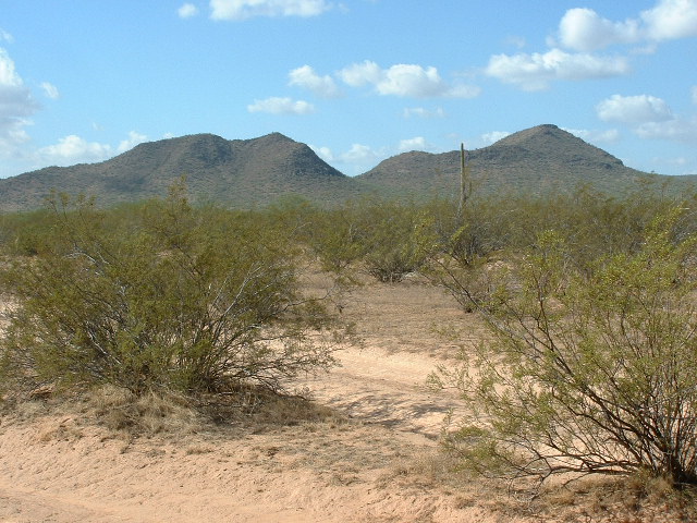
I readied my pack, carrying a lot to drink. Since my scare of 2 weeks earlier, I had made it a rule to always carry more than I’d need, hopefully an important lesson learned. It was surprisingly cool and mostly overcast when I left on foot at exactly 6:00 AM, heading due west over mostly flat country. The sun was rising, and to the east I could see this view over the distant Mesquite Mountains.
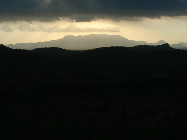
Sunrise over the Mesquite Mountains
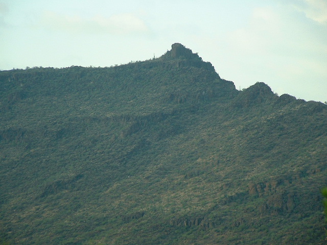
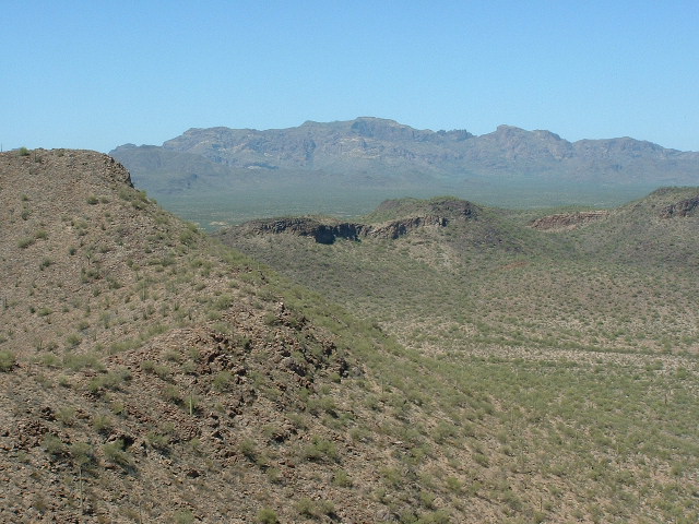
It took most of an hour to reach my mountain, and while climbing I has this view up its eastern slope which was very green, made so by a good monsoon season. I took this shot. I liked how the shaded spot I was in contrasted with the blue sky above, wisps of cloud whipping by on the strong winds.
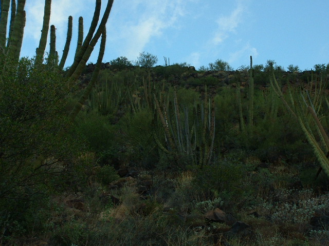
Looking up the slope.
In just over an hour, I had reached the mountain (Peak 2473) and had ascended its eastern slopes. The summit area was a long plateau and was quite windy on top. What a vantage point for views! I’ll show you some of what I saw.
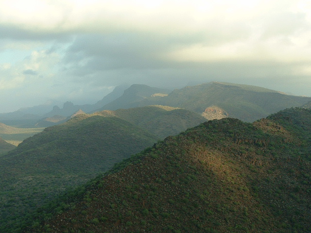
Here’s a look to the southeast, to the Sierra de la Nariz on the horizon. The big bump to the right of center is all in Mexico, where the range high point lies, about 10 miles away.
Sierra de la Nariz
Less than a mile away sits Peak 2921, the high point of the Sierra de Santa Rosa, which lies to the west of the main spine of the Ajo Mountains. This obscure peak has seen fewer than a dozen visitors.
Peak 2921
And here is Peak 2771, which saw its only climber’s ascent in November of 2014. It sits just over a mile to the south of Peak 2473.
Peak 2771
This one is Peak 2614, only a mile and a half to the northwest. Both it and 2771 are in the Sierra de Santa Rosa.
Peak 2614, on the right
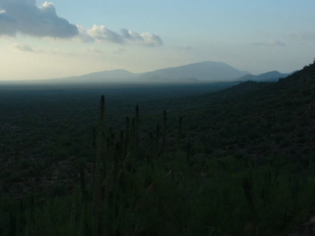
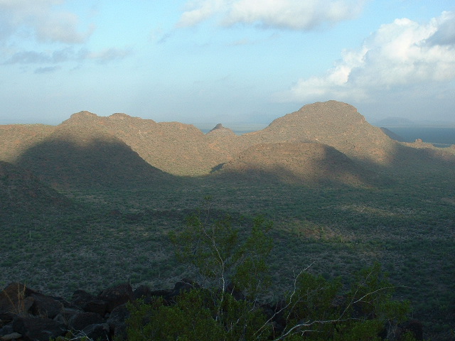
And here’s one more, my favorite view from the summit of Peak 2473 – a look northwest through the misty morning air to the Diaz group of peaks hidden in the clouds.
Northwest to the Diaz Peak group
I found no sign of any previous visitors. While I was building a cairn, I heard in the distance a helicopter. Although I couldn’t see it, it sounded to me like it was circling my vehicle and perhaps landing to check it out – the US Border Patrol, I am sure. I left my register and descended.
As I walked the few miles back to my truck, I was struck by the number of cattle in this valley. I must have encountered 5 or 6 groups of them. It’s funny how, as big and powerful as they are, they run away very quickly from a solitary human. I took this next shot to show you how plentiful Organ-Pipe Cactus is in this area – the hillside is covered with them.
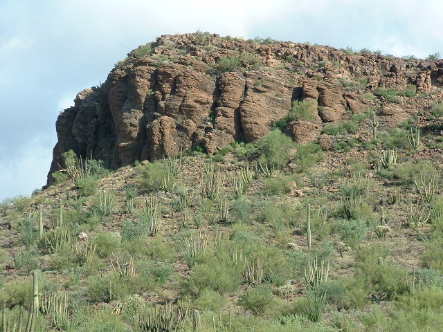
Plenty of cactus
In well under three hours round-trip, I was back at my truck. After some refreshment, I headed out. Once back at the paved highway, I drove north for 15 miles to the village of Gu Vo.
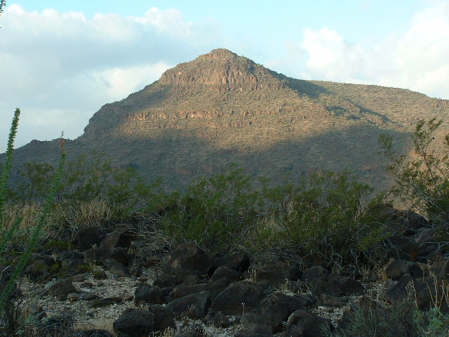
There, I drove east and found the dirt roads I needed. It was early and cool enough to do more climbing. Another road, and a few miles of driving south brought me to where I wanted to be, and I parked east of the Gu Vo Hills in a very picturesque valley directly north of my next two objectives.
Looking south to Peak 2661 on the right and Peak 2574 on the left.
I ate and drank a lot, then got my pack ready. It had become very windy, which I like, and I set out feeling really psyched. It didn’t take long to reach the north slopes of Peak 2661, which I followed to its summit. There was no sign of previous visitors, so I did the cairn and register thing. No luck on any summit today with my cell phone trying to call home. From that summit, I could look past the south end of the next peak and see the high country of the Mesquite Mountains.
Looking southeast to the distant Mesquite Mountains
After a little time there, I descended to the saddle to the east, which was littered with trash left by indocumentados. From there, I climbed the 300 vertical feet to my next summit, Peak 2574, in exactly ten minutes. Once again, no sign of any previous visit. While on the summit, I was looking out over the valley to the north to spot my truck. It didn’t take long to locate it, but I was surprised to see it parked at an angle that seemed quite different from how I had left it. As I was contemplating this mystery, I looked more carefully and realized that it was not my truck I was looking at! Mine was about half a mile to the east.
As I looked at them both, I realized that the other vehicle was one abandoned by Bad Guys – there are large numbers of their vehicles littering the reservation. Mystery solved, I descended and was soon back at my truck.
Today was an important one in that I had now completed the 30 summits in the Ajo Range that were on the reservation, and the 8 summits of the Gu Vo Hills. What an amazing group of peaks these had been, consuming all of my climbing time since May. The Ajo Range includes some of the remotest and most picturesque peaks on the reservation, and I feel privileged to have climbed there.
This climbing was done a dozen years ago, and still resonates with me today. Thanks for journeying with me.