
Christmas break – it seemed like the perfect time to do something a bit exotic. My girlfriend was a teacher and would have the time off. Her friend flew down from Montana and we picked her up at the Tucson airport at 2:30 PM. There’d been nothing but time to plan for this, so the pickup was loaded and ready. There were 3 of us, but only 2 bucket seats in the cab, so somebody always had to be inside the camper shell in the back. Fortunately, there was a sliding rear window in the cab, so we could easily talk back and forth. We left the airport straight away and headed east out of town. Near San Simón, we stopped and cooked a meal, then drove on into the night. In Deming, New Mexico we gassed up at the only station we found open, then motored on. Past Las Cruces, we finally crossed the state line into Texas and found a quiet spot out in the desert near Anthony to camp for the night. It was cozy, the 3 of us squeezed into the back of the truck, but plenty warm. Just after midnight, a deputy in his patrol car pulled up – he said we could stay there for the night but should keep an eye out for locals who “might want to rip us off”.
Merry Christmas! – we survived the night without incident. After a bite to eat, we headed back to I-10 and down to El Paso where we filled up one last time with good ol’ American petrol before crossing the border into Mexico. There, in the city of Ciudad Juarez, we played the tourist game and obtained visas and a vehicle permit. Once that was done, we seemed to drive forever through Juarez before leaving its urban sprawl. Several hours later, we arrived in the city of Chihuahua, only to find that there was no unleaded gas available, and that there wouldn’t be any until ten o’clock the following morning!
That could be a real problem – without being able to fill our tank, plus the 2 5-gallon metal gas cans we’d brought along as a reserve, there’d be no way we could make the drive west to our destination. On the outskirts of the city, we checked out a few potential camp sites before settling on one. There were a few scattered homes nearby, but this was the best we could do – we hoped that nobody would hassle us. The day was early enough that we cooked a meal and relaxed.
The following morning back in the city, we took our place in the long line at the Pemex station and waited our turn. Eventually, we filled the tank plus cans, then breathed a sigh of relief. A nearby bank afforded us the opportunity to change some dollars into pesos. The cloud of pollution hanging over the city had to be seen to be believed – it was worse than Phoenix. Our errands done, we finally headed west and eventually arrived at Ciudad Cuauhtémoc. This city was larger than we expected and, contrary to what we’d been led to believe by our Pemex road atlas, there was unleaded gasoline for sale, so we topped off the tank once again. Continuing west for another 45 minutes brought us to the town of La Junta. We’d been following Highway 16 and wanted to continue on it, so turned southwest in the town and motored on. After a while, though, we started to have doubts as to whether we were on the right road – we stopped and asked a kid (big mistake), who told us “no” and to go back the way we’d come. Back at La Junta, we were told in no uncertain terms that we had been on the correct road the whole time, so once again we turned around and headed southwest. Lesson learned – never ask directions of someone who doesn’t drive.
Before long, we arrived at the junction we sought, and continued south. Leaving farmland behind, we entered forested country, where the road was anything but straight. An hour after leaving the aforementioned junction, we arrived at San Juanito, a dusty, grungy place at 7,900 feet elevation.
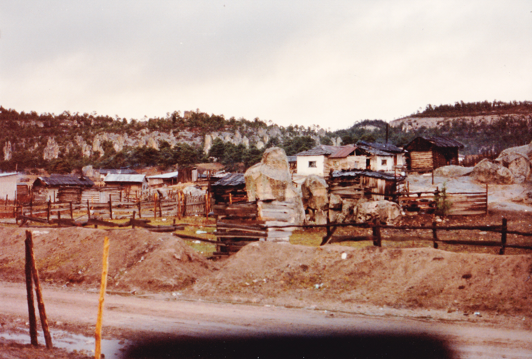
San Juanito
San Juanito
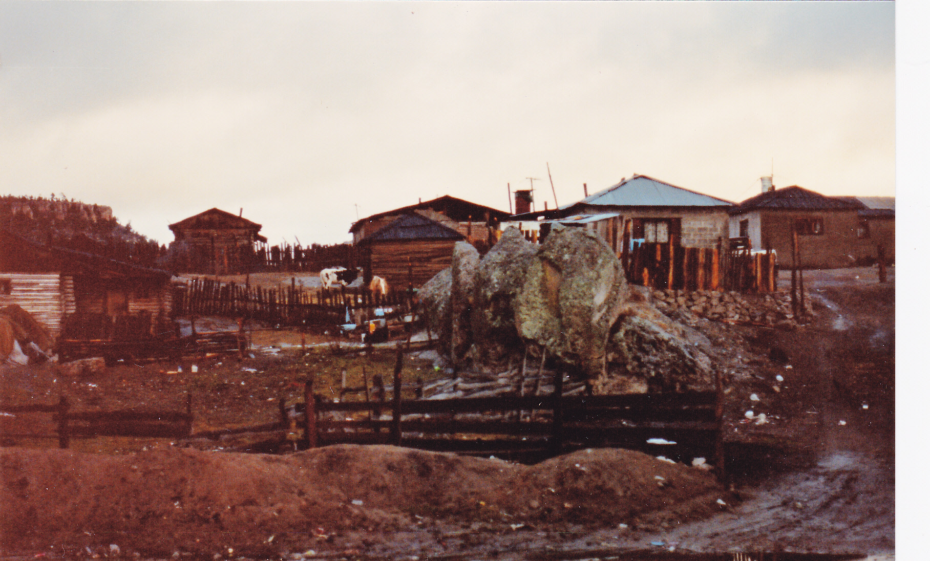
This town owed its existence to the railroad and logging, but there was nothing there to keep us – we blew right on through and kept on driving. More miles of winding roads delivered us to Creel, another town that owed its existence to the railroad. Due to its 7,700-foot elevation, the weather was cool and pleasant. The town of 5,000 souls was crawling with tourists just like ourselves – we asked around to learn about things to do in the area, then drove south out of town a few miles and camped by a lake. The rest of the day was spent around a warm campfire before we turned in for the night.
The following morning, it was quite cold with our early-morning start. Under clear skies, we left at first light and drove a few miles south of Creel to Cascada Cusárare, or to the lodge at least.

The Cusárare Lodge
We parked at the lodge and hiked along a trail through a pine forest to the falls – very scenic, and it turned out to be one of the most popular attractions in the area.
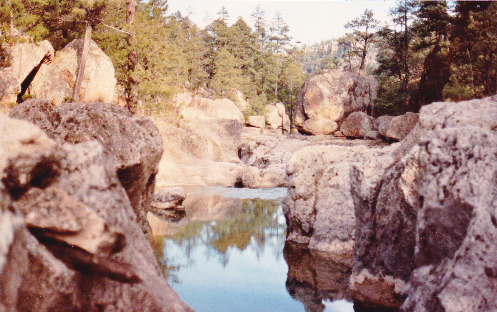
Near the falls
The falls itself was about 100 feet high.
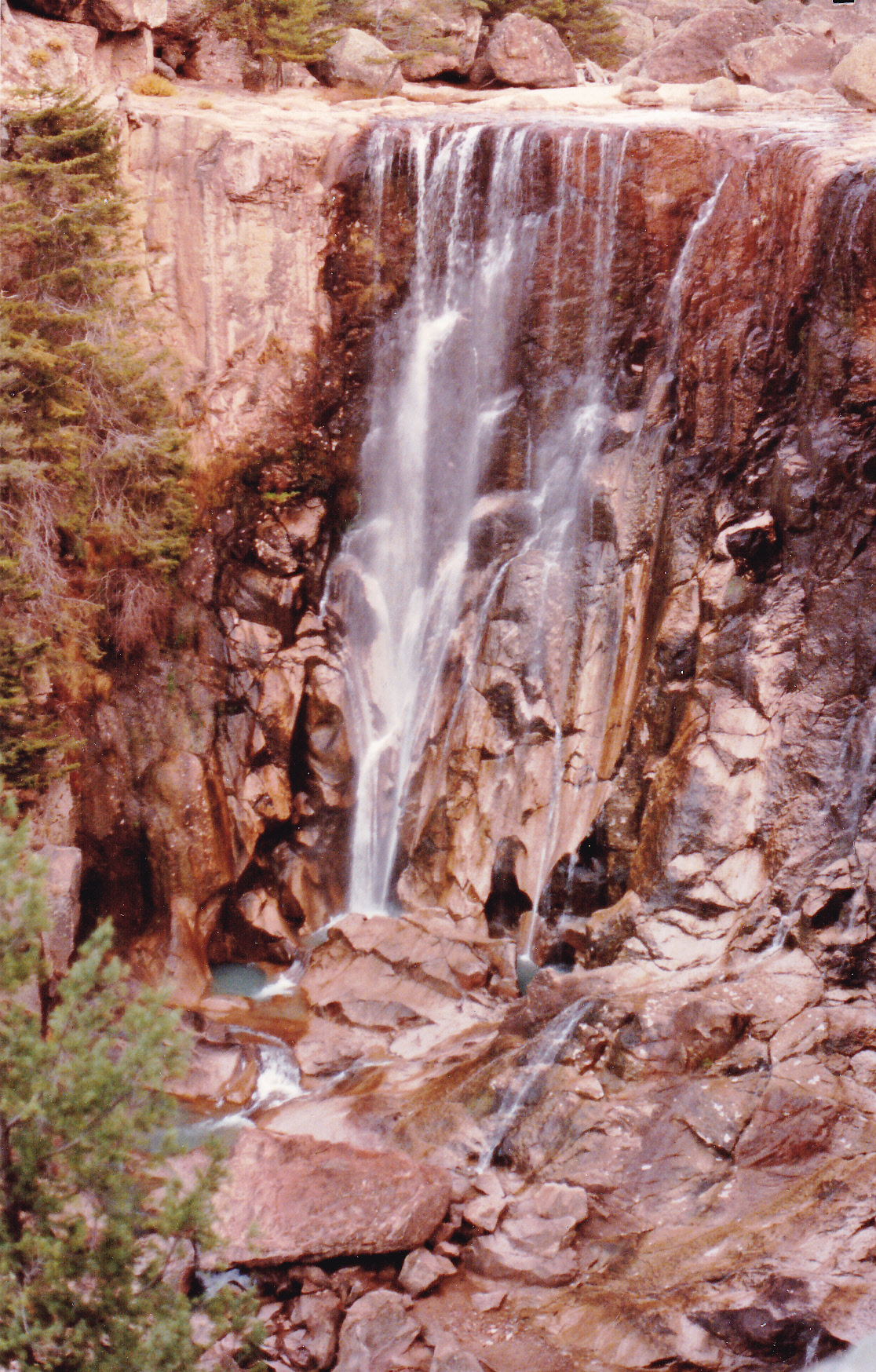
Cusárare Falls
After a short while at the falls, we headed back to the truck and returned to Creel. For 12,000 pesos each (about $4.75 US), we bought round-trip tickets for the train ride to El Divisadero, a spectacular spot along the railway line of the Ferrocarril Chihuahua al Pacífico. Here’s some information about the railroad itself:
Construction of the Chihuahua al Pacífico began in the late 19th century. The revolution, lack of funding, and the overall difficulty of building a railroad over such terrain hindered its completion until 1961. The railroad comprises 405 miles of rails with 39 bridges and 86 tunnels. The total trip takes approximately 15 hours and runs from Los Mochis, Sinaloa on the Pacific Coast to Chihuahua, Chihuahua.
Back in 1972, I had the good fortune to have ridden the train from the coast all the way to Chihuahua city, and it was an unforgettable experience which I still cherish today. The ride I took on the afternoon of December 27, 1989 with the two girls was a chance to re-live a tiny part of it. Our ride went from Creel to the viewpoint known as Divisadero, and once there we disembarked. Which brings me to the title of this story.
Copper Canyon, or Barrancas del Cobre in Spanish, is the name of the canyon upon whose edge we were now perched. We weren’t alone – plenty of tourists were there, taking in the sights along with us. Copper Canyon is actually a group of 6 canyons – no single one of them is larger than Arizona’s Grand Canyon, but as a group they are far larger. The deepest part of Copper Canyon is a bit deeper than the deepest reach of the Grand Canyon. Here are a few photos I took near Divisadero.
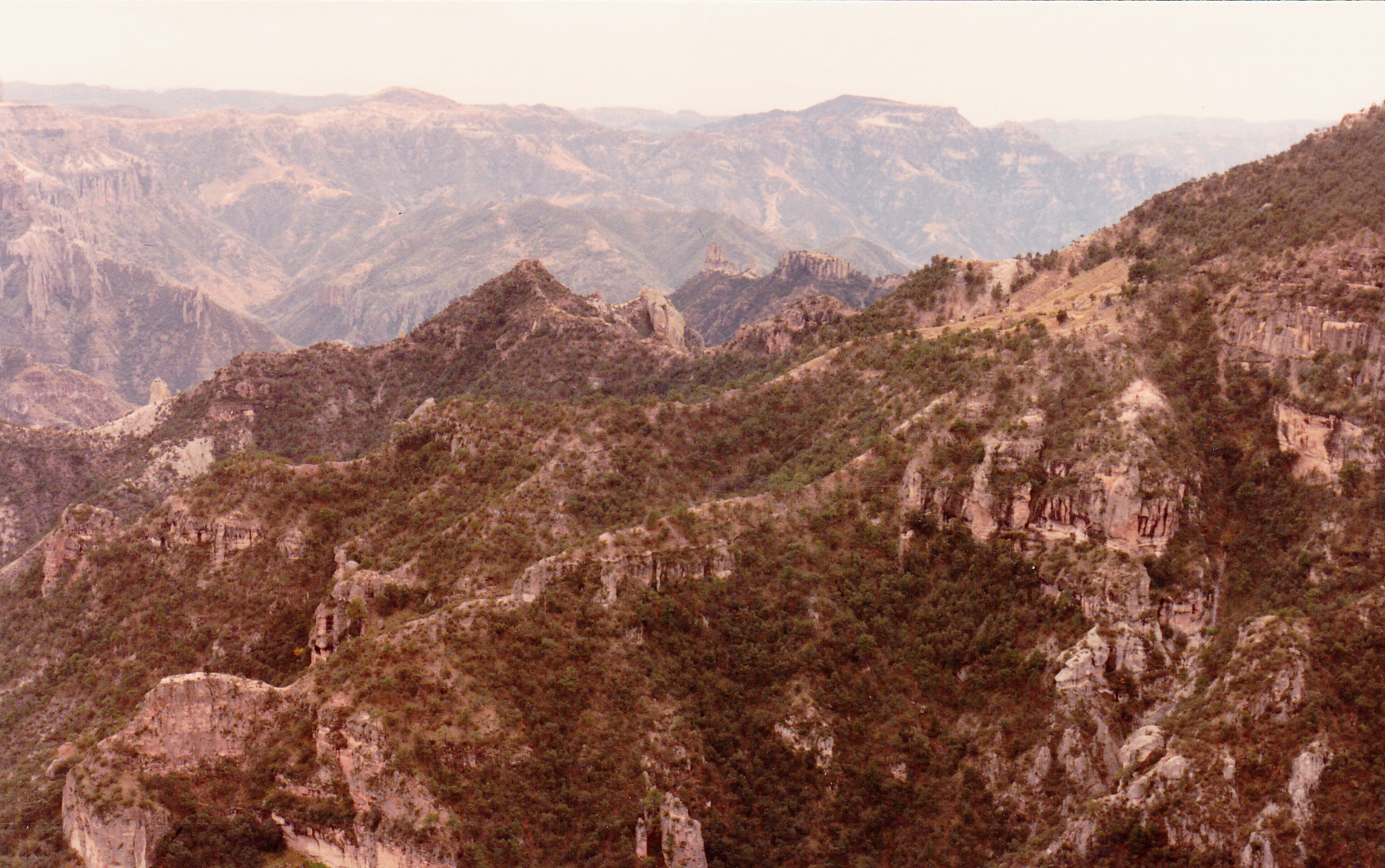
Copper Canyon
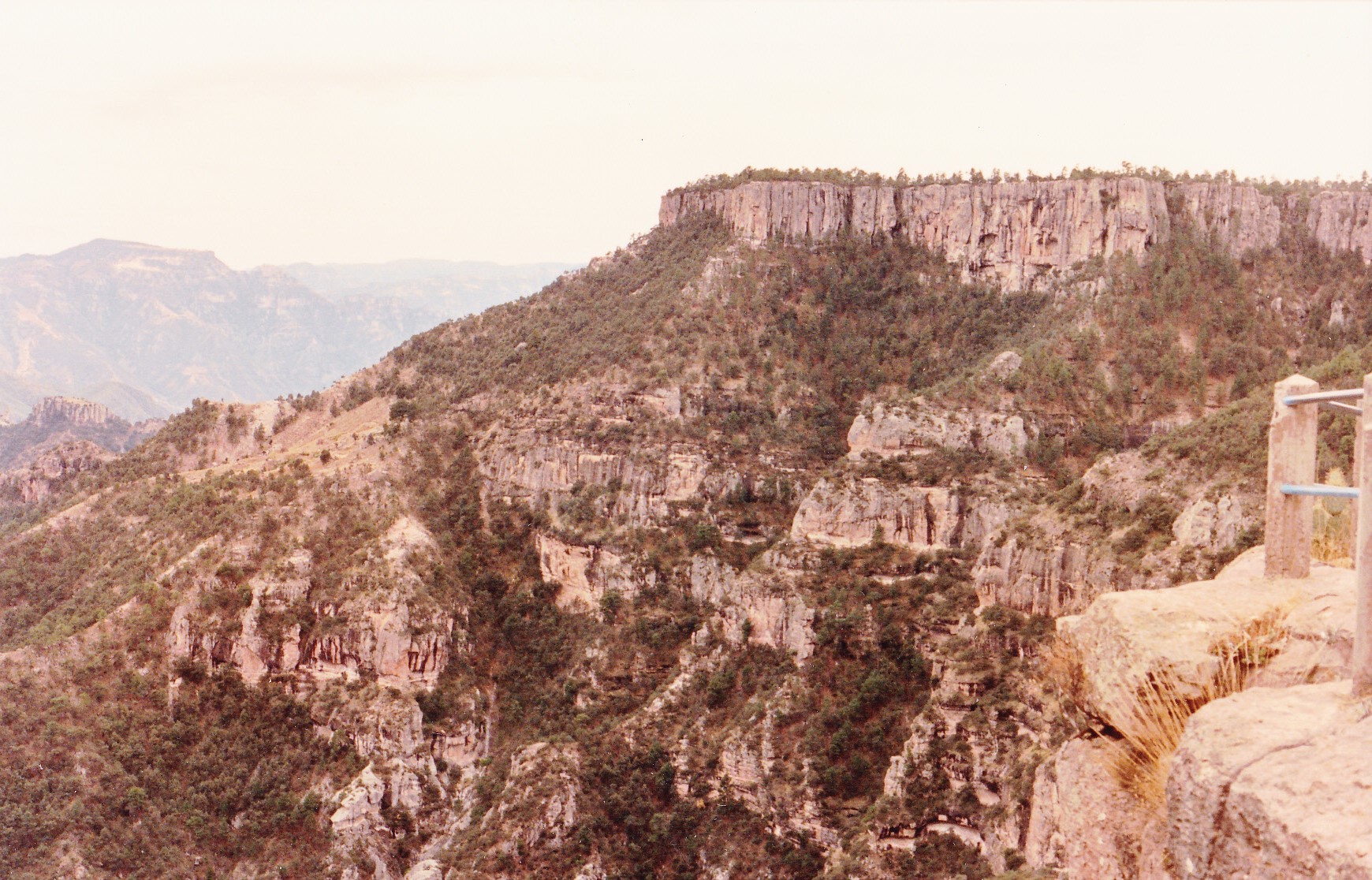
Copper Canyon
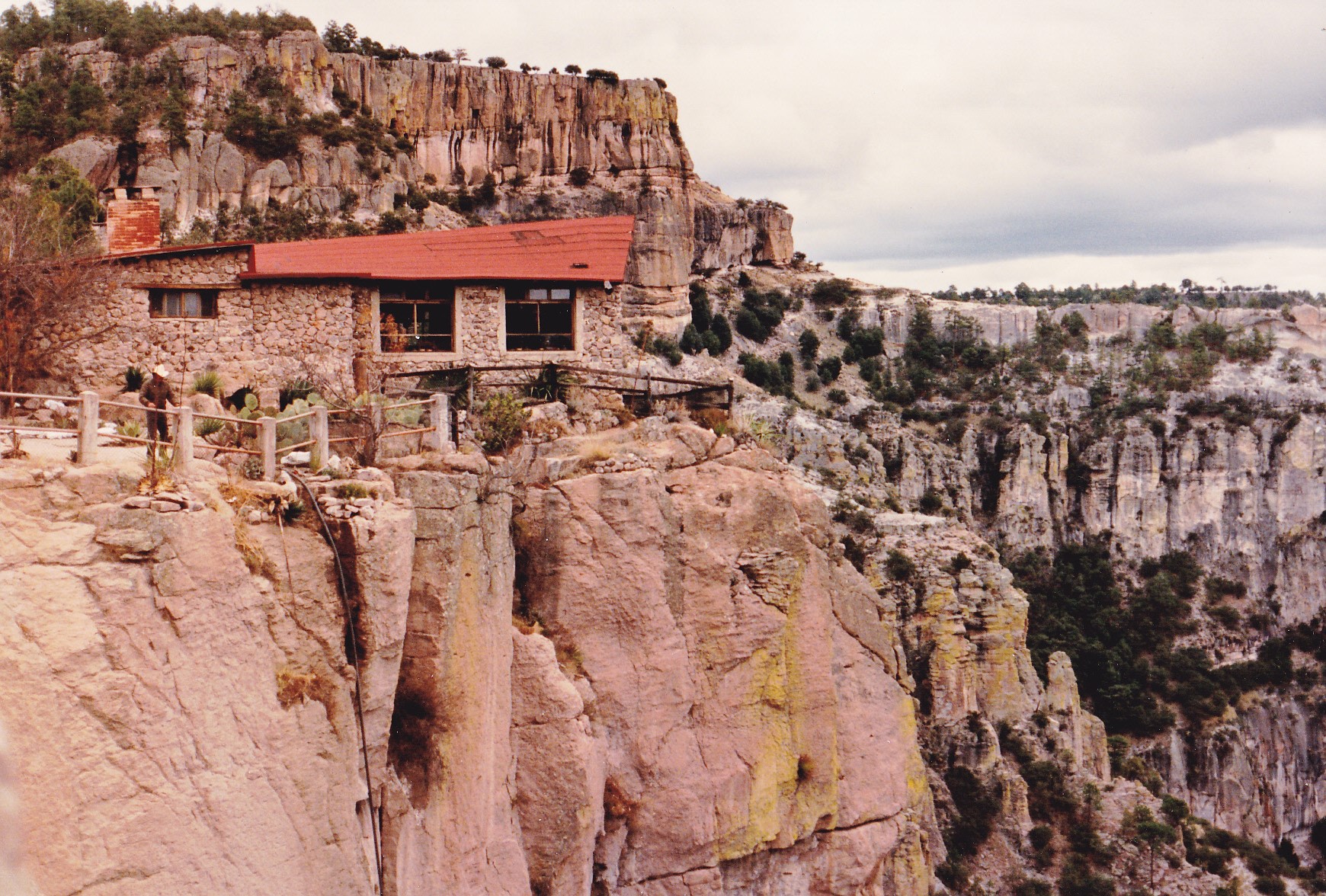
A tea house on the brink of Urique Canyon (the largest of the 6) near Divisadero
An ancient people known as the Tarahumara, or Rarámuri, have inhabited the canyons for centuries. Somewhere between 30,000 and 70,000 of them live there today. Some choose to interact with tourists, such as those I photographed here.
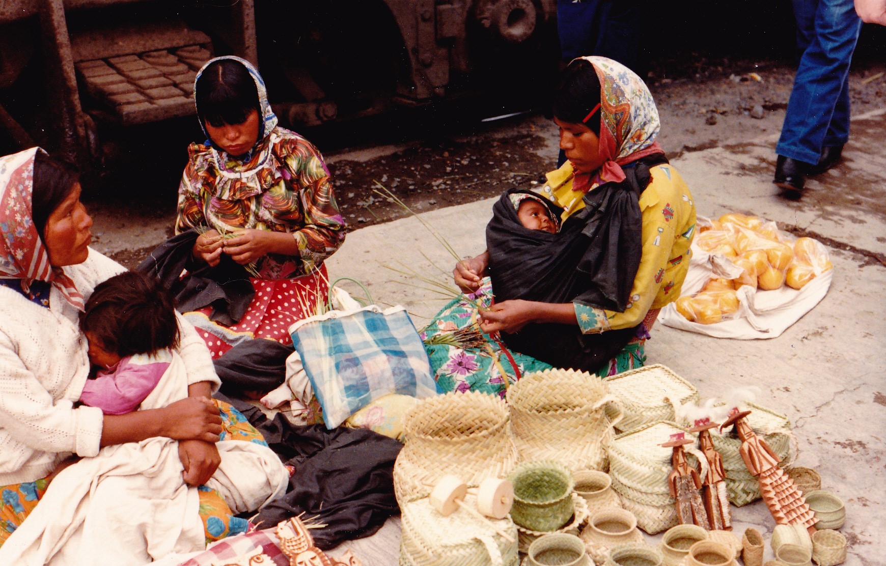
Tarahumara women at Divisadero
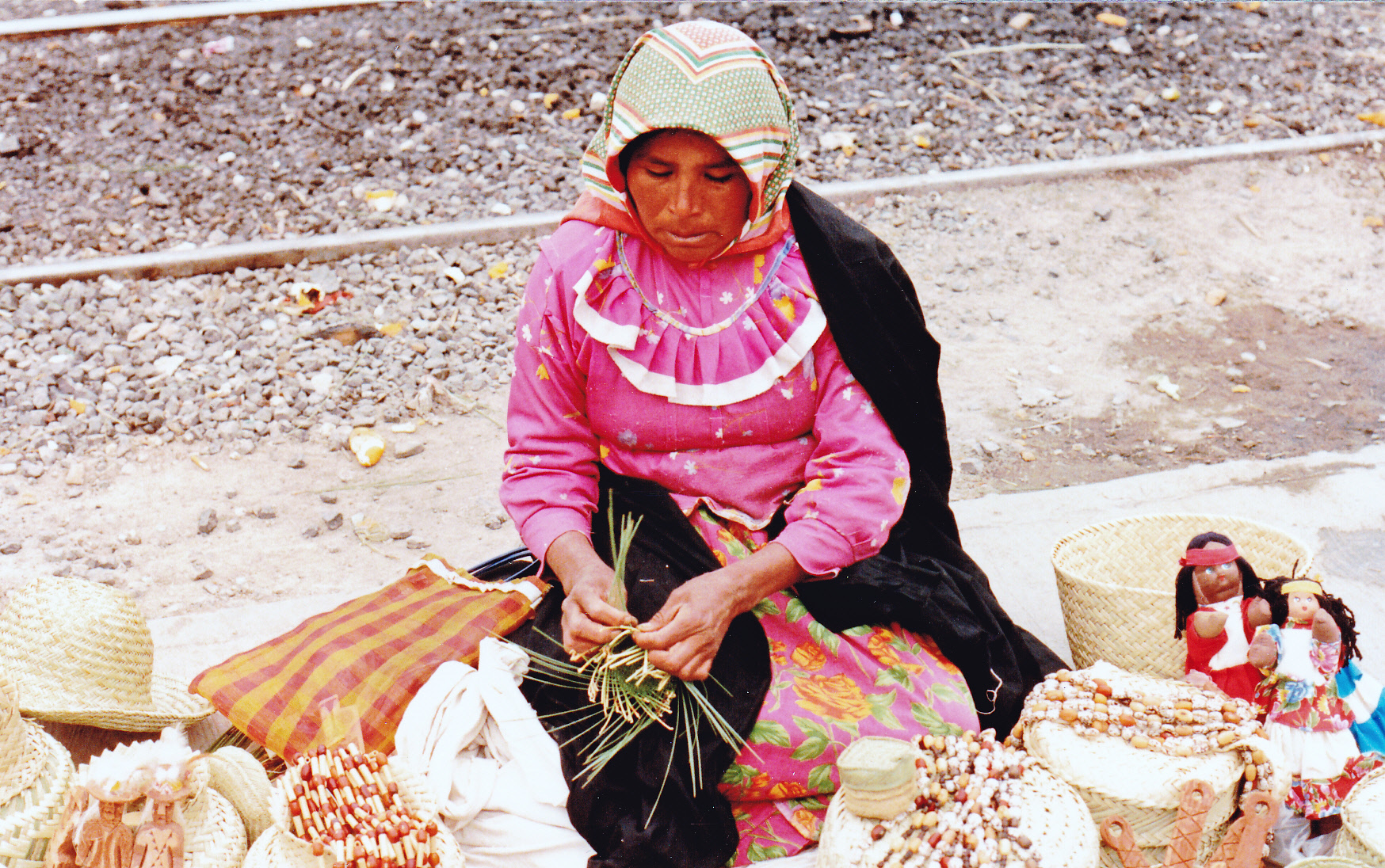
The Tarahumara are legendary long-distance runners – they are known to run up to 200 miles in one session over a period of 2 days. They developed this ability out of necessity, running between their widely-separated communities in the canyon. Another practical application of this skill is that they can run down food sources such as deer and wild turkeys, chasing them until the animals drop from exhaustion.
After an amazing afternoon spent at the canyon (both the goal and the highlight of our trip), we boarded the train for the return to Creel. Ten bucks paid for a meal for the 3 of us, then we headed back to our lake campsite for the night. Overnight, it poured rain. The next morning at daybreak, we pulled out and returned to Creel, then continued north. Precisely at every hour we changed drivers, with one of us always enduring the camper shell. Before we knew it, we were back in Cuahtémoc. After topping up the gas tank, we bought a couple of bottles of Kahlua, then left around mid-day. Continuing north through Colonia Obregón, the afternoon was spent driving through plateau country with mountain ranges both east and west. There was plenty of snow up high but none along the roads we traveled. 200 miles from Cuahtémoc, we reached our goal for the day, Nuevo Casas Grandes.
Dinner was had at a seafood restaurant in town. Once done, we drove south a few more miles to the old village of Casas Grandes and went over to the ruins, which were closed until ten the next morning. Nothing to do but wait it out, so we found a quiet spot to camp for the night. Sitting in the cab of the truck, we heard on the radio that Manuel Noriega, the overthrown Panamanian dictator, was holed up in the Vatican embassy in Panama City.
During the night, one of the girls was terribly sick to her stomach – obviously, the seafood didn’t agree with her! I’ve been very lucky – during the 6 months of my life I’ve spent in Mexico eating their food, I’ve never once been sick, while traveling companions fell by the wayside, stricken with Montezuma’s revenge. When the Paquimé ruins opened in the morning, we paid the equivalent of 25 cents US each to enter. A fascinating couple of hours was spent there taking a good look around. All I have left is this one poor photo taken at the ruins, which is a UNESCO World Heritage Site.
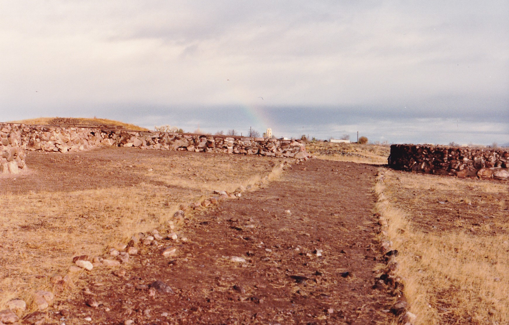
Ruins at Paquimé
At mid-day we left, headed north to Janos where we joined the major Mexican National Highway 2. A few miles beyond, we decided to stop to fix some lunch, where disaster almost struck.
I was the one driving at the time, along a lonely stretch of highway – I went to turn left across the road to a spot where we could park and eat. It was so quiet out there that I somehow took it for granted that we had the whole place to ourselves, so I didn’t bother putting on the turn signal. I had slowed down to a crawl so I could make the left turn, and just before I turned a vehicle came up from behind, passing us on the left. That car must have been doing 60 miles an hour – it had no idea I was turning, so he felt it was okay to pass. Just as I was about to turn the wheel to the left and right into his path, he roared by and was gone. I hadn’t even looked in my left-side rear-view mirror to check for someone trying to pass. It was all over in a second, and the 3 of us sat there stunned, realizing full well that if I had turned a split-second sooner, a horrible collision would have occurred with terrible loss of life. We were badly shaken from the close call, and I surrendered the wheel to one of the girls to continue driving.
While we were stopped for lunch, I poured the last of the gas from our cans into the tank. Continuing west, the highway hugging the US border, we crossed from the state of Chihuahua into Sonora, crossing over a pass through the beautiful Sierra San Luis where it was snowing. After we dropped down from the mountains on to the plain where lies the city of Agua Prieta, a group of Mexican drug-enforcement police pulled us over and searched the truck for drugs. Of course, there was nothing to find and we were allowed to continue.
As we entered the US at the Douglas, Arizona port of entry, the truck was once again searched thoroughly by Border Patrol agents – did we look that suspicious? Once we gassed up, 3 more hours put us back in Tucson. All in all, an enjoyable trip – I’ve often thought of our time at Copper Canyon, but have never been back.