
Hello Readers – before you start to read this, please be sure to read Parts 1, 2 and 3 of the same story.
Good news – my friend and old climbing partner, Brian Rundle, was in Tucson for a visit. He and I had a lot of history together, having started climbing with each other in 1977. We had had many adventures together in remote places, several of which have been the subject of stories on this website. I suggested that we go back to the Roskruge Mountains and climb a group of peaks together – he was totally on board. We headed out to the southern part of the range, once again via the Middle Tank Road, and drove it to its end at a spot called Reservation Tank. It was Friday, February 20th.
Brian and I have always been able to pass the time by talking about all manner of subjects – we’ve taken this to the extreme of being tent-bound due to storms for as long as a week without running out of things to discuss. Today, as we walked along, Brian was enjoying seeing the vegetation and desert beauty up close. It was a striking group of peaks we were going to try today – we could tell the climbing would be a bit challenging at times, but other than that, there should be no surprises.
Heading west, the first thing we did was to climb up and along the double summit of Point 3135. This one didn’t have a full 300 feet of prominence, but it came as close as you could get. Once across it, we dropped down to a wash. The next one on today’s agenda was something called Peak 3330. It was the northernmost of the group of peaks called Dobbs Buttes, (or at least I had lumped it in with them), and it had been causing me some concern for weeks as I’d eyeballed it from elsewhere. It looked pretty steep on top, but a big advantage of being out there with Brian was that he was a skilled rock climber and I knew he wouldn’t take no for an answer. 3330 rises up like a big castle, all pink, orange and buff layers. We went right at it up the east ridge and gained the top ramparts, doing some Class 3-4 rock scrambling to reach the highest point – good fun!
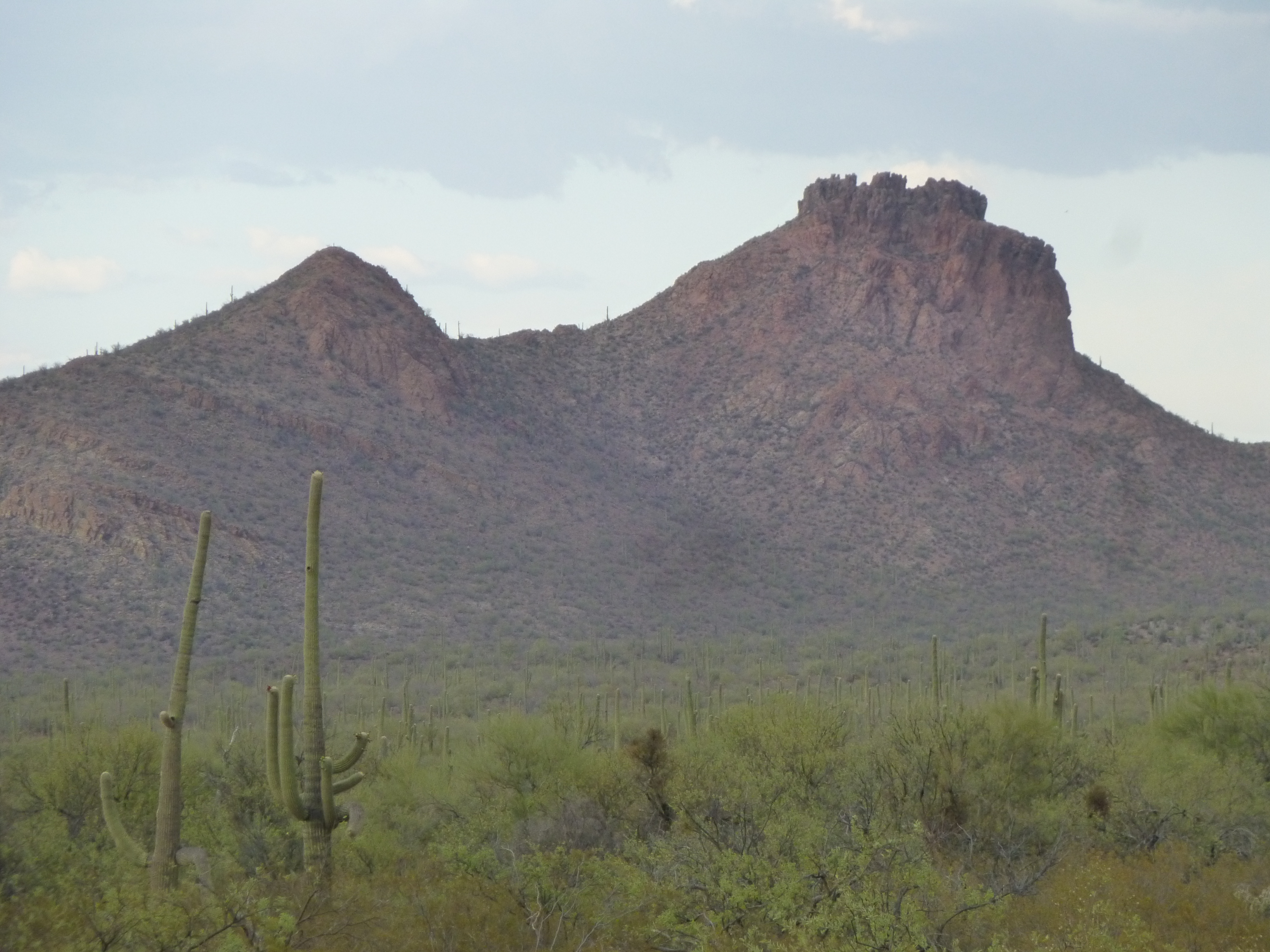
Point 3237 on the left, and Peak 3330 on the right
We left a register there, then dropped down and tagged its western outlier, Point 3237 – it was nothing short of a clean sweep we were after, wanting to leave nothing unclimbed today. One mile south across the desert was the next group, and away we went.
Next on our list was a bump at 3,170 feet, which we traversed from west to east, then dropped down to the east.
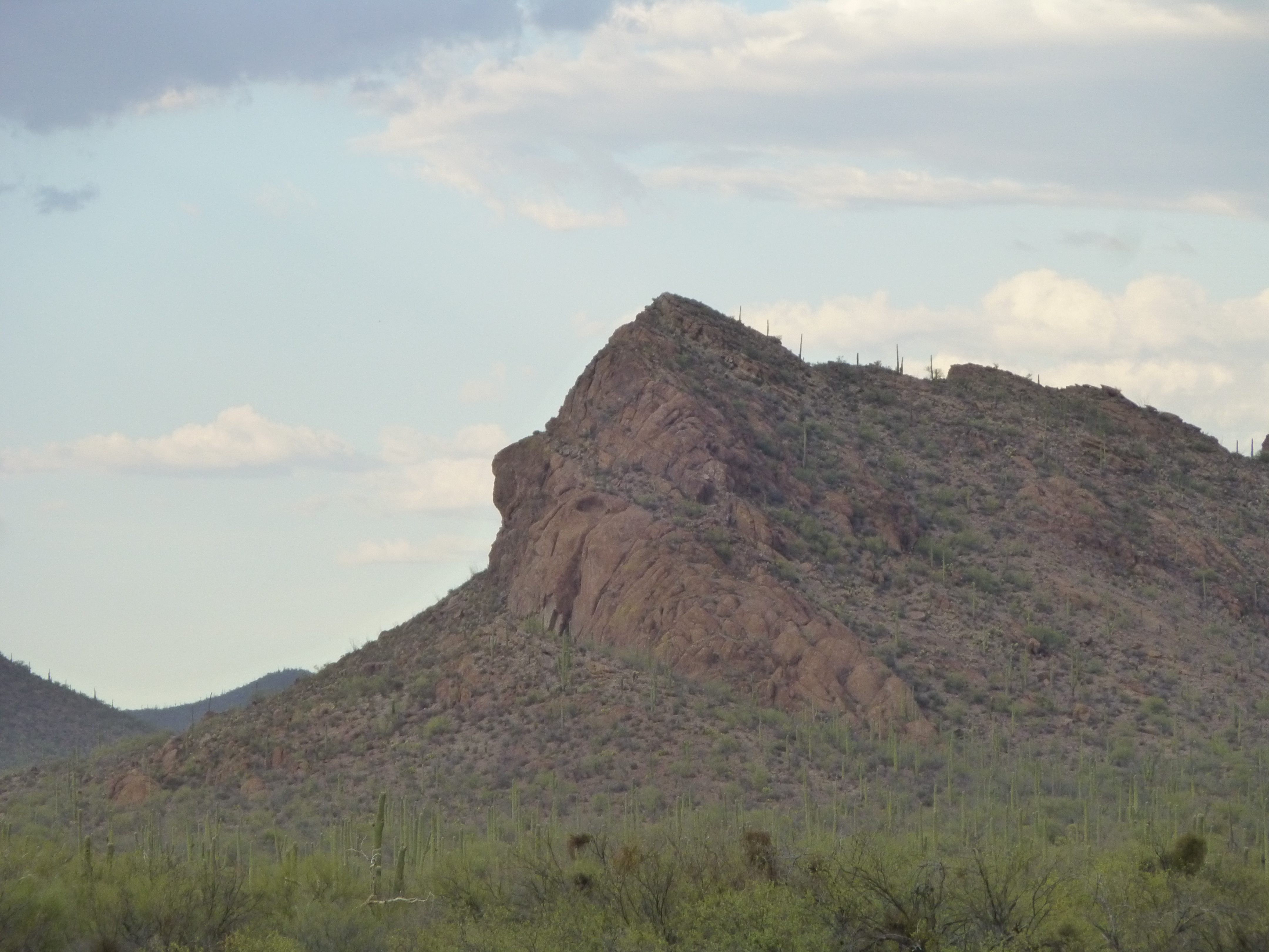
Point 3170, the southwest side
Sharp Peak was next on the list, which we climbed by its northwest slopes, negotiating cliffs at the top.
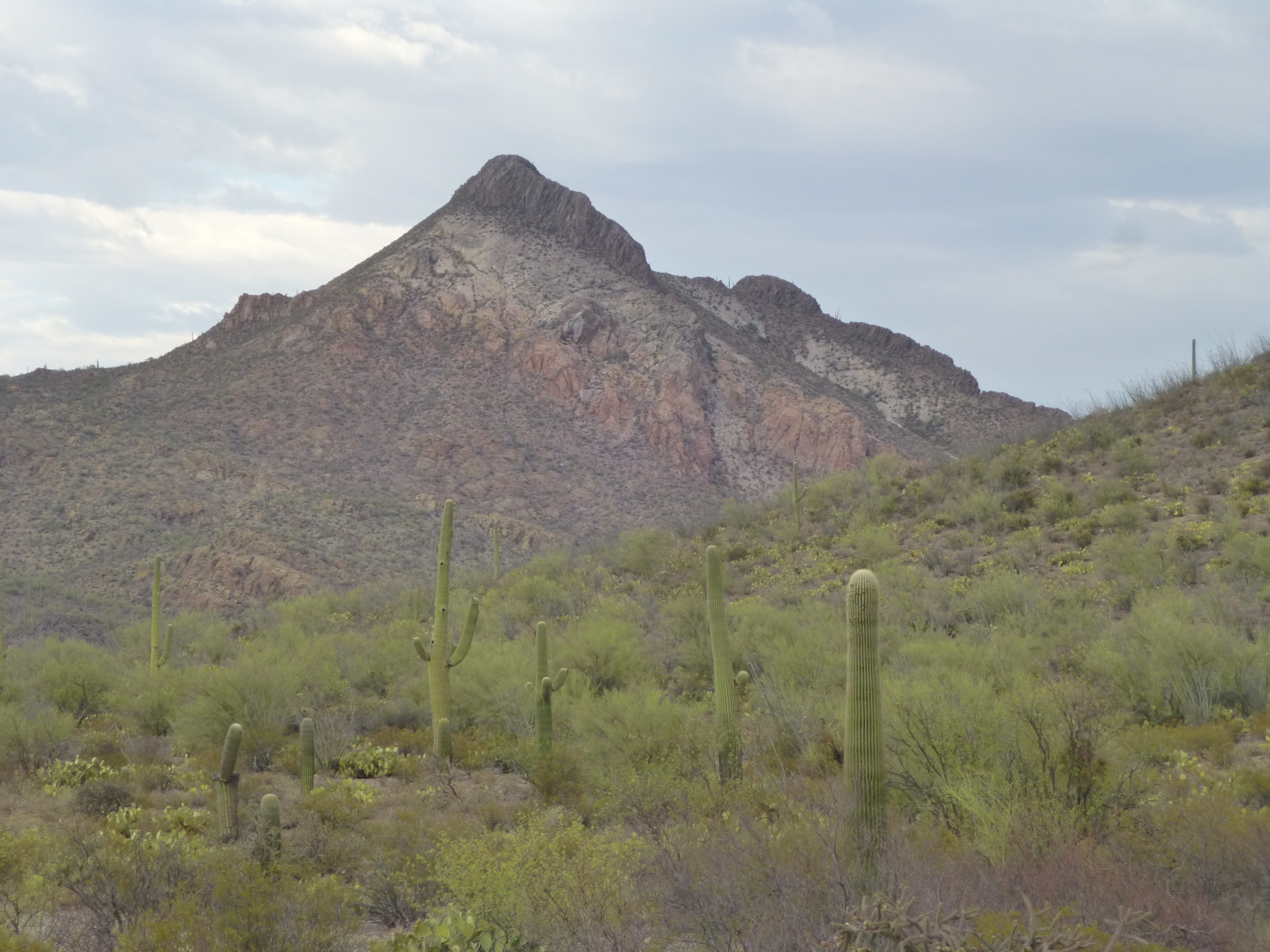
The southwest side of Sharp Peak
While on the summit, it was obvious that the weather was changing, becoming more threatening. Hmmm, maybe we needed to pick up the pace a bit, even though we’d been moving pretty quickly. Down to the saddle to the north, then up the last one of the day, Peak 3690.
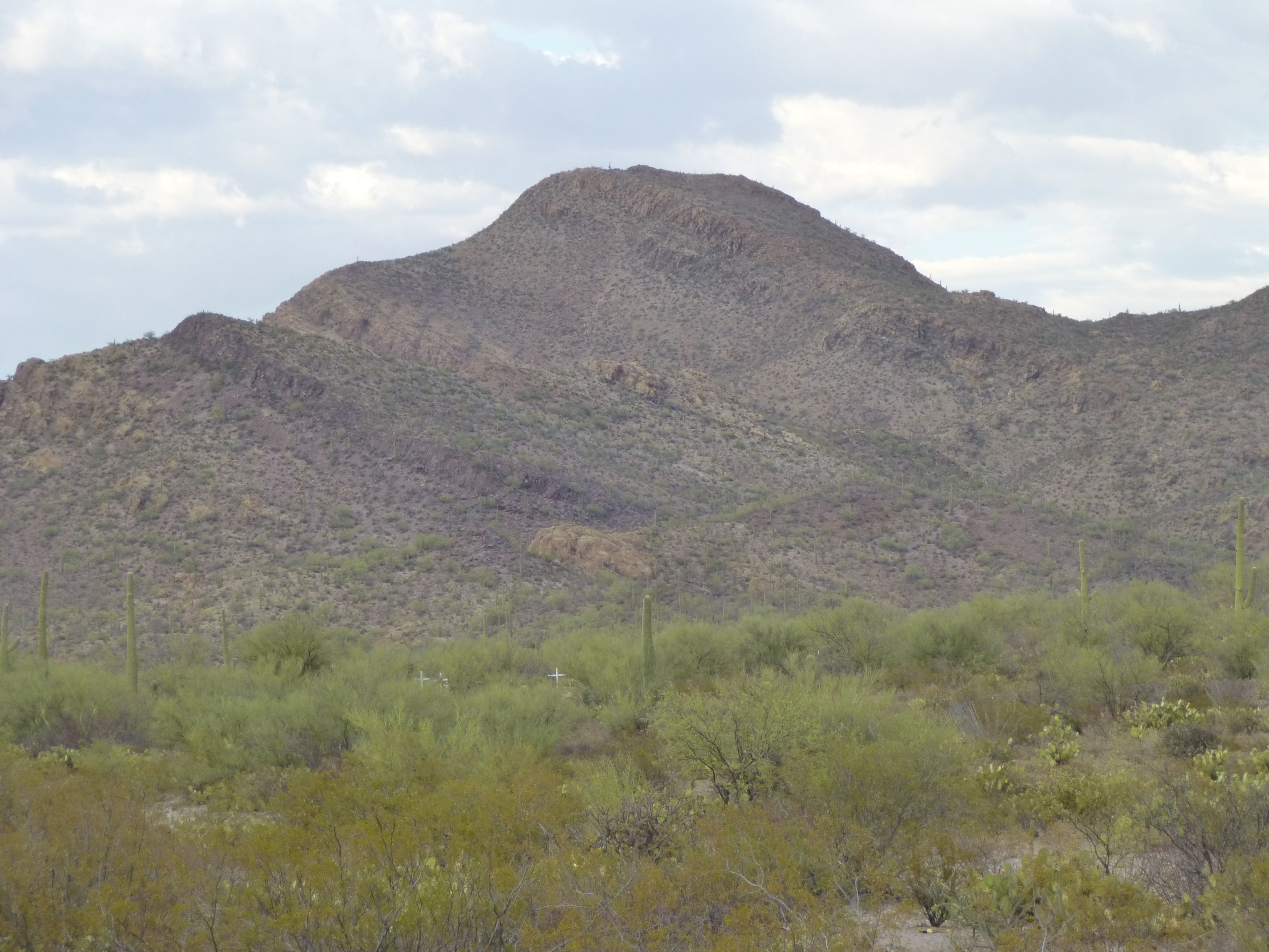
Looking east to Peak 3690
By now, it was obvious a storm was coming – in fact, while we were on top, it started to rain. Beating a hasty retreat off the east side of the mountain, we made it down to the desert floor, headed north, then east some more to get back to the truck. By the time we got there, we looked like a couple of drowned rats.
Once inside the truck, we cranked up the heat and changed into dry clothes. Our day was done – all we had to do now was drive in comfort back to town and a hot meal. It was pouring rain as we slowly drove out, and the road had become a running creek with big puddles of standing water in places. Now remember, my truck was just a low-clearance 2-wheel drive, nothing special. These past months, I’d been lucky, driving pretty much everywhere I’d wanted.
When we were still 2 miles from the highway, we drove into a large open area, very flat. Water had pooled here, big-time, and it looked like a small lake. I hesitated at the edge, wondering if we could drive right through it. There was no way to drive around it, so it was either drive straight through it, along where we guessed the road would be, or just leave the truck there and start walking out to the highway. We thought about it for a few minutes, then decided to go for it – I gunned the engine and away we went, straight into the middle of the lake where all forward motion stopped and we came to a dead stop. There was no traction at all, and we were stuck.
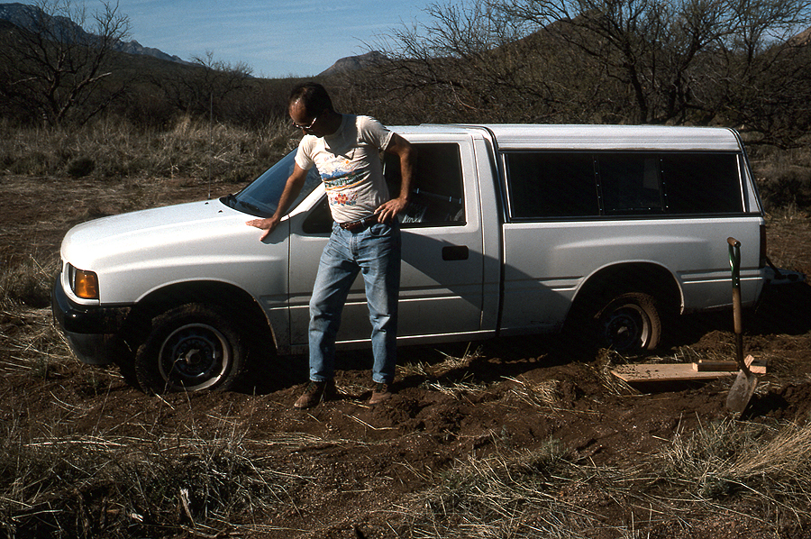
Brian offered to get out and push while I tried to drive. We gave it our best shot, but to no avail – we weren’t going anywhere. Gathering up our stuff, which consisted of day packs and wet clothes, we locked the truck and walked away. Once we reached the edge of our lake, walking the road those last 2 miles was easy. I phoned my wife on the way out, telling her about our predicament. What a trooper – she dropped everything she was doing in the middle of her work-day and left to come get us. By the time we walked out of the desert and up to the paved highway, she pulled up at that very moment. Brian felt badly that I’d abandoned my truck, but it didn’t bother me a bit. Two days later, we drove back there in his rental car, and in an hour and a half we extricated the truck from the mud-hole. Here I am, pondering our next move.
At that point, February 20, 1998, I considered the Roskruge project to be finished. It had spanned 3 1/2 months, start to finish, and had required 13 days in the field to get it all done. There had been 44 different objectives that I wanted to climb, and I found myself leaving a lot more registers out there than I ever thought I would. Yes, I did find evidence of previous climbers on some of the peaks, but surprisingly few. It had been a great winter project and had the advantage of being very close to home.
Four years later, I got to thinking about a couple of things that I’d overlooked, a couple of benchmarks that could be considered part of the range. So, on March 7th of 2002 I drove out to the village of San Pedro one more time. Once there, I headed 4 miles north on dirt roads and parked just west of a small hill called Knoll Benchmark, elevation 2,717 feet. One mile of walking and a couple of hundred feet of climbing took care of it in short order. Clicking on the link below will show you its location.
https://listsofjohn.com/mapf?lat=32.1329&lon=-111.4833&z=15&t=u&d=y
The only feature of note in the vicinity was Viopuli Wash, between the road and Knoll. For some context, La Tortuga Butte lay 3 miles to the northeast.
Once back at my truck, I drove to San Pedro, then west for 2 miles to a bump called San Pedro Benchmark.
https://listsofjohn.com/mapf?lat=32.0749&lon=-111.5192&z=16&t=u&d=y
As I was parking just to the east of it, two O’odham ranchers pulled up behind me. I got out and we talked for a bit. I told them I’d seen the hill from the highway to the south and was curious to drive out to it, and would they mind if I climbed up to the top. As far as they were concerned, it was no problem, as if it were the most common occurrence in the world. I think they were just out there checking fences, and by the time I’d gone to the top, they were already gone. I left small registers on both Knoll and San Pedro that day.
Another 10 years passed, during which time I left the Roskruge alone. But, as luck would have it, in early March of 2017 I was playing around with maps and discovered a peak I’d missed in my travels out there 20 years earlier. One warm afternoon, I dutifully drove in from Highway 86, and after miles of dirt road I reached Aguirre Pass. There, I found a lesser road heading south and ending at a guzzler. These collect rainwater as it falls and save it, usually in an underground tank, channeling it into a trough for animals to drink.
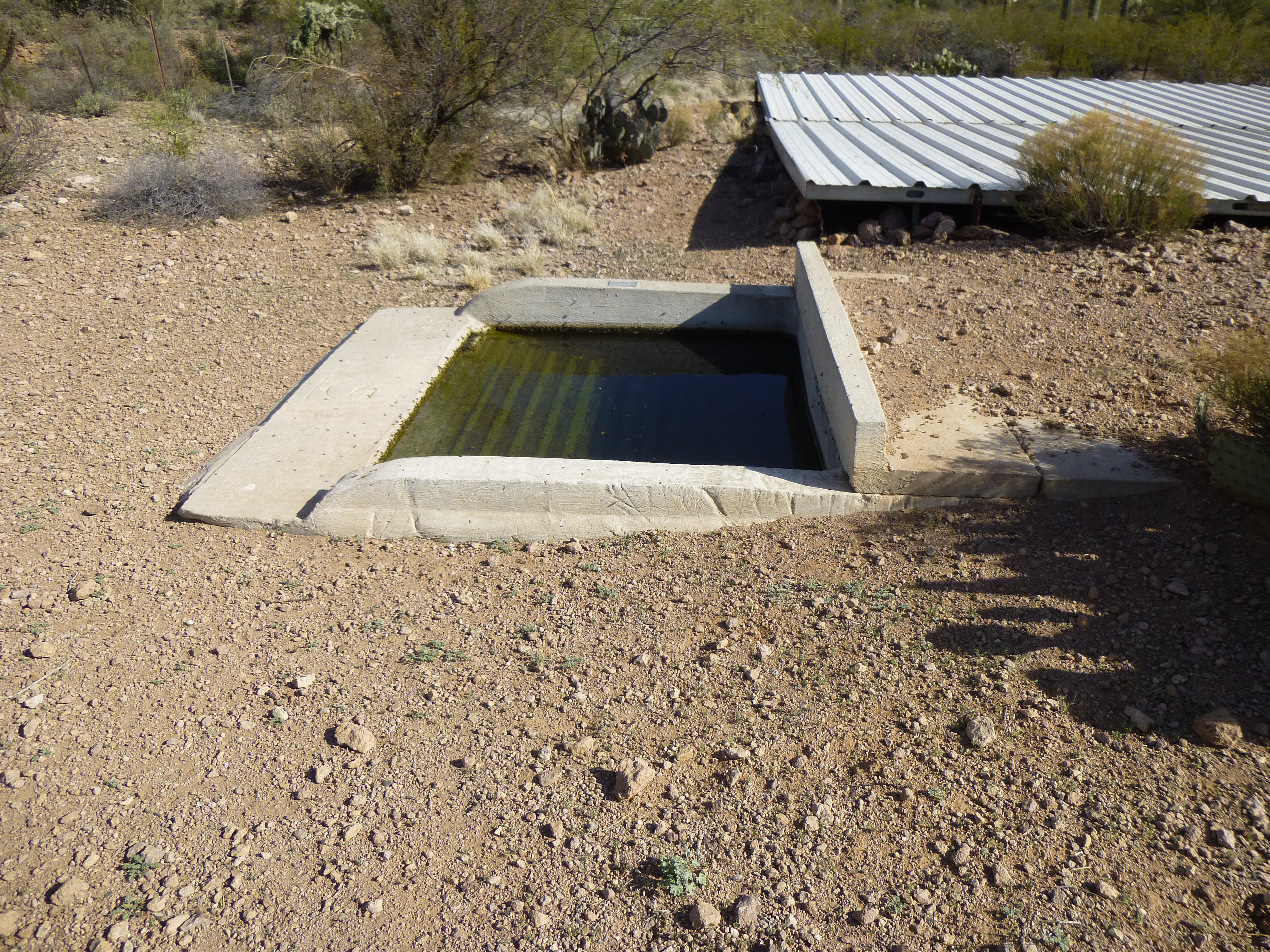
The guzzler
It was an easy walk through low hills and washes to reach Peak 3242, which was visible from where I’d parked.

Looking southwest to Peak 3242
On its summit, I found a rock cairn and left a register inside it.
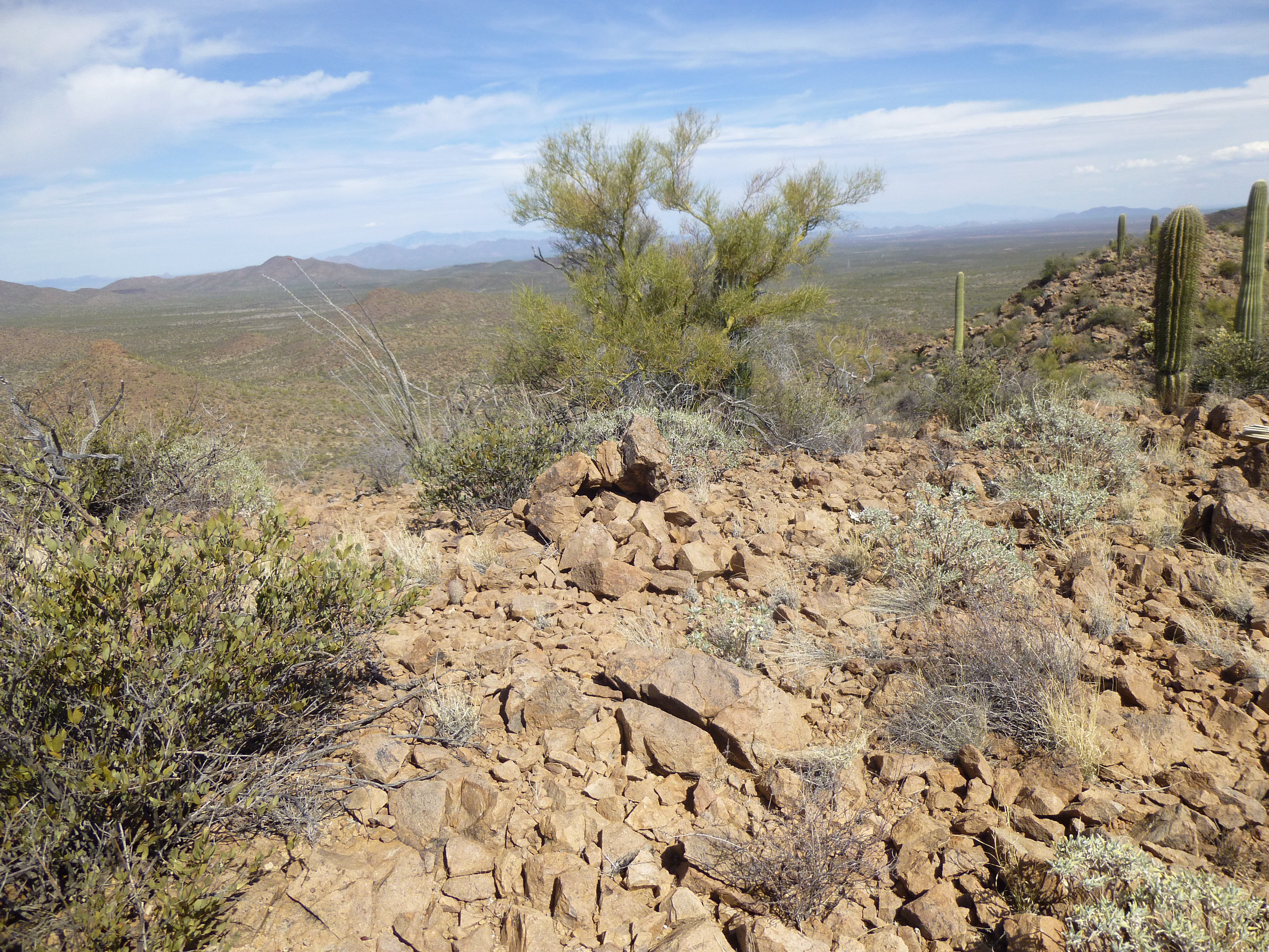
The cairn on the summit.
Back at the truck, I found carpet shoes, evidence that indocumentados had enjoyed the water provided by the guzzler.
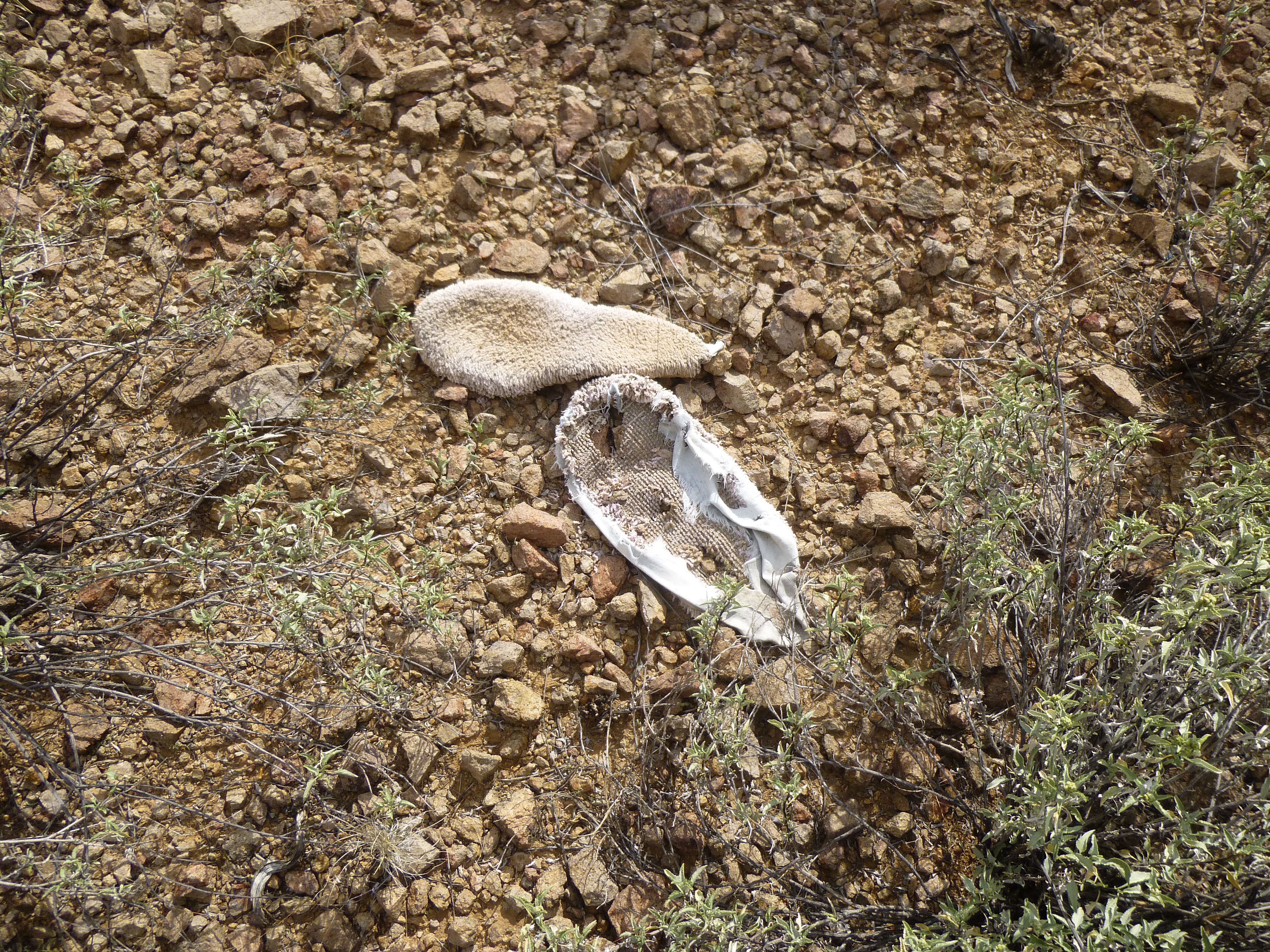
Carpet shoes
Well, now I truly was finished all of the peaks in the Roskruge Mountains. It had been a good run and I’d enjoyed every minute of it. For anyone keeping track, 15 of the 47 objectives I’d climbed were on the Tohono O’odham Indian Reservation; however, all 47 of them were good mountaineering fun.
Please visit our Facebook page at https://www.facebook.com/pages/Desert-Mountaineer/192730747542690