
It was gonna be a good day. Almost 2 years had passed since we had enjoyed a climb together, so it was high time. I picked Brian up before daybreak and we headed south on freeways for 50 miles, then turned off on a lesser paved road for another 25 to take us to the fun and quirky village of Arivaca. There, we started south on Road 216, but about 10 miles in, we stopped to take a closer look at the map and check our position with the GPS. The readings didn’t make any sense – even though both of our units matched, it placed us well off of where we wanted to be. As we sat there in the truck pondering the mystery, an older couple heading into town pulled up beside us and rolled down their window. “Are you lost?” they asked. We told them where we wanted to go, and they informed us that we’d taken a wrong turn at the last road junction. Oops, that was embarrassing! An about-face, and ten minutes later we had fixed our mistake. We continued on Road 601 for a mile, where we arrived at Coches Well.
Coches Well
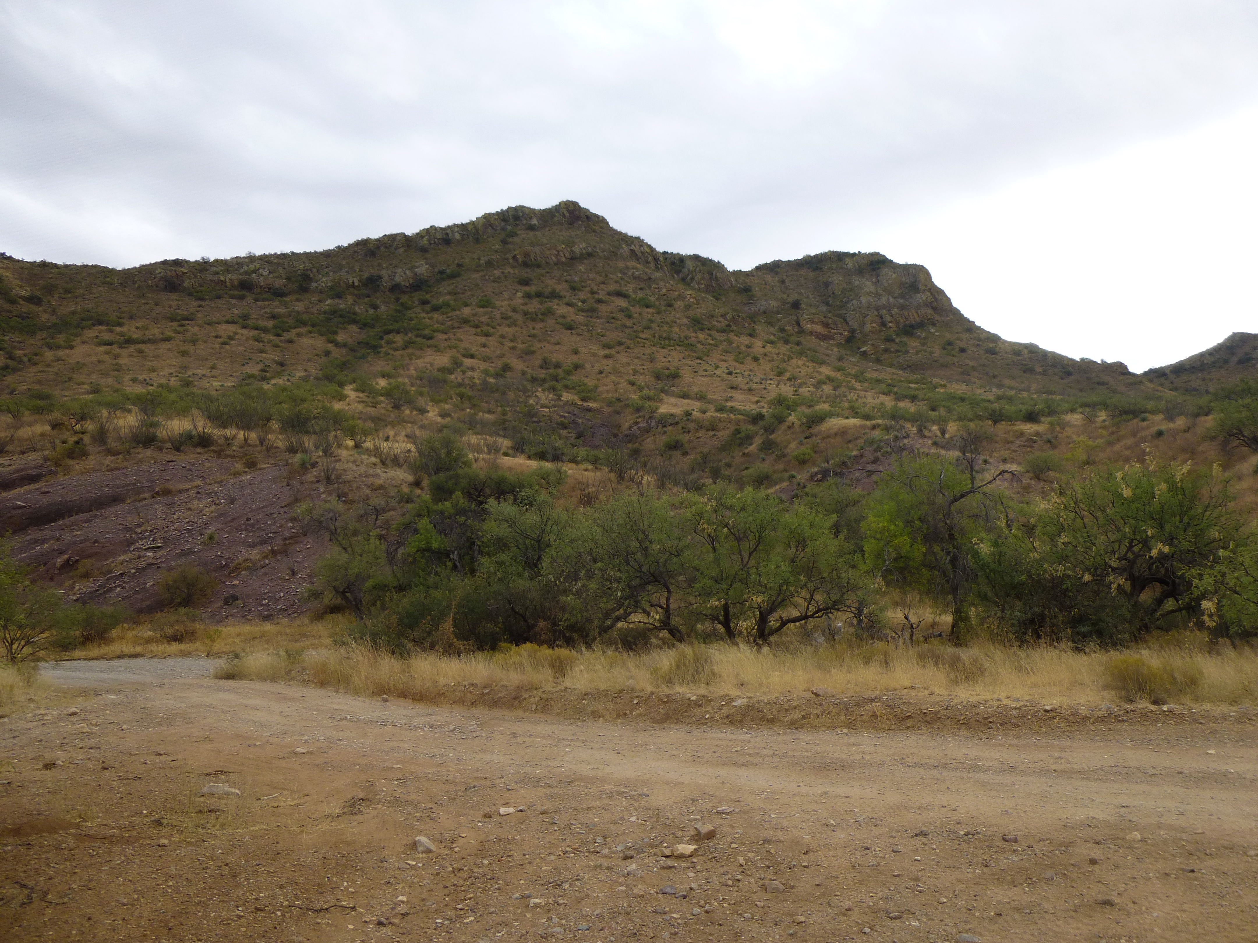
A short drive north on a side road brought us to our first peak of the day. Peak 4555 sat a short distance from the road, and would be an easy jaunt.
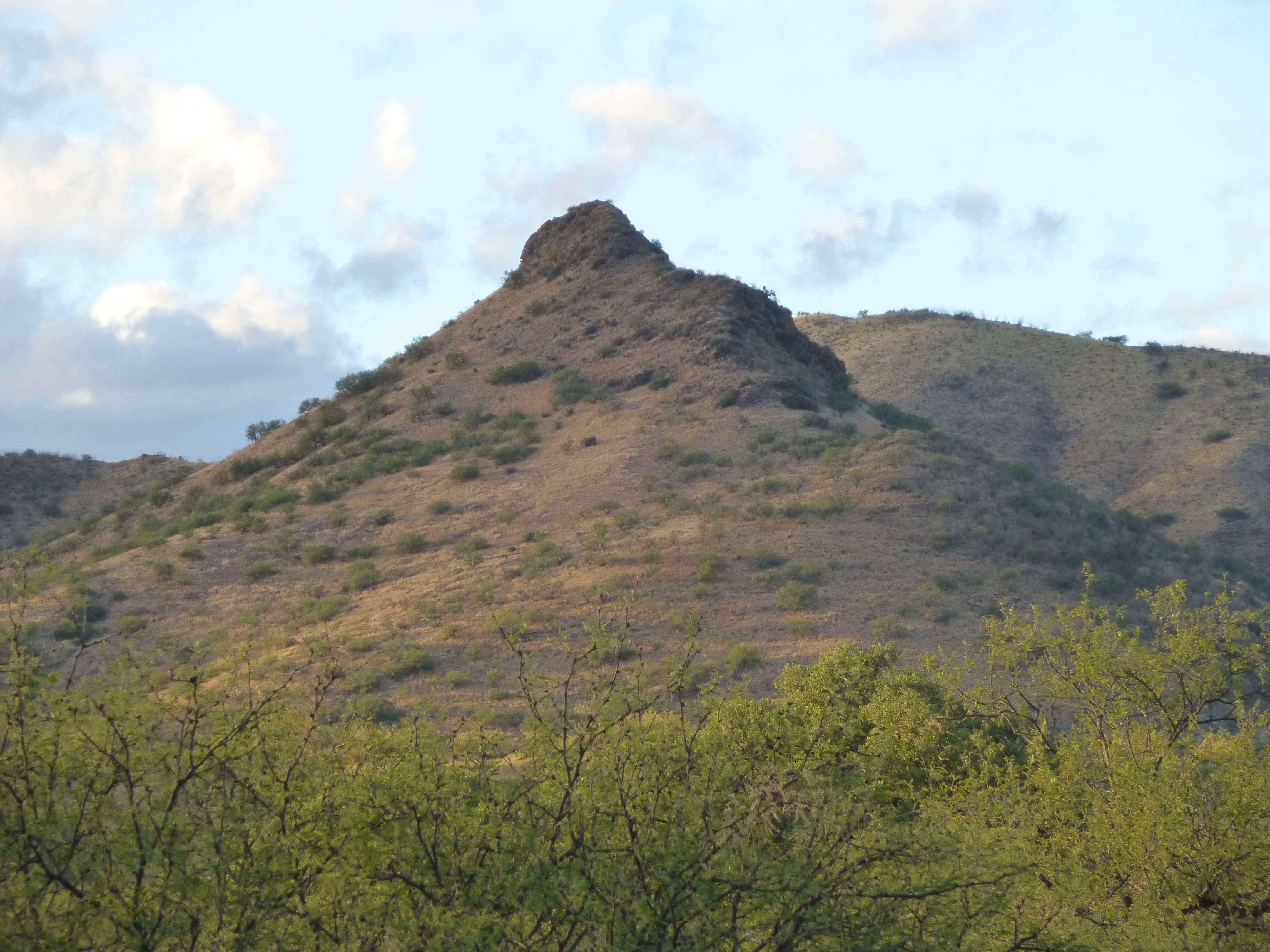
Peak 4555
We dropped down into and crossed Alamito Wash, then made our way up the southeast ridge of the peak. There was plenty of sign that Bad Guys had spent time on the ridge, waiting for the opportune time to move on. Among some of their leavings, we found this snakeskin – it’s the white thing in the middle of the photo, about 3 feet long.
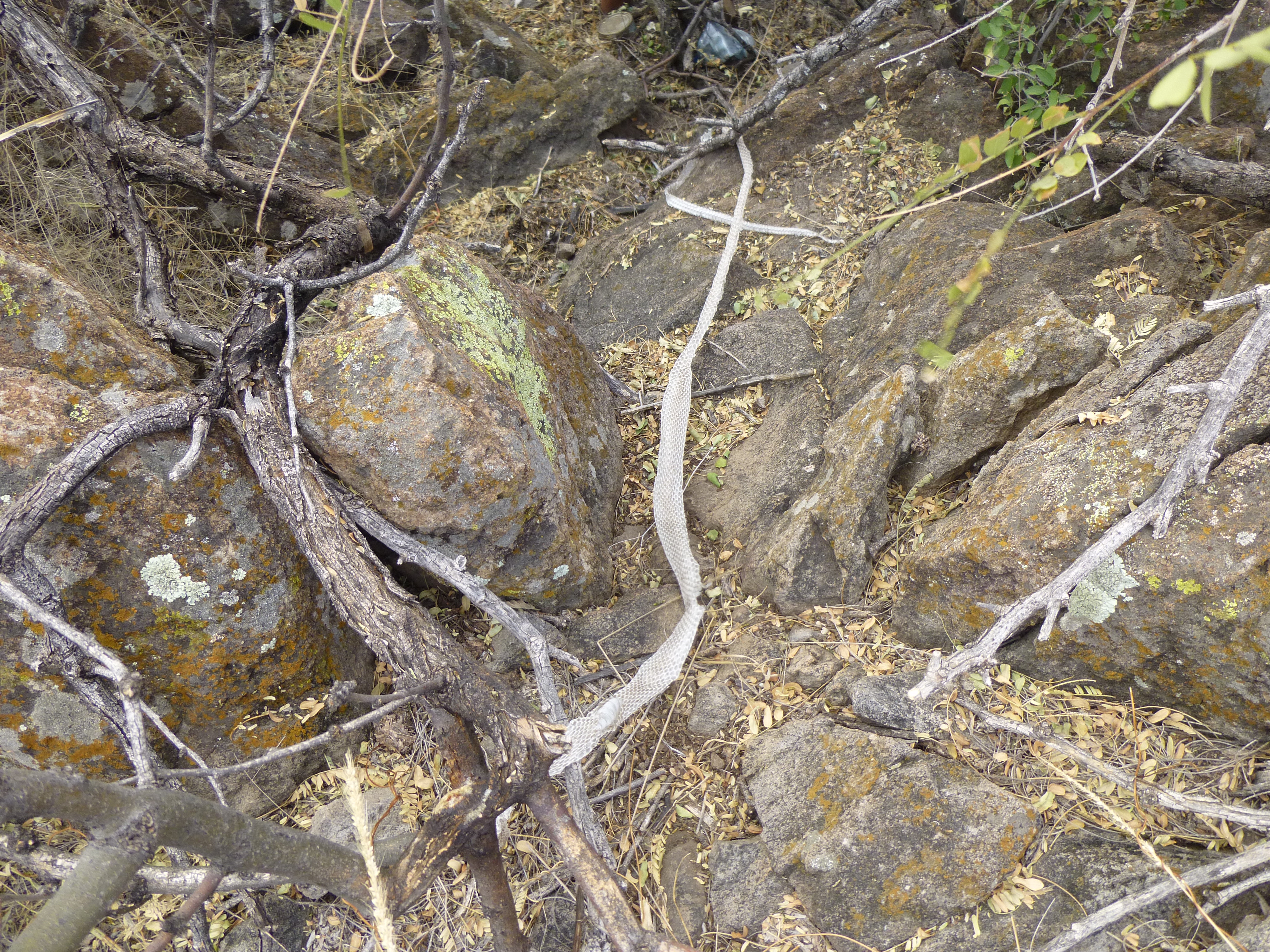
The snakeskin
We left a register on the summit, then started down a different way. From the top, something had caught our eye and we just had to pay a visit. Back down in the wash was this pond – in the far right background, you can see a steep earthen bank that a bulldozer had created.
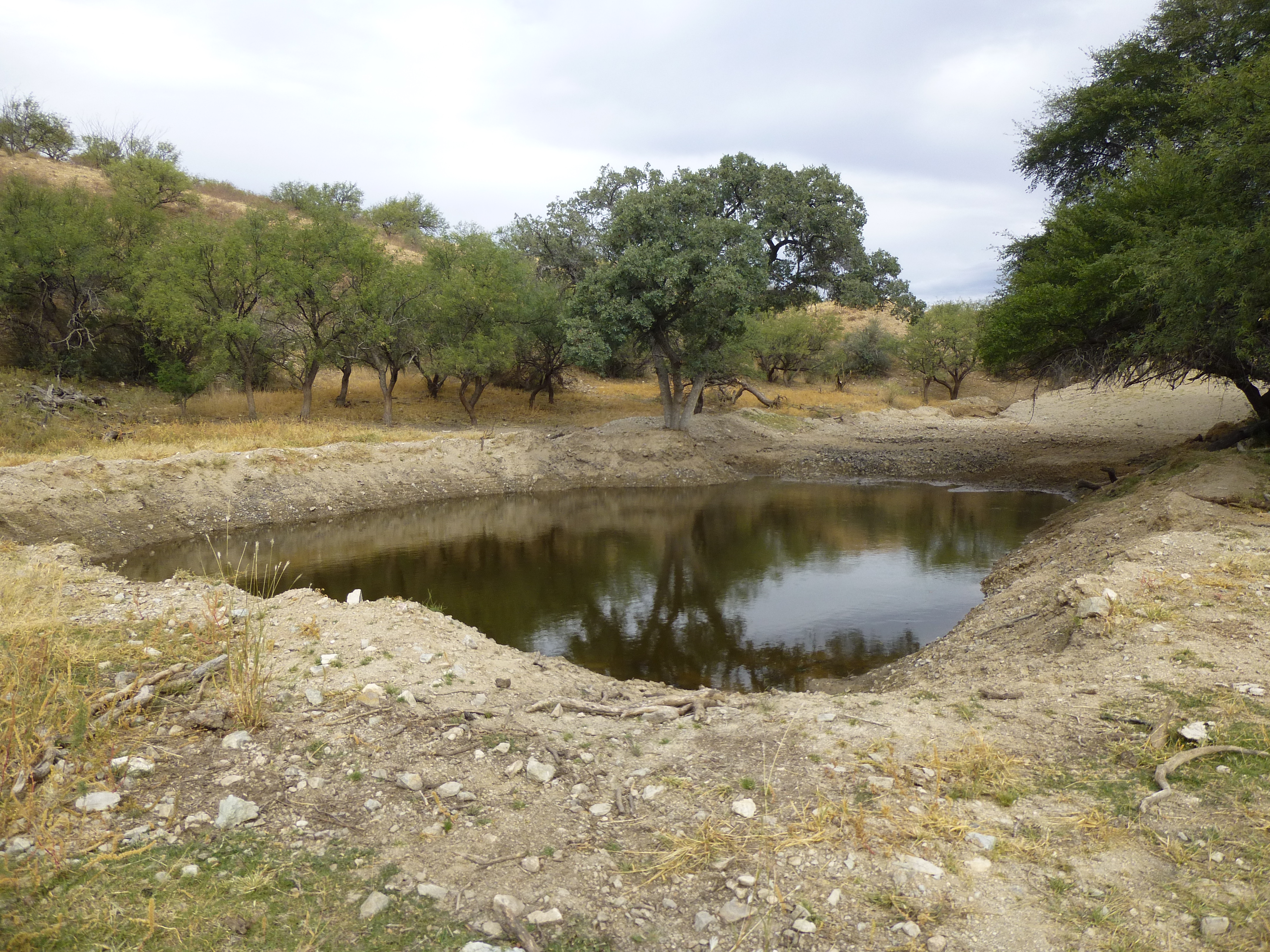
The man-made pond
But here’s the real reason we’d come by – Alamito Tank. It doesn’t look like much with all that scum on it, but it’s an important water supply for cattle and all kinds of wildlife. That’s our peak in the background.
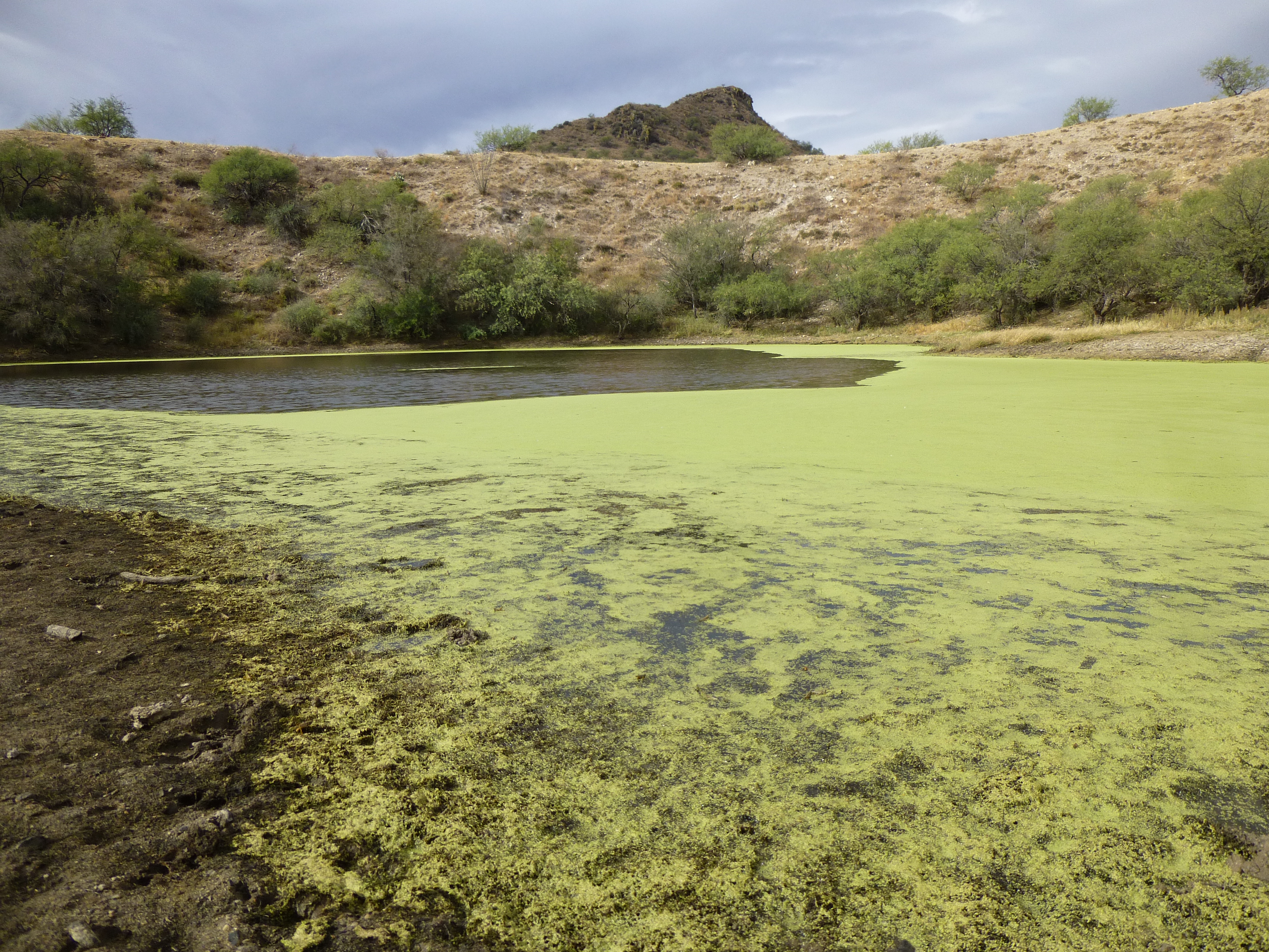
Alamito Tank
On the ground nearby were the remains of a hawk – not much left but feathers, a skull and one talon.
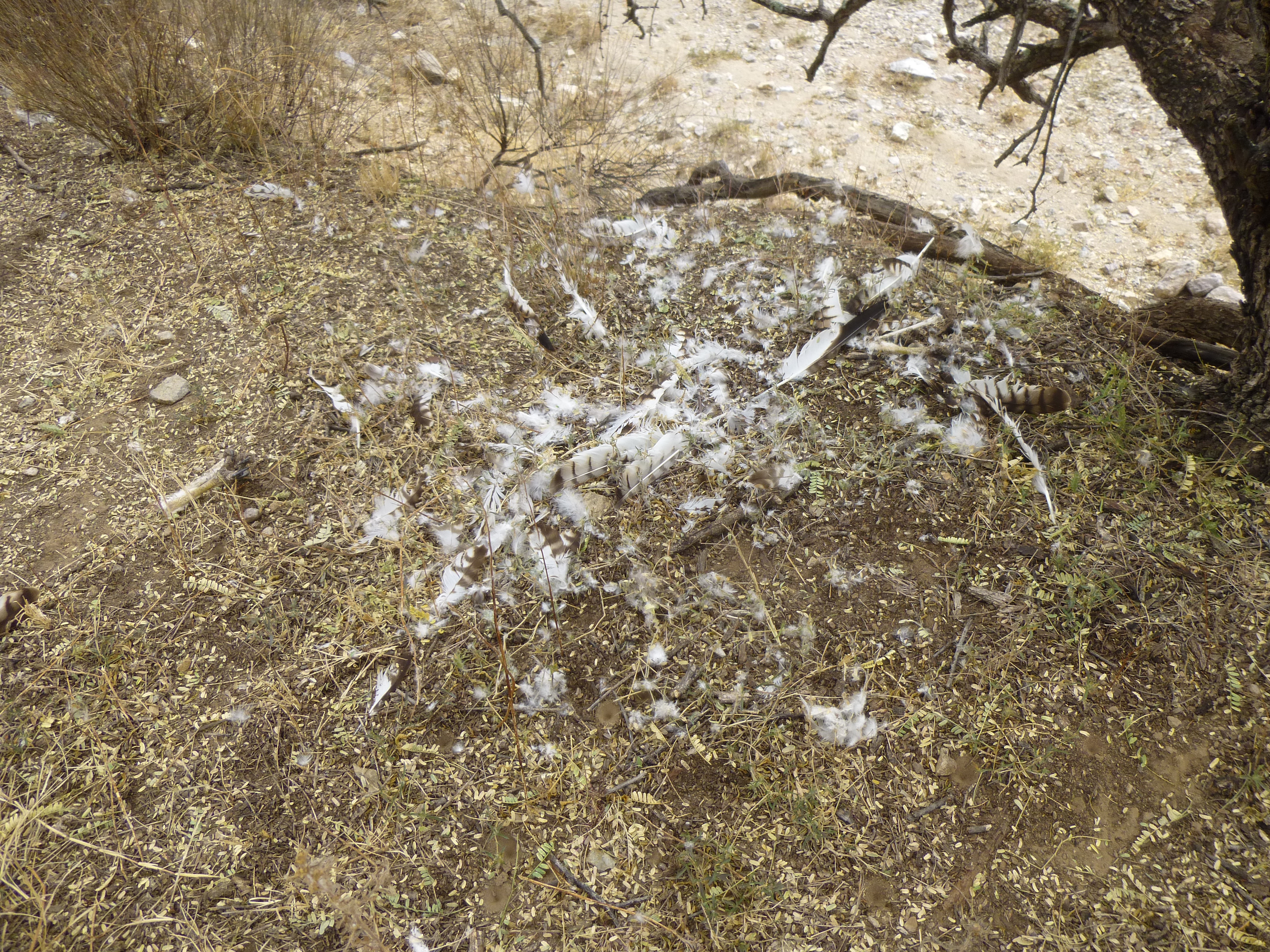
The ex-hawk
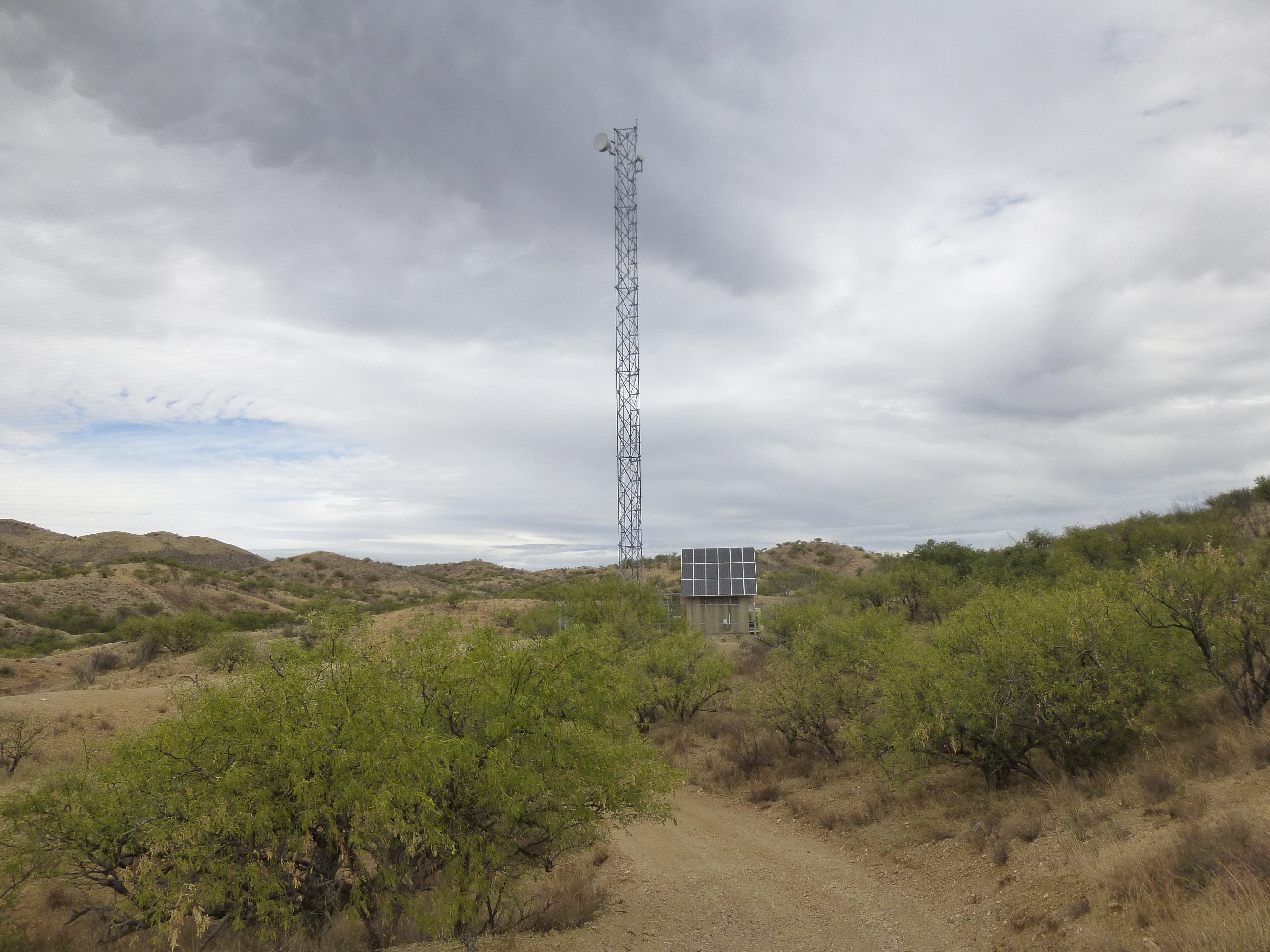
Nearby, at the end of the road, stood a high tower – we weren’t sure what it was for, but we saw 3 of them during the day in this same valley – I suspect they had something to do with law enforcement communications.
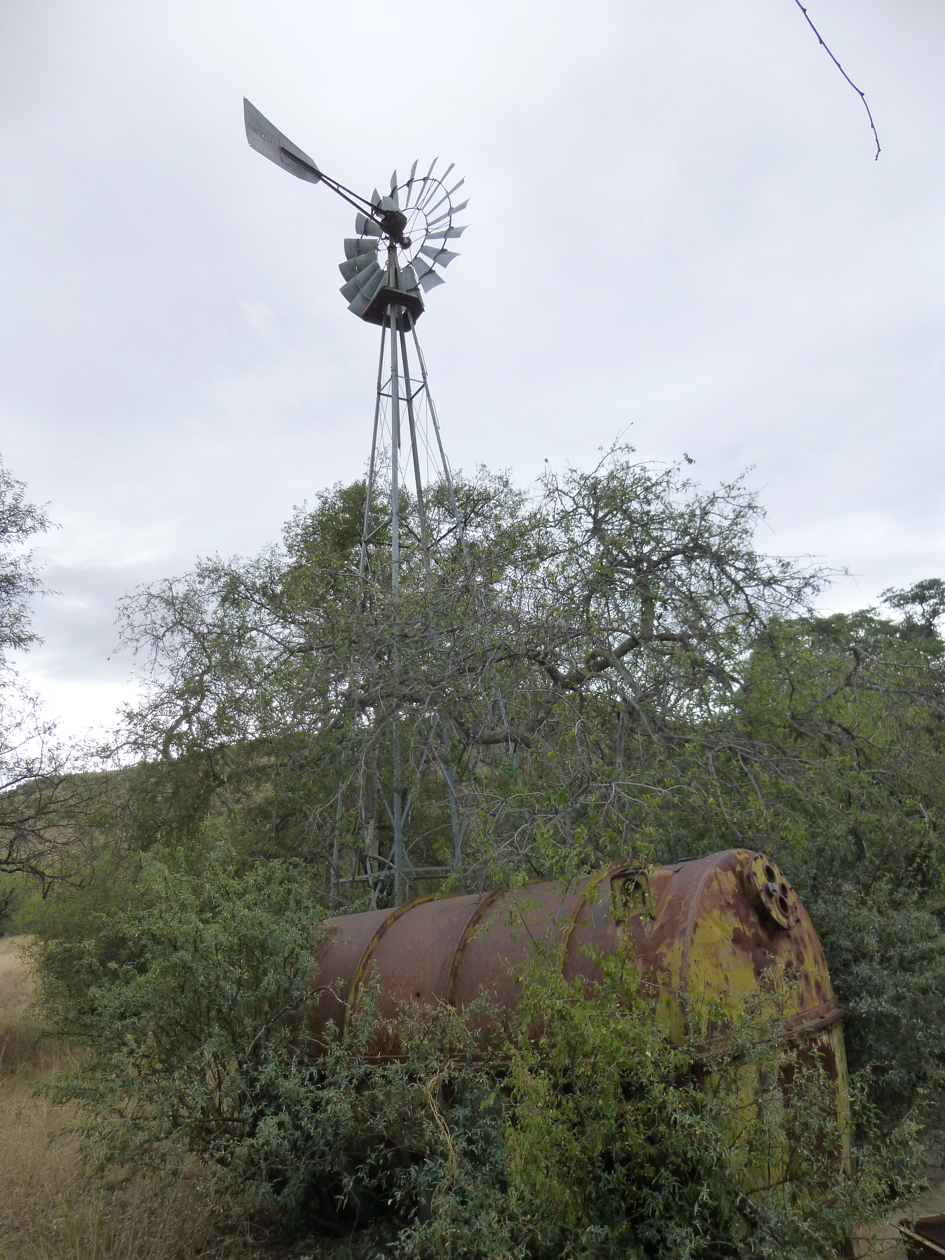
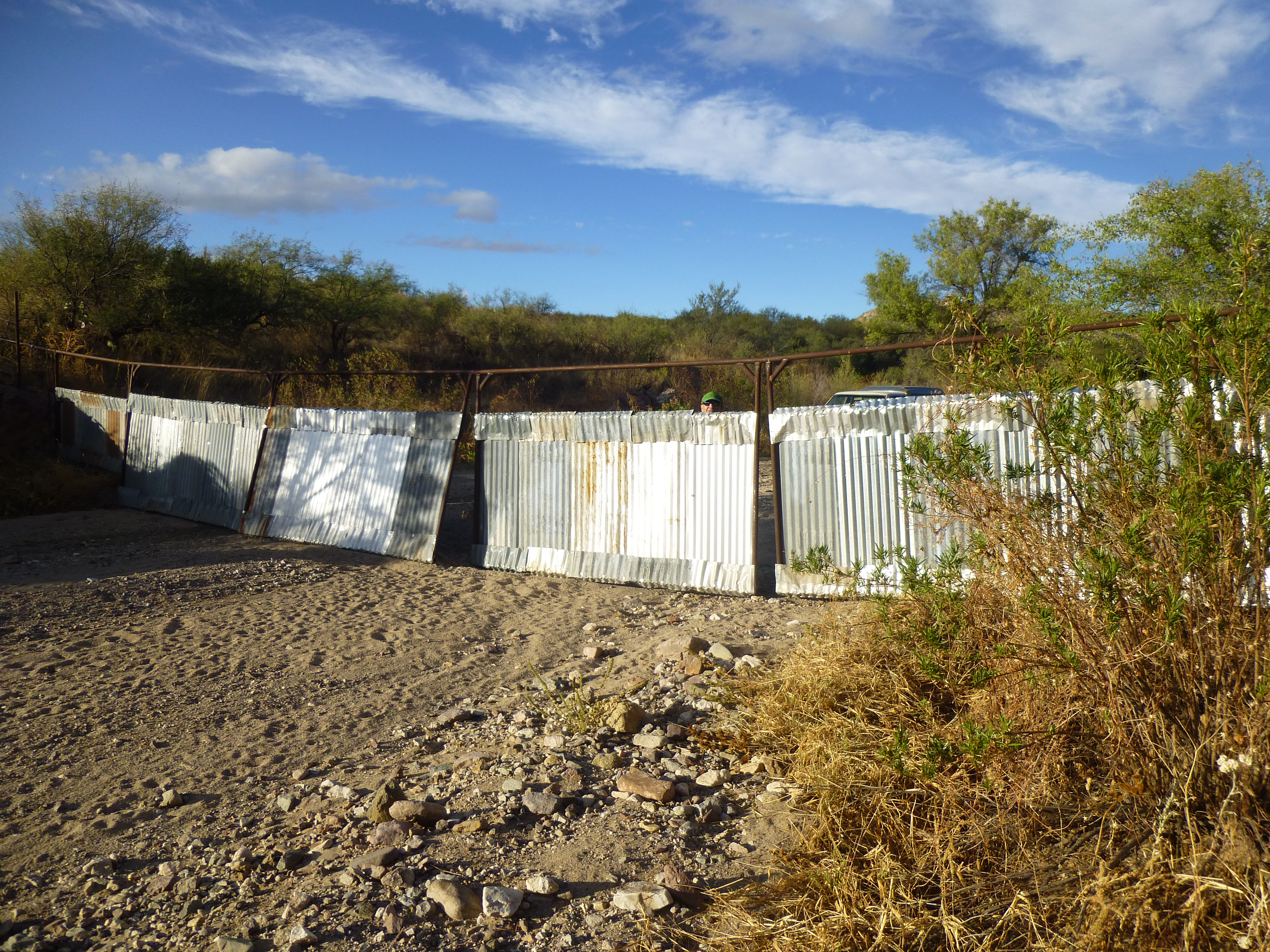
By the time we made it back to the truck, 1 1/2 hours had passed. A few minutes driving took us back to Road 601, then we continued south a short distance and parked on a side road near Coches Windmill.
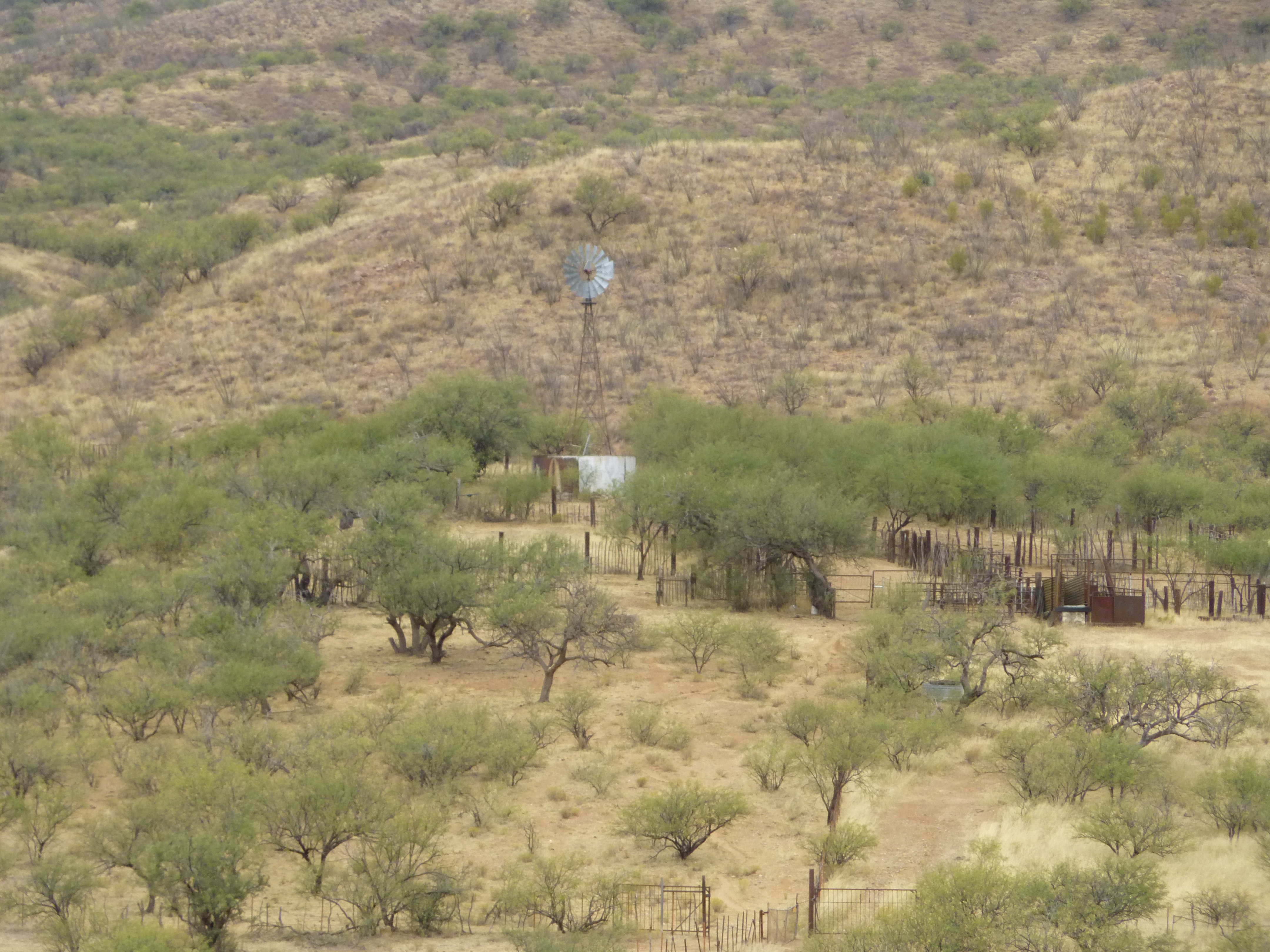
Coches Windmill
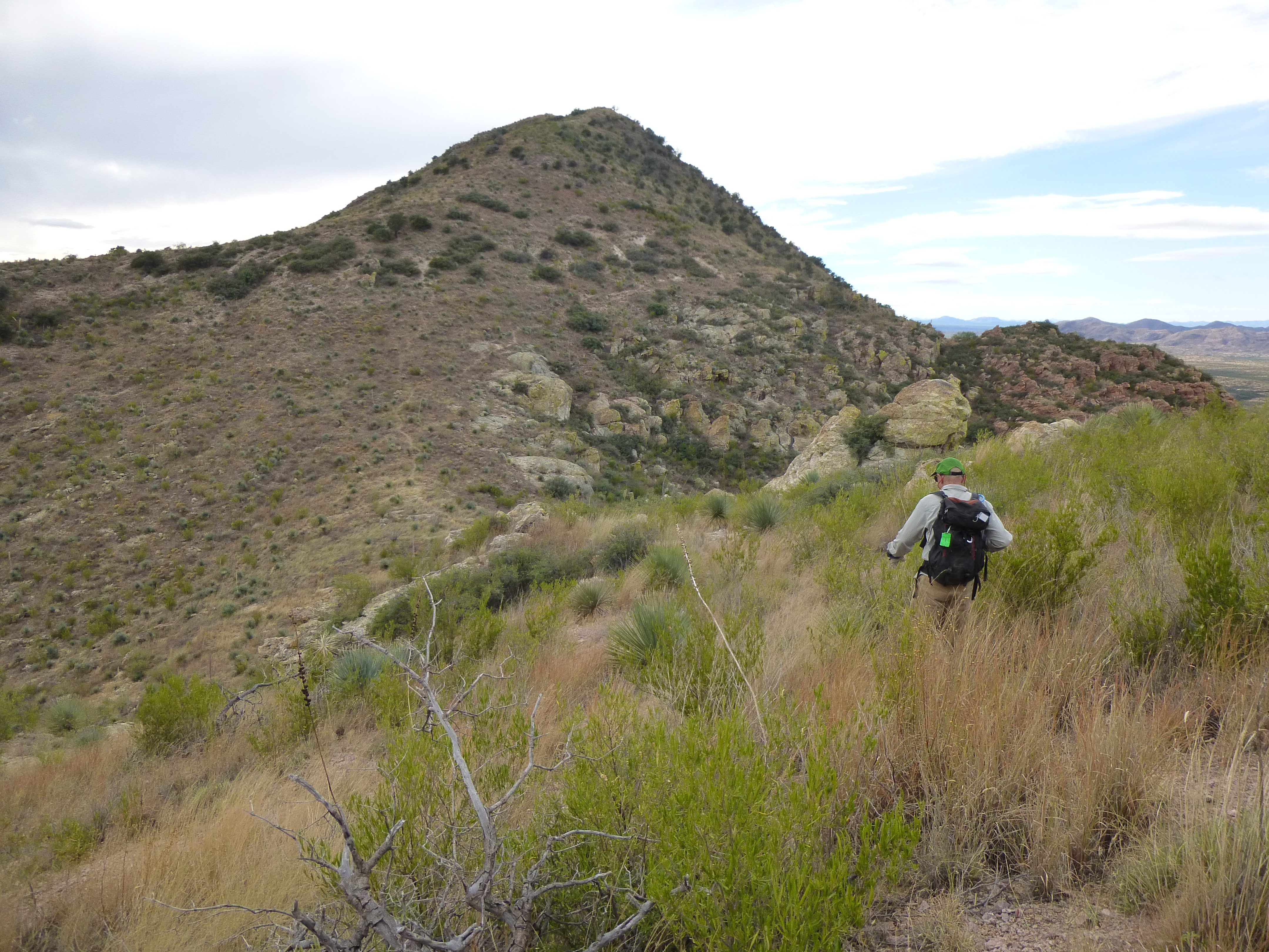
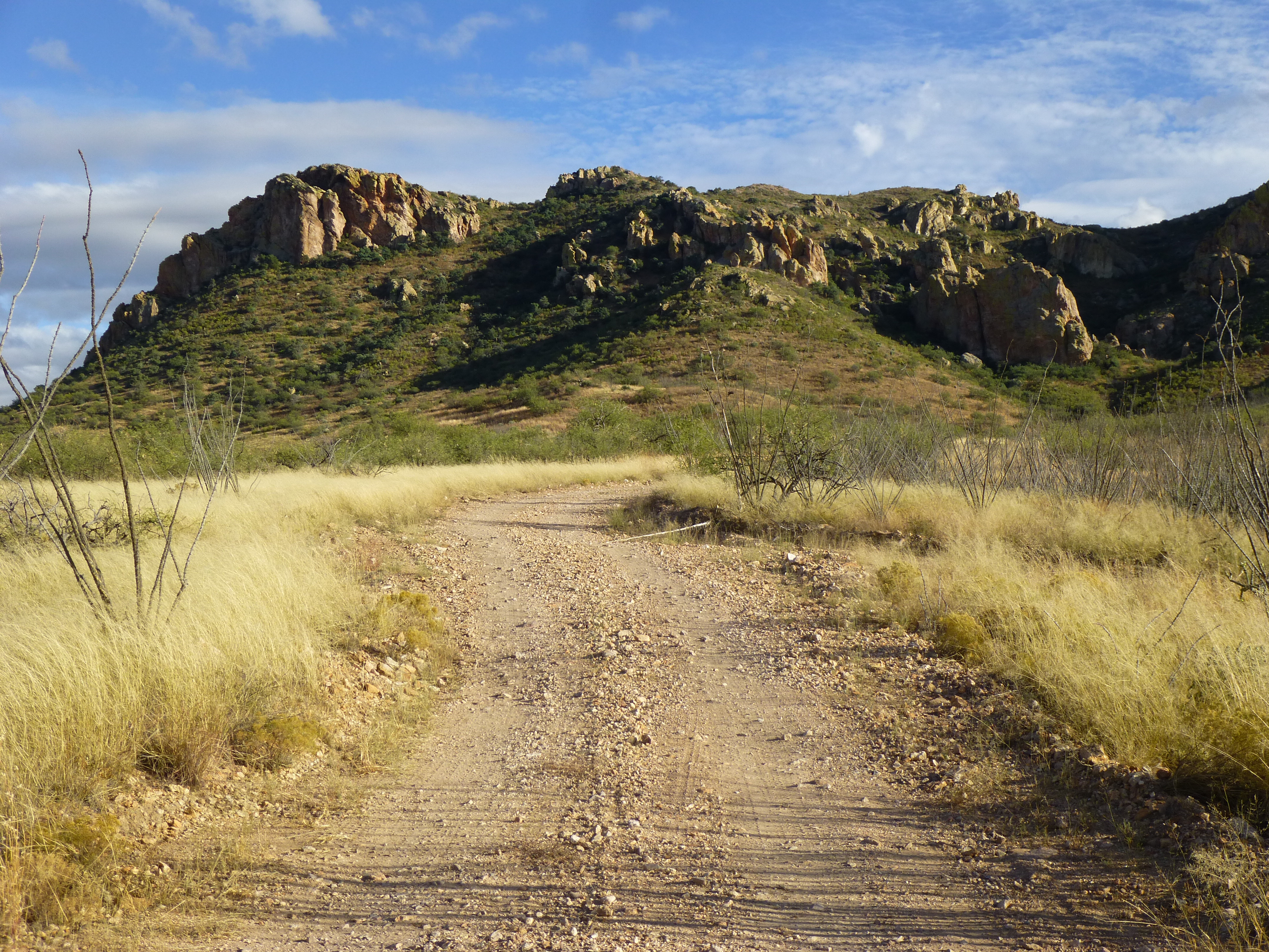
Coches Ridge dominated the eastern side of the valley, running north-south for several miles – a lot of its length was guarded by cliffs. There are 2 summits on it – Coches Ridge South, at 4,775 feet, is the highest point. Today we were here for Coches Ridge North, a bit lower at 4,717 feet. We stood by the truck and studied the mountaintop, trying to make sure that we’d identified the right spot to climb. This whole area has, for years, been a real hotbed of illegal activity – Bad Guys have smuggled drugs and people through here, heading north. Satellite photos show a great many footpaths, all made by this type of activity, and several follow the high country of Coches Ridge. We expected that we could run into someone at any time.
Looking southeast to our peak.
It was an easy bushwhack for the 850 vertical feet up to the crest of the ridge, then a short walk over to the summit. We found a cairn and left a register – it was noon. There was trash aplenty up there, clear evidence of illegal activity. From our vantage point, we had an unbroken view south along the ridge, its 3-mile length reaching almost to the Mexican border. See the lone peak off to the right in the distance – that was the real McCoy, the one I had in my sights.
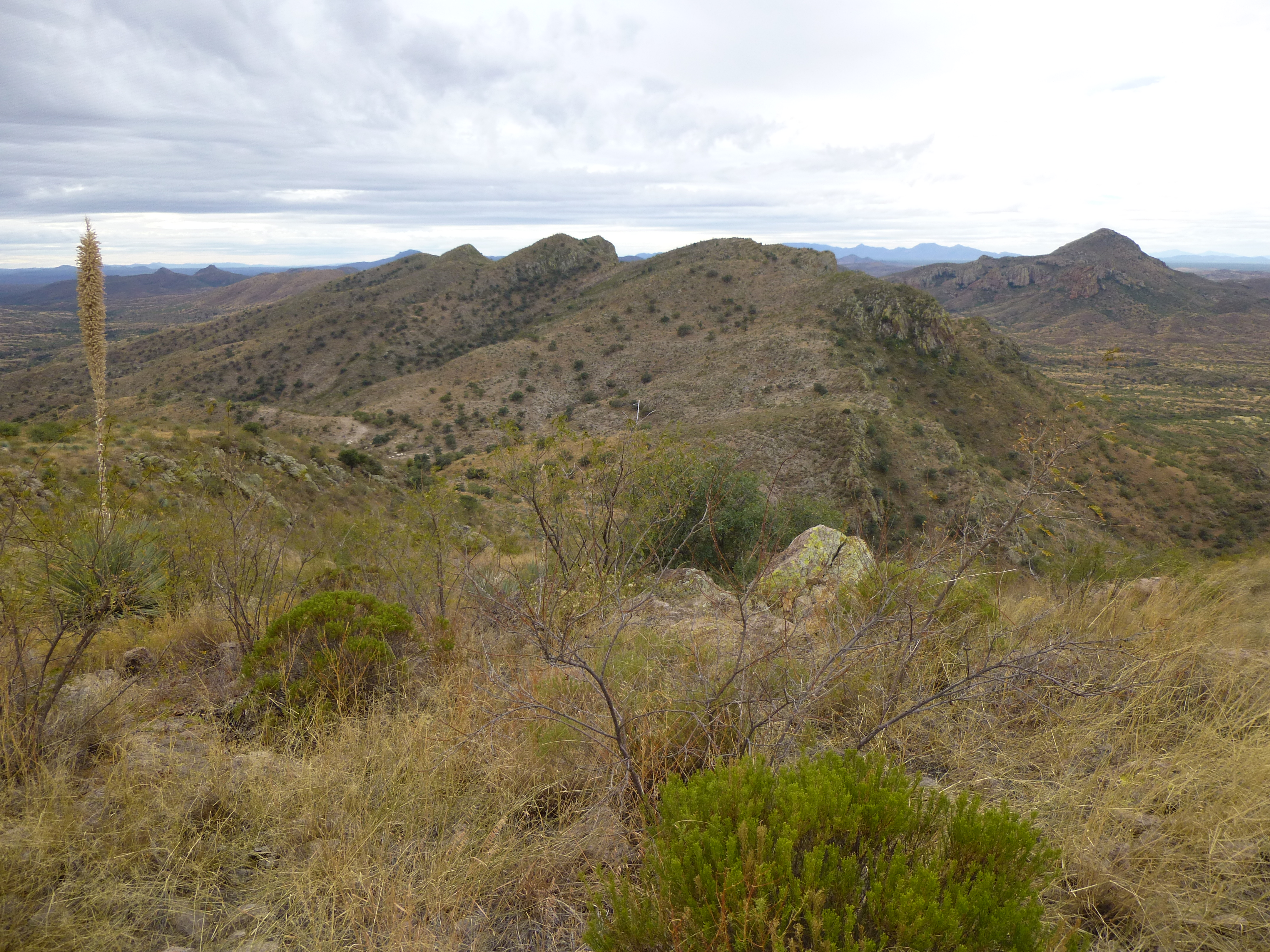
Coches Ridge
The return to the truck was uneventful – we hadn’t seen a soul, but the day was still young. A drive of 3 miles more along Road 601 brought us to a lesser road, which we took. It turned sharply south and headed towards the Mexican border. A mile later we parked at its end on the shoulder of our peak. We were less than a quarter of a mile from Mexico.
This one looked seriously brushy; in addition, there were plenty of cliffs limiting our choice of routes. There appeared to be a lane of sorts, less brushy, that led to the highest part of the peak. Up we went, but soon discovered that any easy going was merely an illusion. It steepened as we climbed, trying to avoid the worst of it. Cliffs made the choice of route for us higher up, funneling us into a narrow channel. At one point, Brian called out that he had found a fence, which we crossed. It seemed like this should be the border, but based on what we learned later, it wasn’t – just a barrier to keep American cows from becoming Mexican cows. It was a bit too far north to be the border.
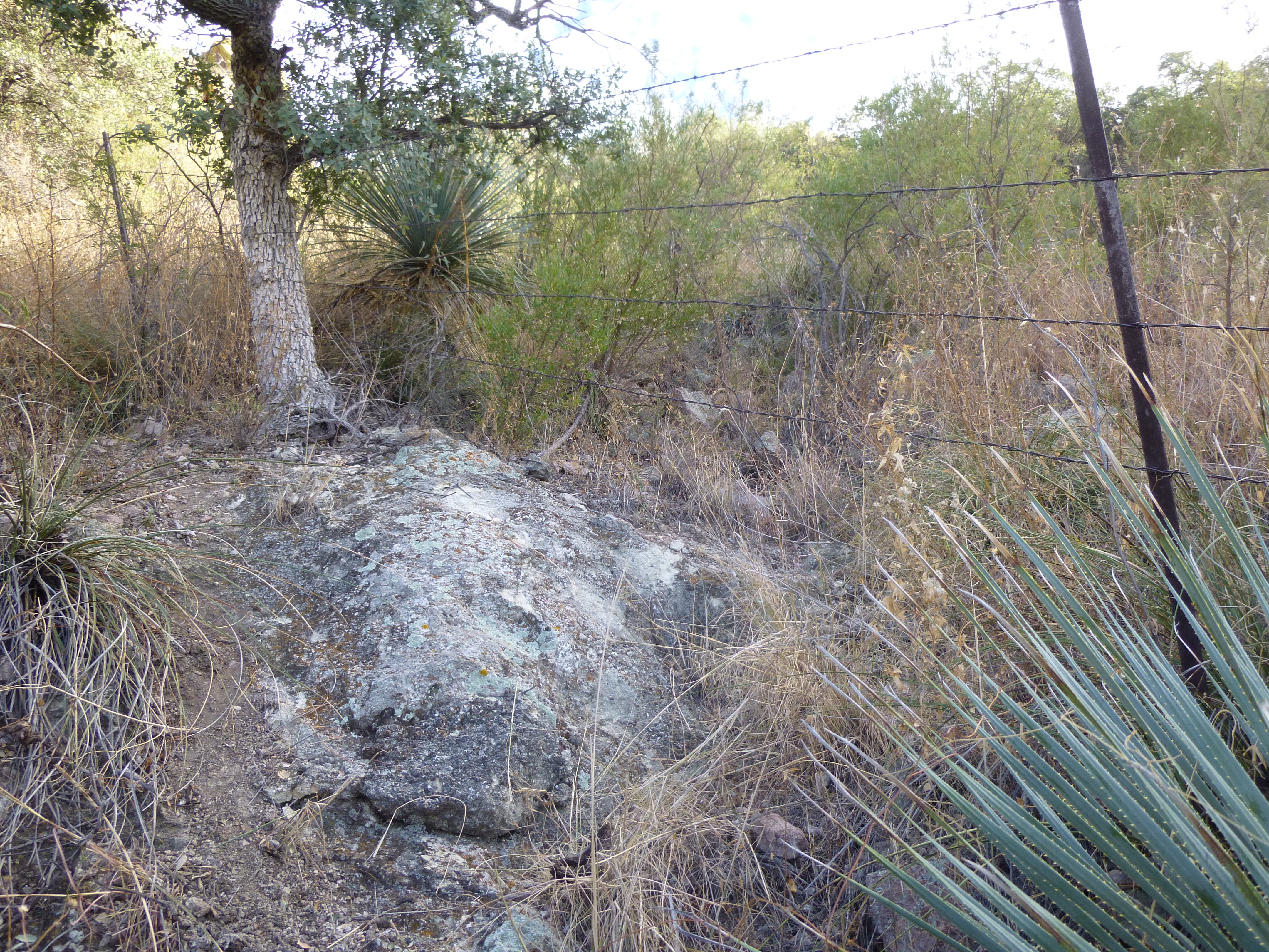
The fence
We thrashed our way higher, and before long stood on the ridge. We knew that we stood on what was labeled Cerro del Fresnal on the US topo map – there wasn’t much to it, a few gentle bumps, and certainly not a summit in its own right.
Cerro del Fresnal
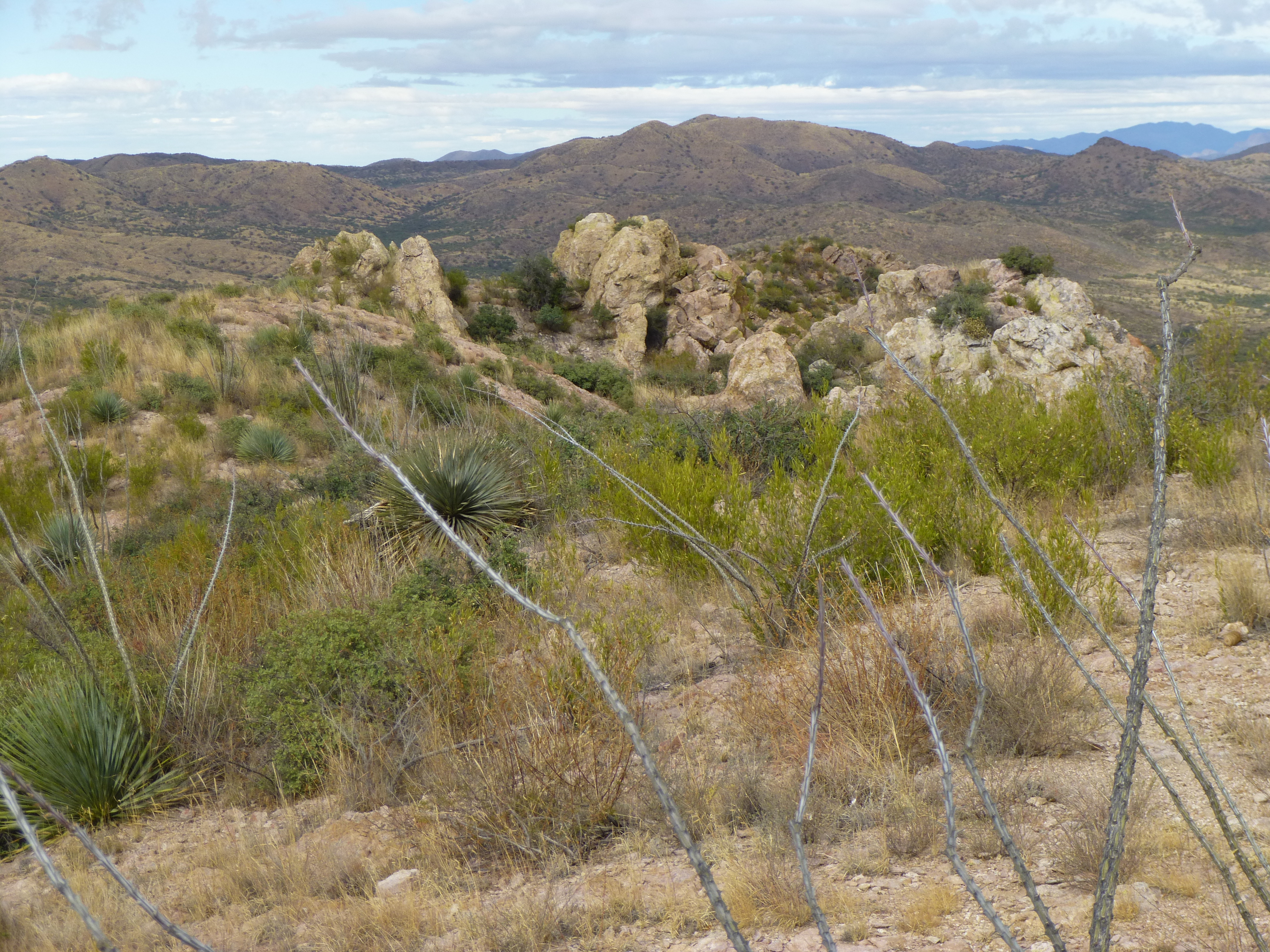
From the valley below, we had seen the unmistakable shape of a border monument near here, but couldn’t find it right away. That was odd, it’s not something you can easily lose. It had to be farther south, so away we went – after crossing a bump or two, we spotted it on a gentle rise a couple of hundred yards away. One cliff in particular forced us to lose some elevation before thrashing our way back up again through the brush on a loose hillside, and we were there.
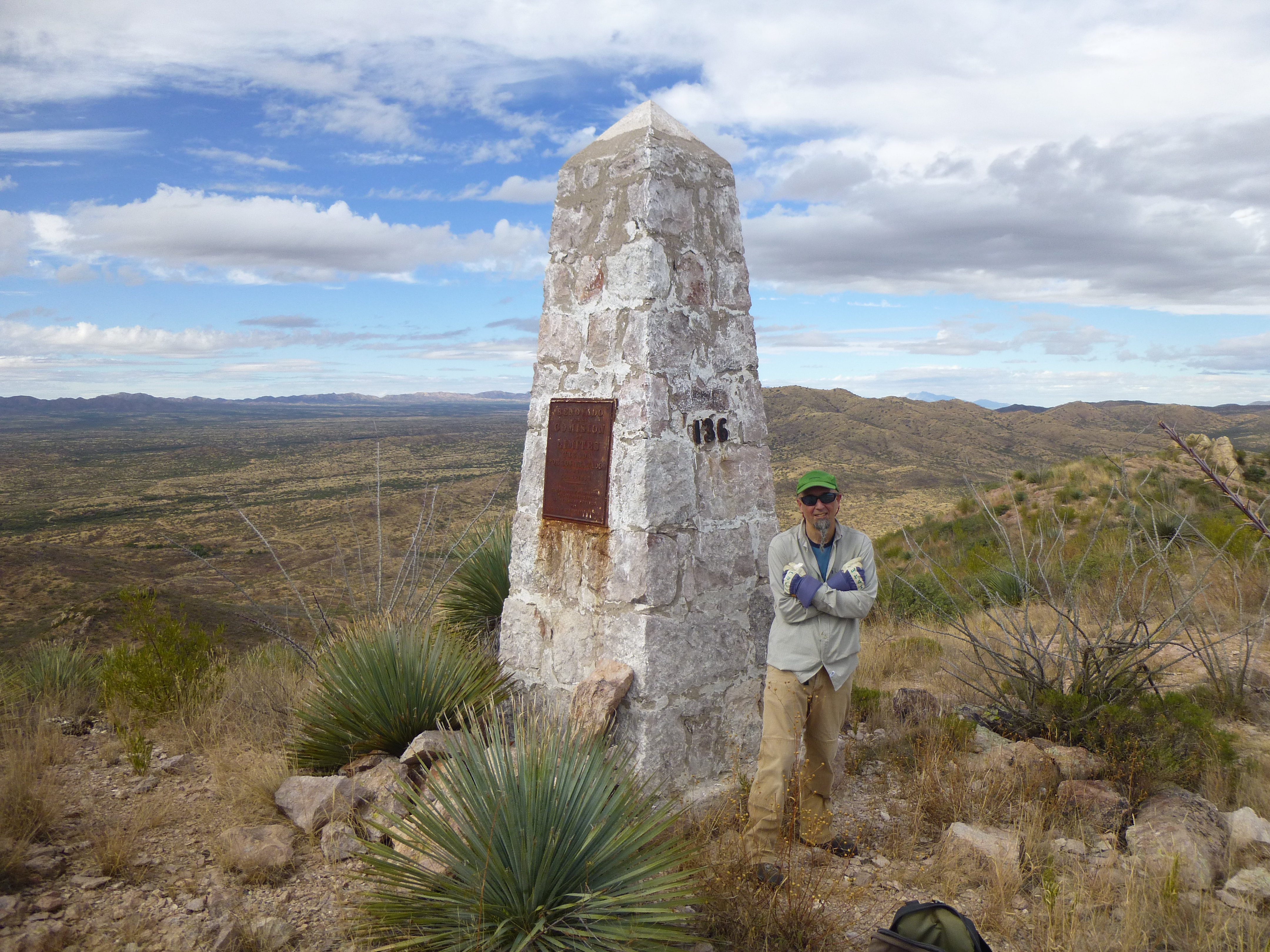
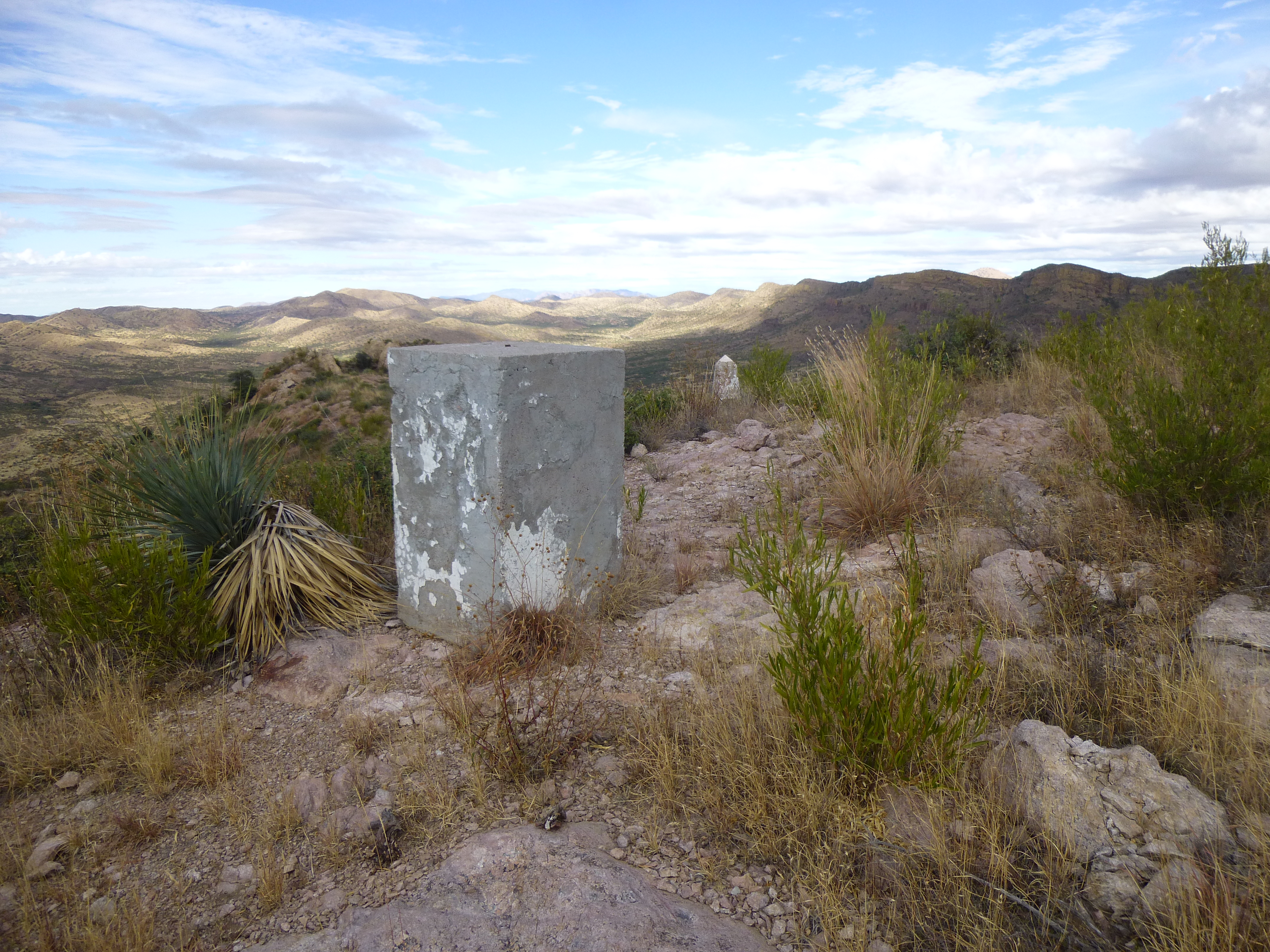
Border Monument 136
Border Monument 136 was a real beauty, one of the old-fashioned ones from way back. It was made of pieces of rock mortared together, and had the old style of metal plaque on each side. Although these were pretty rusted, here’s a photo of each.
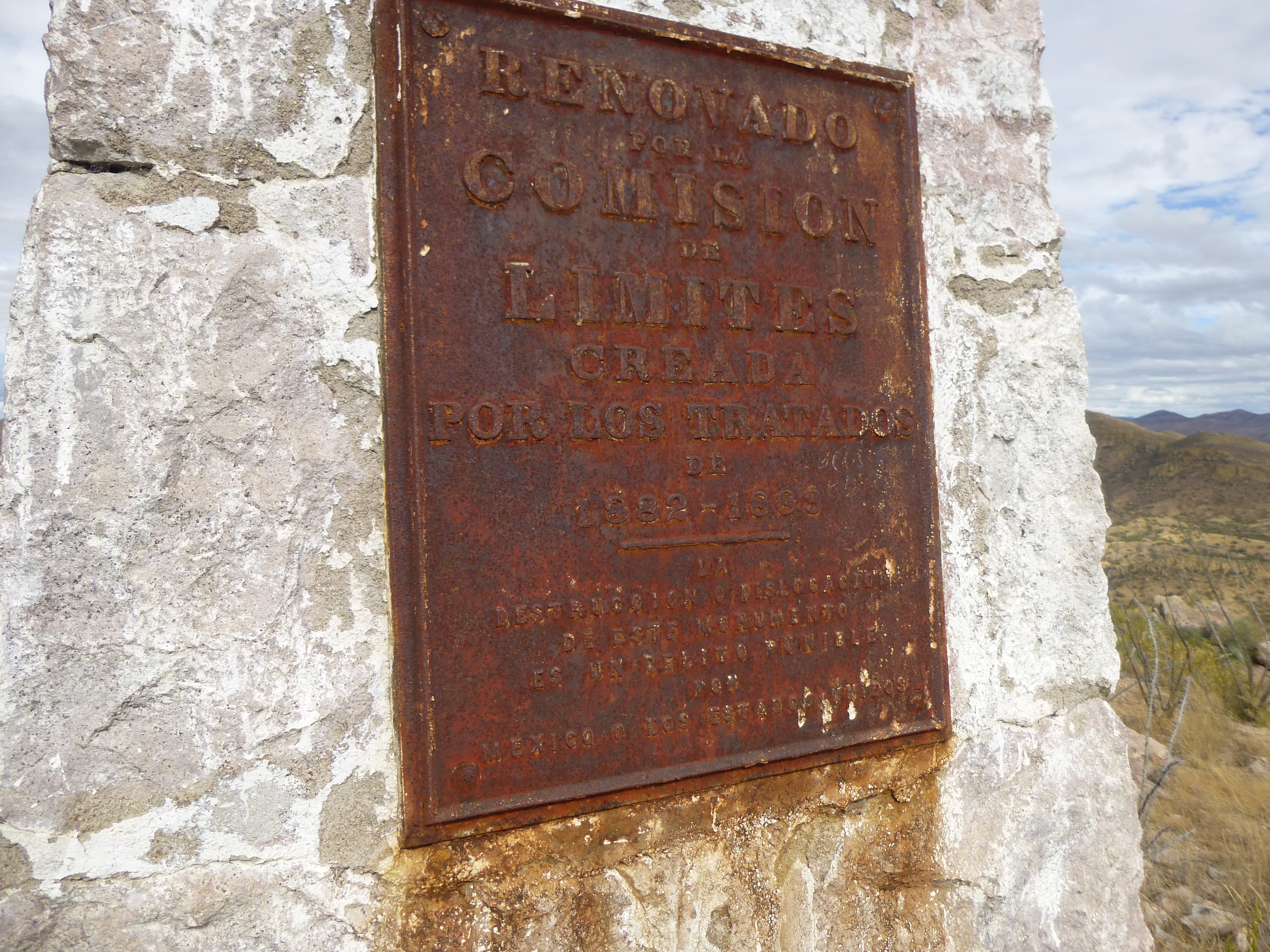
The Mexican plaque
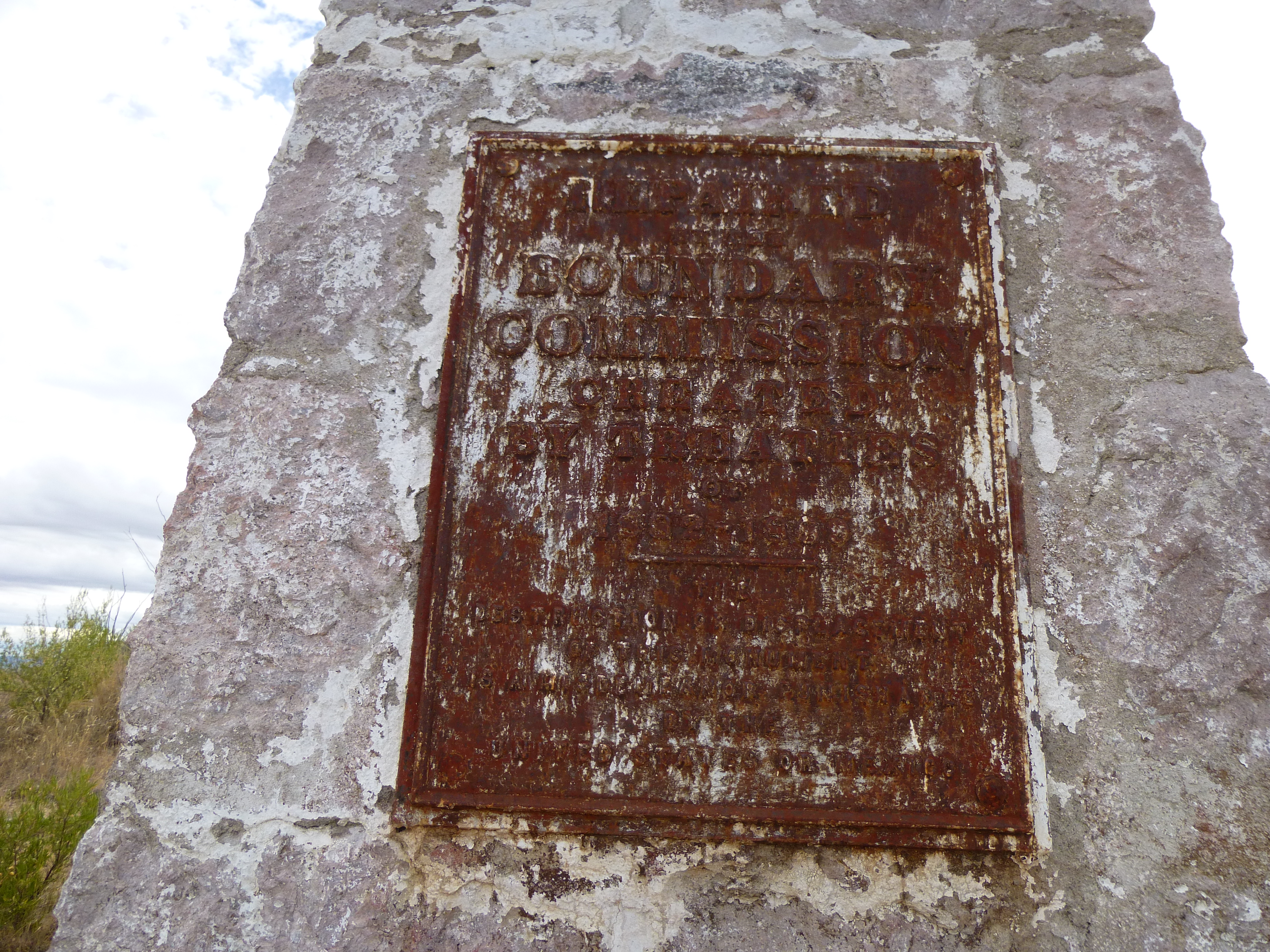
The U.S. plaque
The wording was similar on each one, and this is what they said:
Repaired by the Boundary Commission Created by treaties of 1882-1889 The destruction or displacement of this monument is a misdemeanor punishable by the United States or Mexico
Most of these really tall ones have been replaced over the years by smaller ones made of concrete over a steel framework, so its a treat to come across one of these old-timers.
We weren’t done yet. Visiting the monument was pretty cool, but the real objective lay across the border, just under half a mile to the south. Cerro el Fresnal beckoned, so close we couldn’t resist. It was about 300 feet higher than where we stood at the monument, and was of course the real peak we wanted to climb. It’s interesting how the name differed on the US map and the Mexican map. “Fresnal” is the Spanish word for an ash tree.
Standing by the monument, we could look both east and west and plainly see the border vehicle barrier stretching into the distance. In this photo, it is the dark line in the middle of the photo.
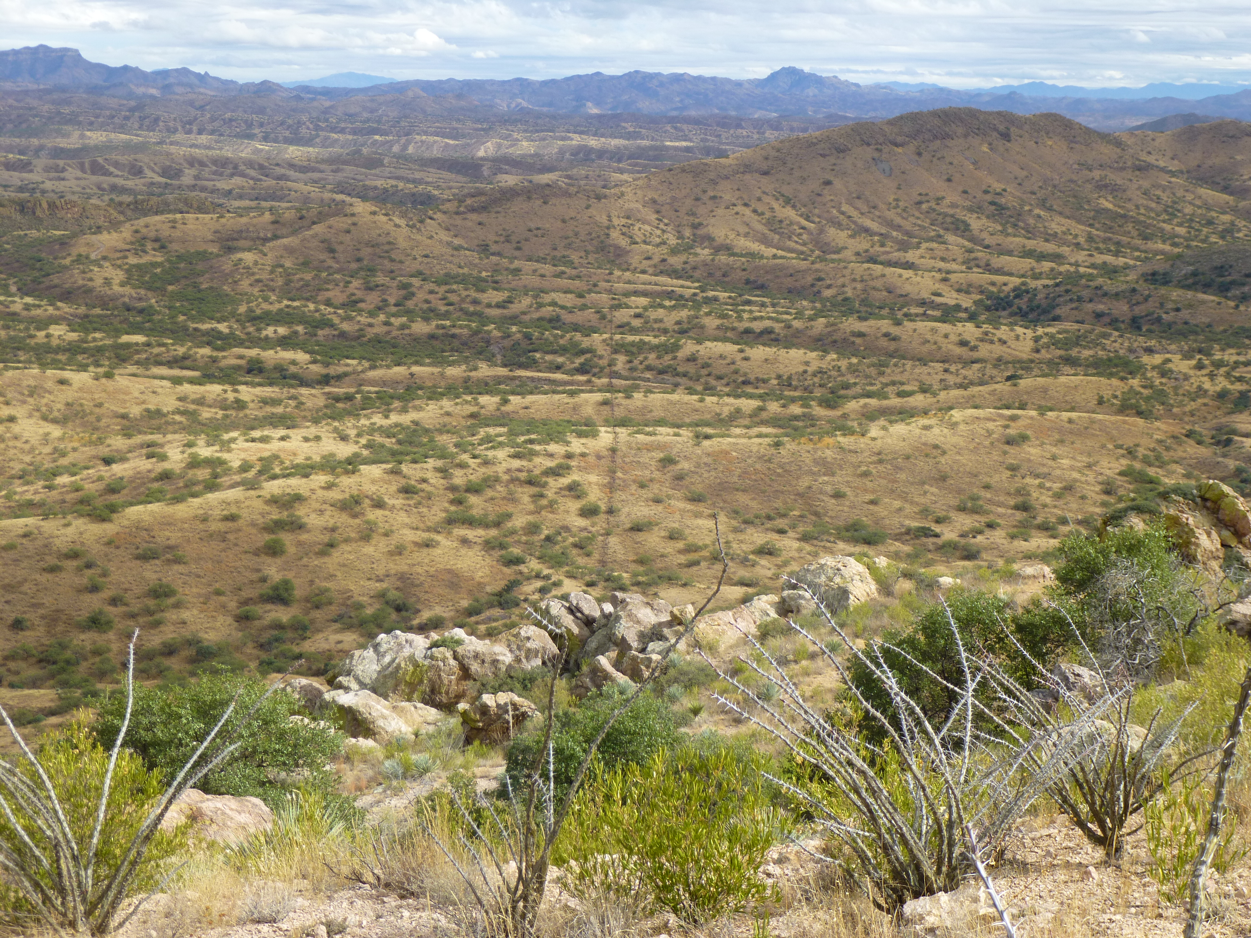
Looking east
From the monument, we could see well-worn footpaths on the north slope of the Mexican peak, a sure sign that a great many Bad Guys had made their way into the US along this mountaintop. Zoom in and you can plainly see them.
The northeast slope of Cerro el Fresnal in Mexico
Going into Mexico to tag the summit wasn’t something we wanted to spend a lot of time doing, so we set off at a good pace, dropping downhill to a saddle and then following one of the paths upwards. There was trash everywhere, left by border-crossers – some of it was scattered across the slope, some was in obvious resting-places. Our hope was to not run into anyone, as we were on their home ground – in fact, we were the indocumentados at this point. It took us 30 minutes to reach the summit (4,890 feet elevation) from the time we left the border monument. It was an open, fairly-flat place – we left no register, as it wouldn’t stay put for long. The views were open and expansive. Here are a few good ones.
25 miles away to the north-northwest sat the mighty Baboquiviri.
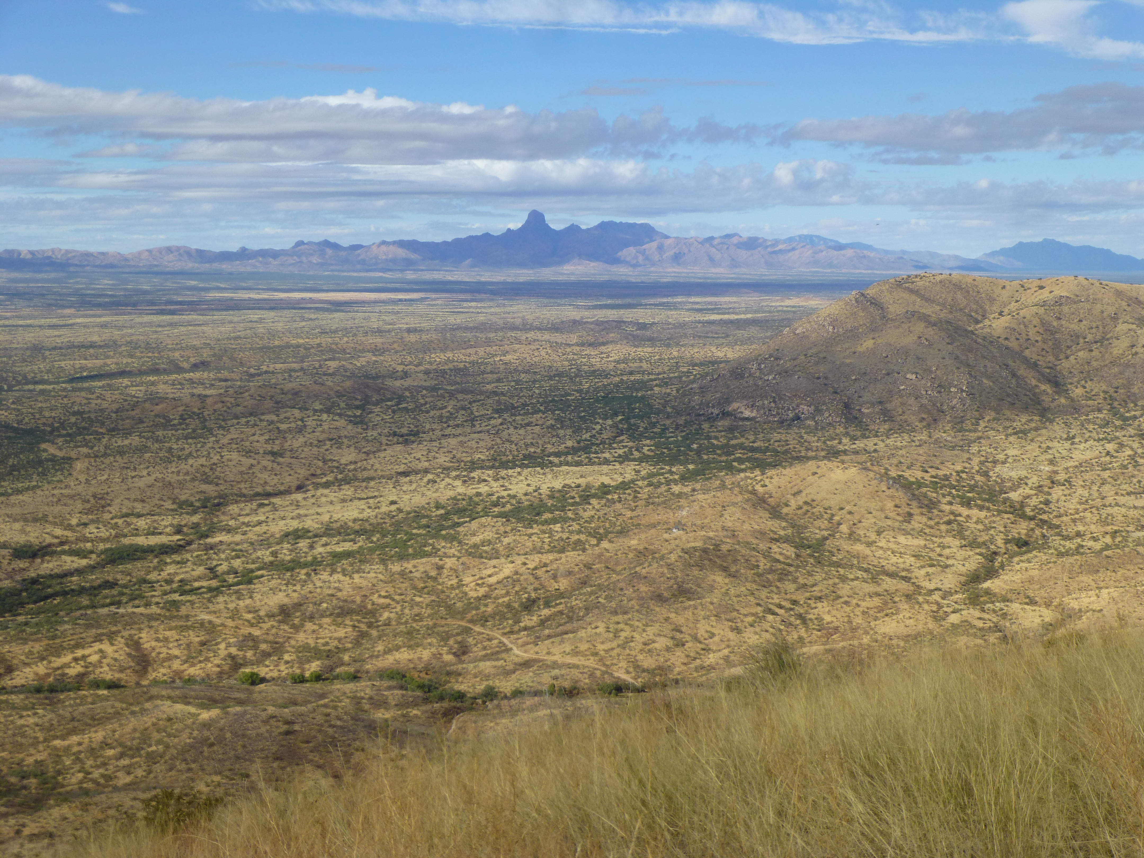
Baboquiviri Peak 7,734′
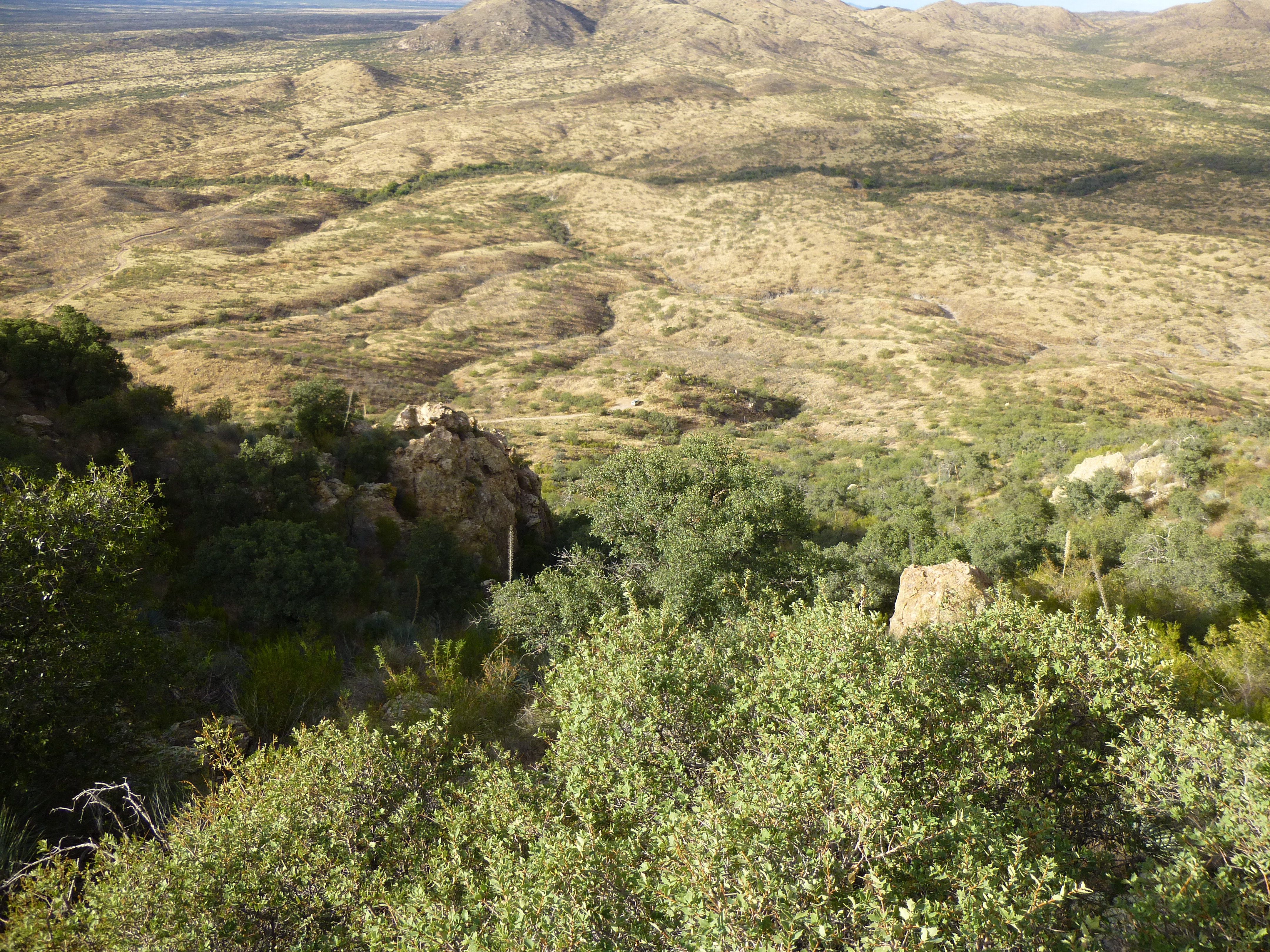
Here’s a view looking northeast: Coches Ridge is the long dark thing across the middle of the photo, 2 miles away; sunlit in the background on the left is the gently rounded Fraguita Peak, 7 miles away; in the far distance, all in shadow on the horizon to the right of center is Mt. Wrightson, 38 miles away.
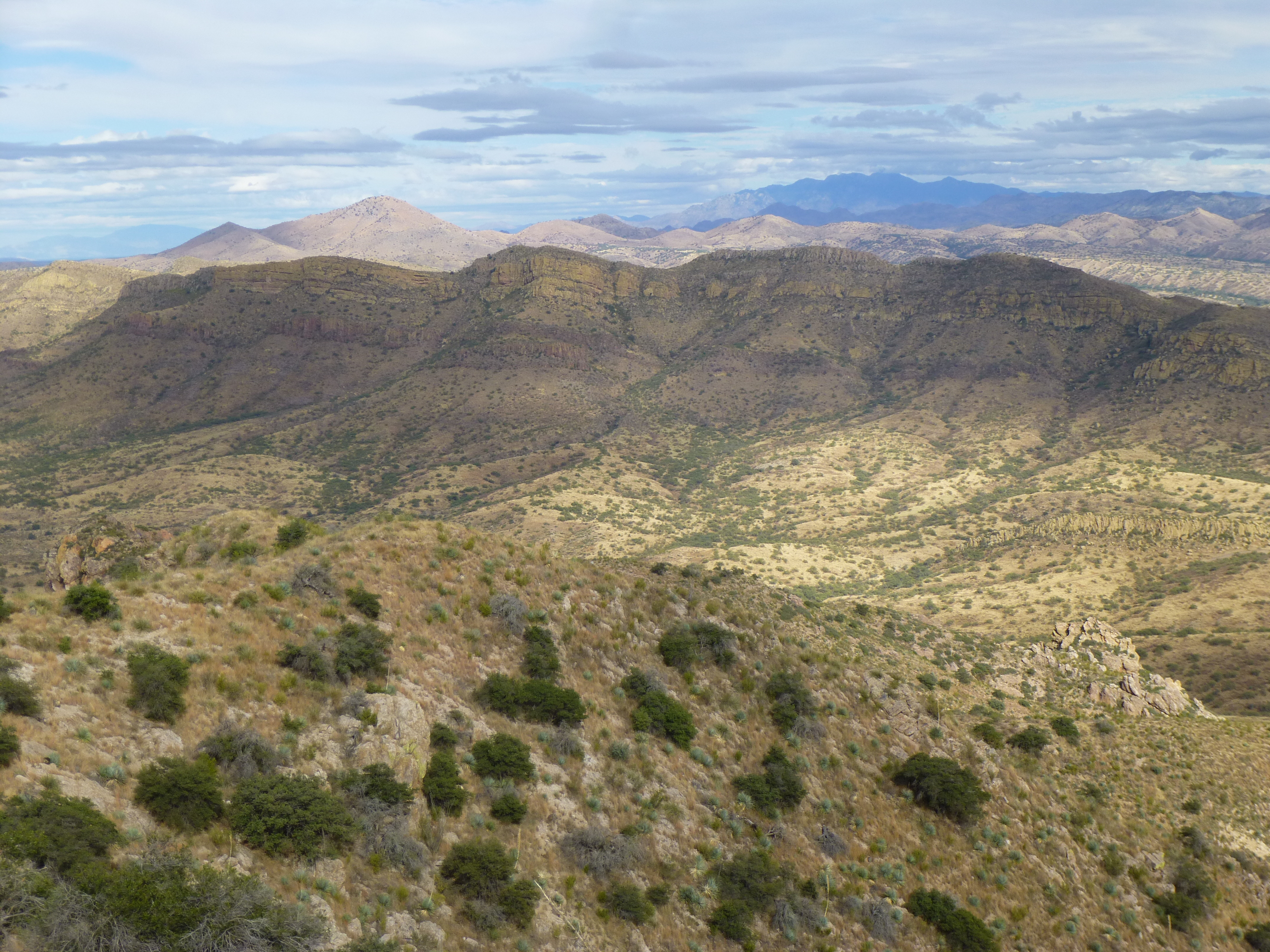
In Mexico, looking northeast.
The surrounding lands in Mexico were beautiful to look at, but so dangerous for any American to spend time in.
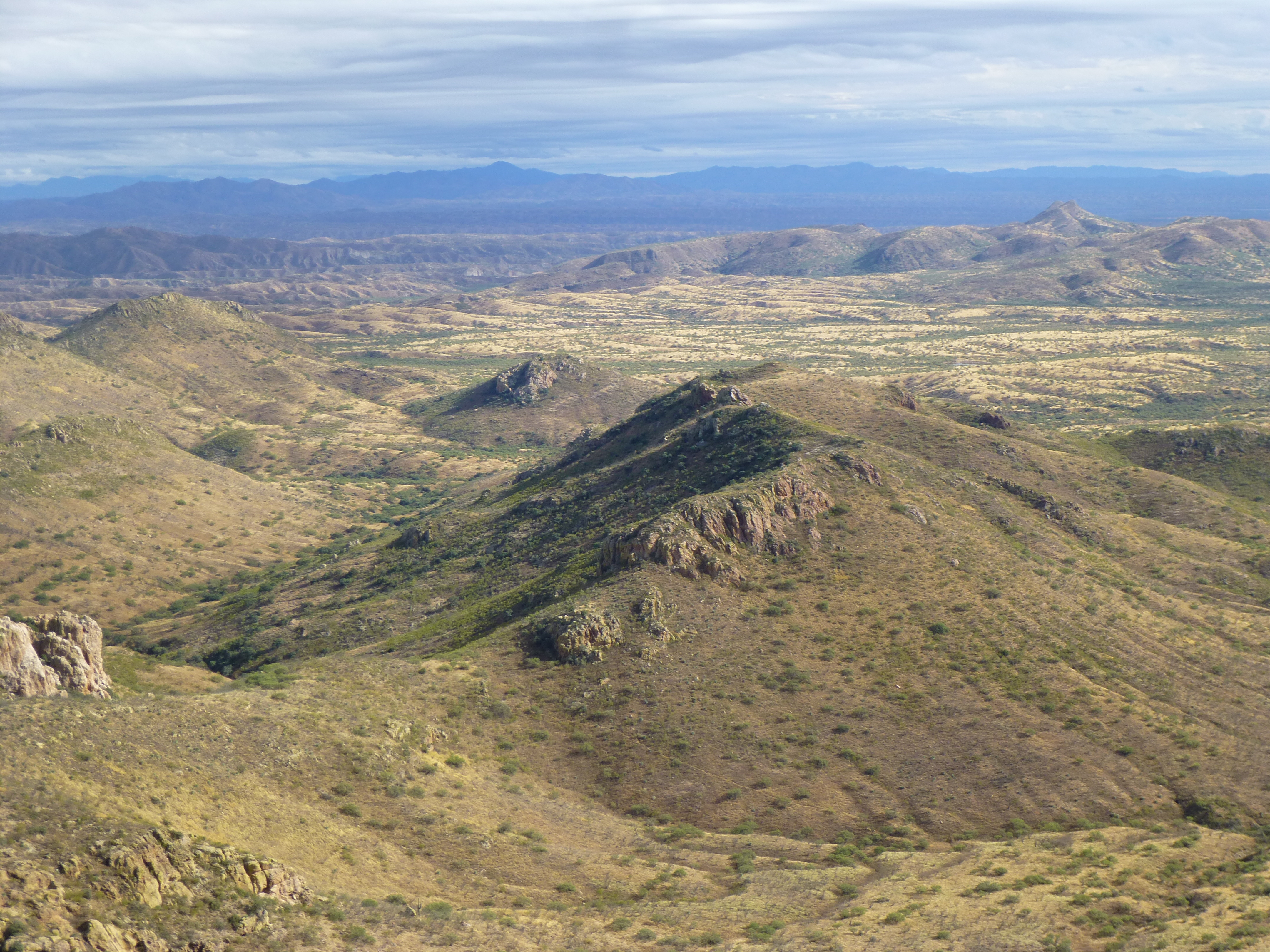
Mexican countryside
We were on the summit for maybe 10 minutes, 15 tops, and thankfully saw no one. Heading back north, as we approached the international boundary we saw something near the monument, something we’d missed before – a strange block of concrete on the Mexican side – bearing no markings of any kind, it was a mystery.
The strange block
From the mountaintop, we had this view 600 feet down the steep slope to the truck – see it in the exact center of the photo? – it was one brushy descent. The climb had taken us 2 1/2 hours, and it felt good to be back on our home soil once again.
Looking back down to the truck.
A short drive down the road gave us this crisp view back to Cerro del Fresnal on the U.S. side of the border. If you zoom way in, you can see the border monument on the skyline in a gentle dip to the right of center.
Cerro del Fresnal
And from a full mile away, this view of it all, both the American side (the flatter part on the left) and the much bigger Mexican side on the right.
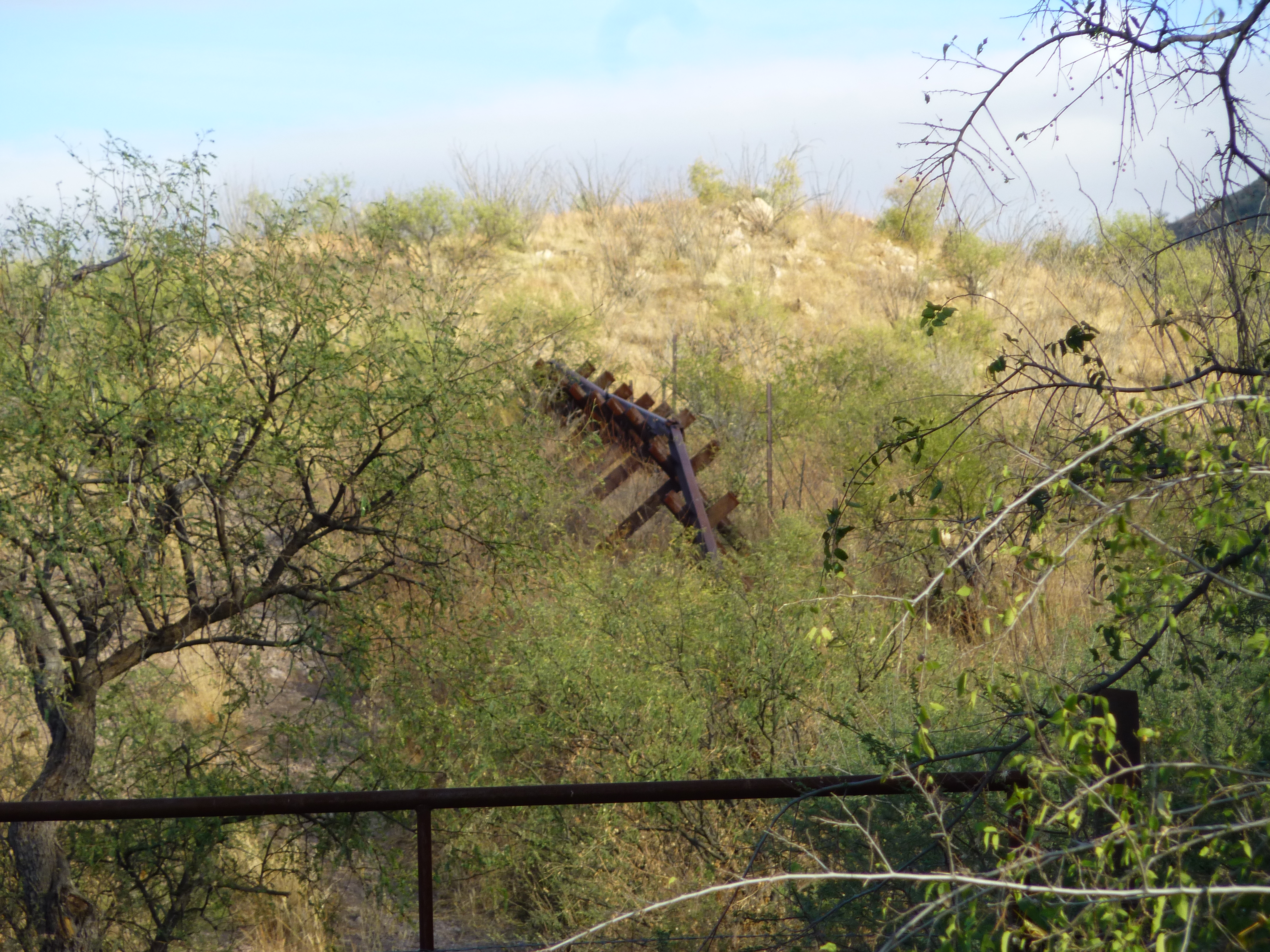
There was one more stop we wanted to make, another visit to the border. A side road took us down to where, at 3,500 feet elevation, Fresnal Wash leaves the U.S. and enters Mexico, where it is called Arroyo el Fresnal. This had been a very porous spot in our border, one taken advantage of by many Bad Guys. As a result, the Border Patrol had erected some defences.
At the border
A Normandy-style vehicle barrier also came down close to the wash.
The vehicle barrier
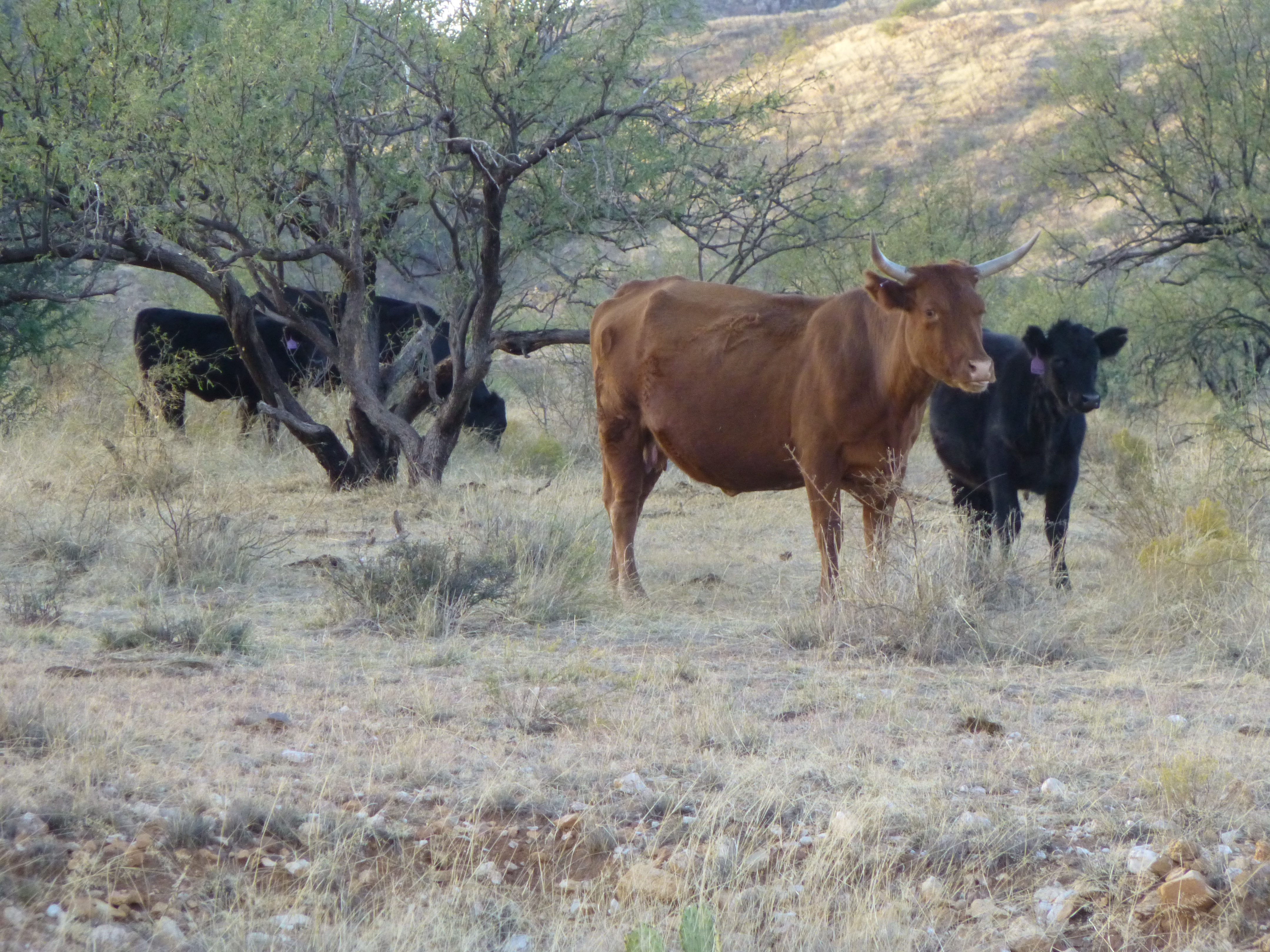
I have no doubt that there were hidden sensors in the vicinity to detect any attempts by Bad Guys to drive a vehicle into the U.S. After pondering all of this for a short while, we started the long drive out. Shadows were getting long, and it was time to be getting home. These were the only residents of the valley we saw all day.
Thirteen hours after starting out, we were safely back home in Tucson. It had been a good day exploring peaks in this part of the border region.