
I had heard a lot about climbing Courthouse Rock – a lot! In 2005, Andy Bates and I had spent 3 days of the Thanksgiving holiday trying to forge a way up the south face of The Ugly Sister in the Baboquiviri Mountains. We never quite made it, but that’s not important. We slept out under the stars each night, high up on the mountain, talking ourselves to sleep as we lay in our sleeping bags. That’s where I heard all the details of the technical climb of Courthouse Rock – it sounded exciting. Well, in 2010, mid-April to be exact, early morning found me and Andy motoring along dirt roads 70 miles west of Phoenix, Arizona. Andy knew the way, he had been here before.
The Eagletail Mountains are a spectacular range – although only about 25 miles long, the range boasts 39 peaks, and most of them lie within a wilderness area. The name comes from the jagged spires on the summit of Eagletail Peak, said to resemble the feathers of a bird’s tail. You can read about the technical climb of that range high point on this website in a story called The Eagletail Mountains.
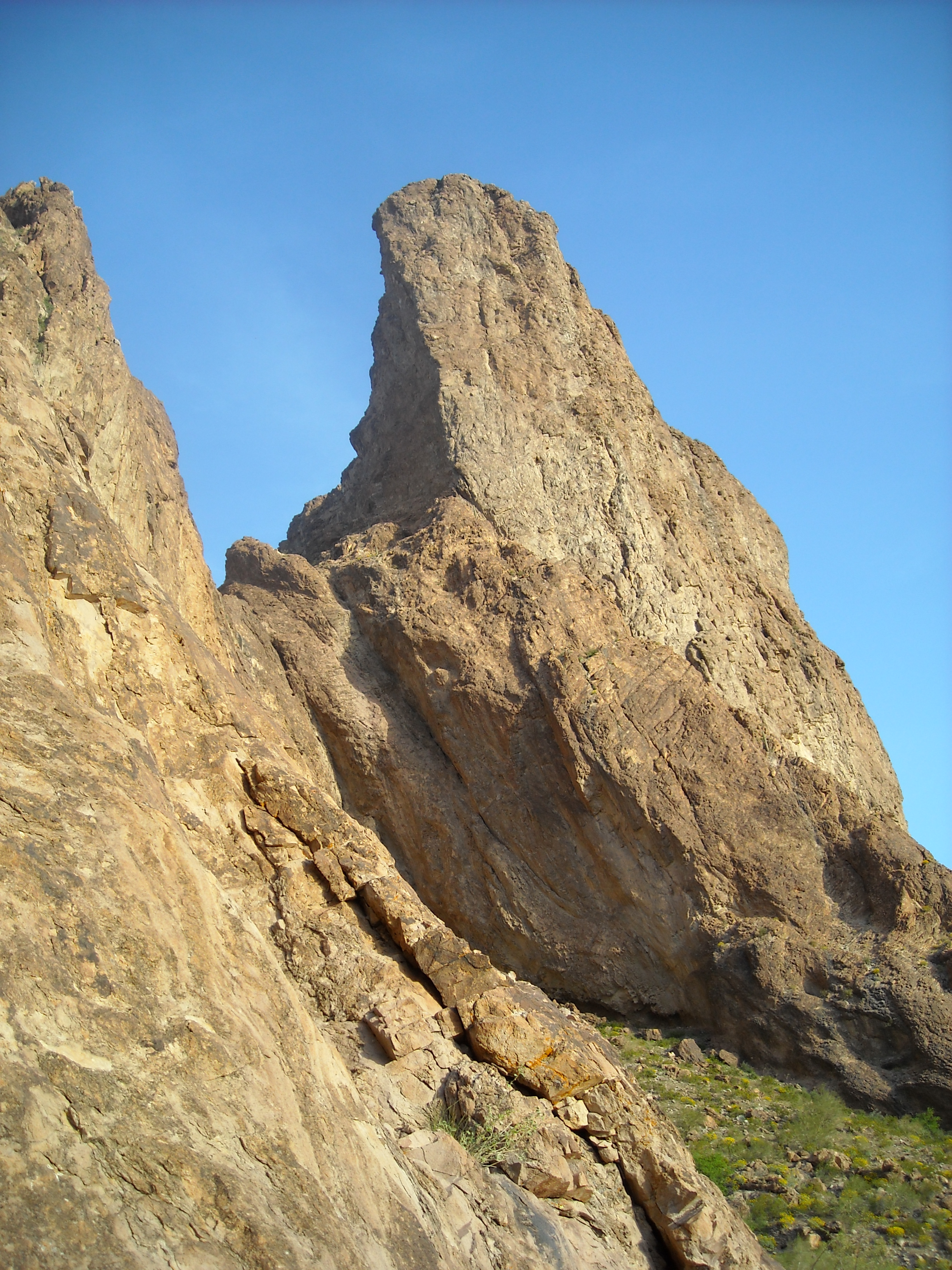
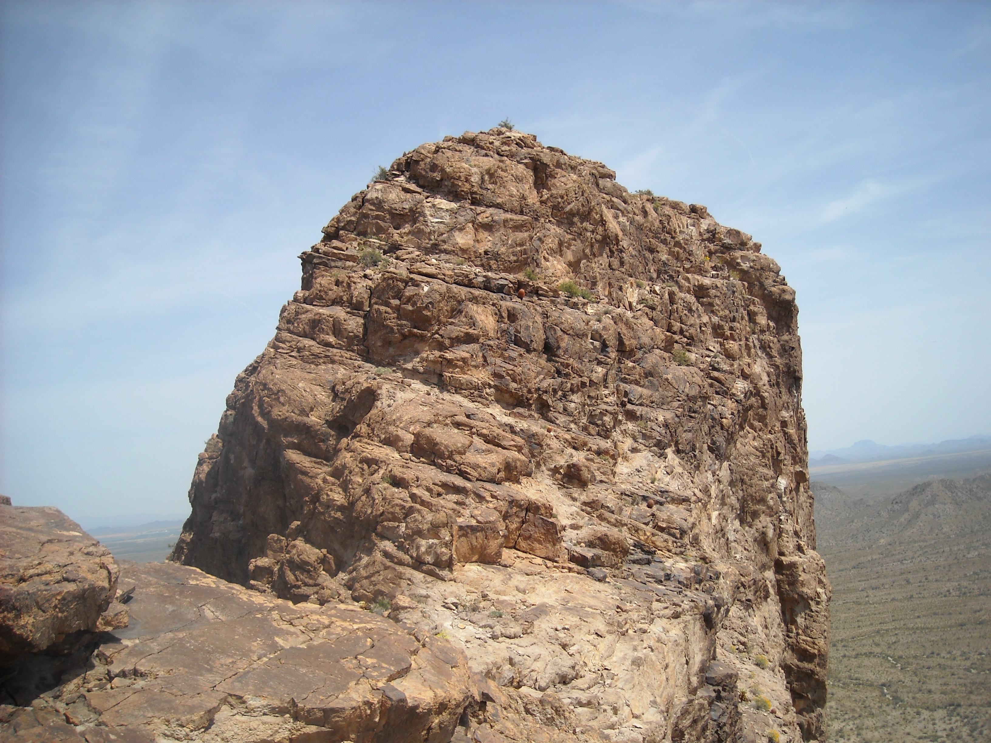
Courthouse Rock soars up from the desert floor – as you approach it, it demands your attention. A century ago, the mountain was referred to as Cathedral Rock by some. Others gave it its present name because of “its likeness to a courthouse”. We finished our drive at a dirt parking area at the base of the peak, at an elevation of 1,570 feet above sea level. This is one impressive spot – the north face soars 1,300 feet above your head and is near-vertical.
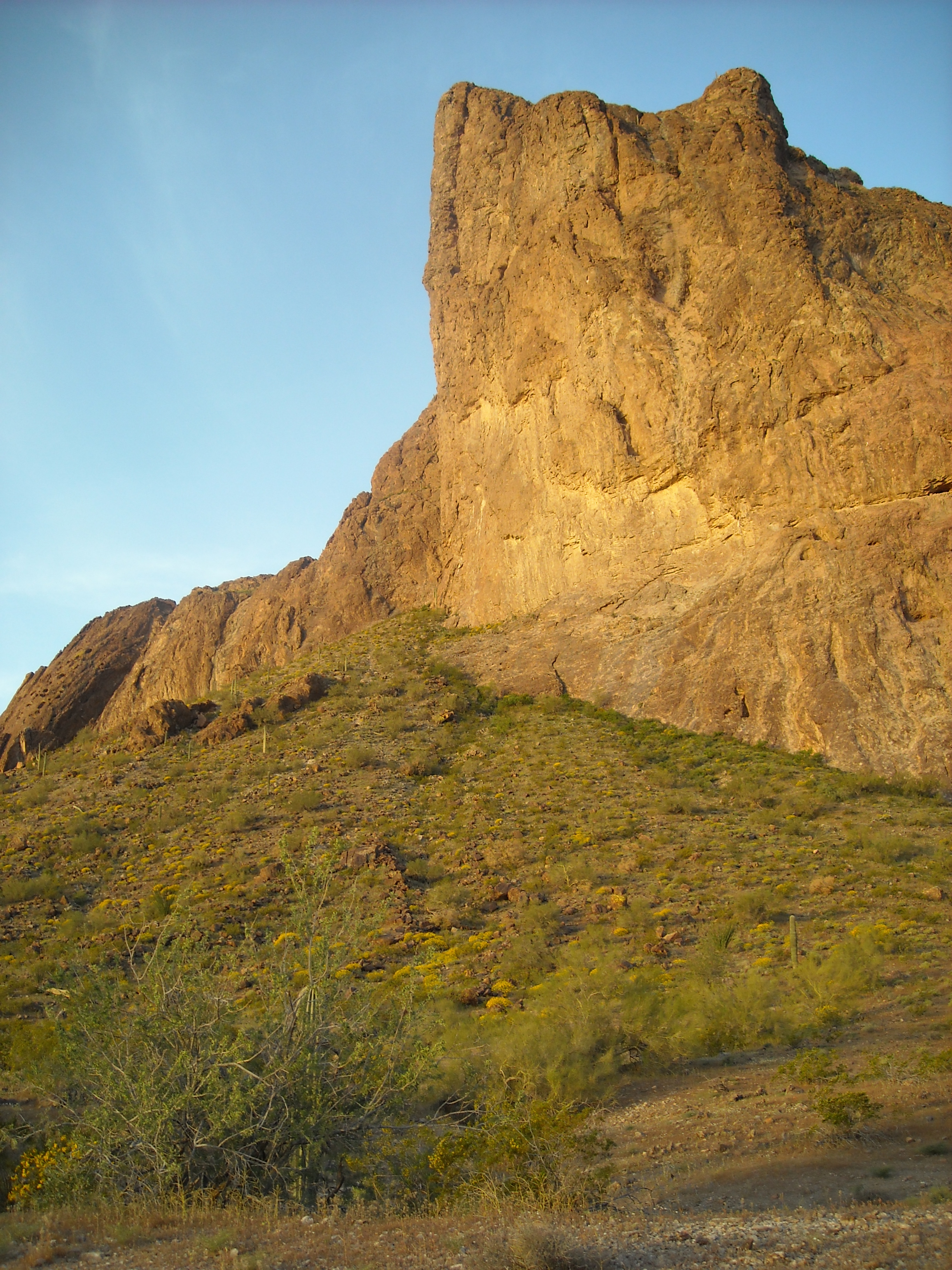
The north face of Courthouse Rock
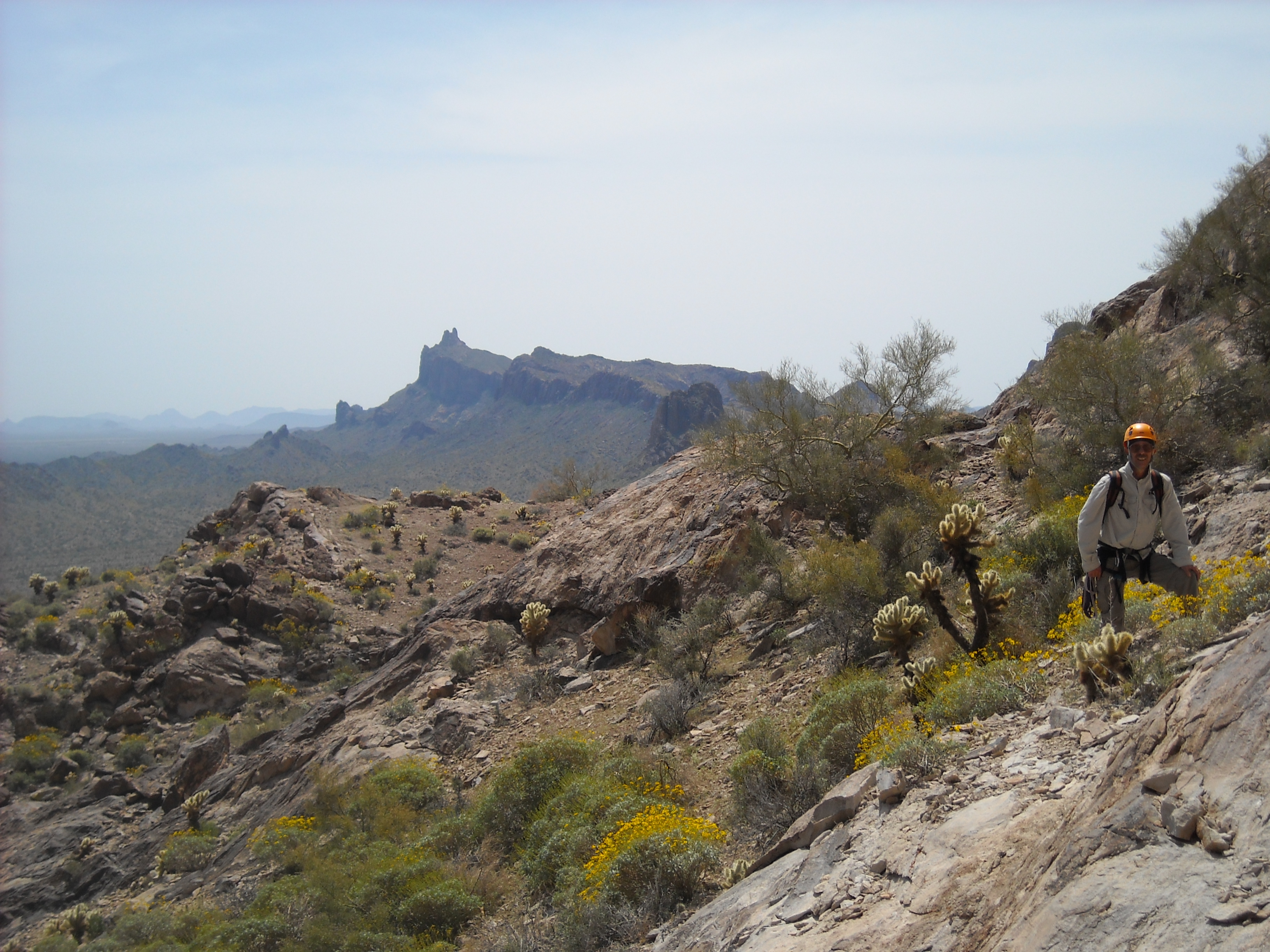
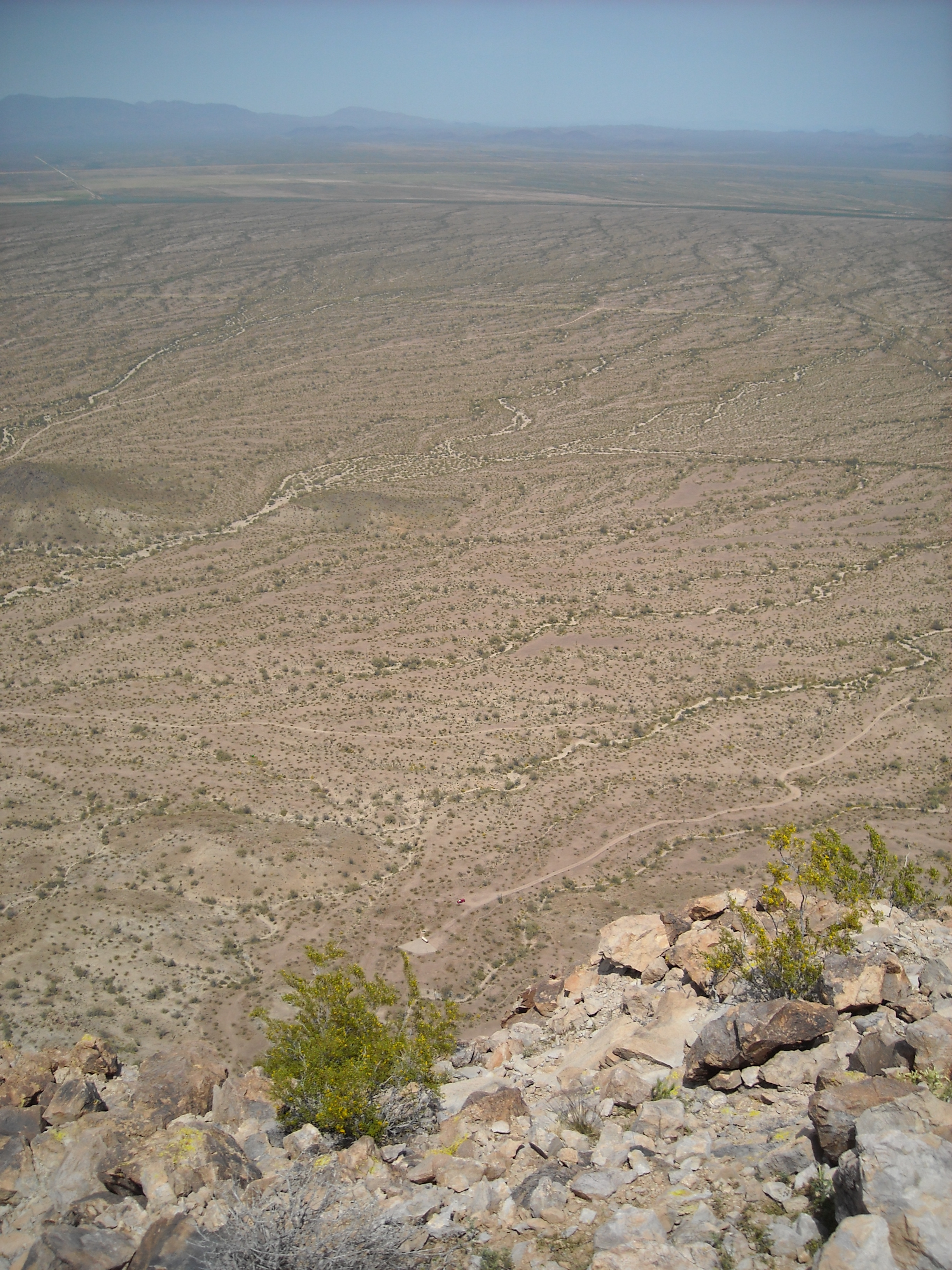
The sun still hadn’t risen by the time we set out on foot – we opted for an early start because we knew it was going to be a hot day. Most people attempt the climb in the cooler winter months – we were a bit late by most standards, as temperatures can easily exceed 100 degrees in April. Crossing a short stretch of flat desert, we had this glimpse of Eagletail Peak, the highest point in this amazing range – it was 3 miles away to the southeast, and is an impressive technical climb in its own right.
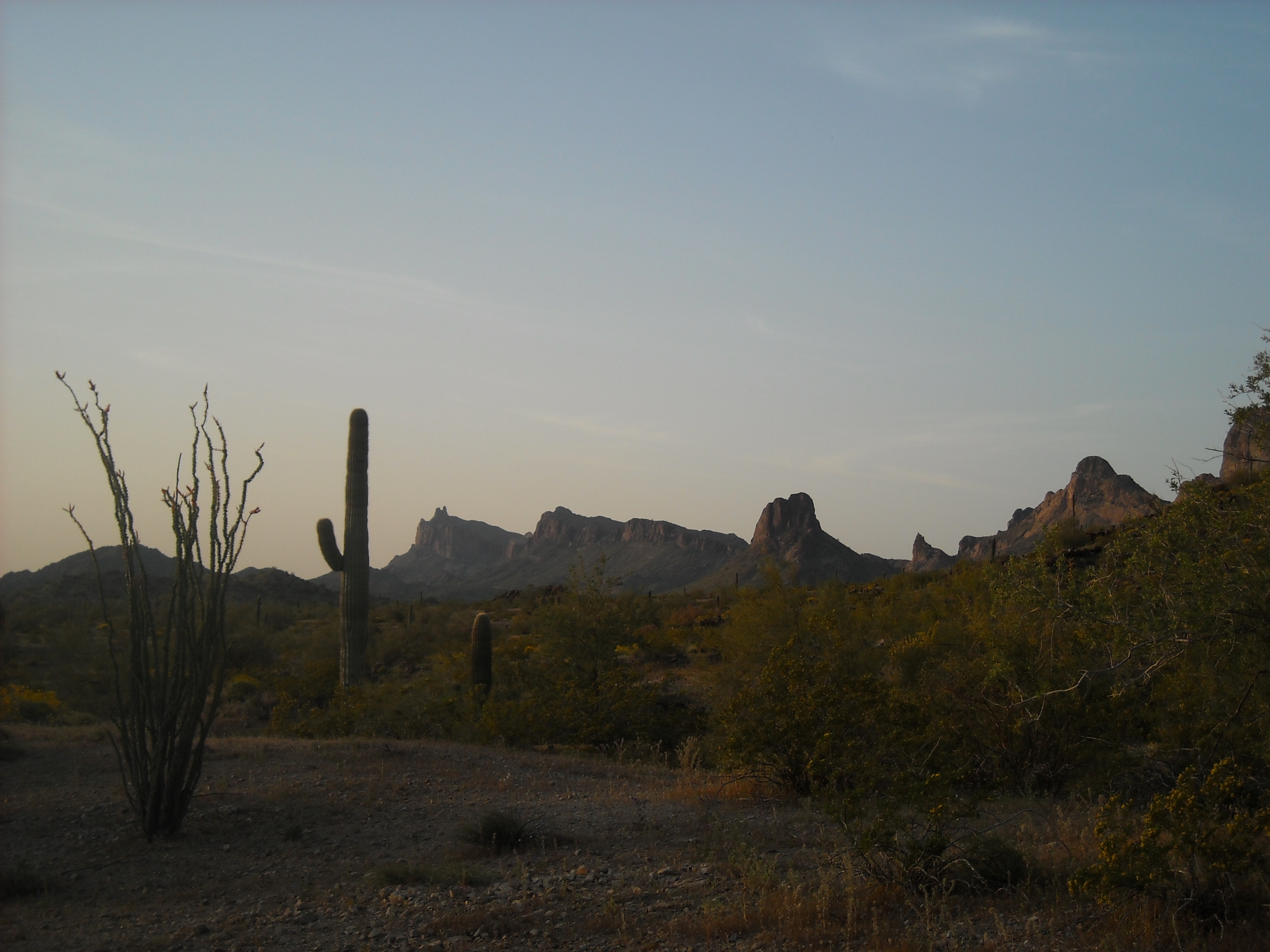
Looking down to Eagletail Peak, the one just to the right of the Saguaro cactus
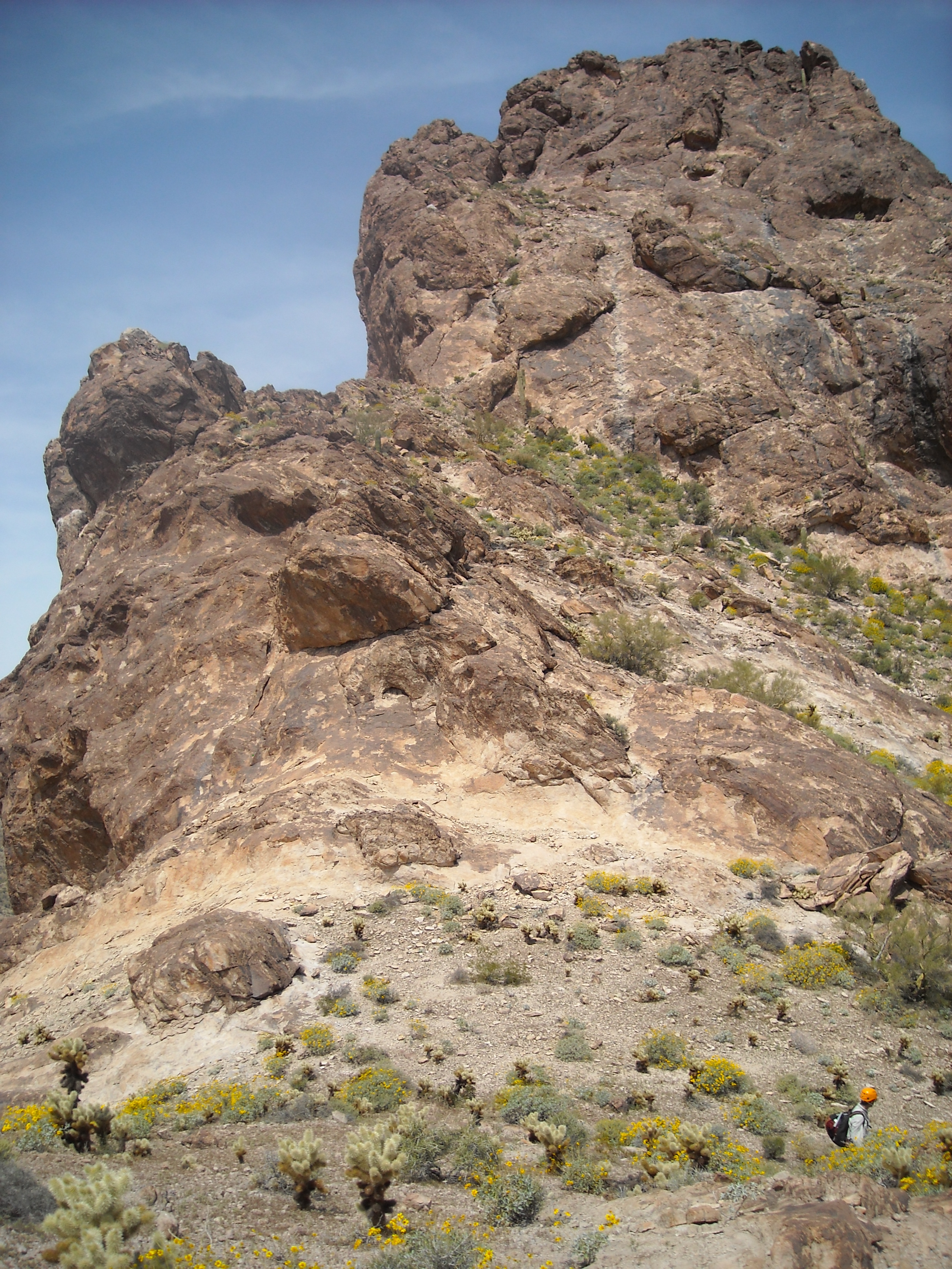
We then started up an easy slope, contouring across the hillside on the east side of the peak.
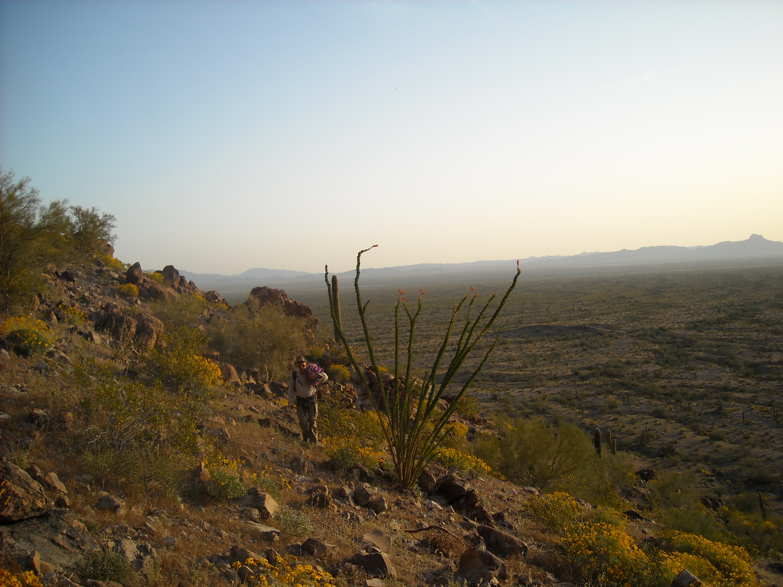
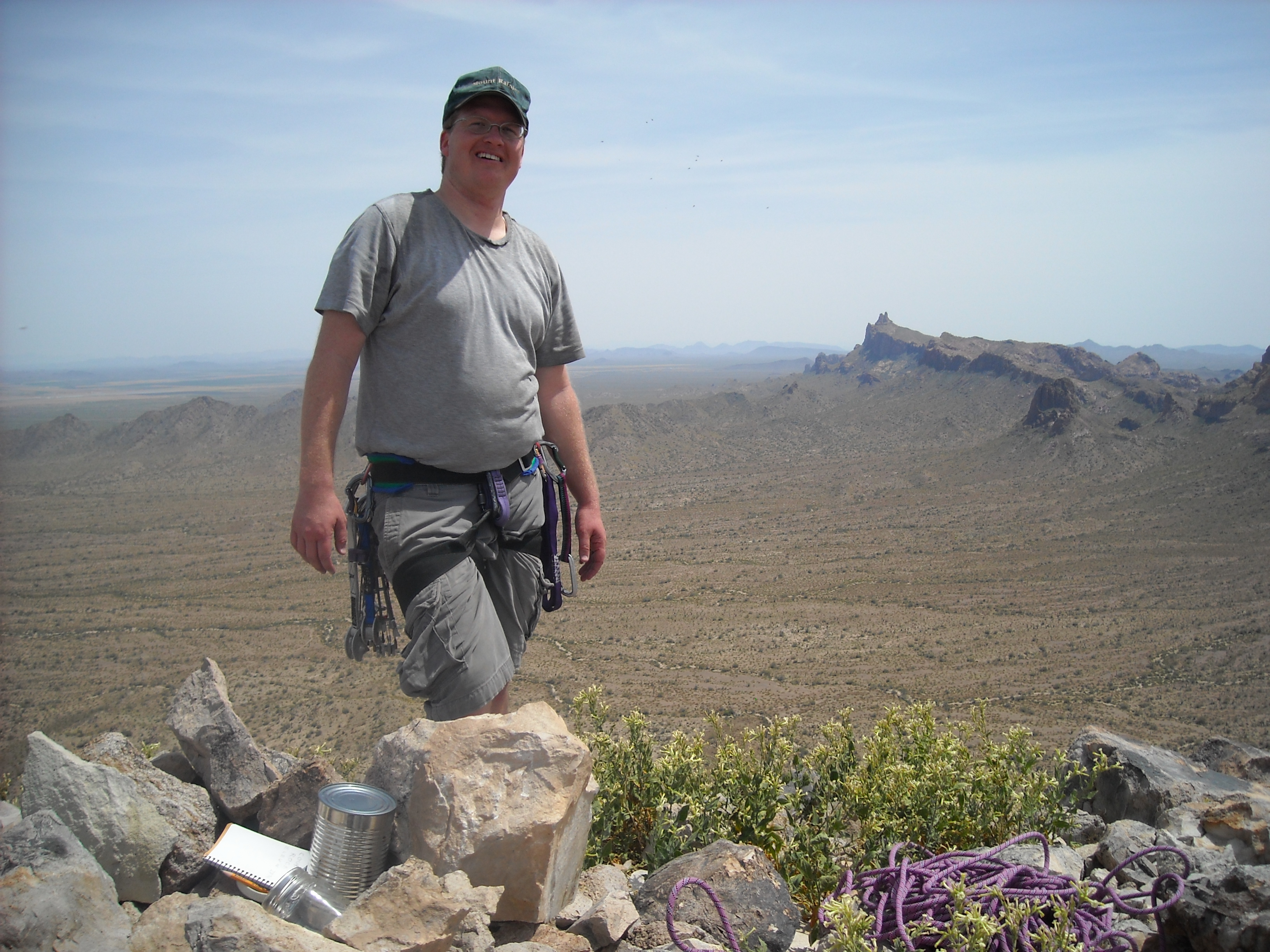
The Desert Mountaineer heading up to the start of the climb.
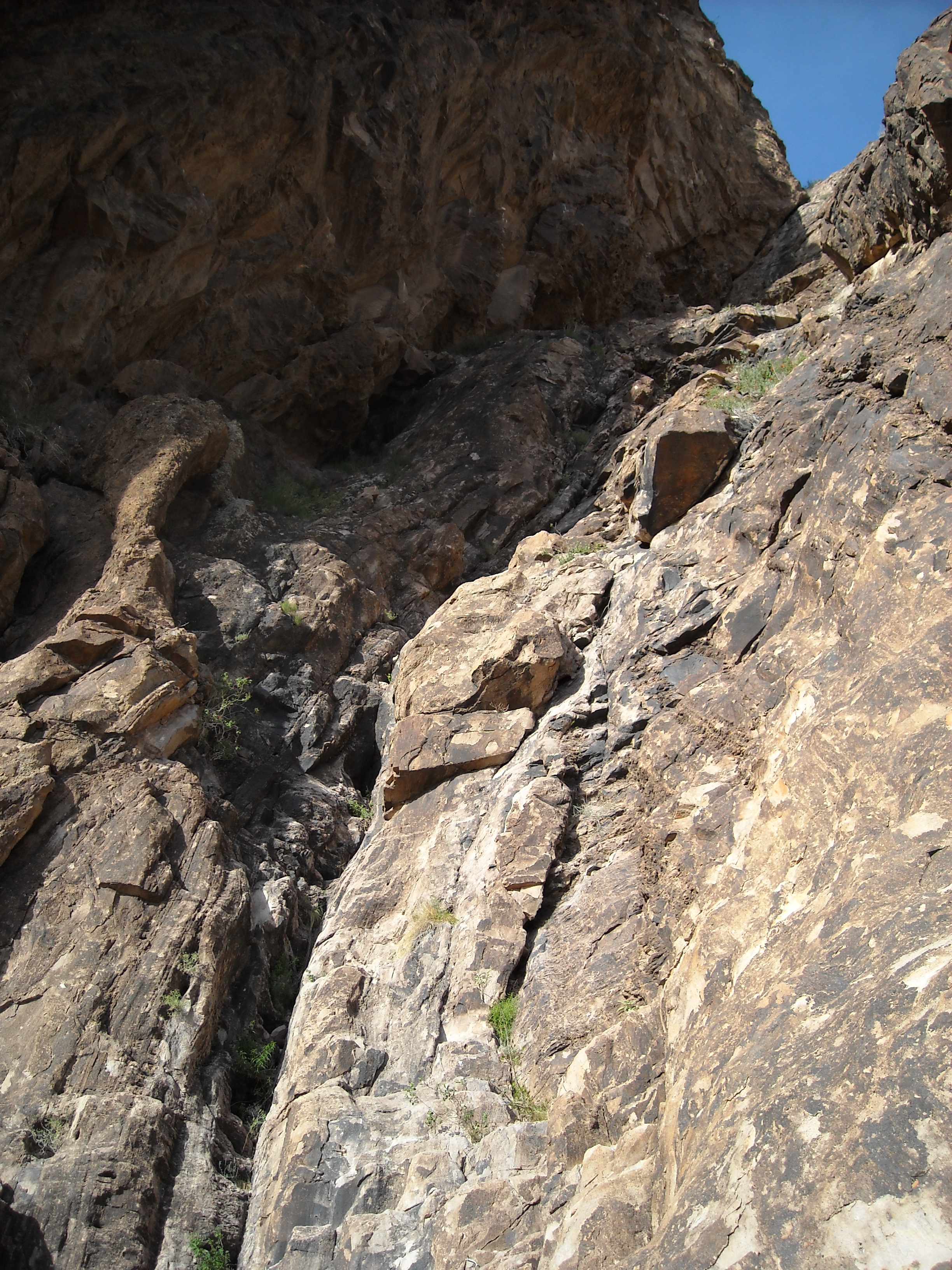
We climbed up to and across a scree slope, continuing to approach a deep, dark gully which rises a good 600 vertical feet up this part of the mountain.
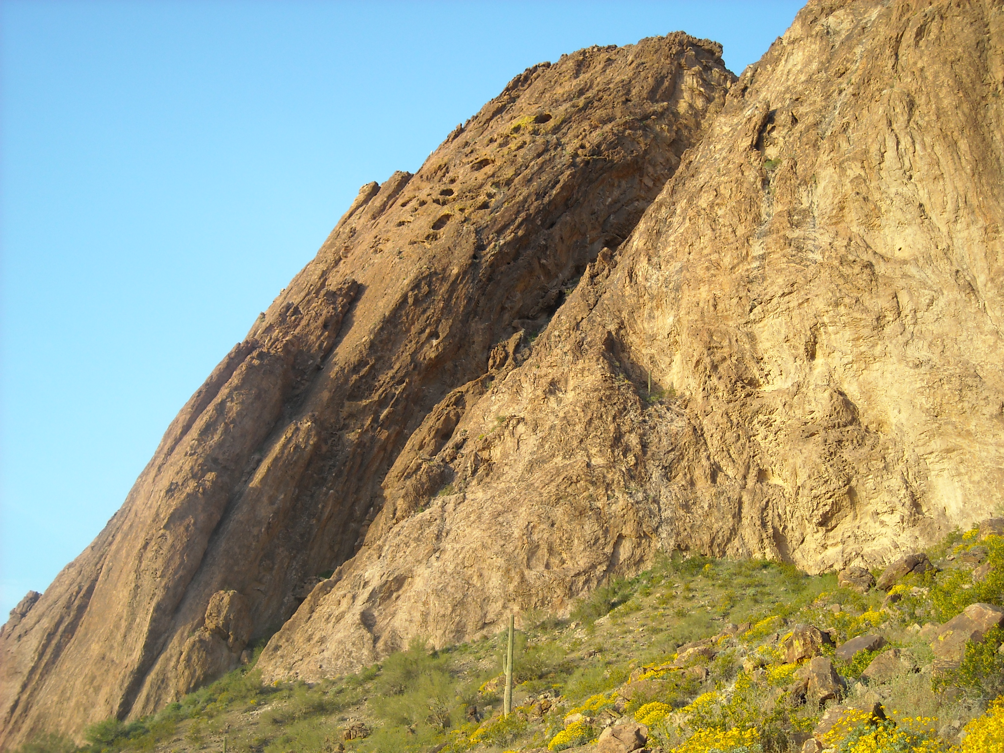
Approaching the gully where the climbing would take place
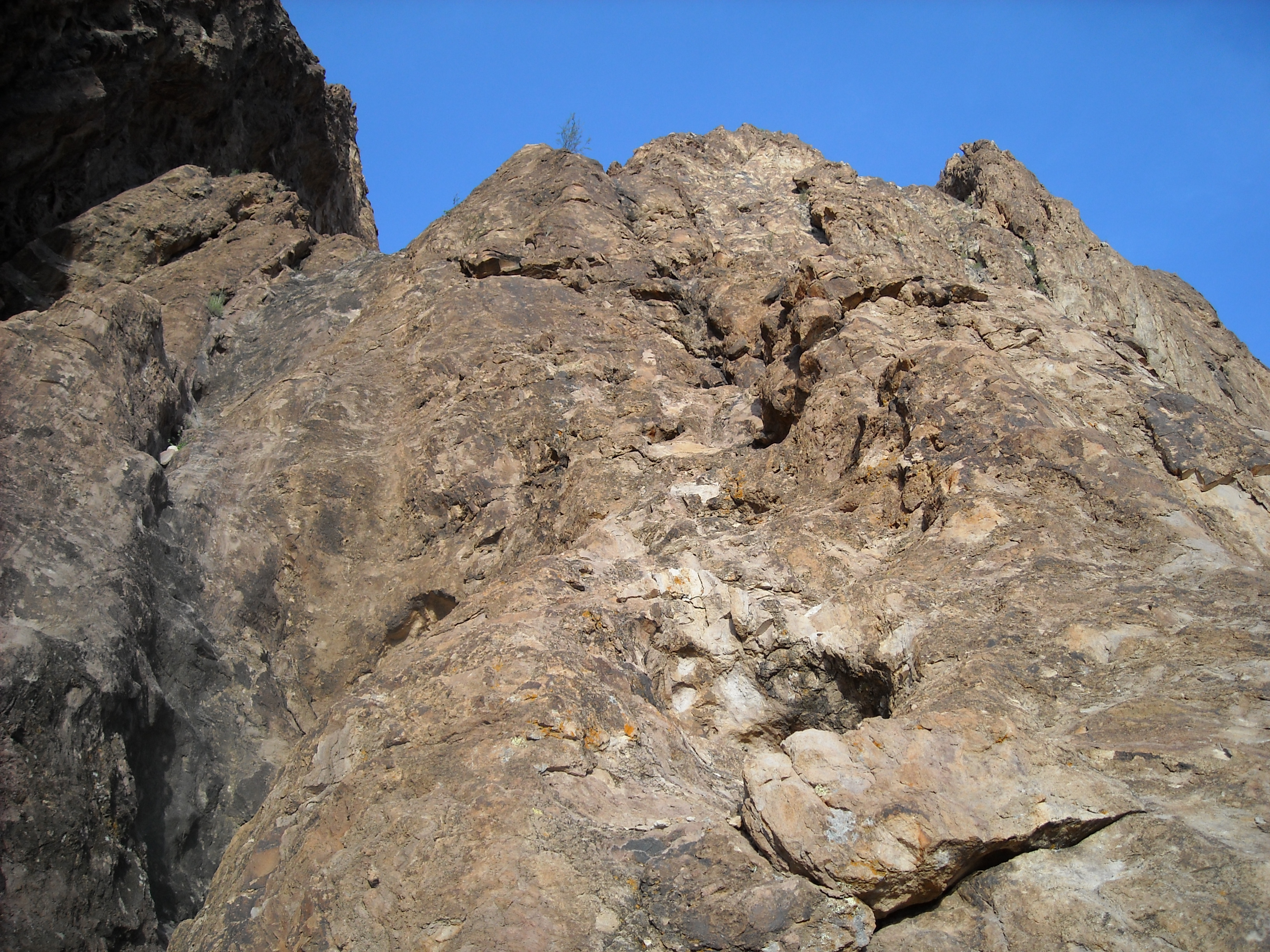
We reached it after an easy 20 minutes, and we were now at 1,910 feet. This was the start of the real climbing. Approaching the gully, we had this look back to the north, to the highest part of the mountain where we hoped we’d end up later today.
Looking back up towards the summit.
There are a number of write-ups by others on this climb, and they differ somewhat in how they grade it. I’ve learned of 4 different routes that have been established, as follows:
- Standard Route, with a difficulty of Class 5.5
- Indie Buttress, with a difficulty of Class 5.8
- Idiopathic, with a difficulty of Class 5.9
- The Groover, with a difficulty of Class 5.10d
Andy and I were here today to climb the Standard Route, the route he’d done once before. Some route descriptions say there are as many as 8 pitches on this route, but some of them are very short and many climbers combine some of the shorter ones to make a longer pitch.
We roped up and Andy started off with my belaying from a ledge. The left side of the gully is a huge, vertical wall – that’s not what we were here to climb. In the gully itself, away from that left wall, are some ribs of rock that run longitudinally up – the second rib is the easiest to climb. The route goes up the left side of the rib for maybe 40 or 50 feet, then out on to the rib itself with one move at about 5.3. Then, up an easy gully; after that, out on to an obvious rock outcrop and up to a big ledge where the next belay station was located. At this point, 170 feet of climbing had occurred and had taken about an hour. Here is a photo of the start of the climb, looking up the first pitch.
Looking up from the start of the climb
From there, the route continued on a ledge, then up a watercourse for quite a while – there was nothing more difficult than 5.2 in this entire section. We reached a ledge which would serve as the next belay station. Andy took this photo of me at the top of the first pitch, where I belayed him up pitch 2.
I am standing at the spot where I belayed Andy for the second pitch.
Here I am following Andy.
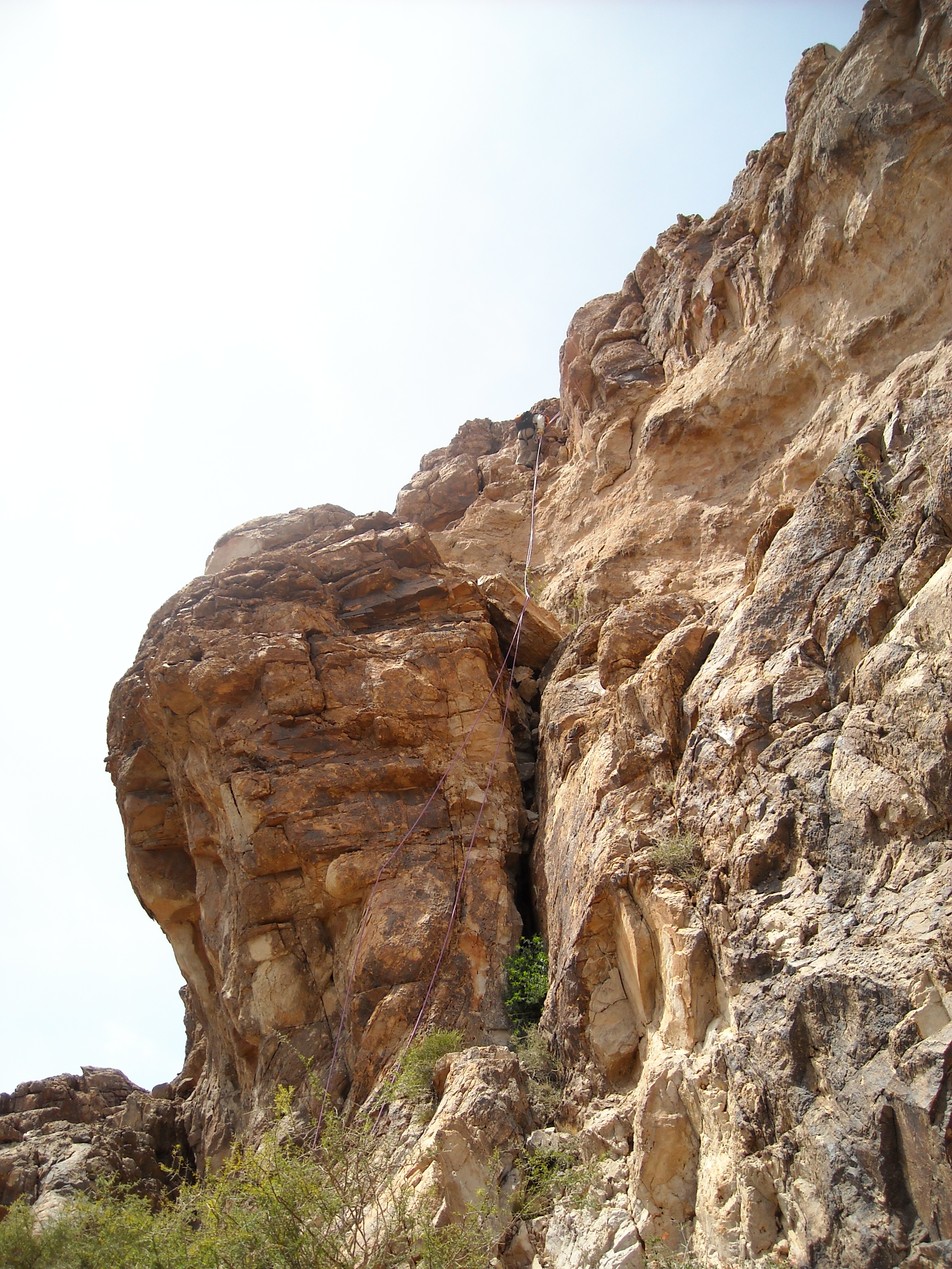
Next came the most memorable part of the climb for me. Here’s a photo looking up the next long stretch of the climb.
The upper part of the gully
The gully was wider now, and steepened dramatically – our route went straight up the face. Andy’s rope was 70 meters, or 230 feet. I did a standing belay, and Andy started up. There were a few bolts – Andy clipped into these as he moved up. He disappeared above a lip at the top, and it became really hard to communicate when he was out of sight. He kept asking me how much rope was still left for him to use to continue climbing – he used it all, and I even had to move up 10 or 15 feet for him to finish the pitch. Once he was securely anchored and ready to bring me up, he shouted down to me that although the wall was really steep, there were plenty of holds.
I started up, and he was right – the pitch was breathtakingly vertical, but there was no shortage of small but excellent holds. I didn’t dawdle, as I wanted to get it done with. By the time I’d moved up far enough that Andy came into view, he said he was surprised that I’d followed so quickly. He’d done all the hard work, all I had to do was follow and unclip from the protection he’d placed, so I told him I really didn’t feel comfortable on that steep wall and wanted to be done and off of it as soon as possible. It was a relief and also a feeling of exhilaration to be finished the pitch. The difficulty on this pitch was 5.5, the hardest on the climb, but we weren’t done yet.
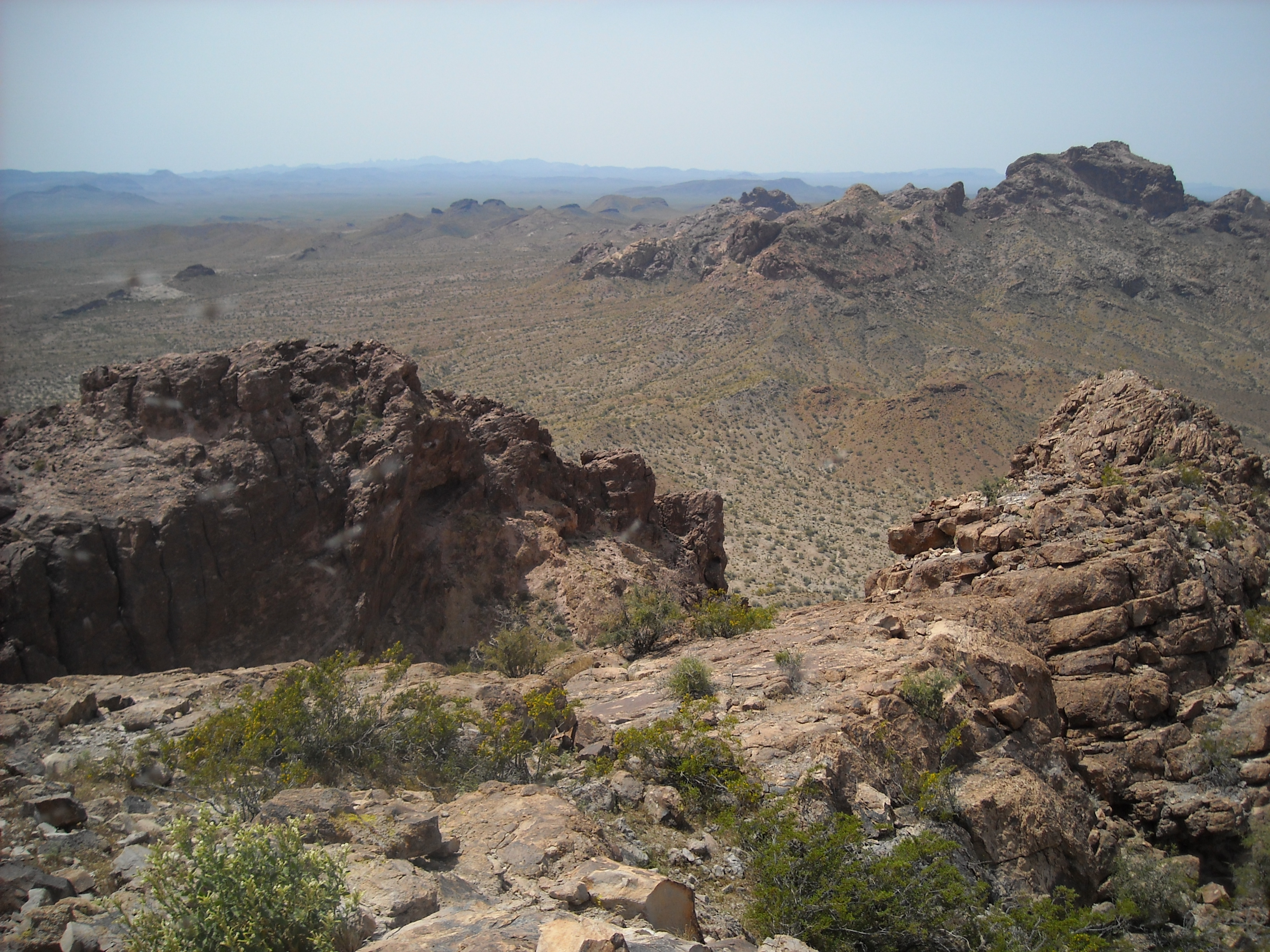
It wasn’t very obvious what we’d have to do to finish the climb, so I just followed Andy’s lead. We coiled up the rope, then set out. Our elevation was about 2,350 feet, and we’d been climbing for almost 4 hours. We walked up to the top of the shoulder of the mountain and headed north. This is the view we had as we walked along, looking back to the southeast – the top of the gully we’d climbed is in the lower left corner of the photo.
Looking back to Eagletail Peak, the range high point.
It was easy going as we headed towards the actual summit – at one point we had to drop down some to avoid a large outcrop, then climb up again. We still had 500 feet to climb to reach the summit. Here’s a shot taken as we walked along – this isn’t the summit.
Just some scenery on the way to the summit
Once we got past the big outcrop that was in our way, we climbed up a steep, rocky gully towards the skyline. Have a look at this next photo – see the tiny red mark along the ridge? – that’s where we needed to go.
At the top of the steep gully, we had to climb a few ledges, then pass an awkward chockstone. We roped up for 60 feet or so – Andy felt that because this short pitch was so exposed and hard to protect, it was the most dangerous part of the entire climb. Once past this part, we were at the red mark you can see in the next photo. From there, it was easy to reach a small saddle, where we unroped – that’s where you see the black mark.
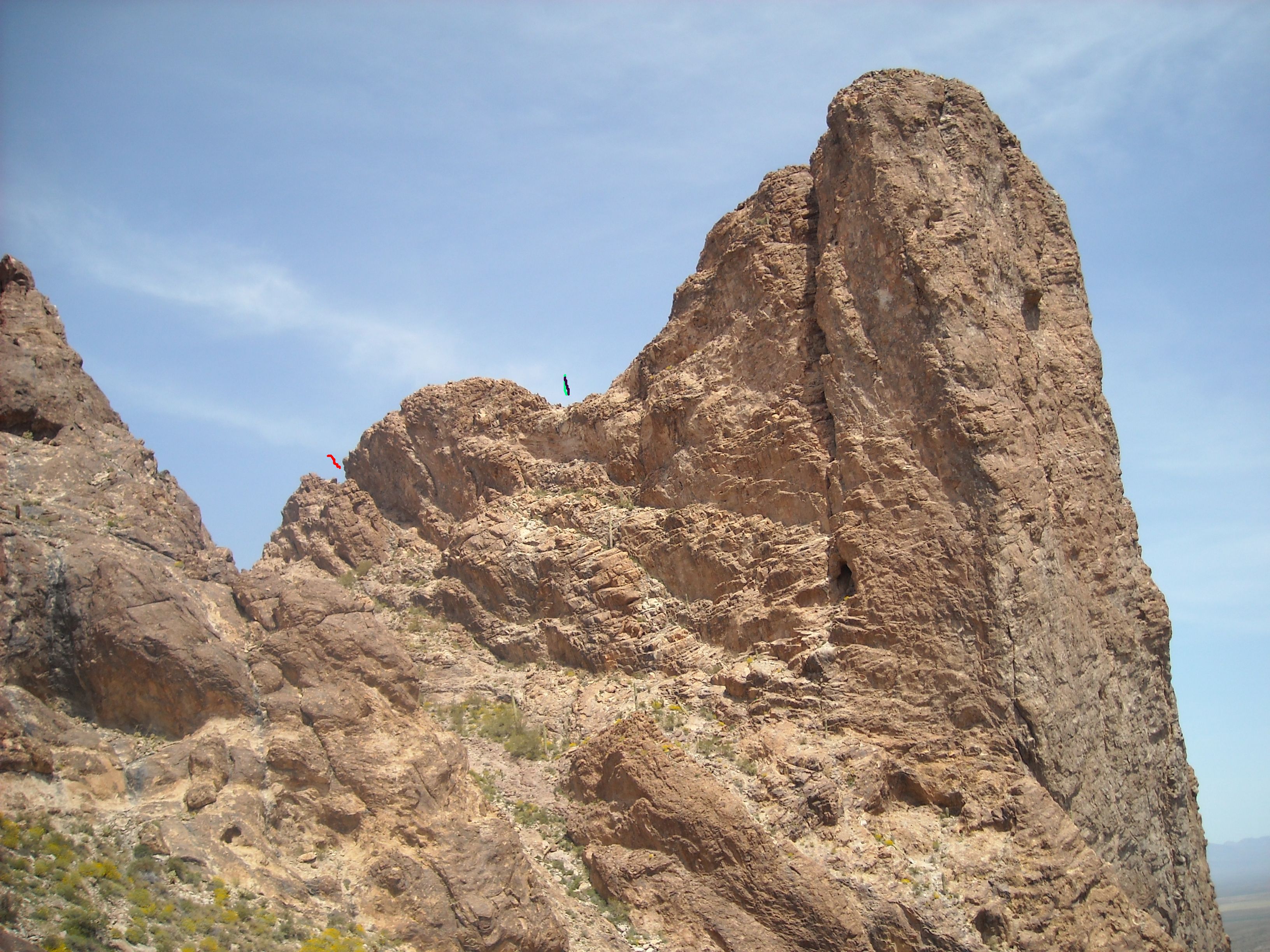
The upper route
Now for the final bit – here’s what that last view looked like, from where the black mark is, looking to the summit.
The summit block
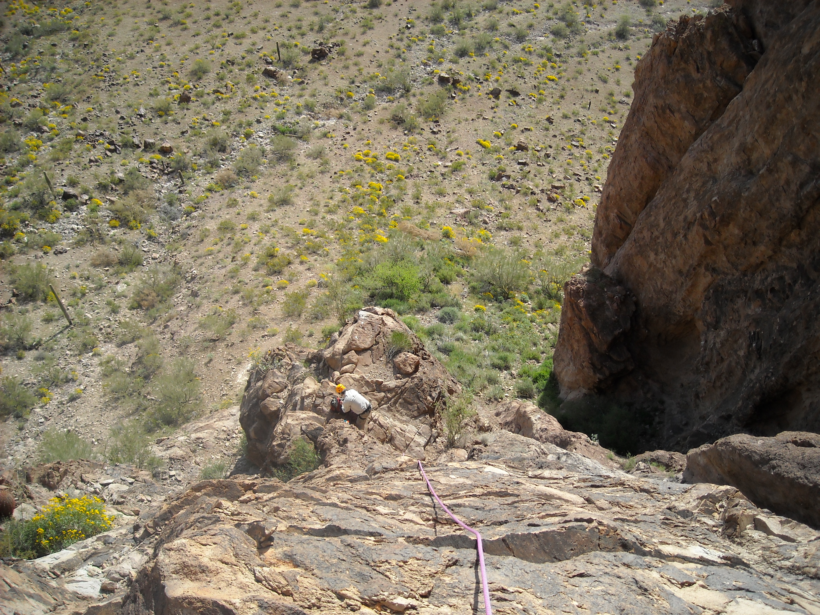
This last 200 feet was solid Class 3, an airy romp – we did this unroped, and it only took a few minutes. It was over – what a rush! And what a place this was. There we were on the summit of Courthouse Rock, elevation 2,874 feet. It had taken us about 6 hours. The views were outrageous. Like this one, looking down very steeply on Andy’s red truck parked by the concrete apron which serves to gather and harvest rainwater for wildlife – see it at the end of the road?
A view from the summit
And how about this one, looking northwest to Eagle Benchmark, less than 3 miles away.
Eagle Benchmark, the big peak on the right in the distance.
In the same photo above, on the far right in the middle and nearby is a distinct bump. Once we climbed up past the red mark shown 4 photos back, we were on that bump between the red mark and the black mark. And here’s us.
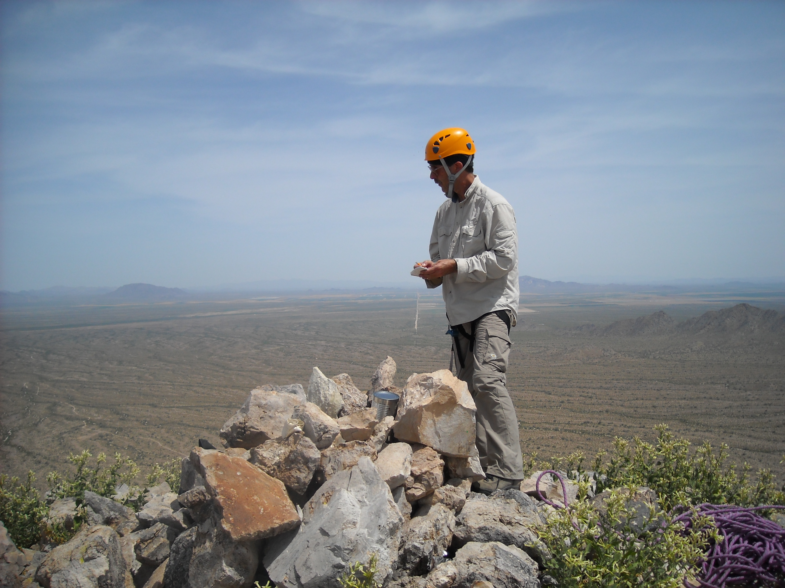
Andy Bates
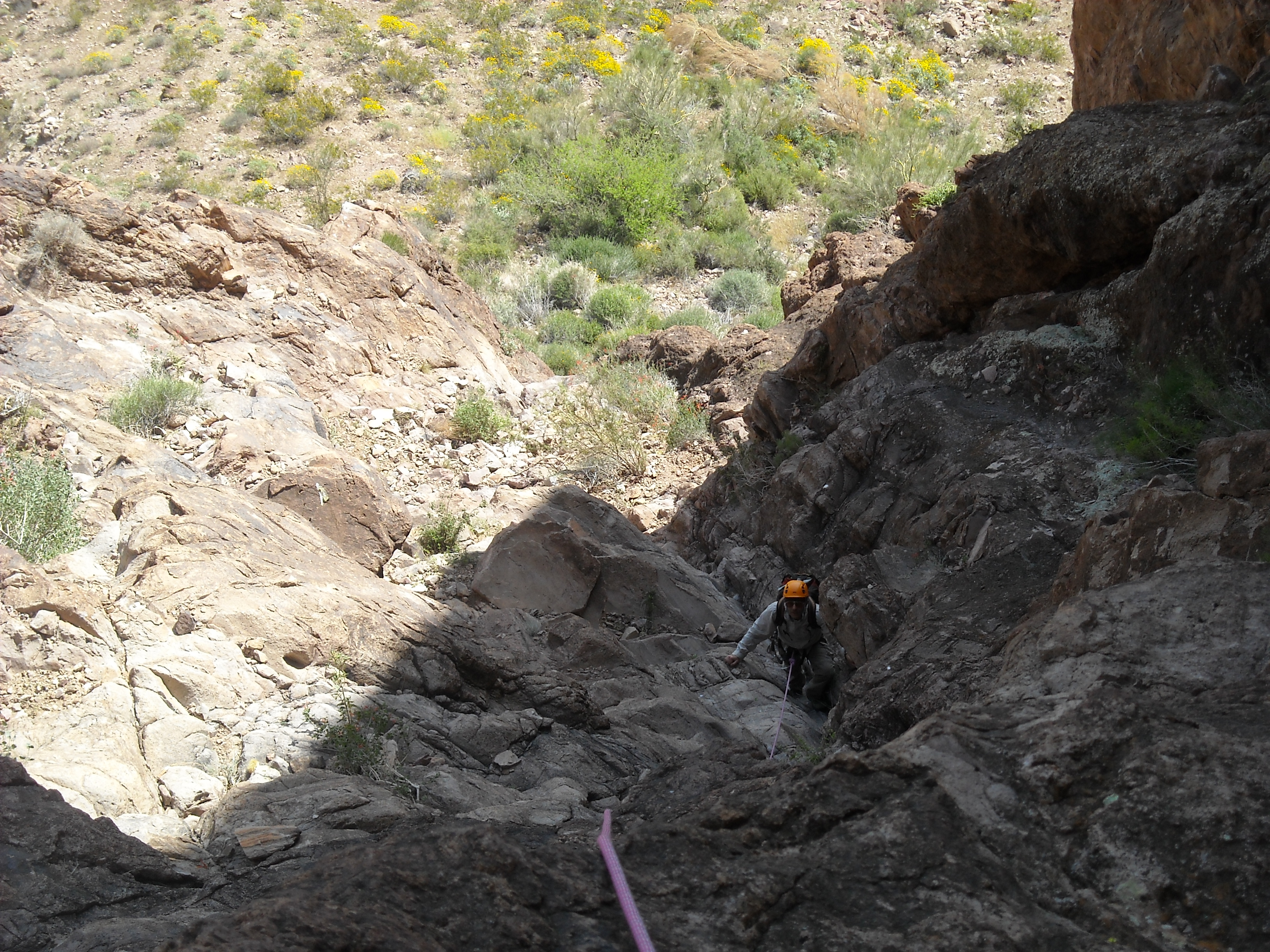
We signed in to the register, enjoyed the view for a short while and then climbed back down to the nearby saddle (black mark). Shortly after that, we were back down to where we’d left the rope. Andy tied in and rappelled down that last roped pitch – then it was my turn. Andy took this photo – you can clearly see the large brown chockstone blocking the route below me – the rope passes directly over it.
The rappel
Once both down, we started the long walk back along the level part of the mountain, and you’ll never guess what we saw? Two desert bighorn sheep! Now, we see sheep in many of Arizona’s rugged mountain ranges, so what was the big deal? How did they get up there?, that was the big deal. As far as we knew, we had come up by the easiest route, so the sheep must have climbed by at least a Class 5.5 route. Was there some path they knew of that they used to climb up and down the mountain on a regular basis? Was it our route, or a different one? They were up high, a little below us, but still well above all of the steep climbing required to get to the upper part of the mountain. And I think we had heard somewhere that others had seen sheep up there too. So are they trapped up there and live there permanently, free of predators? That seems unlikely, though, as there’s no water up high on the mountain. I’d love to know their secret.
Before we knew it, we were rappelling down the steep pitches in the great gully. The day had become hot, and we ran out of water. By the time we reached the truck, our tongues were practically dragging on the ground. Thankfully, a cooler of cold drinks awaited. We were really feeling the heat. Andy said his truck had ice-cold air-conditioning, and I told him it couldn’t be too cold for my liking. Well, 5 minutes after starting the drive out, I was begging him to turn it down some – yep, it was the most awesome AC I’d ever experienced all right! Sadly, as I write this 7 years after our climb, his AC is no more; it has ceased to be; it is bereft of life, it rests in peace; it has expired and gone to meet its maker; its metabolic processes are now history; it has kicked the bucket; it has shuffled off its mortal coil; it has run down the curtain and joined the choir invisible; it is an ex-air conditioner!!
Our climb had taken almost 11 hours, over a total distance of about 2 miles. Aside from the heat, it had been really enjoyable. Definitely better done in the cooler winter months, though. Thanks again, Andy, for leading another great climb.