
Why were we going up Edgar Canyon? It was just a means to an end, the end being a climb of an obscure, no-name peak way out there in the wilds of the northern Santa Catalina Mountains. The topographic map showed a trail from the end of the road on Davis Mesa, and that’s what first attracted us as a route to the peak. As the crow flies, it was only 29 miles from my house to the peak, but that was deceptive. The reality of the situation was much different.
I picked Jake up at a parking lot at 6:00 AM, and we drove north through several communities (Oro Valley, Catalina, Oracle and finally San Manuel) and then across many miles of ranch lands. At last, 72 miles after leaving home, we lurched to a stop at the uppermost end of Davis Mesa. What a drive! Some of these peaks involve more driving than climbing, and this was starting to look like one of them. It was already 9:00 AM when we set out on foot from the truck.
A signpost announced the start of the trail, a hopeful indicator that we’d have an obvious route all the way to our peak.
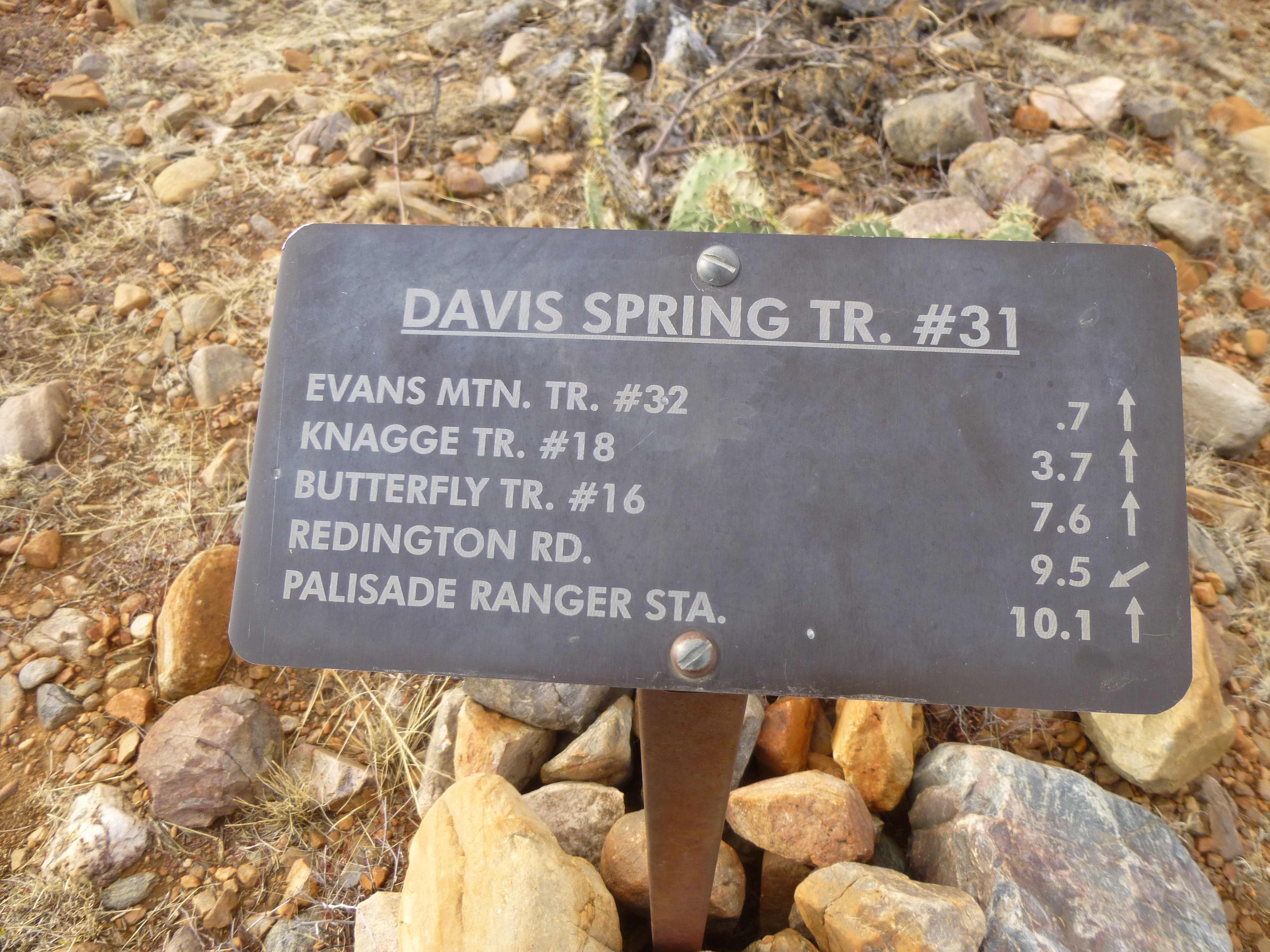
The sign at the start of things.
Unfortunately, this is one of those trails that, in order to go up, you must first go down, and down we went, quickly dropping 340 vertical feet. Here, the trail was obvious.
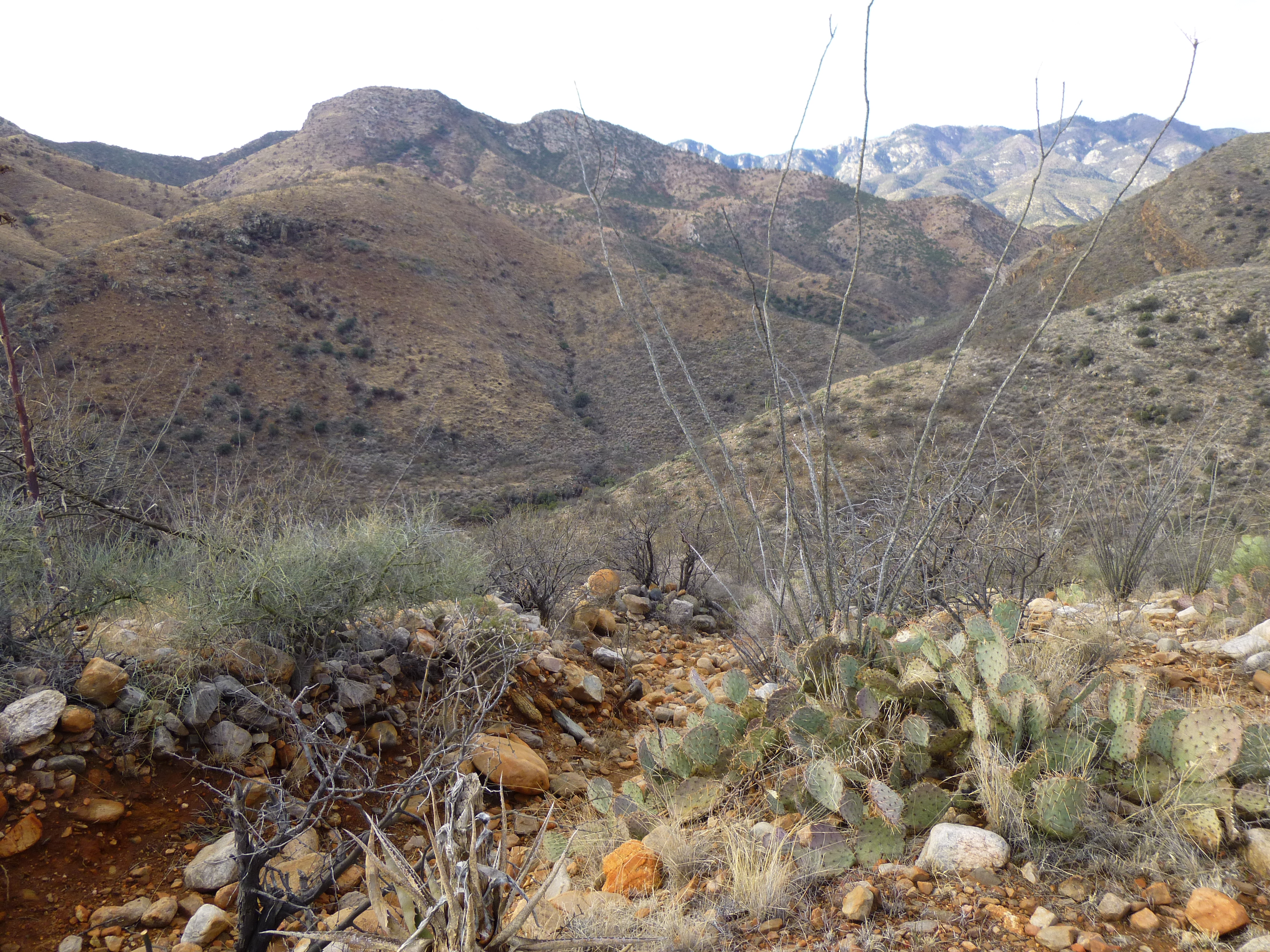
The start of the trail.
On the way down, we passed Davis Spring. A pipe delivered water from the spring to a trough down below, creating a year-round supply for the cattle that spent time here.
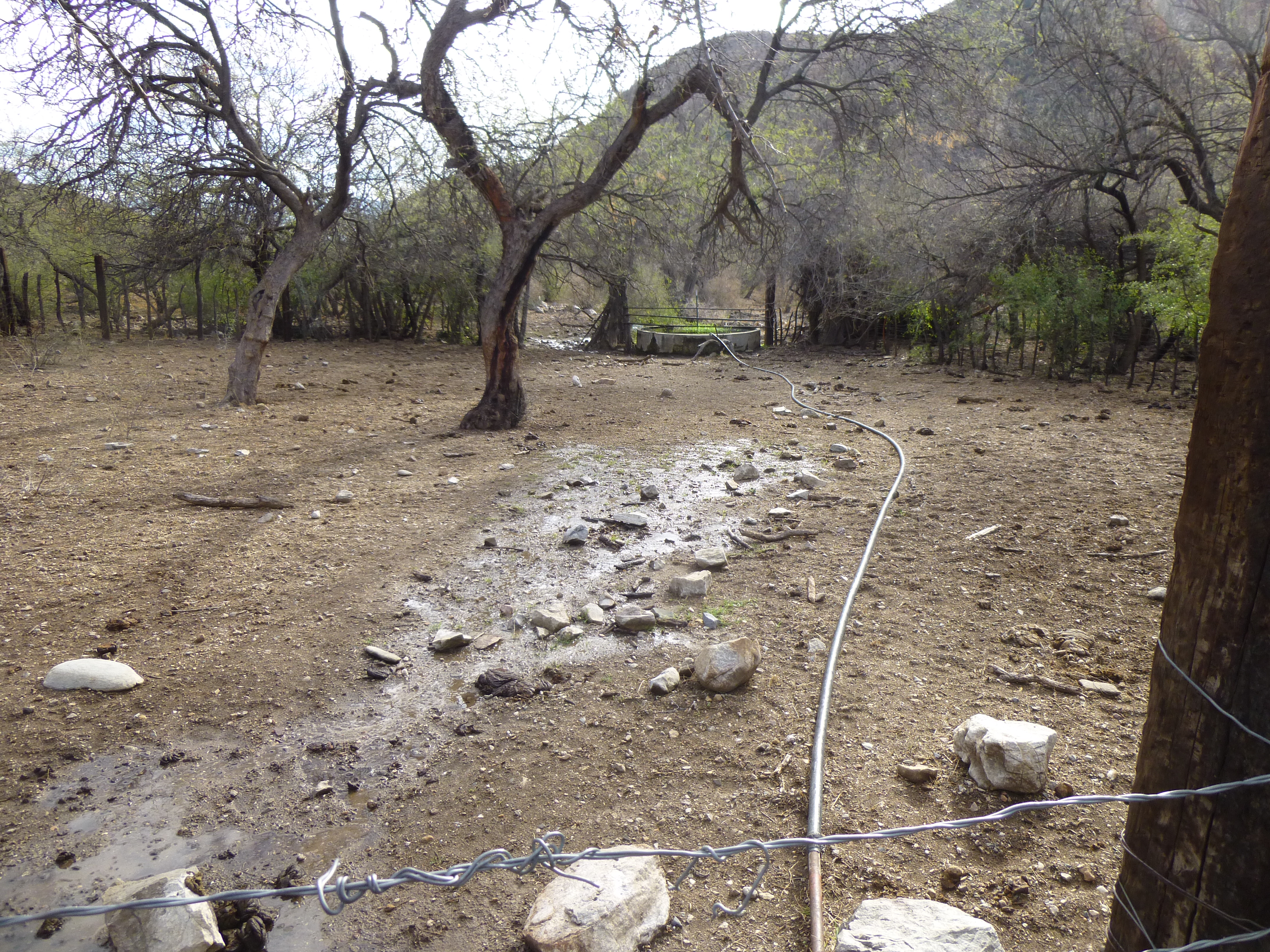
Bringing water to the trough
That first sign at the top of the hill said it was 0.7 miles to the Evans Mountain Trail, which we should have found here near the cattle water. We didn’t. This area had recently experienced heavy rains, and we thought there’d be a good chance that there’d be water running in the bottom of Edgar Canyon. How right we were!
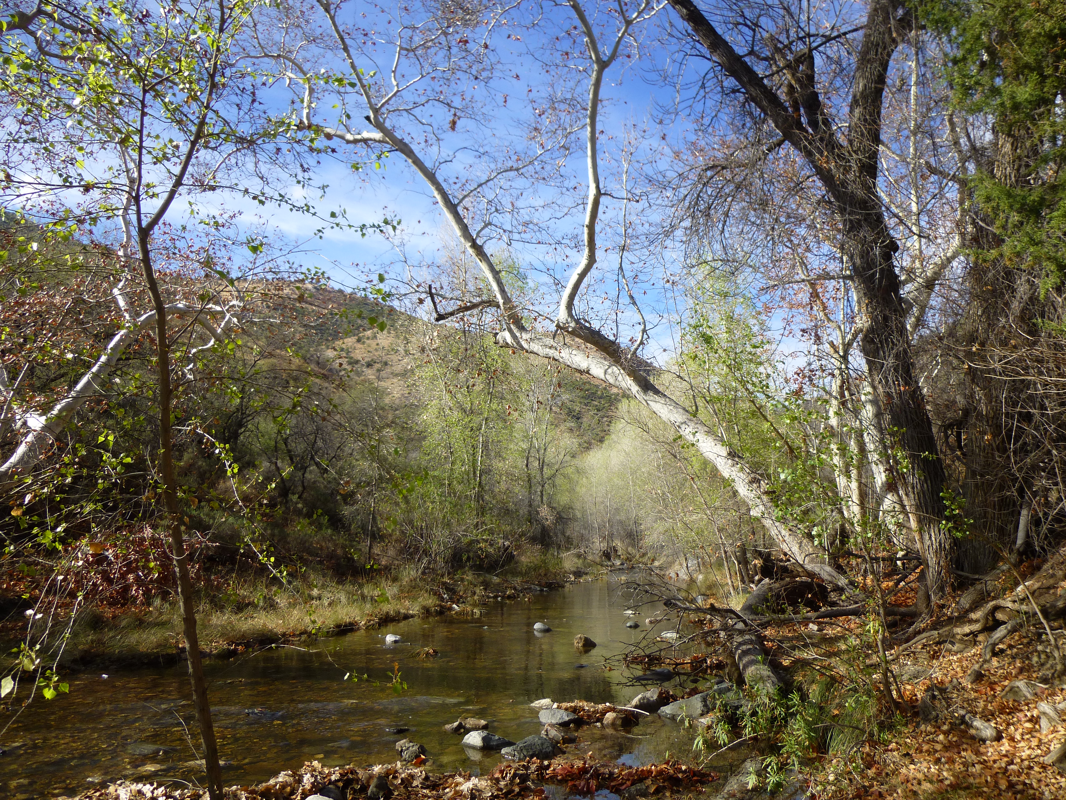
The stream down in Edgar Canyon
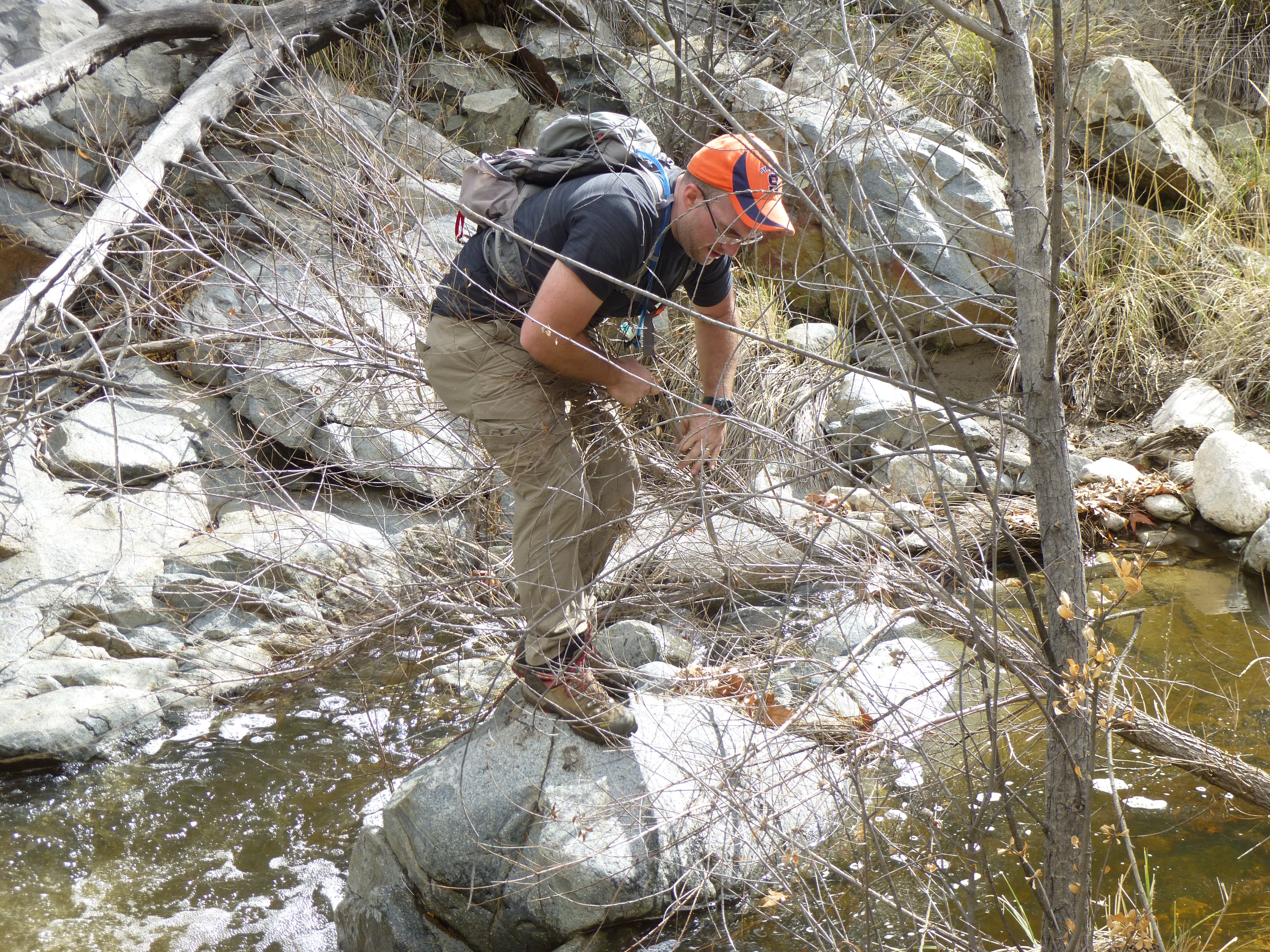
We lost the trail almost as soon as we reached the creek – it seemed to just disappear, and we found ourselves walking wherever the going was easiest. There was plenty of brush, much of it with thorns, and that served to slow us down. Before leaving home, I’d drawn on my map the approximate location of the trail so we’d at least have some idea on which side of the creek it could be found. Even using the GPS to help us, though, we couldn’t find it – all we could conclude was that it was rarely used and the vegetation was reclaiming it. In places, the canyon became deep and narrow, its steep walls forcing us to cross from one side of the creek to the other. This picture shows rock closing in at crazy angles from both sides.
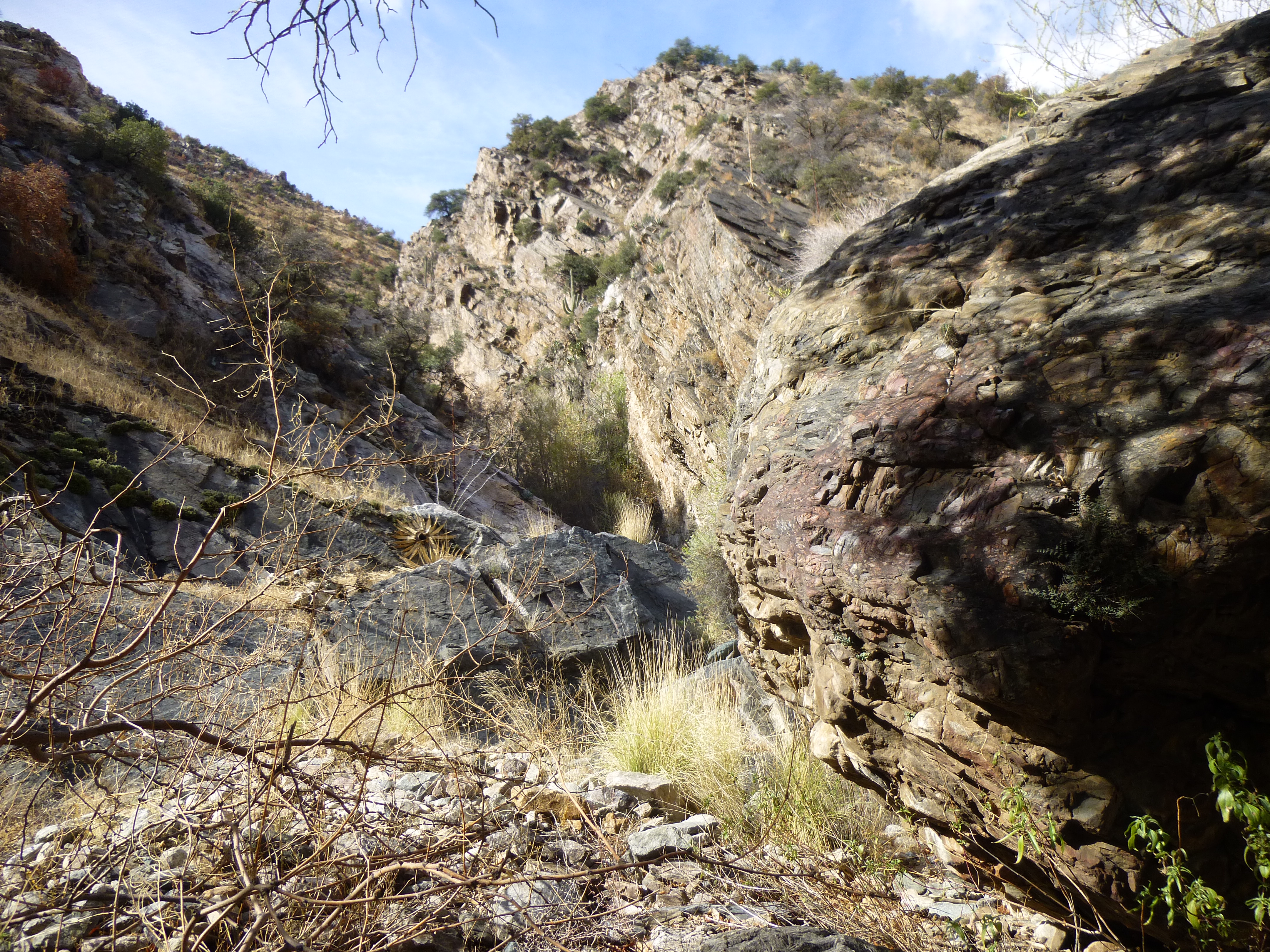
Walls closing in on us.
In places, we were forced to climb up and across cliffs in order to get past spots like this.
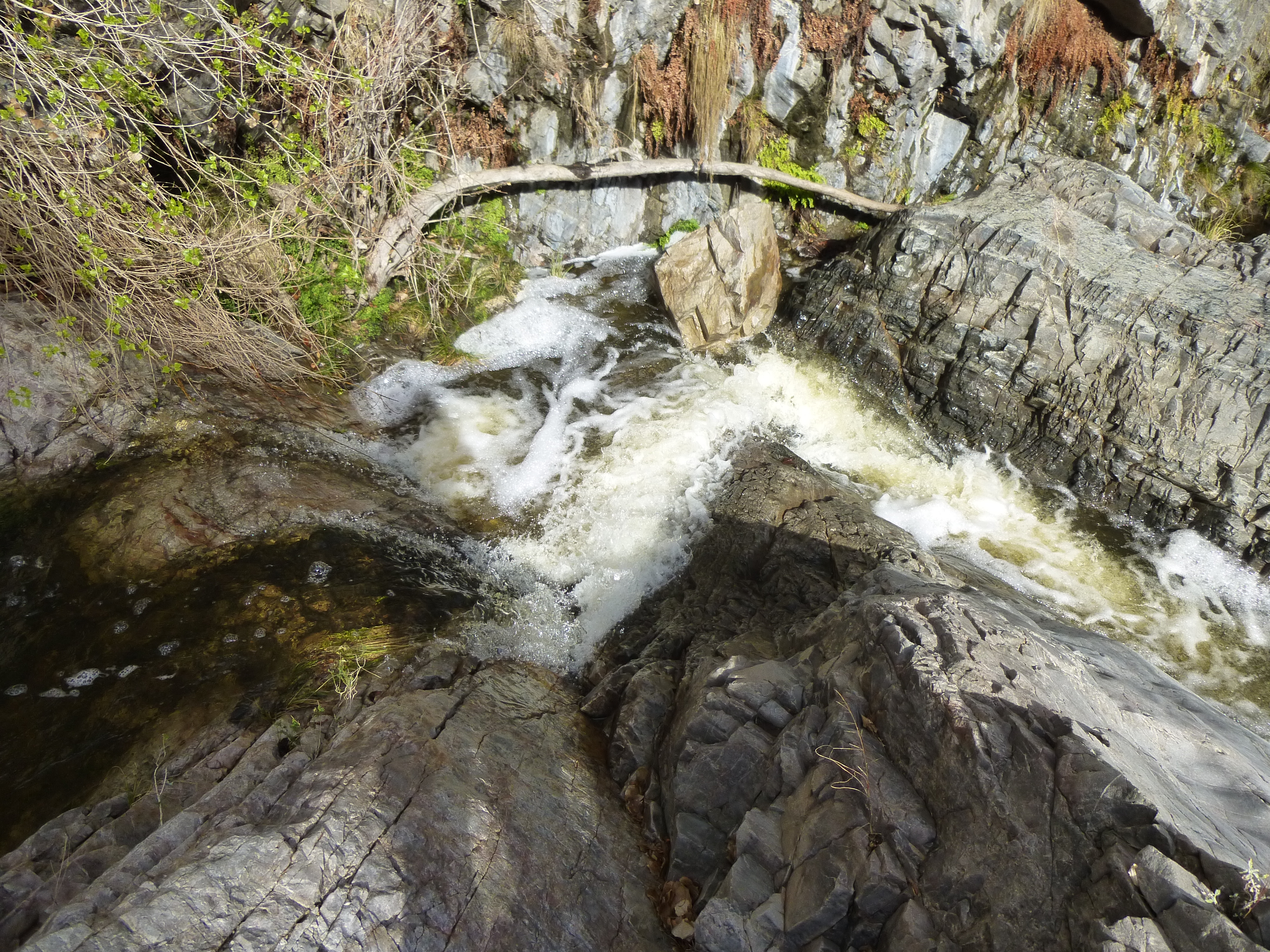
White water.
You can see how narrow the canyon became at times.
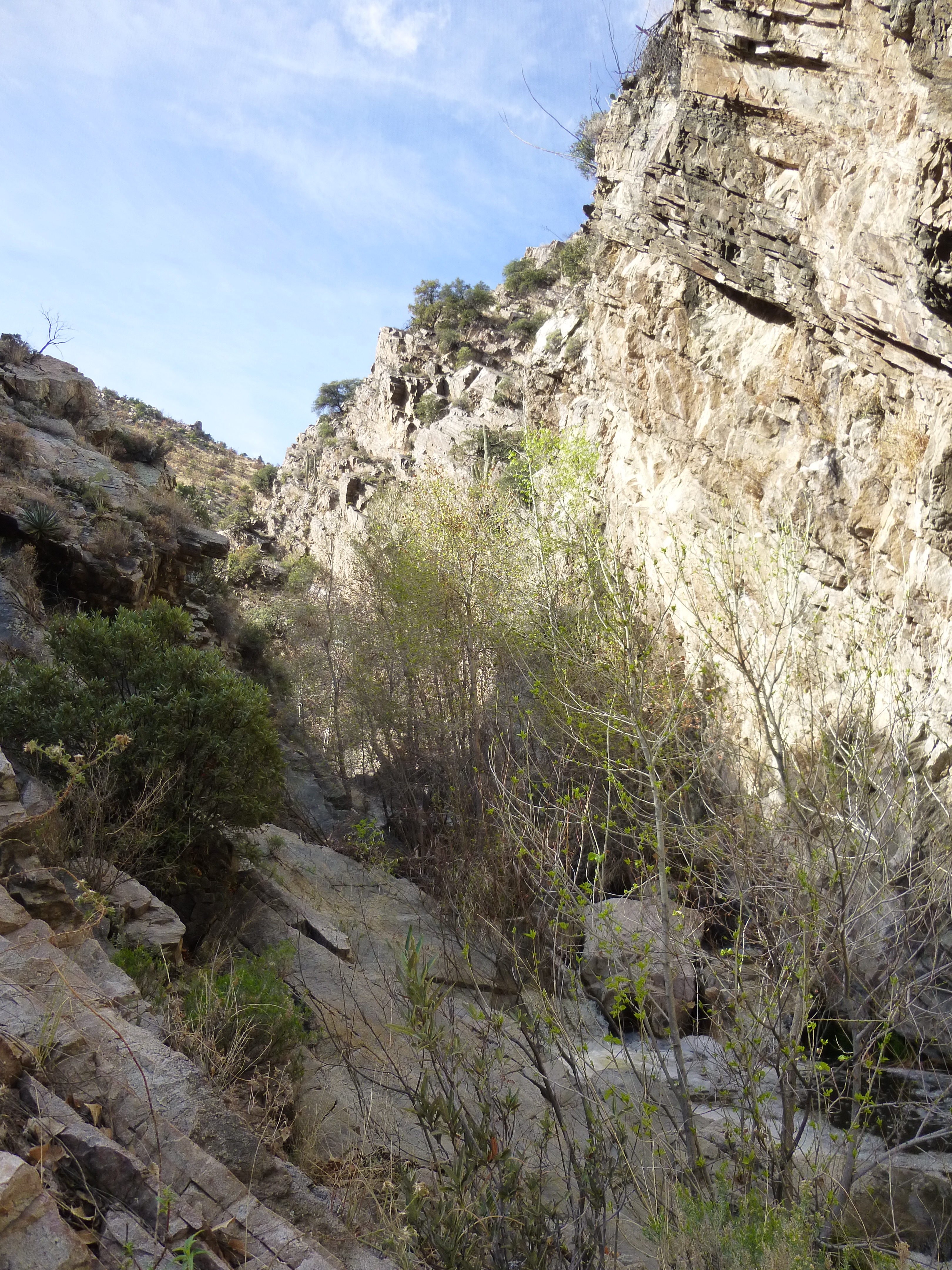
Another tight spot.
To give you an idea of the power with which this stream can run at times, look at this 3-foot section of tree trunk – see how high up it was tossed on to the top of this huge boulder?
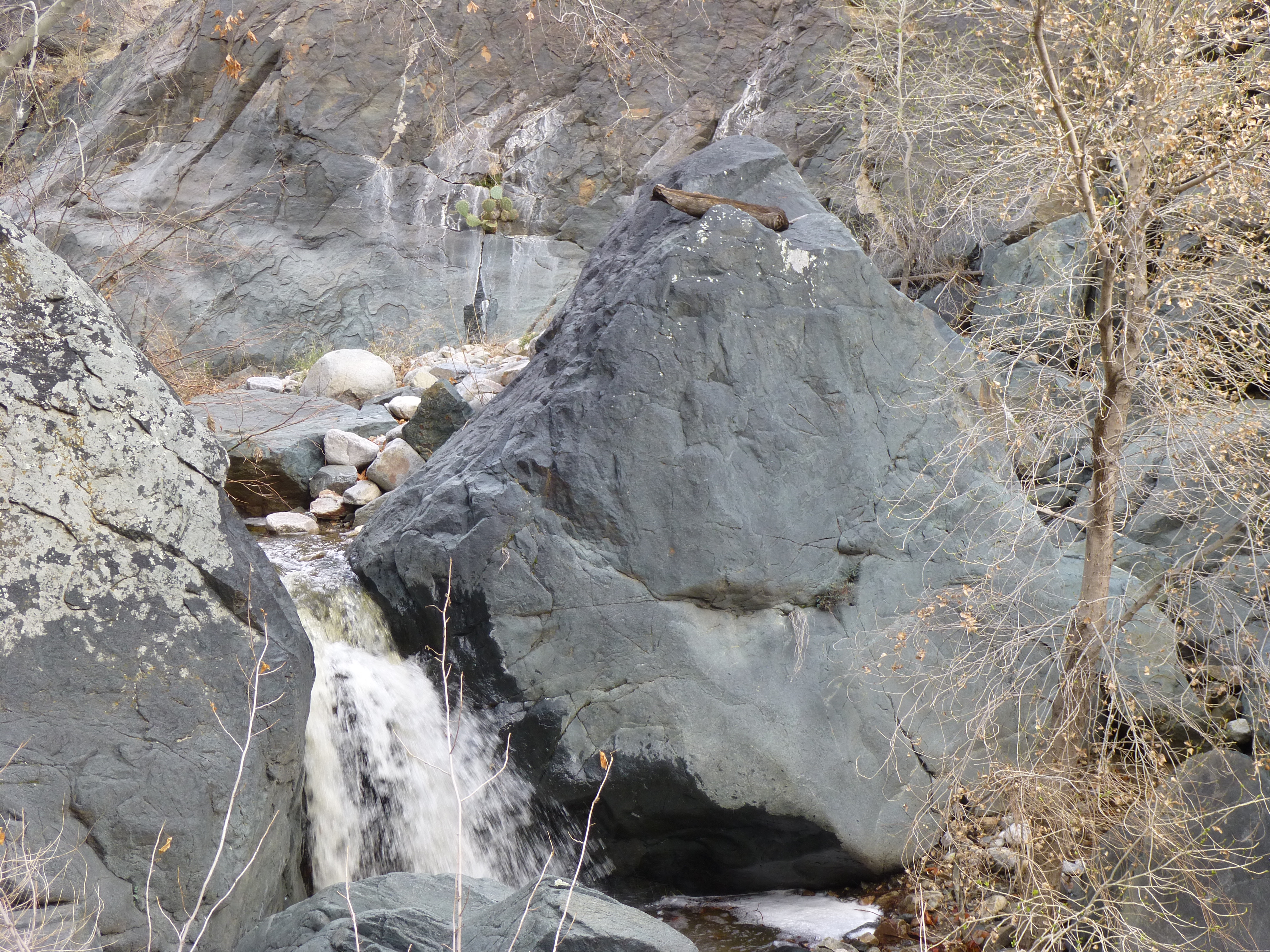
Yikes! What power!
There came a point where we had to cross the stream at the base of a huge cliff. It was tricky, and Jake slipped and fell in, getting good and wet. He scrambled out safely, though, and we moved on upstream, heading ever southward. My turn came later on, where I slipped on a tuffet of grass and plunged into a bit of deep water – no harm done here either. Here’s a look back, up to the summit of Peak 5817, seen as we walked.
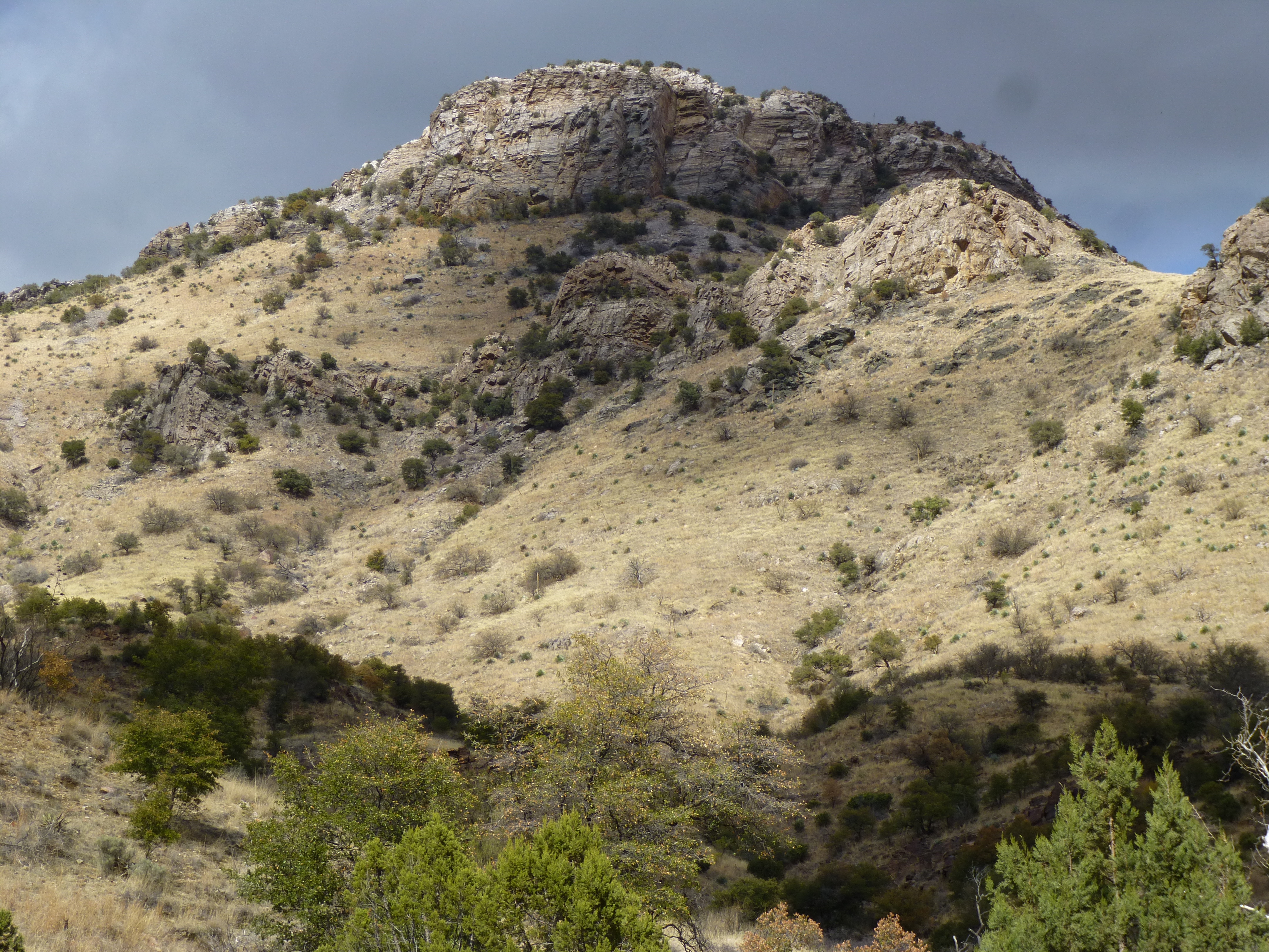
The south side of Peak 5817
The hours passed. There were smaller canyons which we passed on both sides as we continued on upstream – we took note of them all on our map, but just kept on going. One of the major ones was to the west up into Peck Basin, and it too was bypassed. Finally, just after 1:00 PM, we had a little conference about our progress. The verdict was grim. The sky was threatening. We were still more than 1,500 vertical feet below our summit, which still stood some distance away. Yes, we could have carried on and made it, but we knew that if we pushed on to the top of the peak, it’d be a long walk back out in the dark, at least the last few miles. The prudent thing to do was to call it a day and start back, and that’s exactly what we did.
All day long, as we had walked upstream, the terrain had forced us to cross the stream many times. How many? We hadn’t been counting, so just for the heck of it we decided we’d do just that on the way back down. Hopefully we’d learned something of the obstacles all the way upstream, enough that our trip back down would be more efficient. To cut to the chase, on our way downstream we had to cross no less than 27 times. Assuming it was a bit more than that on the way up, it’s safe to say that we crossed the stream a total of at least 60 times that day. It’s a wonder we didn’t fall in more times than we did.
Jake
The return trip back down Edgar Canyon was uneventful, if you don’t count the fact that the weather closed in and it started to rain. By the time we reached the truck, we were pretty wet, and 8 hours had passed since we’d started. We had put in an honest 8.6 miles and 1,425 vertical feet on the day. So there we were, a lot of effort put in with no peak to show for it. It was the best decision, though, to turn back when we did.
So now what? The peak was still there and had to be climbed. After our ill-fated attempt, Jake called me and asked why we hadn’t gone in from the south. He made a good point, and I guess my only answer was that I thought there’d be a good trail up Edgar Canyon and we’d have made much quicker progress than we in fact did. All of the bushwhacking and stream crossing had eaten up way too much of our day, making the whole adventure much more of a long shot.
To try for our mysterious peak from the south would involve an entirely different approach. Six weeks later, I picked Jake up from his east-side home and we drove up the Catalina Highway on a Saturday morning. This is a popular stretch of road, climbing as it does from 2,600 feet elevation down in the city to its culmination at 9,157 feet at the top of Mt. Lemmon. It is popular with runners and cyclists, on this day more so with the latter. We passed many members of a women’s cycling team on the way up, all dressed in their matching outfits.
It was as if we were keeping bankers hours, because by the time we walked away from the vehicle in the roadside parking area it was almost ten in the morning. This approach would be completely different from that of Edgar Canyon. Most of it would be along trails, with a cross-country finish. The Santa Catalina Mountains have an extensive system of trails, and since much of the range falls within the Coronado National Forest, the trails are maintained (at least that was our hope).
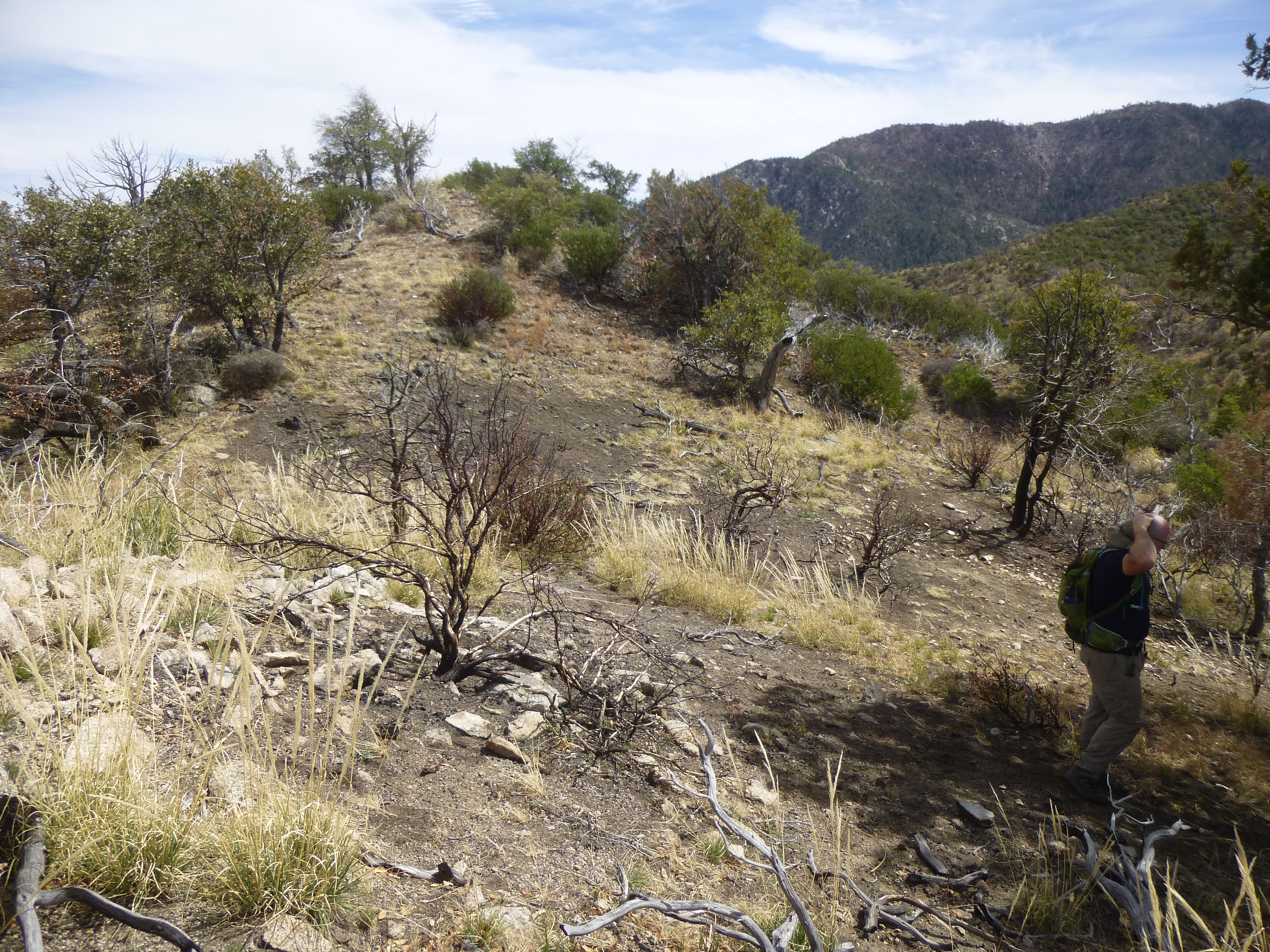
Those of you who follow my stories on a regular basis know that the ol’ Desert Mountaineer almost never climbs mountains that have trails. Today would be the exception. We set out up a steep track, climbing 240 feet to a saddle in the forest which took us up to 7,500 feet. From there, it was steeply downhill on a series of short, steep switchbacks, dropping us 900 vertical feet to where things leveled out somewhat. The trail was still excellent.
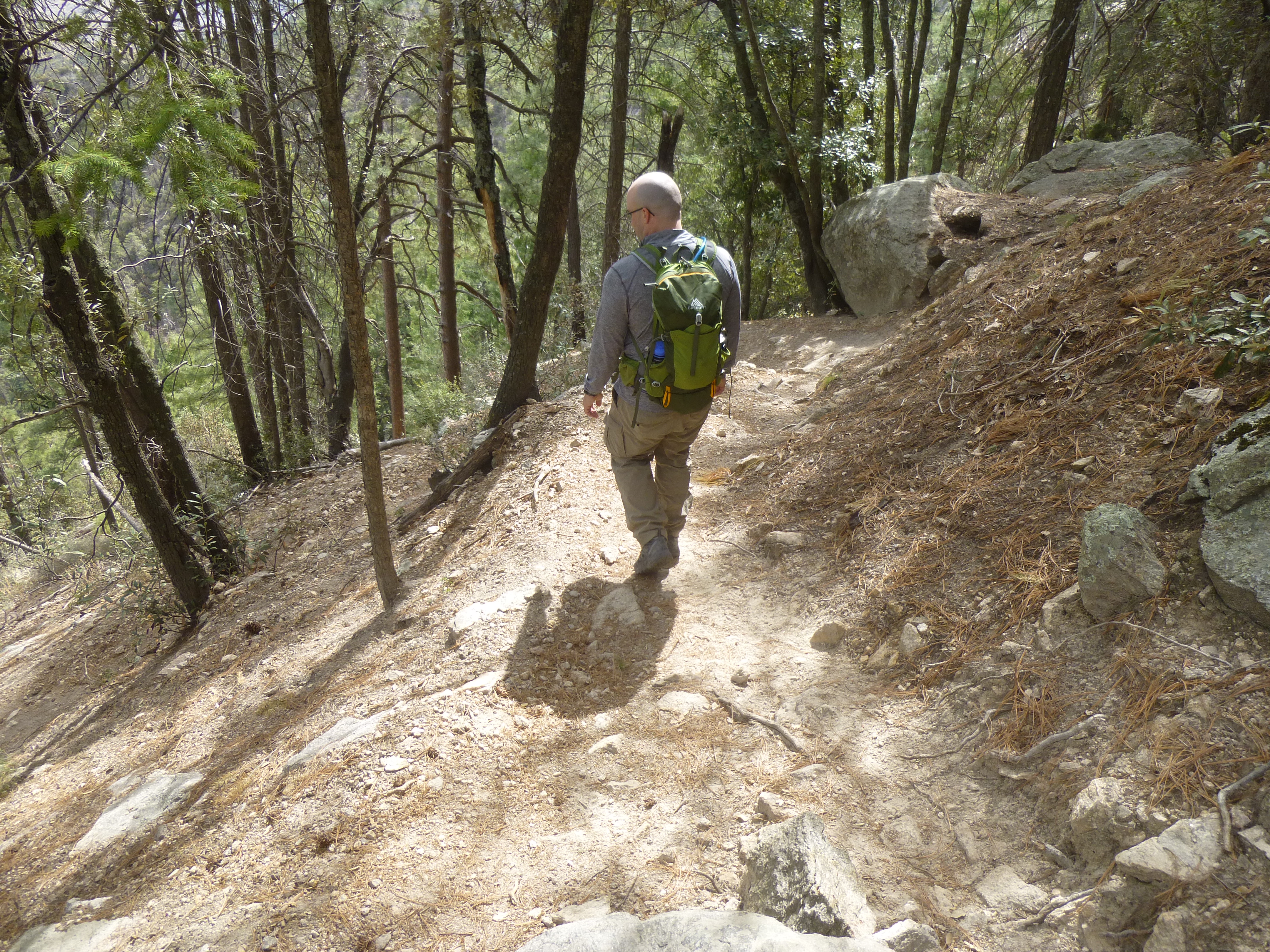
Nice trail
We passed a few trail signs, such as this one.
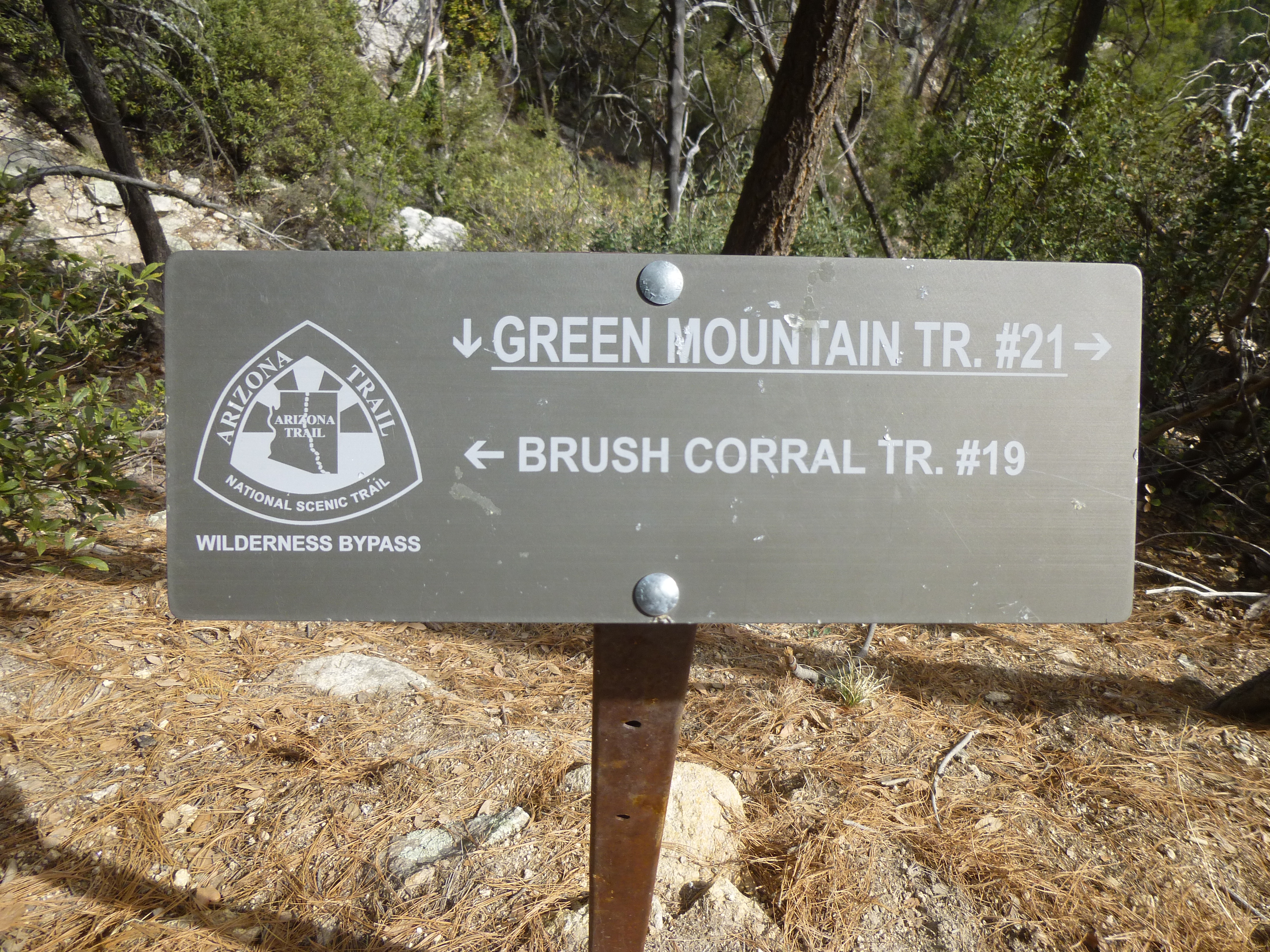
A sign.
Here’s a look back up to where we’d started, up on top.
Looking back up to our starting point.
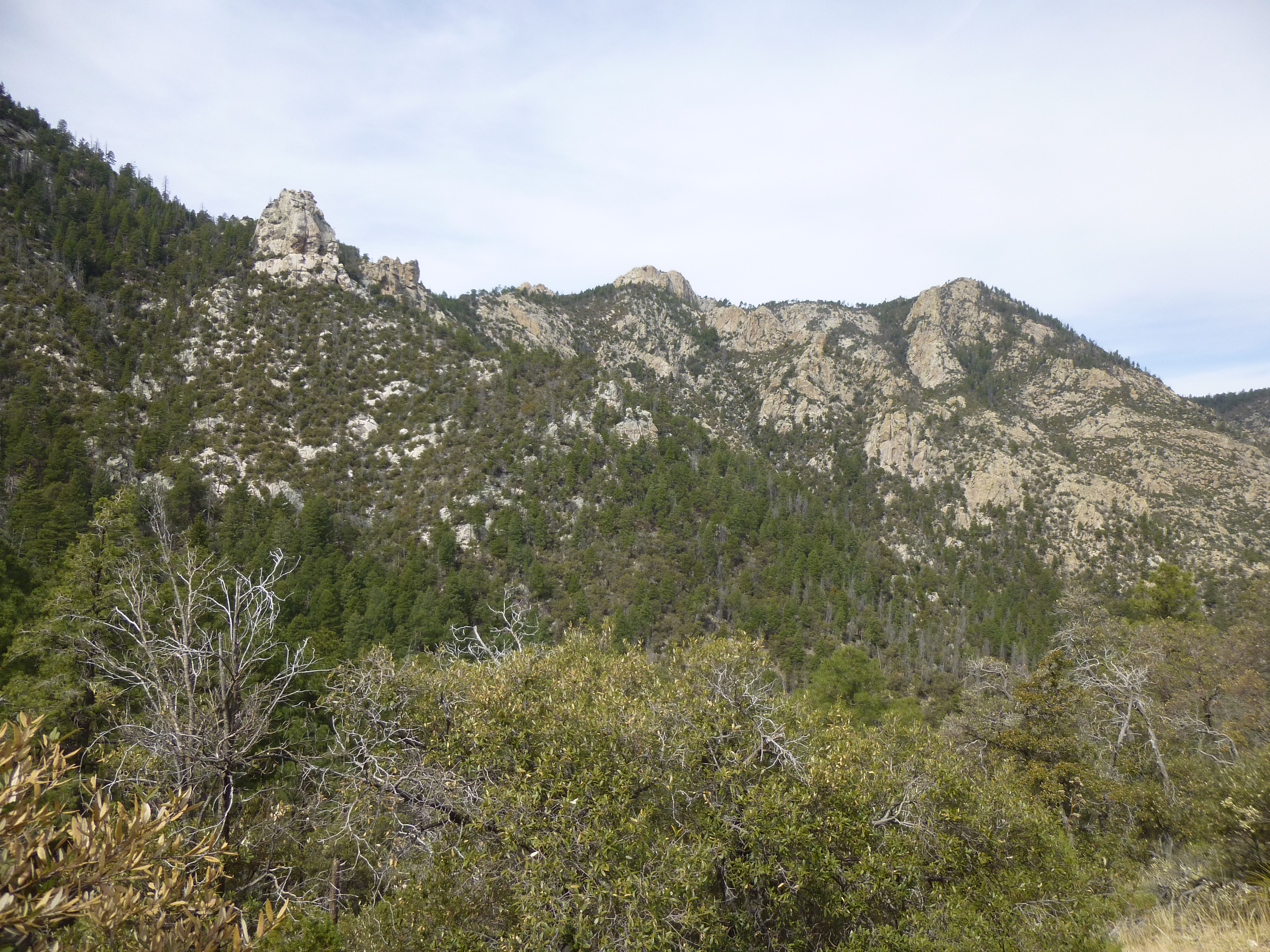
The north side of this range was rocky, and we passed some interesting formations like this one.
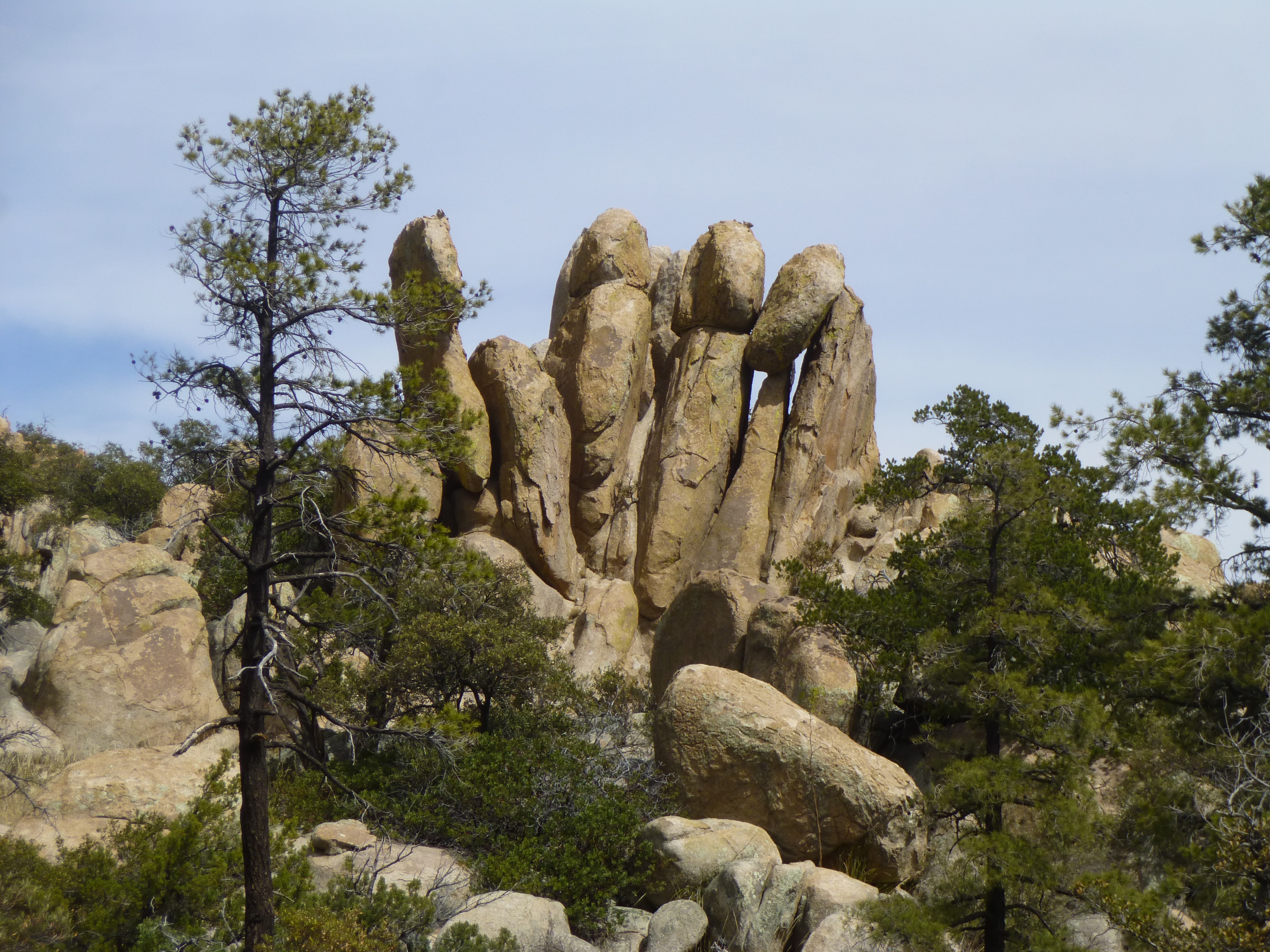
Fingers of rock
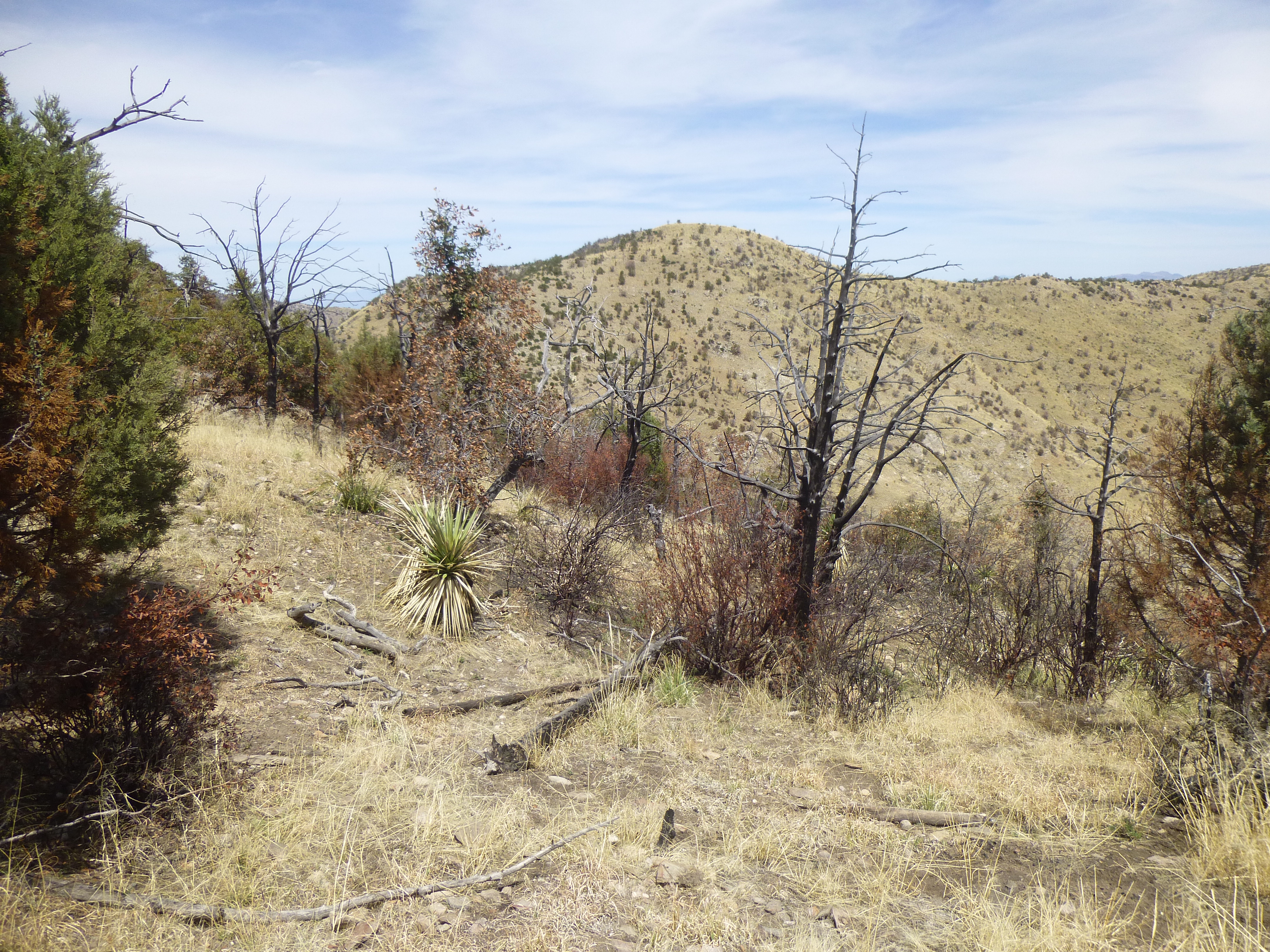
Three miles out from the parking lot, we reached a gentle knoll, a spot where our trail could no longer serve us. It was time to head north cross-country, the thing we did best. A fire had touched this spot in past years.
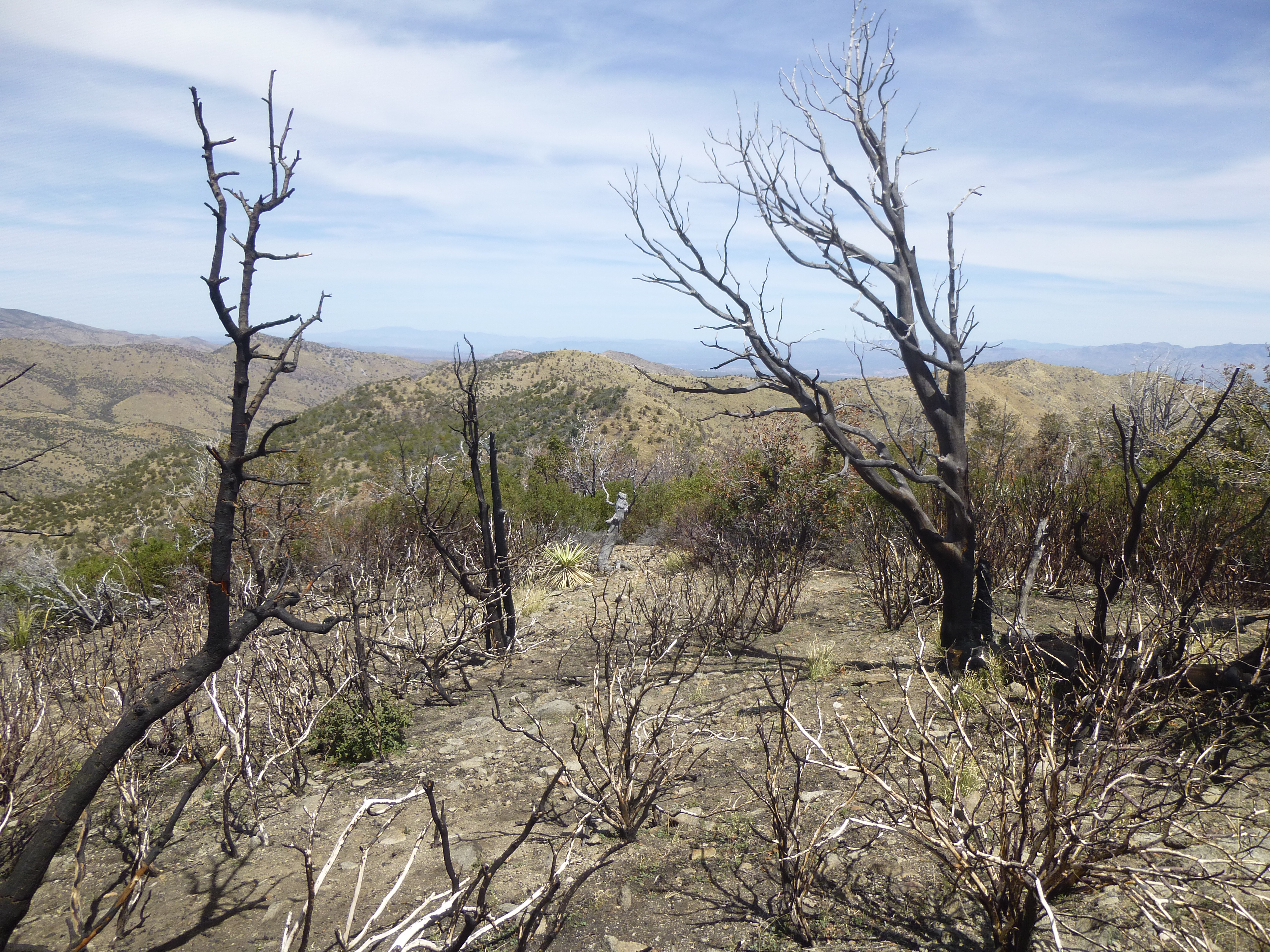
A look north
Here’s a shot looking to 3 bumps over which we needed to climb – the nearest is Point 6090.
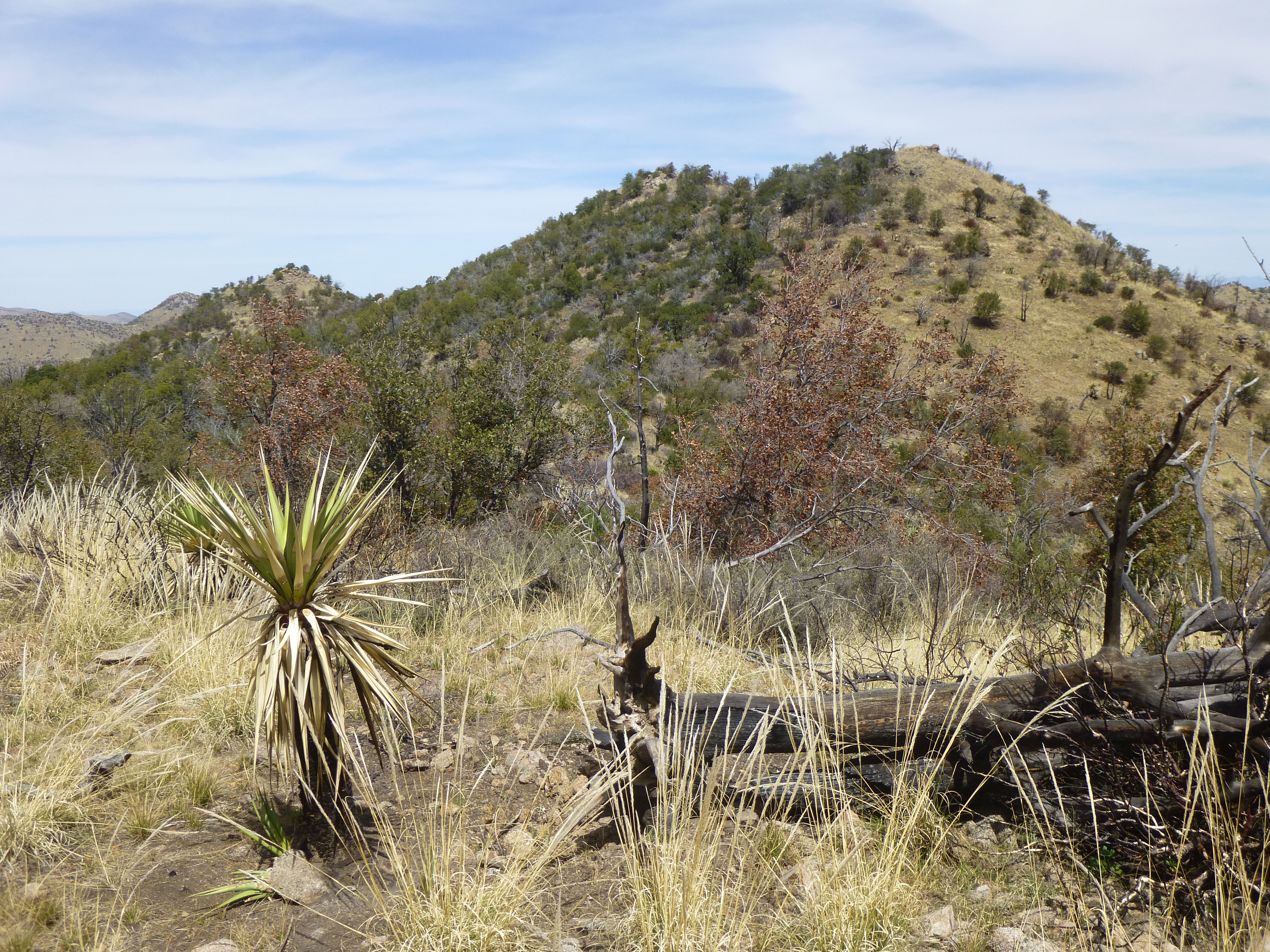
Point 6090
Finally, for the first time on both of our trips, we had a clear look at our goal, the gentle bump in the middle of the next photo.
A first look.
Once past the 3 bumps, it was a straightforward scramble up the southwest ridge – 3 hours after starting out, there we stood on the top of Peak 6101. Finally, done! Just for fun, we looked steeply down to the northwest, down into Edgar Canyon. I’ve placed a yellow dot on the photo, which shows where we’d stopped and turned around on our earlier attempt. It was a full 1,500 vertical feet below where we now stood. Ahh, so near yet so far. See it? – a bit above center, a bit left of center, down at the end of the tan hills. Above the yellow dot, in the middle distance, rises Peak 6053; over to its right along the ridge is Peak 5817.
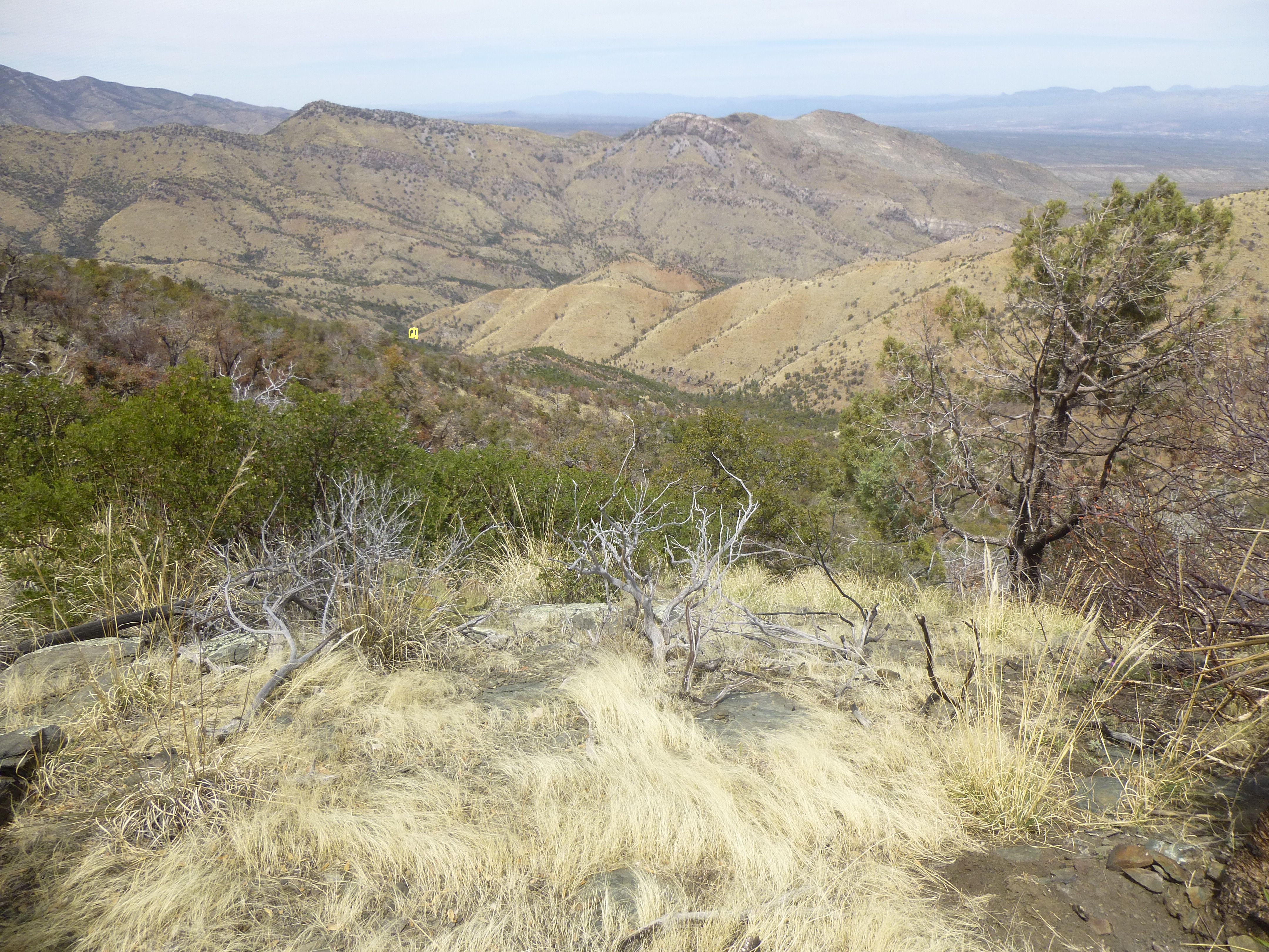
The yellow dot shows where we turned around
There was no sign whatsoever of anyone having visited this spot, so we left a register. After a quiet lunch, we set off on the return trip. All of the real work now lay ahead of us, the uphill climb back to the car. Crossing the 3 bumps along the ridge wasn’t too bad – we could find lanes through most of the brush, keeping the bushwhacking to a minimum. Once past the bumps, we were back on the trail which would take us all the way out.
On the way back to the trail.
There’s not much more to be said – the way back was a bit of a grind – a scenic one, but a grind nevertheless. The return was almost 4 hours, and the tally on the day was a shade over 3,000 feet of climbing (the trail had some serious ups and downs along its path). All things considered, if we had successfully made the summit on our first attempt up Edgar Canyon, the total amount of climbing we would have done would have worked out to have been the same. But then we would have missed out on all the watery fun!