
Here’s something that nobody but a died-in-the-wool peakbagger would ever waste time contemplating, something that the average member of the public would consider a bizarre concept at best: namely, how big does a group of mountains need to be in order to be considered a mountain range?
First of all, what do I mean by big? Certainly not tall, as Arizona has mountain ranges with peaks as low as 1,000 feet, and ones with peaks well over 11,000 feet. Do we need to think in terms of how many miles a range is from one end to the other? Some are as short as one mile, or even less, while others exceed 100 air miles in length. Should we consider how many square miles of surface area a range covers? Or how about this – how many peaks does a range contain? If we are to use that criterion, we need to define “peak”. Let’s just say that for the purposes of this piece, a peak must have 300 feet of prominence, clear or interpolated. And prominence is defined as follows: if you drop down from the summit of a peak to the highest saddle separating it from the next higher peak (no matter how far away that peak might be), that number of vertical feet is the prominence of the peak (also referred to as the “rise” or “relief” of the peak). Let’s just use the term “prominence”, which is the current popular convention.
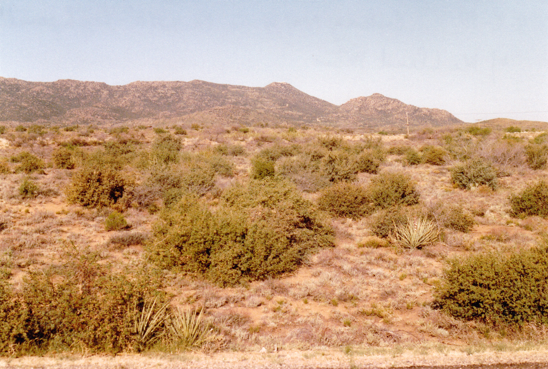
Since it’s probably wise to restrict my ruminations to what I know, I’ll only be discussing mountain ranges in Arizona. Nevertheless, with almost 114,000 square miles at my disposal, I’ll have plenty of fodder to work with.
I ask you this – could a mountain range have NO peaks at all? In other words, could there be within the boundaries of a mountain range not a single peak, not even one with at least 300 feet of prominence? Could a mountain range consist of just a bunch of little bumps, all very small, none of which has a rise of even 300 feet? Apparently not in Arizona, as there isn’t a one. I’ll get more into that later.
Some of our mountain ranges have a lot of peaks – in fact, at least three of them have a hundred or more. One of my favorites is the Sauceda Mountains in south-central Arizona, which approaches to within 40 miles of the Mexican border. It has 100 of the finest peaks you’ll find anywhere. An even-more-populous range is the Gila Bend Mountains, which lies entirely north of Interstate 8 in the southwestern part of the state. It contains an honest 122 peaks. And then there’s the grand-prize winner, the Castle Dome Mountains, with a full measure of 137 within its boundaries – they too are 40 miles north of the border and lie to the east of Highway 95.
Those 3 ranges are densely populated with peaks – allow me to illustrate. The Sauceda Mountains occupy an area 35 miles long by around 10 miles wide, for an average density of 3.5 square miles per peak. The Gila Bend Mountains have a larger footprint – 45 miles by almost 20, giving each of its peaks a luxurious 7+ square miles to itself. The Castle Dome Mountains are 35 miles long but are a slender range, usually only about 5 miles wide and bulging to 10 at their southern end. Their area is therefore about 250 square miles, so they are tightly packed, each occupying a measly 2 square miles. I mention these 3 ranges as examples of our most populous.
Arizona has a lot of ranges – 193 of them, to be exact. The other 190 are all smaller (that is, have fewer peaks than the Big Three). I’d like to focus on the smallest of all our ranges. Since we already know that not a single range has zero peaks, how about those that have only one. When I first began to ponder this, I thought that there would only be one or two ranges that would fall into that category, that is to say having only one peak, but I soon found out otherwise.
The Casa Grande Mountains are only 47 air miles from my home. The range consists of one very sinuous ridge about 5 miles long, as well as several small outliers. The highest point, Peak 2350, sits about in the middle of the ridge, and rises almost 900 feet above the surrounding desert floor. I’ve only been up it once, way back on January 12,1987. The ridge is completely surrounded by farm fields, subdivisions, open desert and 2 freeways. The ridge has many smaller bumps, none of which have more than 150 feet of relief. The 10 or so outliers are also small, none of them having above 250 feet on their own. If you click on the link for Peak 2350, you can see all of this on a map. Another curious thing about this range is something labeled “Casa Grande Military Reserve”. During World War II, parts of the mountain were used for training. A couple of old Jeep trails and Sherman tank tracks can still be seen today on the desert floor. Occasionally an old U.S. Army .30-caliber shell casing or even a magazine clip from an M1 Garand rifle is found.
Another range that I thought would only have one peak is the Yon Dot Mountains. This one sits on the Navajo Indian Reservation near its western edge and is only 10 miles from the Grand Canyon. The range consists of 2 mesas: the northern one, although higher at 6,350 feet, rises only 240 feet above its surroundings and cannot be considered a peak in its own right; the southern mesa’s highest point has an elevation of 6,330 feet, but actually rises 380 feet above the land around it. Therefore, Peak 6330 is the range high point. If you click on the link, you’ll be able to see all of this. The origin of the name Yon Dot is unclear – it sounds like an anglicized term. The Navajo people call these hills Yaa Ndee’nil which means “series of hills going down”. This is a quiet area, very sparsely populated. The Navajo Reservation is large, about the size of West Virginia, and occupies the northeastern corner of Arizona. The Yon Dot Mountains are 273 air miles north of Tucson.
For the next one, we travel to an obscure part of the state. The Buck Mountains sit alone, quite separate and distinct from any other peaks. Miles away to the west lie the Mohave Mountains and the Colorado River, while the Hualapai Mountains dominate the eastern horizon. Interstate 40 is to the north. But mostly, there is just an empty, flat expanse on all sides. The highest point is Buck Benchmark, placed by the U.S. Geological Survey, and at an elevation of 2,400 feet it rises fully 500 feet above the surrounding terrain. This range is basically an arc about 2 miles long. At its far west end is another benchmark, also named Buck, at elevation 2,070 feet, which was placed by the U.S. Coast and Geodetic Survey, but other than those 2 benchmarks, the Buck Mountains are about as uneventful as can be. The remnants of the Palo Verde Mine and the Ideal Mine sit abandoned near the western edge of the arc. The western end of the range is separated from the larger and higher eastern by an old dirt road, but only rises about 225 feet on its own. The range high point saw a flurry of activity mostly in the 80s and 90s, but for last 20 years has sat unvisited by climbers.
Next, let’s consider the McCloud Mountains. This is another oddball, as it consists of a single S-shaped ridge about 6.5 miles long. The highest point of the range is an un-named bump we call Peak 4980, which rises a full 1,090 feet from the surrounding country. The range is located in the central part of the state just west of the village of Hilltop. A road climbs to the top of the peak, and can be seen in this old photo of mine from 1989. Another range with only one peak.
Here’s looking northwest to Peak 4980
Near the high point sits the only named feature, Gray Benchmark, which at 4,913 feet is only slightly lower and sits on the main spine of the ridge. An interesting aspect of this range is the lack of outliers – it’s pretty much just one long ridge, with none of the lesser bumps exceeding 120 feet of relief.
Moving on, let’s have a look at another one – the Grayback Mountains. This is another range that consists of one long ridge, in this case 8 miles, and running N-S. It approaches to within 3 miles of Bagdad. Wait, what’s that – how can that be, you ask? Well, it’s because I’m talking about the mining town in central Arizona, not THE Baghdad in Iraq. This is a copper-mining town pretty much owned by Freeport-McMoran Copper and Gold. Its 2,200 souls probably don’t even know that they’re living on the doorstep of one of the state’s most obscure ranges. The one peak in this range is Grayback Benchmark, elevation 5,133 feet – it’s nothing special to look at, but it does have a surprising 1,353 feet of prominence. The entire area around the ridge is peppered with every type of mining activity, going back a century or more. The biggest other bump on the ridge rises barely 200 feet, and only a couple of short spurs run off of the main ridge. There’s not much else to say about the Graybacks, so I’ll leave it at that.
So far in my discussion of these one-peak ranges, anyone would be able to visit the 5 of them. This next one, however, is quite a departure from what we’ve seen so far. In order to visit it, you would need a high-clearance 4WD vehicle and a permit, and to get the permit you’d need to watch a cautionary video and sign a hold-harmless agreement with the government. I’m talking about a remote range called the Sierra Arida, which translates as the Arid Range, and is located in the far southwest corner of the state. It sits out in the Cabeza Prieta National Wildlife Refuge, not on the edge of it but deep in the interior, and less than 4 miles from the Mexican border. This is a lawless area, over-run by Bad Guys. Mexican drug cartels ply their trade here, running drugs and groups of undocumented border-crossers into the country.
It’s a long haul to get in to the Sierra Arida. You can approach from the east, along the Camino del Diablo, but it’ll take you 2 full days from the town of Ajo. You could come in from Wellton, up north on the Interstate, driving south on the military road and then east on the Camino, and that’ll be a full day. Your third option is to head south from the village of Tacna, passing the Mohawk Sand Dunes, the Sierra Pinta, then through the Tule Desert to Christmas Pass. You’d park just south of the pass to start on foot.
The Sierra Arida is a tiny range, barely 4 miles long and running N-S. It sits at the southeast corner of the much larger Cabeza Prieta Mountains, and is actually a subset of them. Once you’ve made the effort to drive all the way in, it’s a short 2-mile walk to the high point of the range, Peak 1770. The area is truly beautiful and a great example of unspoiled, remote desert. Don’t try it in June, though, as the attempt could kill you. When I went there and climbed it in the first days of 1988, I found no sign of any prior visit.
For such a short range, there are several spots along the ridge with a fair bit of relief. At the north end, Point 1595 has 225 feet; Point 1737, a mile south of the high point, has 180 feet; Point 1542, down at the south end, rises 190 feet. There are 2 outliers at the southeast tip of the range which are almost, but not quite, peaks in their own right: Point 1319 has 290 feet of relief, and Point 1306 has 275 feet – close, but no cigar. This leaves the Sierra Pinta as another of those ranges which truly has only one peak.
For our next one-peak wonder, we travel all the way across the state, to the far northwest corner, to the Sawmill Mountains. Situated in the Kaibab National Forest, the range’s only peak sits a mere 8 miles north of the Colorado River deep in the Grand Canyon. It is 33 miles east of Lake Mead on the Nevada border and 25 miles south of Utah. It’s a long drive on dirt roads across the Arizona Strip to reach Mount Logan, which at 7,866 feet is certainly nothing like THE Mount Logan, Canada’s highest. You can drive a road all the way up to 7,620 feet, or at least you could when I went in there back on April 10 of 1989. From there it was a short walk through the forest to the summit. An interesting feature seen from the top is called Hell’s Hole, a huge eroded amphitheater 1,700 feet deep and a mile across. Here’s the only photo I could find of it.

The Sawmill Mountains are one range where there’s no question about other peaks or near-peaks being part of the range – Mount Logan is it, period. It really stands out, with 1,246 feet of prominence.
Staying in the same part of the state, we only move 52 miles to the northeast. This was the range that almost never was. The high point of the Moquith Mountains sits a mere 780 feet from the Utah border. This is a curious range indeed. Its high point pokes barely into Arizona – Moquitch Benchmark, at 7,058 feet, is the highest spot on an area called Ed Lamb Point. The point, about 2 miles wide, is completely surrounded by the Vermillion Cliffs which soar up 2,000 vertical feet from the desert floor to the south. If you walk north from the high point into Utah, you are on a plateau, almost level, which runs for many miles, but there’s still only the one peak. It is just inside the Kaibab-Paiute Indian Reservation, so technically you’d be trespassing, but since you can drive on the Utah side to within 3,000 feet of it, it’s an easy, stealthy walk into Arizona to bag this one. This is an exceptionally scenic area and well worth the trip from anywhere.
Here’s another one that is so obscure that no one has ever heard of it. Restricted to a single ridge barely 4 miles long, the Connell Mountains have but a single peak. This spot is 31 miles northwest of the city of Prescott, Arizona. Peak 6412 is in a heavily wooded area, deep in the Prescott National Forest. Things were really warming up in late May of 1987 on the day I visited. The only other spot along the ridge with any rise at all is Point 6118, which musters a scant 235 feet.
And now for one more that may be the most dramatic of all the single-peak ranges, the Diablo Mountains. Sitting in Organ Pipe Cactus National Monument, this mountain range approaches to within 9 miles of the Mexican border. From one end to the other, this tiny range is only 2.8 miles long, and that’s measuring it along the height-of-land. A road known as the Ajo Mountain Drive completely surrounds it. Organ Pipe has the notorious reputation of being “the most dangerous park in America”. A lot of bloodshed has occurred here, with raging gun battles involving drug cartels costing many lives. Peak 3372 has almost 900 feet of relief and has some sizeable cliffs along its flanks. Here’s a photo taken on Hallowe’en from the road to the east. This is the least cliffy side and the route most climbers take.
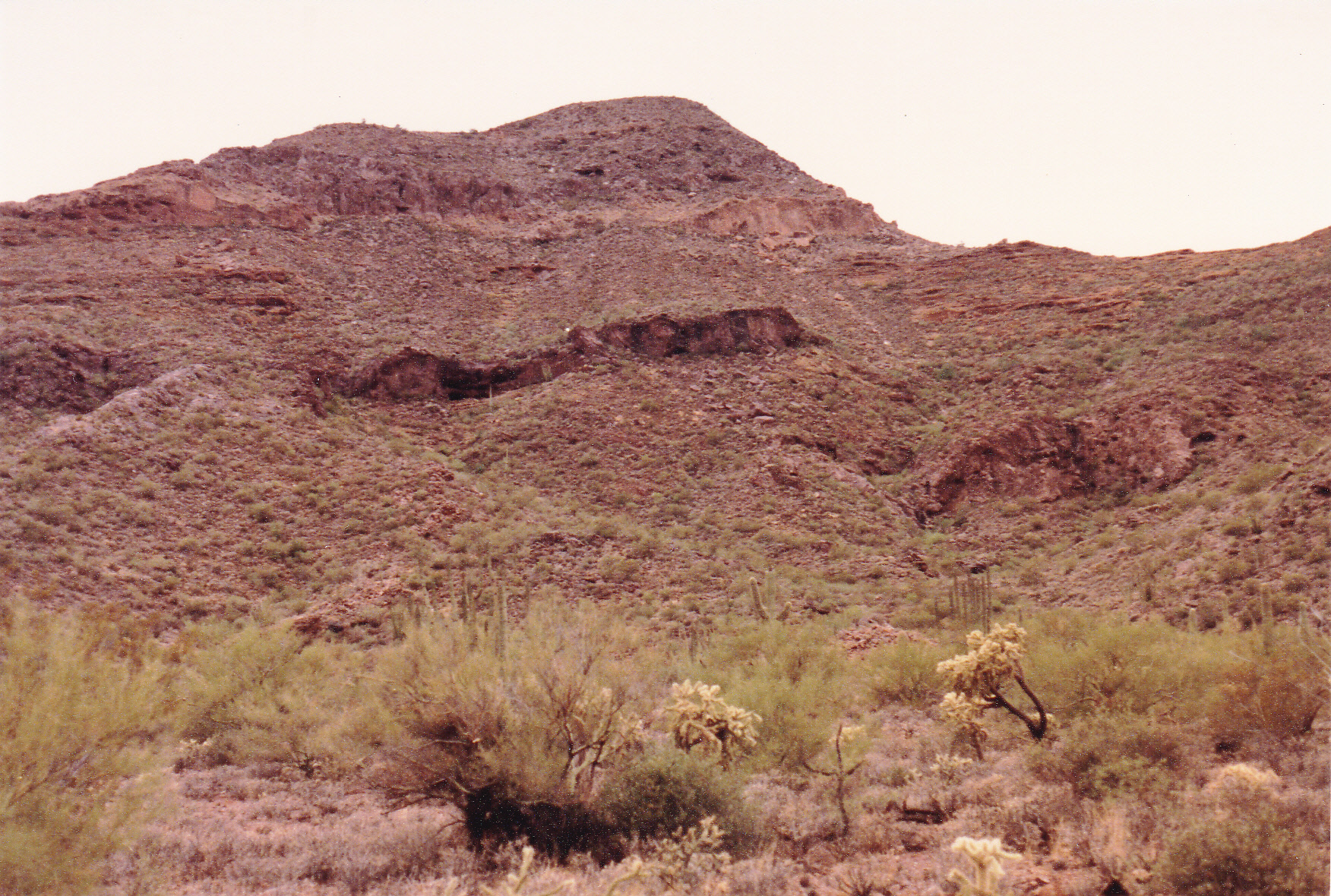
Peak 3372
The range is roughly circular in shape, and has one outlier at its southeast side which rises 230 feet. Diablo Canyon sits dramatically on the north side of the peak, but the real elephant in the room is the Ajo Range to the east, soaring 2,600 feet above the desert floor. This is one of those places you just have to visit.
I’ve discussed 10 mountain ranges in Arizona with only one peak each. There’s one left, and it’s another of those that is way off everyone’s radar. In south-central Arizona sits the Tohono O’odham Indian Reservation, a land the size of Connecticut. It has 400 beautiful peaks, nearly all of which are pristine. One of its many ranges is called the Crooked Mountains, which sits on the south side of Indian Highway 34. It consists of a sinuous single ridge just over 5 miles long. At its north end, Peak 2681 is the high point and only summit. About mid-point along the ridge sits a 2,670-foot contour, with 280 feet of relief, but that’s about as close as we get to a second peak in this range. At the ridge’s southern end can be found an elevated benchmark named Grande, elevation 2,172 feet, but it only rises 90 feet above the surrounding desert – the range high point rises almost 500. This is another peak I climbed in the 1980s, another of those whose summit showed no sign of a previous visit.
I believe that the 11 ranges I’ve discussed are the only ones that have one peak and one peak only in the entire state of Arizona. There are several that have 2, others that have 3, and plenty of others as we raise the count. With 193 ranges to choose from, we can populate a chart pretty well with numbers of peaks in a range, but they aren’t the subject of this piece. So I ask you again, does size matter? Can a mountain range have only one peak and still be a mountain range? Apparently yes, as least as far as historians and map-makers are concerned. I agree.