
I thought I would take a spin down to the border and climb a couple of peaks. Eighty freeway miles from home found me in Nogales, Arizona. This city straddles the frontier. On the Mexican side sits a much bigger city with the same name and a population pushing a quarter million. On the US side sits a much smaller place with only 20,000 or so. The main claim to fame of the Arizona version of Nogales is that much of the winter produce from Mexico is processed through Customs on its way to U.S. markets. Here’s a staggering statistic for you – about 6 billion pounds of produce passes through Nogales each year. That’s billion with a “b”. There’s a lot of waste, though – as much as 60 million pounds of that edible product can be unsellable. Keep that in mind, as I’ll come back to it later.
Much of Nogales sits at around 4,000 feet elevation, and the city is very hilly. I wanted to check out a couple of things on the east side of town, so I started out on the highway that goes to Patagonia, Arizona and then turned north into an area of older homes. Before long, the homes turned into mansions on acreages, and I was greeted by this sign.
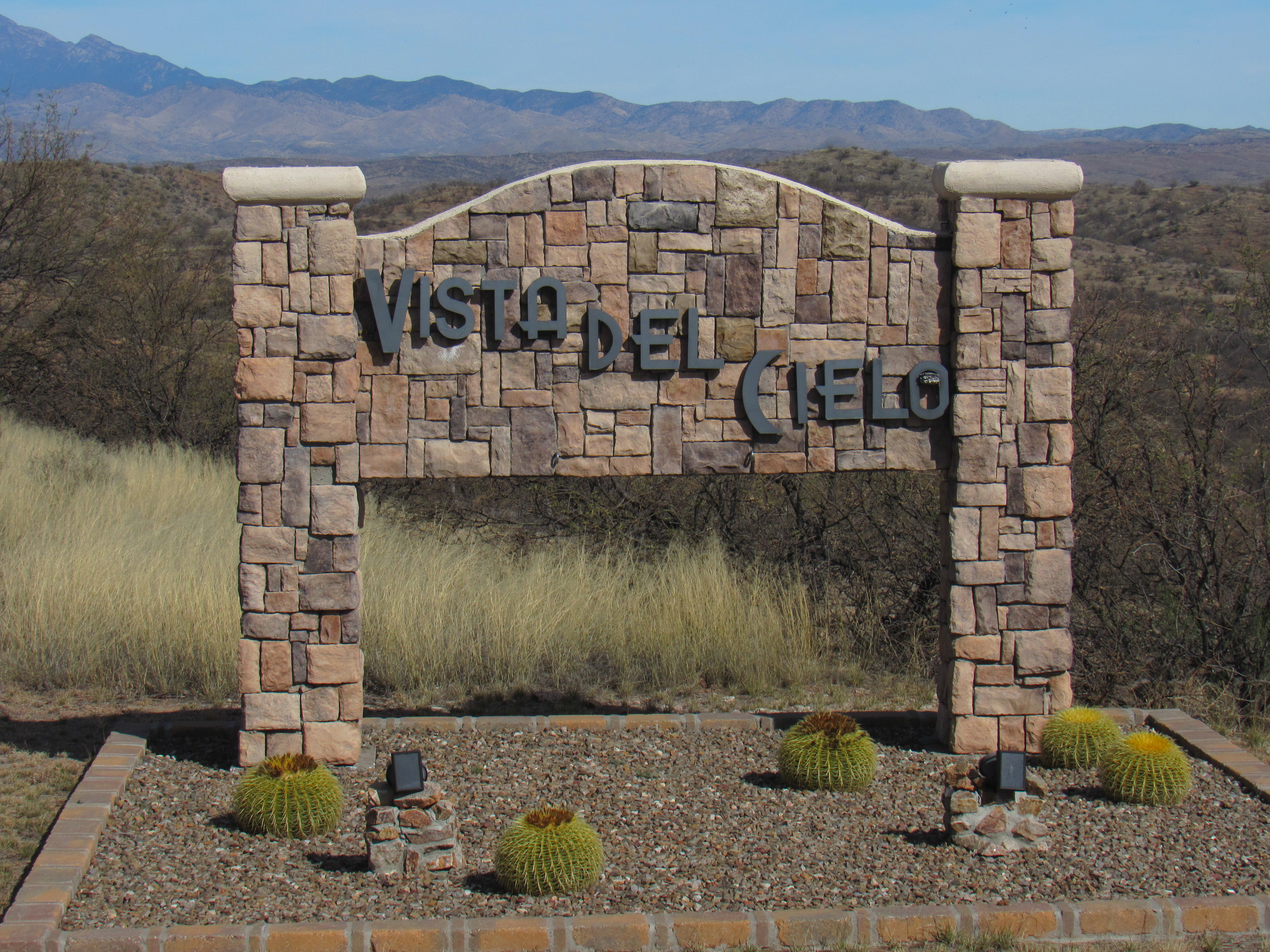
It translates literally as “View of the Sky”, or “Sky View”. It was beautiful, open country and all of the homes had gated driveways. I had this first glimpse of the peak I wanted to reach.
The mountaintop
The higher I drove, the more outrageous the homes became, like this one.
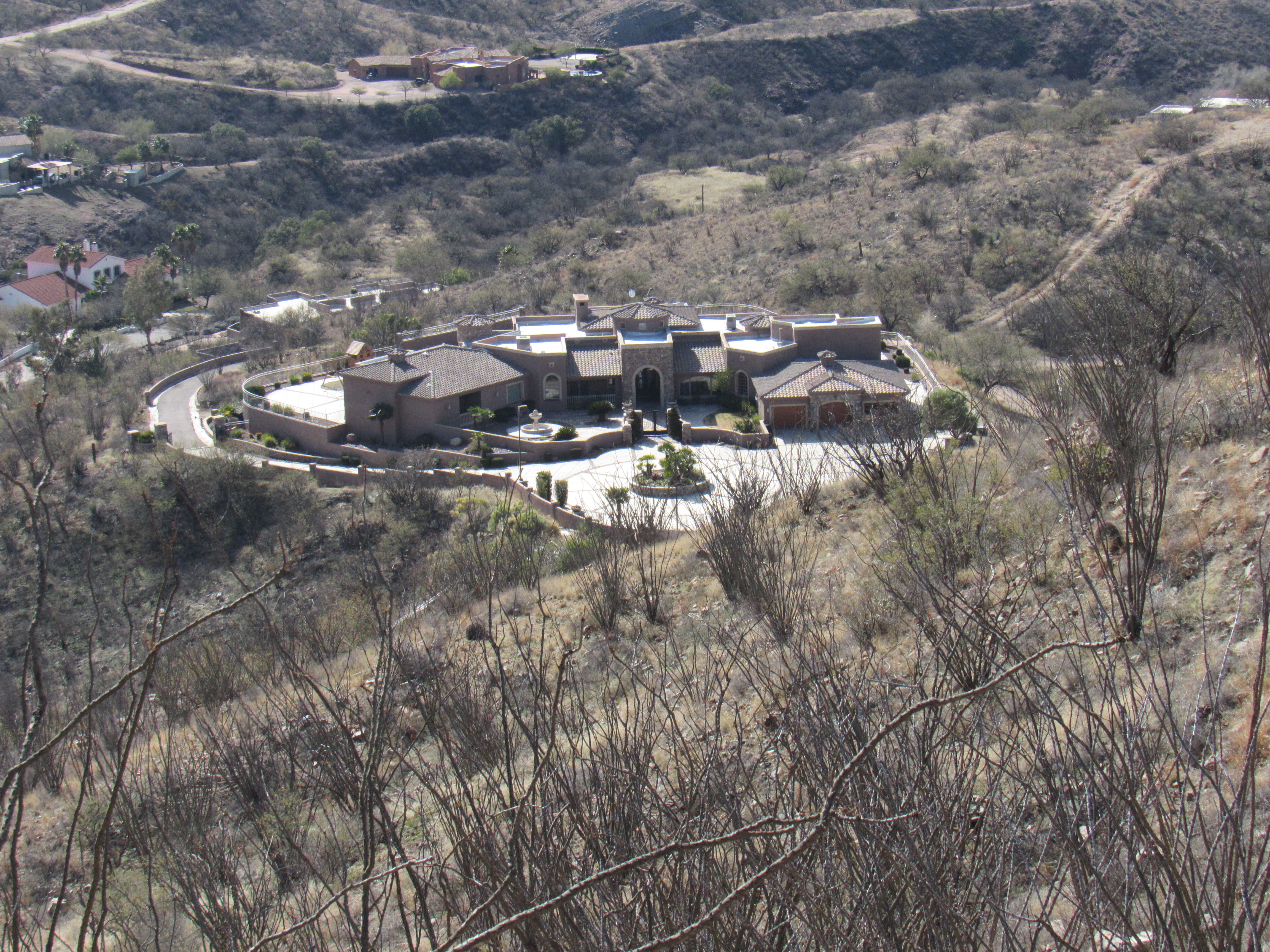
A real mansion
Just as I was congratulating myself on how far up the mountain I was able to drive, I turned a corner and came to that bane of all climbers, a gate. However, it was unlocked and wide open. There were plenty of warning signs on the gate.
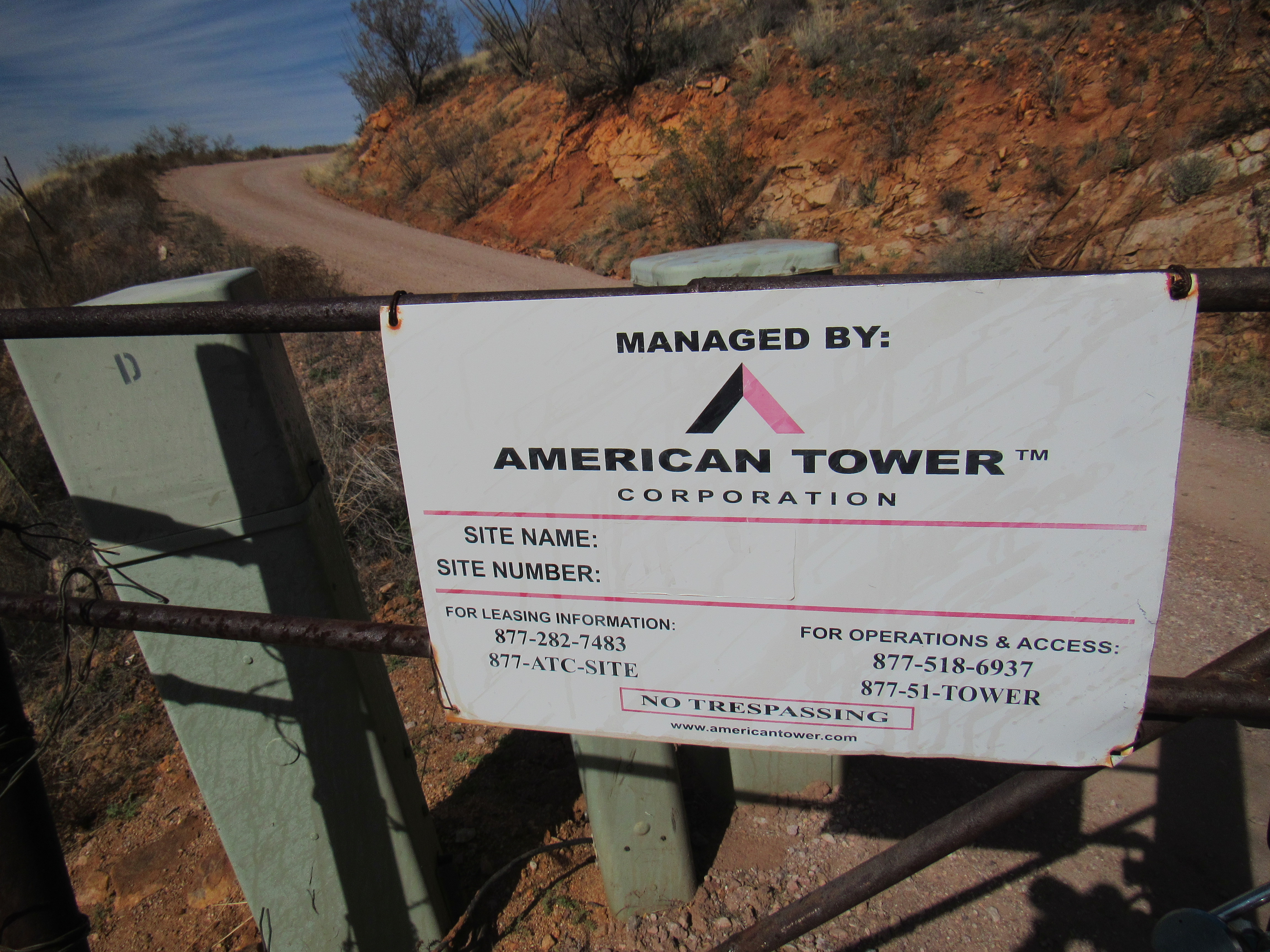
The first sign
See the “No Trespassing” on the bottom. This next sign made it a little more obvious.
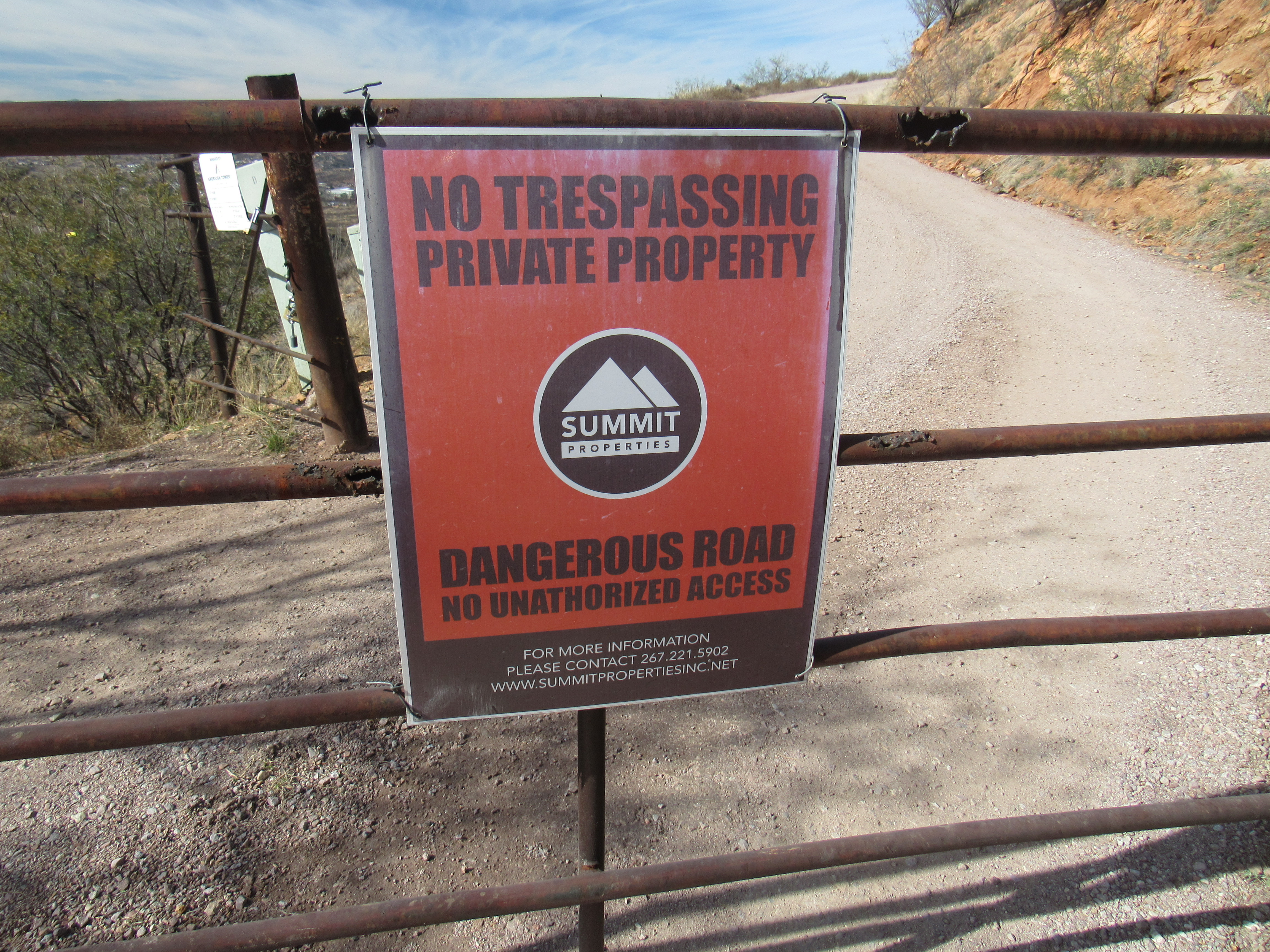
More to the point.
So the question was this – should I drive on through, as the gate was wide open? One more thing I’d like to show you is this.
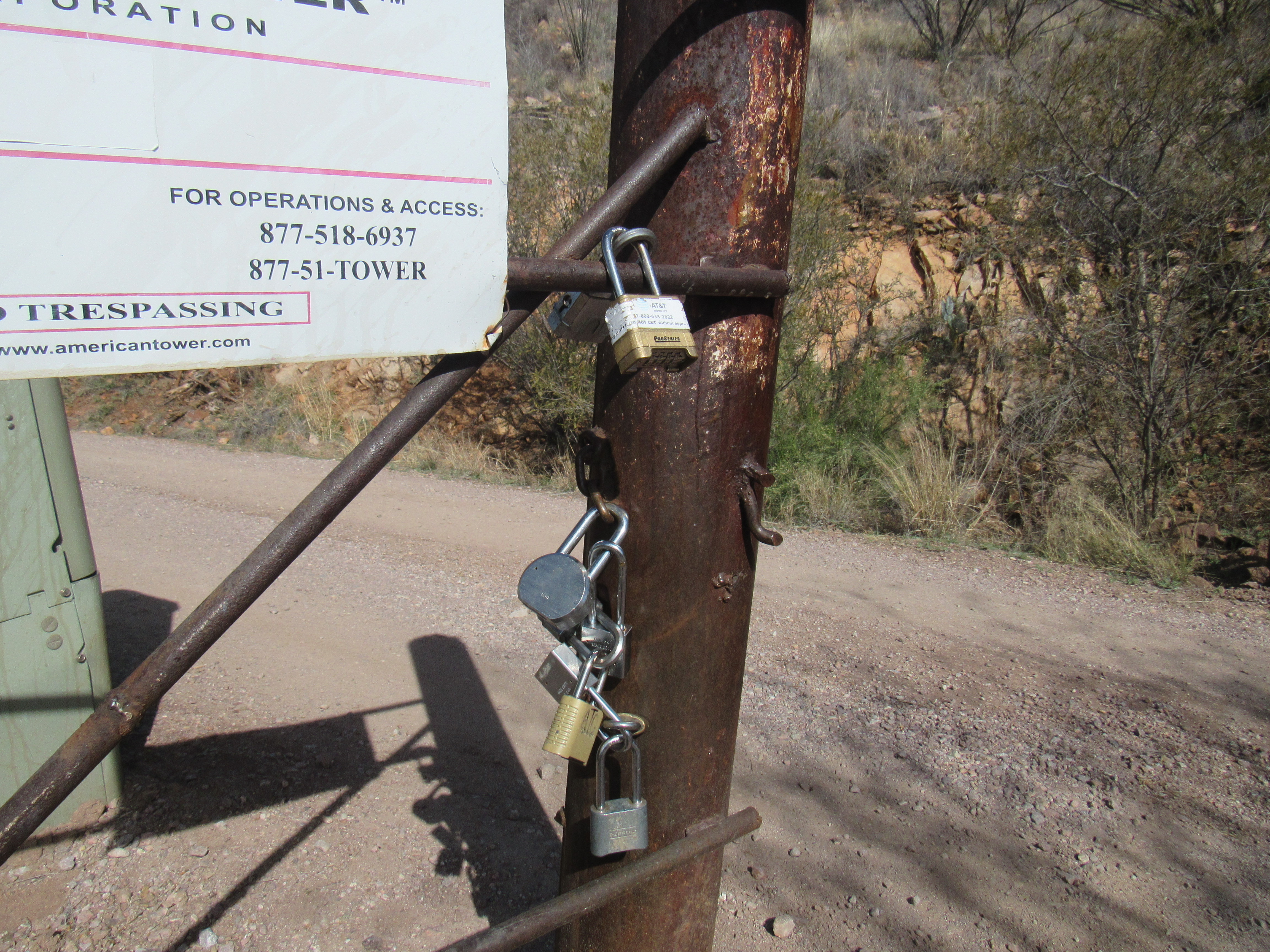
That’s some bunch of locks.
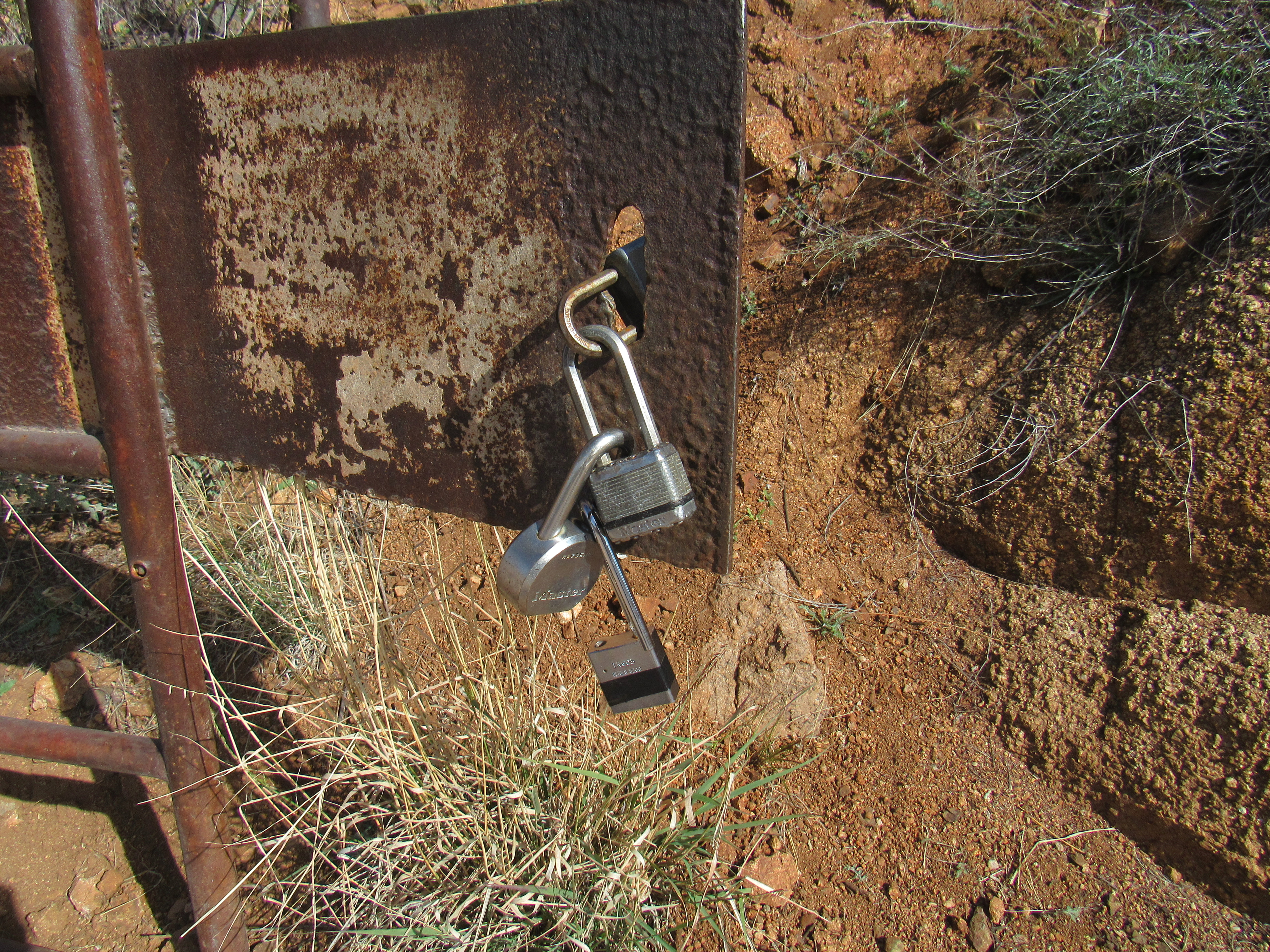
And even more locks.
The pictures show 10 different locks attached to this gate. Why, you might ask, are there so many? Well, it shows that at least 10 different entities want to have unrestricted access to go farther up the mountain. If they daisy-chain their locks together like that, then each can open their own without disturbing the others and pass through the gate whenever they please.
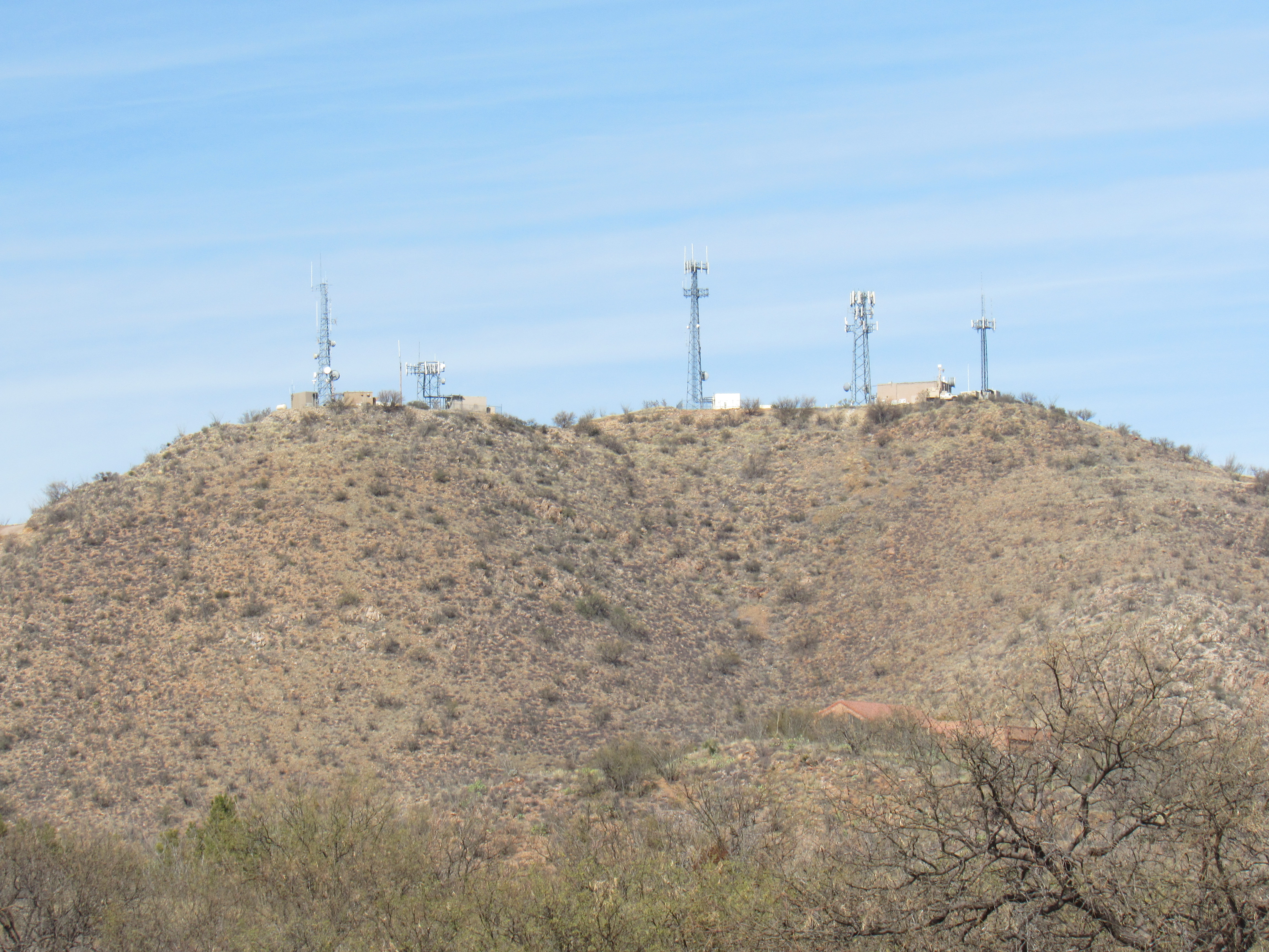
So there I stood, faced with a decision – although the signs said “no trespassing”, should I proceed? Climbers tend to look at it this way – if the gate is wide open, somebody has driven up the mountain who has a right to. They probably aren’t going to be up there for a long time, and it’s likely I’d meet them if they’re on the way down. In that case, the worst that could happen is that they’d say “Hey, you aren’t supposed to be up here”, and you could respond by saying that you found the gate wide open. They would then escort you back down to a point below the gate and nobody is any the worse off. I chose to drive past the gate up the extremely steep road in 4WD for the last 500 vertical feet to the summit, a distance of almost one mile. In no time at all, I pulled up on to a saddle between two bumps that made up the mountaintop.
Both bumps held communications towers, and the place was hopping. I saw some men doing some work on one of the towers, and a group of Border Patrol agents beside one of their trucks which held a tower of its own. I walked quickly over to the higher of the two bumps and tagged the highest point of Mount Benedict. Here’s what it looked like.

The summit
My main task completed, I walked back down to the Border Patrol agents and chatted with them. They said they’d wondered who I was when I drove up – when I told them that I’d found the gate wide open and decided to drive to the top, they said that they were fine with that. Before long, I drove back down, through the gate and found myself back in Vista del Cielo. Maybe it should more accurately be called “Heavenly View”, as the homes are definitely out of this world.
Once back down to the highway, I discovered that the route to my next peak started directly across the road – nothing could be easier. Royal Road was what I followed for a mile through a pleasant residential neighborhood. I had researched this one on satellite photos ahead of time and knew that where the neighborhood ended, a gate sat where the dirt road into the desert began. For some reason, I had concluded that the gate was not locked. At least, I was hoping so, because if it were locked and I had to walk the road all the way to my goal, it would add almost 8 miles round-trip to my day.
When I came to the gate, 2 things caught my eye. A Border Patrol vehicle sat just on my side of the gate, and an old truck was driving away on the other side of the gate and into the desert. Much of the truck was a brilliant orange color, but from that distance I couldn’t tell why. I started to chat with the BP agents, showing them on my map where I wanted to go. They recognized the spot right away as a place where they had another of their lookout towers set up, and that one was manned by military personnel. You need to keep in mind that we were only 2 miles from the Mexican border, so this was a sensitive area bristling with law enforcement.
The agents said they had no problem with my passing through the gate to go to the peak, but the person who really needed to give his permission was the rancher with the old truck who returned at that moment. The agents left, and I went over to talk with the rancher at the gate. He was just about to lock the gate when I showed him on my map where I wanted to go. He said that normally he would never leave the gate unlocked for anyone. On the spur of the moment, I made a suggestion. “How about this – could you leave the gate unlocked for me while I go to the peak?” He thought about it for a moment, then said that he wasn’t comfortable with that. I then suggested that I could almost close the lock but not quite, giving the appearance that it was closed in case anyone else came by. Then, once I had tagged my peak and returned to the gate and passed through it, I would close the lock all the way and the gate would be secure and nobody else could pass through. He seemed fine with that, so that’s what we did.
I hadn’t driven very far from the gate when something caught my eye off to the side, something very orange. A short detour brought me to this.
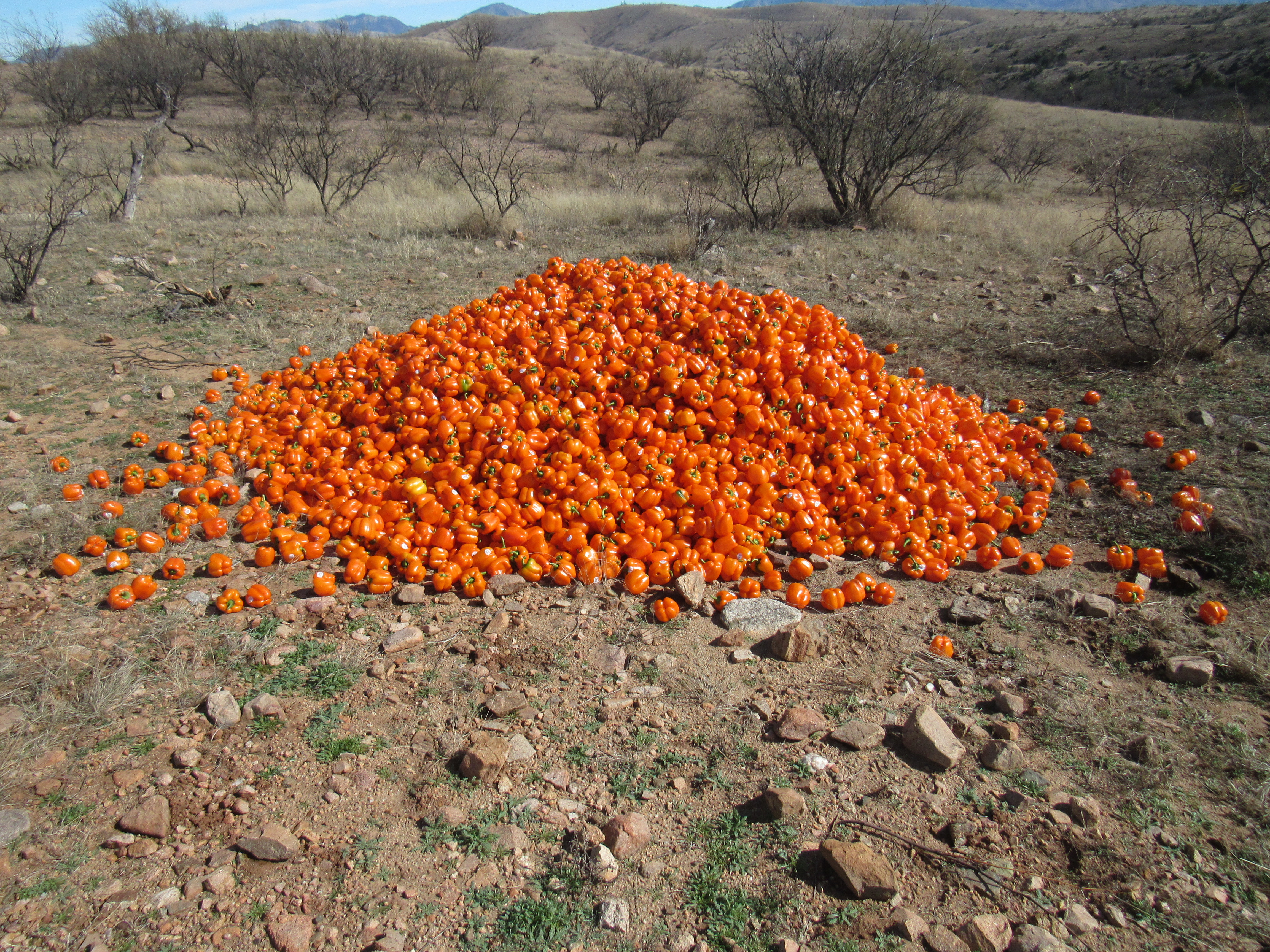
Quite orange
Here’s a closer look.
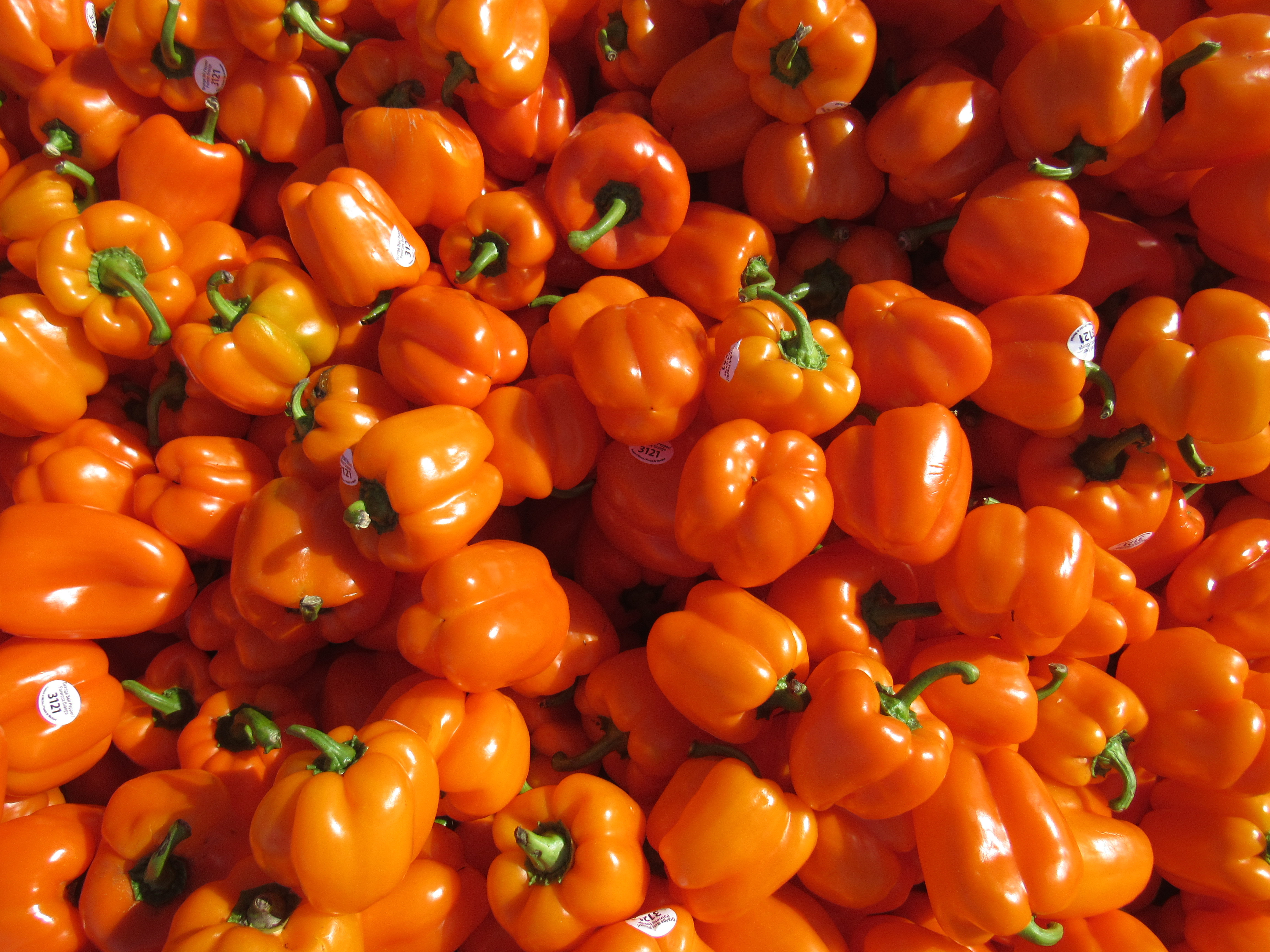
A truckload of orange bell peppers. They looked fine to me. The rancher, Ramón, had told me that something about the peppers made them less than perfect so they could not be sold. He said that he could get as many truckloads of produce as he wanted for free, that the only real cost was getting it loaded into his truck. Since it was a dump truck, there was no effort or expense to unload it. He had also told me that the cattle would in short order smell the peppers and find them and eat every single one. He said that they would also eat onions and even jalapeño peppers, among many other things. The hotness of the jalapeños didn’t bother them at all.
A couple of miles later, I had this look at my peak. The high point is at the tower on the left.
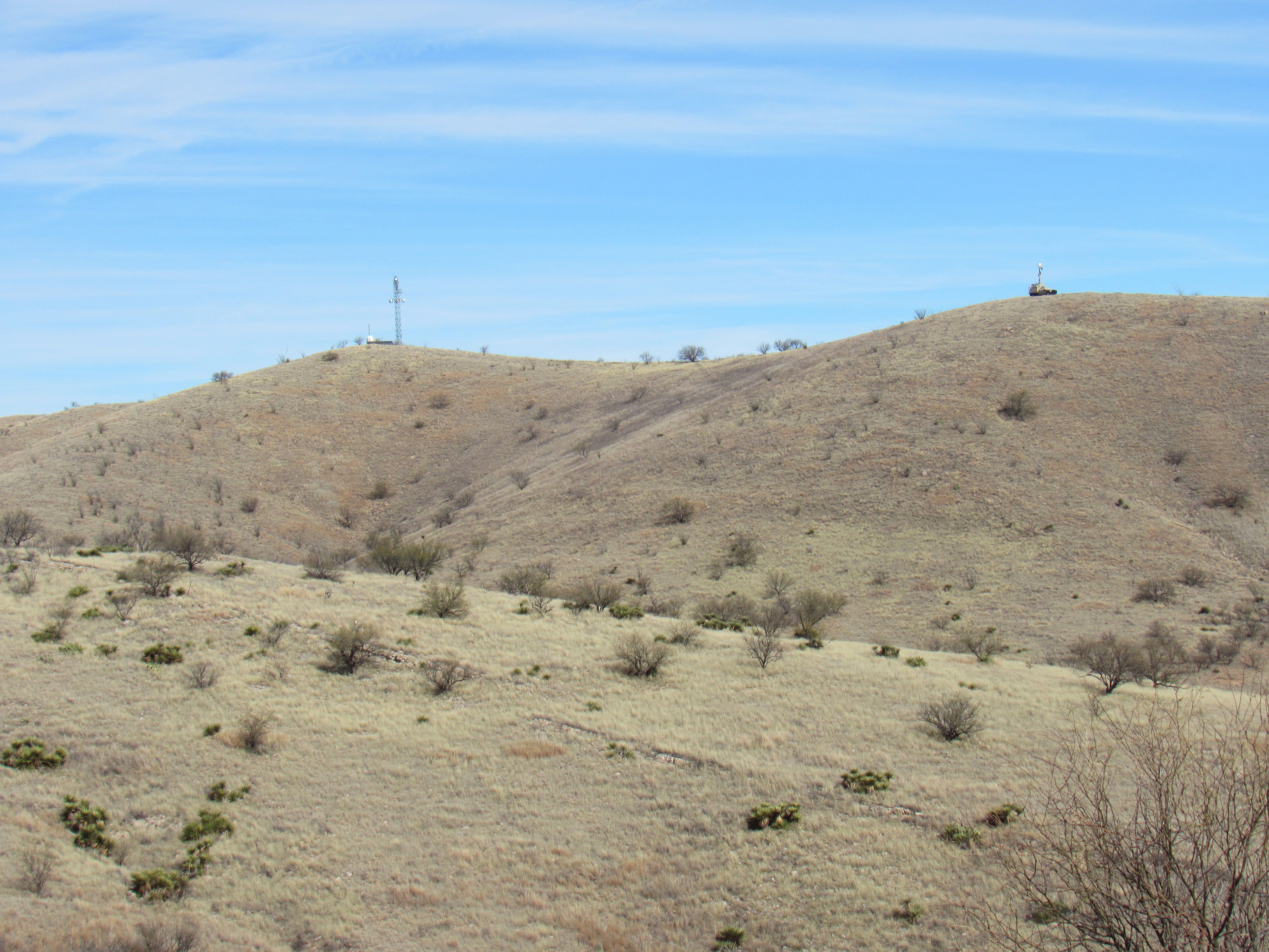
A distant look.
The dirt road was excellent, you could have driven it in a Cadillac, and a couple more miles brought me to the summit of Santa Benchmark. Here’s what it looked like.
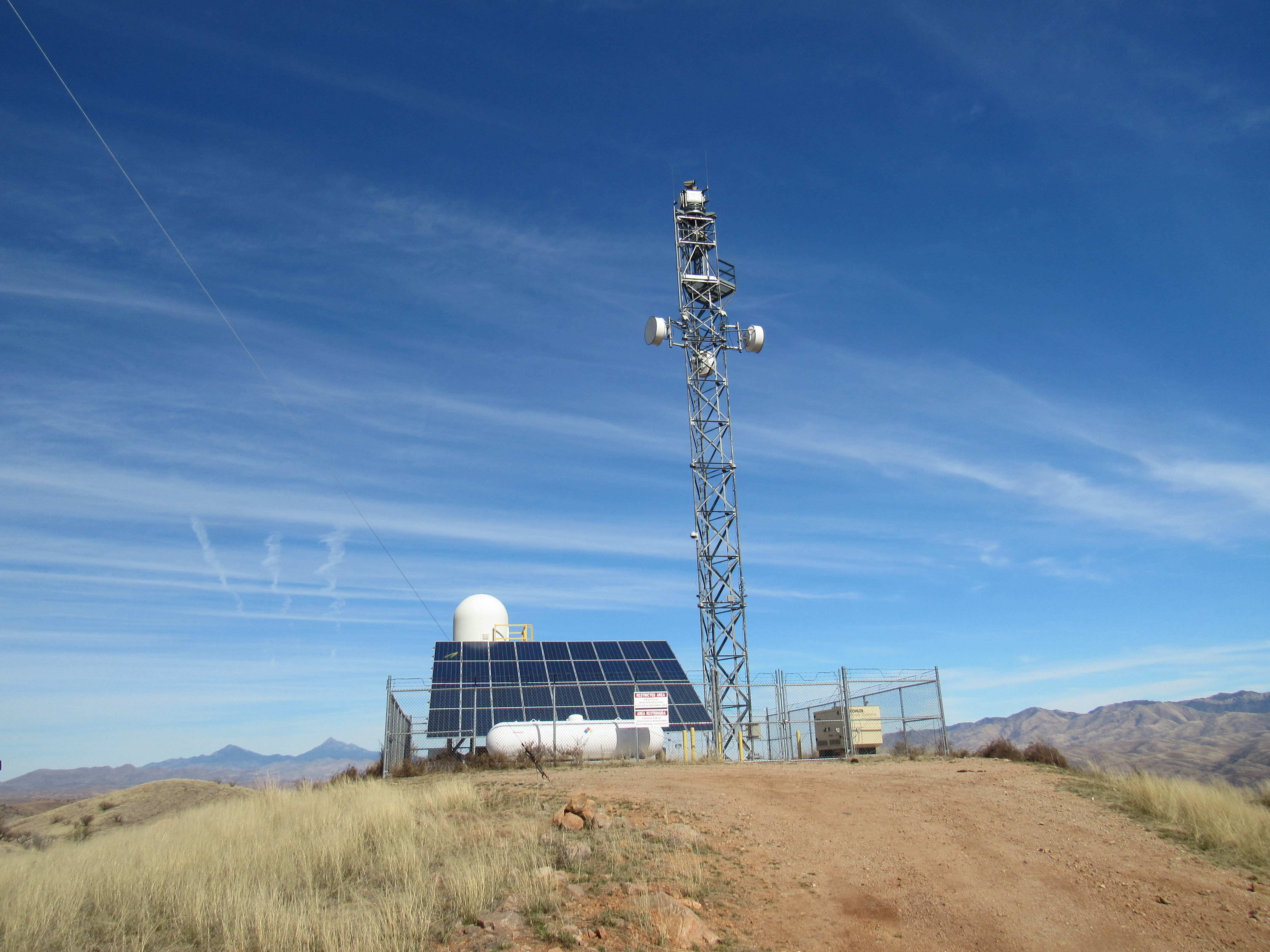
Santa Benchmark, elevation 4,296′
There were some good views from the top. Here’s a look to the east, to the Patagonia Mountains.
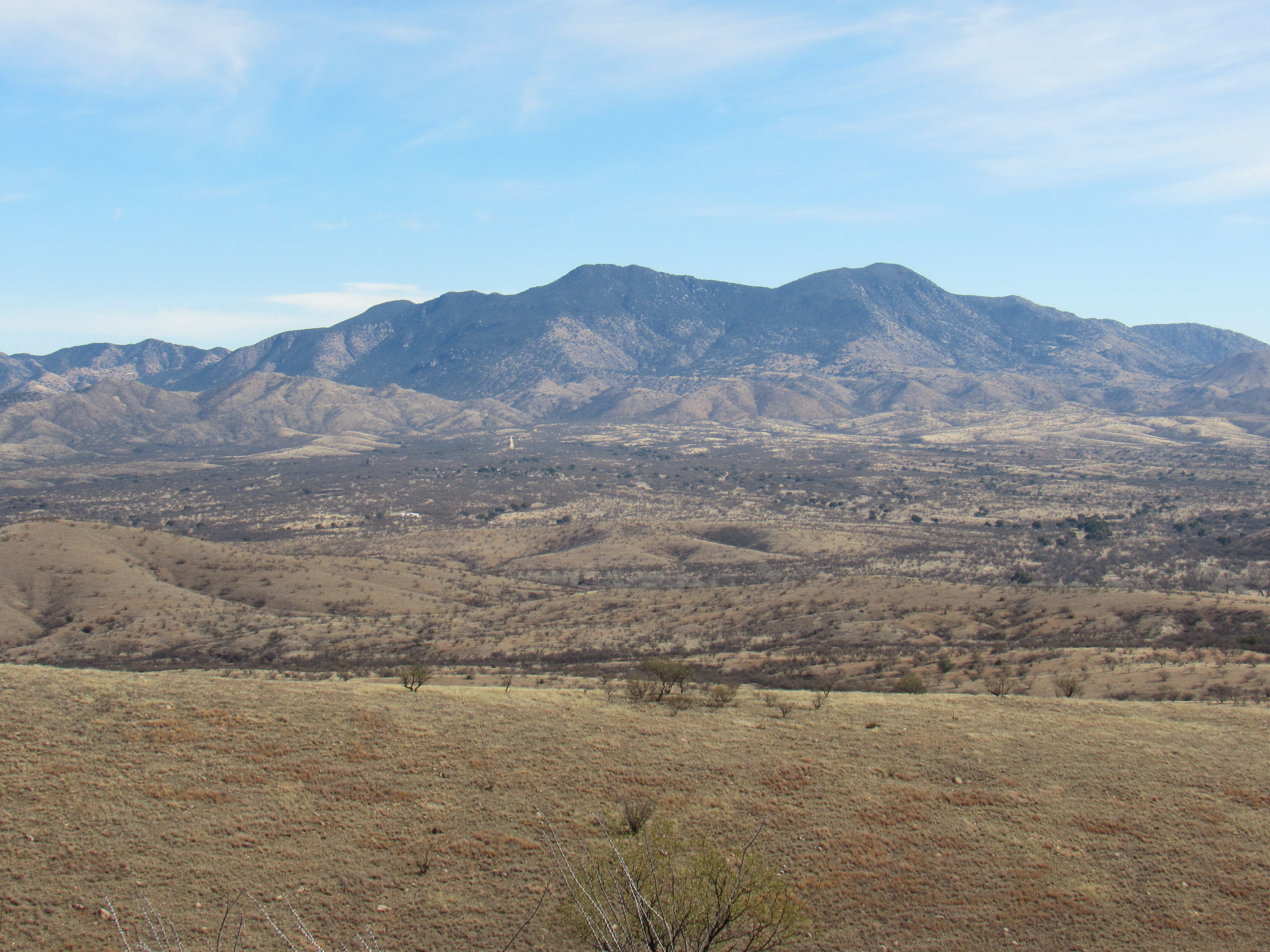
The Patagonia Mountains
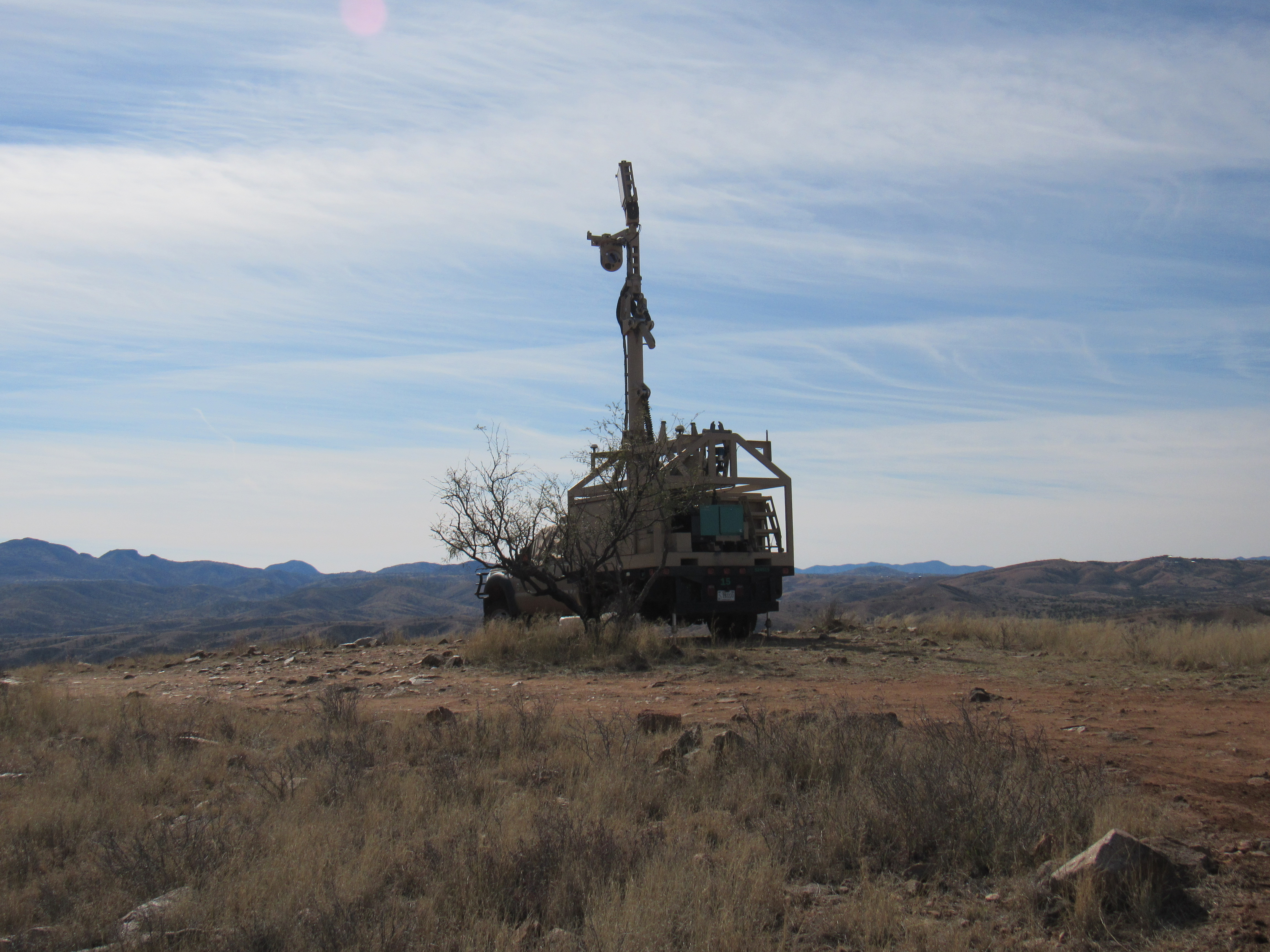
After having tagged Santa, I drove a short distance back down the road where I found some military fellas manning this setup. I believe it was a Border Patrol vehicle which is used for surveillance – it has special equipment which can detect any movement, day or night, even if it is miles away. Army personnel were stationed here and keeping a lookout to help out the Border Patrol. I stopped to say hello but they weren’t in the mood to chat.
There were some other interesting views from near the Army guys. This is a telephoto of a watering hole for cattle with the name “Cautiva Tank”, which translates as “Captive Tank”. Many of our desert tanks have clever names.
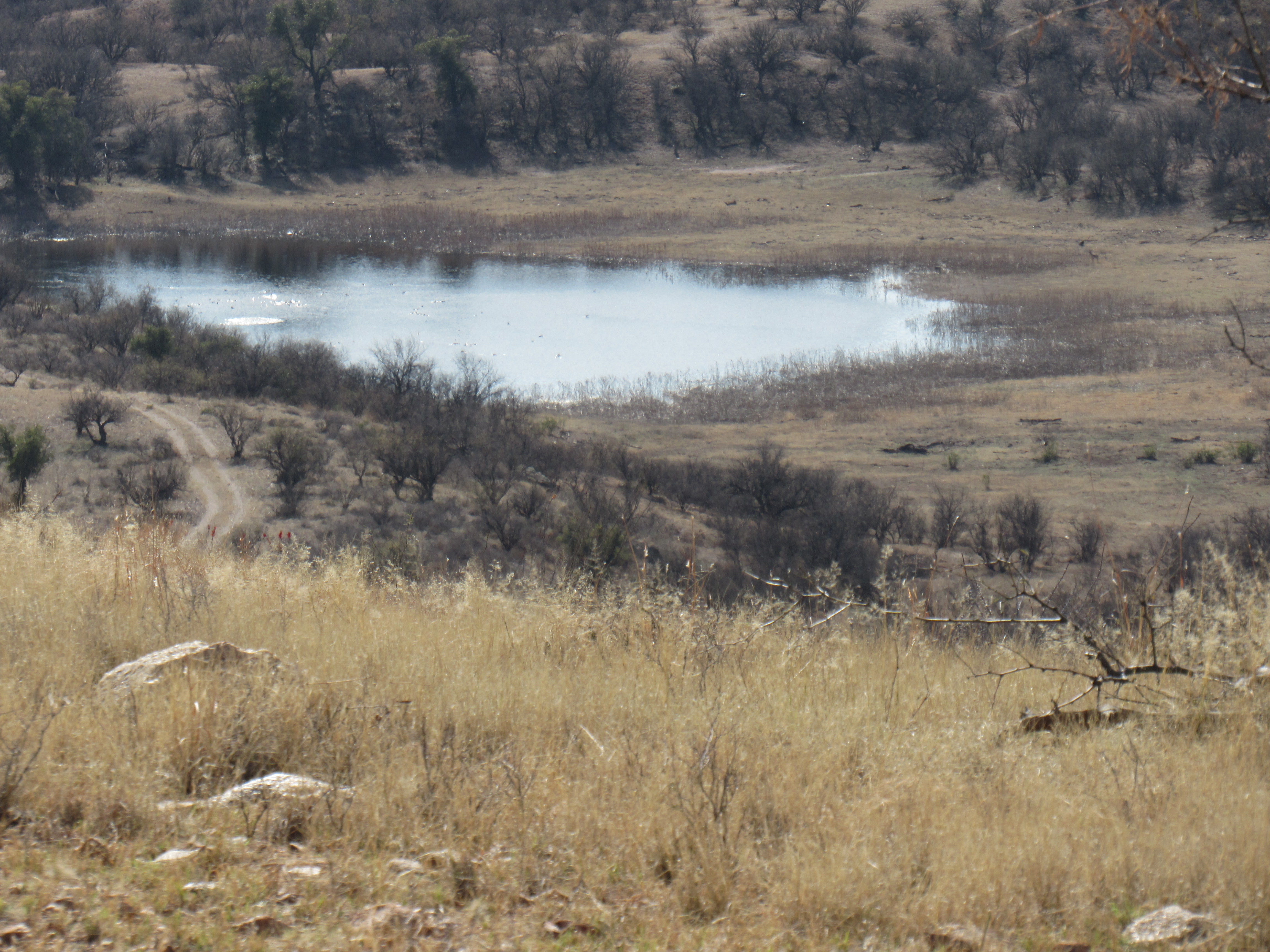
Cautiva Tank
Here’s a view north to Mt. Wrightson (on the right) and Mount Hopkins (on the left), well to the north (long telephoto shot) in the Santa Rita Mountains.
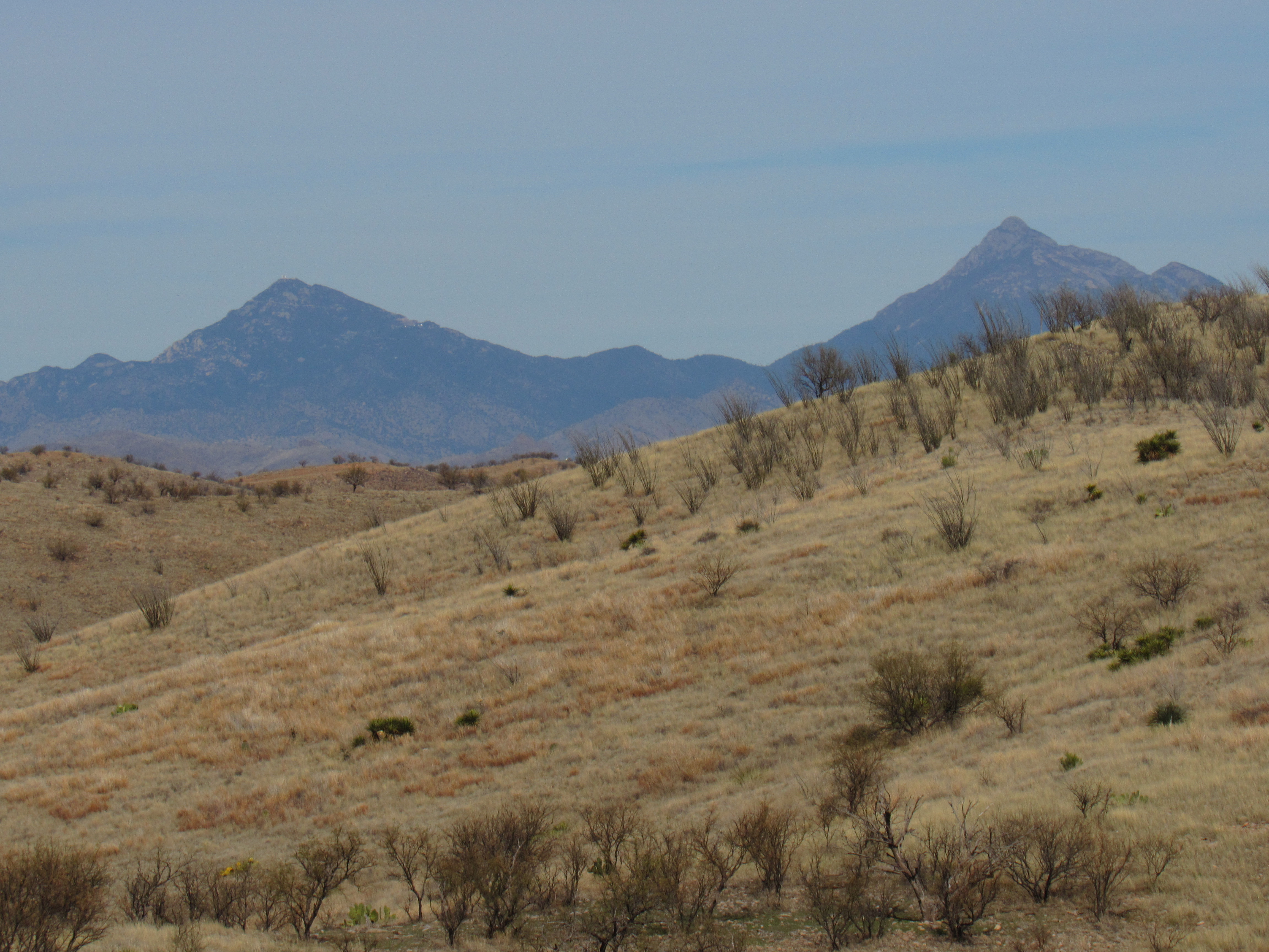
The high peaks of the Santa Ritas
This next one shows San Cayetano Peak, 13 miles distant to the north.
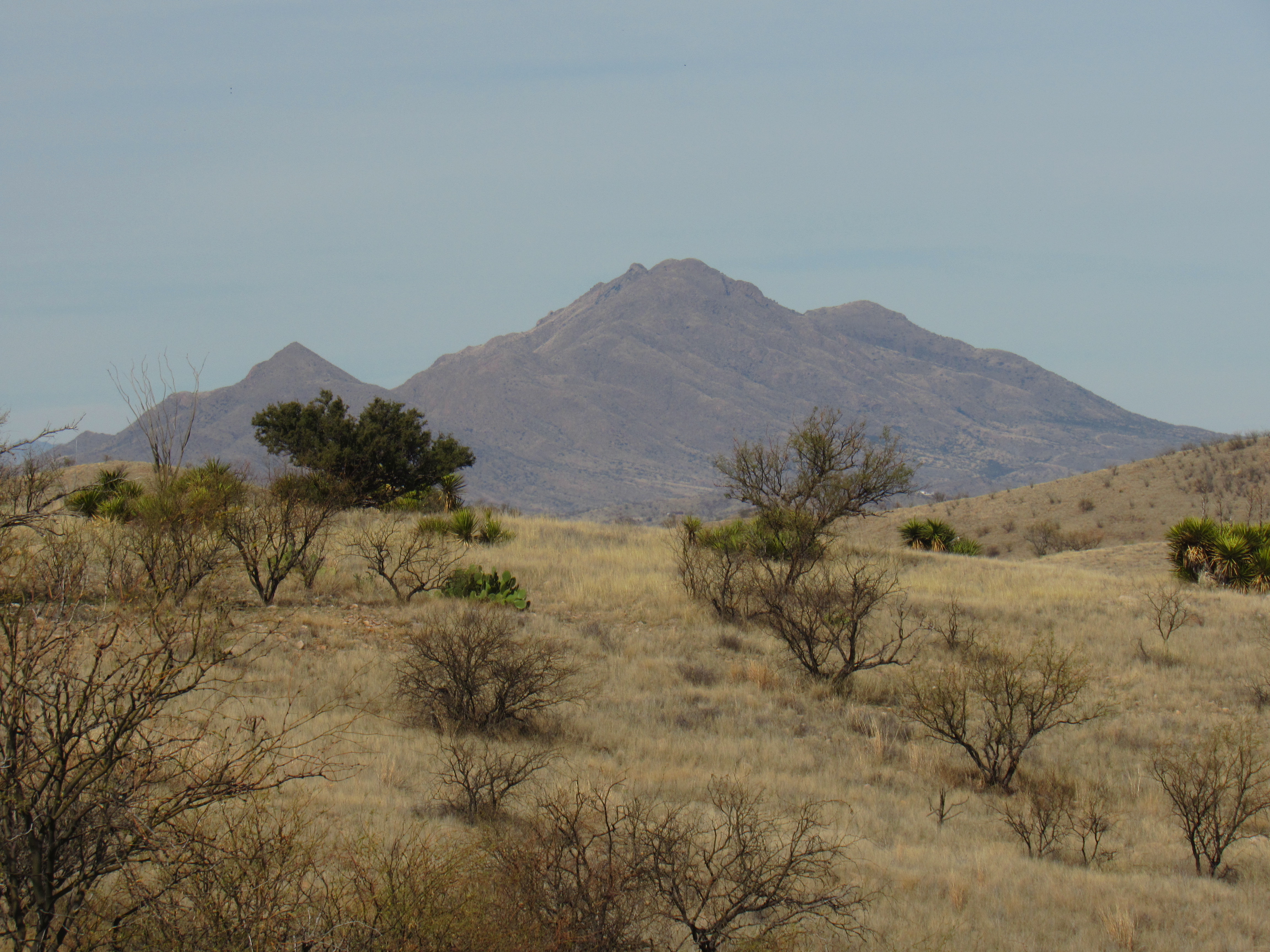
San Cayetano Peak
This next one may be of interest to some of you who don’t live in these parts. It shows a section of the wall along the border with Mexico, just 2 miles away.
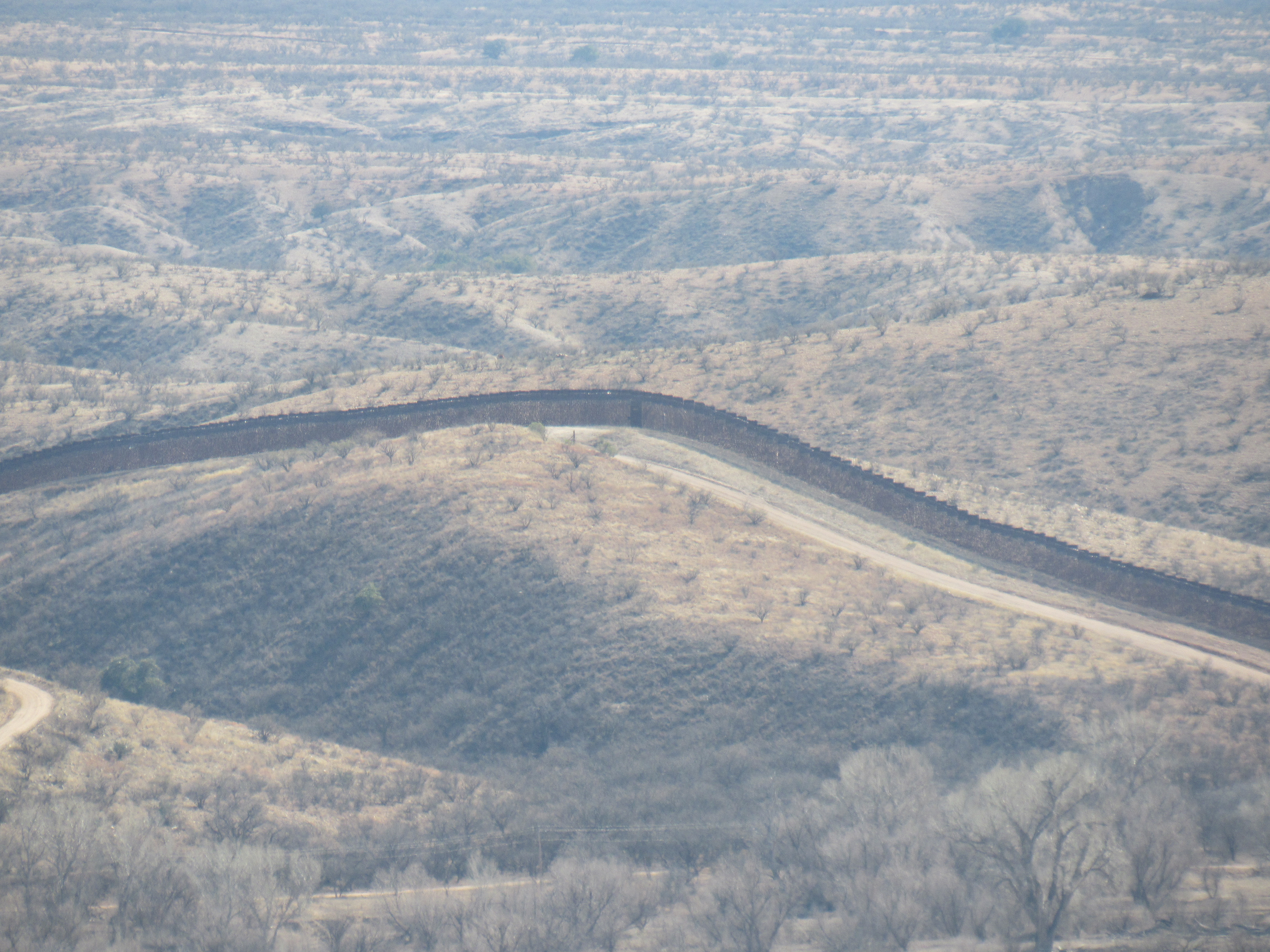
The wall
Well, I had to keep my promise to the rancher, so I headed back the few miles, crossed over the cattleguard and re-locked the gate. I’d had a lucky day – some would say I had horseshoes up my ass – finding both gates open like that. I hope there’ll be more just like it.