
What the heck is a Stikine, you might ask? It’s not a word familiar to many, unless you’ve had occasion to travel to far northwestern British Columbia, Canada. The area gets its name from the Stikine River, 380 miles in length and draining 20,000 square miles of wild country. In 1879, naturalist John Muir traveled the lower third of the river and likened it to a Yosemite that was a hundred miles long. He recorded over 300 glaciers along that stretch. Above the village of Telegraph Creek, the only community along its entire length, sits the Grand Canyon of the Stikine, 45 miles long and 1,000 feet deep – it is considered one of the world’s most difficult whitewater rivers. In the language of the Tahltan people who settled the area thousands of years ago, the river is known as Sak.aani T’áak, which means “Behind Eulachon Country”.
So what gives me the right to be writing about the Stikine? Well, I spent 3 full months there in a mining exploration camp in 1967, exploring on foot and by helicopter, seeing a good chunk of it. I’d like to share with you some of my experiences from that time. First, let me show you something of the camp itself. When we first arrived, there was just a rude strip where a bush plane could land. The single-engine Otter, piloted by legendary pilot Ron Wells of Trans Provincial Airways out of Terrace, BC, made several trips to bring in men and supplies.
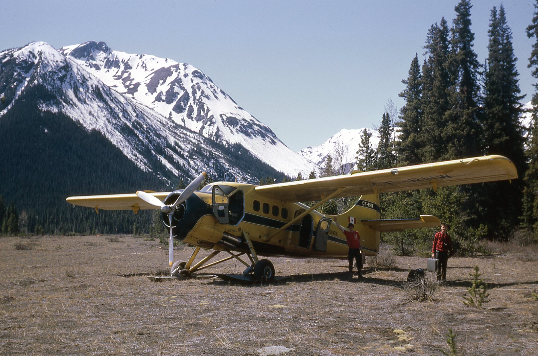
The Otter at camp
Once we had what we needed, we set up a rudimentary camp.
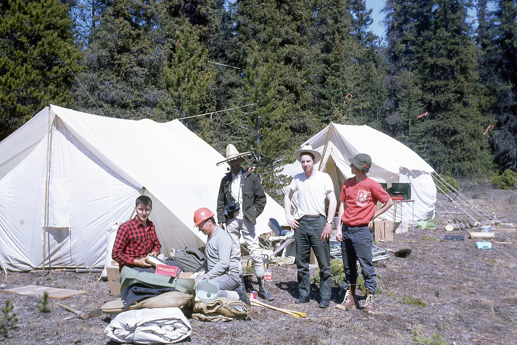
A beginning
After some days of effort, our camp was done, and a comfortable place it was indeed.

All done.
Once our helicopter crew arrived, we totaled 12 men.
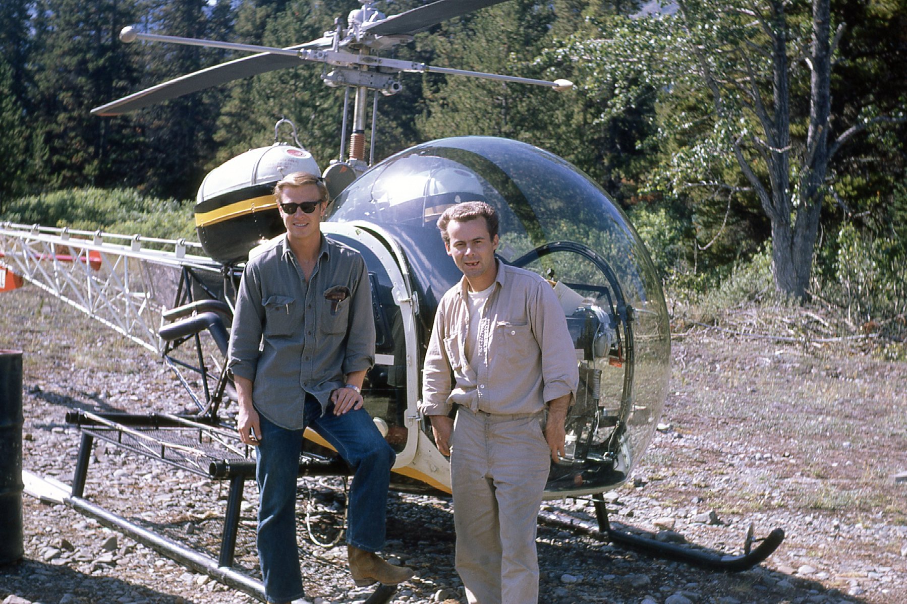
Pilot and mechanic. Of course, the pilot is the one with the cool shades.
Even if we never set foot out of camp, the views were terrific, like this one from the pit toilet we dug nearby.
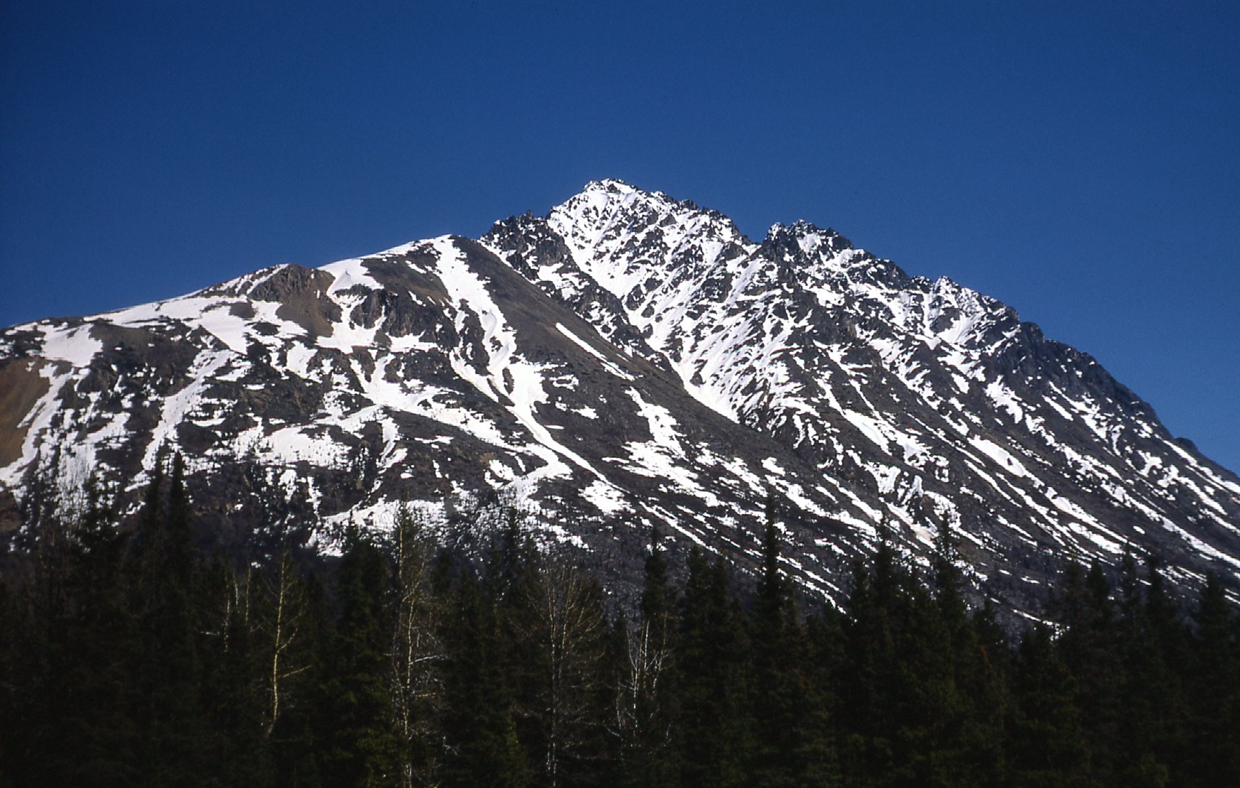
Something to ponder while on the John.
Yeheniko Lake was less than 5 minutes’ walk from camp, and from its shore we had views like these.
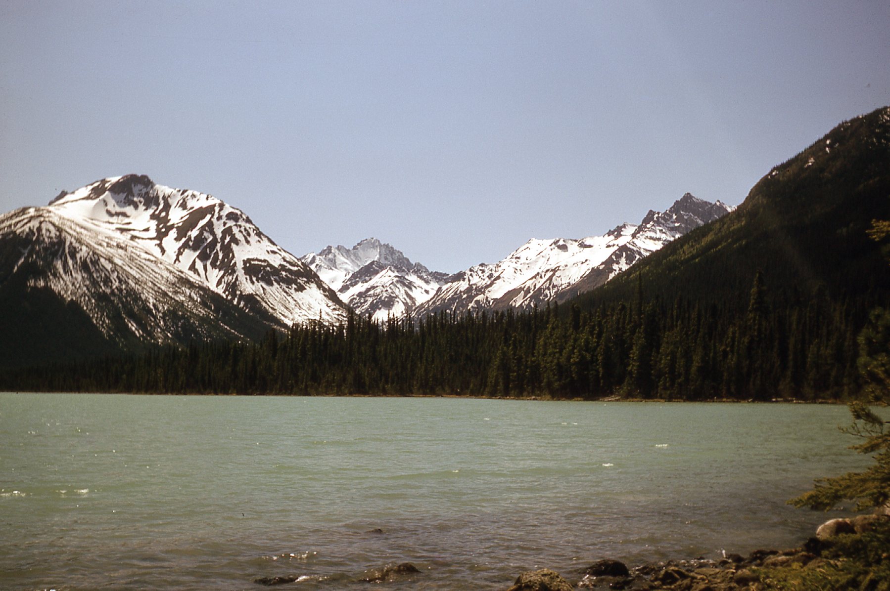
At the lake
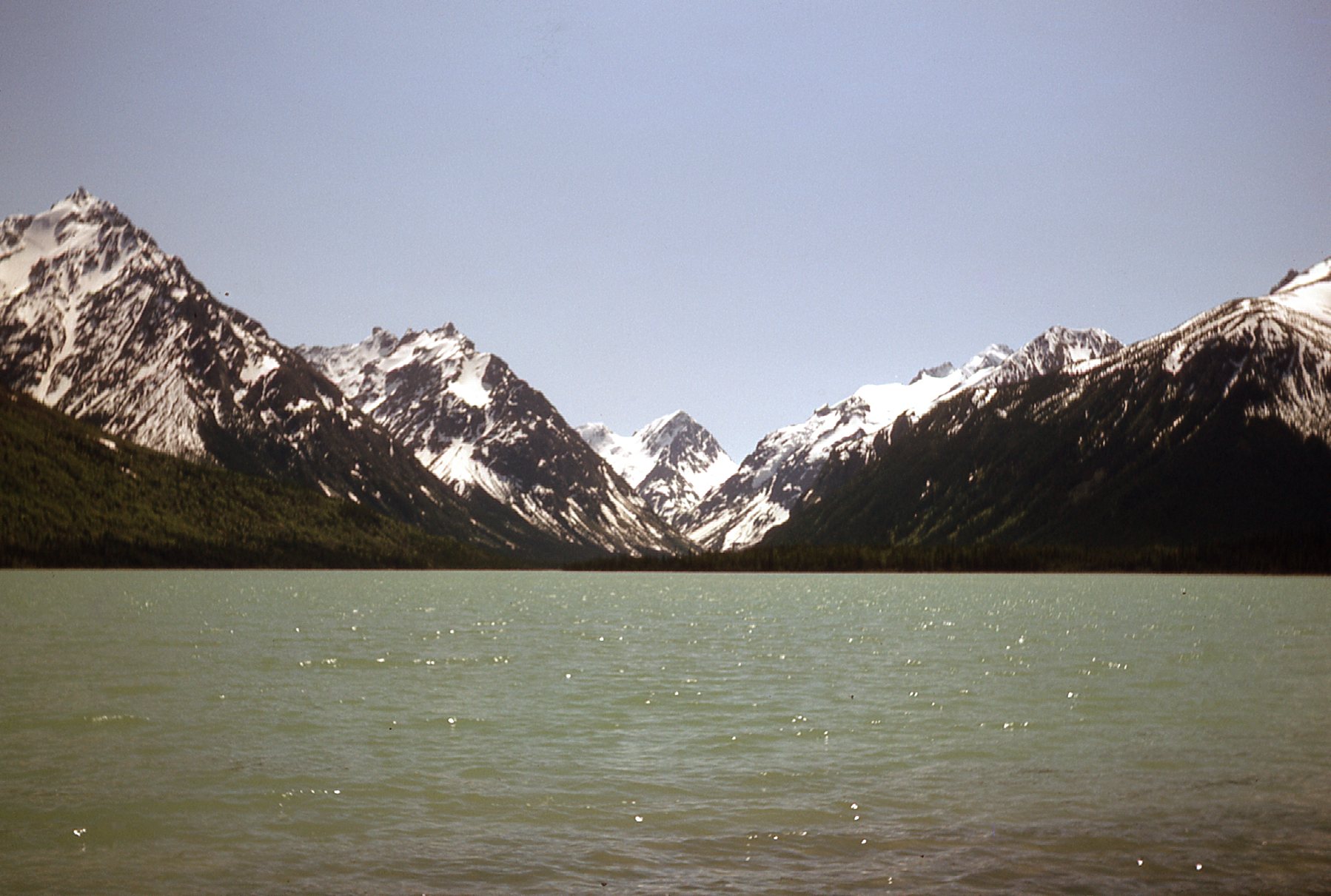
Another view along the lake.
The lake was about 4 miles long, but we didn’t use it for our water supply, although it was as pure as could be – instead, a nearby creek behind camp served us well, as it was much closer. Our camp and the lake itself sat at 2,700′ elevation. Treeline was usually around 4,500′ in that area. The peaks rising directly up from camp were just over 7,000 feet, so even those lowest nearby peaks stood a full 4,300 feet above our heads.
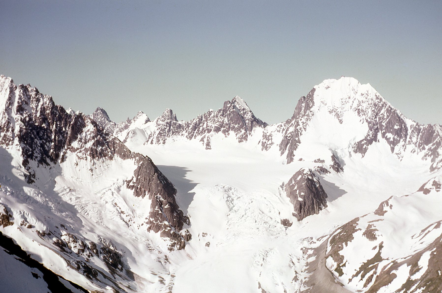
Weather permitting, our daily routine would be as follows: the chopper pilot would take off with 2 of us (we always worked in pairs for safety) and drop us off, often someplace high up (like a ridge or a mountain top), and pick us up down in a valley bottom at a pre-arranged time and place several hours later. This system worked well, and went without a hitch all summer. Those days would typically involve prospecting, looking at rocks for interesting mineralization, as we made our way downslope. Here are some pictures taken on a typical day like that.
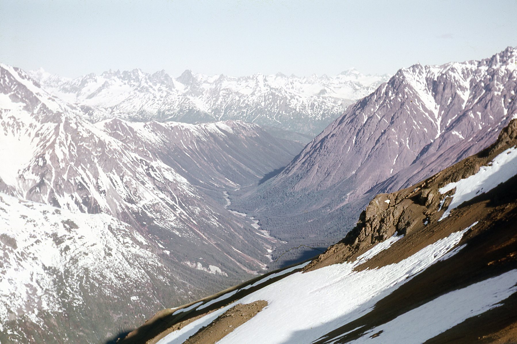
Looking northwest up Strata Creek
The chopper dropped us off at 6,800′
Here’s another view from that day.
Amazing stuff.
And one of me. Boots, day pack, rock hammer, about all we needed.
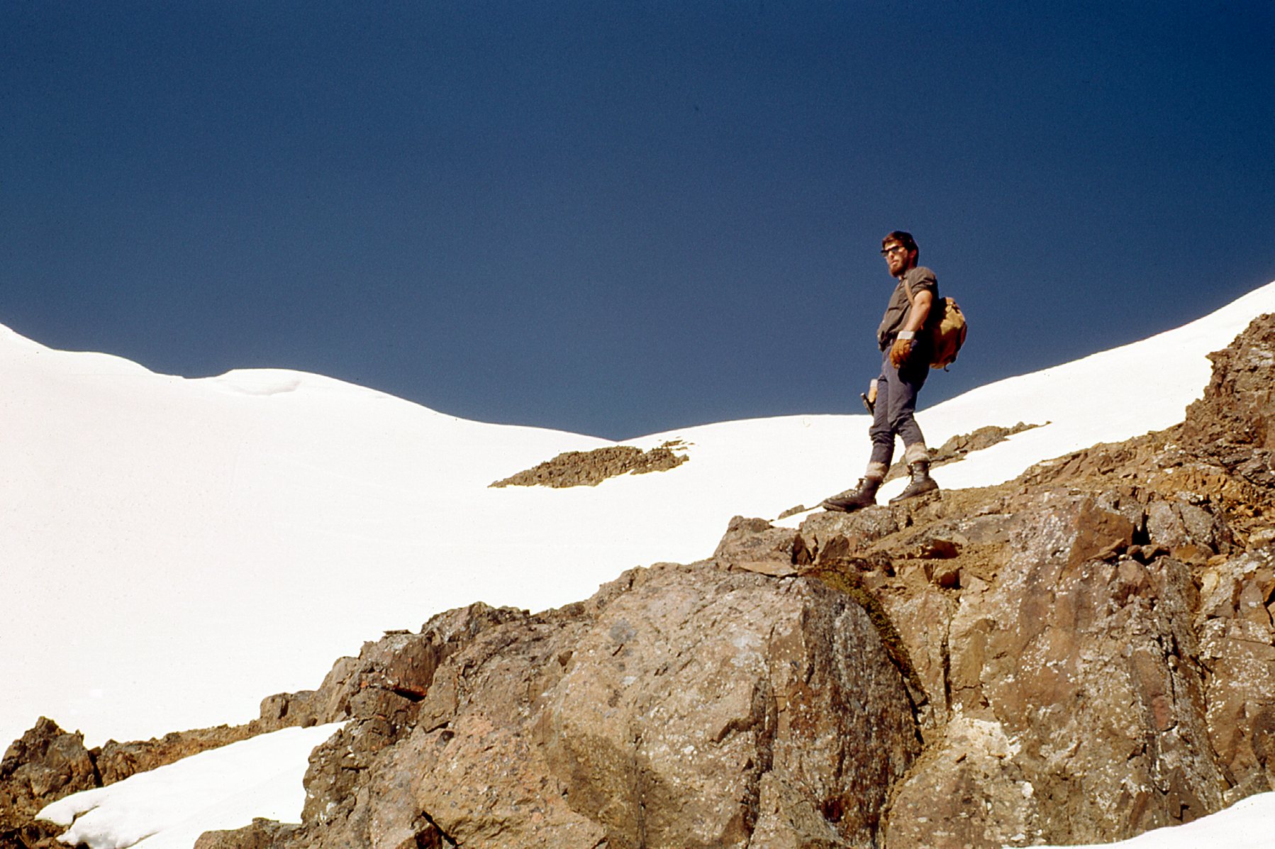
The Desert Mountaineer
Our company, Phelps Dodge, had had a crew in the Stikine the year before. That camp was only a few miles away, near the Scud Glacier. One day we flew over to pay a visit to that place, where a couple of the guys had spent the season the previous year.
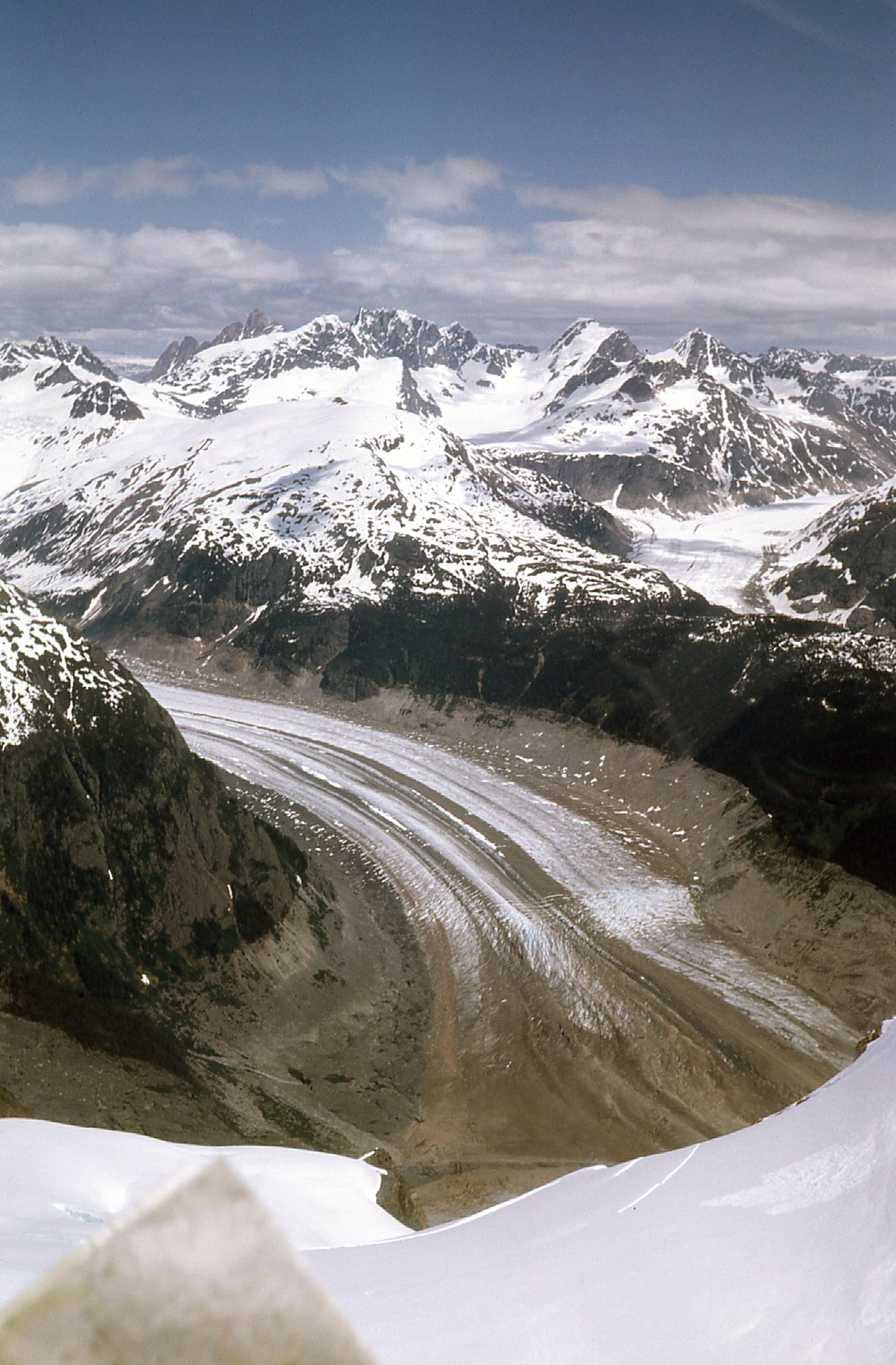
Looking down on to the Scud Glacier from the chopper.
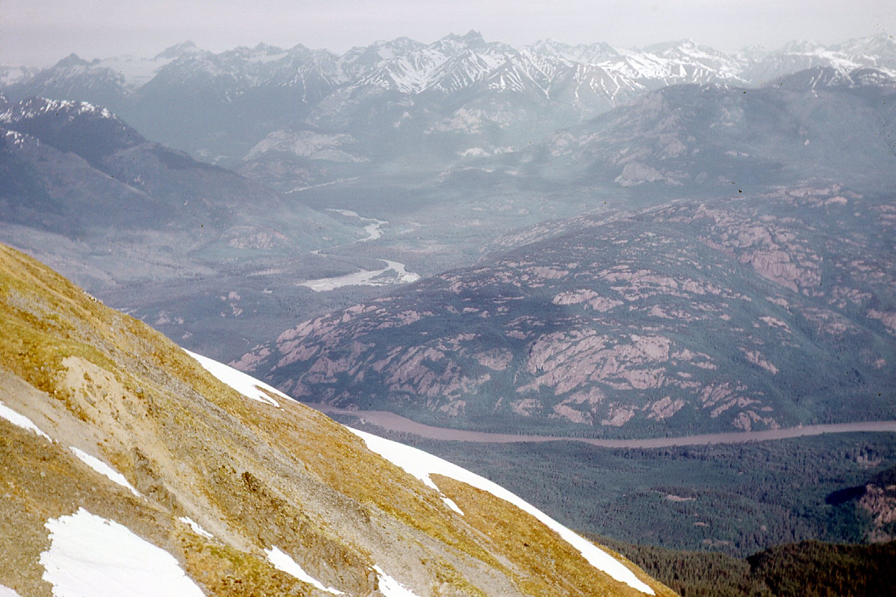
Here we are looking down the Scud River to the distant Stikine River.
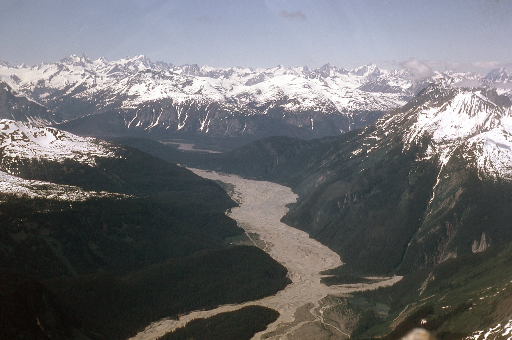
The Scud River
We landed at the old camp.
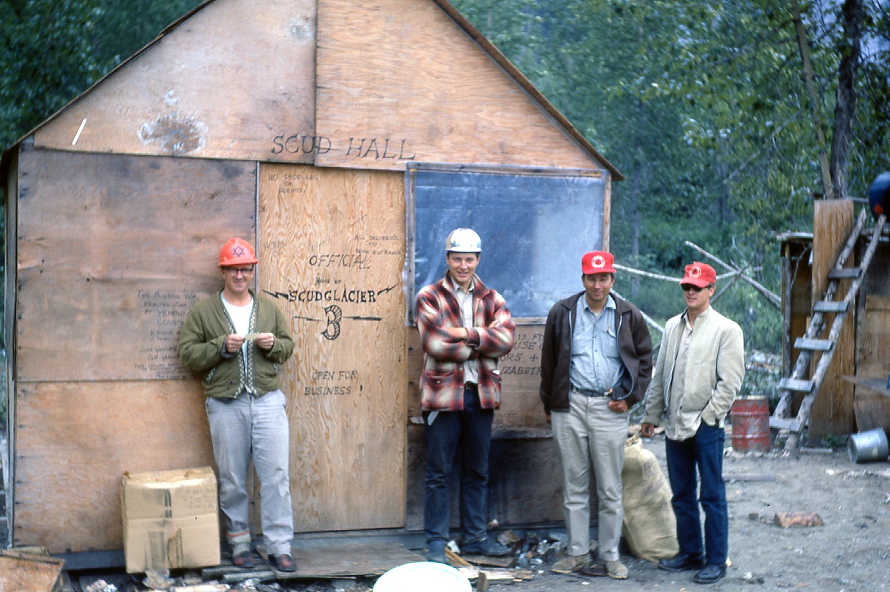
Scud Glacier camp
The guys told me that this was a cold, windy place due to its proximity to the glacier itself – I liked our camp better.
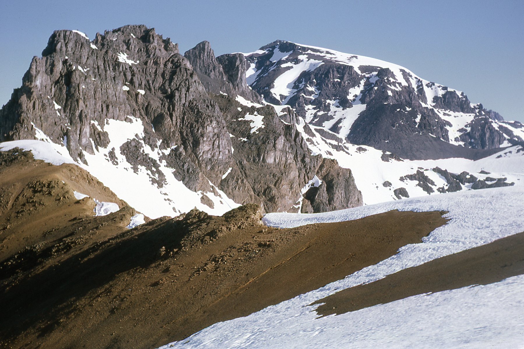
Here’s another example of a day where we were dropped off up high.
We are looking west from Mt. Helveker to the Stikine River (low in photo) and up the valley of the Chutine River.
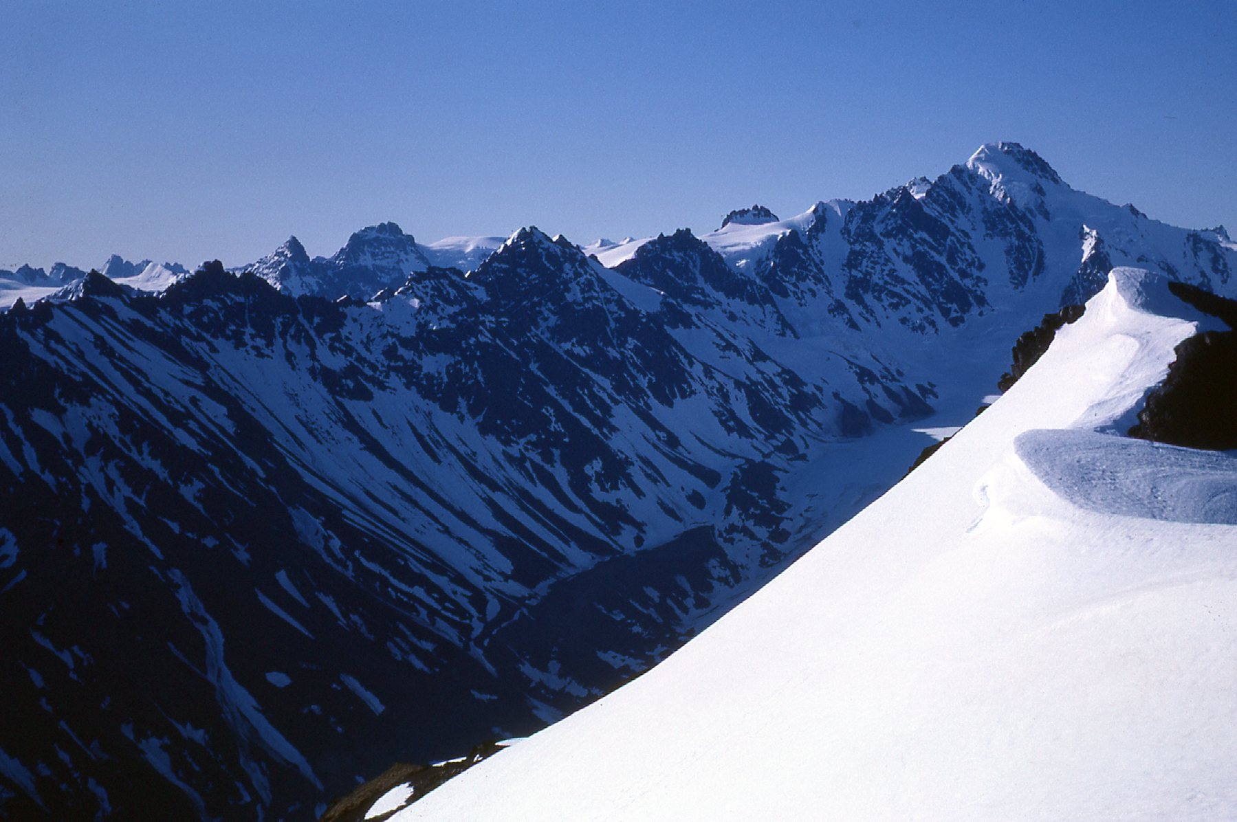
There was no end to the beautiful places they’d set us down for the day.
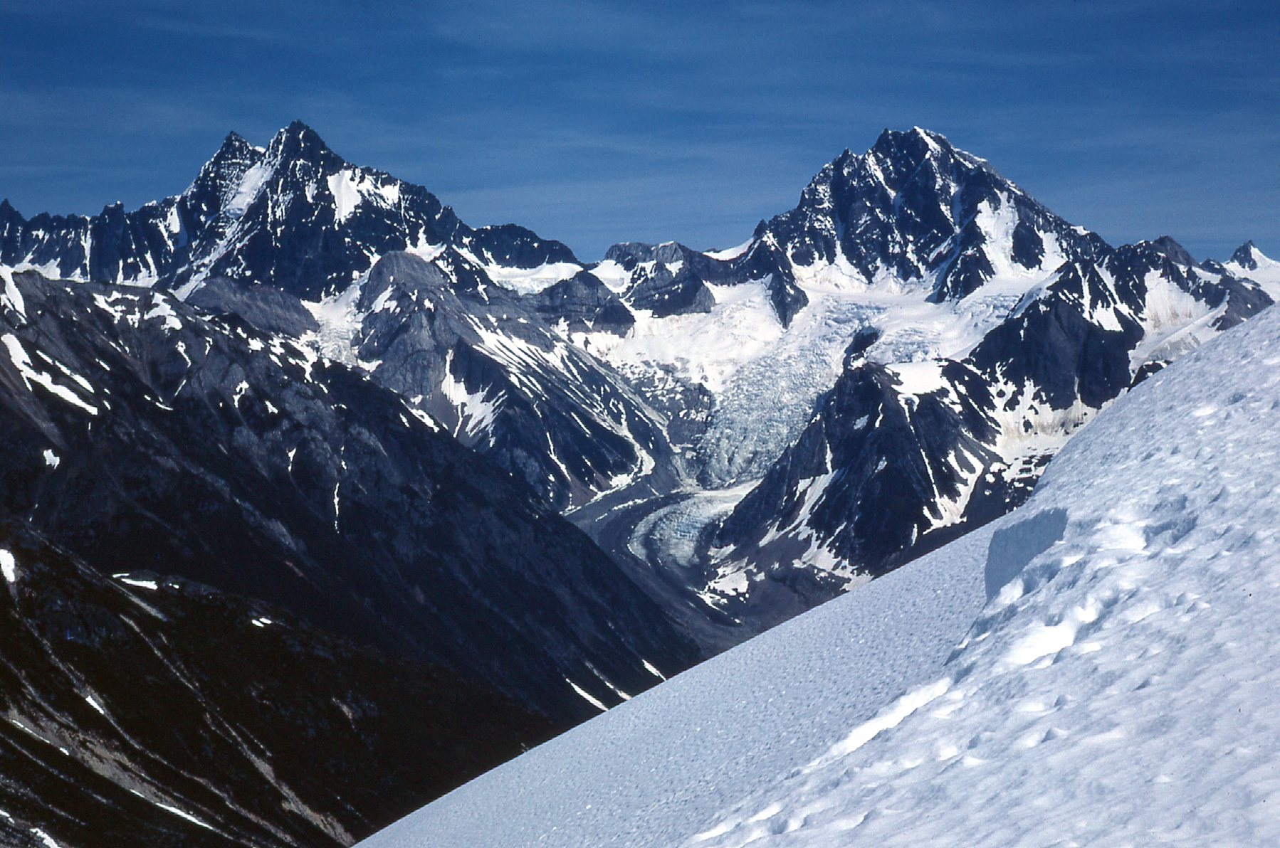
Amazing peaks – un-named, unclimbed.
One day, the chopper had dropped us off high atop a peak directly overlooking the river on its east side. Even though we were thousands of feet above the river, something caught our eye. Down on the river and heading upstream was a sizable boat, looking much like a paddle wheeler. It would have come all the way from Wrangell in Alaska. I’m sure it was a paid tourist excursion, and how we wished we had been down on the shore to see it pass by.
The people who settled this area thousands of years in the past and whose descendants still live in the region today are known as Native Americans in Alaska and First Nations in British Columbia. The international boundary which exists today, a fairly recent innovation, meant nothing to them as people who roamed the area freely without the hindrance of a border. Those people were known as the Shtax’héen Kwáan, also known in English as the Tahltan people, and as you would expect of a people with a rich and ancient culture, they had names for every geographic feature in their land. After much research, I was able to access those names for a few of the features in the area we studied in that summer of 1967 and will use them where appropriate in this piece.
Every time we’d take off from camp in the chopper, the scenery was absolutely mind-blowing. One of the nearest big peaks was this one, named Dokdaon Mountain. It was practically right around the corner from our camp, exactly 10.0 air miles away. Dokdaon is the closest you could write the name in English, but properly written in their language it would be Dákde Aan Shaa, which means “Mountain behind the Village Trail”. Can you imagine seeing this rising up behind your village every day?
Dokdaon Mountain, rising 8,635 feet, on the right.
If you go back 6 pictures, you’ll be at the one where we’re looking down on the Scud River from the chopper. The people of this area had a name for that river in their language, and they called it Sx’athéeni, which means “Sharp River”.
Right next to Dokdaon Mountain sat an even bigger peak known as Endeavour Mountain. This one towers to 9,367 feet, and I don’t have a picture of it, nor could I find one anywhere on the internet. It sat only 12.7 miles from our camp. And there’s one more, even higher, known as Ambition Mountain. This peak is nothing less than spectacular, as you can see from my next picture.
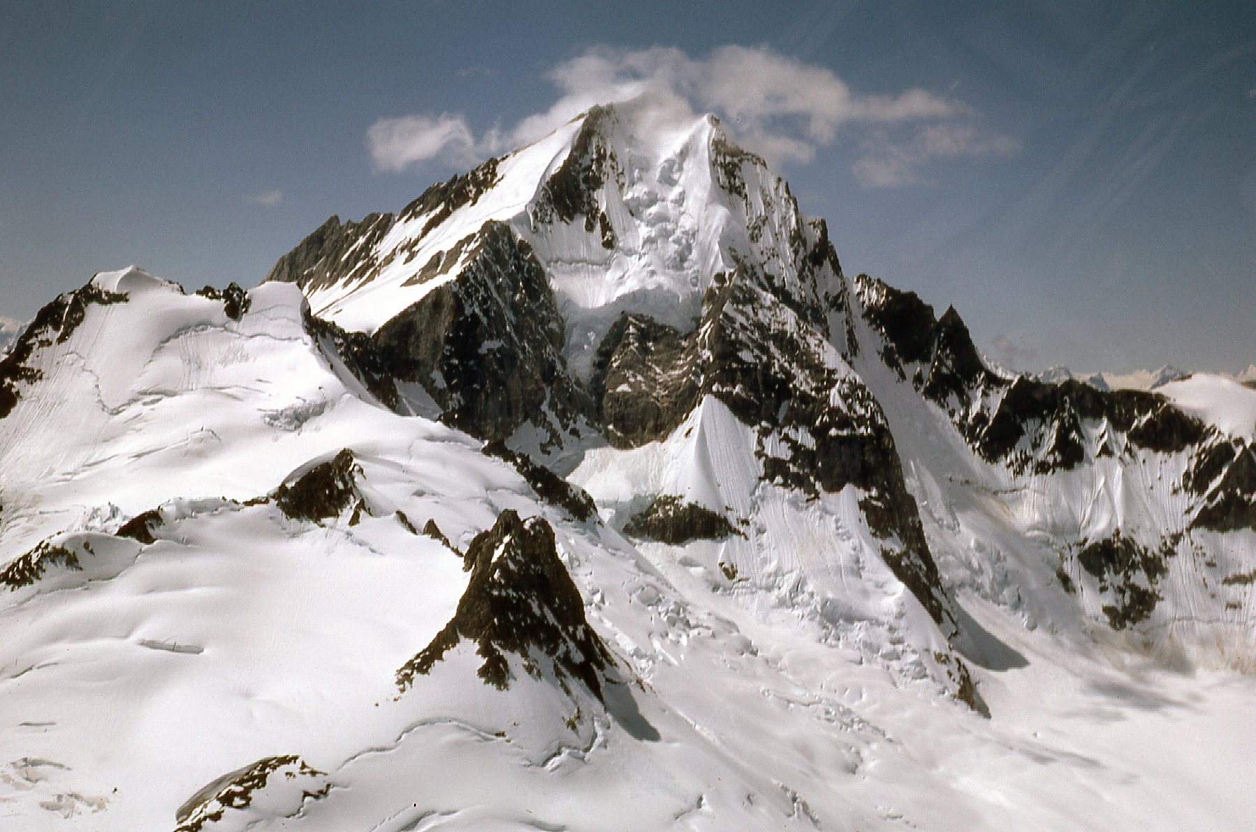
The east side of Ambition Mountain.
This is an ultra-prominence peak, and it rises to 9,688 feet. Talk about heavily-guarded by glaciers!! This is the highest of the Dokdaon – Endeavour – Ambition trio which all sit in a row only 4 miles long. Ambition sat just under 15 air miles from camp. That is really close to where I spent those 3 months that summer. Put another way, you could easily drop that 15-mile stretch on to the continuous area of my home city of Tucson, Arizona and it would all fit with room to spare.
There’s something else I need to tell you about Ambition Mountain. I was so fascinated by it that I begged my boss to allow Murray and me to go try to climb it. Scroll all the way back to the beginning of this story and have a look at the second photo – see the guy on the far right wearing the red shirt and dark hat? That’s Murray Hendren – he’d go with me. At the very end of July, a float plane landed on the lake and dropped off some men on the shore. We never saw them after that, but it turned out that they were climbers and had come here loaded for bear. More on them in a minute.
Our chopper dropped Murray and me off on August 6th on the glacier at 6,500 feet at the foot of the peak. We spent the day climbing but were stopped at 9,100 feet by a gendarme on the long southeast ridge – we just didn’t have the experience to get past that point, plus we weren’t roped up to offer some protection from the exposure. We returned to our starting point, where the pilot picked us up late in the day. I asked him if he’d be okay with flying back up the ridge we’d climbed. No problem, away we went. Just past the gendarme, we saw footprints in the easy snow continuing to the summit. History now records that 4 climbers from Seattle (the ones we’d seen land at the lakeshore near our camp) had made the first ascent on August 3rd, three days before our August 6th attempt. We had no idea that they had flown in for that purpose. I believe they also climbed Endeavour Mountain, or at least attempted it.
Here are a few photos I took during our climb on August 6th, 1967. This first one is looking up the ridge we were climbing, taken at 7,600 feet.
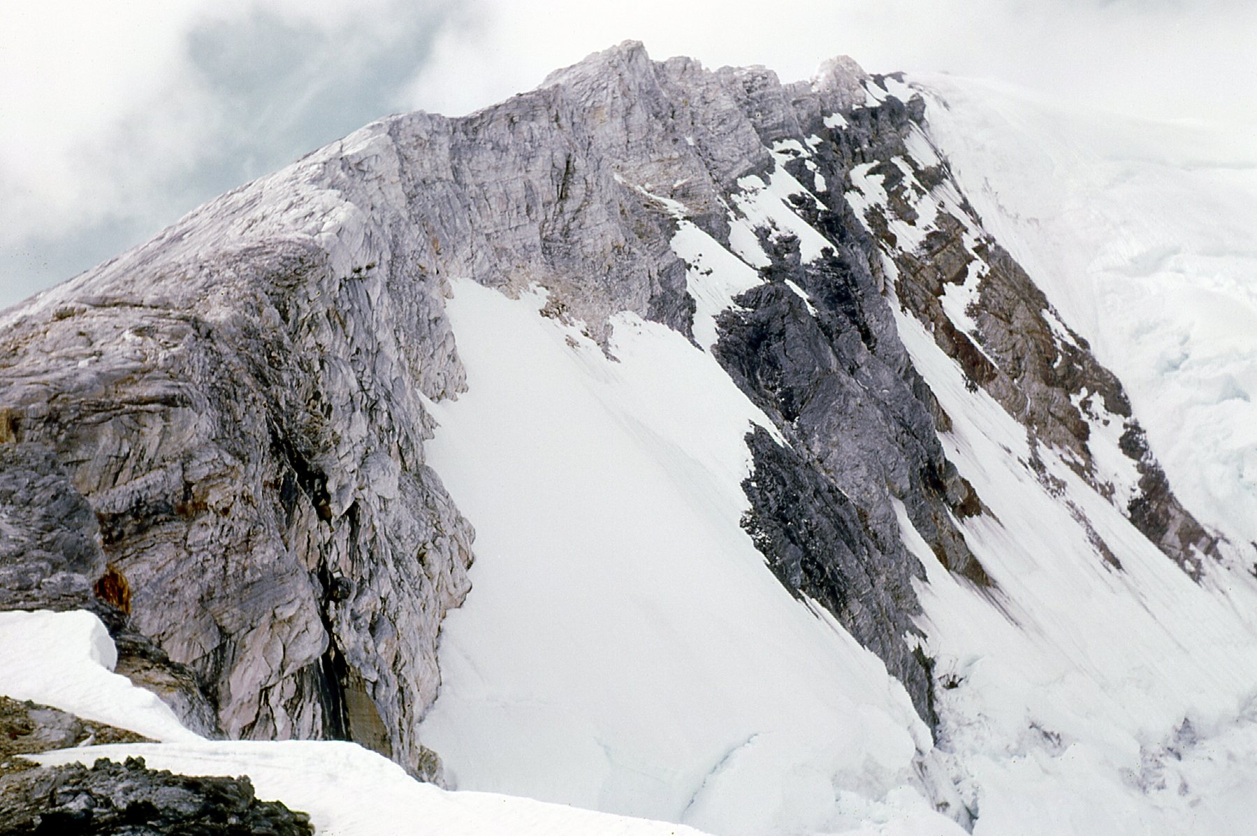
Looking up the ridge we had to climb.
Here’s one from higher up, looking down the ridge as things were clouding up.
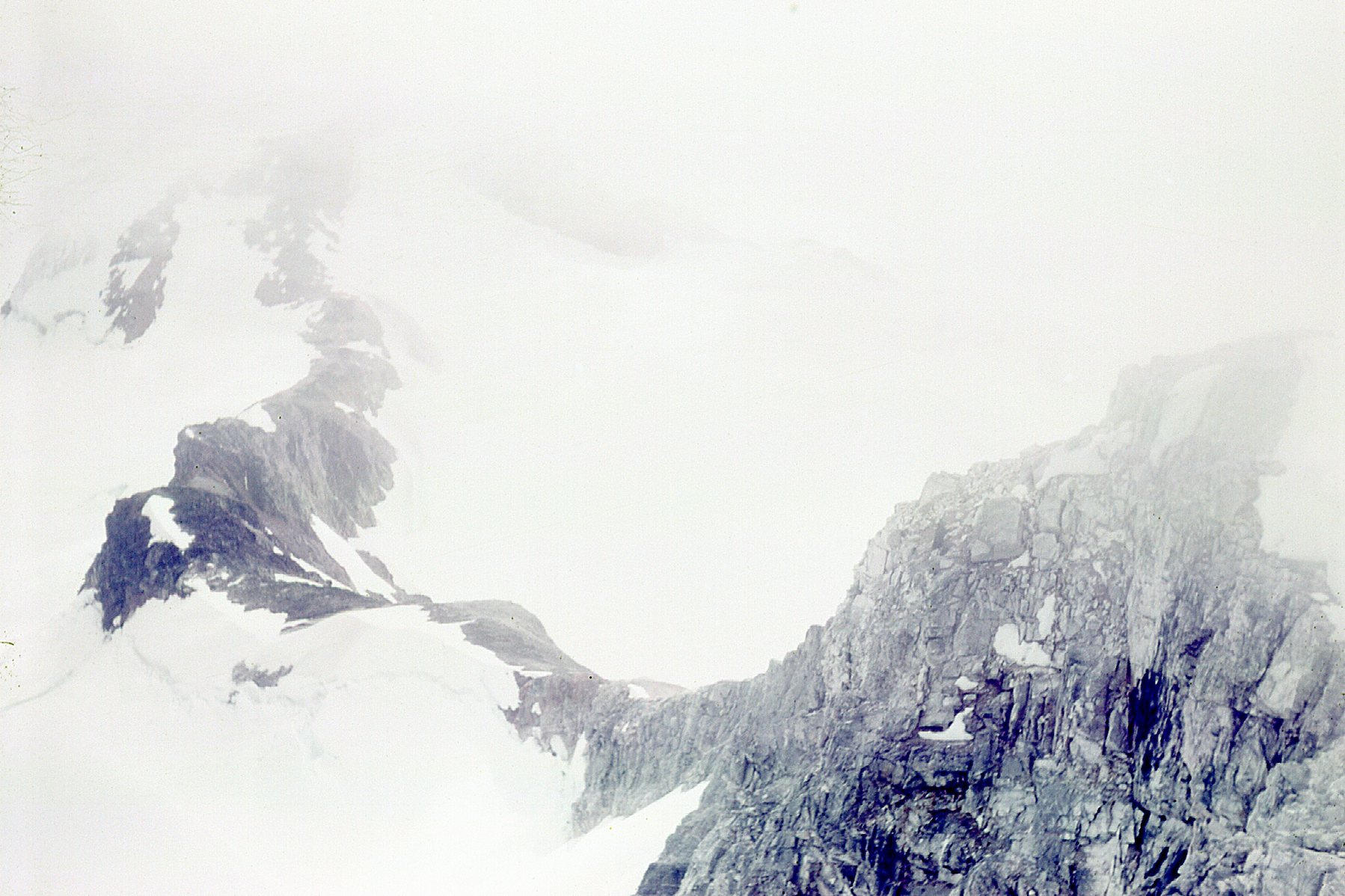
Looking back down the ridge.
Here’s one more, taken from 8,700 feet where we stopped for some lunch.
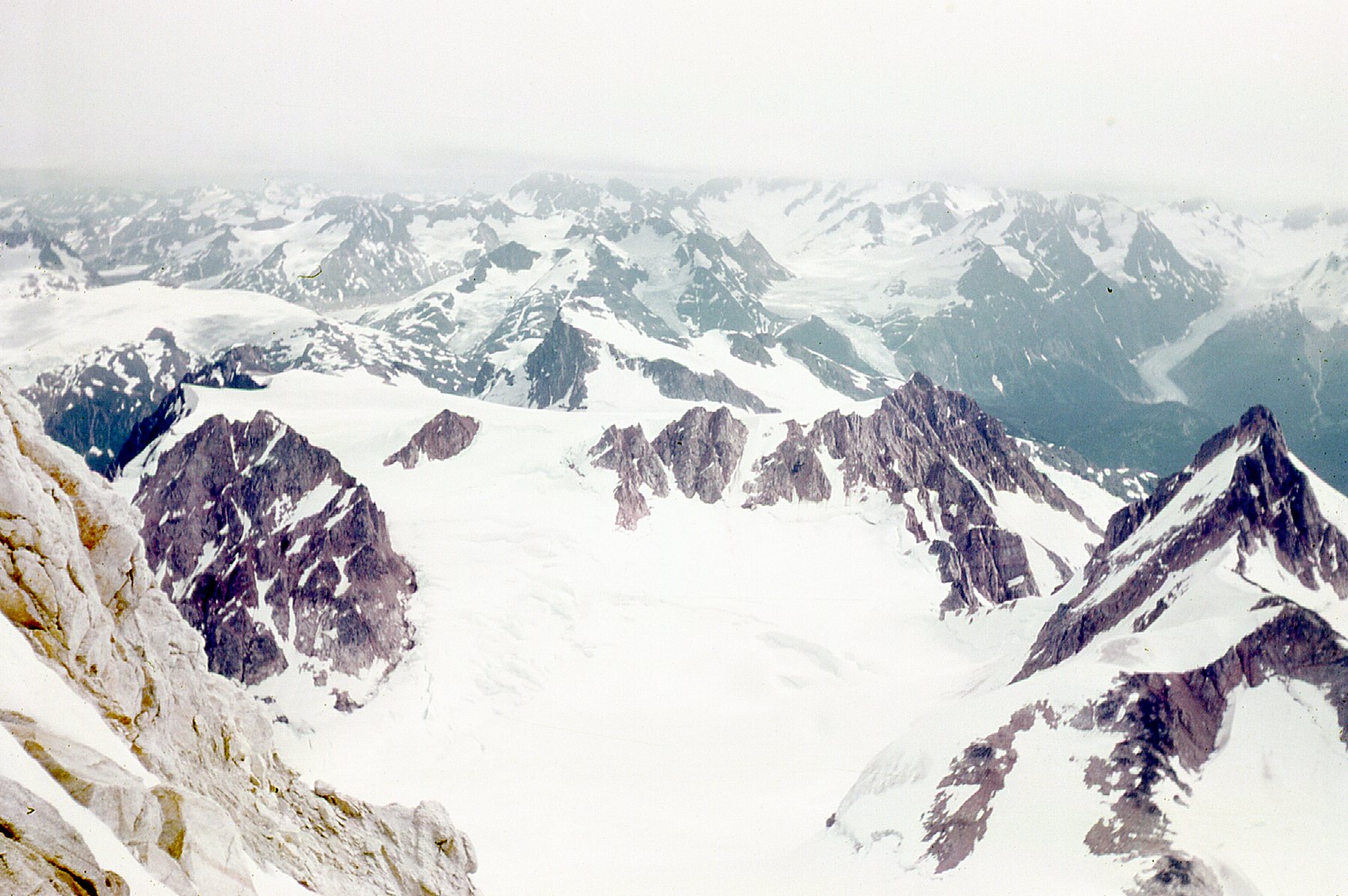
What a lunch spot!
We were amateurs, armed only with crampons, ice axe, map and compass, but we sure had a good time trying to climb Ambition Mountain that day.
Please stay tuned for the rest of my adventures in the Stikine, in a piece called “The Stikine – Part 2”