
When I lived in the Fraser Valley of southwestern British Columbia in the 1970s, a big draw for us climbers were the volcanoes in the Cascade Range of Washington and Oregon. Peaks like Mt. Hood, Mt. St. Helens, Mount Adams, Mt. Rainier, Glacier Peak and Mount Baker were high, glaciated, easy-to-access and all within a day’s drive. The biggest of them all was, of course, Mt. Rainier. It’s the most-heavily-glaciated peak in the lower 48 states, and at well over 14,000 feet a tempting challenge. I lived in a small town called Mission, about an hour’s drive east of Vancouver. It was a nice, quiet place back then with about 5,000 people (now it has 40,000). In 1975, I had already been thinking of giving Rainier a try for years, so when friends Ken and Paul, also from Mission, suggested going – well, that was all the impetus I needed.
On September 4th, the 3 of us piled into my station wagon with all our gear and away we went. It took us 6 hours to drive from Mission down to Interstate 5, then south past Seattle and on lesser state highways until we arrived at the Paradise Ranger Station. I don’t know what the procedure is nowadays, but back then if you wanted to climb Rainier you had to do a bit of paperwork, convincing the rangers that you were qualified, by dint of your previous climbing experience. That done, we set out on foot with full packs from the ranger station at 5,400 feet. It was a slog of 4 1/2 hours up the monotonous Muir Snowfield to finally reach the spot known as Camp Muir at 10,188 feet. All we had to do was follow the myriad footsteps of the many who had preceded us. This picture looks steeply up the snowfield.

Approaching Camp Muir.
Camp Muir was a fascinating place. The stone hut was a 12′ x 25′ one-room shelter with sleeping platforms. A plaque at the entrance said “Erected in memory of John Muir, 1921”. The place was crowded with climbers from all over, not just Americans and Canucks but even from other countries. Like most folks trying the mountain, our plan was to get a few hours of sleep and then set out for the summit. Well, everyone was talking and there was no way anyone was getting any sleep. The hours passed and it was time to move on. We got out of our sleeping bags at midnight and started on foot from the hut by 1:00 AM. I think this may have been the first time I’d ever climbed at night – it was an interesting experience, for sure. By 6:00 AM, we’d reached 12,000 feet and I felt like death warmed over. Nauseous, exhausted, I couldn’t climb another step – I was suffering the classic symptoms of acute mountain sickness. Ken and Paul felt fine, so they continued on to the summit while I slowly made my way back down to Camp Muir. The lower I went, the better I felt, and was soon chipper enough to take plenty of photos. Hours later, the guys arrived at the hut. We packed up and made our way together back down to Paradise, then drove straight home, arriving by 10:00 PM. Since this is the latest in my Pictorial Series of stories, you may recall that the emphasis is on photographs. Yes, I’ve previously published a story on climbing Mt. Rainier but without photos. This time, it’ll be all about the photos. So here are the ones I took on that first attempt that I’ve just described. The climb may have failed, but the photos don’t disappoint.
On the way down, I just started shooting slide film and it paid off. The shots will be in every direction where there was a worthy subject.
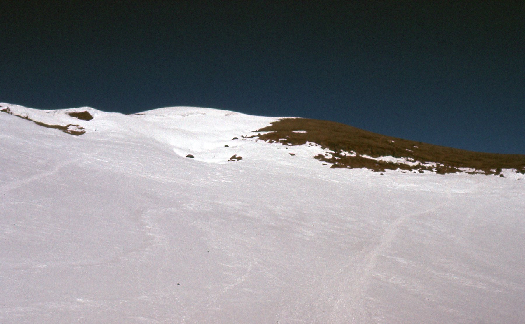
Looking east to the lower Ingraham Glacier from 12,000 feet.
Looking down through Cadaver Gap – see the climber just below me?
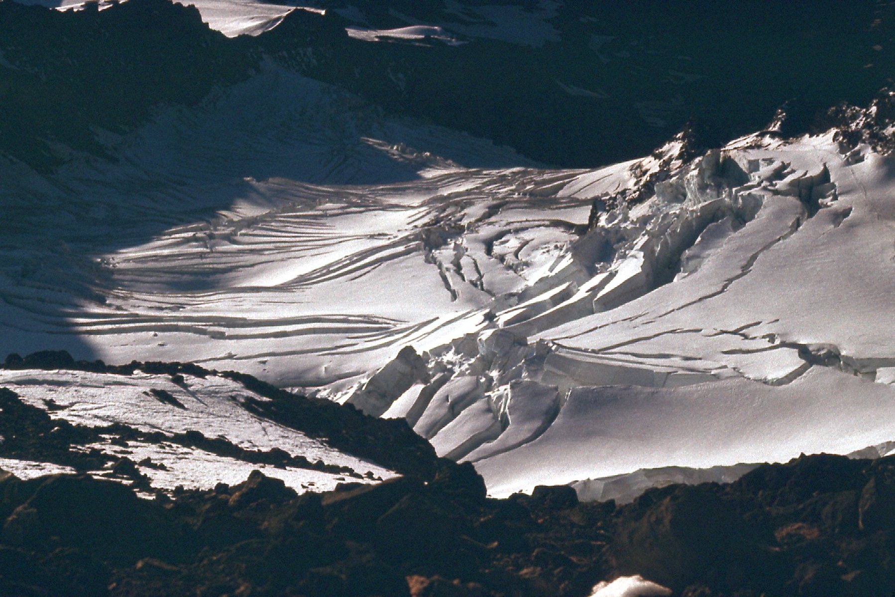
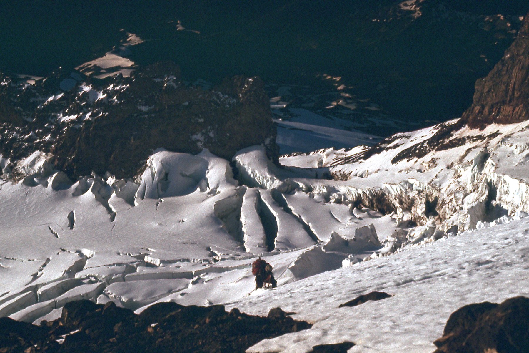
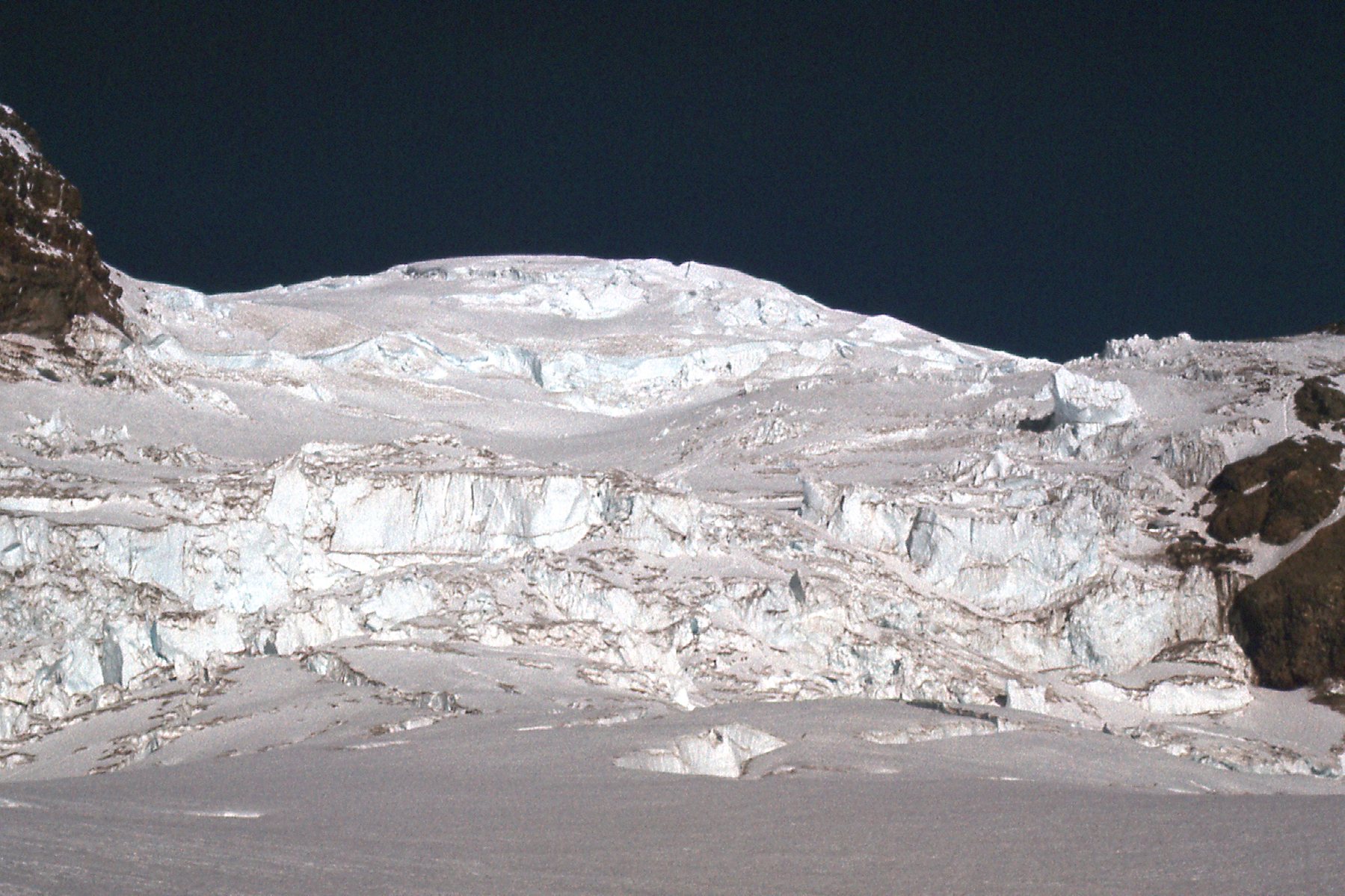
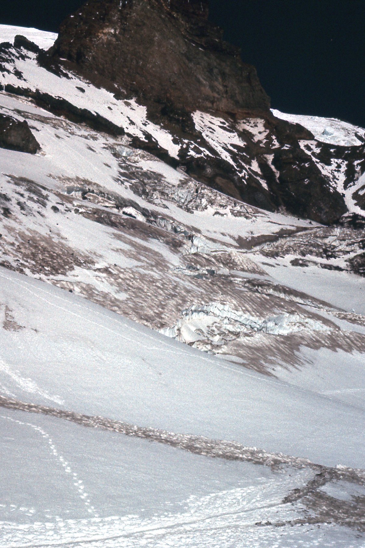
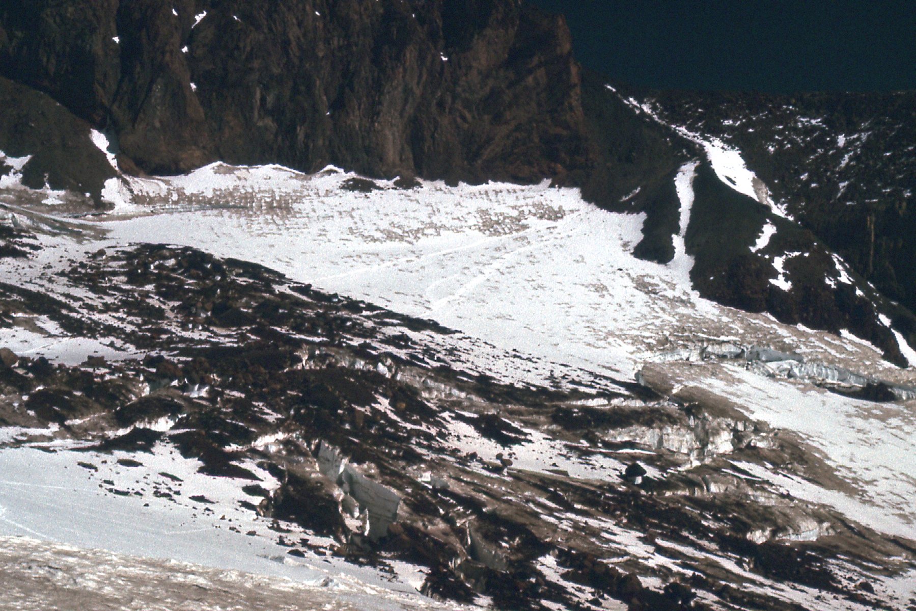
Icefall on the Ingraham Glacier.
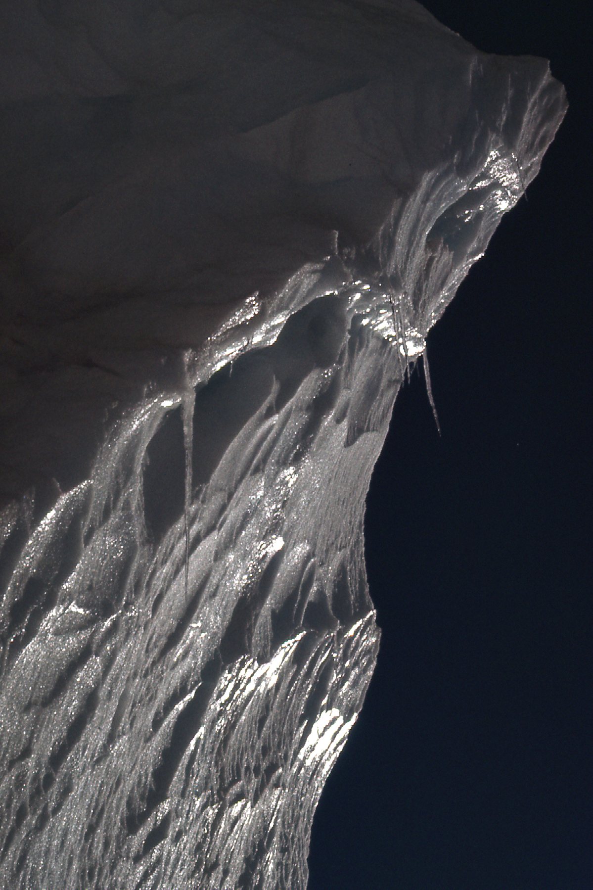
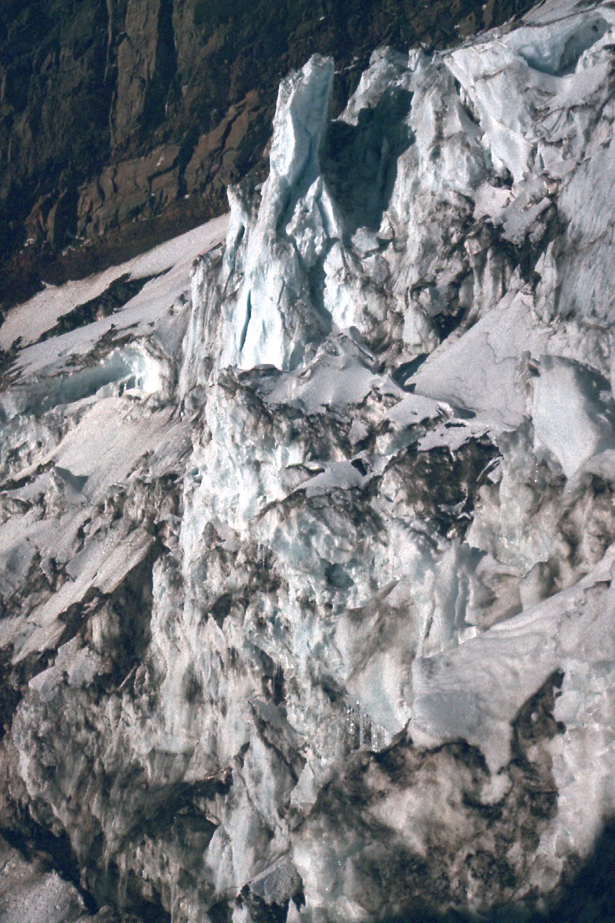
Glacier detail
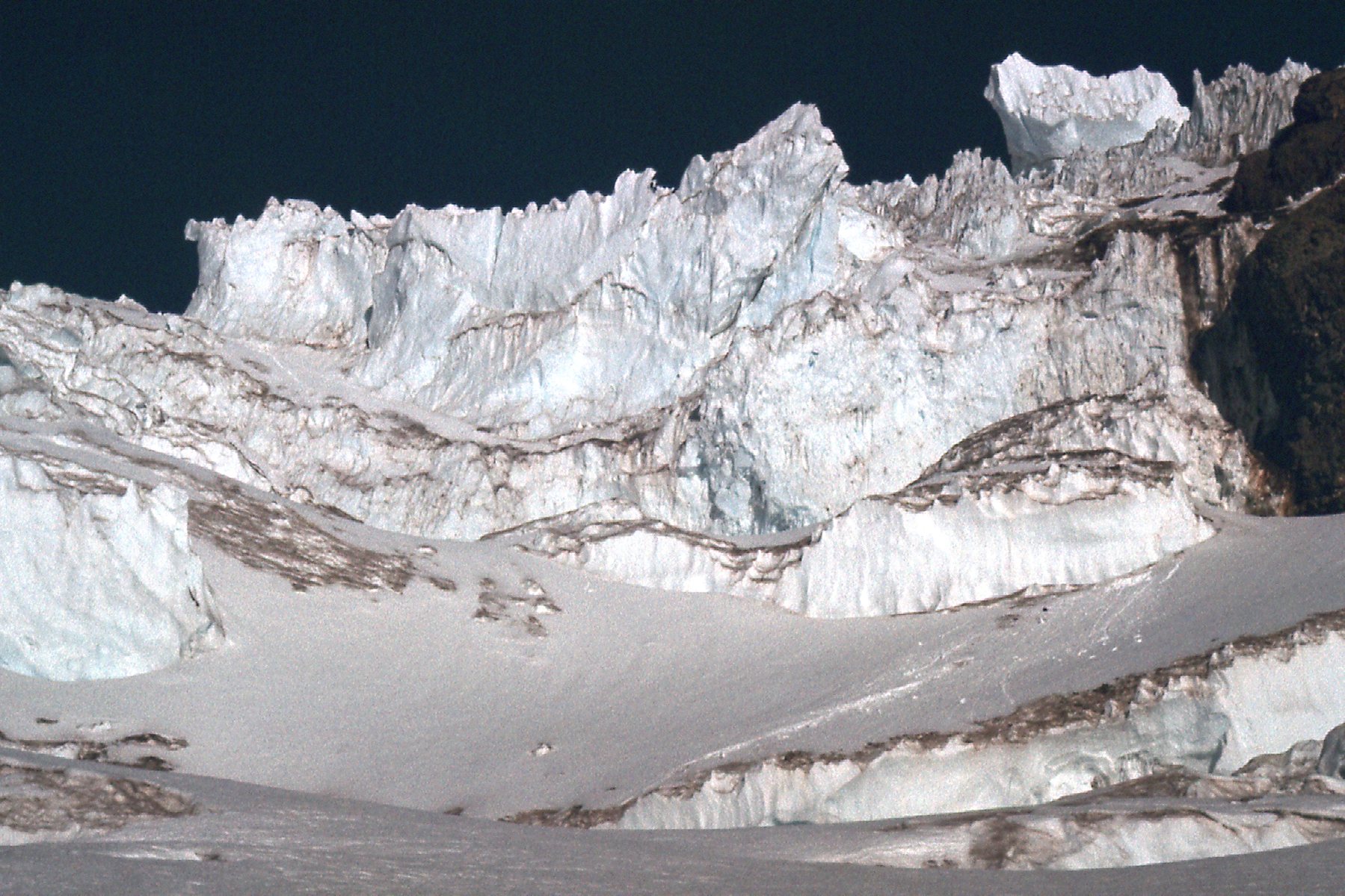
Icefall on the Ingraham Glacier
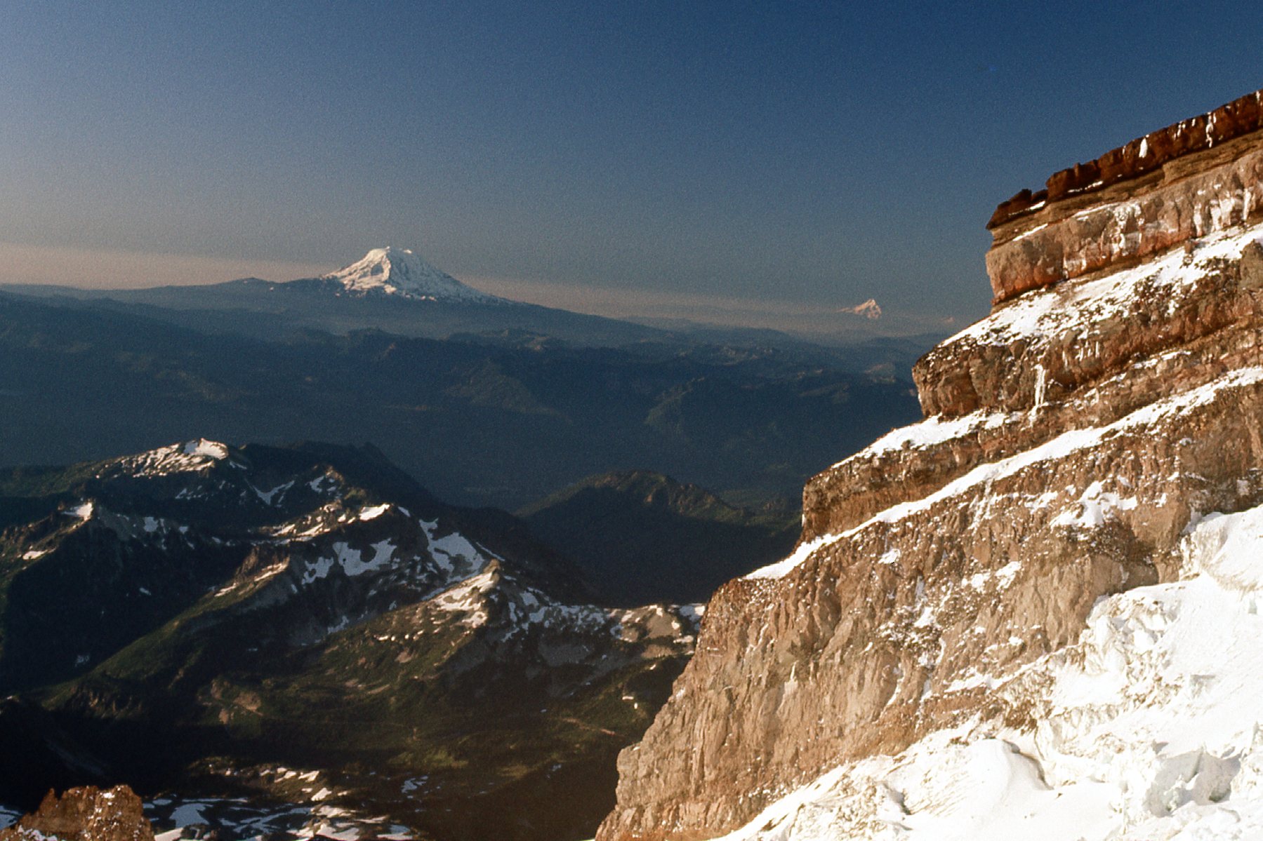
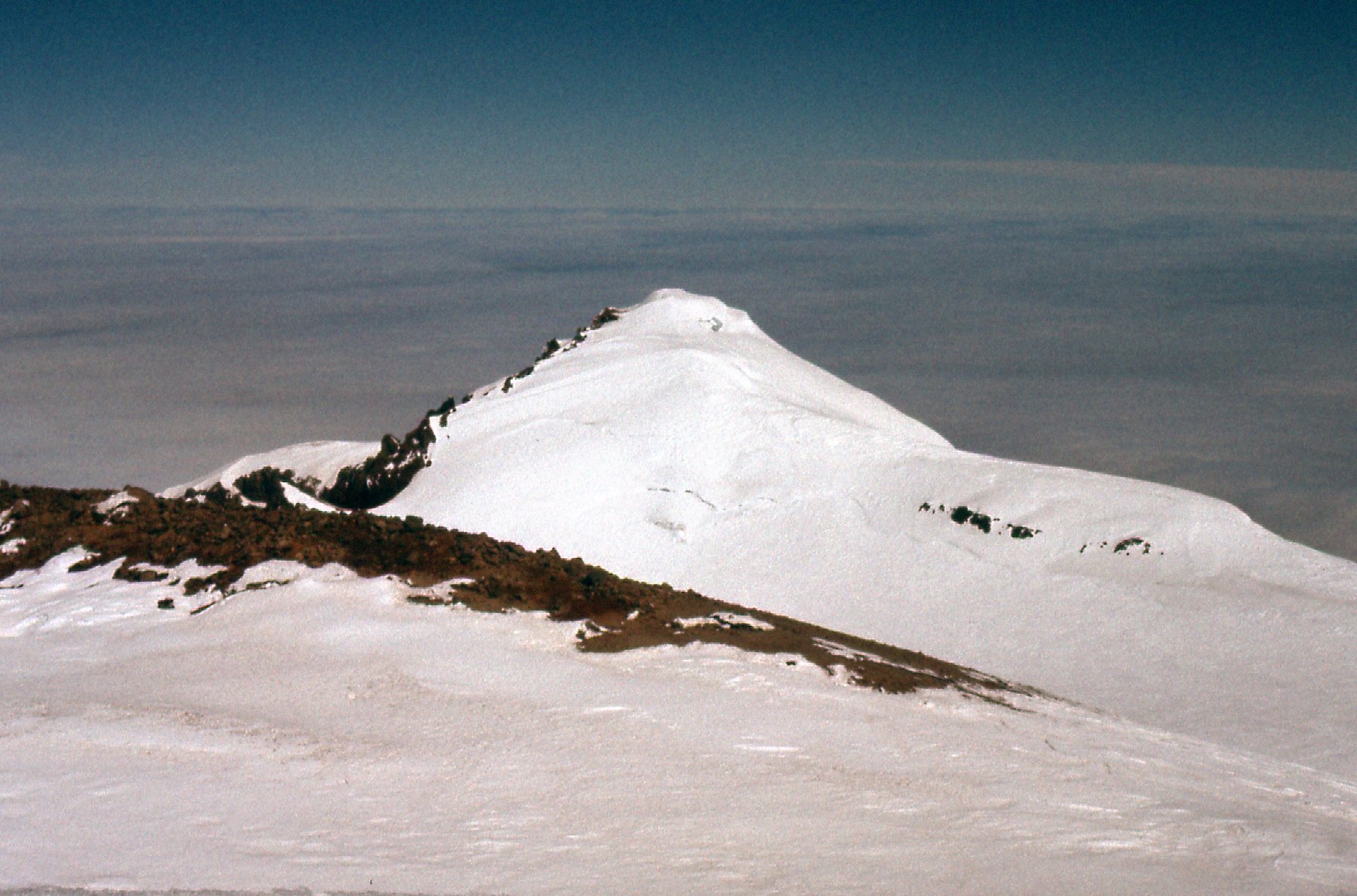
Looking past Gibraltar Rock to Mt. Adams (on the left) and Mt. Hood
Looking north
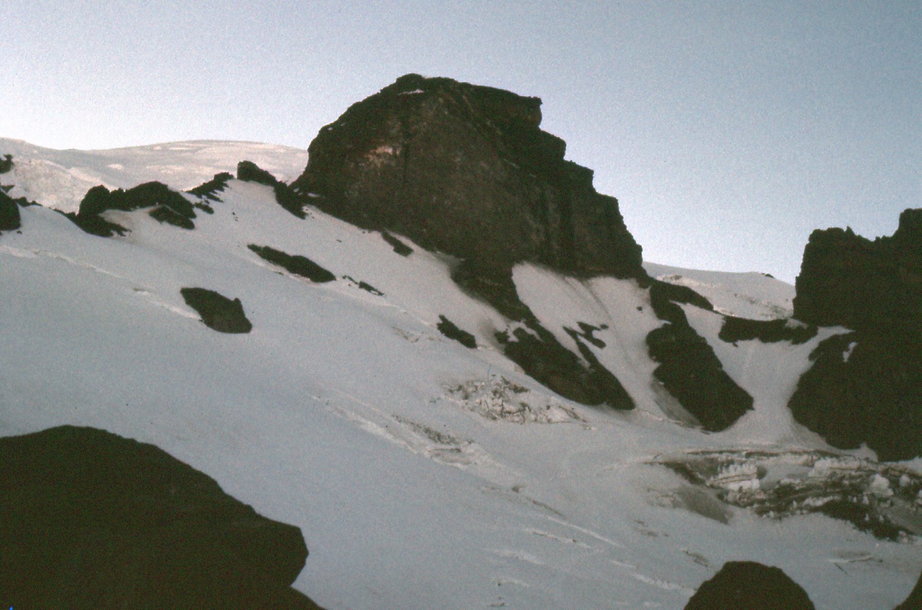
The Disappointment Cleaver. Our route was up that, which is the standard route.
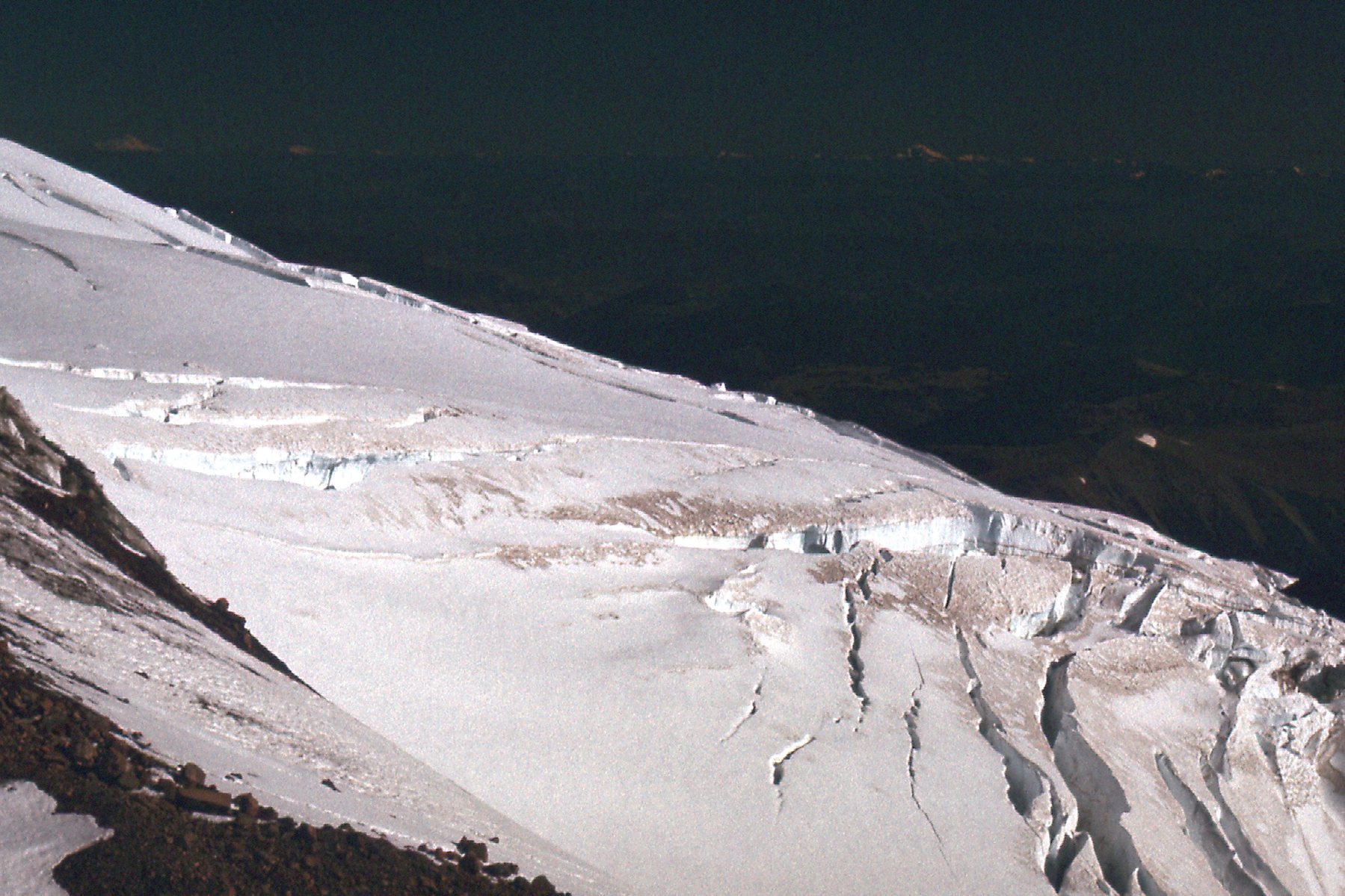
Looking west on the upper Ingraham Glacier
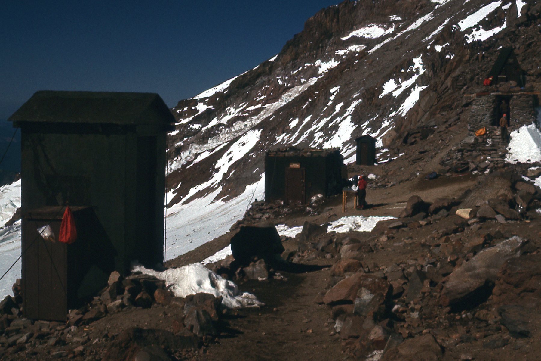
Camp Muir.
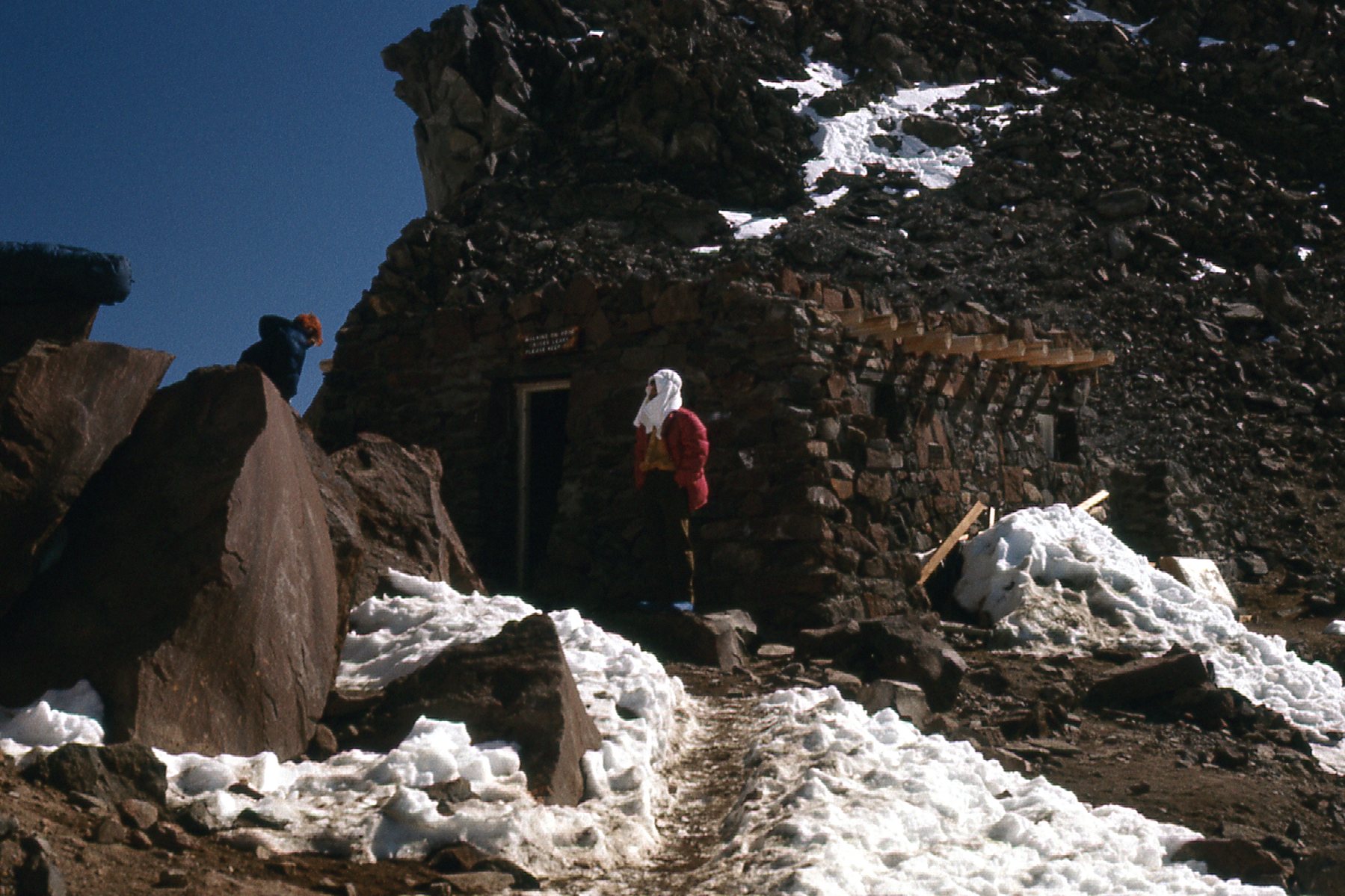
The public hut at Camp Muir.
Gibraltar Rock from Camp Muir.
Looking north from Camp Muir across the Cowlitz Glacier.
And one final look at the mountain from down near Paradise Ranger Station.
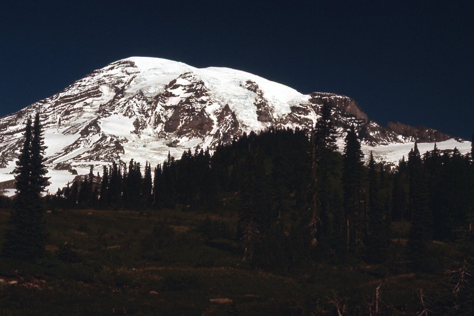
The south side of Mt. Rainier
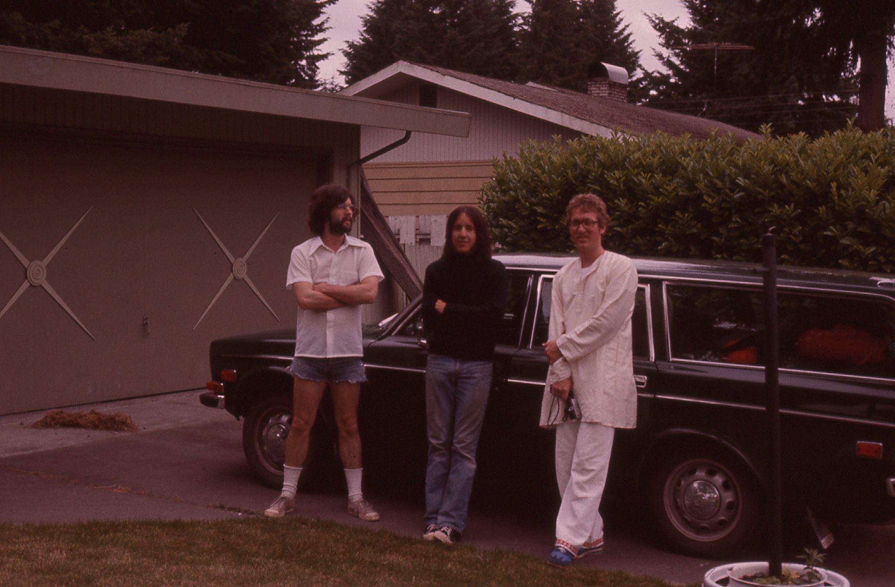
So, my first attempt to climb Rainier had failed. Mountain sickness can hit anyone, and it sure did me in ’75. Was I disappointed? Definitely. I couldn’t let such a prize go without a repeat attempt. A couple of years passed. While on a visit to California, I had met a couple of climbers: Jonathan lived in Olympia, Washington and Ron, in Seattle. More importantly, though, was when I met Brian Rundle while hitchhiking on May 14, 1977. He, Jonathan and I climbed Mt. Lindeman together, and had such a good time in so doing that on June 19, Brian and I found ourselves heading south. We picked up Ron in Seattle, then went on to Olympia where we spent the night at Jonathan’s place.
The next morning, we enjoyed a leisurely drive up to Paradise, then spent the afternoon in a long, slow-motion slog up the snowfield to Camp Muir. The weather was perfect. This time, we’d do things a bit differently, taking more time to get used to the elevation. We slept the night in the stone hut, then spent all the next day just hanging out. We put in some time practicing ice-axe self-arrest and gabbing with climbers from all over. By evening, the cloudy day had turned sunny and we were more than ready for the climb.
Looking northwest from Camp Muir to Gibraltar Rock
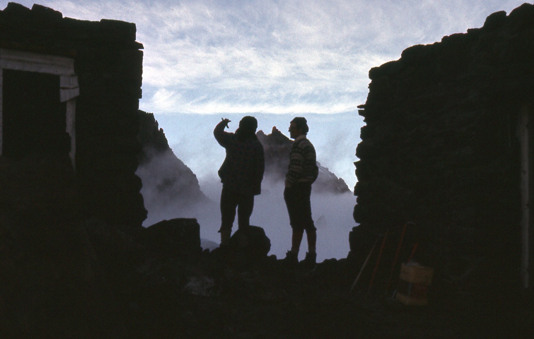
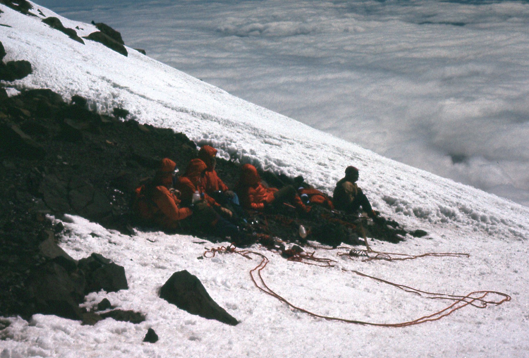
Hanging out at Camp Muir.
After a feeble attempt at sleep, we arose around midnight and gagged down something so we could at least say that we had eaten breakfast. It took us until 1:30 to finally exit the hut and start walking. There were a lot of climbers strung all up and down the mountain, moving by headlamp, and we took our place in the queue. Our choice was the Disappointment Cleaver, the “normal” route used by most climbers. Our path contoured across the Cowlitz Glacier to Cathedral Gap. Once up and through the gap, we climbed on to the Ingraham Glacier and walked past Ingraham Flat, which had been used by some climbers as a camping spot. We contoured around this glacier to a large rocky ridge to the north, and that ridge was the Disappointment Cleaver. There were some steep parts, but nothing difficult. One of the great views in the growing dawn was Little Tahoma Peak. There was a clear, well-trodden path up the cleaver through the snow – it was impossible to get lost.
Once above the cleaver, it was one long snow slope up the Emmons Glacier. The altitude finally caught up to Ron, and he decided to call it quits. He promised to sit in the snow and wait right there for us to return, no matter how long it took. I’m not sure how high he got, maybe 13,000′. He waited patiently, chatting with others as they passed. Meanwhile, the three of us plodded up the steep slope until we finally reached the crater rim. It’s tempting to stop there, as the highest point is still 20 minutes walk away across the nearly-flat crater, but if you don’t go the rest of the way, you haven’t climbed the mountain, period. So of course we went, and before long stood on the summit of Mt. Rainier, elevation 14,411 feet. It was clear and sunny, but extremely windy. Here’s our hero shot from the summit. On this trip, the pictures I took were mostly from the summit area. The first one was our hero shot on the very top.
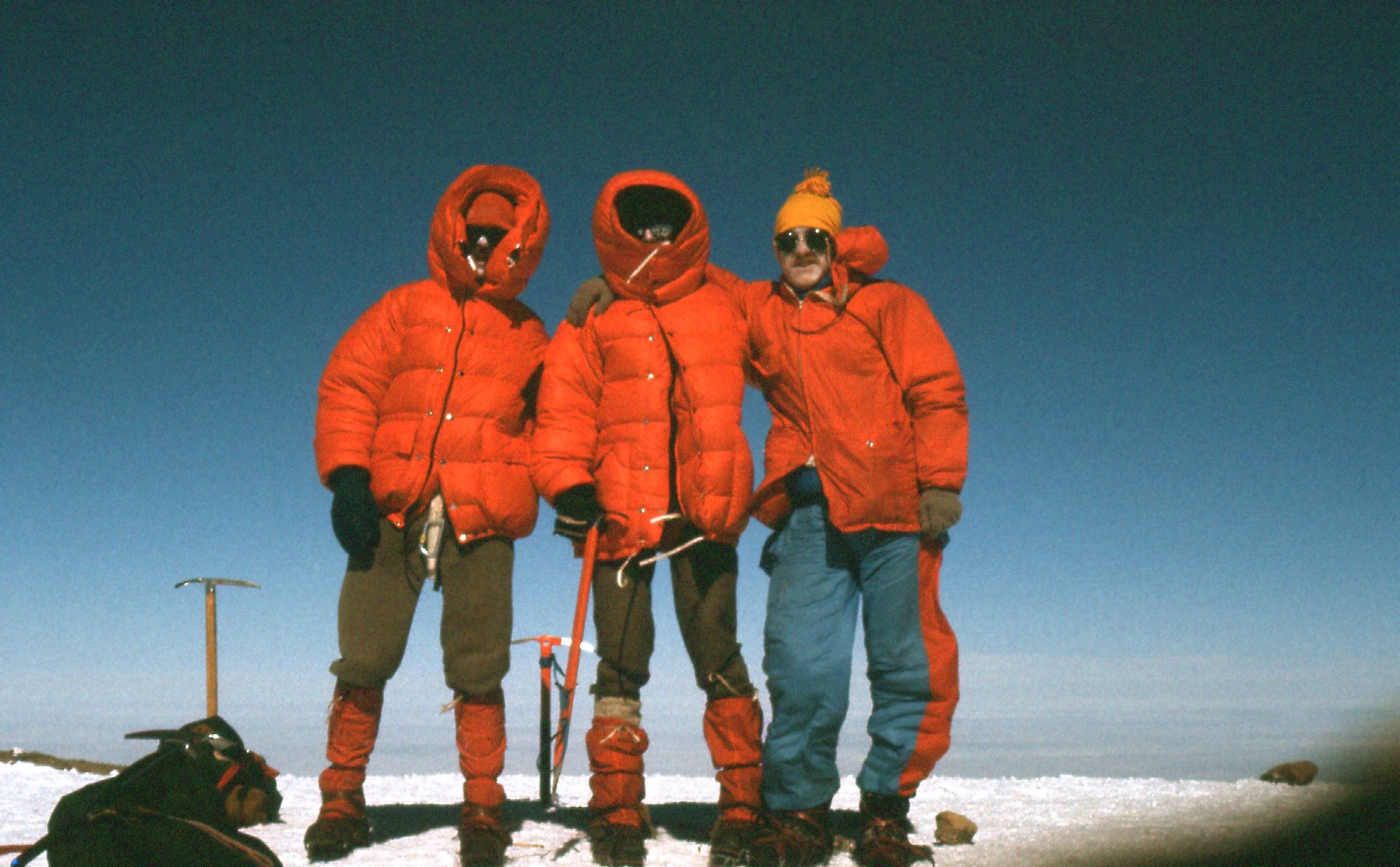
Left to right: me, Brian, Jonathan
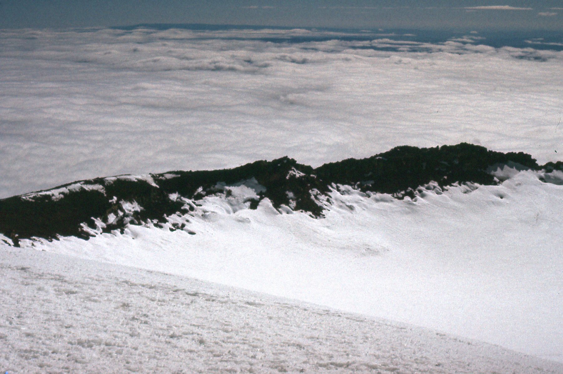
Looking northeast from the summit.
Looking east across the crater from the summit.
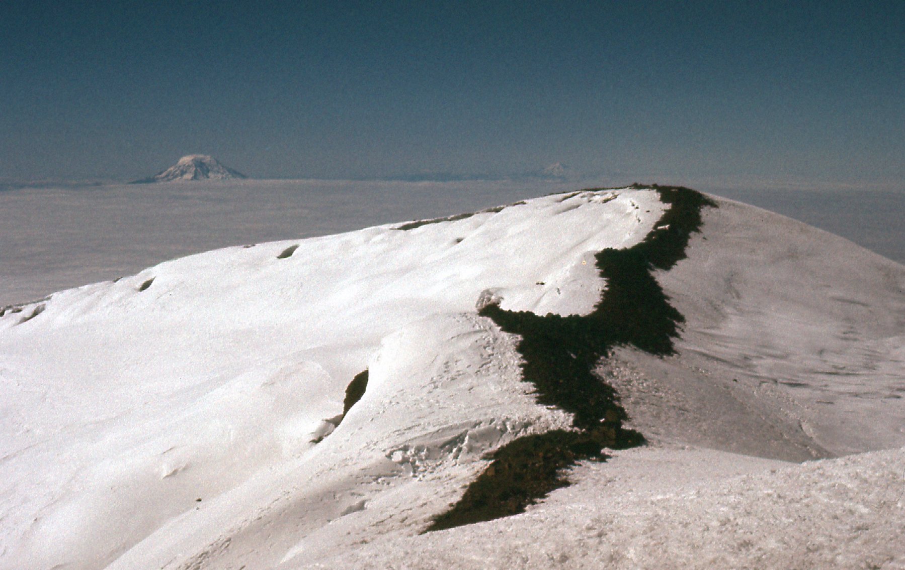
Looking south along the crater rim. That’s Mt. Adams on the left, and Mt. Hood faintly visible above the dark area of the rim.
Looking northwest to Liberty Cap, elevation 14,112′
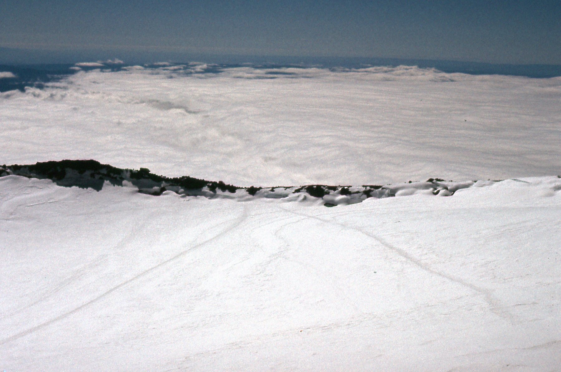
We didn’t stay long on the summit. Once we had crossed the crater again, we had this look back.
West across the crater to the summit.
Just below the crater lip, we passed these folks. They were part of a guided group. Many decide to not cross the crater to the true summit, instead stopping here. What a waste, they’ve already done 99% of the work to do the climb.
At 14,200′ on the south side of the crater.
On the way back down, we picked up Ron, and were all back at Camp Muir by 1:30 PM, twelve hours after starting out. The weather had turned, and it was a miserable descent to Paradise in clouds and rain. By the time we got back to Jonathan’s place in Olympia, it was 8:00 PM.
Back in Olympia. Left to right: Ron, Brian, Jonathan.
The next day, Brian and I dropped Ron off in Seattle, bought some gear at REI, and were back at my place in the Great White North by 3:30 in the afternoon. It had been a great climb, and made more fun by having summitted on the summer solstice.
I actually went back to Rainier one more time. It was 1990, and I arrived with Susan after we had climbed our way north through the Cascades. She was excited to try the mountain, and I was proud to guide her to the top. We left Camp Muir at midnight and I got us off track right away – we ended up way off route by following a set of footprints by headlamp that led to a campsite of some scientists. By the time I realized my mistake and we’d returned to Camp Muir, it was too late to start again for the summit. We headed down the mountain later in the day in a thunderstorm. I still remember plodding down the trench made by many others in the Muir Snowfield, and hearing our ice axes buzz as the electrical charge built up. We were pretty jumpy, worrying that a bolt from the blue would do us in. It didn’t, and we made it down just fine, but I still regret leading us astray. Rainier – great mountain, and a great experience for me, one of the good ones.