
As many of you regular readers of my website already know, the Sauceda Mountains are one of my favorite places anywhere. They have been the subject of many of my stories, so it’s probably no surprise that I’m writing yet another. This time, I thought I’d focus on the southernmost end of the range where are found its highest mountains. A whopping total of 105 peaks can be found in the Saucedas, making it a true giant among Arizona ranges. I drew an equilateral triangle on the map, a mile and a half on a side, and 4 of the 6 highest peaks were found within it. Step 2 miles outside of that triangle and you find a 5th, while a 6th is still pretty close, only 7 miles away. That’s a pretty tight grouping when you consider that the range is 36 air miles in length.
A brief introduction to those 6 highest tells us that 2 of them are on the Tohono O’odham Indian Reservation (Peaks 3930 and 3563) and the other 4 are all on BLM land (Sauceda Benchmark, Coffeepot Mountain, Peaks 4030 and 3790). I’ll shed more light on all of them in a minute, but just know for now that my goal on this particular day was to climb 2 of the 6. In any case, you’ll get a good look at 5 of them in this story.
The highest point in the range is Sauceda Benchmark, at 4,118 feet elevation. As the high point, it’s quite a draw and has been climbed by numerous peakbaggers. Everyone climbs it from the gas pipeline road via a long walk up its northwest ridge. Well, almost everyone. Back in 2006, a group of us climbed Peak 3930 together. Andy Martin, one of the group, lit out from 3930 and followed the convoluted ridge a long way to the northwest to arrive at the summit of Sauceda Benchmark – he is probably the only climber who will ever do it by anything other than the normal route which all the rest of us used. Coffeepot Mountain is nearby and has seen several ascents. Another one of the 6 highest, Peak 3563, is buried deep inside the Indian Reservation and has only been climbed by 3 hardy souls. That still leaves 2 more, Peaks 3790 and 4030, and they were the ones I was here to climb today.
It was a Friday on February 27th, 2015, while on a multi-day climbing trip, that I set out around 6:30 AM for what I knew would be a great day on the heights. I had followed a tired dirt road to a game-water catchment and parked there, at around 2,600 feet elevation, for my outing. The valley bottom was still deep in shadow as I headed east.
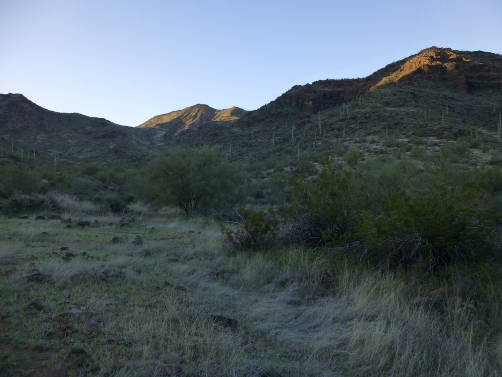
Deep in the valley.
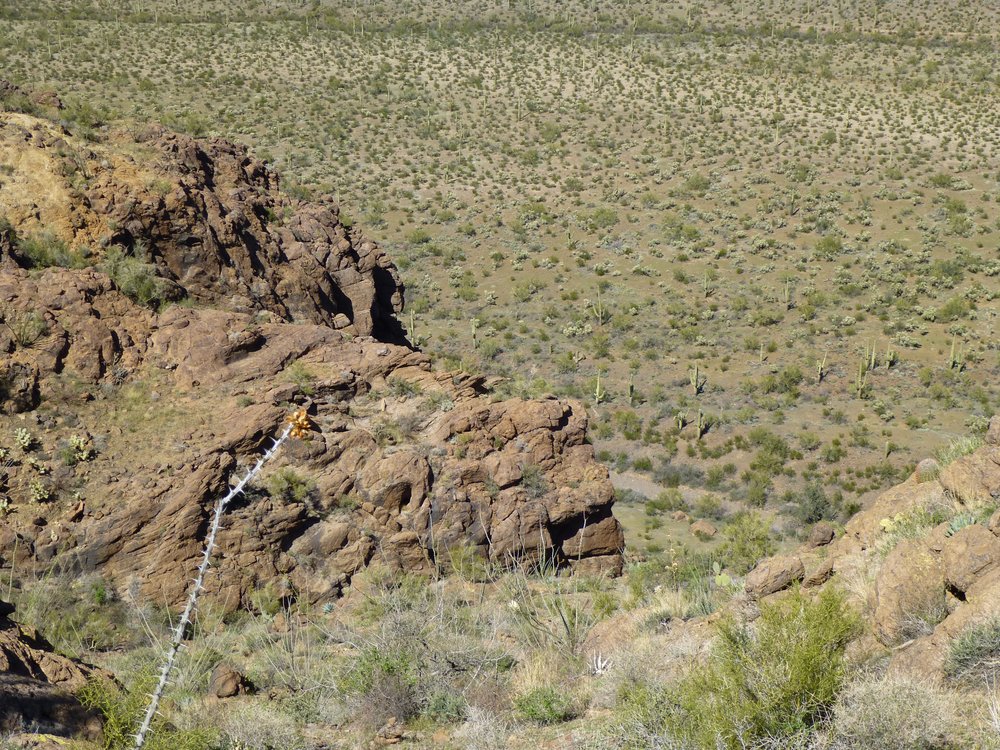
Along the way, this flower added a bit of color to my day.
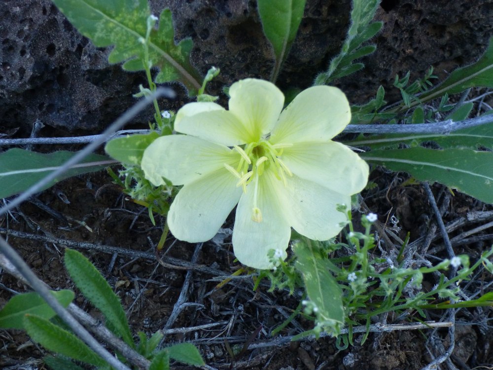
A bit of color.
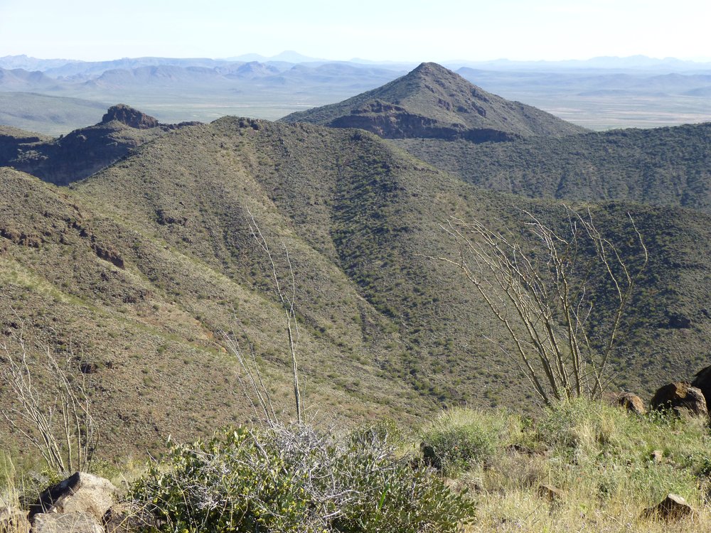
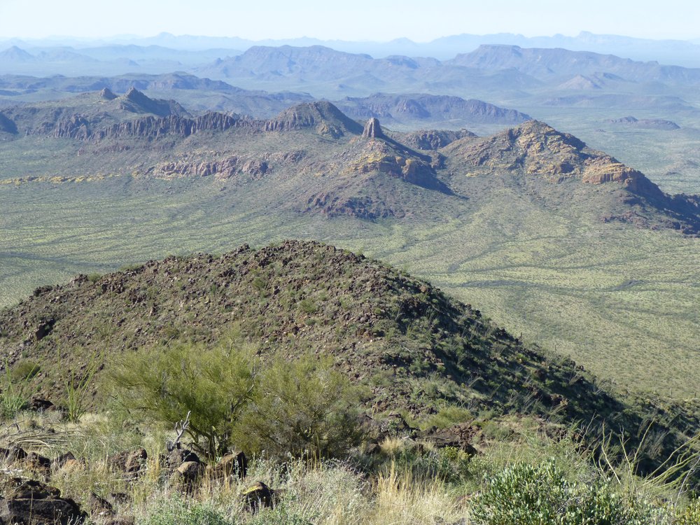
I could also see up to the high ridge of Sauceda Benchmark, about 1,500 feet above me.
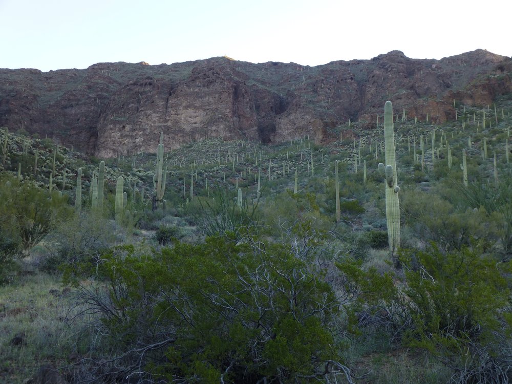
A look up to the highest part of the range.
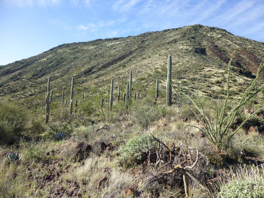
It was easy going for the mile and a half along the valley floor, which took me up to 2,900 feet. That had me perfectly placed to start some actual climbing. I decided I’d go up to the right of the reddish butte you can see in the middle of the picture below.
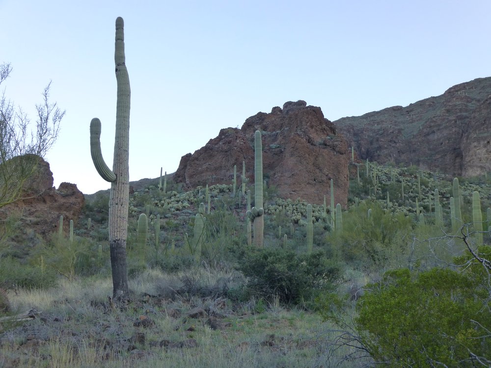
The start of the actual climbing.
Once I got a ways up alongside the butte, I had this look back down to the valley bottom. The sun had risen just enough to touch the valley floor in certain spots, and lit up this patch of saguaro cacti.
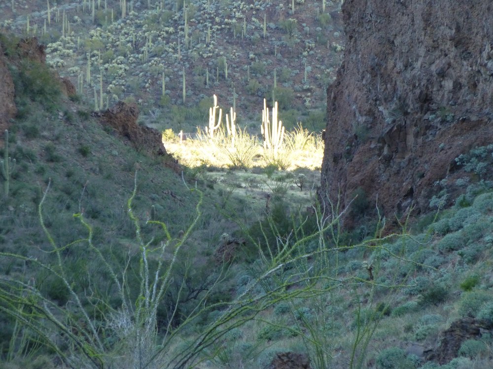
The first sunlight in the valley floor.
Another 900 vertical feet took me up a side valley, then a ridge, to finally end up on the top of Peak 3790, the 4th-highest summit in the range – it was 8:40 AM by the time I topped out. The views were outstanding – allow me to share some of them with you now. Here’s one of Sauceda Benchmark, the range’s highest point. It is only 1.3 miles to the north.
Sauceda Benchmark, elevation 4,118 feet.
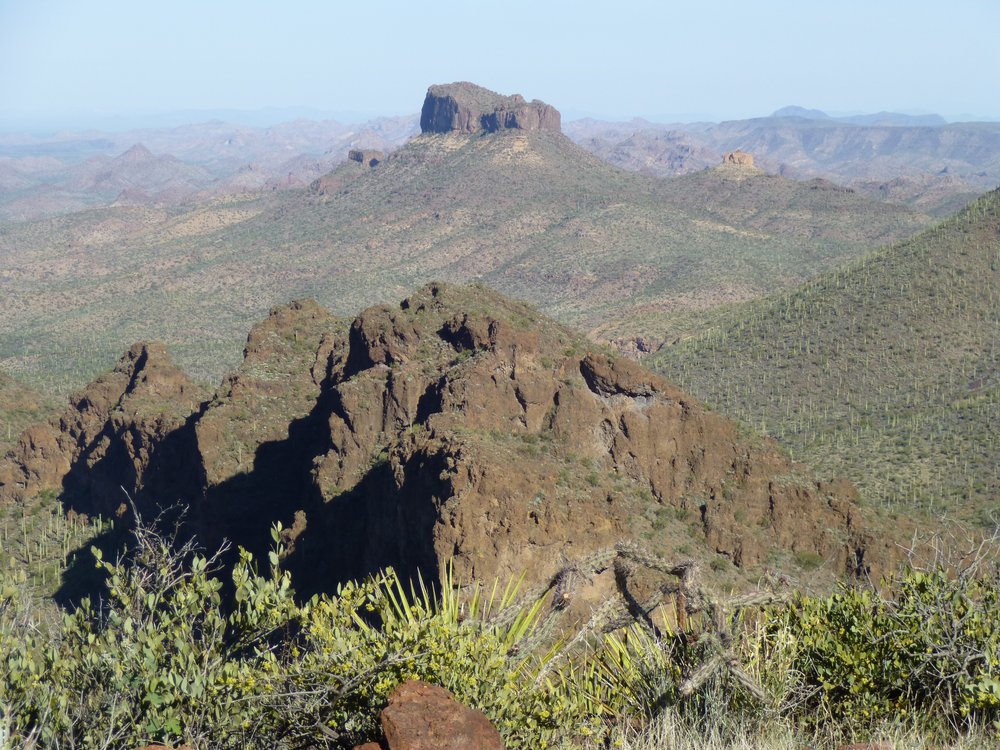
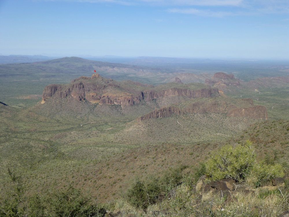
Just under a mile to the east sat Peak 3930, a quarter-mile inside the boundary of the Tohono O’odham Indian Reservation. I’m showing you my under-exposed version of this picture, as I like how it shows the texture of the vegetation along the slope. On the extreme left edge of the photo can be seen a distant flat-topped peak. It is the aptly-named Table Top, 34 miles to the northeast.
Peak 3930, the 3rd-highest peak in the entire range.
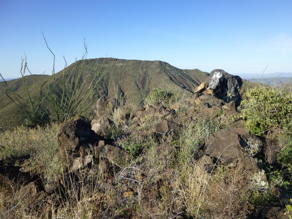
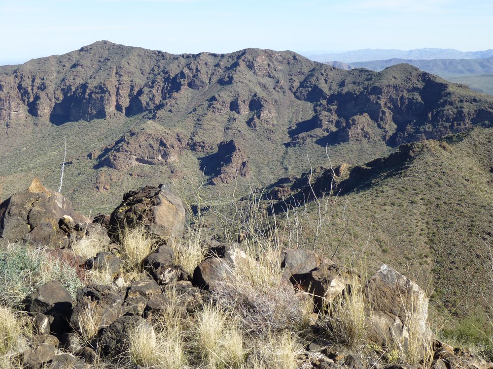
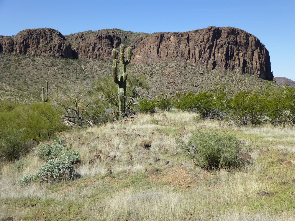
Here’s another classic view from the same spot. We are looking northwest. That’s the shoulder of Sauceda Benchmark filling the lower right portion of the photo. Over to the left, we see the dramatic Coffeepot Mountain. It is the 6th-highest mountain in the range, and is only 3.5 miles away in this telephoto shot. But what’s that out in the distance over on the right horizon? It’s the ubiquitous, flat-topped Hat Mountain, 16 miles away. It’s a fun technical climb.
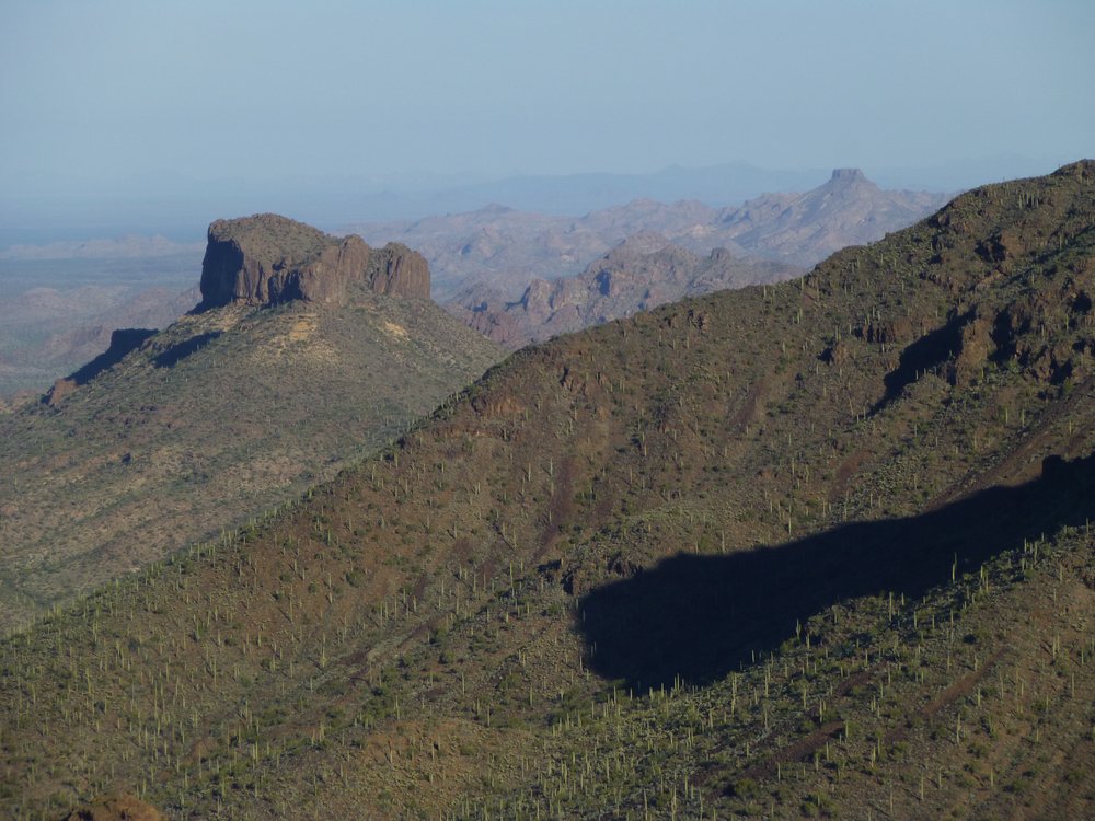
Looking northwest.
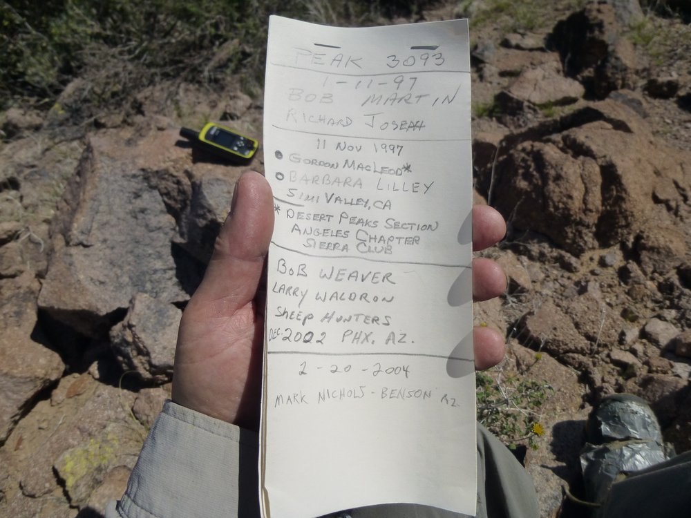
Here’s the climbers’ register I found atop the peak.
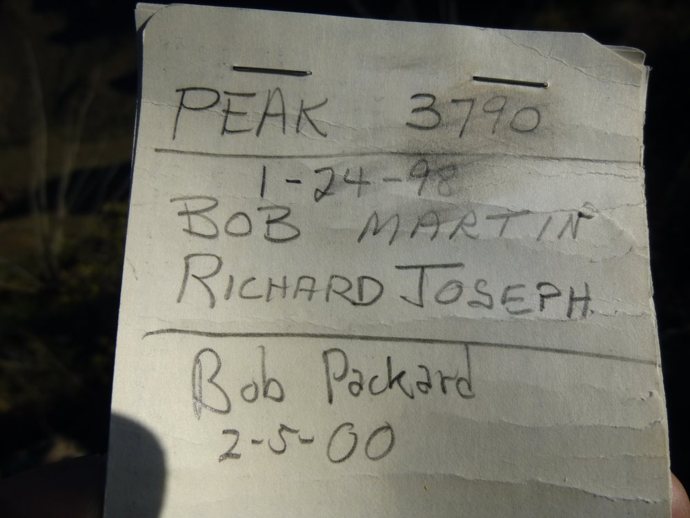
The register.
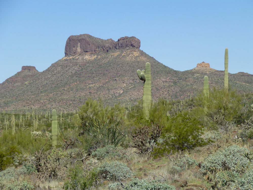
Okay, one more photo from the summit. Here, we see my next peak which is only 0.7 miles away to the southwest. It is Peak 4030 which is the 2nd-highest one in the range.
Peak 4030, which is 240 feet higher than where I’m standing.
Once I signed in to the register, I left Peak 3790 and started down its west ridge. After crossing a couple of intervening bumps, I found myself in a saddle about 400 feet lower by 9:30 AM. Here’s what lay ahead of me, a 550-foot climb up an easy slope.
Uphill we go.
While in the saddle, though, I had this look to a nearby outlier with Coffeepot behind it.
Point 3290 in front of Coffeepot.
By 10:06, I found myself on the summit of Peak 4030, which, as you already know, was the second-highest peak in the Sauceda Mountains – it was my Number Two. Now that I was so high again, I had good looks back to a couple of peaks shown earlier. Here’s Peak 3930 again, the pointed one out there on the horizon just to the right of center. In front of it and left of center is the long summit ridge of Peak 3790, the first one I’d climbed today.
Looking northeast to Peak 3930.
And here’s another perspective on Sauceda Benchmark, the highest in the range, now in full sun. It’s only about 90 feet higher than where I was standing.
Sauceda Benchmark
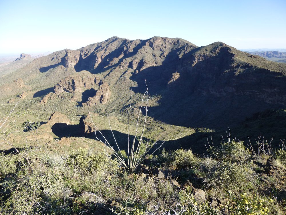
More great views which I want to share, especially looking west across the valley 1,400 vertical feet below, to a different range, the Sikort Chuapo Mountains. The proper name of the range is Sikol Chehpo, which in the O’odham language means “Round Mashing Pit”. Here’s the first one. Look on the left side of the photo – see the very broad, gentle summit just touching the horizon way our there? That is Papago Benchmark, elevation 3,202 feet, which is the high point of the Batamote Mountains. Now look in the clock direction of about 4:30 from there to see a red dot. The dot sits just above the light brown summit of Peak 3310, a low 5th-class climb on rotten rock. It’s one of those climbs which, as you’re doing it solo, you think to yourself “What the hell am I doing here? – I must be crazy.”
Looking west from Pk 4030
Moving the camera over to the left from the above view, here’s what we see. The light -colored one on the right is Peak 3370. Over on the left edge of the photo we see a steeper, blocky-looking one – that’s Peak 3325. And how about that white streak way out there near the horizon? That’s the waste rock from the New Cornelia open-pit mine by the town of Ajo, 16 miles to the west.
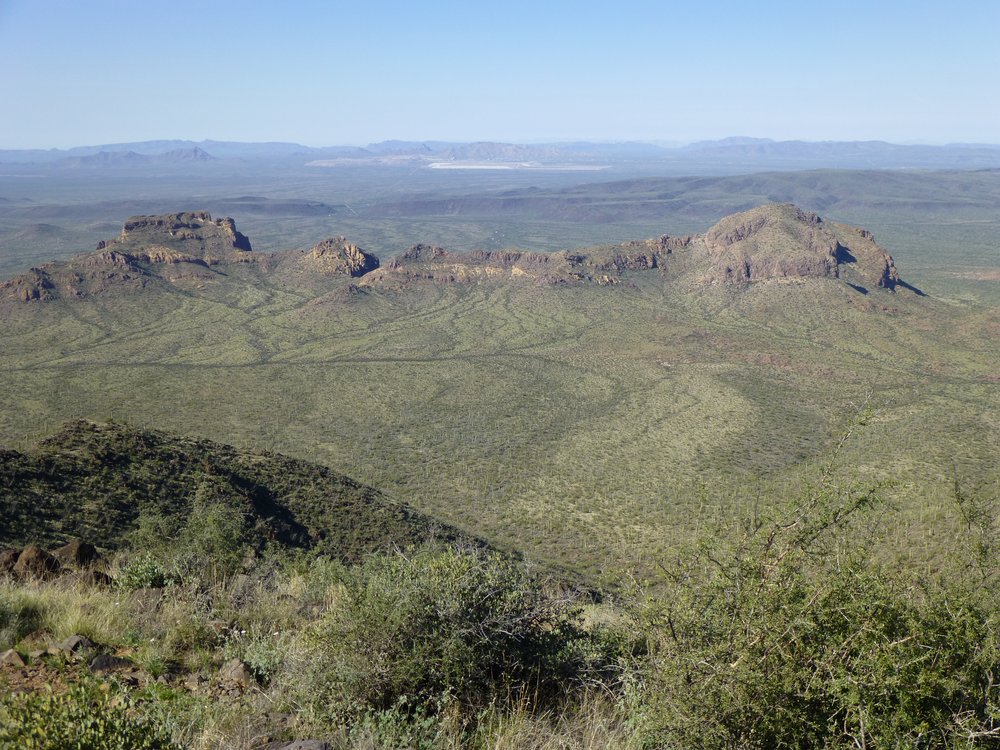
Two more peaks.
Okay, here’s another photo that connects to the left side of the one above.
Looking southwest to Peak 3290
In the above photo, we are looking down the southwest ridge of Peak 4030. Those are still the Sikort Chuapo Mountains out there in the middle distance. See the sharply-pointed one in the upper middle part of the photo? That’s Peak 3290. When I climbed it, it was obvious that the cartographers had left off at least 3 of the topographic contours. A steep bugger, one of those facing-in climbs. The picture in the link shows the easiest side, the one I did.
Anyway, back to where I was, atop Peak 4030. After signing in to the register, I started down the long, meandering, enjoyable northwest ridge. An hour and a half later, I had finished the 1.7 downhill miles, dropping me the 1,400 feet to the valley floor. It was now 11:30 AM, and I was staring at the final peak I wanted to do today. I took a bit of a lunch break, then wandered over to it. There was a decent break in the cliffs on this side.
The east side of Peak 3093.
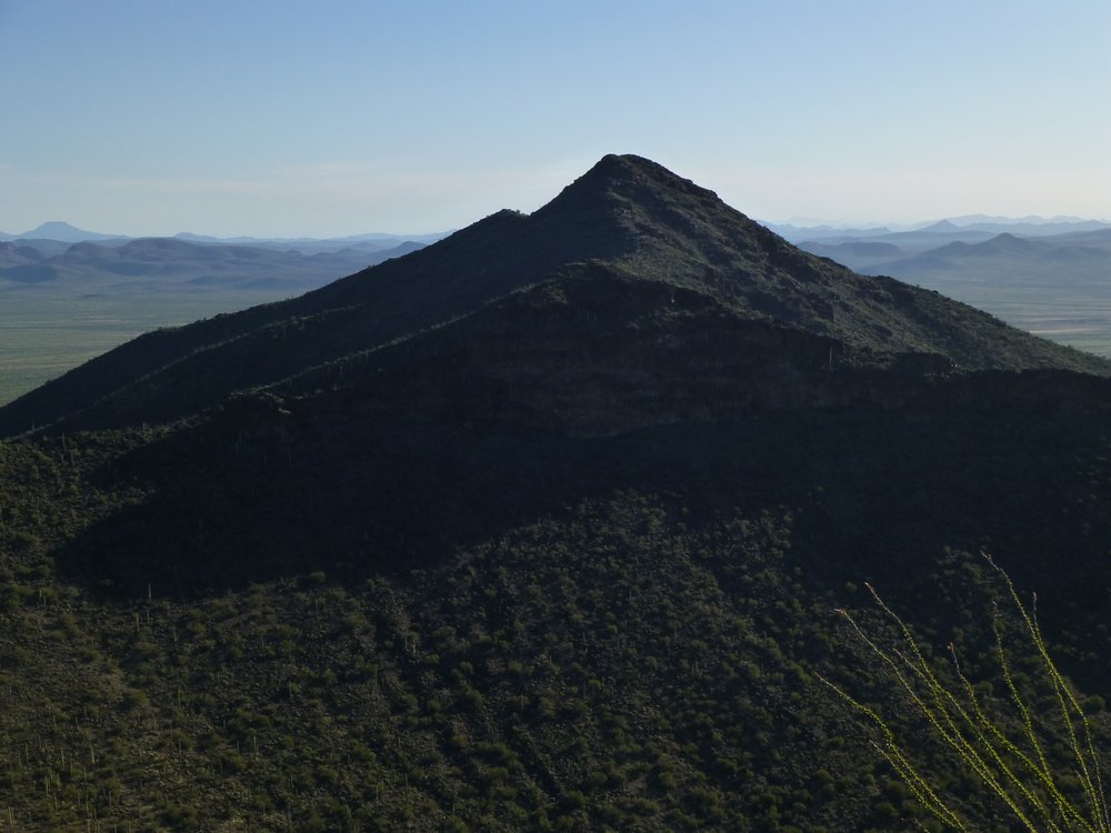
Coffeepot Mountain was closer now, only 2.3 miles away.
Looking north to Coffeepot Mountain.
I sauntered up to the top, enjoying the fine day, arriving just after one in the afternoon. Interesting summit register – it’s not often we see other than climbers signing into these. That black and yellow thing to the left of the register is my emergency rescue device. I’ve never used it for an SOS yet, but I do send a message from the top of each peak to let friends know exactly where I am. The shiny grey thing in the lower right is duct tape holding my boot together.
Look who’s been here.
Here’s a look down from the summit area to the desert floor below, the route I used.
Looking back down.
All I had to do now to finish my day was drop back down to the desert floor and continue north to where I’d parked my truck. I was out about 7 1/2 hours on the day – not a bad return for 3 nice peaks. I had parked near what the Fish and Game people call a guzzler. It’s a water catchment, and that’s what it does – collects and stores rainwater for wildlife to drink. People can use the water too. The water was inside this fenced area, easily accessed by man and beast alike.
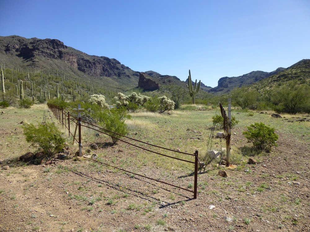
Game water.
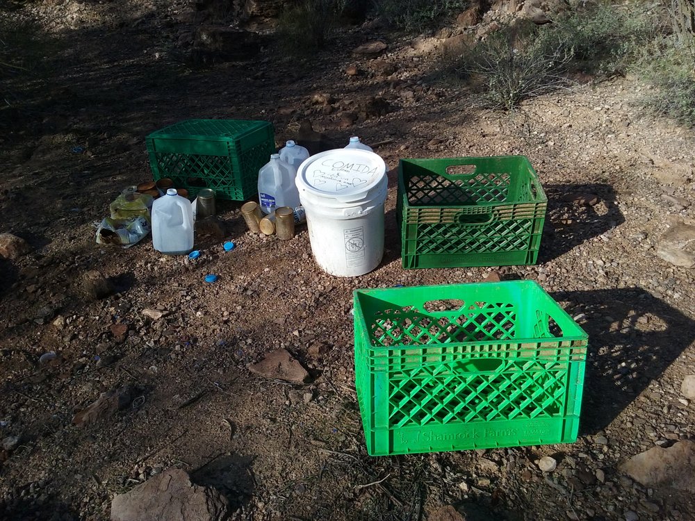
Near to where I was parked, something white caught my eye. I knew right away what it was. There’s a group that loosely calls themselves “Samaritans”, whose sworn mission it is to leave food, water and clothing along paths traveled by undocumented border-crossers in the desert. I’ve come across their places many times, and it annoys the hell out of me every time I do, for several reasons.
First of all, the stuff they leave out there is littering. Every jurisdiction they’re in, whether it’s BLM land, a national monument, a national park or a military reservation has laws against this. Sure, passers-by take and use the stuff, but they in turn leave a trail of garbage that stretches out for miles from these spots. They are directly contributing to littering what would otherwise be pristine desert, which is heartbreaking to see. In addition, by leaving these items, they are creating an incentive to encourage even more illegal activity. It’s not just border-crossers who take and use this stuff, it’s also criminals working for the drug cartels, so they’re aiding and abetting this type of activity. It helps lure even more people to use these paths, as word gets around, and in turn increases the number of people out there who can potentially die from harsh desert conditions. The presence of these people out there makes it more dangerous for those who just want to enjoy the desert, as some of them are armed, desperate and dangerous.
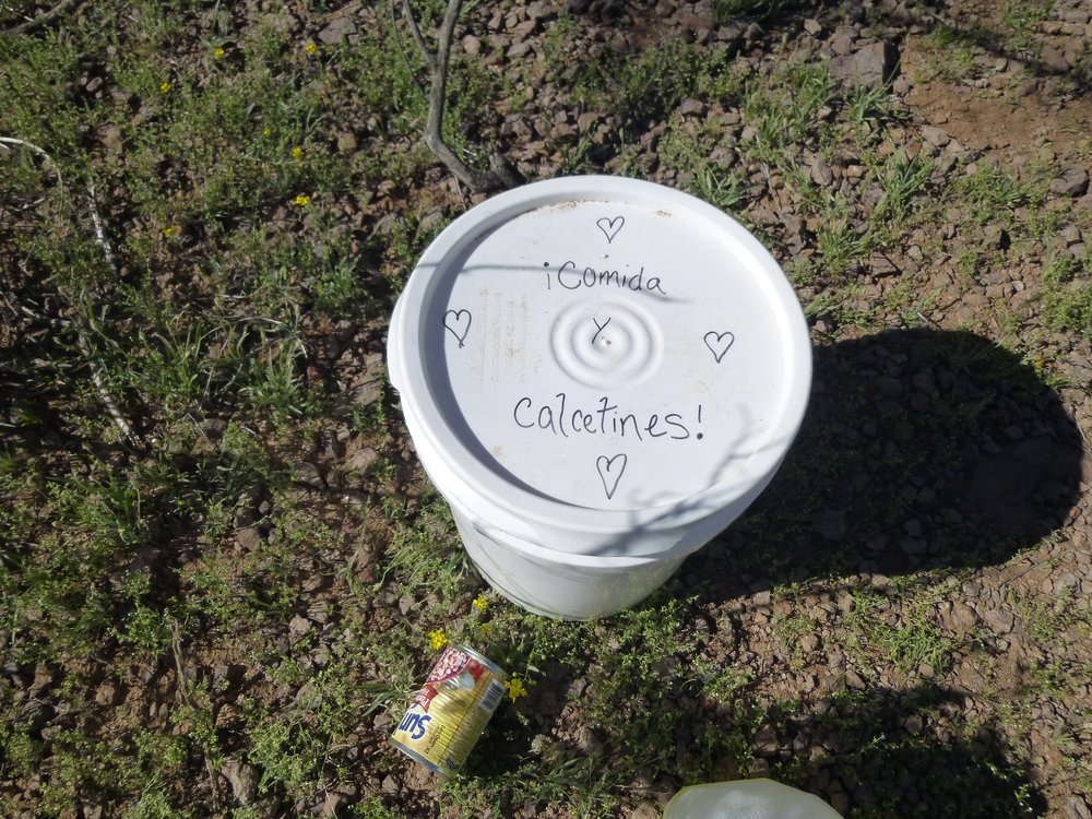
Let me show you some pictures to illustrate my point. This is pretty typical.
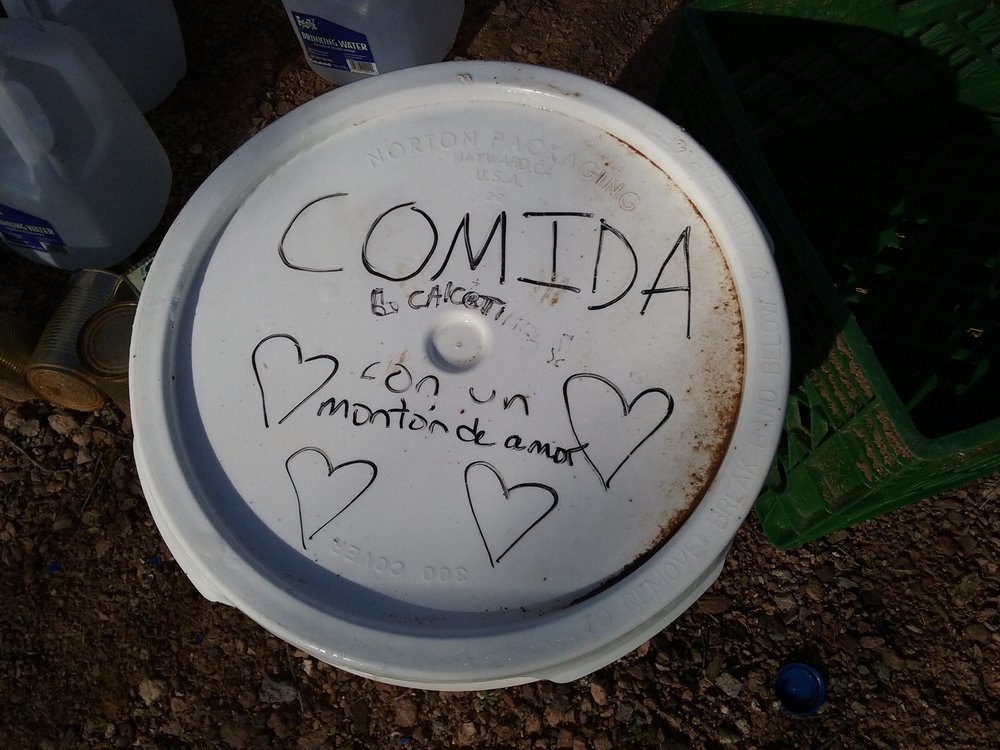
The writing says “Food and socks. With lots of love.”
This one says “Food and socks”
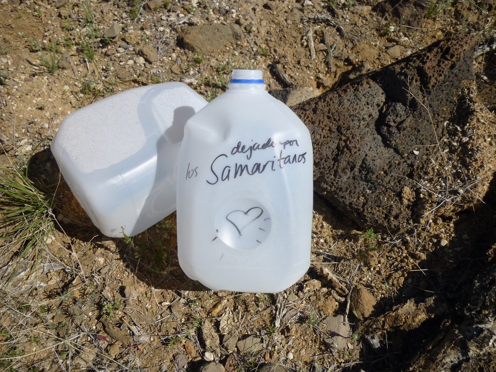
The writing says “Left by The Samaritans”
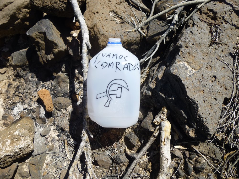
Comrades, with a hammer and sickle – are you kidding me?
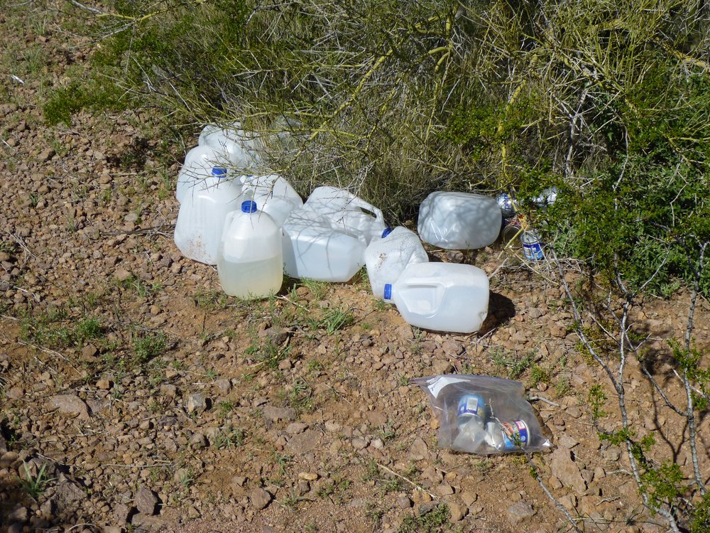
Once the indocumentados pick this stuff up, here’s what happens.
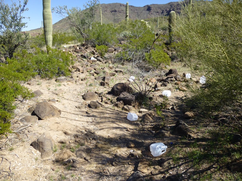
Litter
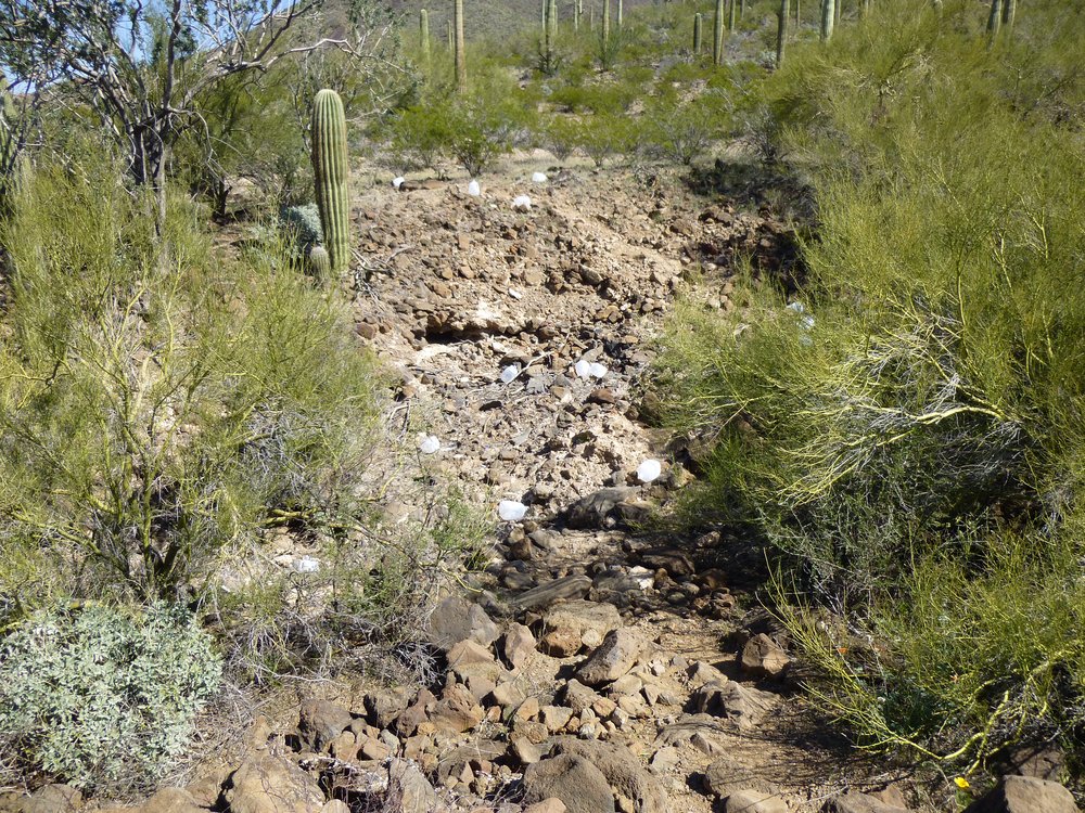
Litter
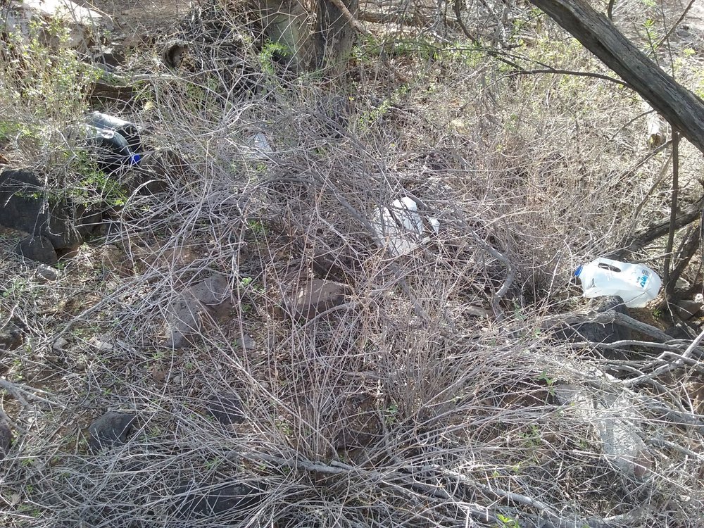
More litter
In a short while, the desert sun and the heat turn these plastic jugs very brittle, like eggshells. They crumble at the slightest touch, but they never break down and go away.
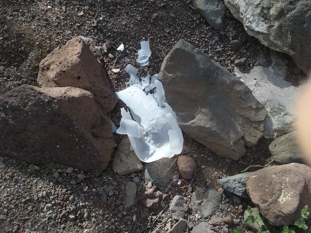
Litter
Now don’t get me wrong, I don’t want to see anyone die in the desert. I’ve rescued several people myself over the years. But there are better ways to do this. The government has authorized the placement of large blue barrels of water in strategic locations to help border-crossers who are in dire straits. These barrels are marked by white flags atop tall poles so they can be seen from a distance. But under no circumstances is it allowed for anyone to leave trash as shown above. One time I came across some of these Samaritans leaving a mess out in the desert near Hat Mountain.
Guilty!
I called the details in to the US Air Force range police and they revoked the permits of those who were doing this. Not only that, they were livid that this was going on, telling me that they were trying to catch the perpetrators who were leaving this trash everywhere. I’ve been told the same thing by officials of Organ Pipe National Monument and the Bureau of Land Management.
Sorry, I wish I didn’t have to sully this piece with something as annoying as this Samaritan business, but it really chaps my hide!