
A long time ago, in a country far, far away, I met up with some friends to climb a mountain. It was called Icy Peak (I love the name!) and a more beautiful setting you’d be hard-pressed to find. It was 10 miles south of the Canadian border and located in North Cascades National Park in Washington state. Climber friend Ross Lillie had organized the trip with 12 of his buddies from his cross-country ski club. Also in attendance was Brian Rundle, another of our climbing partners. Brian and I had known each other about a year, and had done some significant climbing together in that time, most notably an expedition into the remote Lillooet Range. Back in 1978 when we went in to climb Icy, you could drive in farther than you can now. Ross’s memory is better than mine, and he recalls that we could drive around as far as where Price Creek meets the North Fork of the Nooksack River. Nowadays, not so far as that, because the road ends at Ruth Creek on the north side of the river.
From the trailhead, we walked 4 miles to reach the spot where we’d camp. Talk about a unique site, it was a huge boulder that even had its own name – The Great Trog. I don’t think I’ve ever seen a bigger piece of rock. Many of the folks camped beneath its overhanging edge. The only mention I find of the Trog on the internet is from the year 2010 – I’m sure it’s still there, as there’s no power on earth that could ever move it. Brian and I had barely arrived when the two of us lit out and headed for the summit. The weather was warm and sunny and we made it to the top in good time. The route we followed was up the river to its source in Nooksack Cirque, then up snow slopes on the south side to the summit of Icy Peak at 7,073 feet. What a spot, the views were terrific! I have some photos to show you a bit later, but here’s a description from the website SummitPost that describes things well.
Icy Peak is a great peak to climb for several reasons. First, it probably has the best view of the North side of Shuksan possible. Also close-ups of the Price Glacier, North Face, Jagged Ridge, Cloud Cap Peak and Blum.
It is amazing to be there, staring up at a perspective of Shuksan you can’t see anywhere else. You also get the “remote” feel for the North Cascades since there is little to no traffic at this point. A wild, lonesome cirque, a wasteland of glacial violence, one of the most dramatic spots in the North Cascades. Icefalls, waterfalls, moraines, a raging river, the stark pinnacle of Nooksack Tower, and the 5,000-foot northeast wall of Mt Shuksan.
We all camped together that night of June 2nd, 1978 under The Great Trog. Very early the next morning, preparations were made for an ascent to the summit. Ross and Ken were ready to go. Nobody in the ski club wanted to make the climb, so they all slept in. For some reason I no longer recall, I decided that I wanted to climb the peak a second time. We all left camp at 5:00 AM, but I didn’t take the same route as Ken and Ross. Instead, I ended up climbing up slabs on the north side of the peak and met them on the summit. It took 4 3/4 hours to climb the 3,500 vertical feet from camp, and it was about 3 miles from camp to the summit. Ross recalls that there was slushy snow on the climb. We spent an hour on top, then descended together. It took an hour and a half to get back to camp, arriving there at 12:20 PM. Nobody stayed there another night, instead all heading home in the afternoon. Ross and I had only climbed a few peaks together before this one, but one of them was the first ascent of an ultra-prominence mountain called Robertson Peak, located about 60 miles to the north in Canada.
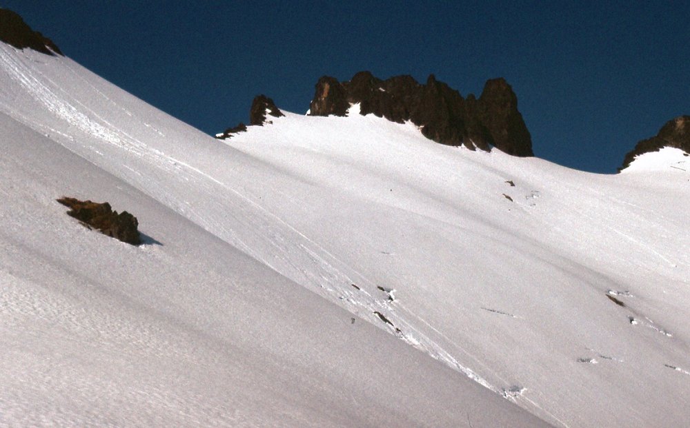
I took some pictures on that second ascent which I’d like to share with you here. This first one is from down low, looking up towards the summit.
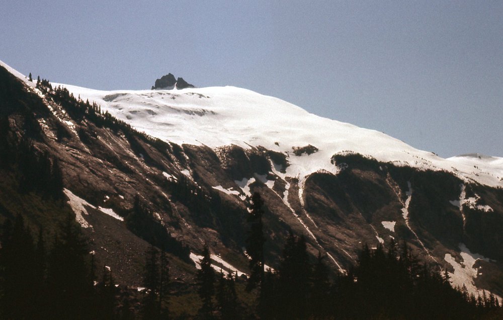
The west side of Icy Peak
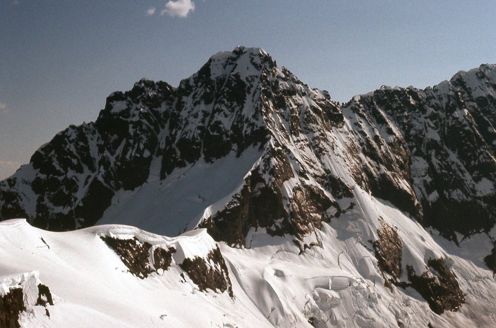
This next one shows Seapho Peak which was also known as “Cloudcap Peak”. This photo was taken down low in Nooksack Cirque.
Seapho Peak in the center, with the aptly-named Jagged Ridge to the right of it.
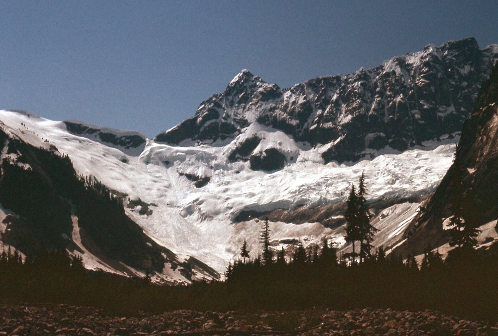
Another shot that was taken lower down is this one. Here, we see the 5,000-foot north face of Mount Shuksan. Its summit is the pointed peak in the center up on the skyline. The dark rocky prow in the upper right is known as Nooksack Tower.
Looking up to Mount Shuksan
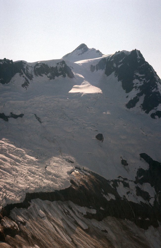
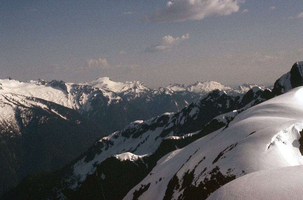
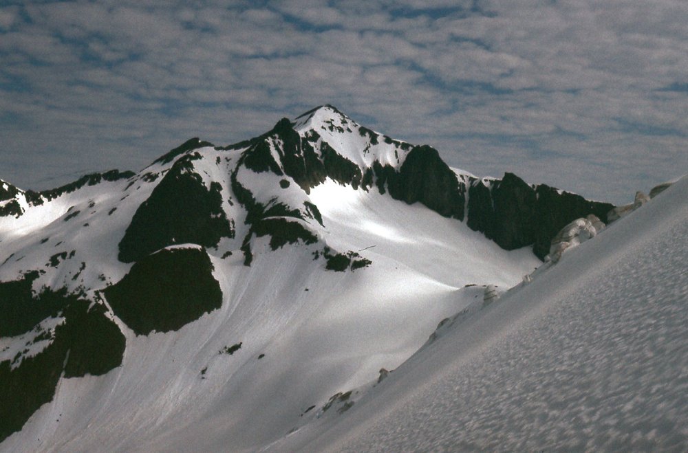
From higher up on the mountain, these expansive views started to open up. Here is a much better view of the north side of Seapho Peak. It stands almost 400 feet higher than Icy Peak.
Seapho Peak (“Cloudcap”)
Here’s a view of the highest parts of Icy Peak.
Icy Peak seen from the south side.
Then there were these longer views. Ross Lillie, who organized this trip, is a master at identifying details in mountain panoramas. He has an encyclopedic knowledge of peaks and can really dissect the details in a picture. Many’s the time I’ve asked him to look at a photo and help me figure out what exactly it is that we are seeing. He always comes through in grand style, picking out the tiniest details where I’m stumped. I’m going to share with you here 3 photos I took from high on Icy, as well as 2 of Ross’s photos. Each of these will be accompanied with Ross’s descriptions of what is in the photo, and you’ll be impressed with the detail. I know it may seem like overkill if you’re not a mountaineer, but hey, it’s what we do!
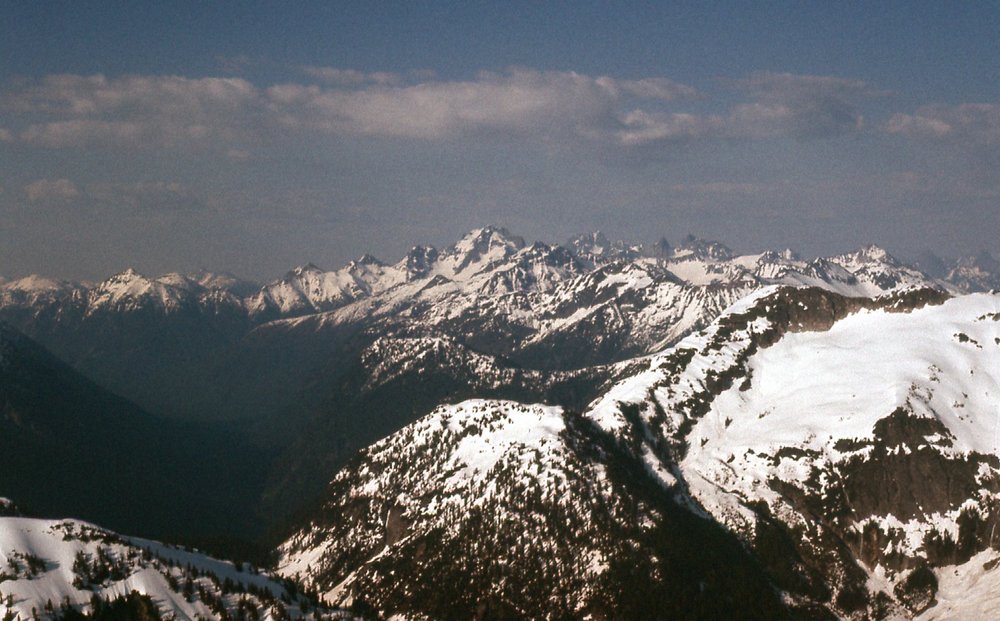
Here’s one to the south. The big white peak to the left of center is Bacon Peak, elevation 7,061 feet. Farther away and to the right of center, the white peak is Mt. Watson, elevation 6,220 feet.
Looking south.
Here’s another, this time looking northeast to the Mount Redoubt area near the Canadian border. If you zoom in on this next photo, you’ll see these details as Ross describes them:
Towards Mount Redoubt
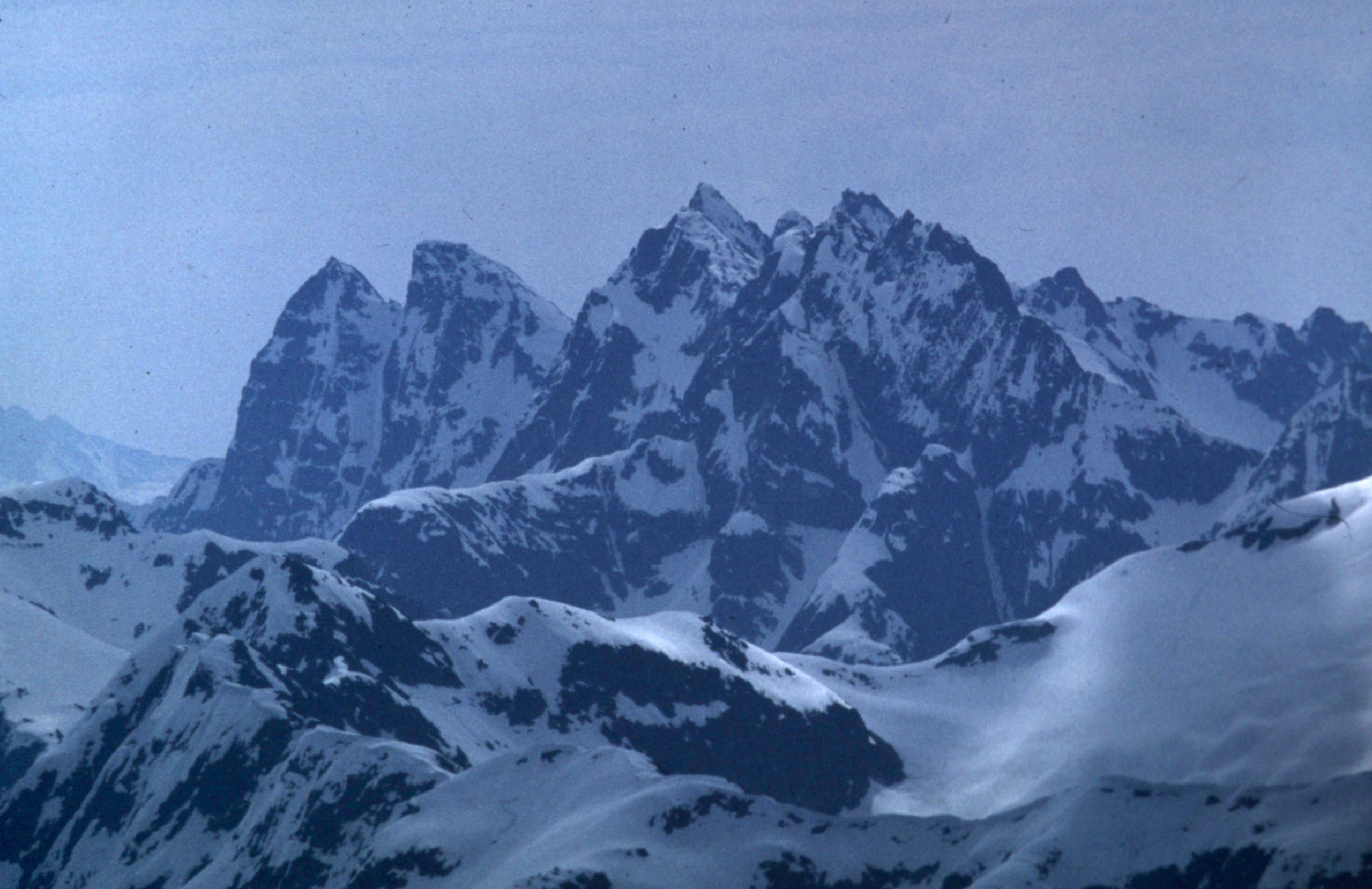
This next photo is one Ross took from Icy – I love this one. Here, we are looking north to a group of peaks all in Canada. The tall one on the left edge is Slesse Mountain. Then, moving to the right, we see these peaks on the horizon from left to right: Knight Peak (flat, white); Baby Munday Peak (dark, pointed, center of photo); Stewart Peak; The Still; Welch Peak (far right edge, very tall).
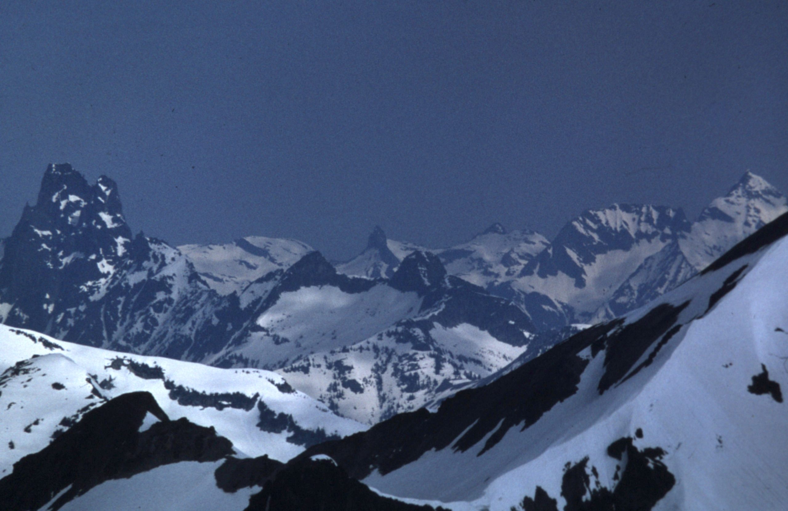
Looking north into Canada to the Cheam Range
My notes say that this next one is looking a bit south of east. Ross describes what we are seeing as follows:
Looking east-northeast.
Here is a telephoto Ross took which shows in much greater detail the group of peaks seen on the right side of my photo above. Here is a description of what you are seeing, moving from left to right. On the left and a bit lower down are East McMillan Spire, then West McMillan Spire; Mt. Terror is right in the center and is the highest one; Mt. Degenhart is the tiny bump lower down to the right of Terror and in behind; then we have Ottohorn which looks higher and to the right of Degenhart, but is actually closer than Terror.
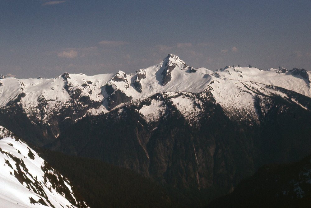
Not even 2 miles to the north sat Ruth Mountain, only 42 feet higher than Icy Peak. Another beauty, isn’t it?
Ruth Mountain
To the south, I could see Mount Blum. It was only 6 miles away, but stands a full 600 feet higher than Icy Peak.
Mount Blum, elevation 7,680 feet.
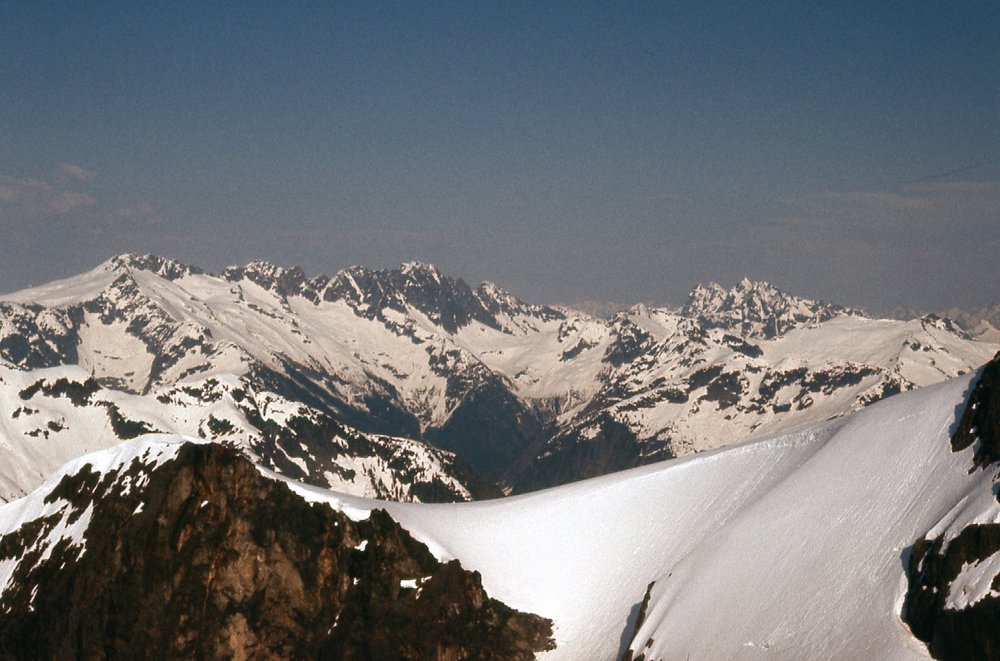
Folks, I’ve saved my favorite one for last. Get a load of this. It’s the East Nooksack glacier filling almost the entire field of view. Jagged Ridge fills the left skyline. In the upper right we see the summit pyramid of Mt. Shuksan touching the sky, with Nooksack Tower, almost 900 feet lower, at about 4 o’clock from it. Mt. Shuksan sits over 2,000 vertical feet above us in this view – Brian Rundle and I had climbed it by the Hourglass route 6 months earlier.
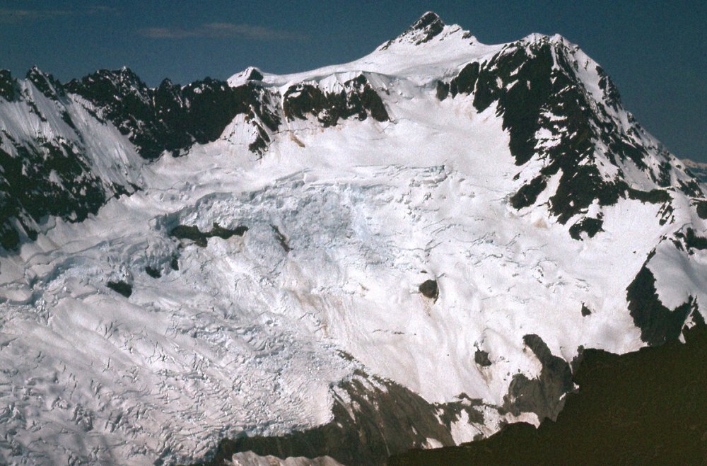
The East Nooksack Glacier
I hope you enjoyed the pictures. Now there’s something else I want to tell you about the geography of this area. I’ve already mentioned that to climb Icy Peak, we had camped along the North Fork of the Nooksack River. This fork of the river has its beginnings in the snowfields on the south slope of Icy Peak, as well as the East Nooksack Glacier. The river runs west and enters the Pacific Ocean near Bellingham, but it’s what it does along the way that I want to discuss with you.
As it heads west, after 19 miles it goes over Nooksack Falls, a drop of 88 feet. Nine miles later, it passes the village of Glacier, well-known to those who climb Mount Baker by the Coleman Glacier route on the mountain’s north side. Eight miles later it passes the hamlet of Maple Falls. In seven more miles, something important happens – the Middle Fork of the Nooksack River joins the North, and only 3 miles after that the South Fork adds its flow. The Nooksack is now complete, all 3 of its major tributaries have come together. One mile beyond that, we pass the village of Deming. Carrying on another 12 miles takes us to the town of Everson – we are now about 60 miles from Icy Peak, and I want to pause here. The river has become quite substantial, often as much as 200 feet wide.
Everson sits at an elevation of only 85 feet above sea level, and it protects itself from the waters of the Nooksack by a series of dikes. Those dikes normally do a good job, keeping the river in its bed and moving it safely past the town and on to the ocean. I say normally, but in November of 2021 something very unusual happened. A weather event called an atmospheric river hit northwestern Washington and southwestern British Columbia, and what an event it was. An unprecedented amount of rain fell in a short period of time, and the Nooksack River burst the dikes at the town of Everson. We all know that water flows downhill, and in this case the direction it took was north instead of the usual west. It flooded Everson, then continued north to the town of Sumas right at the border. Sumas is only 43 feet above sea level, and while humans need to pay attention to international boundaries, water does not. Water from the Nooksack flooded Sumas, shutting down an important border crossing between the two countries. It then continued north and flooded many square miles of prime farmland between the cities of Abbotsford and Chilliwack. Here’s what that looked like. So remember, this vast lake you see below is all water from the Nooksack River spilling its banks and flowing north from the USA into Canada – normally it is all dry farmland.

This flooding occurred so quickly that people living there had little warning. Although there was no loss of human life in this area, it was a different story when it came to livestock. The final tally of farm animals that drowned in the flood was as follows: 628,000 poultry; 420 cows; 12,000 hogs; 110 beehives.
So there you have it, Icy Peak and the Nooksack River that drains it. I hope you enjoyed the pictures, and thanks for coming along for the ride.