
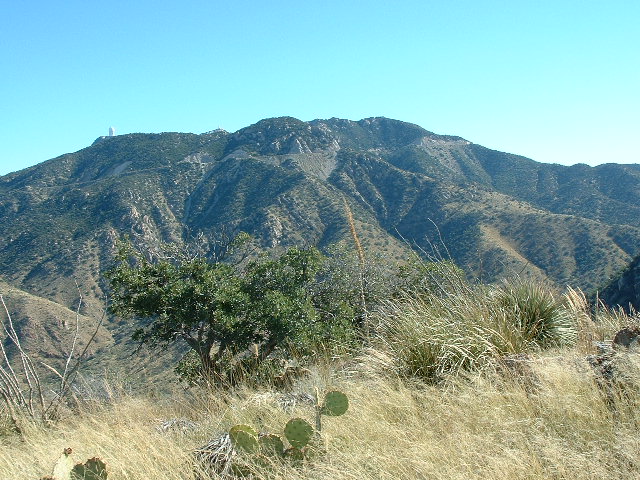
Those of you who don’t live in southern Arizona may never have heard of Kitt Peak, so allow me to tell you a bit about it. Yes, it’s the name of a mountain, elevation 6,880 feet and the highest point of the Quinlan Mountains, but it’s more than that. An observatory sits on the highest areas of the peak, a collection of almost two dozen optical telescopes and 2 radio telescopes. Together, they comprise the largest, most diverse collection of research telescopes in any one place in the world. Founded in 1964, the place is still a going concern today. The Mayall 4-meter telescope, dedicated in 1973, was the second-largest optical scope in the world at the time. In this photo, it is the large structure on the upper right side, and the building stands 18 stories tall.
Here in the desert, by the time late October arrives, our hot summer days are a thing of the past, and we’re getting into our prime climbing weather. It was at just such a time, about 20 years before I’m writing this, that I hit upon what I thought was a clever idea. I would drive up the paved road that leads to the observatory, but not all the way to the top. Instead, I would park at one of the pull-outs at the side of the road, and then travel downhill on foot, overland, and tag some summits along the way, finishing way down on the desert floor below.
The highest part of the mountain is actually a long ridge – the part of it that sits above the 6,000-foot level is just over 3 miles long. There’s plenty of room to accommodate all of those telescopes and all of the other facilities needed to keep the place running. I decided that the perfect starting point would be where the road makes a large bend at the 5,650-foot level, a place where there was plenty of room to pull over and park out of the traffic. It’s important to mention that Kitt Peak lies within the Tohono O’odham Indian Reservation, and the mountaintop is leased from the T.O. Nation on a long-term basis.
There was just one fly in the ointment, though, and it was a fairly big one. If I walked away from my parked vehicle and carried on downhill with my grand scheme, the place where I’d finish would be at a remote dirt road out in the middle of nowhere. How would I get back up to my parked truck? I knew that by studying the maps, there’d be a lot of ground to cover to get back. I wasn’t interested in climbing back uphill the way I’d have come down, so I’d have to follow roads. That would be 5.3 miles of dirt road, then 8.4 miles along the highway, then exactly ten miles up the paved Kitt Peak road to where I was parked – a total of 23.7 miles. What if I could talk a friend into doing this with me, and we’d park a vehicle at each end? That would work, but I didn’t know anyone who was willing. Another option would be to have a friend ride with me to the starting point – I’d then bag the peaks alone, and they would drive my truck back down and around, then park at the point where I’d finish and they’d be there waiting for me. Bingo! That seemed more do-able. My friend Mike, who also lived in Tucson, agreed to be the driver, so it now seemed like we could make this happen.
The big day arrived – it was October 29th. We left town pretty early and drove the 62 miles of paved roads to arrive at the roadside where I’d begin. We figured the descent would take me many hours, yet Mike could drive down and around to the pickup spot in only an hour or so. He decided that instead of waiting there for me all that time with nothing to do, he’d accompany me on foot for the first part of my journey. Perfect! By the time we shouldered our day packs and walked away from the truck, it was still pretty early, only 7:10 AM.
It was a perfect blue-sky day, with only a slight breeze and a pleasant, cool temperature. I was carrying with me a good map, as well as a compass and a GPS. Since I’d be traveling downhill, I had the advantage of being able to see the lay of the land stretched out below me, so it was pretty easy to see where I needed to head at all times. My route would change direction constantly, as I’d be following ridgetops, but again, I could see ahead quite well and stay on track.
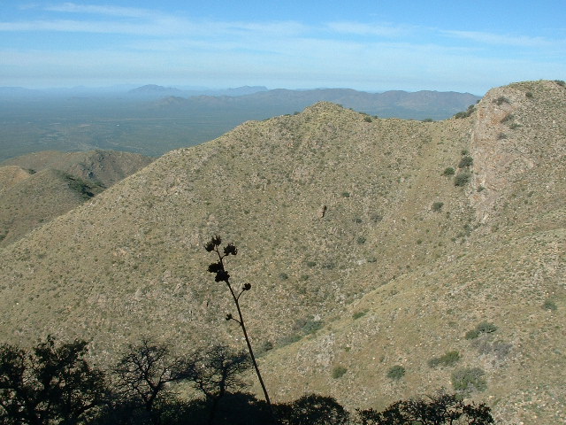
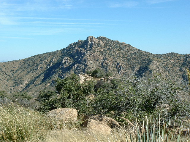
We started from the truck and immediately dropped downhill. The slope wasn’t too steep, and we were pleased that it wasn’t too brushy. Sometimes that elevation in Arizona can be filled with manzanita, a bushwhacking nightmare, but not today, not here. We weren’t in any hurry, and it was nice to have Mike’s company, so we took our sweet time. The thing about following ridges is that you have to take whatever they throw at you – brush, cliffs, weather, snakes and any and all ups and downs along the way. We reached a saddle, then began a 600-foot climb up to our first peak. It was 8:40 by the time we stood atop Peak 5472. Here’s Mike on the summit. From the saddle we had crossed below, we had transitioned from the Quinlan Mountains to the Baboquivari Mountains, where I would spend the rest of my day.
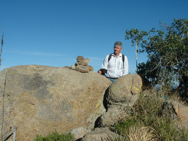
Mike and the cairn we built on top of Peak 5472.
We had a good view down to Baboquivari Peak, the tall one in the center skyline of the next photo. It is 12 miles away.
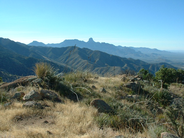
Looking south to Baboquivari Peak
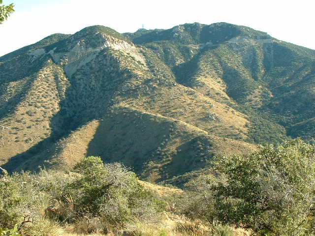
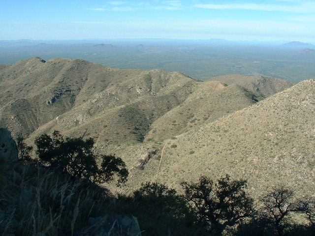
There was also a good view to the northeast, back up to our starting point along the highway. In the next photo, if you look at the skyline, right in the center you can see the tall Mayall telescope, a faint whitish blur. Just below and to the left of it, you can see the road. There is a huge cut where they had to blast away rock to create a path for the road, and it shows as a whitish gash in the sunshine – at the foot of that is where we parked. Our path then followed the ridge downhill towards us, zigzagging but staying on the sunny part. Lower down, our path is not visible, but from down there in a saddle we climbed up 600 feet to where I am taking the photo.
Looking east.
The plan was for Mike to leave me here and to retrace his steps back up to the truck, then to drive down the mountain and around to eventually park down on the desert floor where I would find him. We both figured that we had plenty of time to do what we each had to do – little did we know that something would happen later to mess up those plans.
We said our goodbyes and I headed downslope to the northwest while Mike did likewise, but to the northeast. Within moments we had lost sight of each other, each of us alone on the mountain. Once again, I had good going and before long had dropped several hundred feet. I reached a saddle, then climbed up to a significant bump shown as Point 5212 on my map. Up and over that, then downslope again. After dropping a couple of hundred feet, I stopped briefly at around 5,000 feet elevation and took a few pictures. This next one shows the mountain I was planning to climb next.
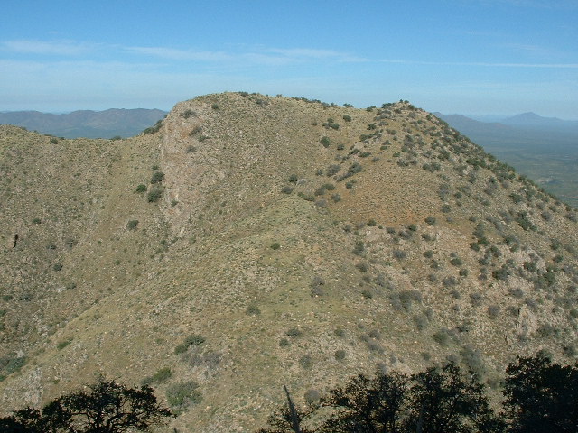
A nice full-on view of Peak 5081, its southeast slope.
From the next saddle below, I then climbed up a few hundred feet, up the slope you see in the above photo, and found myself on top of Peak 5081. It was ten o’clock in the morning. I found no sign of any previous visit by anyone, so I built a small cairn and left a glass jar register inside it. Oh, wait, one more thing – from the same spot where I took the previous photo, I took a couple of others, thinking that they might benefit me later. This next one connects to the left side of the previous one above, and shows the southwest ridge of Peak 5081 as it drops down from the summit.
This shows the southwest ridge
I took one more from that same spot – this shows some of the mountainous terrain to the southwest of Peak 5081. This photo connects to the left side of the photo above.
The rumpled country
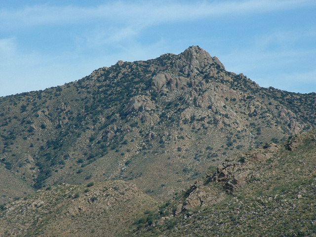
Once I reached the top of Peak 5081, a major milestone in my day, I had good views, which I’d like to share with you here. This first one has us looking back east, all the way back up to Kitt Peak. This time, the Mayall Telescope can be see on the far left, right beside the highest point of Kitt Peak.
Looking east, way back up to my starting point on Kitt Peak.
In this next one, we are looking southeast, back up to Peak 5472, the last peak I had been on, where I said goodbye to Mike.
Back to Peak 5472
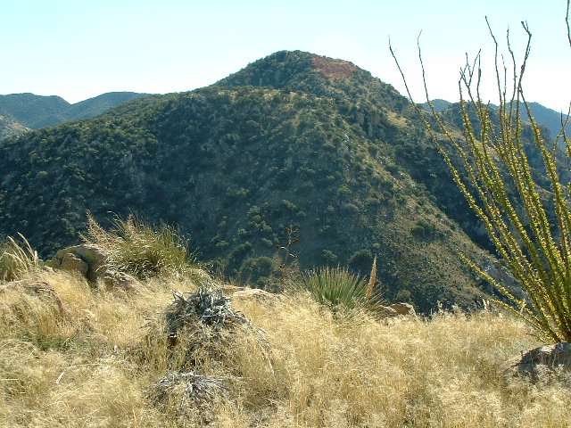
Although it wasn’t part of today’s climbing, here is a view I had to the northeast to Peak 5432.
Peak 5432, its southern aspect. It is about 1 1/2 miles away.
This next photo shows where I would have to go to continue. Here, we are looking from the top of Peak 5081 down along its southwest ridge. I would need to drop about 400 feet down this ridge, in the process crossing over 4 distinct bumps along the way. While descending the ridge, I would be looking down into San Juan Canyon on my left.
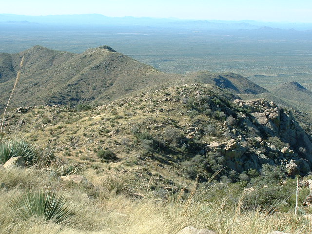
Down this ridge was the next part of the journey.
As you can see from the above photo, it was pretty wide-open country. Grassy weeds and shin-daggers, but nothing too bad. By the time I had dropped down to and stood atop that 4th bump, I was down to around 4,450 feet elevation.
Oh, one more thing – from the top of Peak 5081, I had my first look at my next peak, what would be my third of the day. That’s it, the one way out there in the middle of the photo, far below and far away.
Looking west to Peak 4282 from the top of Peak 5081,
Okay, where were we? Oh yes, I had reached that 4th bump. What I had to do next was to leave the ridge I’d been following southwest from Peak 5081 and make a major change of direction. Now I’d head northwest, down and down, losing the better part of another thousand feet, until I stood in another saddle. From there, it was a gentle climb continuing northwest until I stood on top of Peak 4282. It was almost noon by the time I reached the summit, which appeared unvisited and untouched by any previous climbers. I left my usual summit register, then had a good look around. I could still see Peak 5432 to the northeast, but now it was 2 1/2 miles away and stood over 1,200 feet above me.
The southwest side of Peak 5432
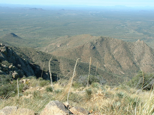
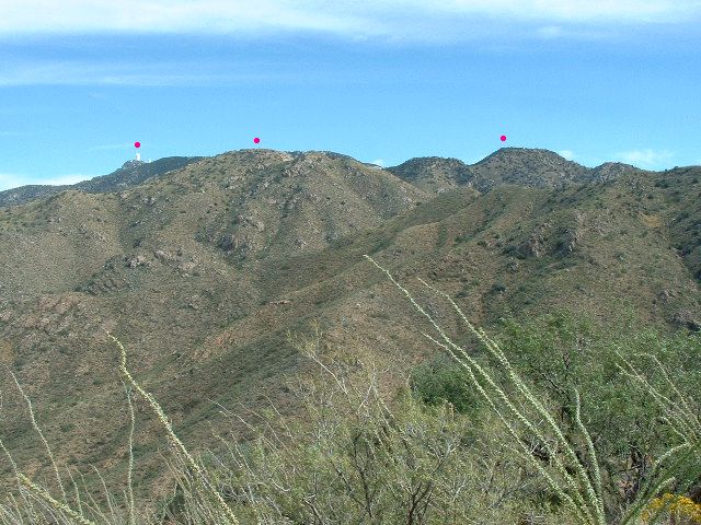
The best view, though, was this one looking back to where I’d been up until now. You can see both of the earlier peaks in this picture, and to make it easier I’ve put red dots over them. Allow me to explain. The dot over on the left marks the Mayall telescope, which is 4 1/4 air miles away. The dot farthest to the right is Peak 5472, the first one climbed today. The dot in the middle is Peak 5081, the second one climbed today.
The journey thus far.
So now it was noon, and I took stock of what remained to be done. The third of the 3 peaks on today’s agenda was climbed, and as I stood on its summit, I could see much of the path I still had to travel ahead of me. To reach the road where I hoped to find Mike waiting, I still had to descend about 1,200 vertical feet, and to do that I’d travel southwest. Away I went, heading down a ridge, reaching a saddle, then up and over a bump to arrive at a bigger bump, shown on the map at Point 3648. From there, I had a clear view down to the road in the distance, and I could see the truck! Continuing down, I crossed one final bump, then dropped the last couple of hundred feet to the road.
I was relieved to see Mike, parked right where we’d agreed beforehand. For some reason, he didn’t look too pleased. I soon understood why. He said that when he had left me and eventually climbed back up to the truck parked at the side of the paved road, he went to leave but the truck wouldn’t start. Now Mike is one helluva good mechanic, and he soon diagnosed the problem – the battery terminals were so corroded that they weren’t making good contact. He also discovered that the tool kit I carried in the truck was pathetically inadequate. It took him a long time to work with what little he had at his disposal to clean up the terminals and connections so that juice was flowing again and could start the truck.
He said that he hadn’t been waiting very long, actually. He also said that “every time I go out climbing with you, there’s some mechanical problem with your damn truck.” Well, that was true, but we had only gone out once before and at that time there had been a problem with the clutch – nevertheless, we had limped home okay that time and hadn’t been stranded. All’s well that ends well, though, and we drove back to Tucson without incident.
So here’s what my day had involved. I had traveled 7.4 miles and it had taken me 6 hours and 25 minutes for the whole thing. Three peaks were climbed (and it appears that none of them have been repeated in the 20 years since I was there). Counting all of the ups and downs along the way, I had climbed 2,375 feet uphill and 4,000 feet downhill. It was an interesting experience to have a downhill sort of day to climb peaks, very different from the norm, and I really enjoyed it. It’s not often you’d be able to cobble together such a trip, but try it if you can.