Horace Grosvenor was a member of the Masonic Order, and his internment is recognized as one of the first Masonic burials in Arizona. Despite the imminent threat of further Apache attacks, Raphael Pumpelly and other survivors performed a makeshift Masonic service. Because no formal lodge existed in the territory yet (the Grand Lodge of Arizona wasn’t formed until 1882), the service was a rare act of “civilized” ritual in a region descending into chaos. He was buried near the Santa Rita Hacienda. For decades, the site was lost to the elements, but it remains a point of interest for Masonic historians tracing the fraternity’s pioneer roots in the Southwest.
The Santa Rita Mining Company used a blend of German engineering and traditional Mexican smelting known as the Patio Process and the Adobe Furnace.
Extraction: Miners used hand drills and black powder to blast silver-lead ore from the mountainside. The ore was then hauled to the surface in leather bags called tenates.
The “German” Cupellation: Under Grosvenor and Pumpelly, the company utilized cupellation, a process where ore is heated to high temperatures in a furnace; the lead oxidizes and is absorbed, leaving behind a “button” of nearly pure silver.
The Mexican Blast Furnace: They built Adobe Furnaces (called hornos) fueled by local mesquite charcoal. These were efficient but required constant manual labor from Mexican buscones (prospectors).
Currency: Due to the lack of minted coins, the company often paid workers in boletas—printed slips of paper redeemable for goods at the company store, a common practice in isolated Arizona mining camps.
While the hills themselves are natural features, the specific locations tied to Grosvenor’s life are in various states of preservation: Santa Rita Mining Site – the original site of the Hacienda de Santa Rita is located on private or restricted land in the Santa Rita Mountains. Very few physical remnants of the 1860s adobe structures remain visible today. The exact location of the first Masonic Burial site is considered a “lost” historical location, though it is generally cited as being near the foot of the Santa Rita Mountains east of Tubac.
Okay, I’ll move on to our actual climb, the reason we went there in the first place, although I’m glad I was able to gather all of the preceding historical details for you.
In southern Arizona, along Arizona Highway 82, about half-way between Nogales and Patagonia, we found the start of Salero Road. After a couple of miles, the name changes to Forest Service Road 143. It was only 8 miles along the excellent dirt road that we drove to reach our trailhead, but en route we passed near the old Salero Mine.
This is one of the oldest mines of the district. Discovered by the pioneer Jesuits and worked about 1828 to 1830 by the Tumacacori missionaries, and later by Mexicans, it was worked by early Americans prior to 1900, and only on a small scale since then. Total production would be some 500 tons of ore averaging about 12% Pb, 24 oz. Ag/T, less than 1% Cu and zinc, and minor gold.
The map shows that all of the area around our climb is a part of what is called Luis Maria Baca Float No. 3. I went online and learned this:
The Treaty of Guadalupe Hidalgo of 1848 and the Gadsden Purchase of 1853 transferred approximately 560,000 square miles of Mexico to the United States. It took more than a half-century for the courts to unscramble myriad rival claims to the Spanish and Mexican land grants included in the Mexican Cession. The controversies in southern Arizona surrounding the Tumacacori, Calabasas and Baca Flora grants resulted in several noteworthy U.S. Supreme Court decisions. The land that comprised Baca Float Number Three lies totally within the Sonoran desert in Santa Cruz County, Arizona and the Santa Cruz River, an intermittent water source, flows through the float and has played a critical role in its history. The legal and institutional history of the Baca Float Number Three clearly demonstrated that private property rights were protected under the Treaty of Guadalupe Hidalgo and the Gadsden Purchase, and at the time of Arizona statehood in 1912, these rights could not have passed in trust from the United States Government to the State of Arizona. Significantly, in 1860 the United States Congress acknowledged the validity of the Mexican grant and this notion was affirmed in subsequent federal court cases. The historical record is clear: the United States pledged to respect property fights of Mexicans in the ceded territories and subsequent Supreme Court decisions interpreting the treaty language asserts that successors in title to lands originally belonging to Mexican landholders enjoy the full right and benefits of their Mexican predecessors.
We parked on the side of the road. Across from our parking spot, another road started south, and that was the one that we wanted to travel. A big metal gate blocked the way. We had brought bicycles with us, thinking that they might come in handy, and it appeared that they would. We wrangled the bikes over the gate and, wearing our day packs, started south down that road (it is shown on Google Maps as Calle del Ensueño). What a ride! One minute, we’d be coasting down a steep hill really fast, and the next we’d be pedaling hard uphill. Up and down, up and down. My map program says that in the next 1 1/4 miles we pedaled uphill a total of 232 vertical feet, and coasted downhill a total of 147 vertical feet. This brought us to where a lesser side road branched off to the west. We followed this road for a mile, but it soon became too rough to ride, and where it did, we ditched the bikes. There we were, at around 4,700 feet in the lower reaches of Cieneguita Canyon (it means “little swamp”), and it was from there that we had our first good view of our objective.
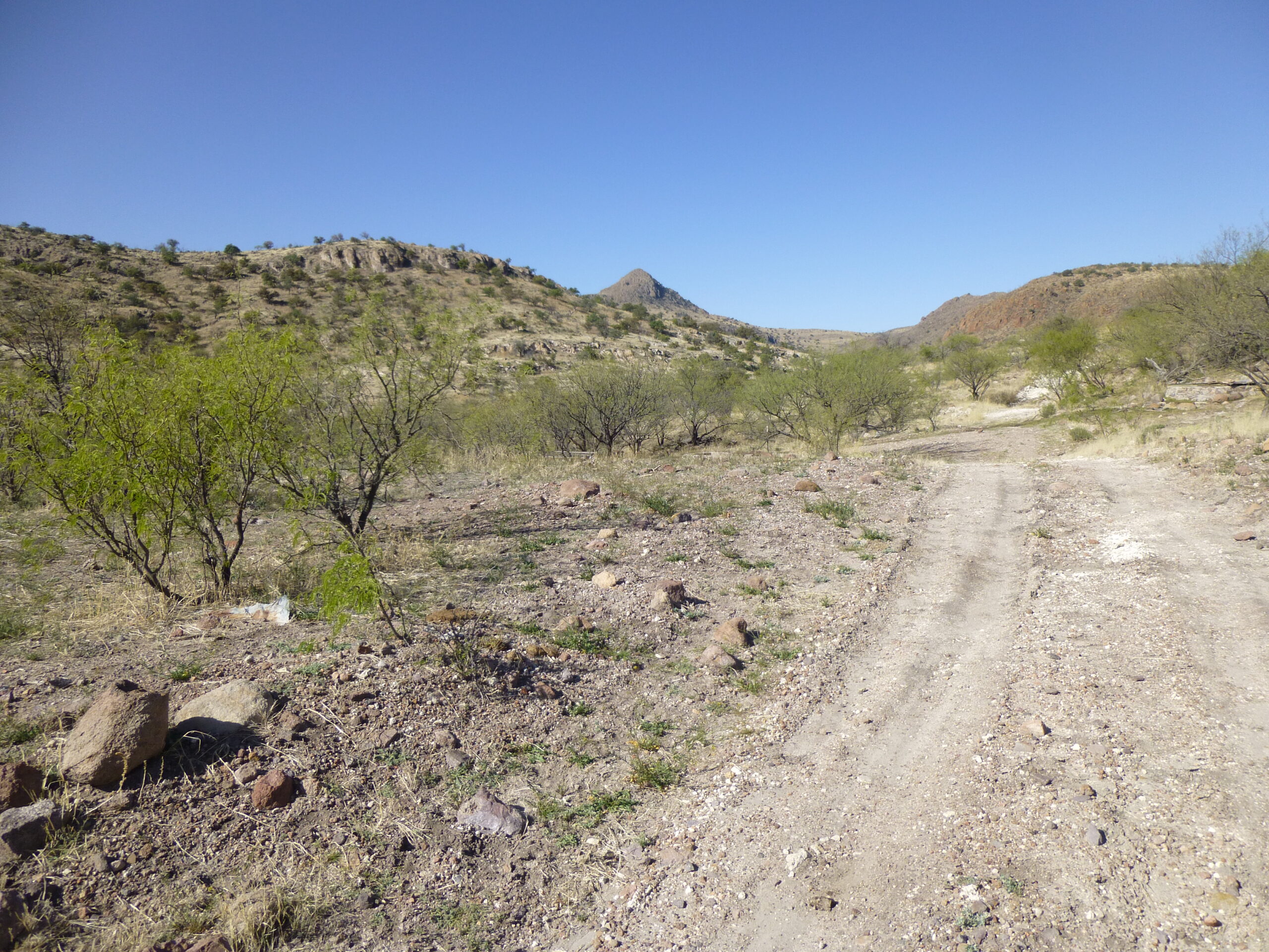
Our first glimpse of Peak 5466, in the distance over the ridge.
We set off cross-country and soon headed over a low saddle and dropped down into Coal Mine Canyon. The closer we got, the better it looked. Here is what we saw as we got nearer.
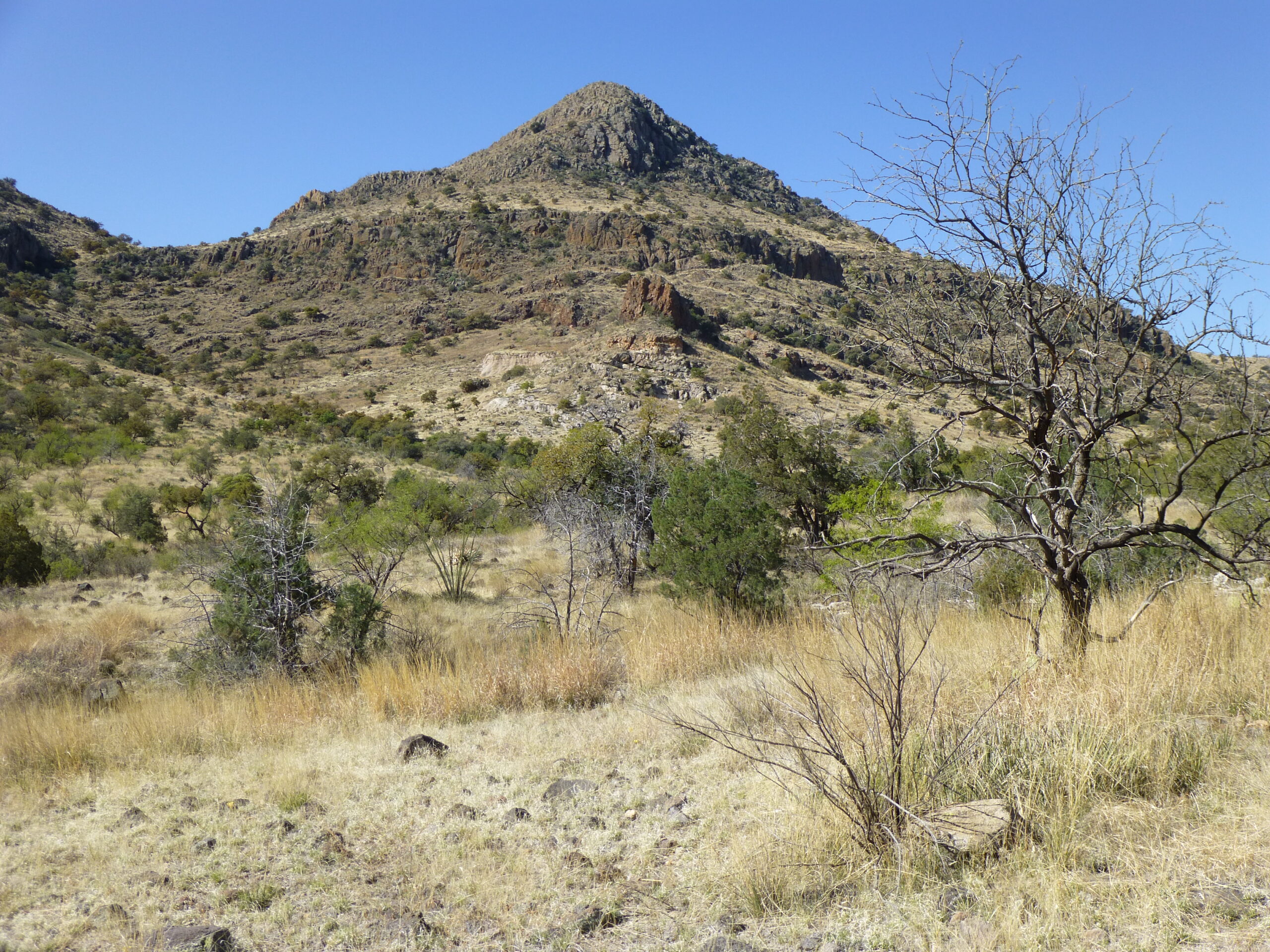
A nice-looking peak. That’s the northeast side.
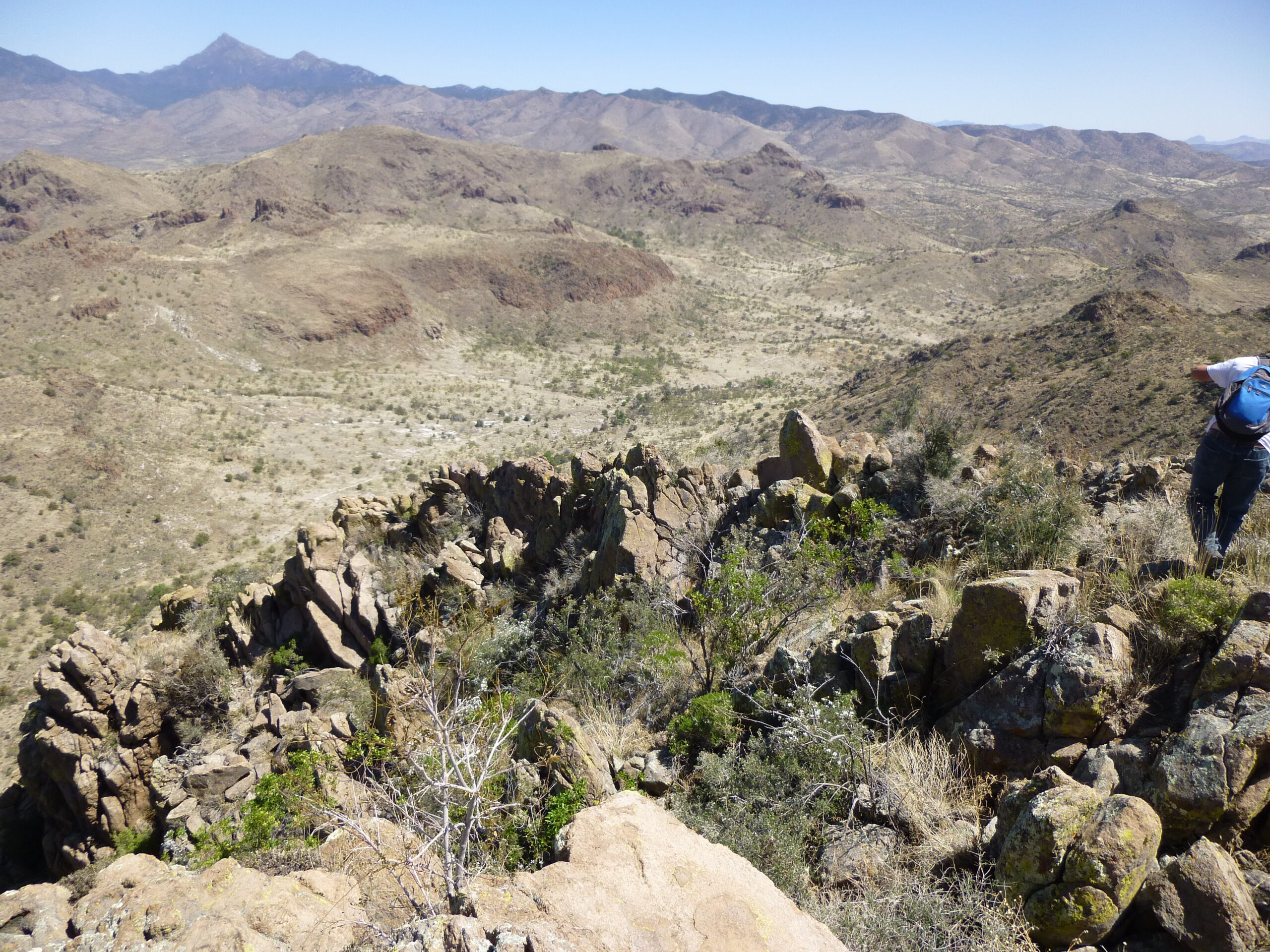
It was an enjoyable scramble to reach the top of Peak 5466, the high point of the Grosvenor Hills. Considering the fact that it has a full thousand feet of prominence, it’s surprising that there are only 5 climbers of record who have climbed it, and the last 3 of us did it in 2014. We signed in to the register left by Mark Nichols in 2001, then sat a while and enjoyed the view. To the west, we had this unbroken view of the San Cayetano Mountains.
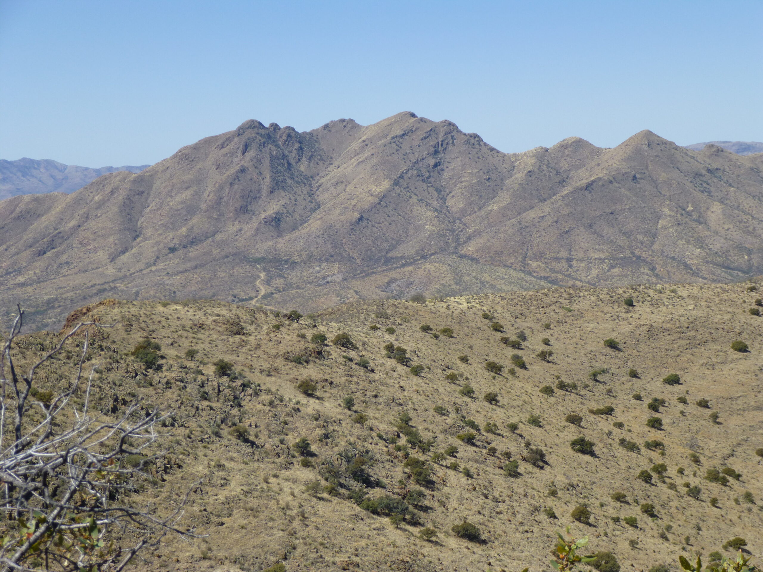
Looking west. The range high point, San Cayetano Peak, is in the middle, with almost 2,000 feet of prominence.
Then there was this million-dollar view to the north. Eleven air miles away, we can see three prominent peaks on the horizon. The one on the left is Mt. Hopkins, elevation 8,580 feet. If you zoom in, you can see something white on its summit. That’s the Smithsonian Astrophysical Observatory. The tallest peak, over on the right, is Mount Wrightson, elevation 9,453 feet. Further over to its right and lower is Josephine Peak, elevation 8,478 feet.
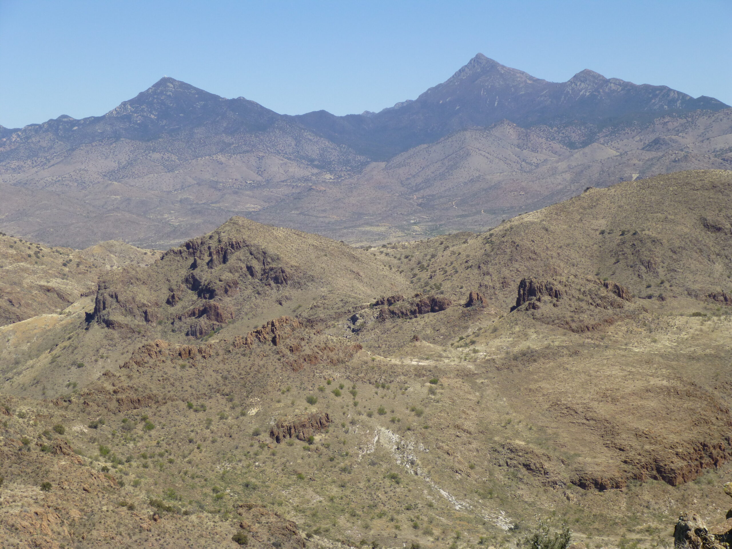
Looking north to high peaks in the Santa Rita Mountains.
Here’s where we sat on the summit and had lunch.
On top.
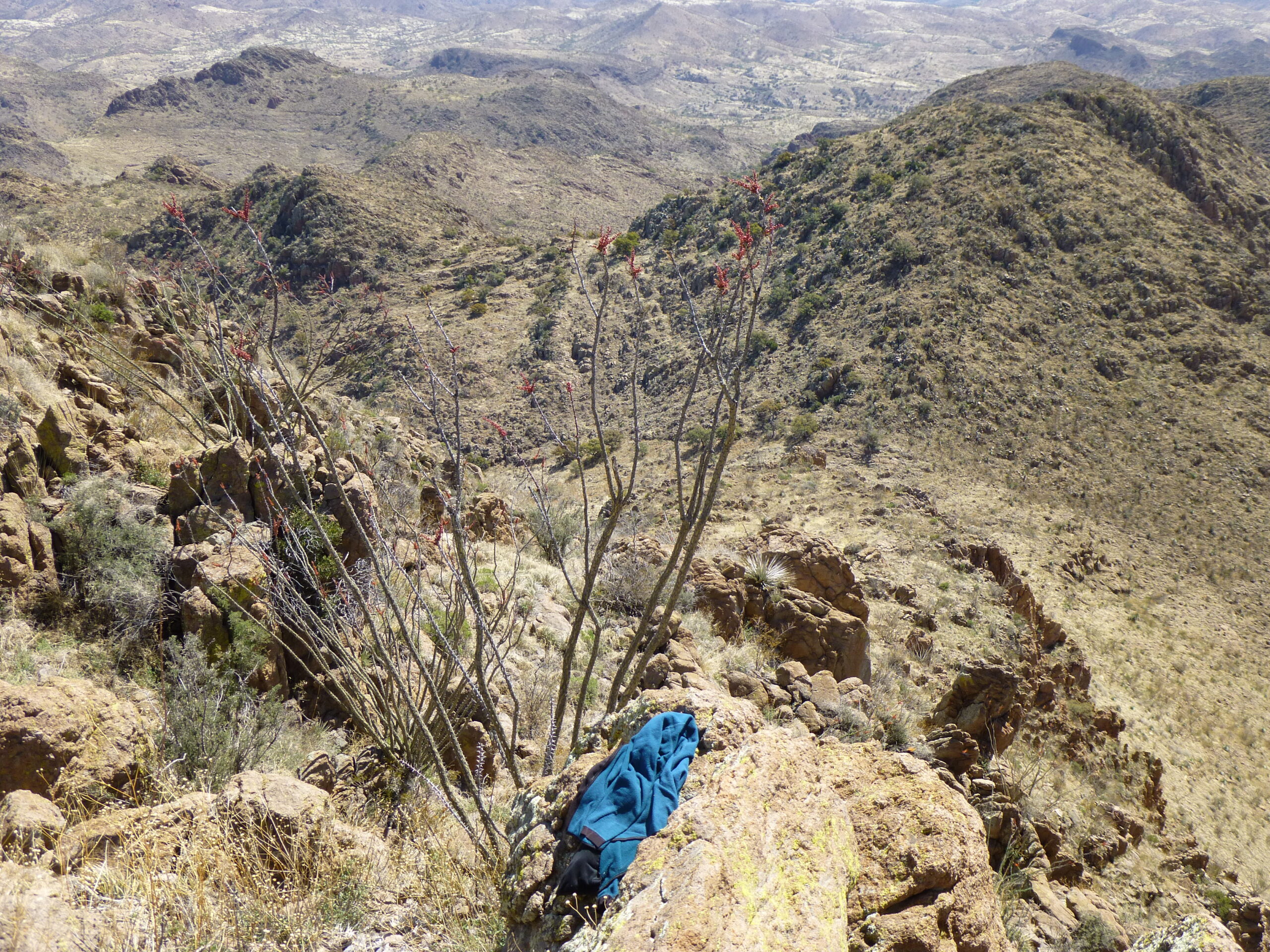
Here’s a view looking down, showing much of the way we’d come in.
Our route came up the light-colored valley cutting diagonally across the photo from mid-left to just above center.
It was easy-enough going to get back to our bikes, and the ride back out to the gate was straightforward, except pedaling the steeper uphill parts. Something strange happened, though, as we got back to the gate – it opened! Perhaps there was a sensor there that saw us? Who knows? If it had opened for us when we arrived on our way in, we could have driven all the way to the road’s end and avoided the bike ride. Oh well. When we got back to the truck, we put the bikes in back and drove back out to the east. We had one more stop to make, though, and after barely 3 miles of driving, we pulled over and did a quick climb of Peak 5077. Click the link to see a photo – easy peasy. The drive out and home was easy. It was nice to get a glimpse into an area with so much mining and ranching history.

