One winter’s day about eight years ago, I had a plan to go out to the Castle Mountains and climb a few peaks in the company of Mark Nichols, a climber from Benson, Arizona. There are 193 mountain ranges in the state of Arizona – Mark had climbed the high point of all but 15 of these ranges, so he was pretty motivated to add one more. Not only that, Peak 3150 was an interesting and challenging climb – everyone who had done it spoke highly of their experience on the mountain. From my side, I was on a mission to climb all of the 402 peaks on the Tohono O’odham Indian Reservation, and this outing would add a few more.
Mark and I met at 4:30 A.M. in Tucson and drove in darkness into the heart of the res. An hour and a half later, when turning on to Indian Highway 34 from the much busier Indian Highway 15, close to the town of Santa Rosa, we were stopped by the Tribal Police. They were very polite and professional. I told them I had a permit to climb out there, they asked to see it, and I complied. Satisfied that we were legit, they wished us a safe climb.
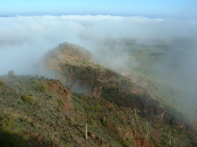
We carried on, but were now heading west on Highway 34 in thick fog – that was unexpected! I was forced to drive more and more slowly, as I was afraid of hitting a cow (in this area, they seem to wander on to the highway at will). Our speed was down to 20 miles per hour, and even less at times. The fog was so thick that we had to use our GPS to find our turnoff on to the dirt road that we needed.
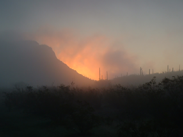
The first light of day was creeping in to the eastern sky as we drove up the excellent dirt road, but we really couldn’t see a thing. The fog was so thick we were still using the GPS to figure out where we were, and before long we stopped at a spot we had picked out in advance, a spot that seemed like a perfect starting point for our climbing. We were north of the range highpoint, sitting in a thick fog, and we couldn’t see a thing! Finally, the sun rose and we were treated to a fiery display.
As badly as we wanted to get moving, we couldn’t. If we had started out, even with map and compass, the chance of wandering into unfriendly country was too great. There were rotten cliffs all through this valley, and if we didn’t have good visibility we could easily run into trouble. So we waited for the fog to lift, and waited, and waited. Finally, after about an hour, it let up enough that we had a few glimpses of the surrounding peaks, and only then did we start. Mark headed south to his objective, Peak 3150, and I headed southwest to mine, Peak 2910.
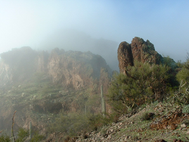
We were each carrying a small walkie-talkie so we could keep in touch. After nearly an hour, we spoke at our first scheduled time. I was in swirling mist up on the east ridge of my peak. The map indicated that the north ridge would have been the best route, but I threw caution to the wind and had tried a different route. Big mistake! I kept running into bands of cliffs which were often overhanging and blocked any upward progress. Finally, I gained the upper part of the north ridge and found the only way to the summit.
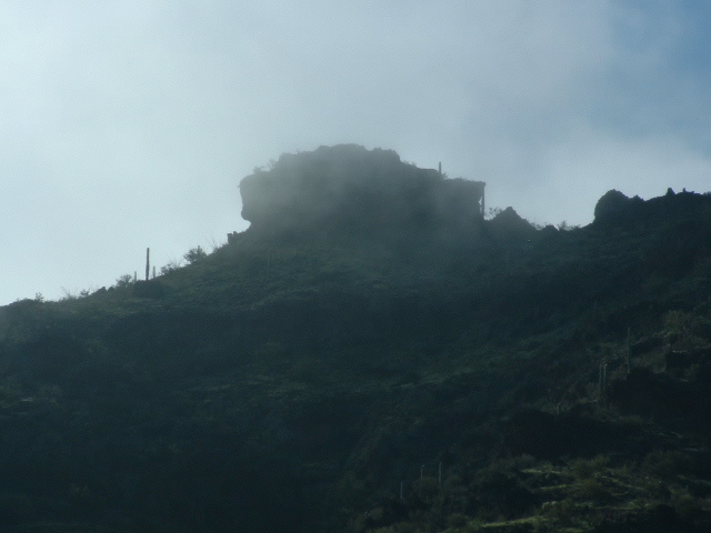
I called Mark and learned that he was negotiating the upper reaches of his peak. Only a few have summited the range high point, most of whom are reading this, and they know it involves a tricky bit of route-finding. I can still remember talking with mark on the radio. He was telling me that it didn’t look too bad, that it was going well and that he was almost at the summit. Then, he came to the crux move, some kind of an airy gap – a kind of “What the ……!” moment – and confirmed that it was definitely Class 4 with a lot of exposure. I had never been up it by his route – my only ascent was almost twenty years earlier by the west ridge, and it was low 5th Class. I think that everyone else did it by Mark’s route. The fog parted for a moment, enough that I had this glimpse of Mark’s peak to the northeast. This shot was a long telephoto.
I left a cairn and register and descended the north ridge. En route, I spoke to Mark again – he was just stepping on to the summit of his peak. I think he must have spent quite a while on top. I had a good view to the desert floor through gaps in the fog.
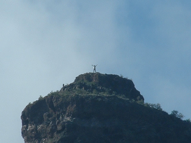
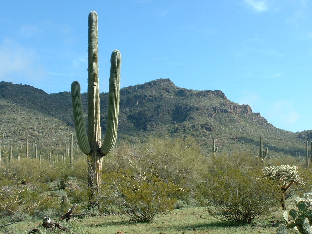
I made good time back to the truck, then drove farther east to the end of the road and stopped in a beautiful park-like setting. I could actually see Mark standing on his summit and took some pictures of him there. This is a high-magnification telephoto of Mark on the high point of the Castle Mountains.
Continuing northeast on foot, I soon arrived at nearby Peak 2950. This is a double summit, but a quick check with my 5-power hand level showed that the other contender, the one farthest to the northeast, was a good five to ten feet lower. I build another cairn and left a register.
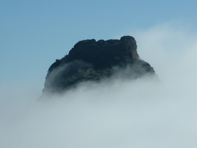
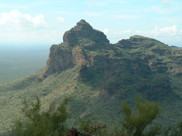
Before I left, I had a beautiful view back to Peak 3150, the high point of the Castle Mountains. The fog had lifted and here it is. Mark’s route was mostly up the left side.
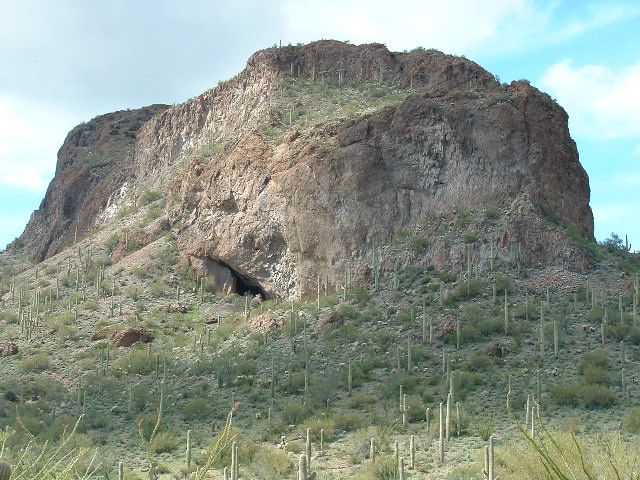
Descending to the truck, I arrived at the same time Mark did. By now, the fog had all but disappeared. We drove back out to Highway 34 and headed east to Ventana Pass. Once over it, a short drive brought us to a turnoff which headed southwest to Cave Mountain – the rough road ends after only a kilometer. We parked in plain view of the large cave mouth on the east side of the mountain.
There is a well-used trail over to the cave, then one must follow talus slopes to gain more elevation. Our climber friend Dave Jurasevich had given us a route description, which involved some steep Class 3 scrambling above the talus to gain the east ridge, which is then followed to the summit. That was some clever route-finding you did, Dave – it helped a lot. Although we found no register on the summit, we knew it had been visited before, at least by Dave, and probably others. Mark had a spare register in his pack, so we filled it out and built a cairn for it.
The descent went without incident, but the steep Class 3 bit certainly had us paying close attention to every step we took. Once back at the truck, we left immediately and made it back to Tucson in time for dinner. Fog in the desert – a rare event, but our timing was just right to enjoy this unusual day.
Please visit our Facebook page at https://www.facebook.com/pages/Desert-Mountaineer/192730747542690

